Frederick Peak & South Pinnacle (The Pinnacles)
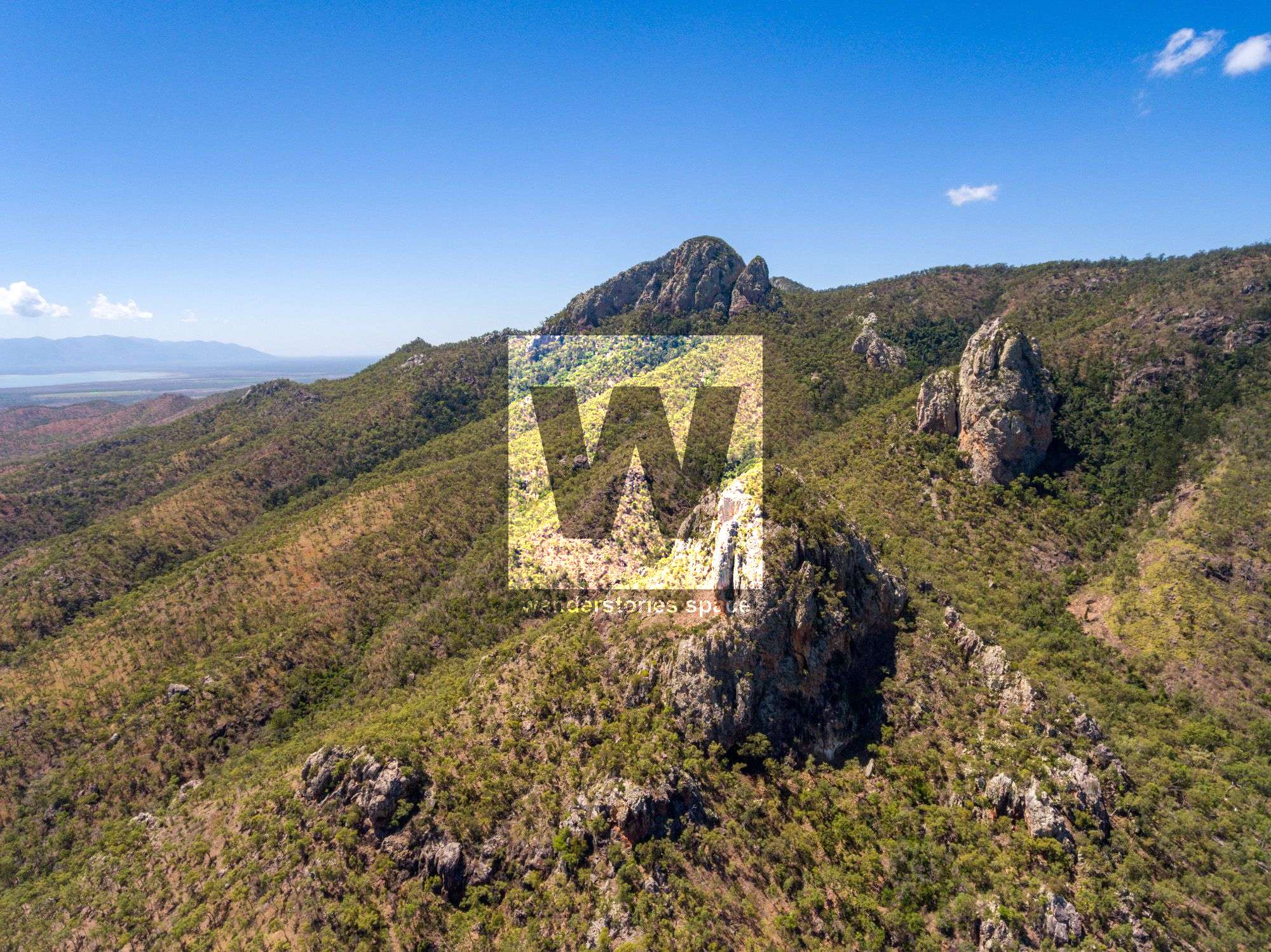
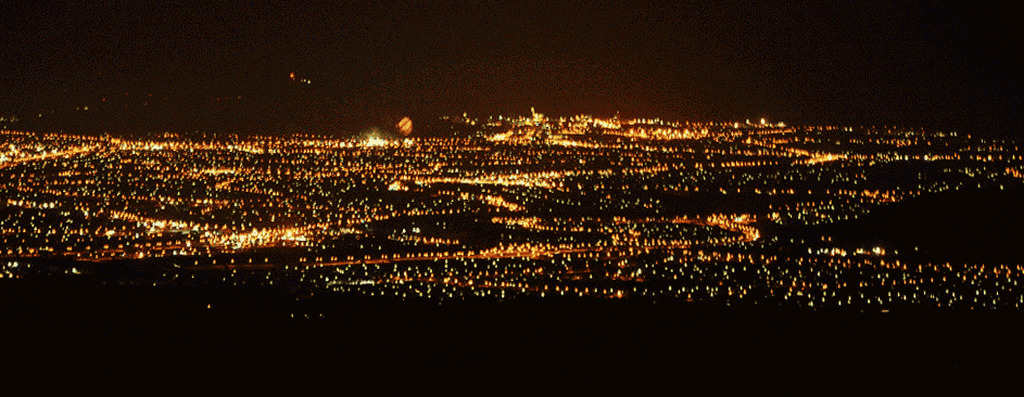
Despite the name, Frederick Peak also refers to a number of rocky pinnacles in the area and is commonly referred to as 'Freds'. It is located just outside of Townsville and offers superb views of Townsville city, all the way from the Ross River Dam out to North Shore.

Location - Townsville, Queensland, Australia
Best time - May to October
Distance - Frederick Peak is a 2-kilometre hike from the last car park
Time - 4-8 hours, Frederick Peak is a half-day return hike for the fit and experienced bushwalker with good navigational skills
Difficulty - 5, overall intermediate
North Sentinel (Fish Bowl) - Intermediate, grade 4
South Sentinel (Chasm) - Intermediate, grade 4
Frederick Peak - Hard, grade 5
South Pinnacle - Hard and strenuous, grade 5
Pinnacles Traverse - Hard and strenuous, grade 5, takes 10-20 hours
Despite the name, Frederick Peak also refers to a number of rocky pinnacles in the area and is commonly referred to as 'Freds Peak', 'The Pinnacles' or just plain 'Freds' to the regular rock climbers. It's often misspelt with an 's' suffix e.g., "Frederick's Peak" or "Fredericks Peak". The area is also known as "Pinnacles Mountain" or "Pinnacles National Park" to some. The walk-in can be a bit of a mission if you don't have at least a four-wheel drive or a ute with high clearance, but it is worth it. Although there aren't year-round flowing creeks or waterholes, the environment and the hike are spectacular.
Quick Access
Highlights, Rock Climbing, How to Get There, Trail Notes, Camping, Hazards, Weather, Vegetation, What to Wear, What to Take
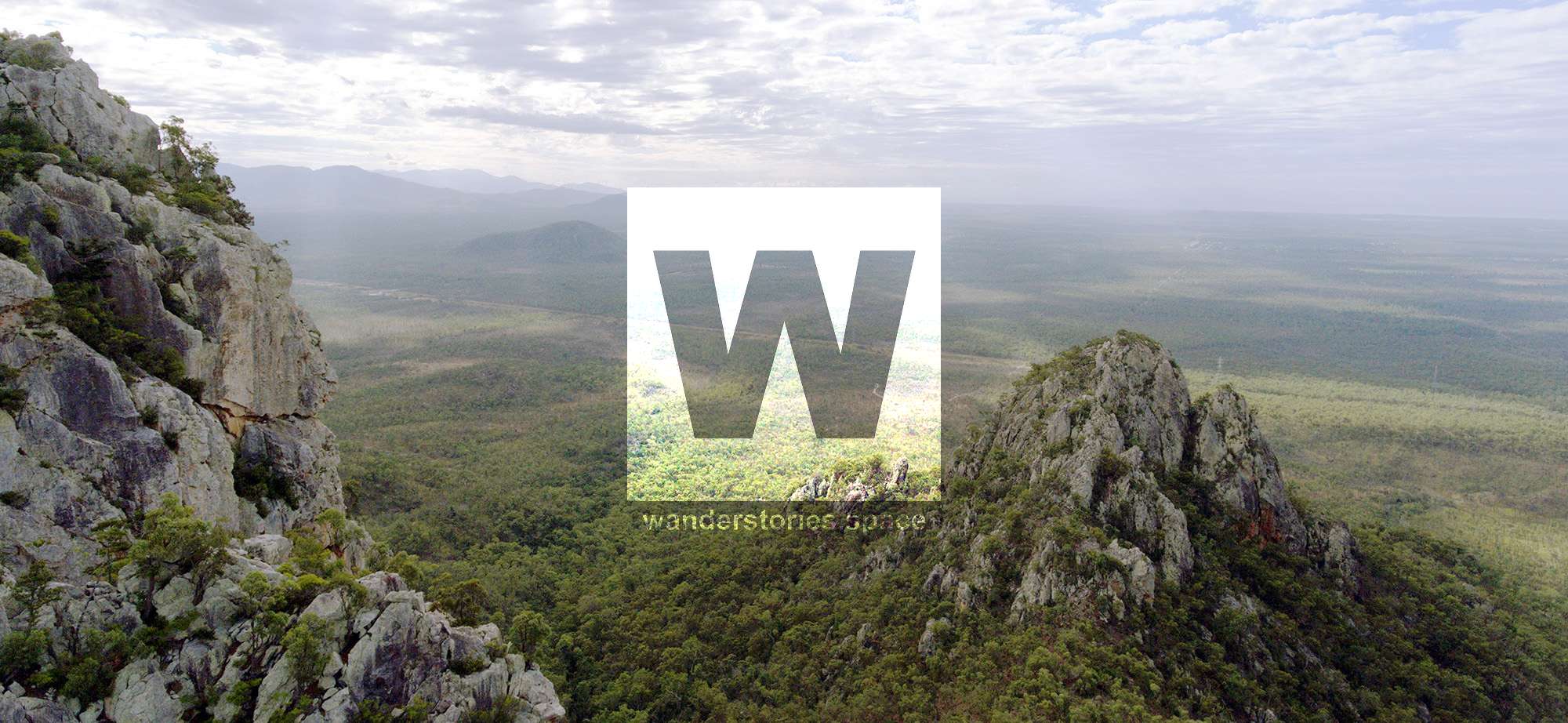
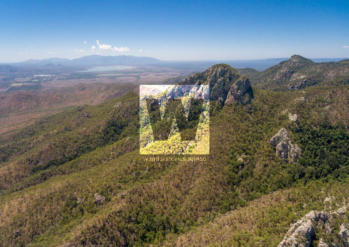
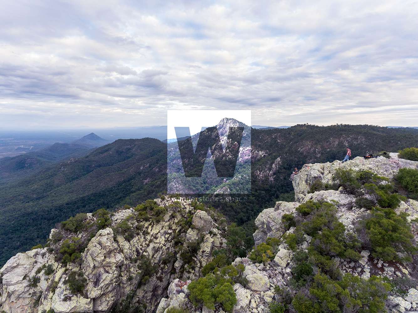
Frederick Peak offers a superb view of the entire city and unlike Mount Stuart, the area offers views from Townsville Dam to the coast at Northern Beaches. Four prominent pinnacles are situated on the Hervey Range end; which includes the North and South Sentinels (sometimes referred to as the North and South Terminus or Front and Second Pinnacle), Frederick Peak and, off in the distance, the South Pinnacle (The Pinnacles). The surrounding arid environment is home to a large variety of wildlife.
https://www.instagram.com/p/h68fLsxPwT/
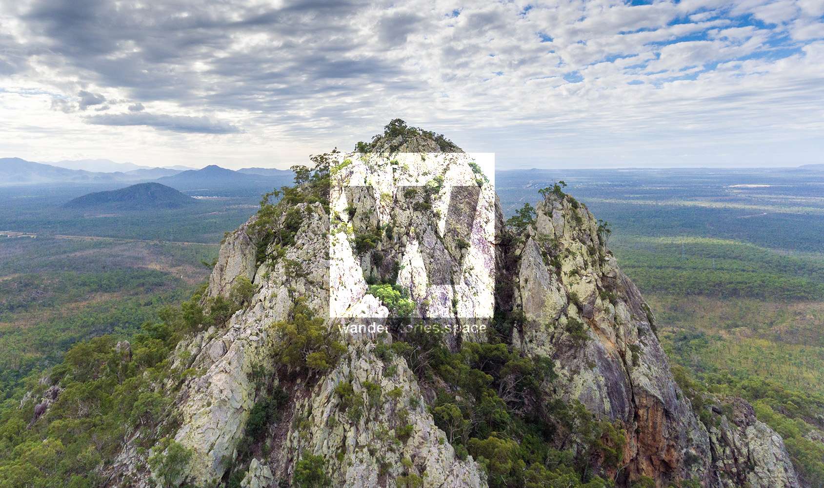
These Rhyolite peaks of Frederick Peak and South Pinnacle protrude above the surrounding plateaux. Geologically, they are possibly the only obvious examples in the region of what may have originally been part of deep underground volcanic vent passages from one of the very ancient mountain building periods that crafted almost all mountains and plains that are visible.
HIGHLIGHTS
North Sentinel and South Sentinel
The first two pinnacles are the most popular in the area for rock climbing due to the ease of access. They are sometimes referred to as the north and south terminus. The North Sentinel can be easily summited via the backside however summiting the South Sentinel is not an easy task and should not be attempted free solo unless you are a very experienced rock climber and know the risks. The traditional route is an exposed climb called Body Armour and is graded 12 in the Ewbank system.
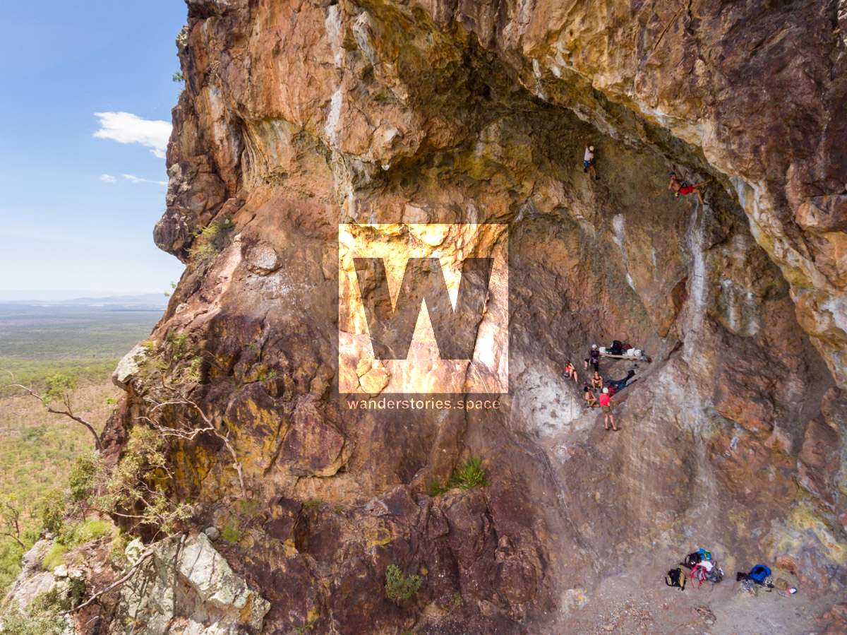
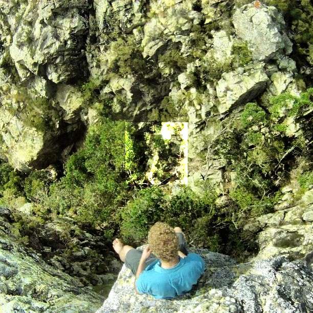
The rock features in this area are very interesting and is probably a geologist's dream. The highlights would have to be The Fish Bowl, The Archway and The Corridor (may also be known as the chasm to some). To climb up through The Corridor, you must be a decent climber and is not for beginners; you also should not be afraid of tight spaces to climb through The Corridor.
Frederick Peak
The must-see exceptional views from Frederick Peak (679m) are easily accessed via the conventional route which is going around the backside of the peak (see interactive map). However, there are many other routes that can be taken to the summit; for example, the razorback East Ridge, King Frederick (14), and Milk Run (12). If you are in living in Townsville, you should put this on your list to the summit.
South Pinnacle
Off in the distance is South Pinnacle (729m) and is hardly visited by humans. Rock climbers are generally not into hiking and offers the same view as Frederick Peak. The headwaters of Round Mountain Creek flow of the South Pinnacle.
ROCK CLIMBING AT FREDS
The rock climbing here is some of the best in Townsville! The rock is intrusive rhyolite and is well-featured. The scenery is breathtaking and there's no better feeling than hanging off the side of these cliffs with a view like that. Due to its remoteness, and perhaps the relatively small climbing community in Townsville, it took quite some time before Frederick Peak really took off. If you're an inexperienced climber, try the more user-friendly crags with easy access such as Mount Stuart or some bouldering at Castle Hill or Harvey's Marbles. If you are an avid and experienced climber, read the Frederick Peak Climbing Guide and theCrag.
ACCESS AND HOW TO GET THERE
Frederick Peak is located just outside of Townsville and was USL (Unallocated State Land); a politically correct way of saying Crown Land. Queensland Parks and Wildlife Service (QPWS) have registered an interest in this area and won the bid on the land. This means that it may become part of Pinnacles National Park. Currently, QPWS is currently working with the RANQ (Rock Climbing Association of North Queensland) to provide access to this new section of the national park.
Access to the area has always been a sensitive issue as access required passing through private property. For these reasons, access instructions were not given in this article. However, access to Frederick Peak is no longer permissible via Granite Vale Road. A fence is now in place bordering the private property. The primary route to access Frederick Peak is via the Gumlow area which can be done via four-wheel drive or a longer hike.
Enter via Gumlow Road / Moncrief Road OR enter via Bowhunters Road, Allambie Lane / Woodfield Road. From the quarry private property sign, take a right and meet the powerline track. Follow the powerline track and then merge into the other HV powerline track. See the interactive access map below.
Access Map
Before you set off on your adventure, please beware that this is a remote area and that it's not a beginner's walk. There is no track and you will need to be able to navigate yourself through the bush. A competent four-wheel drive is necessary. Please do not wreck these tracks by going out when it has been raining and stick to the existing tracks. If you have the time, please do a little bit of track and trail maintenance too.
As usual, a code of conduct must be followed to maintain access to the area. You don't want there to be a reason why we are locked out of more places around Townsville (Forestry Road, Ollera Creek, Dalberg). Local delinquents who have previously dumped garbage alongside the dirt access road and burned car carcases now litter the area. If you witness any illegal dumping report them to the Townsville Council on 1300 878 001. Taking note of the vehicle's registration number, make, model, time, date, and location is required to help eradicate these pests.
Don't leave breadcrumbs! Do not leave shields in trees, tape, or paint behind you unless you are an experienced trail marker and have set out for that purpose with the appropriate approval. If you can navigate properly, you won't need to mark the trail as a 'just in case'. If you are, you're not only ruining it for others as they try to follow your poorly positioned markers, you're out of your depth and you shouldn't be there in the first place. If you feel this is you but would like to go, contact the Townsville Bushwalking Club, a social group, or an experienced friend.
Please do not disturb the vegetation and follow the advice of the local rock climbers. They are very experienced in the area and come out here every weekend; it's pretty much their home... Stick to their unofficial trails as much as possible to reduce the human impact.
Do your business at least 100 metres away from trails, cliffs, and campsites.
There are lots of hidden rocks under the long grass so you will need to be good on your feet - especially when heading out to South Pinnacle. Guinea grass and lantana cover sections of the hillsides which can make the walk unpleasant at times.
Frederick Peak Trail Notes
There are many ways to summit Frederick Peak; here are the main two options:
The Normal Route (via the pinnacles/sentinels)
This conventional hiker's route is the easiest way to summit Frederick Peak, though it still is difficult and requires some navigation experience.
Starting in the car park area, continue to walk uphill to where there is a trail just on your right. If you reach the end of the four-wheel drive track, you've gone 20 metres too far. The track now contours around the base of the North Sentinel. Just below the saddle is an obvious fork in the track. The left fork will take you up to the saddle between the North and South Sentinel and the right fork will take you to the base of the South Sentinel. Taking the left fork is easier. If you find yourself at the base of the South Sentinel, you can also continue up and around the left side of the cliff. Once at the saddle, the track continues on towards Hidden Pinnacle. The trail contours around the valley with sections of the track having been dug with a maddock. The track is long overgrown and disused by the climbers; Now that trail has faded and has become hard to follow. Surveyors tape marks the routes previous adventures have taken (often poorly placed). Follow them at your own peril as they are scattered around the place, not following one single route, and can cause confusion.
The original route crosses the gully (intermittent stream) and continues around the base of the Hidden Pinnacle before arriving at the base of Frederick Peak. Ascend the steep loose section to Plagiarism Wall which connects to the ridgeline.
Another route people have taken is ascending along the spur of the South Sentinel to the ridgeline and then passing above Hidden Pinnacle to Plagiarism Wall at Frederick Peak.
Another ascends the spur just after Hidden Pinnacle and then along the ridge to Plagiarism Wall at Frederick Peak.
However you get to Plagiarism Wall, the route then continues around the backside (south) of the pinnacle and then up the gully between the two cliffs. Please note that rocks are loose and there are stinging trees in this area.
East Ridge Route
The eastern ridge is harder than the normal route. There are exposed cliffs and many loose rocks along this razorback ridge. Some parts require scrambling (grade 5) up or beside cliffs. Be careful not to crush your legs, fall off the ridgeline, or dislodge rocks onto the people below you. Note that rock climbers may also be on the cliffs below.
The route was marked with rock cairns, pink tape, and blue spray paint however, the route is fairly disused, the tape is long gone, the spray paint has faded, and rock cairns are to a minimum. Sound navigation and appropriate experience are recommended. There are hints of the formed track along the way with remains of broken branches from ages ago. Note that the vegetation atop of the peak is fragile so keep disturbance to a minimal.
The views along the ridgelines are spectacular and provide views across to Frederick Peak that are not often seen.
Interactive Map
Pinnacles Traverse
The pinnacles traverse can be done via many variant routes and can be linked in with Wild Horse Mtn and Frederick Peak - See the interactive map below. Basically, you can walk any of the routes shown below but usually down via Frederick Peak to Round Mountain. There are many small gorges and mini-waterfalls in the area to explore.
Doing an overnighter
The walk-in is uphill, loose in sections, overgrown and difficult to follow at night; Over the last years being frequented by rock climbers, there is now a noticeable, rough path trampled up to the first campsite (saddle) and the two pinnacles.
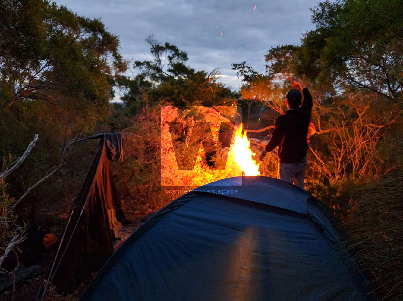
Camping is possible, although there are no amenities available obviously. There is a large area situated on the ridgeline between the North and South Sentinels to set up camp; which provides great views of Townsville and a cool breeze. There is also a very tiny dirt patch on top of Frederick Peak for two people to set up a small tent.
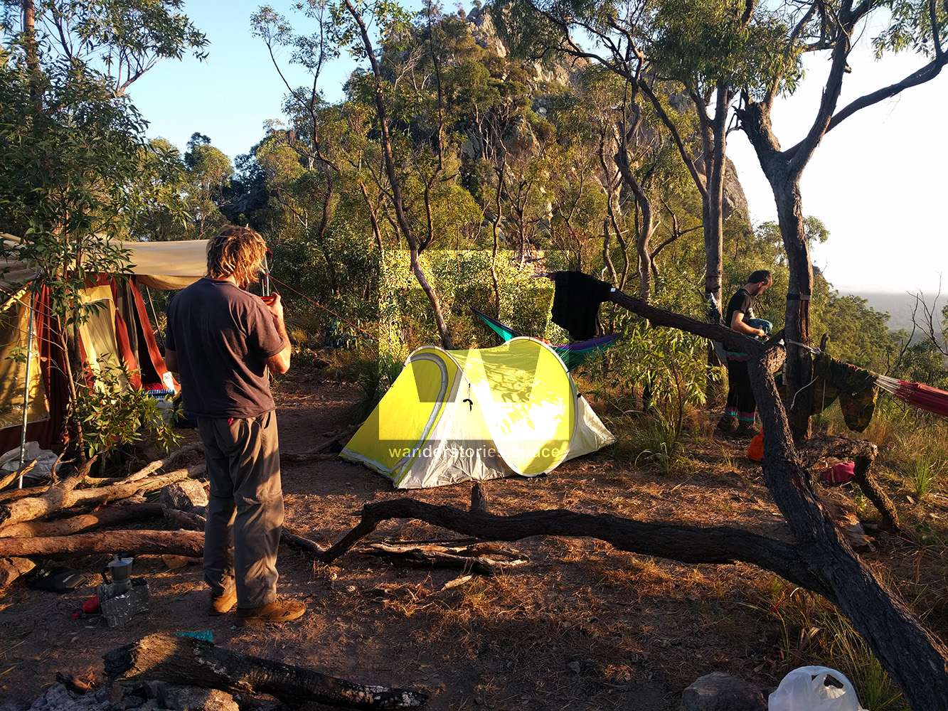
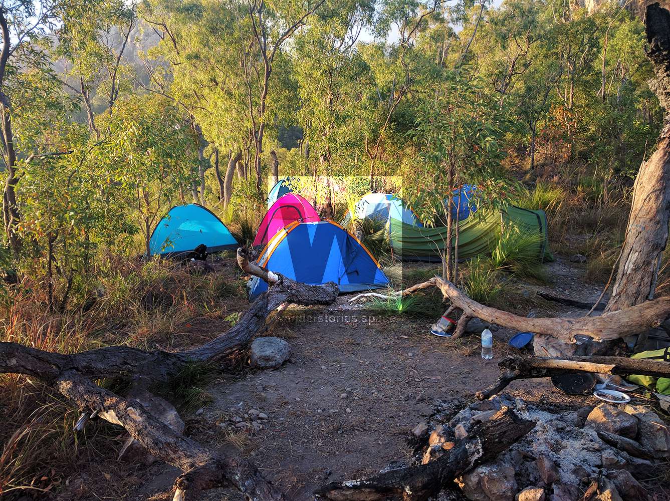
Campsites along the way
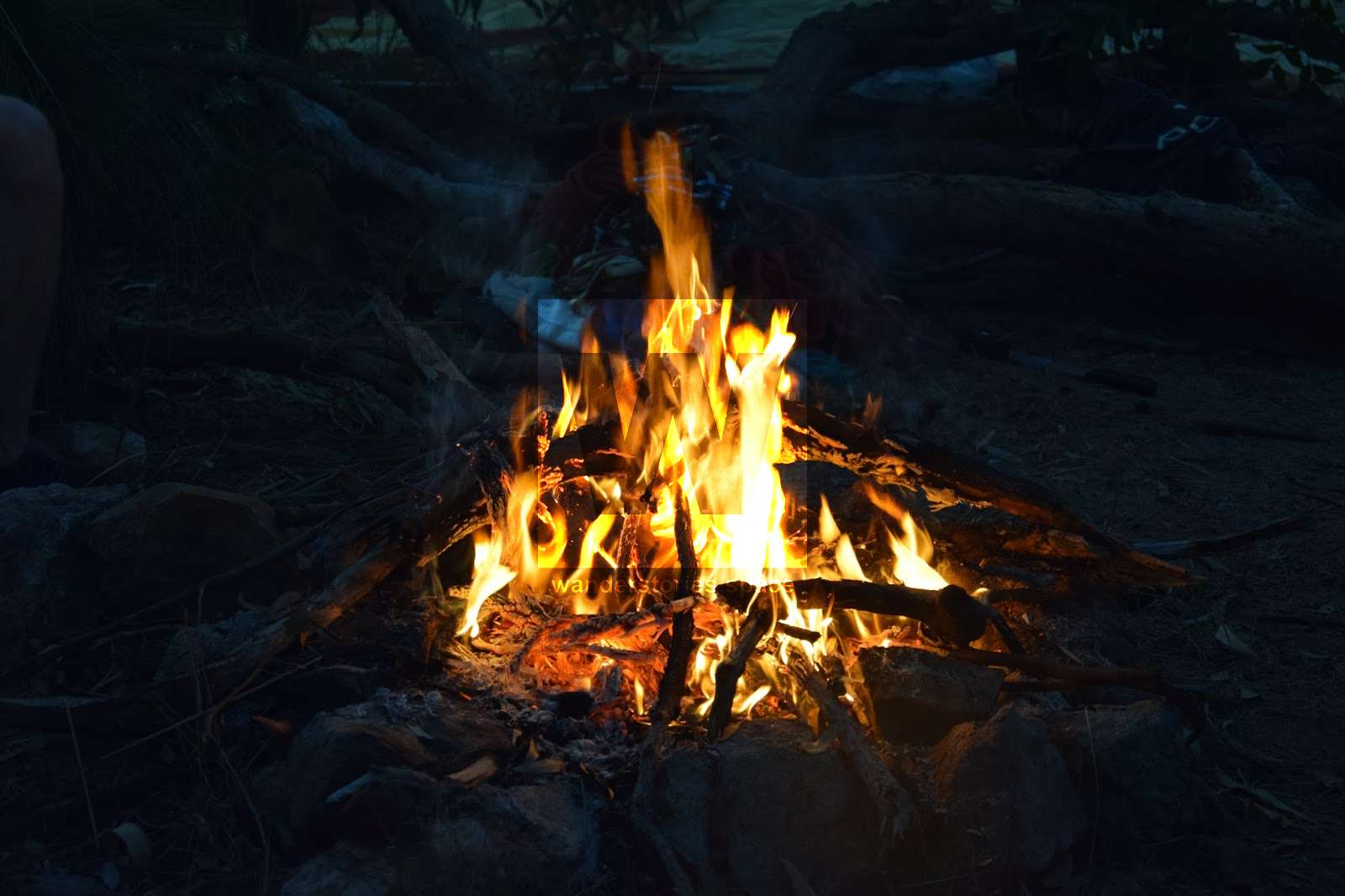
Note that vegetation atop Frederick Peak is fragile and fires are not recommended. Do not damage, e.g., axe or saw, the sensitive flora atop this peak.
It's a great place to watch fireworks and to take in Townsville's city lights.
HAZARDS AND WHAT TO KNOW
There are a few hazardous creatures you may encounter on this adventure. These include rainforest scorpion, yellow paper wasp, death adder, and Queensland tarantula. Also, there's the Gimpie Gimpie (stinging tree) plant. But don't let this deter you, it is Australia after all. Remember to take a first aid kit (with compression bandages for snake bites). Also, consider a PLB (Personal Locator Beacon) or an EPIRB (Emergency Position Indicating Radio Beacon).
There are a few things to think about: Dubouzetia on the north (front) pinnacle. Plants on top of Frederick Peak are very old and slow to recover from damage.
DO NOT THROW ROCKS OF THE CLIFFS AS ROCK CLIMBERS MAY BE BELOW!
WEATHER AND WHEN TO DO IT
The weather at Frederick Peak is similar to the rest of Townsville. The best time of year to do this trek is in winter. The winter months are from May to October and the summer months are from November to April.
"The winter months are dominated by SE trade winds and mostly fine weather. Further north the coastline runs north/south and the trade winds are lifted to produce rainfall right through the year. However, Townsville lies on a section of coastline that turns east/west, so the lifting effect is not present. As a result, our winter months are dominated by blue skies, warm days and cool nights - although every now and then we can experience a few days of showery weather." - Bureau of Meteorology
"The summer months are hot and humid with "build-up" thunderstorms starting in late October or November. Bursts of monsoon rains from late December through until early April deliver our highest rainfalls, and this is also the season that Tropical Cyclones can threaten the region. The monsoon winds coming down from the northern hemisphere pick up abundant heat and moisture to feed into the monsoon trough, often producing widespread flooding rains over the region." - Bureau of Meteorology
The wet season lies November to April, but rain mainly occurs in January, February and March; and the dry season lies between May to October. There isn't any water up there for almost all of the year but if you're very lucky, there may be a little stream. After some long and heavy rain, there will be a trickle down a small creek bed between the South Sentinel and Frederick Peak. Summer is extremely hot, so carry plenty of water and it is recommended at least three litres of water per person per day in Winter. This is a winter hike and it is recommended not to do this hike in summer.
VEGETATION
It's an incredibly diverse mountain right in our suburbs. Open cliff ecosystems are each unique regionally and one is clearly unique to the world. This mountain has large patches of semi-evergreen rainforest almost in the suburbs through to seasonally very dry rainforests. Poplar gum woodland, tall bluegum forest (related species) to brush box shrubland and dwarfed open cliff ecosystems.
The dominant eucalypts are the white mahogany (Eucalyptus acmenoides), one of the stringbarks, and the pink bloodwood (Corymbia intermedia). Both these trees are widespread species that can grow into much larger trees in areas with more favourable soil and climatic conditions. Patches of semi-deciduous vine thickets, a type of dry rainforest, are visible from the top of the peak (the darker green vegetation on the slope below the summit). You also pass through this forest as you ascend Frederick Peak; this is one of the areas where Gympie Gympie (Dendrocnide moroides), also known as stinging tree, can be found.
This area is also home to an endemic plant, especially the first pinnacle (North Sentinel) featuring the only place in the world where Dubouzetia saxatilis (Elaeocarpaceae, small shrub) can be found, perhaps some thousand steep cliff crevice loving plants. This is the only place in Australia for the Dubouzetia genus except for another cliff loving species that inhabits a few Northern Territory waterholes.
WHAT TO WEAR
Sun protective clothing:
- Hat and a long-sleeved shirt
- Long pants (also help stop the sticks and vegetation from scratching your legs)
- Sunglasses
- Sunscreen
- Open hand gloves for sun protection
The Australian sun is extremely harsh and there's not much shade from trees as protection.
WHAT TO TAKE
- At least 3 litres of water
- Food and snacks
- Navigation equipment
- Topographical map and compass
- GPS with route loaded - First Aid Kit
- PLB (Personal Locator Beacon)
- Compression Bandages for snake bites and known how to use them
- Blisters plasters - we recommend the Compeed Blister Mixed Pack 5
- Gauze or cotton pads for wounds
- Assorted band-aids for smaller cuts
- Antiseptic cream
- Tweezers and splinter extractor needles
- Antihistamine
- Paracetamol
- Ibuprofen
- Aspirin
- Compact first aid manual or app
Research online or book a first aid course and learn what to do in different situations. You should also have installed the Australian Red Cross First Aid app on your phone which guides you through up-to-date first aid.
Another useful app is the Emergency+ app which was developed by Australia's emergency services, government and industry partners. The app uses GPS functionality built into smart phones to help a Triple Zero (000) caller provide critical location details required to mobilise emergency services.
This article, and all other articles, are for entertainment purposes only and are not to be used as a guide. Please see our Disclaimer for more information.