The journey to The Black Hole, Jourama Falls
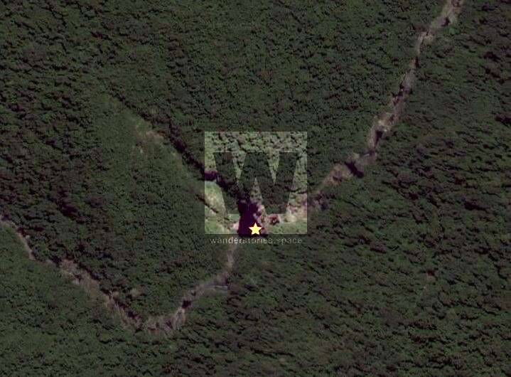
Have you ever looked at a map and found something peculiar and you just had to know what was there? Well that's exactly what happened; I found a black spot on Google Maps, well up Waterview Creek.

UPDATE 2019: New track to The Black Hole from the Paluma to Jourama Track.
UPDATE: New track from Paluma Dam to Jourama Falls hike.
UPDATE: New trip plan Hidden Valley to Jourama Falls hike.
Have you ever looked at a map and found something peculiar and you just had to know what was there? Well, in 2019, that's exactly what happened; I found a black hole on Google Maps well up Waterview Creek and invited my good friend, Matthew along for the expedition.
Our aim was to reach a seemingly large waterhole, just over 2 km upstream from the main falls, camping there overnight.
I've been to the top of Jourama Falls with Matt twice before this adventure (the first time in 2007) and many times with other friends. It's actually my favorite waterfall in North Queensland because it's so untouched and feels so remote.
The hike to the top of the falls only takes an hour and a half for the fit bushwalker and 45 minutes back down. It's best walked at the start of winter just after the wet season. This way the Guinea Grass won't be as overgrown or wet and slippery.
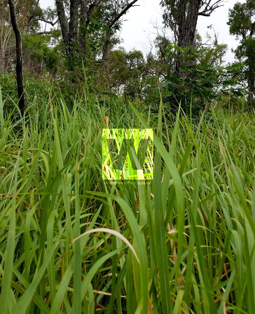
It's only a short distance to the top, but it's very steep which will slow you down, making you wait to catch your breath.
Depending on the route you take, you will come across two of my most hated plants, lantana and stinging trees (gympie tree). You may also come across a few other declared weeds.
I recommend a pair of hiking boots with aggressive tread, gators for the spear grass and light and breathable long pants, preferably made from material that won't attract the spear grass. The pointed sticks and sharp flora that will scratch up your legs otherwise.
Directions to the top of Jourama Falls
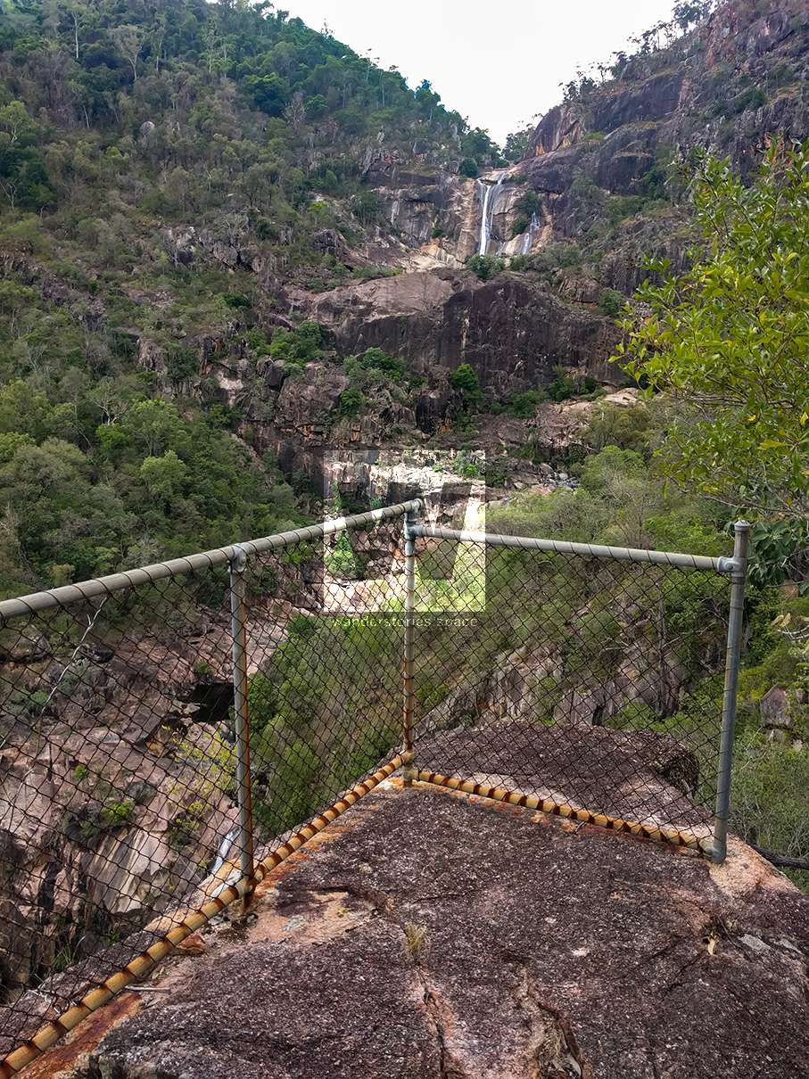
Drive to the end of the Jourama Falls road and park here. Walk along the track for 15 minutes to the only lookout. From here, you'll have to find your own way to the top. A bit further up from this lookout is the old lookout. You can still make out the track caved into the side of the hill winding its way up. You'll know once you reach the old lookout as there is still the old rusty fence.
Rarely you will find a path of flatten vegetation from other hikers but don't be mislead by animal tracks.
(UPDATE: Now that there is a tagged path by Wilfred, the Townsville Bushwalking Club hike this track every now and then.)
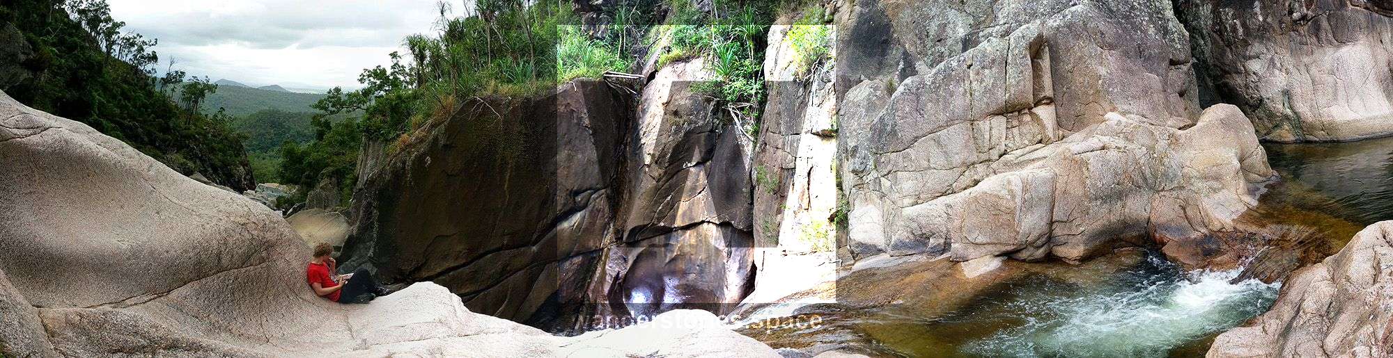
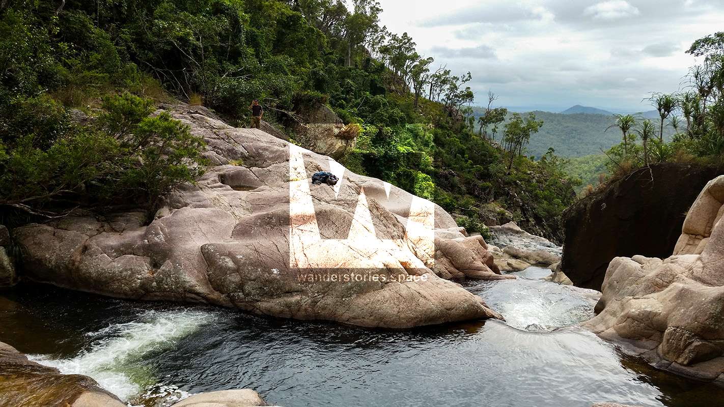
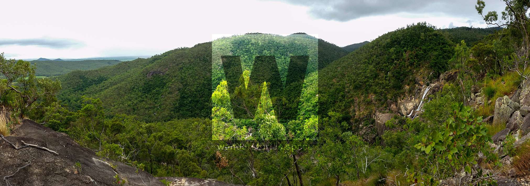
From the main, still maintained lookout, head directly up to the right climbing about 15m to the rock structure. Following the saddle across and up slightly diagonally to the left about 300 metres and you'll be on top of the cliff face (picture below). I recommend having a rest break here for you and your fellow comrades to take advantage of any cool breeze and the amazing view! Ascend another 600 metres slightly diagonally to the left again. Follow the contour of the hills and across a valley. Then descend safely down into Waterview Creek.
Here's an interactive map of the track to better describe the route:
There are a few different places that are flat enough to camp comfortably.
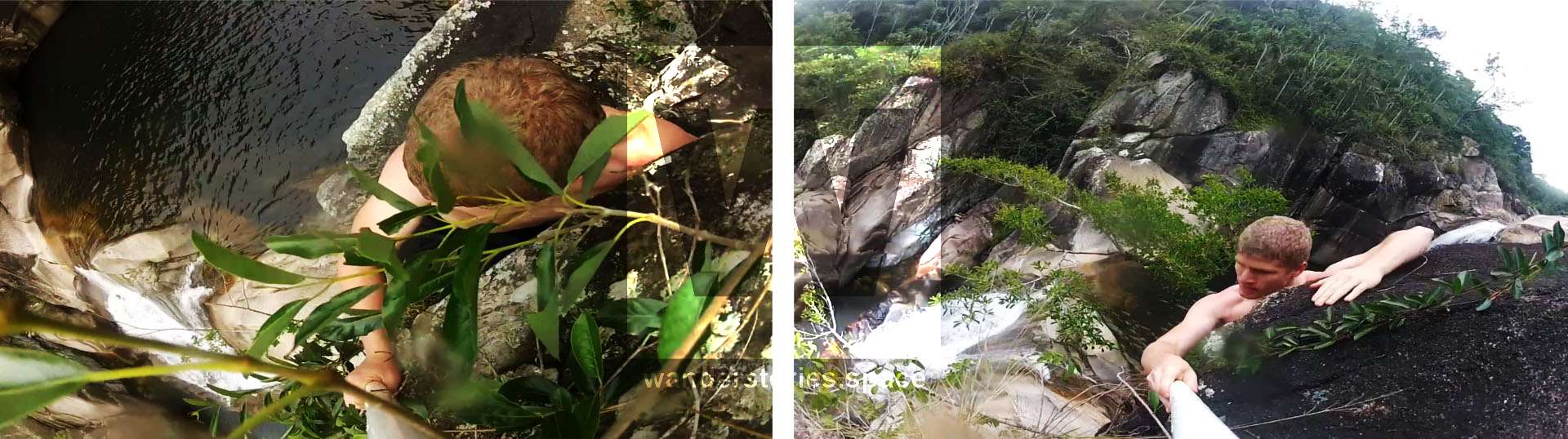
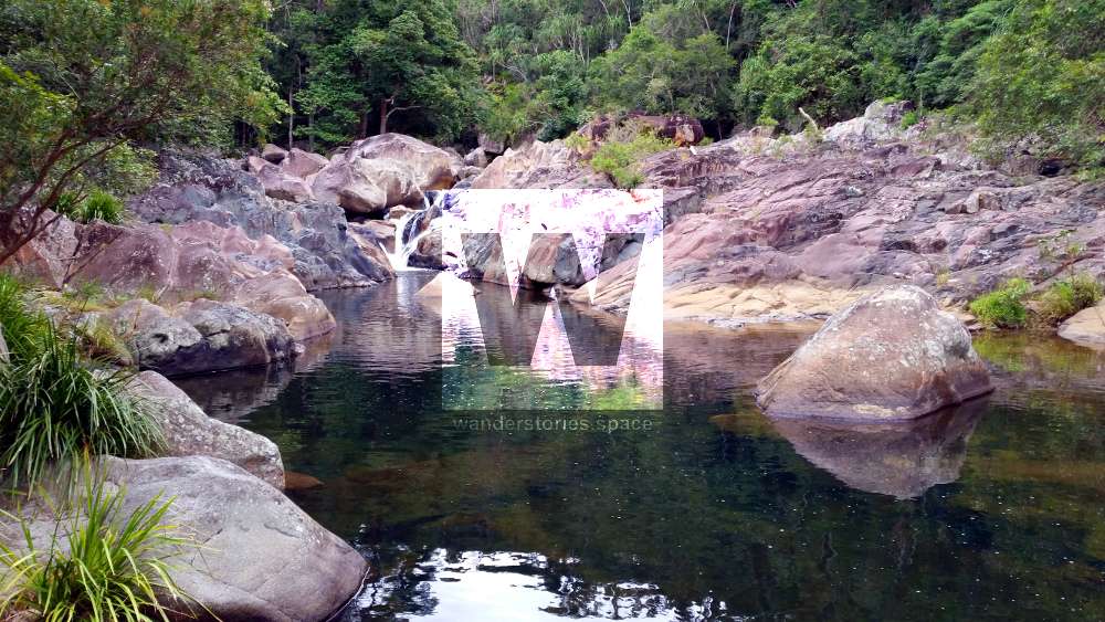
I wouldn't recommend going down the valley as moving is slow and you risk exposure to the stinging tree. I would, however, recommend that you take a compass and a topography map with you. There are three large swimming holes available at the top to refresh. You may also find some small leeches in the water clinging to the rocks.
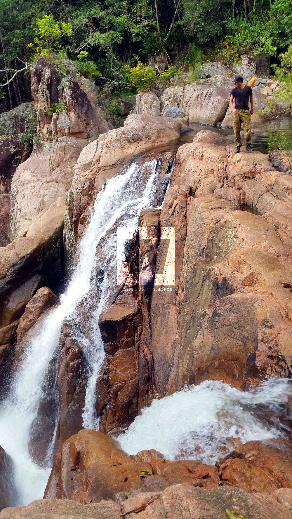
You can jump from waterfall at the very top (pictured below) down into the pool below; Always check first as there might have been a flood during the wet season that has washed down trees that are laying in wait just under the water or a dead trees might have fallen in from the above cliffs. Climbing back up can be difficult and I do not recommend it for someone who is afraid of heights or has zero rock climbing experience.
After having a quick rest and setting a gopro on a time lapse, we hiked up further along the creek. We had planned to do it in two days. So we had enough food for 2 days, and camping gear to stay the night.
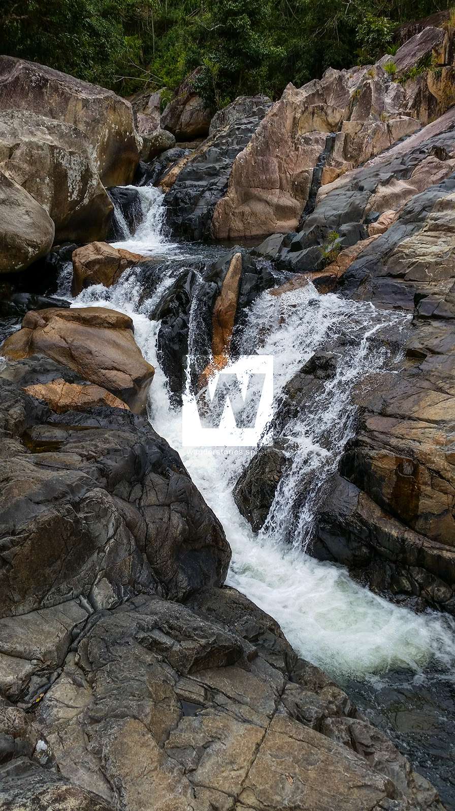
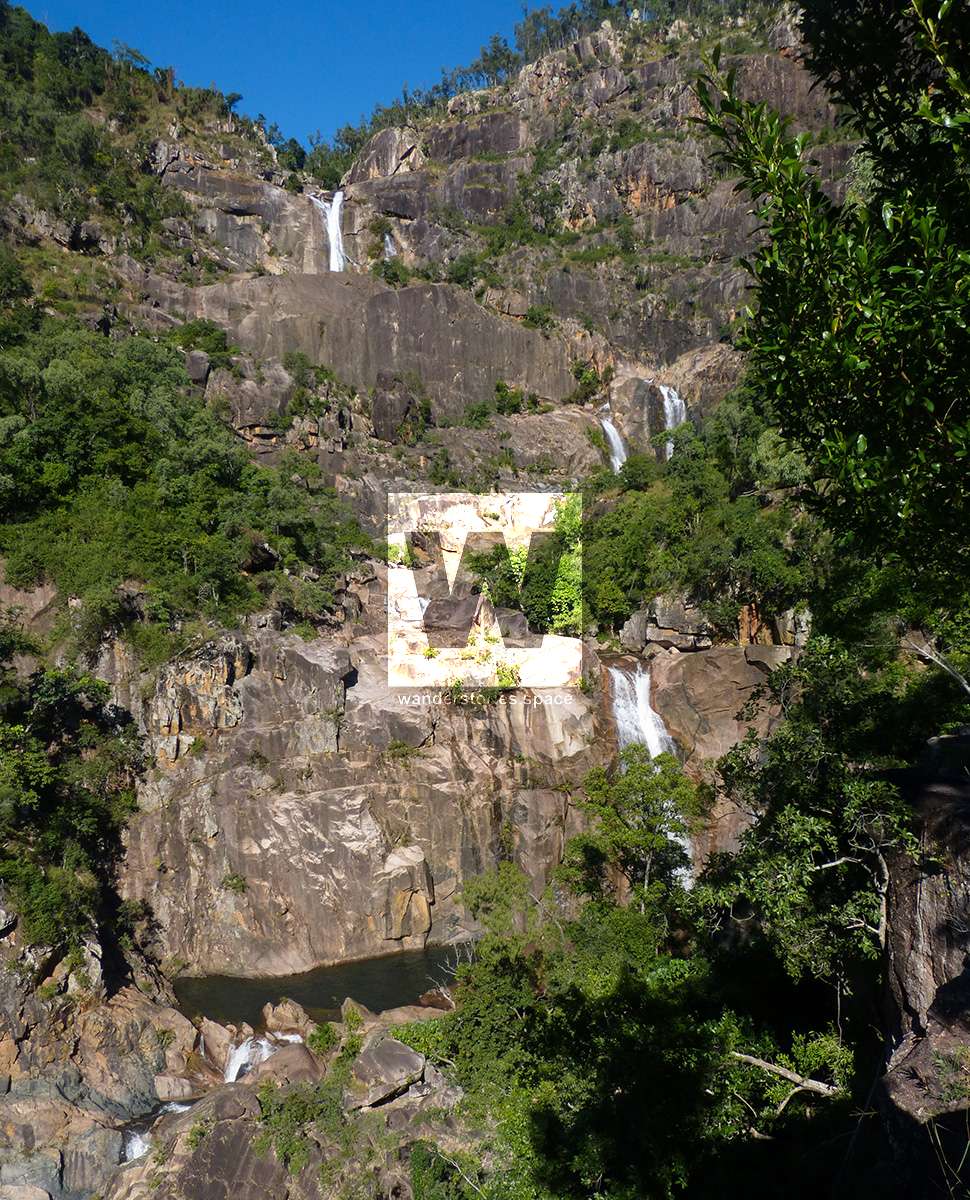
It's pretty easy from now on following the river upstream rock hopping for most of it. However, after drizzling all day, the rocks became super slippery and it was very difficult to move forward. Waterfall after waterfall, we forced to climb up out of creek bed and through thick rainforest forest.
We were 200m away from the black hole and I couldn't convince Matt to go on or camp the night anymore - I don't blame him, it was very wet and cold after the storm rolled in. There wasn't much time before dark so we started heading back down to the car without stopping. I'll say it, the scenery was spectacular but the rock hopping and slipping over was very rough on our bodies. Although we didn't make it to our destination, we both enjoy the journey.
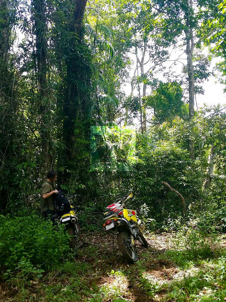
Half a year later we then tried our luck with our motorbikes going up from the old forestry road, Jacobsen's track. Parking our motorcycles at the top of the black hole and working our way down through the thick, dense rainforest.
After wading through the myriad wait-a-whiles (lawyer cane), we made into in the riverbed.
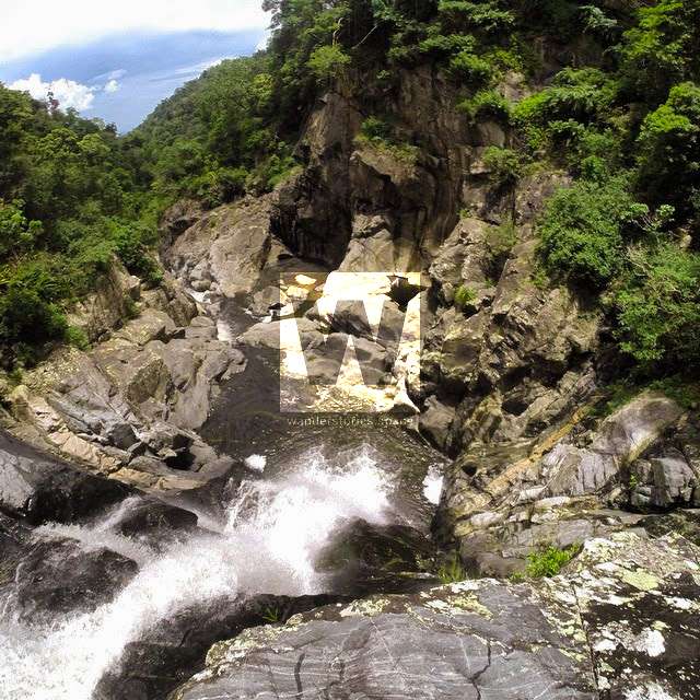
Rock hopping our way down the creek, climbing over rocks and down small waterfalls for about half an hour, we made it to an impassable dropoff and canyon. Matt wasn't keen on finding a way around. Here we decided to rest, take in all the nature and relaxed a little.
(UPDATE: Now these two rappels have been bolted so you can now abseil down into the Black Hole)
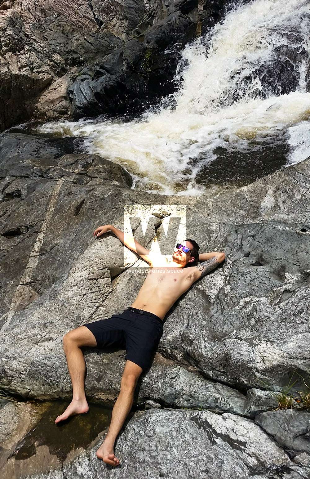
It was very thrilling being in the middle of nowhere, right in the heart of nature with only the sounds of birds whistling and water running.
Here's an interactive map of this journey.
Another half a year later and I had conquered that "black hole" solo.
After those failures, Matt wasn't keen to go back again and I couldn't find anyone else that was crazy enough to give it a go.
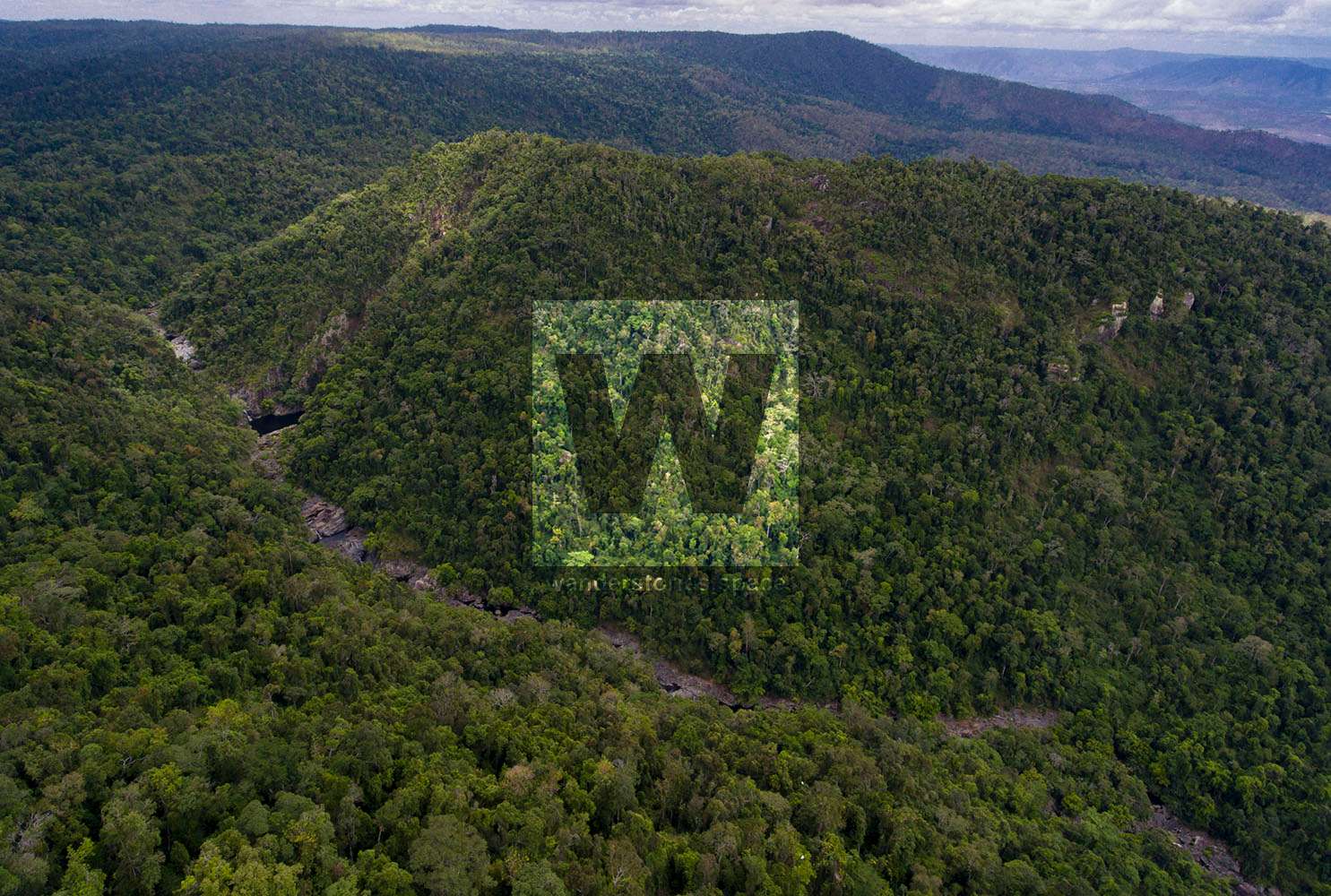
So solo it was. I thought I'd try an alternative route this time. After hiking up along the ridgeline, the vegetation soon became too dense and thick with lantana. From here I made my way down into the waterview valley, rock hopping the creek bed to the black hole - it was much easier when the rocks were not wet. With the rock being dry, the waterfalls were easy enough to scale so there was no need to go bush thankfully.
After arriving at my destination, I was rewarded with an amazing, jurassic view of the 25m deep waterhole. Time for a refreshing swim!
Here's the interactive map of the route I took.
I've hiked to the top of the Black Hole several times now via several different routes.
See also the following articles that cover the area:
 Luen Warneke
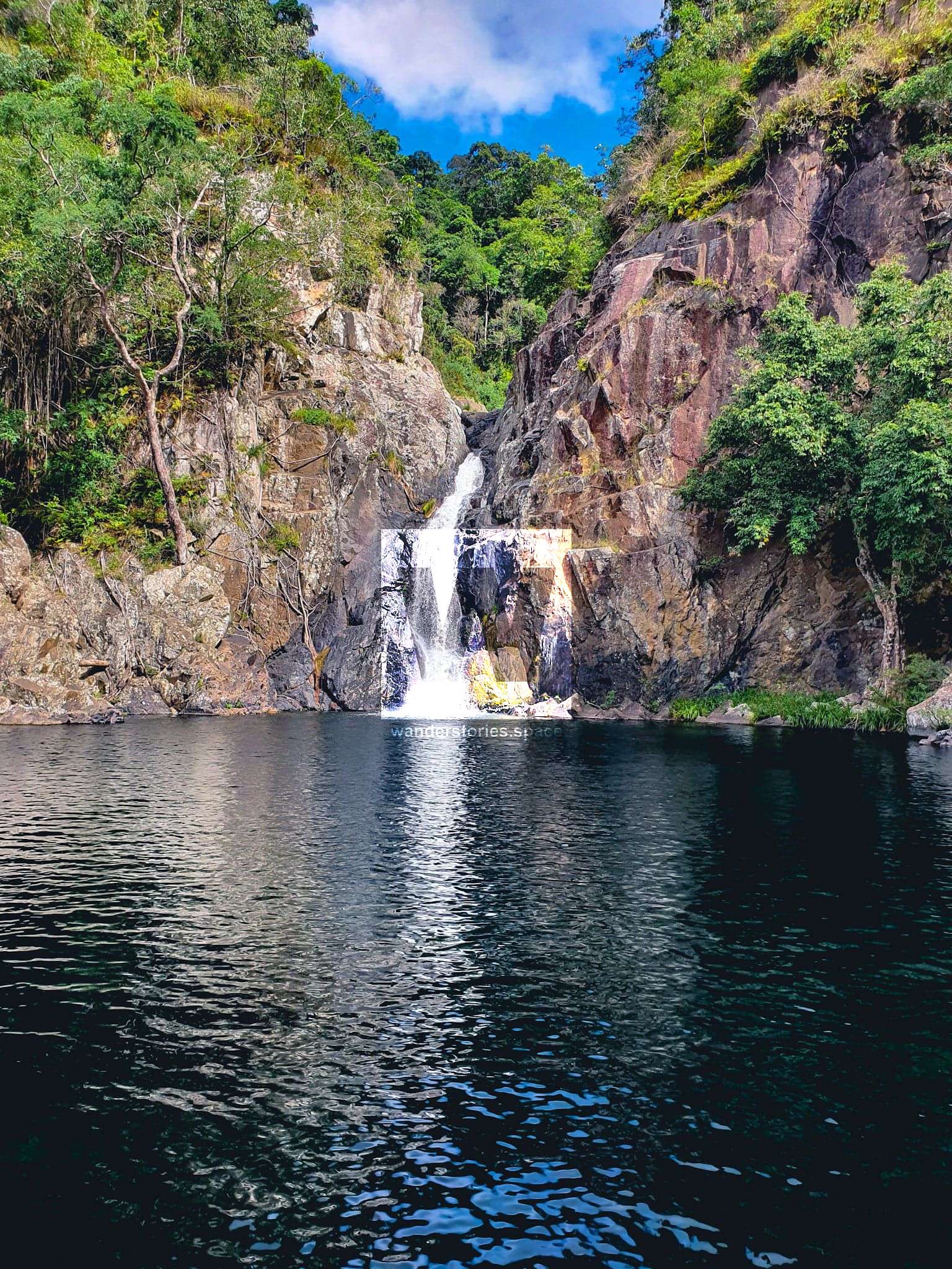 Luen Warneke
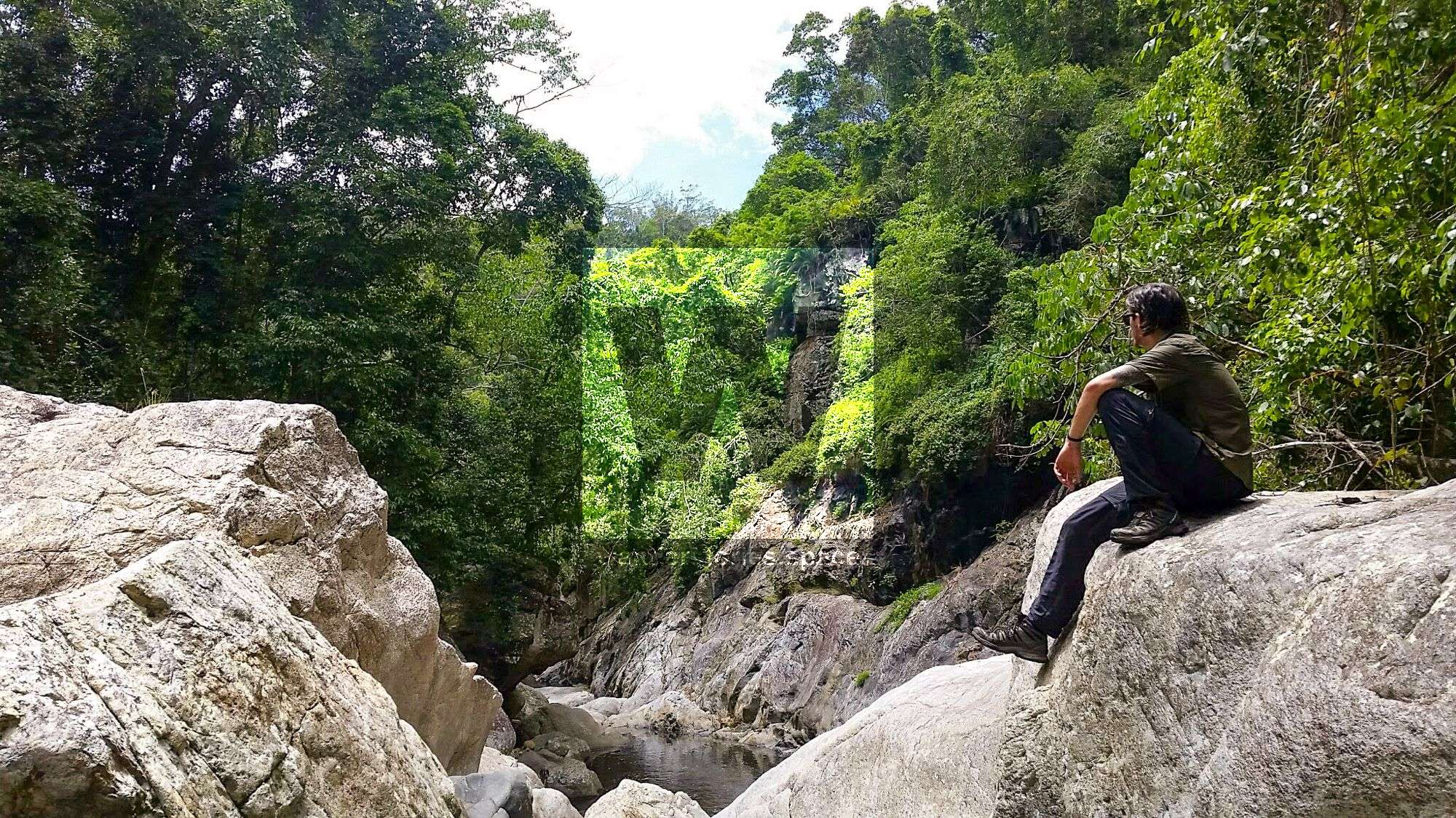 Luen Warneke
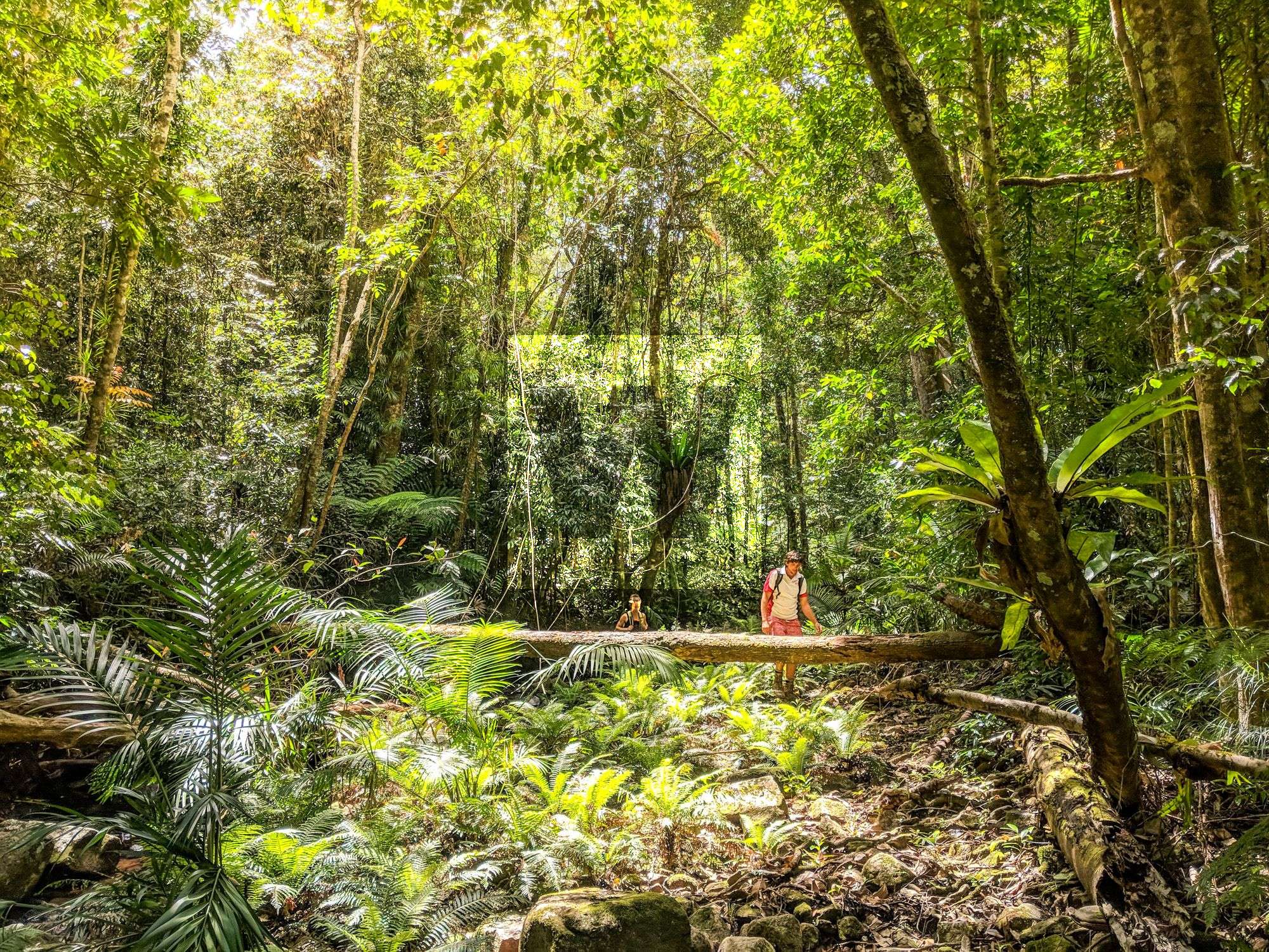 Luen Warneke
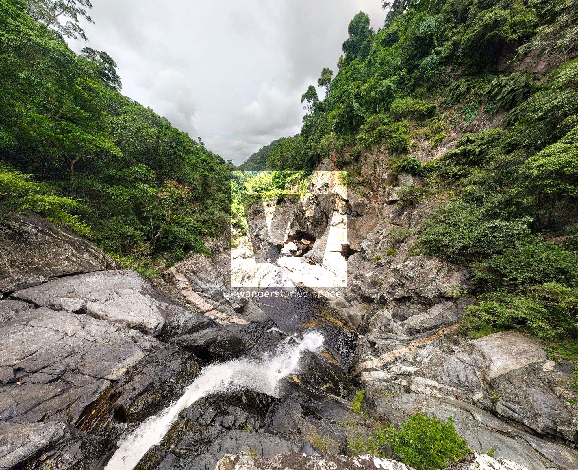
This article, and all other articles, are for entertainment purposes only and are not to be used as a guide. Please see our Disclaimer for more information.