Benham Creek
Located in the Paluma Village vicinity, Benham's Creek was originally called Ethel Creek by the Benham brothers, and back in the mining days, one of Ethel Creek's small pools was used for bathing.

Location - Paluma Range National Park, North Queensland, Australia
Difficulty - Grade 5
Distance - 2 kilometres return
Time - Allow 3-4 hours return
Located in the Paluma Village vicinity, Benham's Creek was originally called Ethel Creek by the Benham brothers, and back in the mining days, one of Ethel Creek's small pools was used for bathing. Later, a surveyor erroneously gave the name Ethel Creek to a larger stream that joins Benham's Creek further north. An official decision was made in 1939 to rename the original Ethel Creek as Benham's Creek.
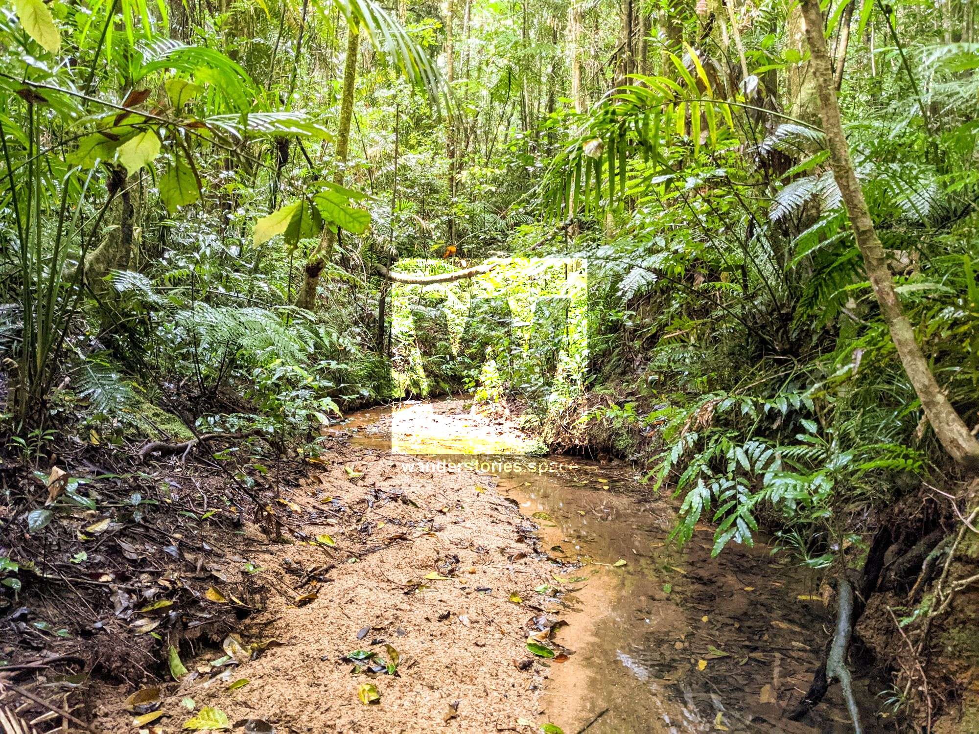
Benham's Creek runs to the north of Paluma behind the Community Centre – about 200 meters along the Andree Griffin Track starting from the toilet block – and forms the southern boundary of Paluma Range National Park (previously called Mt Spec National Park). Benham's Creek has its own concrete weir (including a resident platypus) and eventually joins with Cloudy Creek near the bottom of the range just before flowing into Big Crystal Creek.
The Benhams were among the first Europeans to explore and inhabit what is now Paluma Range National Park, and so it follows that many local place names in Paluma commemorate members of the Benham family. Nicknamed 'possum', Arthur Benham is credited for clearing 'Cloudy Clearing', which is now known as Paluma Village. Some believe that, when the Benhams were setting up Cloudy Clearing, they were simply improving upon an existing Aboriginal campsite. It is hard to say for sure, however. Even though the Benhams were among the first Europeans in the Mt Spec-Paluma area, there are few historical reports that suggest they communicated with the local Aboriginal people.
How to get there
You can access the start of Benham's Creek at the end of Lookout Road - near the Rainforest Inn and the High Ropes Course (the old rangers station). From here, the creek follows the National Park boundary behind Gumburu and the houses on the northern side of Mt Spec Road, which is the main street in Paluma. It then proceeds along the creek, behind the Community Centre, and then it continues parallel to Smith Crescent. The creek then takes a bit of a turn and heads northeast and flows into Cloudy Creek 100 meters before Cloudy Creek Falls.
To skip the headwaters (and thicker vegetation), join in (or exit) at any of these other points:
- School Track
- Weir
- School Track
- Andree Griffin Track
- Georgee's Waterfall Track
- Frith's Track
- and then a long walk to Cloudy Creek Falls Track.
Interactive Map
The area around Benham Creek is littered with old tin mining history. Rich with mining history with plenty of digging and water races to explore nearby.
Easy to access and exit at some points.
Take secateurs.
Flows into the weir behind the Paluma Community Centre / Paluma Community Green.
Listen to birds and the streams as you walk down the creek.
Flows into Cloudy Creek near Cloudy Creek Falls.
Tips: rocks are slippery and mossy. Choose footwear wisely
This article, and all other articles, are for entertainment purposes only and are not to be used as a guide. Please see our Disclaimer for more information.