Wanderstories Maps
Wanderstories is passionate about the outdoors, which is why we've spent time creating a web app to help you plan and review your adventures and a topographical map source to view the hidden gems around North Queensland. We've also recently embarked on the route of making a map of waterfalls in Australia.
Web app for mapping
See the mapping web app. Also, see the transparent overlay tool, which some prefer. The mapping website at https://maps.wanderstories.space/ was designed and built by Luen Warneke. The code repository can be found on GitHub. The map used Leaflet and custom plug-ins like BOM Radar, Permalink Extended, Save & Share, and mouseCoordinateQLD/mapGrid to link to the printable QLD Topo and ImageTopo maps. With a wide range of baselayers (such as QTOPO, QImagery, Custom WS OSM-based Maps) to switch between and a selection of overlays (such as Strava Heatmap, TrailForks Heatmap, SlopeShading, and Queensland National Park alerts) making this a great one-stop app to plan trips.
Web app for Queensland Waterfalls
We have also been busy wrangling data on all the waterfalls in Australia. This is an ongoing project and will be updated when we have the time. See our data preview waterfalls.wanderstories.space.
Web app for Historical Mines
coming 2025
Map source & data
We have compiled a list of map sources for use with mobile apps, such as Guru Maps, Backcountry Navigator, Gaia Maps, Locus Maps, and Avenza Maps, and desktop and web editors, such as QGIS and JOSM. For the full list of our tile servers, see our map sources article.
Wanderstories has created their own topographical map source by contributing data to OpenStreetMap (OSM). These data are then leveraged by using Mapbox to create the end result - a Wanderstories-styled tile with additional custom data. We have also added additional data to these maps that is not available on OpenStreetMap, Mapbox, MapTiler, or any other source for that matter.
OpenStreetMap creates and provides free geographic data, such as street maps, publicly. The project was started because most "free" maps actually have severe legal or technical restrictions on their uses, holding back people from using them and the data in creative, productive, and/or unexpected ways.
OpenStreetMap data and the maps from this site are available for free, but OpenStreetMap totally relies on the input of its users, so please consider contributing GPS traces and/or by mapping your surroundings if you find this service useful.
OSM Wanderstories Map Style
Maps using OpenStreetMap and Mapbox map designs and/or data must display the text attribution, and you must add these forms of attribution when using the Wanderstories Maps.
"map tiles © Wanderstories / map engine © Mapbox / map data © OpenStreetMap contributors under ODbL / Improve this map"
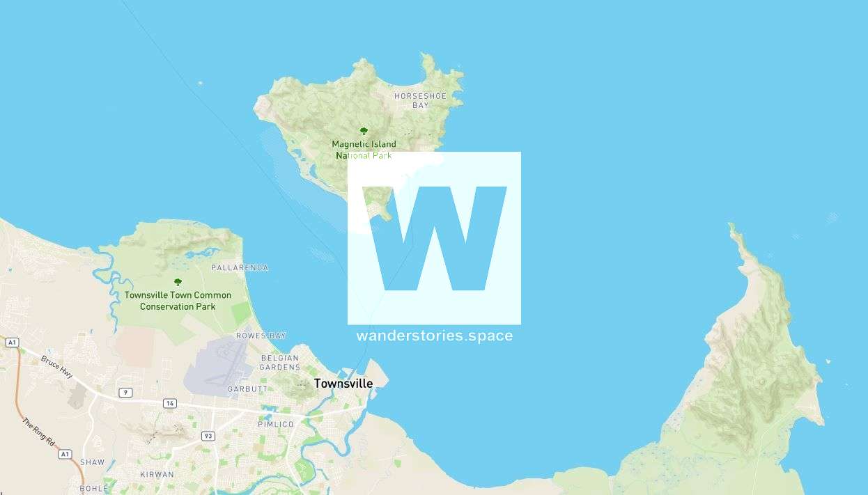
Map of Townsville, Queensland, Australia
https://maps.wanderstories.space/outdoor/{z}/{x}/{y}OSM The Island of Mo'orea, French Polynesia
In 2018 on a holiday in Mo'orea, French Polynesia, Luen was looking for a map of the island so he could hike to all the places. After searching for a long time, he found the Thunderforest Outdoor maps and soon realised he could edit the map via OpenStreetMap. Luen then took on the project of completely mapping the island, roads, tracks, paths, buildings, reefs, cliffs, waterfalls, creeks, and after many hours of mapping, the island was complete. Using the government elevation data, accurate topographical lines were created as the Global NASA DEM data has some errors, mainly Mt Rotui.
Map of Mo'orea, French Polynesia
https://maps.wanderstories.space/moorea/{z}/{x}/{y}Map section of Mo'orea, French Polynesia


What's on the maps?
- Topography (altitude contours) and relief shading
- Bathymetry (depth contours) in some places
- Sealed roads, unsealed roads, bush tracks, walking tracks
- Rivers and creeks with names, wetlands, lakes
- Railway lines, disused lines, stations
- Towns, localities, buildings
- Huts, helipads, campsites, bridges, gates, etc
- Historical disused logging & forestry roads
- Historical mines such as historical mine shafts and tunnels
- Historical ruins, such as old huts, old mining camps
Change Log
We are always improving and updating our articles and map data, so keep an eye out for updated versions and subscribe below for updates.
Jan 29, 2023
Refracted code
Oct 2, 2022
Rewritten in NodeJS
Nov 19, 2020
Initial release in PHP
Why are they free?
Luen was eager to study more detailed data on the maps, finding them essential for planning adventures. Luen created these maps based on his own experiences, encompassing activities such as hiking, climbing, biking, four-wheel driving, paddling, and more. They have been crafted to serve not only as functional guides but also as companions for anyone who seizes any opportunity to explore the great outdoors.
Data Sources
Wanderstories uses data from the following sources:
- Field surveys - Locally surveyed via hiking and GPS
- pers.comm
- Historical map data (mining and logging eras)
- OpenStreetMap - See Luen Warneke.
- Queensland Government - QLD Department of Natural Resources, Mines and Energy
- Geoscience Australia
Source data is obviously modified and made available free, subject to the continuation of the conditions of these licences, including attribution.
This website incorporates data which is:
© Commonwealth of Australia (Geoscience Australia) 2000,2002,2006 ("Data"). The Commonwealth has not evaluated the Data as altered and incorporated within Wanderstories and therefore gives no warranty regarding its accuracy, completeness, currency or suitability for any particular purpose.
Split, Index, Grid, Datum, Projection
Current maps are in WGS84 / pseudo mercator (EPSG:3857). They’re split and named based on standard government schema. A UTM grid is overlaid.
Copyright notice
Nearly all the data used in this map comes from OpenStreetMap contributors, like Luen Warneke. OpenStreetMap is open data, licensed under the Open Data Commons Open Database License (ODbL).
Data is also collected from other datasets, namely Wanderstories GPX files.
Mapbox makes it easy to leverage the data from OpenStreetMap and create the end styling. Therefore, attribution includes © Wanderstories, © Mapbox, and © OpenStreetMap.
When changing layers on the Wanderstories interactive maps, attribution is automatically updated and credited appropriately.
Usage Terms
The Wanderstories maps and data ("the website") is a free service provided by Wanderstories.
Attribution-NonCommercial-NoDerivatives 4.0 International (CC BY-NC-ND 4.0)
You are free to:
- Share — copy and redistribute the material in any medium or format
- Attribution — You must give appropriate credit, provide a link to the license and to this page, and indicate if changes were made. You may do so in any reasonable manner but not in any way that suggests the licensor endorses you or your use.
- NonCommercial — You may not use the material for commercial purposes.
- NoDerivatives — If you remix, transform, or build upon the material, you may not distribute the modified material unless with written permission.
When accessing the website, we'd like to warn you that:
- it's a work in progress;
- we'll be adding, removing and changing features and data without notice;
- it uses experimental algorithms and hardware;
- it uses data from a variety of sources, and all such data is potentially inaccurate, probably incomplete and not up-to-date;
- we're not giving you any kind of professional, scientific, medical, technical or expert advice; and
- we're not charging you to access the maps.
With that in mind, you bear all the risk and responsibility for whatever use you make of the website and the content that you use from the website. We have no liability to you for any loss or damage you suffer as a result of the use you make of the website. Not only that, if you ignore our warnings and rely on the website in some way that causes you or someone else to suffer some loss or damage, then you agree to reimburse us for our time and any costs or expenses that we might incur as a result of you ignoring our warnings.
Wanderstories excludes all warranties, whether express, implied, statutory or otherwise, relating in any way to this website or your use of this website, maps, or service. If, despite all of this, for some reason, we are limited in our ability to exclude or modify liability, then to the extent permitted by law, we will limit our liability to refund you any money you have paid to Wanderstories to access the website. If there is anything in our usage terms you don't like and can't accept, then don't access the website.
See also our Disclaimer.