Cowley Falls, Friendship Falls, and Cowley 3 Falls
This waterfall is a massive waterfall located next to the Palmerston Highway. A rough track takes you to the top of the falls and we describe how to get to the bottom of Cowley Falls to see the cave-like feature.

Location - Wooroonooran National Park, North Queensland, Australia
Distance - To the top: ~2 km return; Bottom of Cowley and Friendship Falls: ~5 km circuit.
Duration - To the top: ~1-2 hours return; Bottom of Cowley and Friendship Falls: 4-6 hour circuit.
Difficulty - To the top: Grade 4, on a rough track; Bottom of Cowley and Friendship Falls: Grade 5.
Elevation gain - ~110 metres
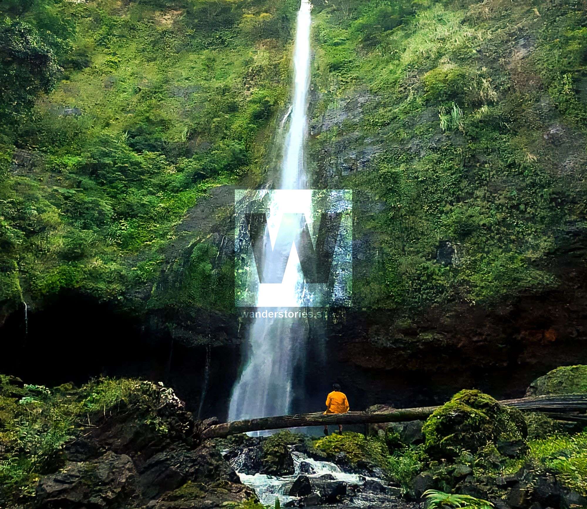
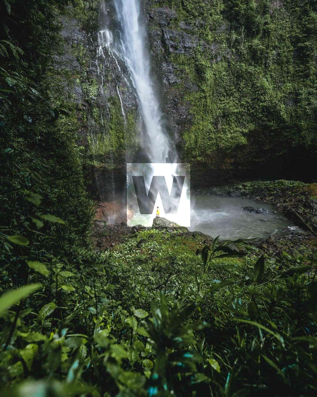
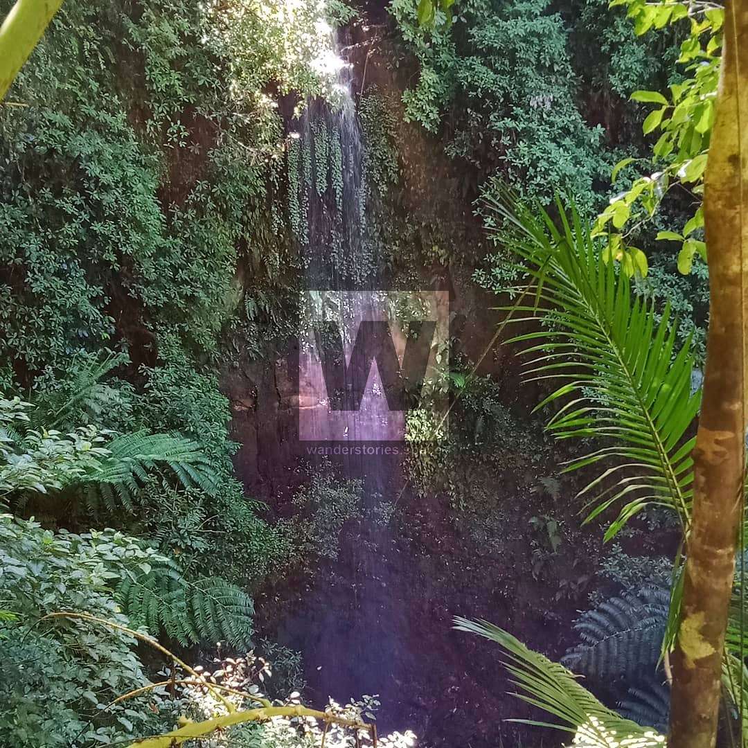
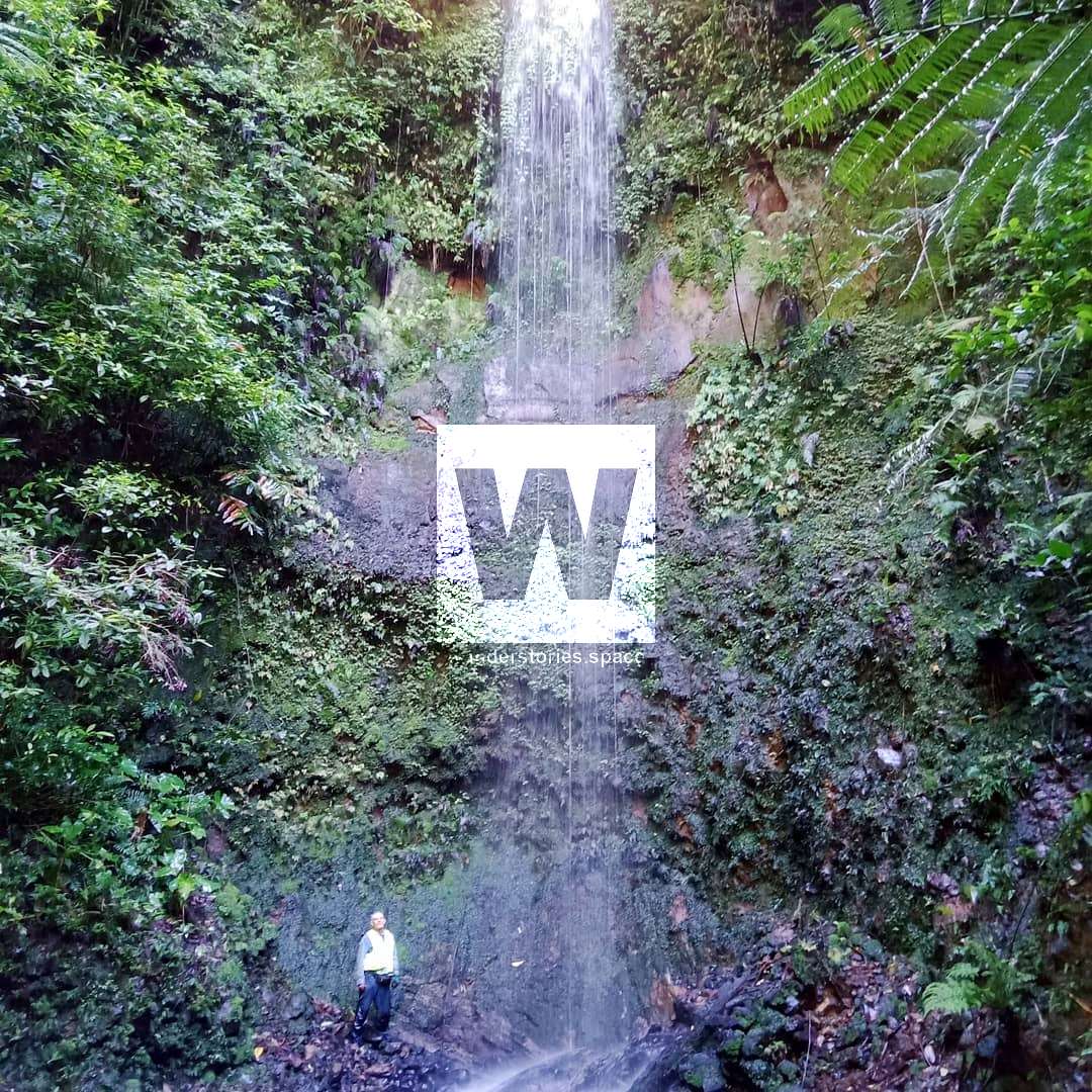
A stunning waterfall is located closer than you think. The Aboriginal name for Cowley Falls is Durbudgerbah,, and it is located just off the Palmerston Highway and is a large drop-off. The base of the falls has a small cave-like feature to it. Below, we describe the old, long-forgotten tourist track to the top of the falls, the steep new track down the ridgeline, and the whitewater kayaker's track up from the river. Linking these routes makes for a great circuit.
The early settlers took the Geraldton Tramway to within 10 miles of the falls and then a horseback trail the rest of the way.
Cowley Falls, Friendship Falls (a.k.a. Little Cowley Falls), and Cowley 3.
See also the Friendship Falls article.
The locals have maintained an old track. This trail is no longer an official national park trail and, therefore, unmaintained for the most part and will be overgrown in places. You can still make out the concrete stairs from when it used to be a popular tourist destination.
How to get to the top
Pull off the Palmerston Highway onto the road works gravel storage area (near the tea plantation). Park at the end of this road near the gate.
It's a little tricky to find the trail at the start so keep an eye out for the pink flagging tape. Once you've found the trail, it becomes a but more well-worn and easier to follow. Follow the track to Mitcha Creek and once next to the creek, head downstream to the top of Cowley Falls.
Video credit: @exploring_withem
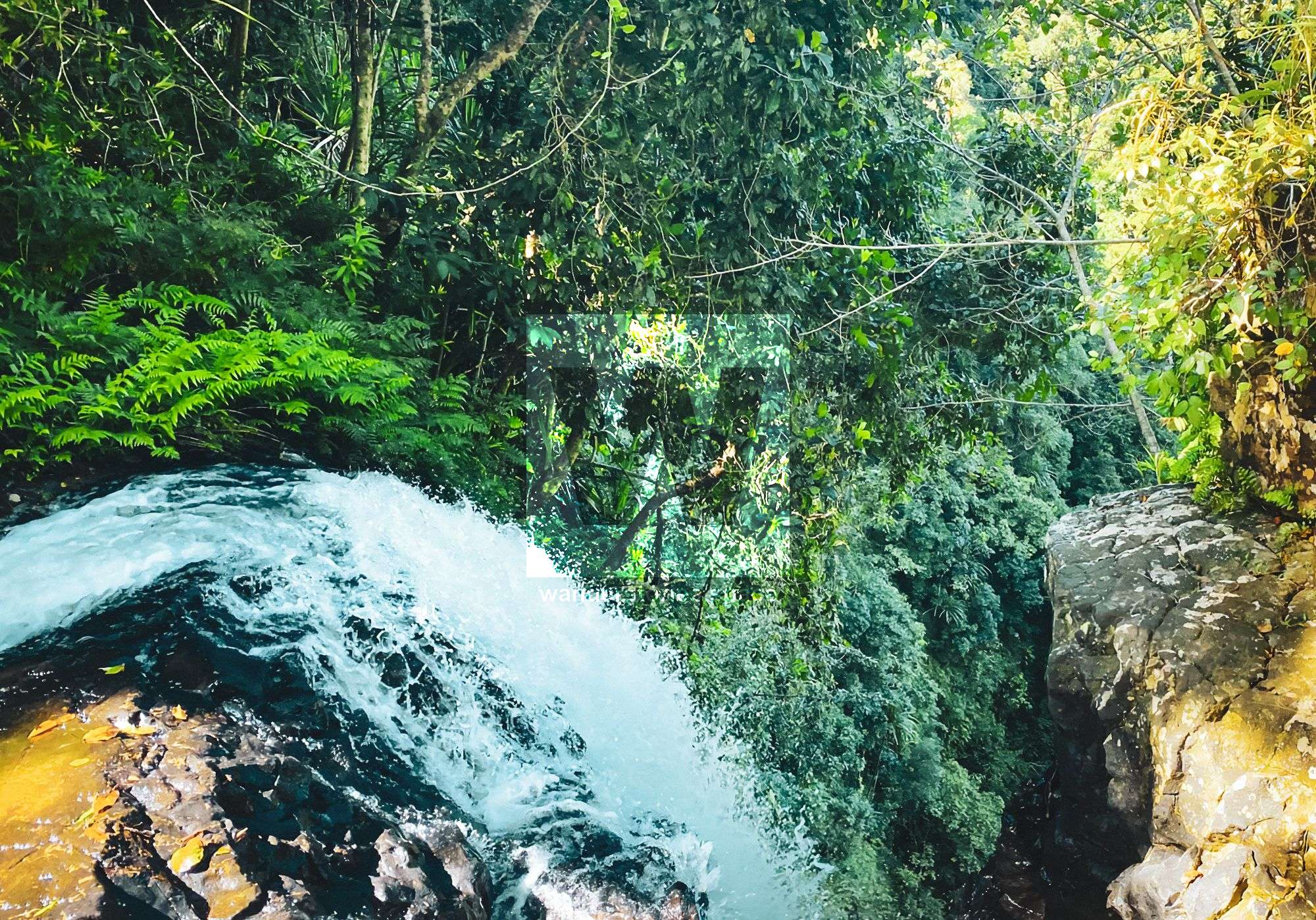
On your way back, if you head upstream about 120 metres from where the track joins the creek, you will see a very small cascade.
To get to the bottom
To get to the base of the falls, you have two options:
- The steep ridgeline next to Cowley Falls. You'll need to go "off-track" contouring around the rim of the falls and then very steeply down the ridgeline, avoiding the cliffs. This track becomes less steep near Mitcha Creek. Now you rock hop up Mitcha Creek to the base of Cowley Falls.
- The whitewater paddlers route (also a steep ridgeline but not as bad). The ridgeline down to Friendship Falls (a.k.a. Little Cowley Falls) and the South Johnston River is one that is used by whitewater kayakers. When you're near the river, you can choose to go upstream of the tributary to Friendship Falls. At the river, continue upstream to Micha Creek. The trees are marked with pink flagging tape.
Linking these routes creates a perfect circuit.
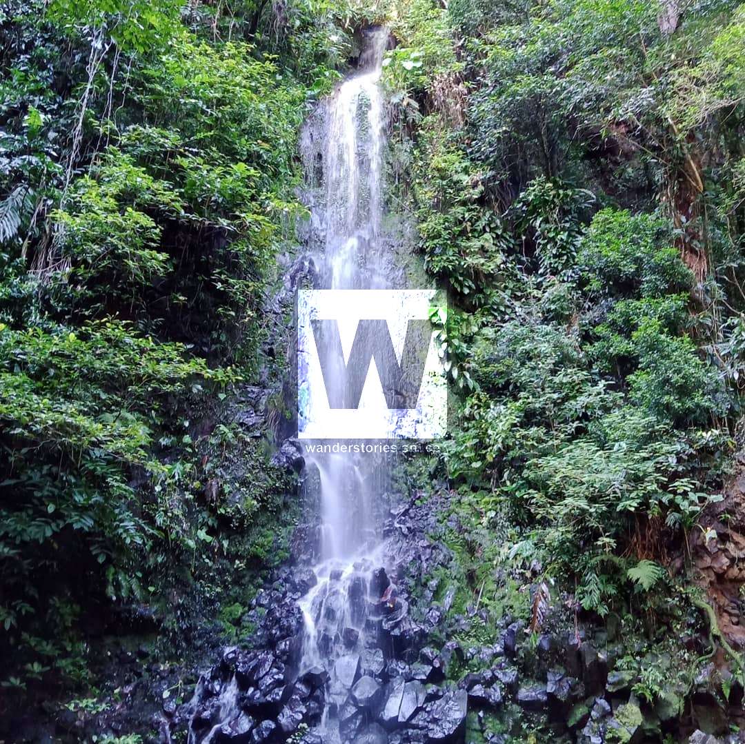
Cowley 3; Photo credit: @drinnanjames
Also, note, Cowley 3 waterfall is not commonly seen.
The basalt rock formations are definitely interesting.
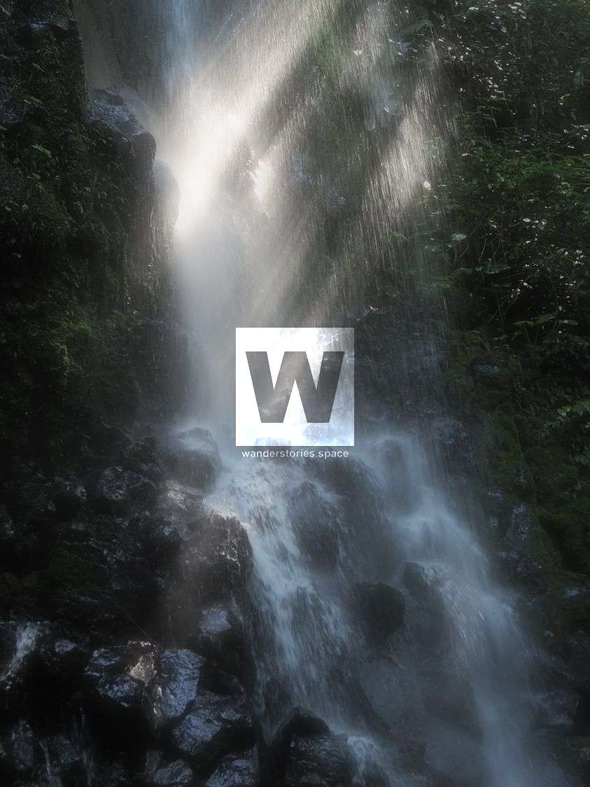
Photo credit: @fieldsofwild
Interactive Map
Notes
- The route is slippery after rain.
- Vegetation at the base of the falls is fragile. Trend gently.
- Crocs in the South Johnston River but it's rare they are that far upstream.
- Stay away from cliff edges and steep slopes.
- Be mindful of the lawyer cane (wait-a-while) and gimpie gimpie (stinging trees).
This article, and all other articles, are for entertainment purposes only and are not to be used as a guide. Please see our Disclaimer for more information.