Expedition National Park
Expedition National Park shares its western border with Carnarvon Gorge and is similarly comprised of huge sandstone escarpments, deep gorges and wide-open valleys.

Location - Expedition (Limited Depth) National Park, Central Queensland, Australia
Difficulty - Grade 4, moderate
Distance - 6 km return to Robinson Gorge
Time - Allow 2 hours return to Robinson Gorge
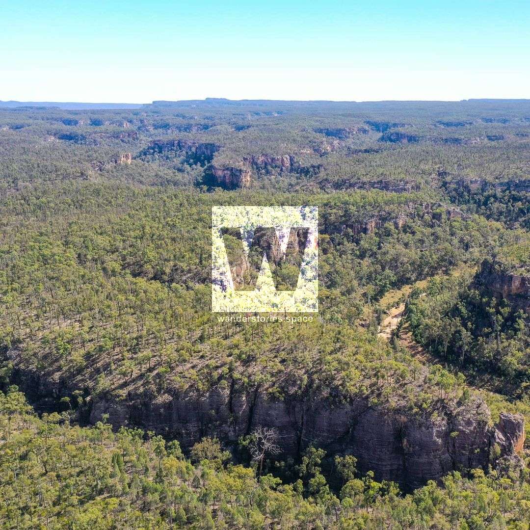
Expedition National Park is part of the Central Queensland Sandstone Belt and is comprised of wild terrain with huge sandstone escarpments up to 100 metres high, deep gorges, and wide-open valleys and shares its western border with Carnarvon Range. Expedition National Park is Explorer Ludwig Leichhardt passed through here in 1844 during his journey to Port Essington near Darwin and named many landscape features after members or supporters of his expedition.
The park is split up into three different sections: Robinson Gorge, Lonesome and Beilba sections and is accessible by four-wheel drive.
For thousands of years, Aboriginal people lived in this area, leaving behind stencil rock art on cliffs and overhangs in the more remote parts of the park which displays a rich social and spiritual association with this landscape as well as other sacred sites. Please respect this place, as it is of special significance and spirituality to Kongabulla Clan of the Iman Tribe - the Carpet Snake People.
Bush camping and camping in designated camping areas are permitted in all three sections of Expedition National Park. Expedition National Park offers a range of camping opportunities at Robinson Gorge on the east side of the park and at Lonesome and Beilba on the west side of the park. There are three official camping areas in total and various bush camping locations elsewhere in the park: Starkvale camping area, Lonesome bush camping, Beilba bush camping, as well as Remote bush camping permits.
Most of the park is covered by dry eucalypt forest, the mature spotted gum forest being the only intact forest of this type. Mount Cannondale in the Amphitheatre contains one of the largest intact softwood scrub remnants in the central highlands. Patches of dry rainforest scrub grow in narrow side gorges and wildflowers flourish along the cliff tops.
Walking tracks are provided in Robinson Gorge section of Expedition National Park. There are no official walking tracks at Lonesome or Beilba sections.
Robinson Gorge section
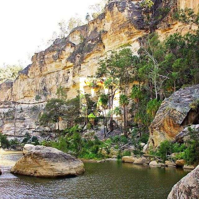
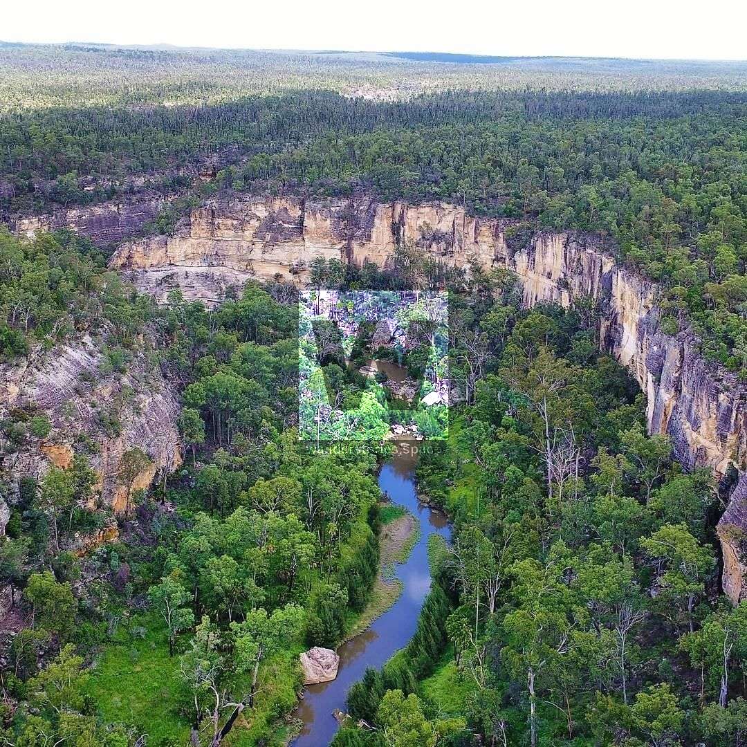
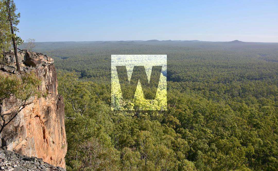
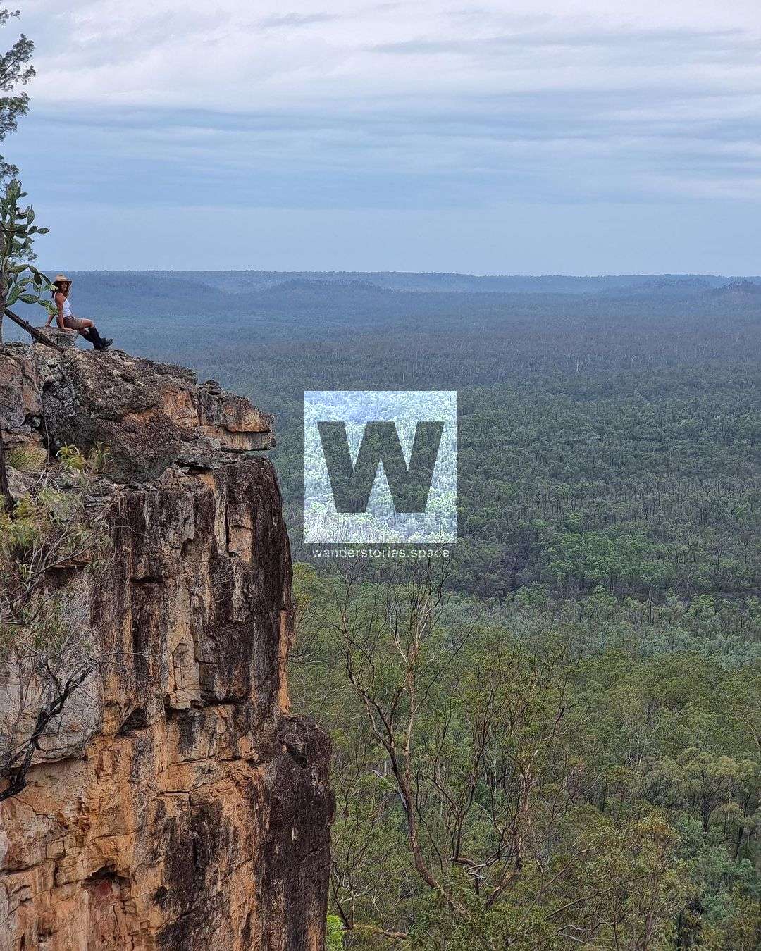
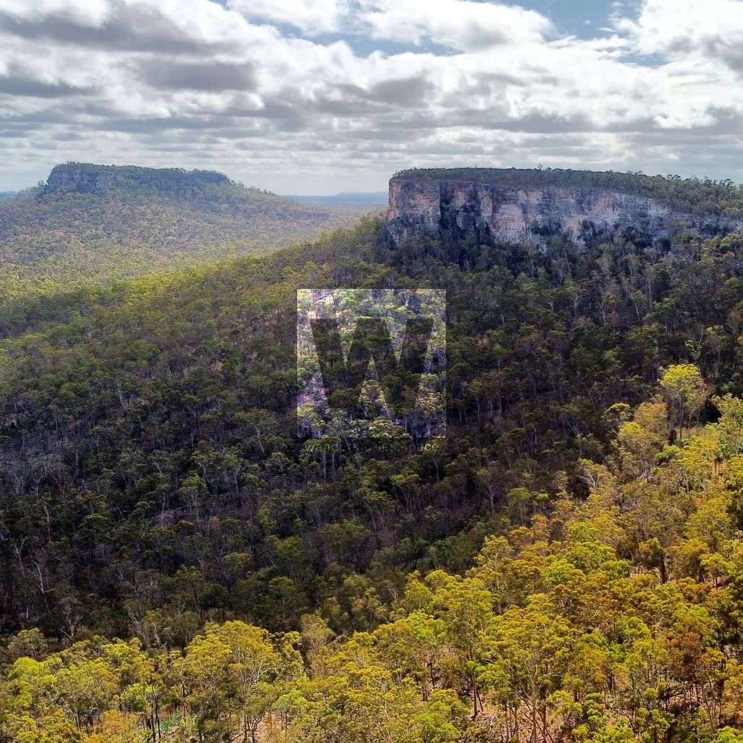
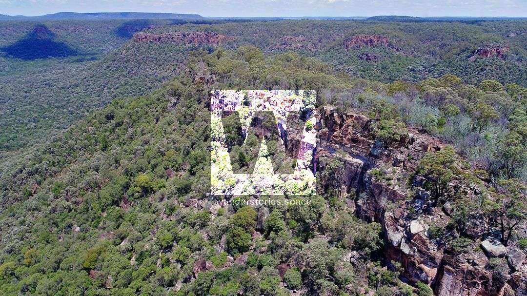
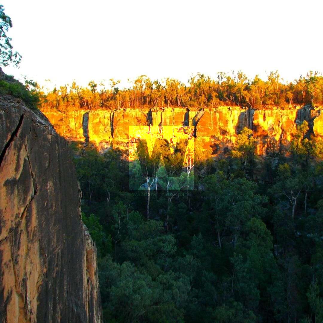
Robinson Gorge is the main feature of Expedition National Park and is located on the Expedition Range between Taroom and Rolleston. The gorge winds 14 kilometres between sheer sandstone cliffs with a broad shallow basin in the north and narrows to a deep pool and narrow gorge towards its southern end with a spectacular deep pool.
Enjoy isolation in a rugged and heavily-timbered plateau, deeply dissected by gorges of beautiful white, yellow, orange and salmon-coloured sandstone. See Dawson River palms (Livistona nitida), cabbage palms, bottlebrush, and wattles lining creeks with patches of dry rainforest in side-gorges and wildflowers along cliff tops. Spot rare plants including towering Eucalyptus rubiginosa and small, prickly Leucopogon grandiflorus.
Tracks in this section are signposted. Most tracks are best suited to experienced, well-equipped bushwalkers while some rough, ungraded walking tracks are suitable for fit family groups.
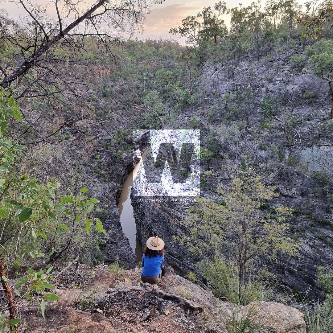
Robinson Gorge lookout
Difficulty: Grade 4
Distance: 4 km return
Time: allow 1 hour
From Starkvale, this track leads to the escarpment edge overlooking wide, tree-lined Robinson Gorge. There are numerous natural cliffs in the area and parents need to supervise children closely.
Robinson Gorge access track
Difficulty: Grade 4
Distance: 6 km return
Time: allow 2 hours
From Starkvale, head towards the lookout then turn off at the signposted intersection and descend into the gorge along a steep, rough trail. There are no marked trails in the gorge. There are numerous natural cliffs in the area and creeks can contain deep waterholes with very cold water.
Shepherds Peak track
Difficulty: Grade 4
Distance: 3.6 km return
Time: allow 1 hour 30 minutes
This trail leads 1.8 kilometres from Starkvale camping area to a sandstone plateau, Shepherds Peak, with excellent views over the park and the surrounding peaks and creeks. Walkthrough the 'Ruined City' of the Boxvale Sandstone just below Shepherds Peak. Take extreme care on top of Shepherds Peak as there are crevasses and unguarded cliffs.
Cattle Dip track
Difficulty: Grade 4
Distance: 1.2 km return
Time: allow 1 hour
The cattle dip car park is located 2.7 km from the Starkvale Creek campsite via a sign-posted track which passes the location of an old shepherd's hut (no visible trace remains). Walk 600 metres south from the car park to the 'Cattle Dip' - a spectacular narrow cleft between sheer rock walls surrounding a permanent waterhole.
Lonesome section
The Lonesome section of a grazing property and was gazetted in 1972 to protect scientific and aesthetic values. It lies along the edge of Carnarvon range and offers spectacular, panoramic views to the southern end of Arcadia Valley, Dawson River, the Carnarvon ranges and mountain spurs.
Brigalow scrubs, wilga, Lancewood, native bauhinia, bottlebrush, and riverine vegetation are prominent throughout Lonesome. One of the few remaining areas of brigalow growing in the red clay soils of the Arcadia Valley. 'The Candlesticks' form an impressive sandstone silhouette above the landscape of Lonesome.
Lonesome lookout provides sweeping views over the Arcadia Valley and the Expedition Range in the distance. There are no formal walking tracks in the park, so take a topographic map and GPS if you want to explore.
Beilba section
Beilba section is a remote area with rugged plateaus and scenic escarpments along the Upper Dawson River. Remnants from cattle grazing can be seen while enjoying a variety of vegetation types, including nearly 4000ha of brigalow, lancewood and softwood shrubs.
Wildflowers, including grevilleas, flannel flowers, acacias and pea flowers provide splashes of colour throughout the park in late winter and spring. Glimpse squatter pigeons in open woodlands and wallaroos on basalt hills in the centre of the park. Beilba section, also on the Carnarvon range border, preserves an important corridor along Dawson River to the north and Baffle Creek to the south. It protects an intact example of an escarpment country.
Interactive Map
Robinson Gorge walking tracks map
Notes
DANGER: Unfenced cliff edges. One slip could be fatal—serious injury or death may result from walking near the edge. Keep to the track. Supervise children closely.
Expedition National Park is remote and undeveloped. Visitors must be well prepared and self-sufficient. If you intend to bushwalk off-track, obtain a topographic map, compass, Emergency Personal Locator Beacon (PLB) and GPS, and ask for advice before setting off.
Ensure you carry adequate drinking water. Bring at least 7 litres of water per person per day for drinking, cooking and washing as streams are seasonal and water quality cannot be relied upon.
Bring a fuel stove and rubbish bags to take your rubbish away with you. Rubbish bins are not provided in the national park.
Gas companies drill for coal methane gas in the Beilba section. Please take care to avoid drilling sites.
This article, and all other articles, are for entertainment purposes only and are not to be used as a guide. Please see our Disclaimer for more information.