Kahlpahlim Rock / Lamb's Head
Kahlpahlim Rock, also known as Lambs Head, is a challenging yet rewarding hiking trail located in the Davies Creek National Park. The summit of this hike rewards adventurers with breathtaking views.

Location - Dinden National Park, Far North Queensland, Australia
Difficulty - Grade 4, off-track, difficult
Distance - Approximately 11 km return
Duration - Allow 4-6 hours return
Elevation gain - ~800m
Lambs Head, also known as Kahlpahlim Rock, is a challenging yet rewarding hiking trail located in the Dinden National Park, next to Davies Creek National Park. This trail, situated near the town of Mareeba, Queensland, offers hikers a unique experience of traversing through dense pine forests and lush tropical rainforests. The summit of this hike rewards adventurers with breathtaking views of Cairns and the Atherton Tablelands.
Directions to the Trailhead
The trailhead for Lambs Head is approximately 1 hour and 15 minutes from Cairns. To reach the trailhead, start by heading up the winding Kennedy Highway, passing Barron Falls and Kuranda. Continue for another 25 minutes on the same highway until you reach Davies Creek Road on the left. Follow this road past Davies Creek Falls and several designated camping sites until you reach a small car park with a signpost indicating the start of the Ridge Track. You can either start your hike here or continue driving for another 5 minutes down Davies Creek Road to the car park for the Kahlpahlim Rock walking trail.
Interactive Map
Hiking the Kahlpahlim Rock Trail
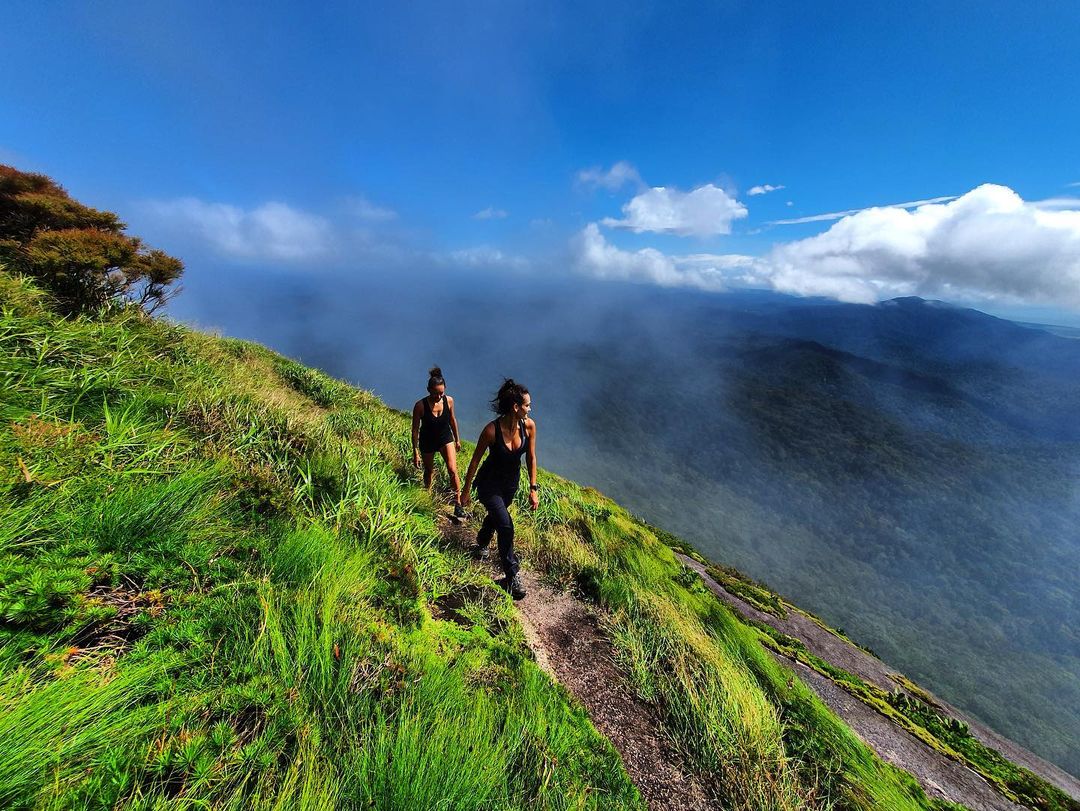
The Kahlpahlim Rock hike is a favourite among Cairns locals due to its changing terrain and stunning views. The trail is well-marked with orange arrows and ribbons on trees. The hike is commonly rated as hard, but with a decent level of fitness, it is manageable. The circuit distance is an 18 km return trip, with an elevation gain of over 800 m. The hike typically takes just over 4 hours to complete at a moderate pace.
The trail starts through tropical flora and climbs steeply on an old pine-dotted logging trail, over a rocky outcrop, and ends with an ascent through thick, wet tropical rainforest. Both the Kahlpahlim Rock Trail and the Ridge Trail meet up at a plateauing rocky section. From here, it's a wet, steep ascent to the foot of the huge Kahlpahlim Rock.
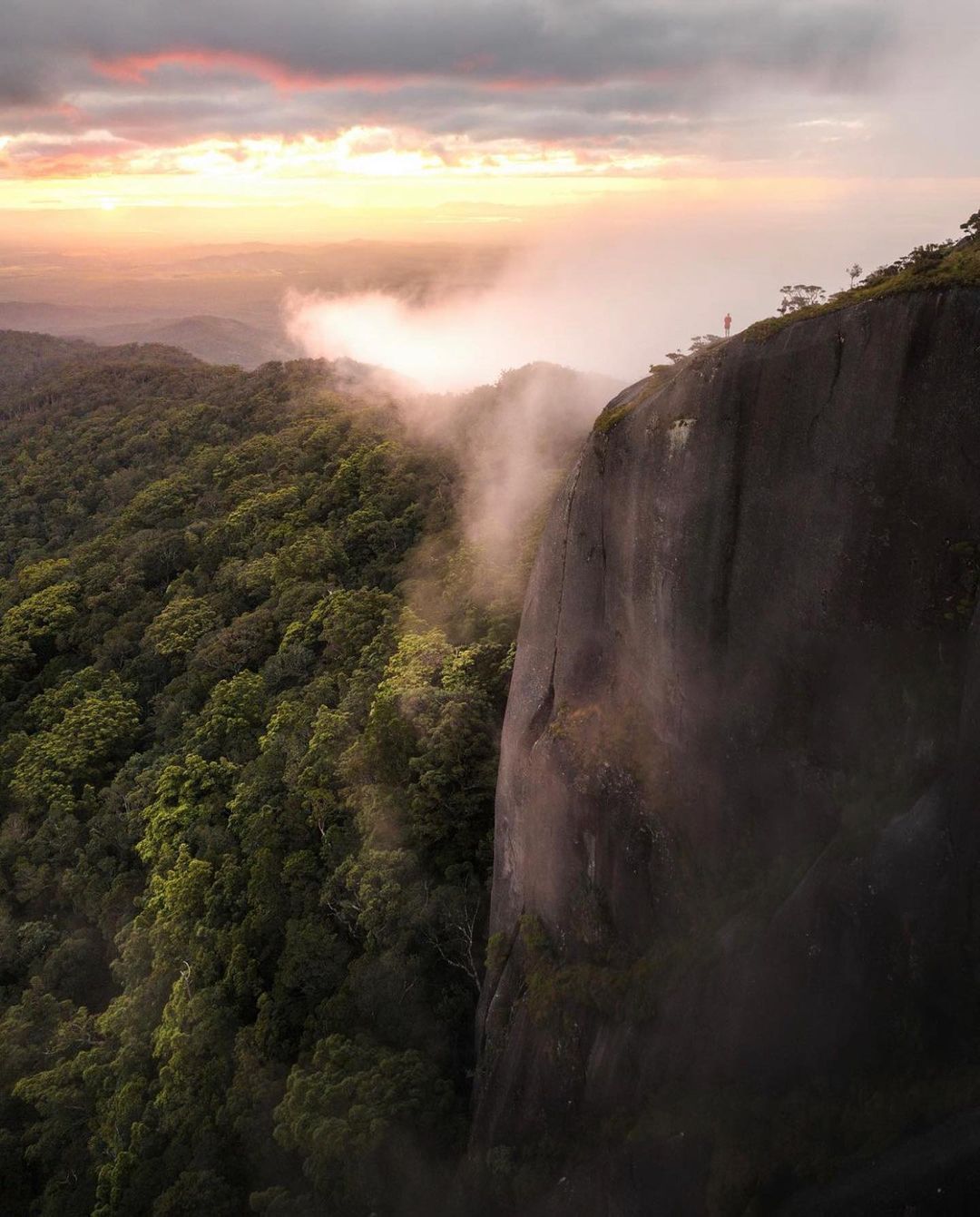
The Summit and Views
At the top of the Kahlpahlim Rock hike, the best views of Cairns and the adjacent rainforest can be found by climbing the rocky clearing to the right as you gain the ridge. You can also walk left here, following the orange markers to a clearing with a large research station. If you follow the trail markers further into the adjacent bush, you'll also be led out to a steep grassy clearing with great views out towards the Atherton Tablelands.
Notes
The Kahlpahlim Rock hike is best completed in a circuit loop. Both trails lead to Lamb's Head Rock, so you can choose which track you want to start with. Note that the car park locations for these track trailheads are in separate locations down Davies Creek Road, so if you walk the circuit loop, there'll be a final 20-minute section of road walking.
Remember to carry enough water and snacks, wear appropriate hiking shoes, and inform someone of your hiking plans. The trail is not recommended during wet weather due to the steep and slippery terrain.
This article, and all other articles, are for entertainment purposes only and are not to be used as a guide. Please see our Disclaimer for more information.