Minerva Hills National Park
Minerva Hills National Park is located 4 km northwest of Springsure in Central Queensland, Australia. This area was formed 23-34 million years ago by volcanic activity. Today, Minerva Hills features cliffs, jagged peaks, gorges, open woodlands, dry rainforest, and spectacular views.


Location - Minerva Hills National Park, Central Queensland, Australia
Difficulty - grade 1-3, easy
Distance - 1.6 km return for the Skyline Lookouts
Time - Allow 1 hour return for the Skyline Lookouts
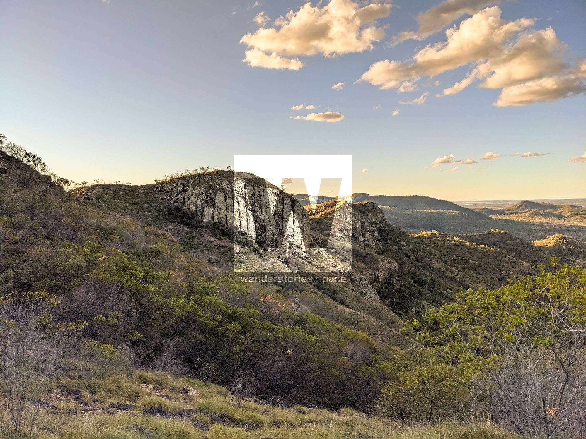
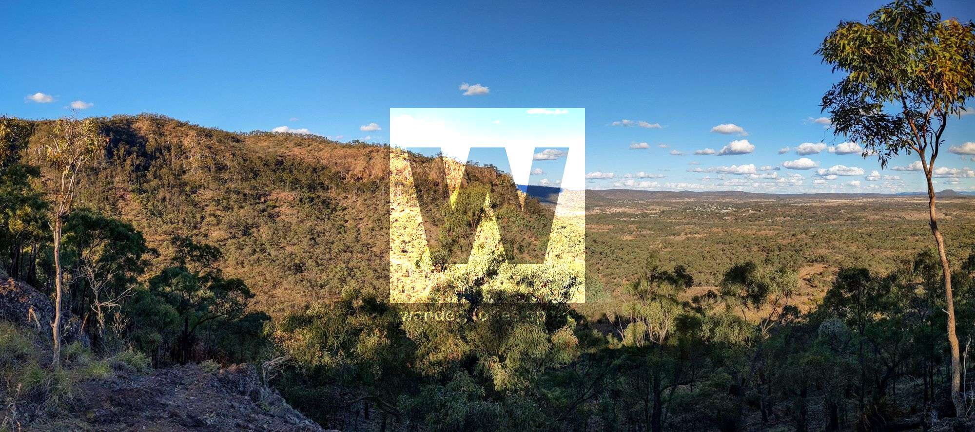
Minerva Hills National Park is located four kilometres northwest of Springsure and about 67 kilometres south of Emerald in Central Queensland, Australia. This area was formed during the Oligocene geological epoch (23-34 million years ago) by volcanic activity that formed the Cosgrove Hot Spot, the longest chain (over 2,000 kilometres) of continental volcanoes on the planet. Today, Minerva Hills National Park features volcanic cliffs, jagged peaks, sheltered gorges, open woodlands, and little pockets of dry rainforest as well as spectacular views to enjoy.
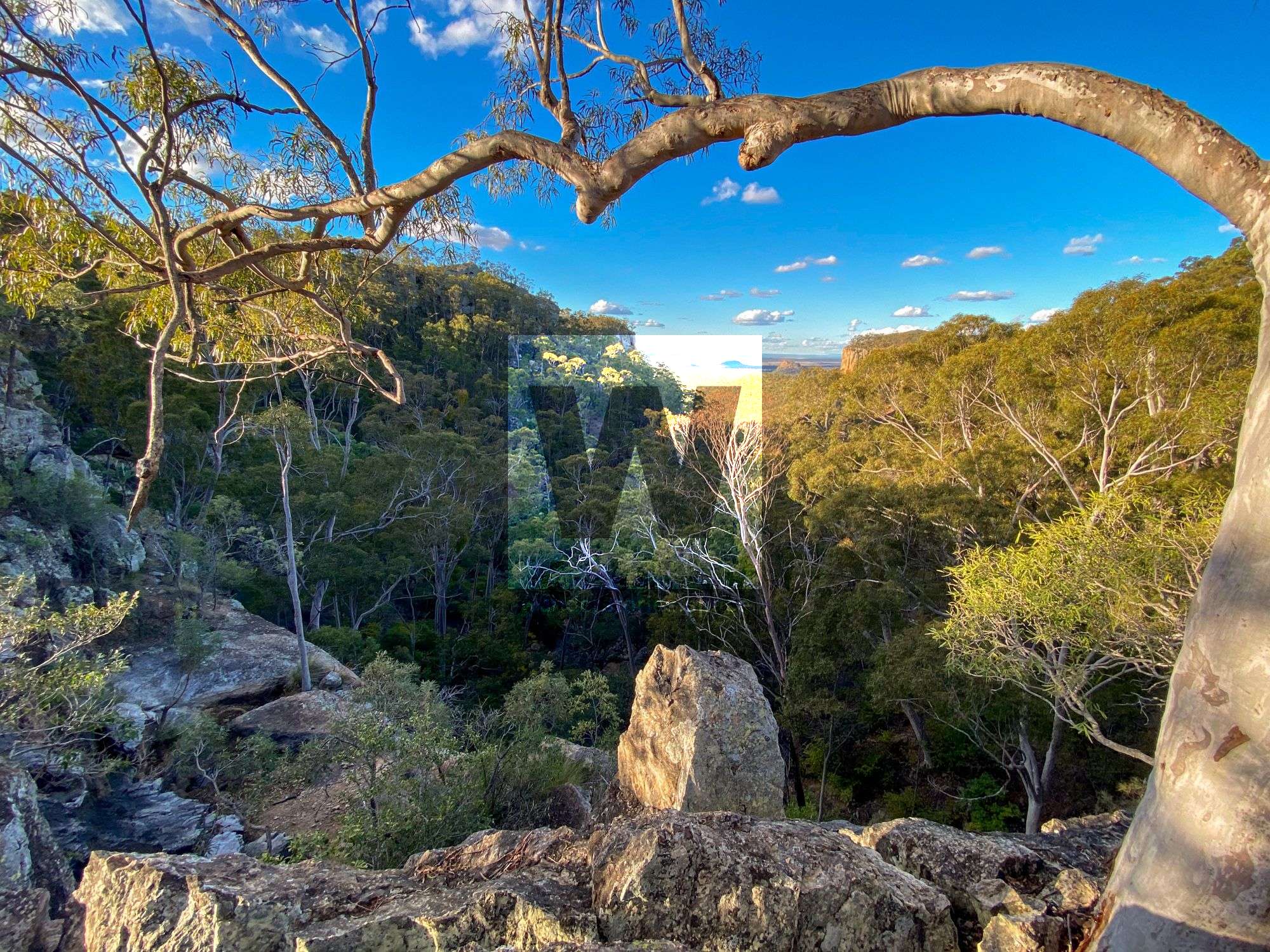
Take in the grassy, open woodlands, which include eucalypts like mountain coolibahs and silver-leaved ironbarks, as well as closely related gum-topped bloodwoods that tower over the cycads and grass trees. When the wattles are in bloom, the trails and mountain summits are bright yellow. The figs, stinging trees, and vines, however, flourish within the sheltered gorges and at the cliff bases, reminding us of the dry tropical rainforests that persist through these areas. Spotted gum forests and low-lying heath can also be observed throughout this park.
Beyond the vegetation, the entire area looks as though stones and large boulders were scattered en masse from the sky. Rock art remains from the Kariai people who lived in the surrounding area leading up to when Europeans settled.
Biodiversity extends to the animal life as well. Eastern pebble-mound mice and fawn-footed melomys are a couple of the more unusual species inhabiting Minerva Hills. But, you will likely see more of the common species, such as kangaroos, wallaroos, and wallabies, especially as they graze at sunrise or sunset. You may even spot a koala. Be sure to bring your binoculars. Moreover, take an opportunity to go spotlighting at night, and see if you can find sugar gliders or greater gliders.
Unfortunately, camping is not allowed in the park; however, there are many options outside of the park boundaries.
How to get there
Access to the Minerva Hills National Park is via Dendle Scenic Drive, which is west of Springsure. You will not need a four-wheel drive vehicle to access this park during dry conditions; however, a high clearance vehicle is required. Regardless, be mindful of the road conditions and know your vehicle's capabilities.
Interactive Map
What to see
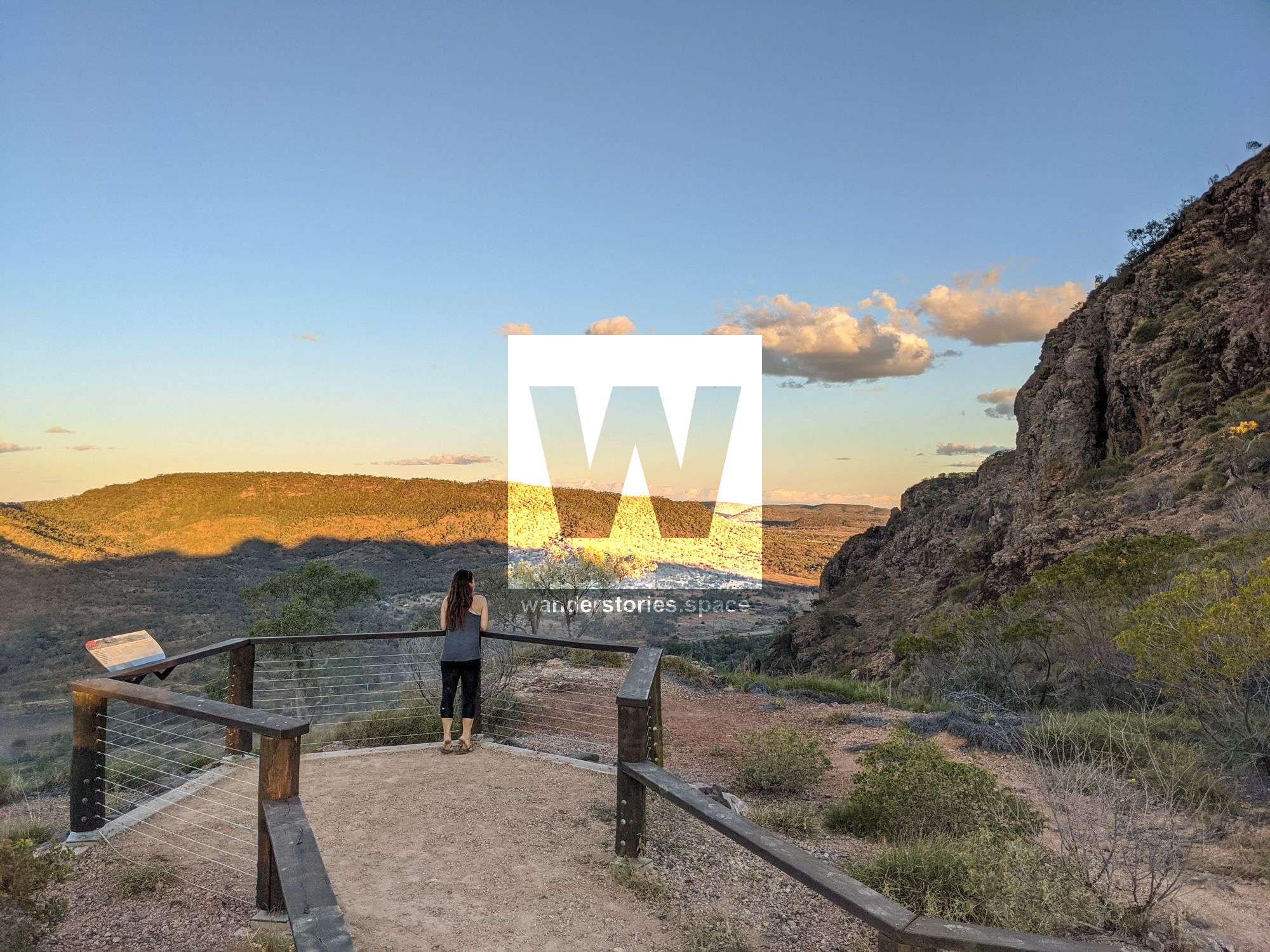
Relax in the day-use area, and enjoy panoramic views across surrounding countryside and of the Springsure township from four easy-to-access lookouts.
Springsure Lookout
Take the first right off of Dendle Drive down a dirt track to reach Springsure Lookout, which is only a short walk from the car park. This track is recommended for four-wheel-drive vehicles only, but you could otherwise park and walk the distance to the lookout. Enjoy the scenery of the southeastern section of Springsure township. Bring a picnic lunch or dinner to enjoy, as there is a table at this site.
Norwood Creek Picnic Area
Perhaps take your picnic to the Norwood Creek Picnic Area instead. To get here, take the first left off Dendle Drive. See if you can spot any of the elusive koalas living in the treetops. This track is also recommended for four-wheel-drive vehicles only.
Fred's Gorge Lookout
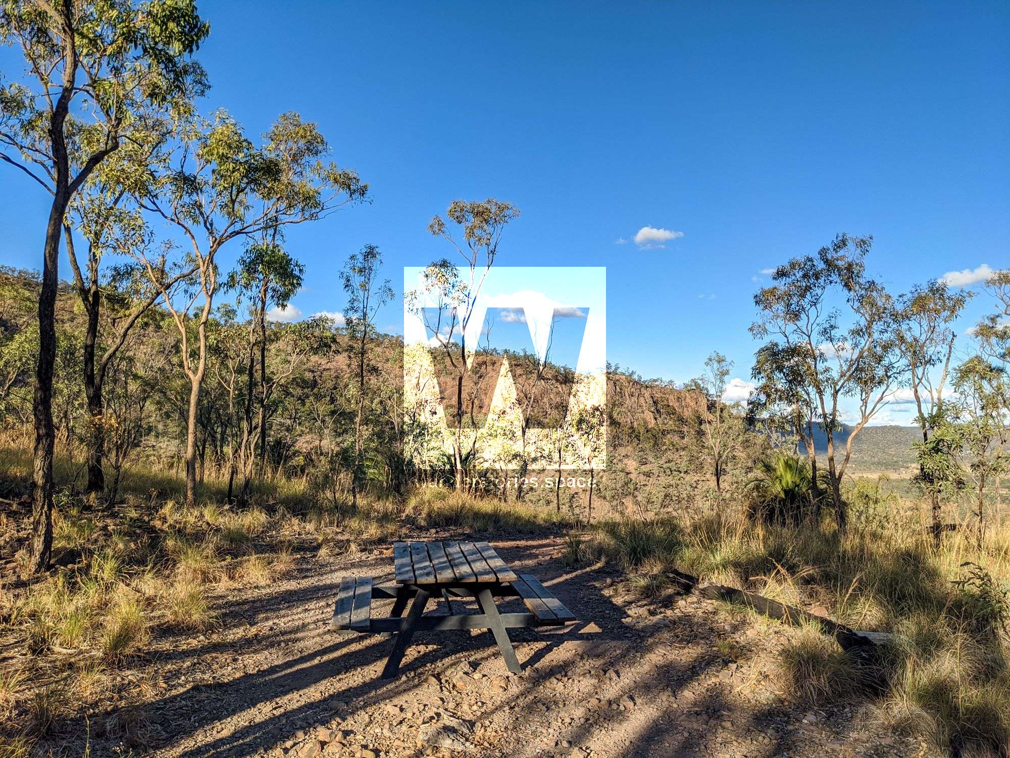
Follow Dendle Drive up Mount Zamia to Fred's Gorge day-use area. This site offers a day-use area with a picnic table, shelter, toilets, and drinking water. Enjoy a picnic here, and take in the views from the top of the mountain.
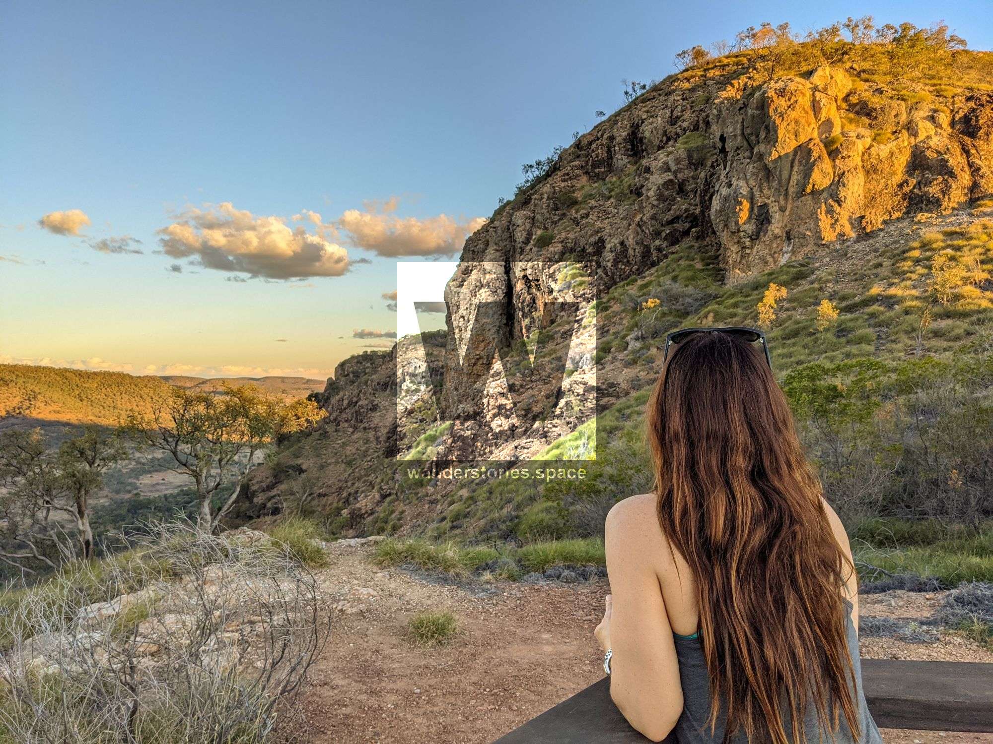
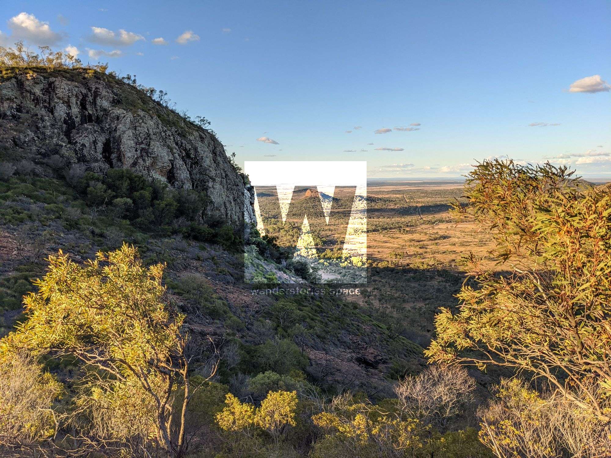
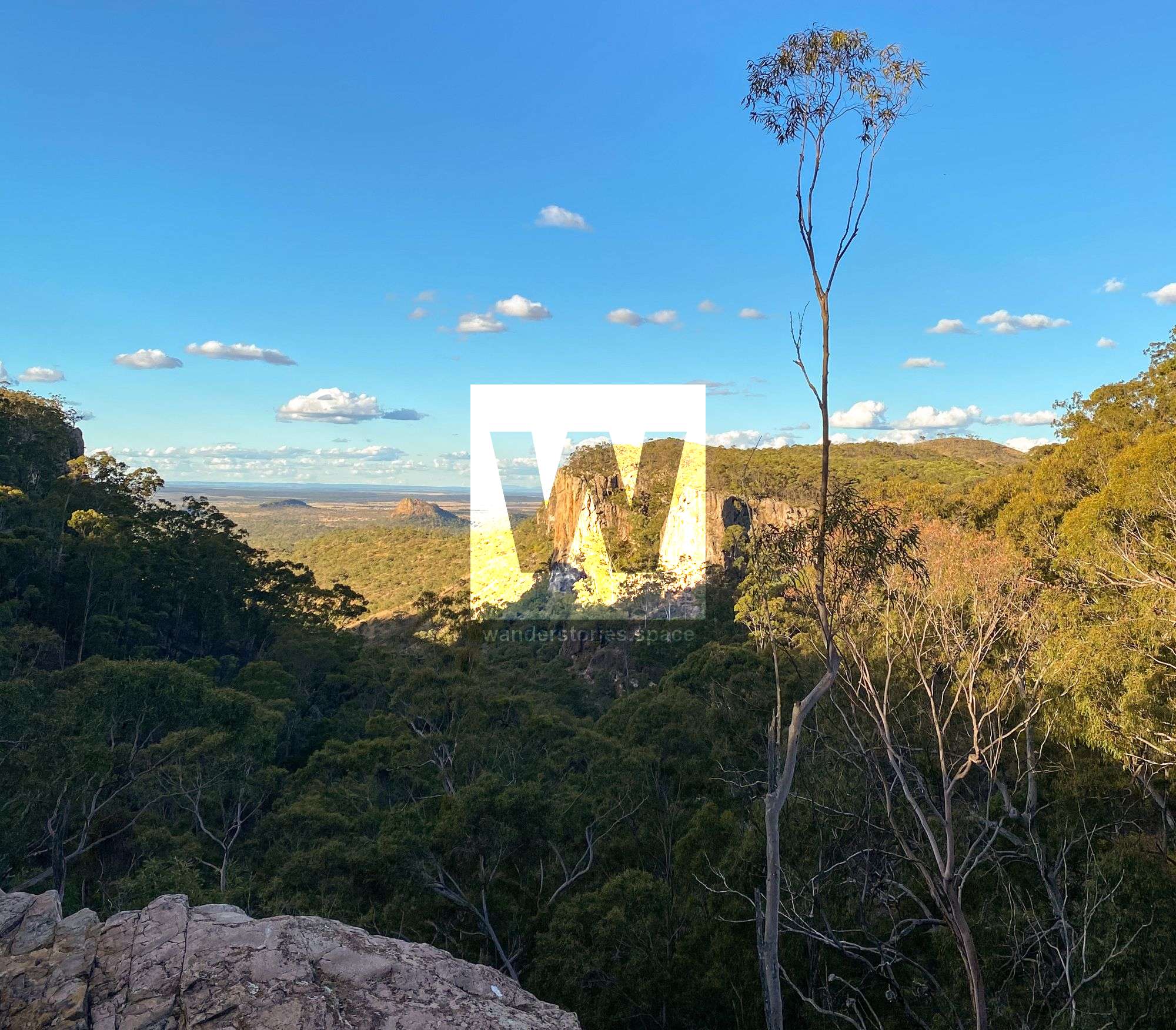
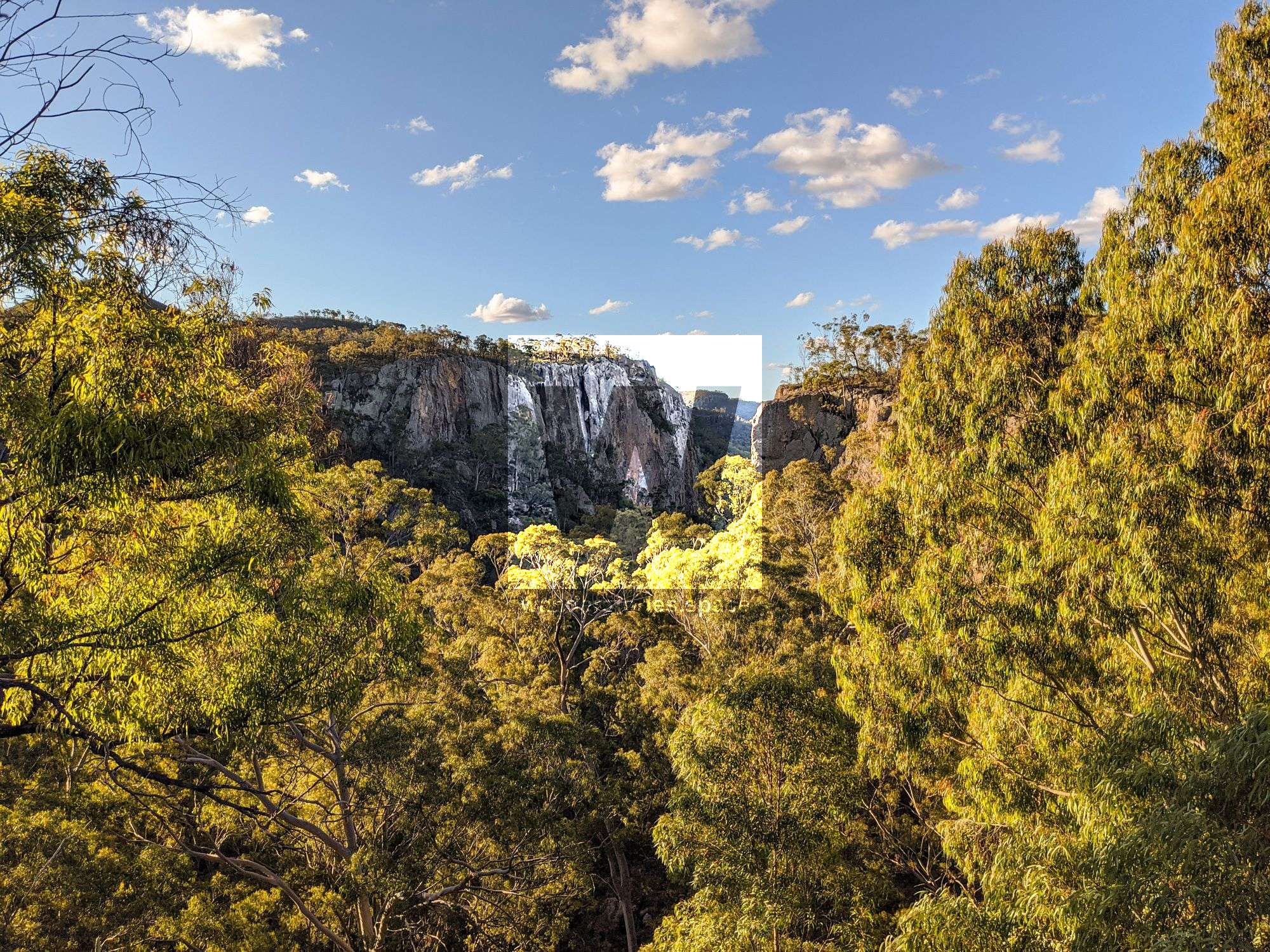
Skyline Lookouts
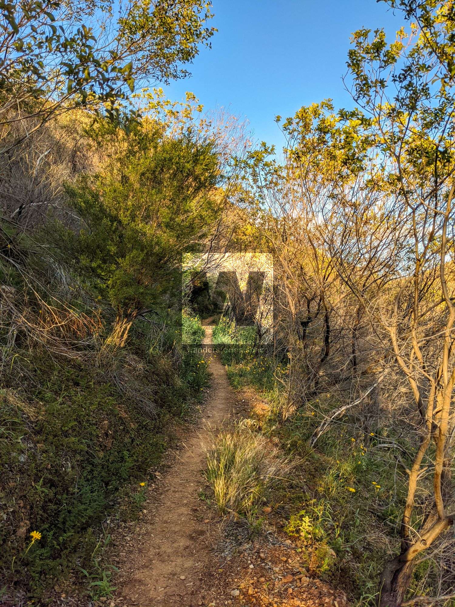
Distance: 1.6 km return (40–55 minutes)
Grade: Easy
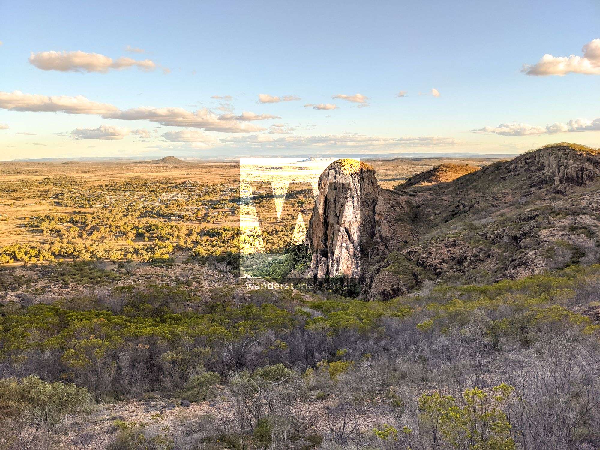
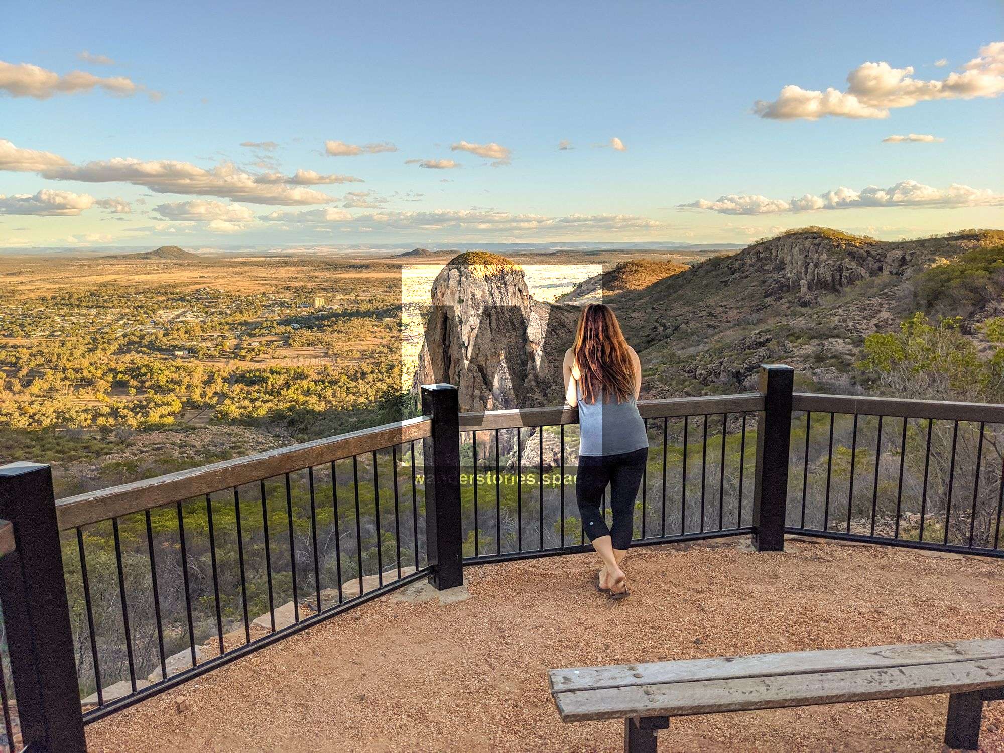
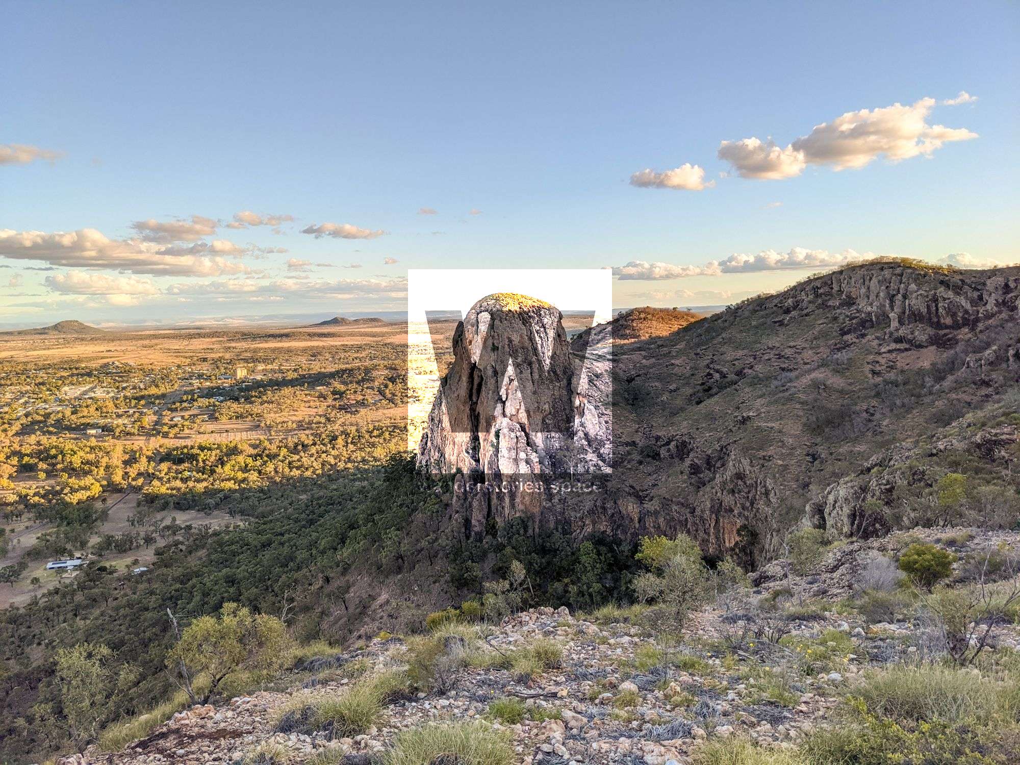
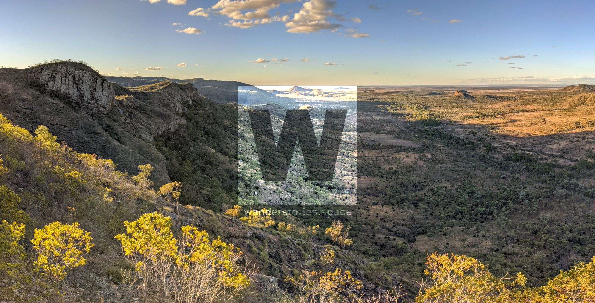
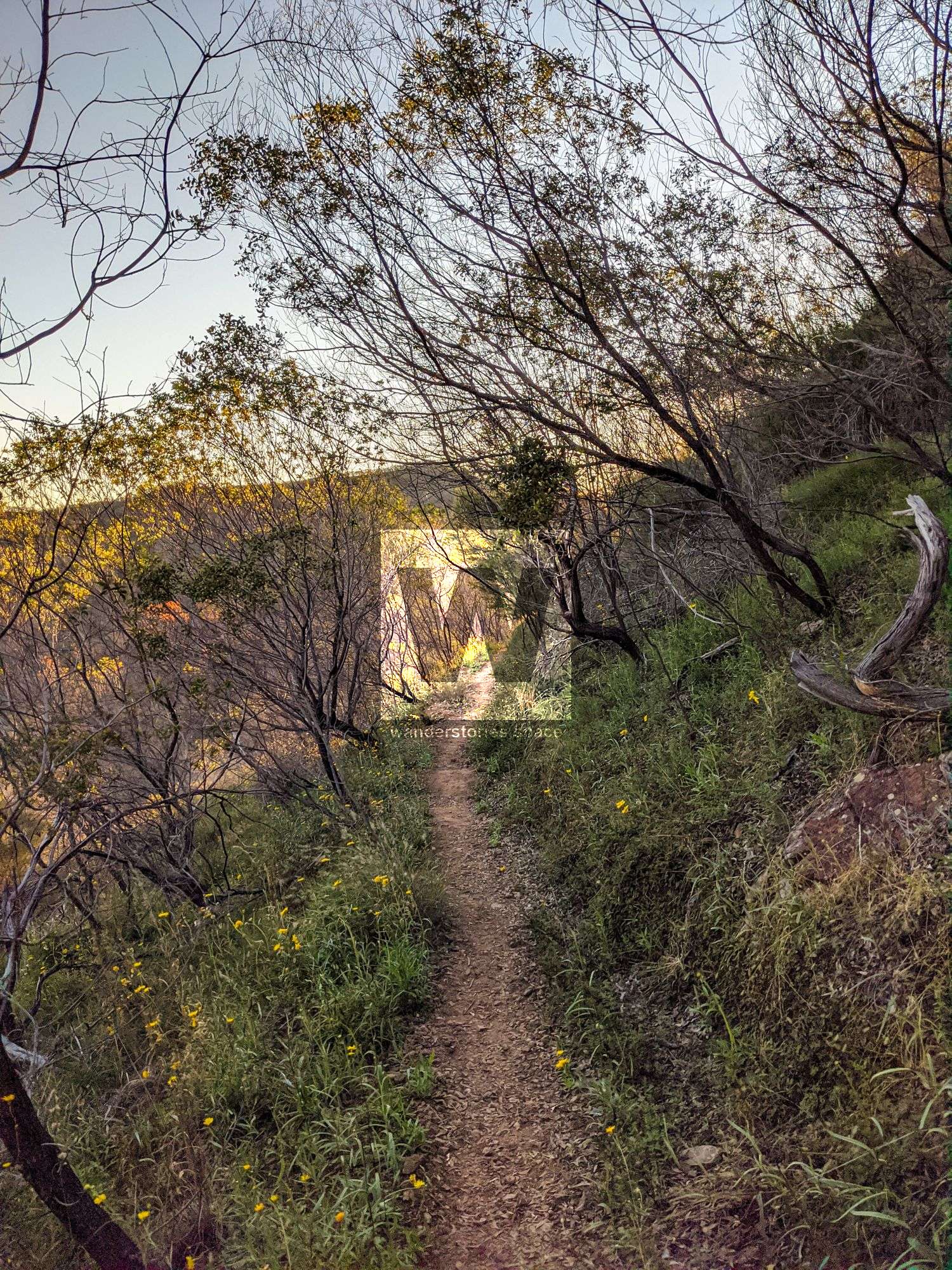
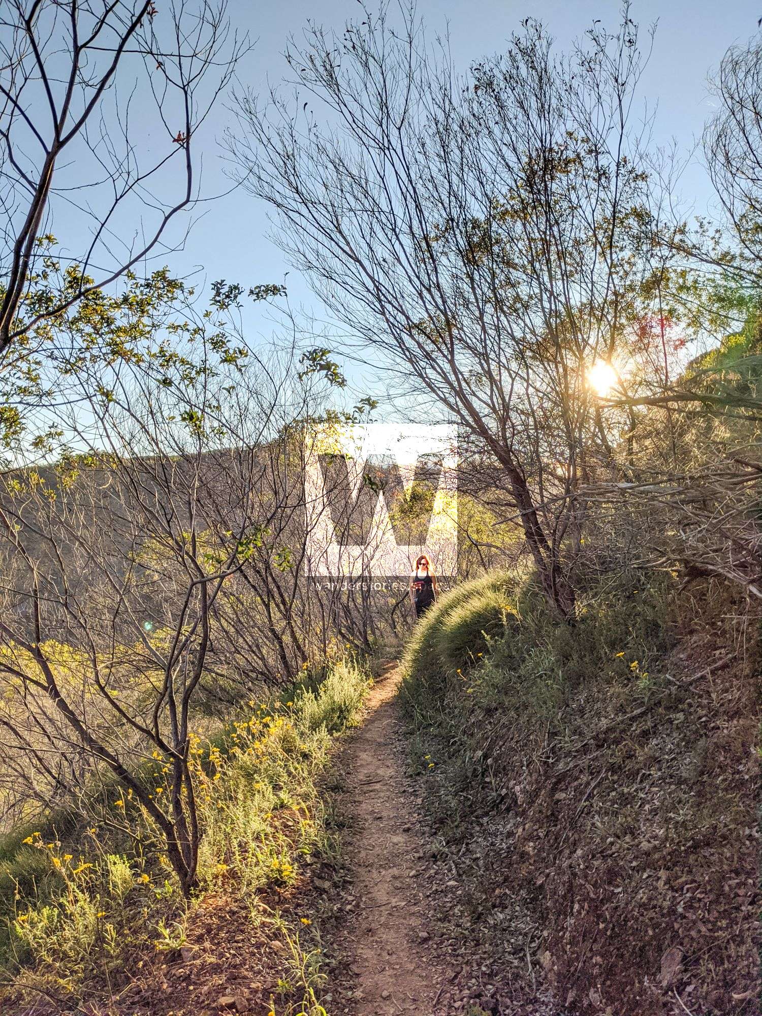
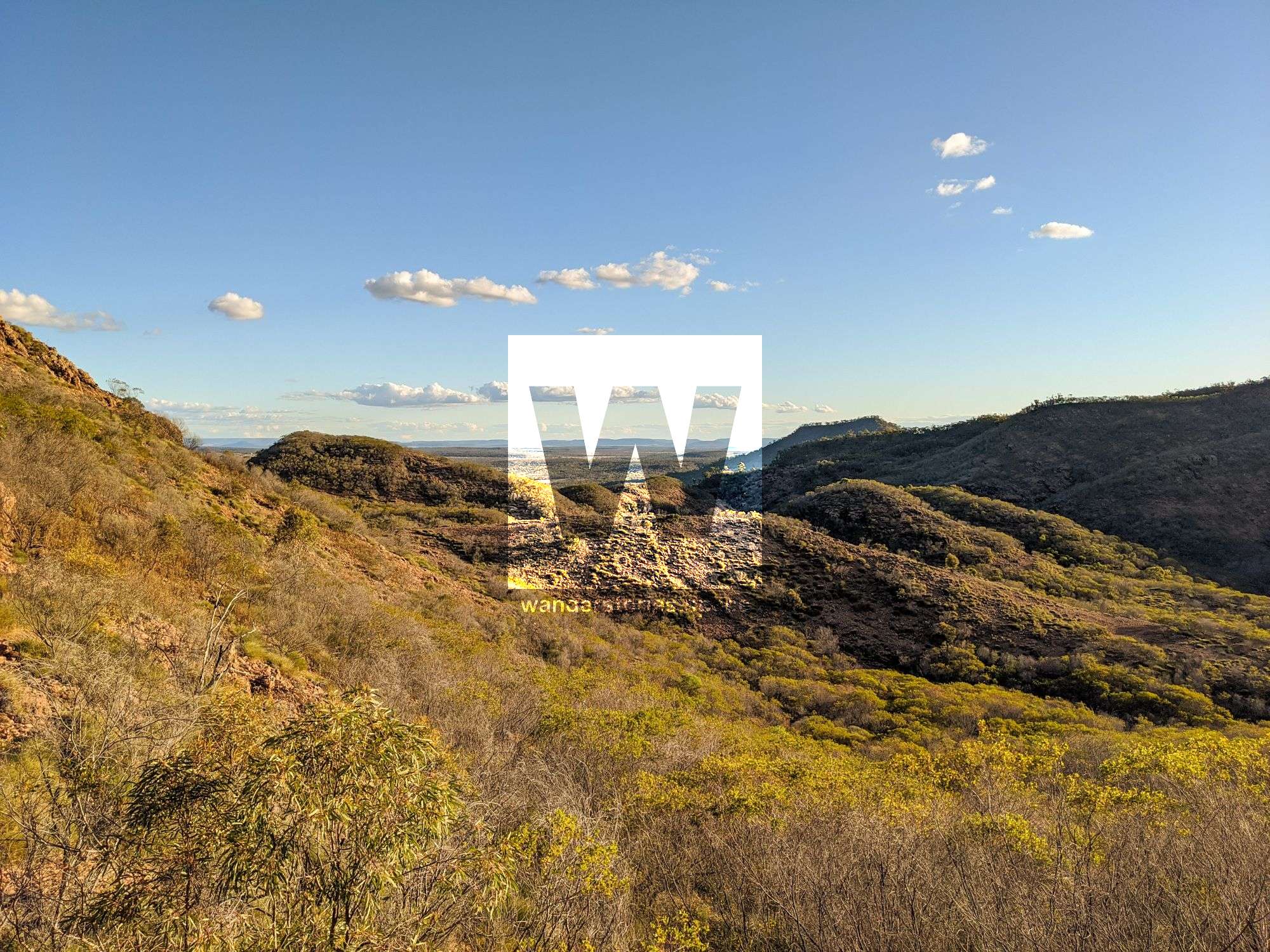
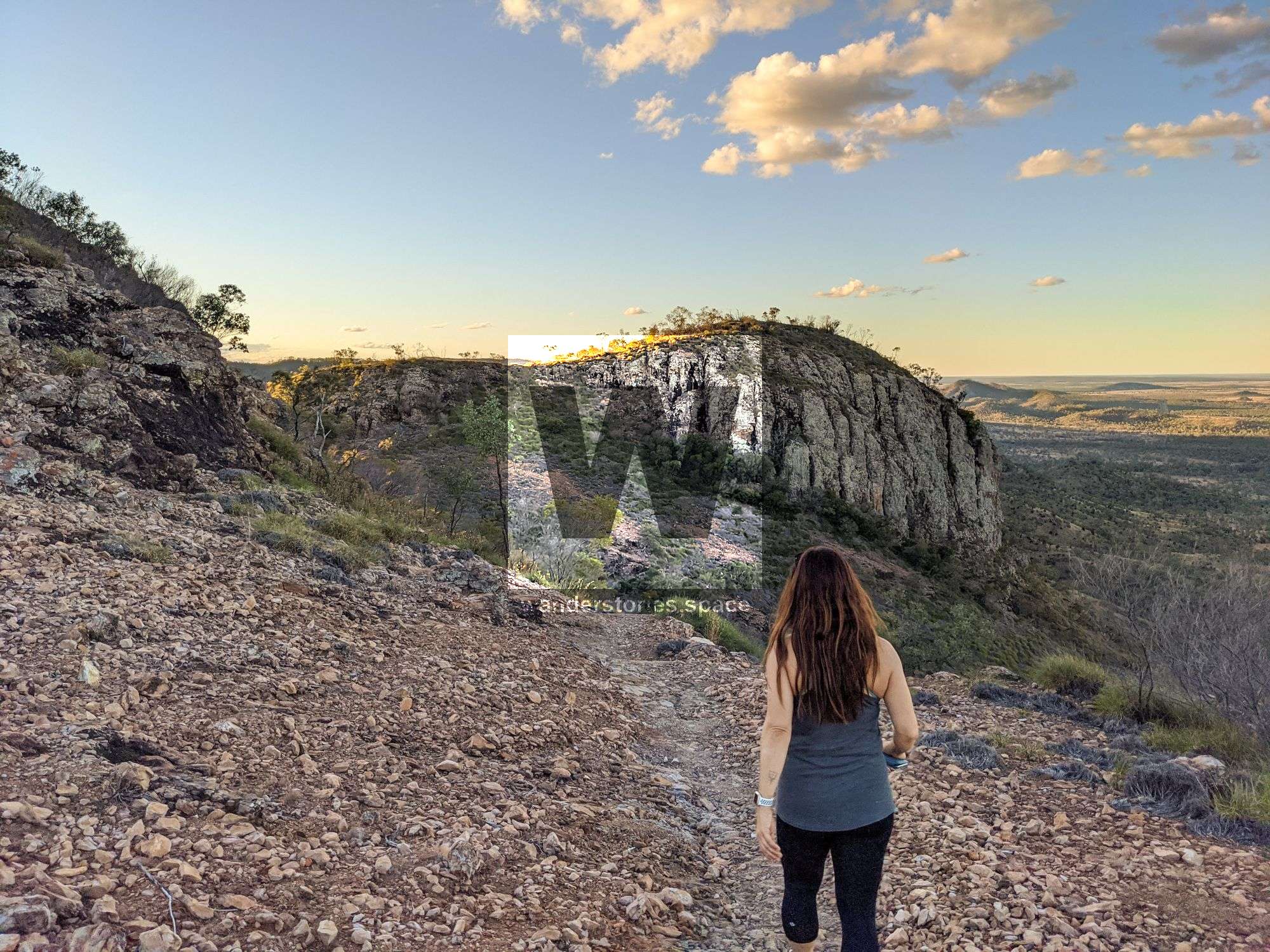
From the small car park, a trail traverses the landscape to two viewing platforms. The southern lookout provides views of the iconic Virgin Rock (also known as 'The Tower') on Mount Zamia and views of Springsure Township. The northern lookout provides grand views northwards beyond Eclipse Gap.
Virgin Rock was named as such because, to the town, the shape looks like the Virgin Mary cradling the Baby Jesus. See if you can spot these figures at night time when Virgin Rock is illuminated.
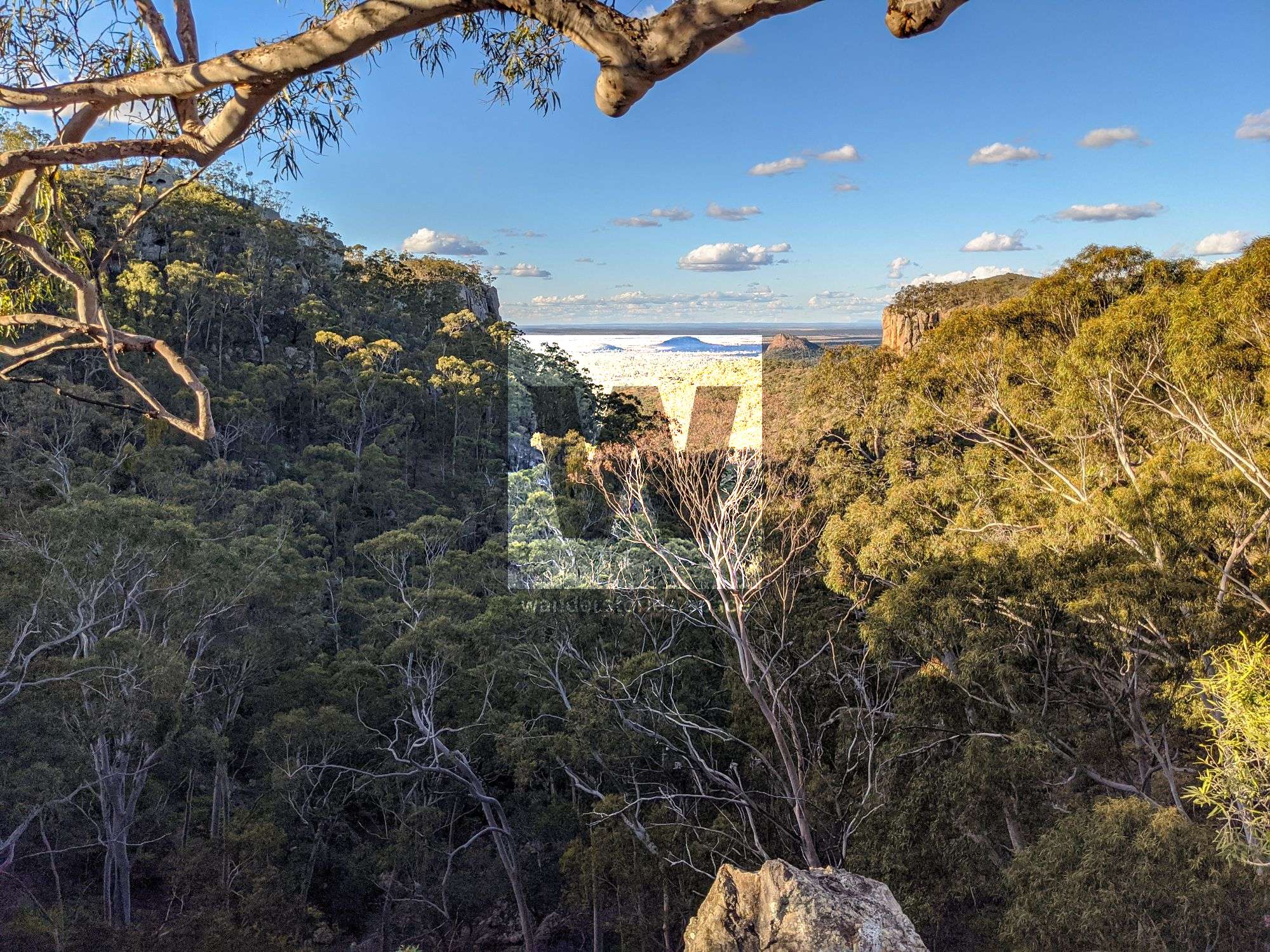
Eclipse Gap Lookout
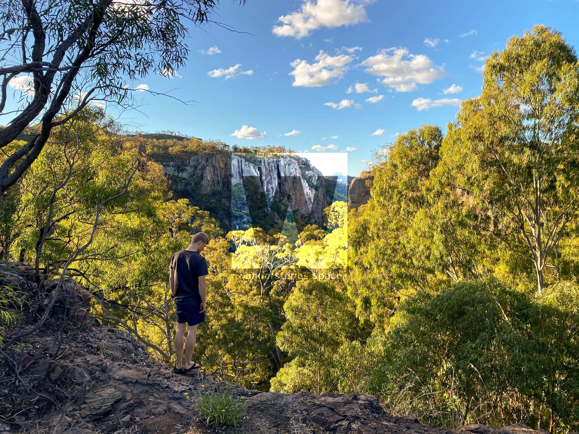
Follow Dendle Drive to the end where you will reach the Eclipse Gap car park. Then, a short walk leads to a stellar look out, especially at sunset. You will enjoy views of Dillies Knob, a remnant basalt column from the region’s volcanic past, and vast tracts of farming lands. Don't miss this one!
This article, and all other articles, are for entertainment purposes only and are not to be used as a guide. Please see our Disclaimer for more information.