Mount Bartle Frere Trail
A comprehensive guide to hiking Queensland's tallest mountain, Mount Bartle Frere. Everything you need to know!

Location - Wooroonooran National Park, Queensland, Australia
Difficulty - 5, Strenuous overnighter or day trip
Distance- 12 km return or 12 km through walk
Duration- 8-14 hours
Overview
Mount Bartle Frere summit is 1,611 metres above sea level and lies within the Wooroonooran National Park. The 15 km return hike to summit Mount Bartle Frere in Wooroonooran National Park is not for the faint-hearted, particularly if your plan is to conquer it in one day return. The walk starts at 100 metres above sea level, reaching 1,622 metres at the summit. The walk is a 15 km return from the eastern side. Expect this walk to take 10 - 12 hours. It's usually ascended from the eastern side return to Josephine Falls, it can also be done as a thorough hike to Atherton Tablelands. Plan a time to turn around, to ensure safe descent down the mountain. The annual rainfall of Mount Bartle Frere is about 3,559 mm.
The FKT (Fastest Known Time) from the car park to Mt Bartle Frere summit is 1 hour 38 minutes.
Highlights
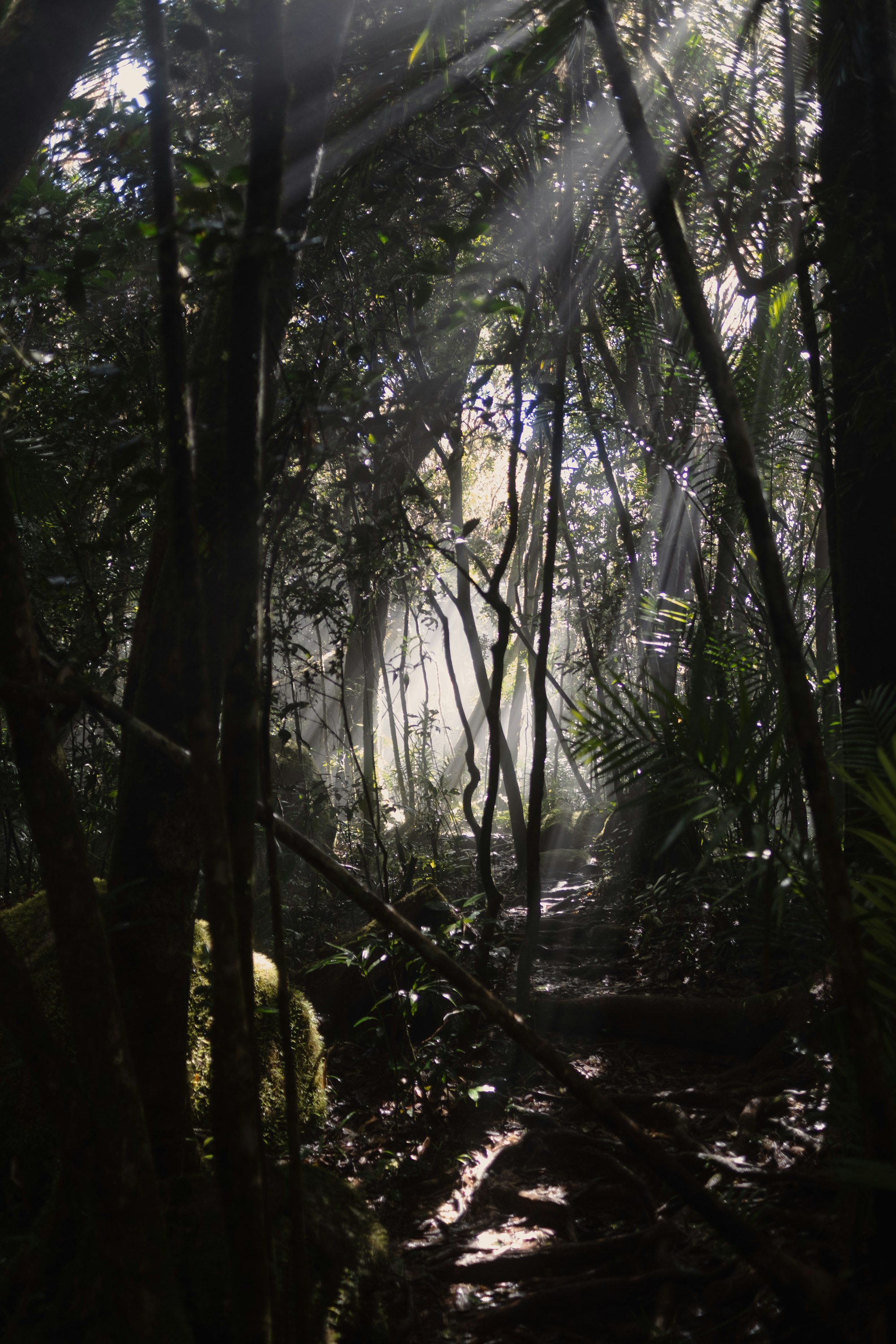
- The misty surroundings
- Standing on the top of Queensland
- The views on a clear day, especially at sunrise!
- Walking through the beautiful tropical rainforest of the Wet Tropics World Heritage Area
Introduction
Mount Bartle Frere is the highest mountain in Queensland, located in the Wonooroonan National Park, about 51 kilometres from Cairns. It's a popular hike that offers stunning views of Cairns and the Atherton Tablelands, and can be completed in one long day or over two days with an overnight stay at the Eastern Summit Camp campsite. The hike starts at the car park for Josephine Falls, and takes the more scenic but steeper eastern approach to the summit. The total distance to the summit is around 8 kilometres. The elevation of Mount Bartle Frere is 1611 meters above sea level, and the average gradient is around 20 degrees. The hike is considered very difficult, with steep inclines and vertical sections, but no technical climbing skills are required. Camping on the trail requires a permit, which costs around $6 AUD and goes towards rainforest conservation. There are markings every kilometre along the trail, as well as flagging tape to help hikers stay on course. It's recommended to bring plenty of water, snacks, and sun protection for the hike.
Duration
The hike to the summit of this mountain typically takes place over two-days, although it is possible to complete the hike in a single day. The ascent to the summit of Mount Bartle Frere takes an average of 4-5 hours at a quick pace with little stops, and is best completed in good weather conditions. Many hikers choose to start their hike at the Josephine Falls car park at first light, around 6:00 am, and reach the summit by midday. However, it is possible to complete the ascent and descent in a single day, although this can be challenging on the knees. Alternatively, hikers can camp at the Eastern Summit Camp, where they can set up a tent and choose to summit either the same afternoon or the following morning.
Distance
According to information from QLD Parks, the total distance to the summit of Mount Bartle Frere is approximately a bit over 8 kilometres. However, some hikers have recorded a distance of around 11 kilometres on the track due to the winding turns and the GPS scatter.
Difficulty
The track is regarded as being highly challenging, with lengthy stretches of steep climbs some of them even vertical. However, all you'll need to reach the summit is a respectable level of fitness - no technical climbing expertise.
Elevation
The tallest peak in Queensland is Mount Bartle Frere, which rises 1,611 metres above sea level. With an average gradient of 20 degrees in parts, it is a difficult and taxing hike. The Mount Bartle Frere trek is more physically demanding than Mount Kosciuszko, Australia's highest peak, despite the fact that it is not the country's tallest mountain.
Camping
Camping is allowed on the trail, but a permit must be purchased for around $6 AUD. The money goes towards rainforest conservation, and although there may not be anyone checking, it is still worth purchasing.
Interactive Map and GPX Route Download
The official Mount Bartle Frere track can be found by downloading the GPX file or the Queensland Parks map.
Best time to hike Mount Bartle Frere
The best time to hike Mount Bartle Frere is during the dry season, from March to September, when the weather is cooler and the conditions are better - before the wet seasons and not too hot and humid but there's still water in the creeks. However, it's still possible to climb the mountain in the wet summer season, but it can be very wet and slippery, and leeches may be present.
Weather and Climate
Mount Bartle Frere is part of the Bellenden Ker Range, which also has its own weather patterns. The foothills of the mountain are generally warm and humid, consisting mostly of tropical rainforest. As the hike progresses, the weather becomes cooler and shifts to a cloud forest climate. The summit and surrounding ranges are typically 10 degrees cooler than the coast, so it is important to bring warm clothing if you plan on camping.
Environment, Flora, and Fauna
The Mount Bartle Frere trail in Queensland, Australia is a challenging hike that takes hikers through a number of different vegetation zones. Each of these habitats is home to a unique array of flora and fauna. In the subtropical rainforest, hikers may encounter a variety of birds and mammals, including the Australian King Parrot, the Eastern Whipbird, the Lumholtz's Tree-kangaroo, and the Daintree River Ringtail Possum. Eucalyptus forests are home to a variety of marsupials, such as the Daintree River Ringtail Possum, as well as a variety of birds. At the highest elevations of the trail, hikers may see a variety of mossy and orchid flowers. The rainforest is home to a diverse array of flora, including towering trees, ferns, and epiphytes (plants that grow on other plants). Some of the plant species that you may encounter on the trail include the Stinging Tree and the Queensland Maple. The Mount Bartle Frere trail offers hikers the chance to experience a diverse array of plant and animal species in a beautiful and unique environment.
Getting to the Eastern Trail Head (Josephine Falls)
The hiking trail starts at the Josephine Falls parking lot, which is 51 kilometres (approximately an hour's drive) from Cairns or 3.5 hours from Townsville, close to the town of Babinda. You can leave your car there for free the night if you plan to do this hike over two days. Just below the trail to Josephine Falls at the Josephine Falls parking lot, there is a sign pointing to the Mount Bartle Frere track.
This track takes the more popular eastern approach to the summit. This track is more difficult and steeper than the western side. However, it's more scenic, very well-marked and closer to Cairns.
The Trail
Josephine Falls Car Park to Big Rock camping area
Distance: 3 km
Duration: 1 - 2 hours
The first two kilometres of the Mount Bartle Frere hike are easy, with a gentle, undulating warm-up through tropical rainforest. After about 3 kilometres, you will come to the first river crossings, which can be challenging in the wet season. There are about nine creek crossings in total. Just past this, you will reach Big Rock Camp, where there is a small space for a tent.
To continue on to the Mount Bartle Frere summit, take the trail to the right. Left takes you on a short hike to Broken Nose Lookout.
Big Rock to Broken Nose Lookout
Distance: 2 km
Duration: 1 - 2hr return
If you are planning to take the Bartle Frere trail, be aware that the trail to Broken Nose branches off at Big Rock camp. The climb from Big Rock camp to Broken Nose (962m) is quite steep, with an elevation gain of 400 meters over a distance of 2 kilometres. It is recommended to allow about 2 hours for this part of the trail. There is no water available along the way, so be sure to bring enough with you.
Despite the challenging climb, the views from Broken Nose are well worth the effort. From this vantage point, you can see the coast and the Atherton Tableland. After taking in the views, you can return to Josephine Falls by retracing your steps along the same route.
Many hikers choose to leave their overnight packs at Big Rock camp and only bring a day pack on the climb to Broken Nose. This allows them to travel lighter and more easily enjoy the views at the summit.
Big Rock to the Eastern camping area
Distance: 4 km
Duration: 3 - 5 hours
You'll notice the climb start almost immediately after leaving the Broken Nose Lookout trail. There are brief sections of irregular, vertical root climbing and ascents.
The most challenging kilometres are the last few. Pay attention to the kilometre markings. This segment has a continual climb and is fairly steep. There will be a few vertical stretches where you can climb the steep roots up the mountain by yourself. Over a distance of 4 kilometres, this portion of the path has a severe ascent with an elevation gain of 1,000 metres. For this leg of the travel, it is advised to allow around 5 hours.
There is a camping pad at Eastern Summit camp, and hikers are encouraged to use it to minimise the impact on the environment. However, please note that the camping pad may be used to land a helicopter in case of an emergency, so be sure to remove any equipment from the pad during the day.
Those who choose to camp overnight at Eastern Summit will have the opportunity to experience the beauty of the sunset and sunrise, weather permitting. Enjoy the stunning views and peaceful atmosphere of the camp.
Eastern camping area
The emergency hut at the Eastern Summit Camp can provide shelter and a place to change clothes. A small clearing, suitable for a two-person tent, is located past the helicopter pad and through the short shrubs.
No water, unless walking off track down into the streams. There is a rough track on the southern side of the helipad that takes you down to a stream but it's recommended to treat any water you collect.
It's hard to describe the feeling of elation that one experiences as one feels upon emerging into the sunlight after hours spent in the misty rainforest. While it is impossible to fully comprehend the enormity of the mountain, the experience is nonetheless spectacular due to the constantly changing cloud forms across the vast landscape.
From the Eastern Summit Camp, it is approximately 45 minutes to reach the summit. It is advisable to assess the amount of daylight remaining and decide whether to attempt the summit in the morning or the afternoon. If the weather is clear, it may be better to aim for the summit in the afternoon, as the boulder scramble ahead can be slippery in the morning and the sunrise views from the camp may be better.
This is a good spot to camp, with excellent views of the Coral Coast visible from the tent.
Eastern camping area to the summit
Distance: 500 m
Duration: 30 min - 1 hour
The trail to the summit includes a false peak and mostly rock hopping and boulder scrambling, aided by bolted rails. However, this can be difficult in wet conditions. After the false peak, there is a section with good 360-degree views, followed by a winding trail and a steep final climb through the rainforest to the summit.
The summit itself is unremarkable, consisting of a small clearing with taller trees and a sign, but there is a boulder nearby that offers excellent views of the Tablelands.
Mount Bartle Frere summit
If you have someone to pick you up and want to through-hike, it's possible to continue down the Western Ridge. However, if you decide to descend on the same side, then you'll just need to follow the same trail that you came in on.
The descent is much easier, however, might get a little hard on your knees. It took us roughly 4 hours to reach Josephine Falls car park from the Eastern Summit Camp.
The summit to the western camping area
Distance: 750 m
Duration: 30 min - 1 hour
It is 750 meters from the summit of Bartle Frere to the western camping area. The trail becomes a scramble over and through large granite boulders. Be aware that this section of the trail can be very slippery when it is wet, so take care when navigating through the boulders.
Western camping area
This camping area is situated in a small clearing beside a creek and is suitable as a rest stop or as a place to spend the night. Take some time to relax and enjoy the peaceful surroundings before continuing on your journey.
Western camping area to North West Peak
Distance: 1 km
Duration: 1-2 hours
The trail continues from the Western Summit camp to North West Peak. If the weather is clear, you can enjoy excellent views of Bellenden Ker and the Mulgrave River valley from an exposed outcrop of rocks that is 1 kilometre from North West Peak (1,476m).
North West Peak to Junction Camp
Distance: 5 km
Duration: 3-5 hours
Bobbin Bobbin Falls are a beautiful and serene spot, with the water cascading down from a creek. It is a nice place to take a break and rest before continuing on your journey. Enjoy the peaceful atmosphere and the refreshing mist from the falls.
Related hikes
Josephine Falls
What could be more fitting than a refreshing swim in a tropical rainforest waterfall to wash away all that sweat and dirt after summitting? It's only a 700-metre walk to Josephine Falls from the parking lot, and it is well worth the trip.
Kahlpahlim Rock Hike
The hike takes you through a dense rainforest, where you can see a variety of tropical plants and animals. The highlight of the hike is the spectacular Kahlpahlim Rock, a massive boulder perched on the edge of a cliff with breathtaking views of the surrounding landscape.
Devils Thumb Hike – (Manjal Jimalji)
The trail is relatively easy and well-marked, making it suitable for hikers of all levels. The highlight of the hike is the spectacular Devil's Thumb, a rocky peak with breathtaking views of the surrounding landscape. From the top of The Thumb, you can see the rolling hills and lush forests that stretch out before you.
Essential Gear
- Hydration pack with at least 3L water
- Food and snacks
- Solid well-fitted hiking boots
- Long pants
- Head torch
- Cold and wet weather gear (e.g. a waterproof jacket)
- Satellite phone or EPIRB/PLB + a first aid kit
- A companion to share the ups and downs with
Safety & Notes
- A good level of fitness is required to safely complete this hike.
- It is an excellent idea to be prepared for all types of weather because Mount Bartle Frere frequently experiences rain, which makes the path treacherously slick.
- Good preparation is essential for staying safe during this walk.
- Check out this important info from Queensland National Parks before heading out.
- Watch out for Gimpe trees, their stings can last up to a year.
This article, and all other articles, are for entertainment purposes only and are not to be used as a guide. Please see our Disclaimer for more information.