Mount Tohiea
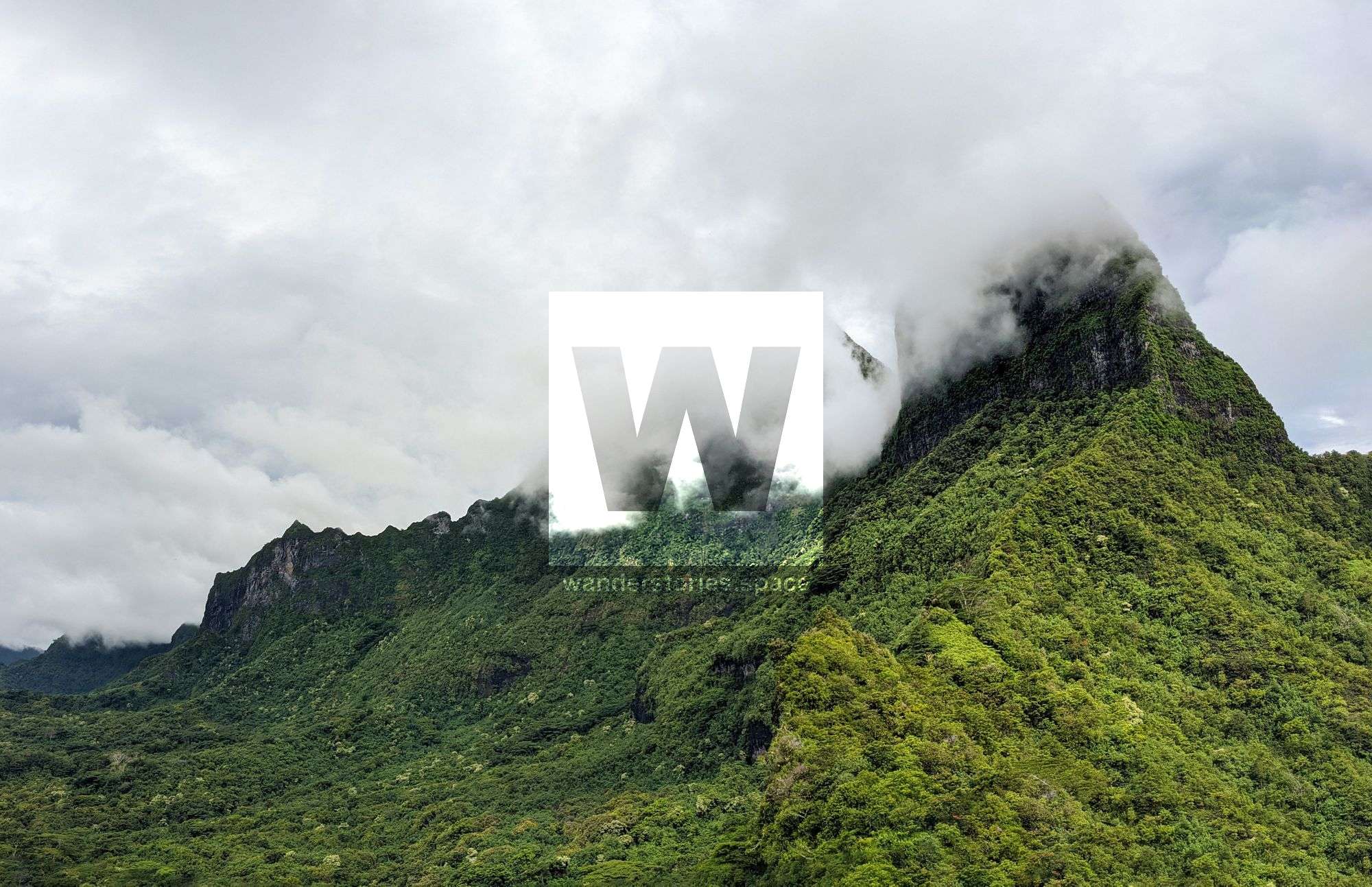
Mount Tohiea is a volcanic peak and the highest point on the island of Mo'orea in French Polynesia at 1,207 metres and is located near the island centre.

Location - Starting at Haumi locale, Mo'orea, French Polynesia
Duration - 6-10 hours return depending on fitness
Distance - ~5 km return
Difficulty - 5, difficult and strenuous
Mount Tohiea, also spelt Tohi'e'a, Tohive'a, and Tohivea, is a volcanic peak and the highest point on the island of Mo'orea in French Polynesia at 1,207 metres and is located near the island centre. On its slopes are many streams and fertile soils. During heavy rain, waterfalls stretch across the upper section peak's slopes and can be seen all around the island making for a sight to be seen.
Mo'orea is about 10 miles in width from the west to the east. The highest point is Mount Tohi'e'a, near the centre of Mo'orea and right beside Mount Tamarutofa (916 m) and Mount Mou'aroa (880 m). together they dominate the vista from the two bays and can be seen from the island of Tahiti. There are also hiking trails in the mountains.
There are hiking trails along the summit close to Belvedere Point where people can view Mont Routui and the two bays and three peninsulas of Moorea. Mount Tohivea is a dormant volcano that is easily visible from Papeete, the capital of French Polynesia. The surrounding peaks are almost as tall as Mount Tohive'a. These include Mount Rotui (899 m), Mount Mou'aroa (880 m) – both of which can be seen from Belvedere Point – Mou'aputa (830 m), and Mou'a Tamaru To'ofa (916 m).
There is very little information available on Tohive'a, however Mike Kelsey, author of the "Climbers and Hikers Guide to the Worlds Mountains, 4th edition", states that the mountain is "almost impossible to climb and thus won't be included in the book". The local climbing club, have climbed this mountain from the east but it is extremely difficult and not recommended due to the steep terrain and loose soil and vegetation.
The Route
Start by driving to Haumi locale (-17.5701670,-149.7952768) and then uphill on road "291334". You can get to the trailhead by scooter. The road becomes a bit rocky after a bit but definitely doable in a scooter. Park in the back and out of sight. Next to this parking spot is a road a bit lower that continues further uphill. Follow the road until you get to a metal pipe that is approximately 20 centimetres in diameter. Follow the pipe to the right into the forest.
You will get to a little concrete dam structure, cross it and continue along the track. After two minutes, you'll cross the little stream and there will be two markings on trees. This is probably the only place where the track is confusing. After this, you walk uphill a little, passing a few mape trees. From here, it is uphill for 3.5 hours – just follow the track and look out for the markings on the trees.
Continue to climb uphill until you end up on top and on the main ridge. The path is pretty clear and straightforward but could become indistinguishable if no one has walked this route in a while. There are about three five-metre tall cliffs where you find yourself scrambling. There are approximately 30 fixed ropes in total that are installed to assist at these difficult sections – especially on the way back down.
Interactive Map
Notes
- The walk is steep and never flat – maybe two times you go a little down to climb right back up again. It's very tough on your legs.
- It takes fast people around 3.5 hours to climb up and 2 hours 15 minutes to come back down. Some people took more than 6 hours to ascend, so it's not an easy hike.
- Go there early, like 6 am because clouds tend to be up there from around 10 am.
- There is no water anywhere. Do not bathe in the water of that concrete dam. That's the drinking water of the village!
- You should bring 4 litres of water minimum. 5-6 litres is recommended. It's steady uphill and you sweat it out in no time.
- It's not an overly beautiful hike, more like a challenge.
- Definitely do not go when there was rain the day earlier.
- Do not go alone.
This article, and all other articles, are for entertainment purposes only and are not to be used as a guide. Please see our Disclaimer for more information.