Paddling the Burdekin River
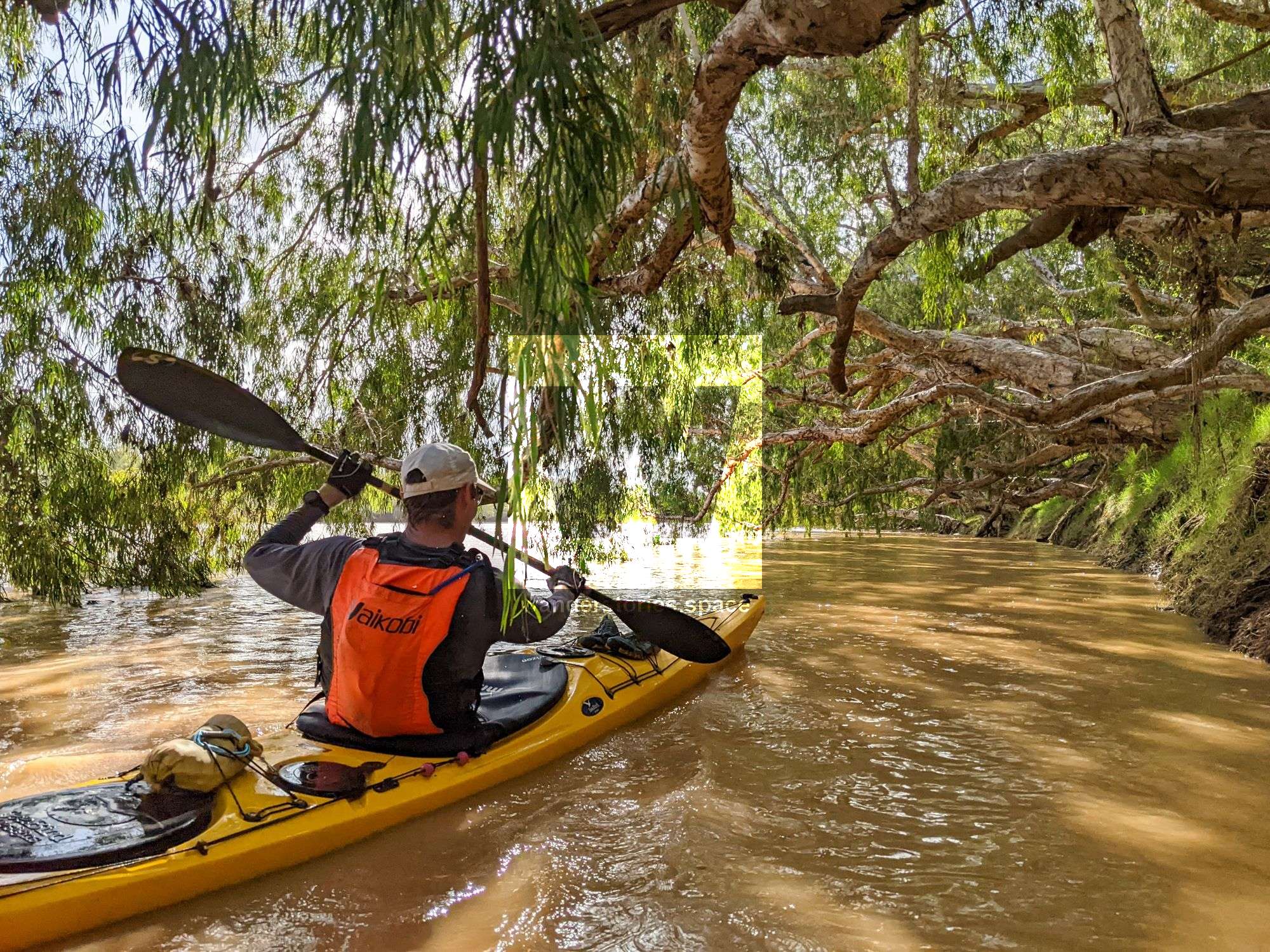
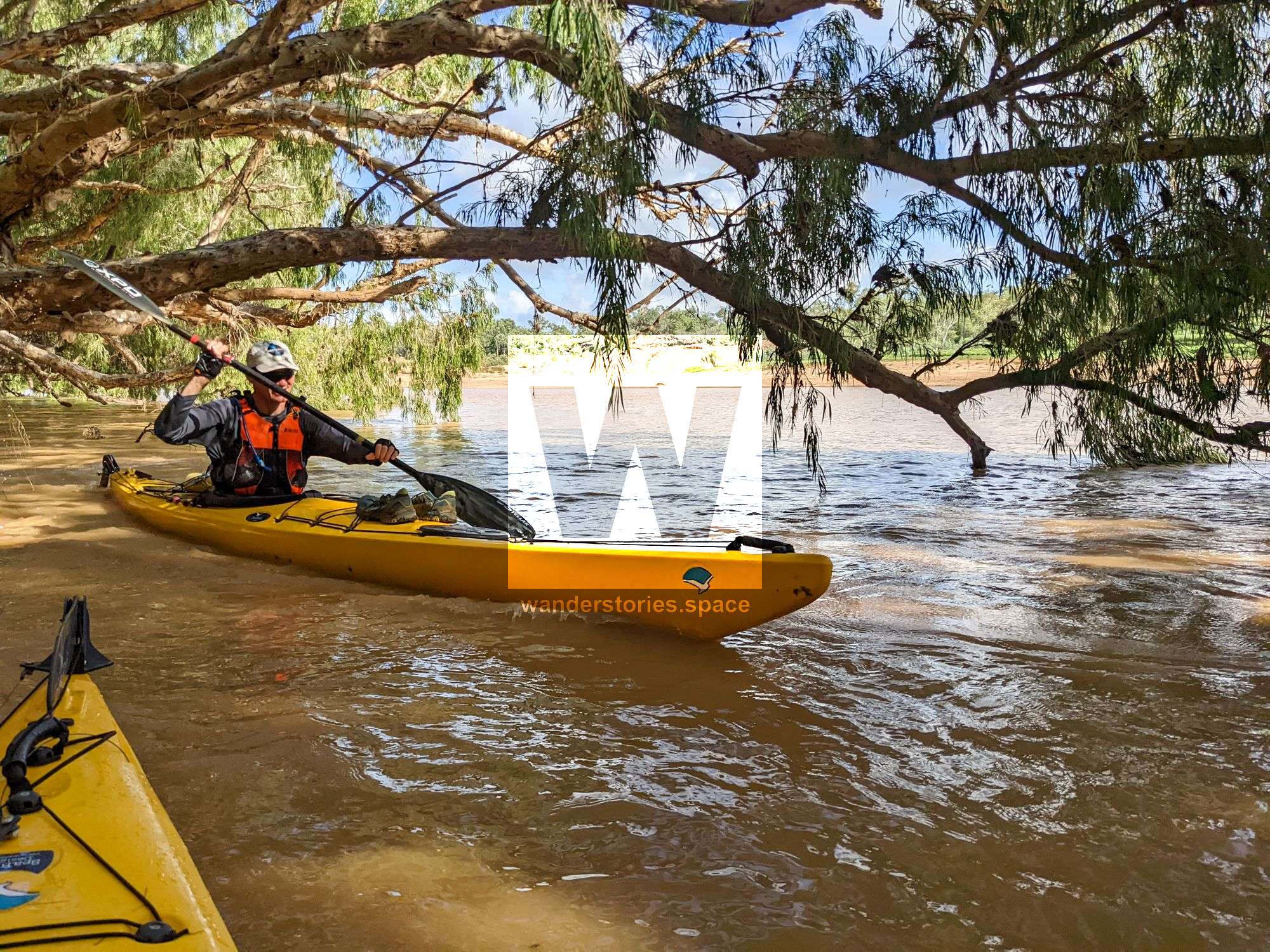
Kayaking down the Burdekin is an incredibly rewarding adventure. The river is home to small cascades, birdlife, fish, and of course, crocodiles (in the lower sections).

Location - Hidden Valley to Hervey Range to Charters Towers
Type - Kayaking / Canoe / Rafting / Bikerafting (Packrafting)
Difficulty - Mostly flatwater with some grade 1/2s
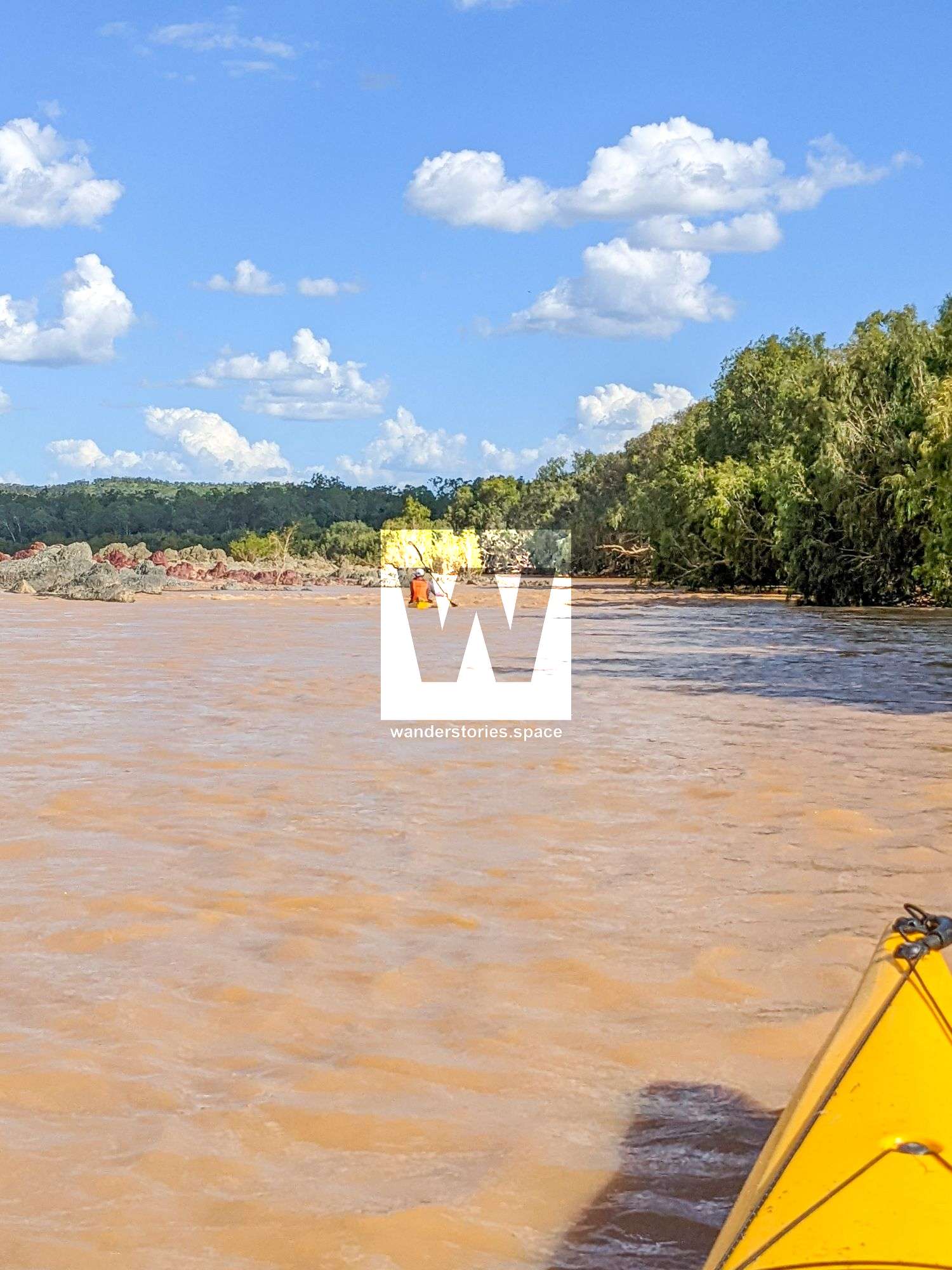
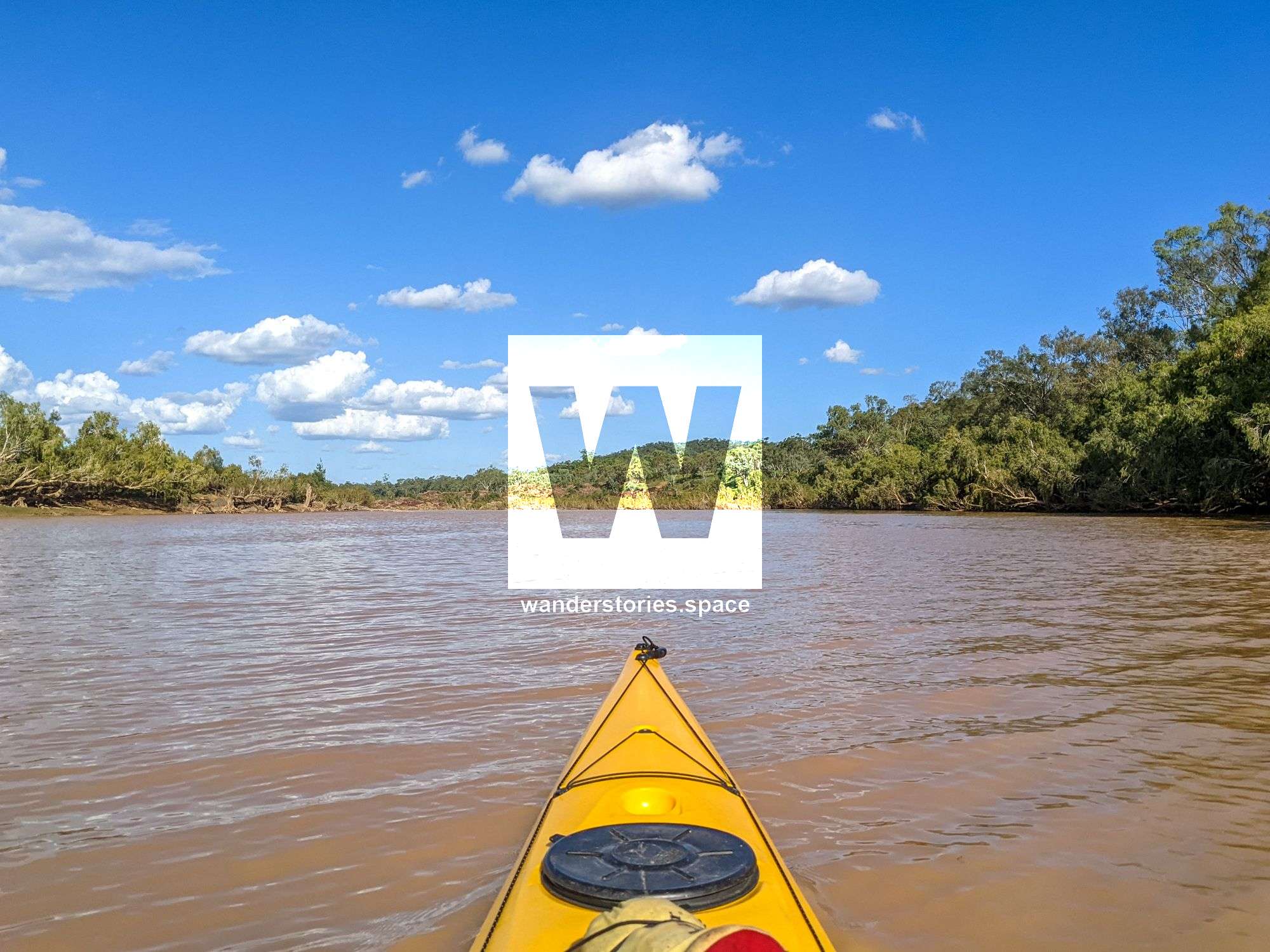
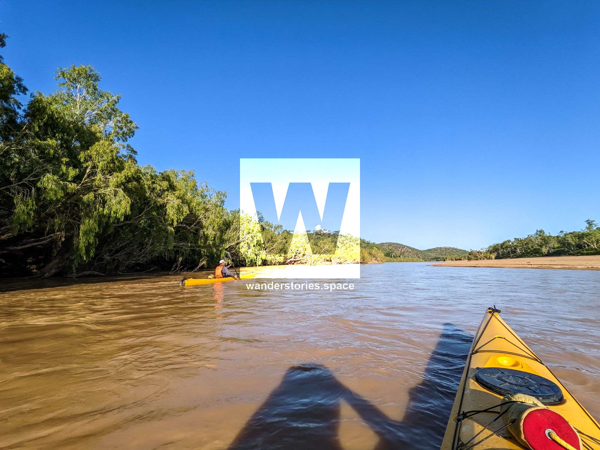
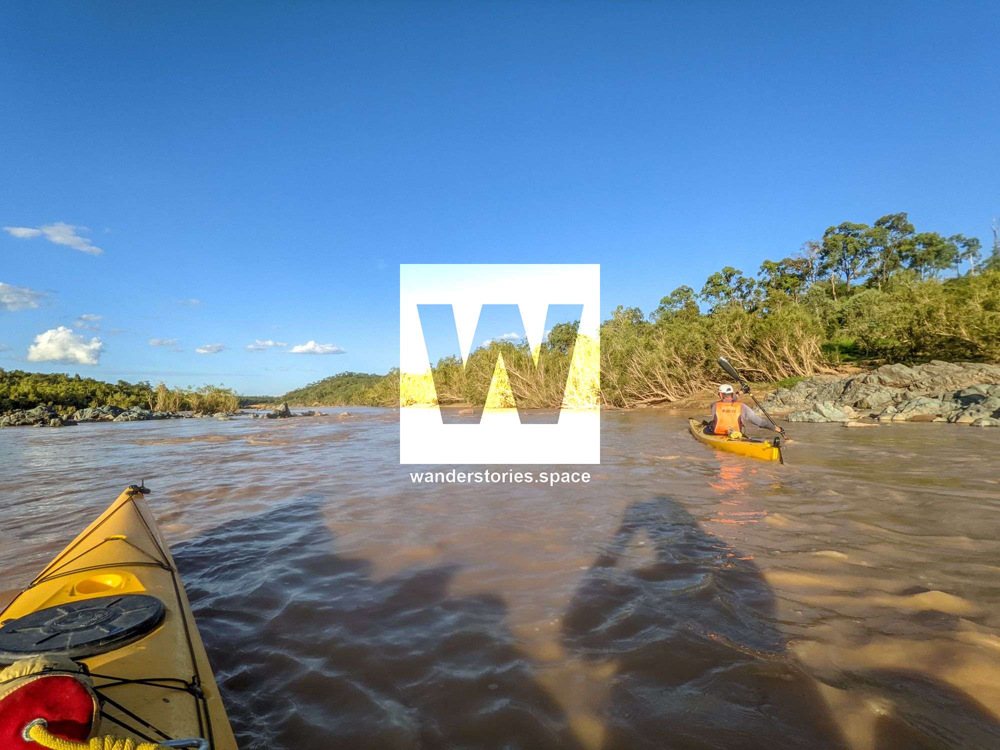
Kayaking down the Burdekin is an incredibly rewarding adventure. Enjoy a gentle paddle downstream, and you take in the abundance of birdlife with some big birds in the mix and a large variety of wildlife, including lots of cattle, wild bores, and fish. This trip will take you down Australia's largest river by (peak) discharge volume. Due to the river's length, there are many sections to paddle. However, the lower downstream you head, the more crocodiles.
The river was named in honour of Thomas Burdekin, who was one of the sponsors of the Ludwig Leichhardt expedition in 1845.
Notes
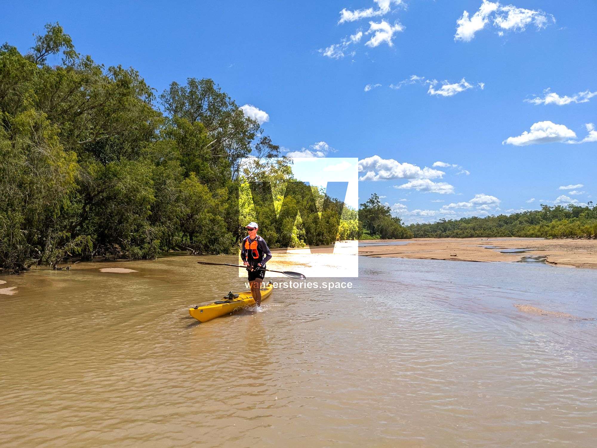
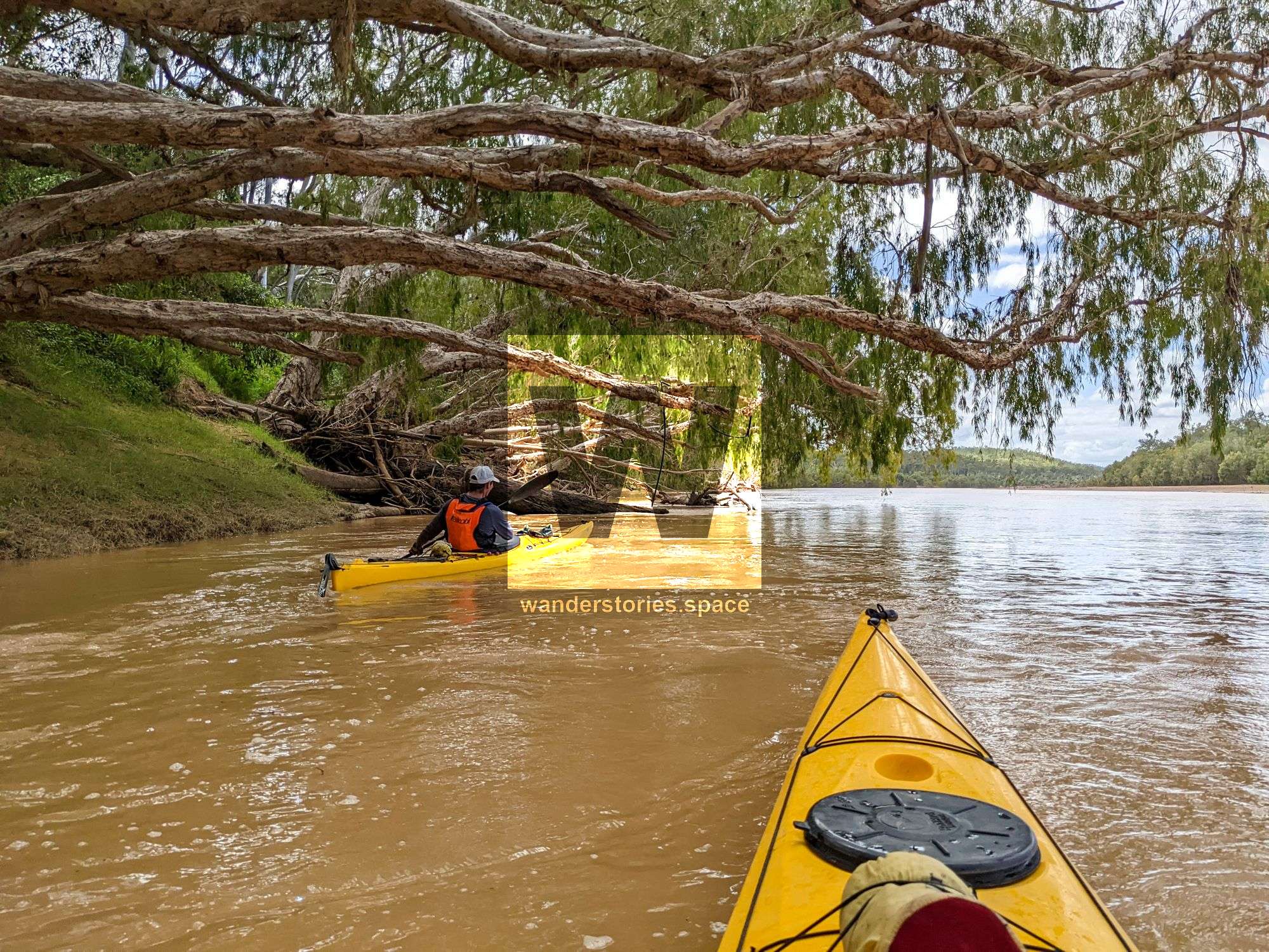
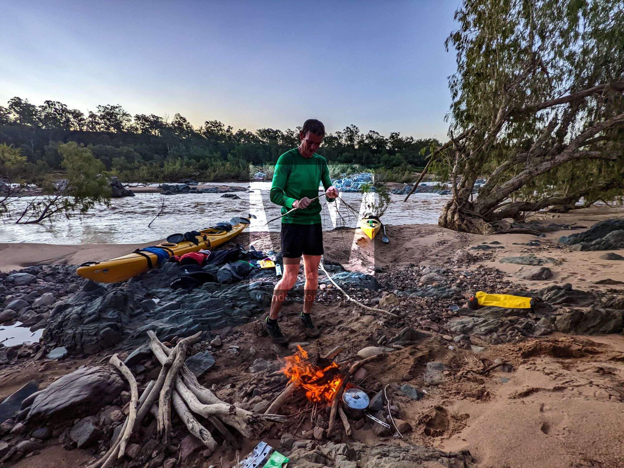
You may have to get out and walk your watercraft across the sand in lower flow. So be sure to go after the wet season to avoid dragging your kayak too much. However, you will also need to be aware of strainers. Note that this is a very committing adventure and that you are surrounded by private property. Several bridges cross the river along the journey. You can easily paddle down most sections in a decent amount of flow. Although you can bikeraft this river, there are a lot of flat sections, which will slow down progress in a non-streamlined boat.
Check the BOM Right Height tables beforehand.
It's doable at 1.5m on Gainsford Gauge, but you'd be dragging boats a fair bit. It's better above 1.7m. It starts to get less safe above 2.0m due to overhanging trees becoming strainers. Still, it's doable, but with care, and not for beginner paddlers at that level.
It's not really worth paddling at less than about 1.6m (usually just dry season levels). I wouldn't take inexperienced paddlers with you if it's much more than 2.0m, and I'd think twice if it was much more than 3m, though more skilled whitewater paddlers could paddle it when it's higher.
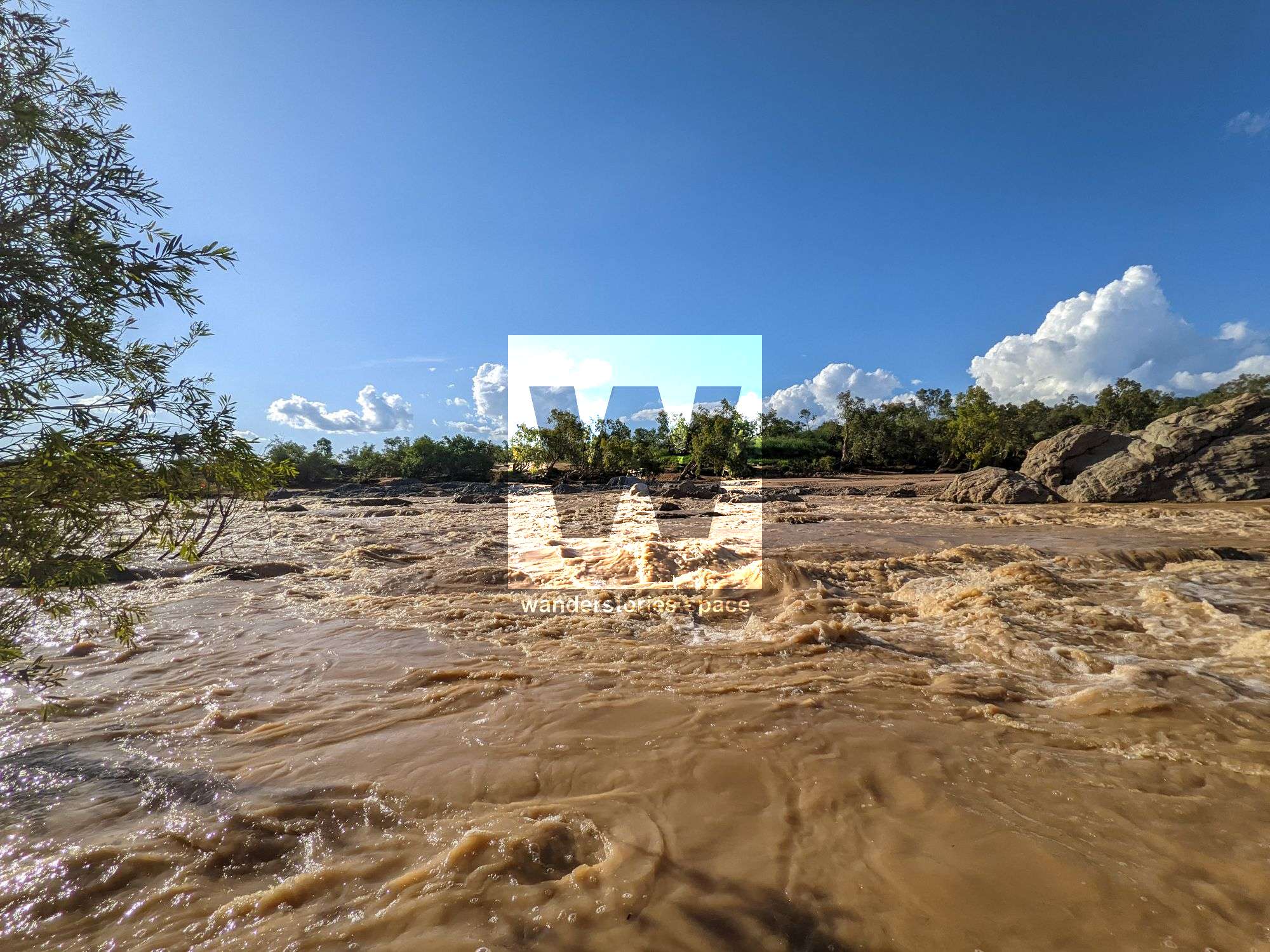
The Burdekin River has been paddled at high flow in the past - 10+m at Battery Creek / 10+m at Mt Fullstop - and is pretty wild. 10.7m, according to the Sellheim gauge on BOM).
Be mindful of crocodiles, especially downstream of the weir. They are in the dam and upstream of it too, but a lot less so. Farmers near Charters Towers say they have seen them, but very rarely, like once a decade or so.
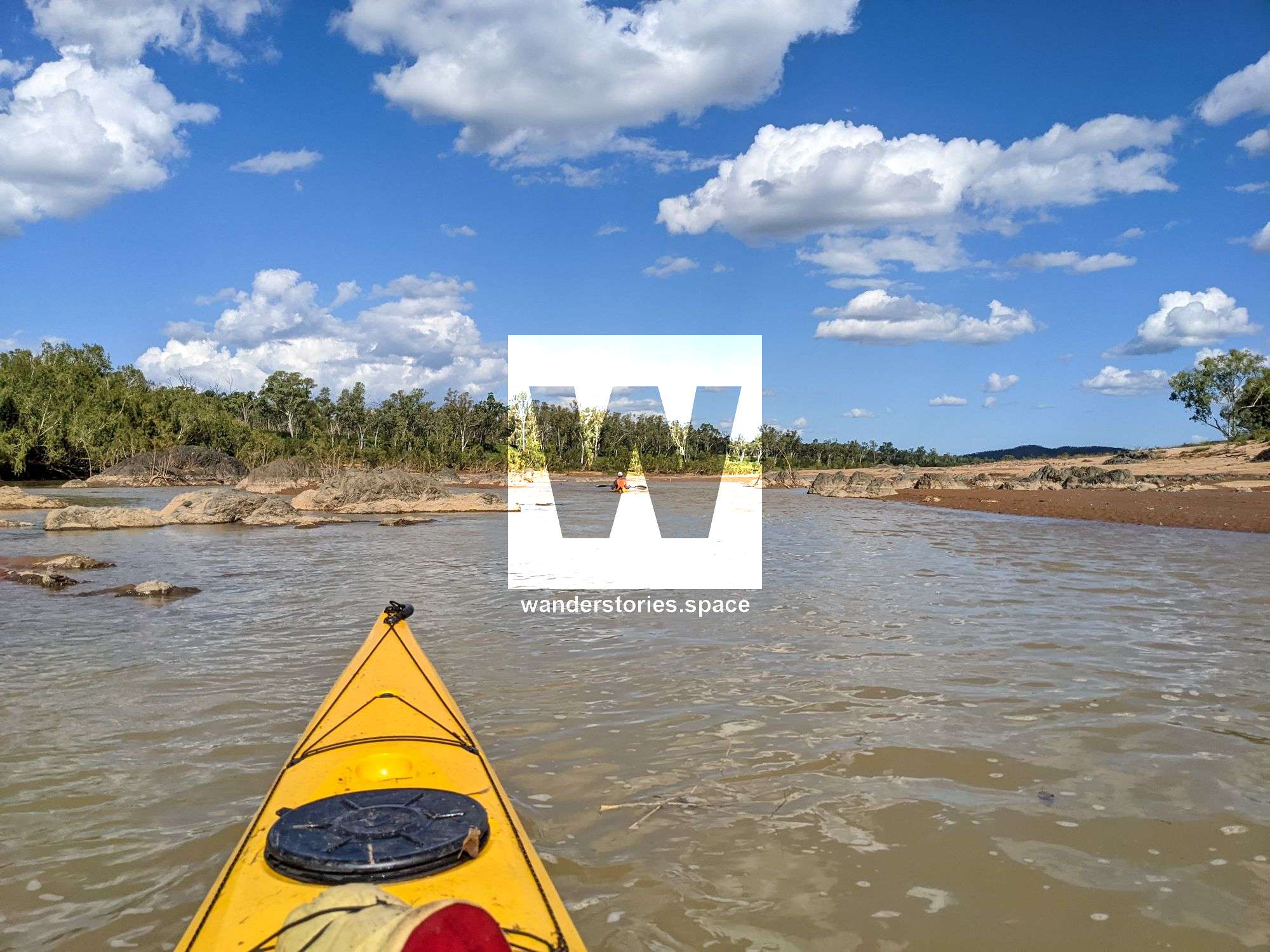
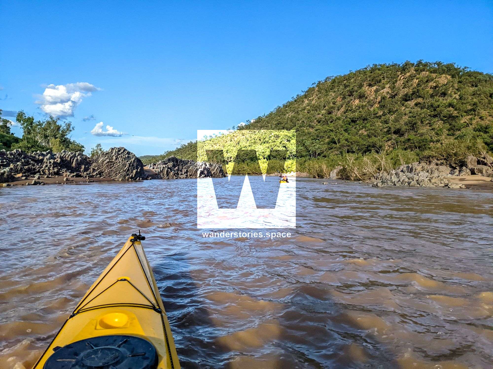
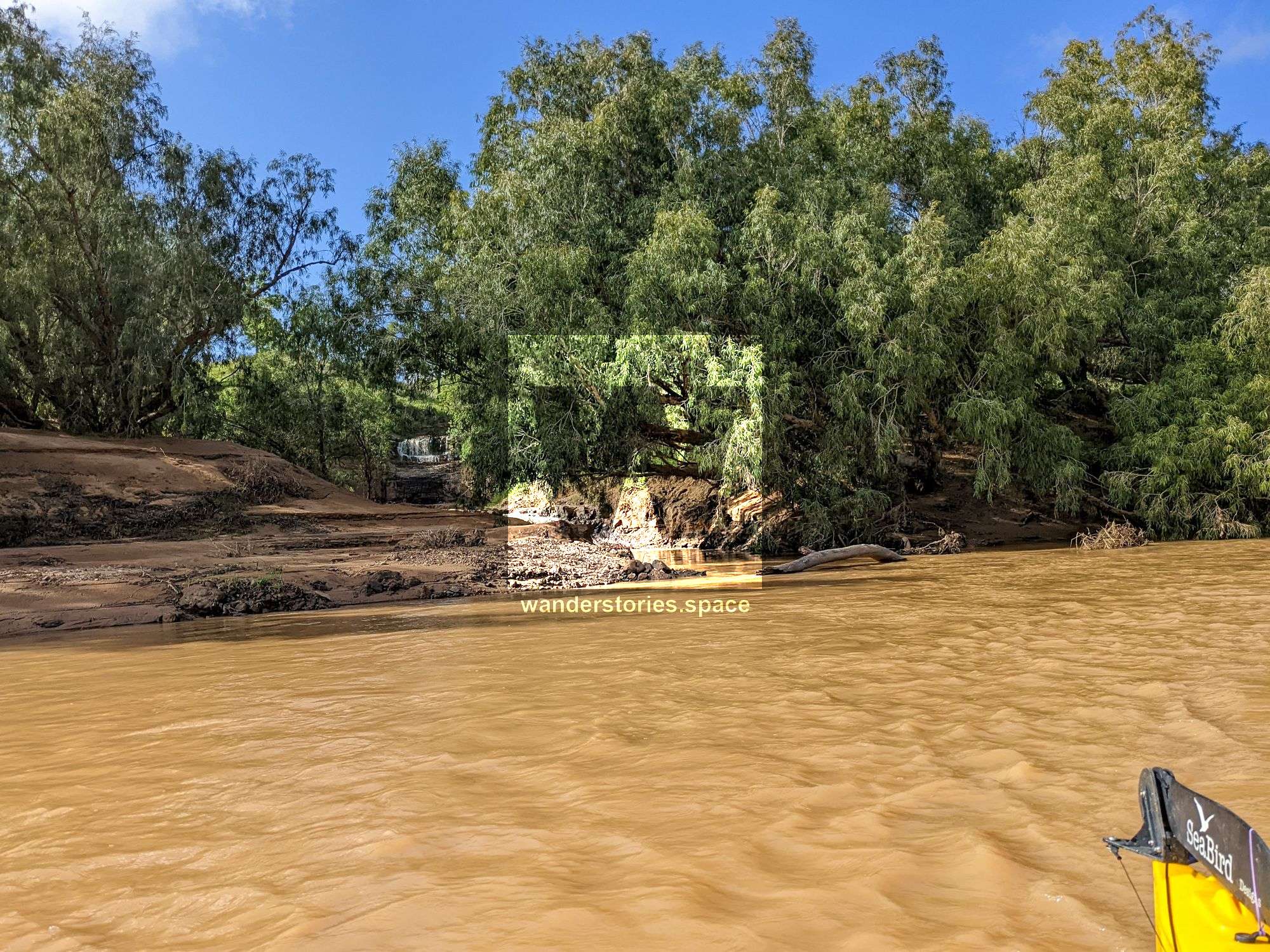
There are some rapids along the way that are worth scouting before you commit, but mostly it's just gentle flow unless you are going at ridiculously high water.
Feel free to contact us.
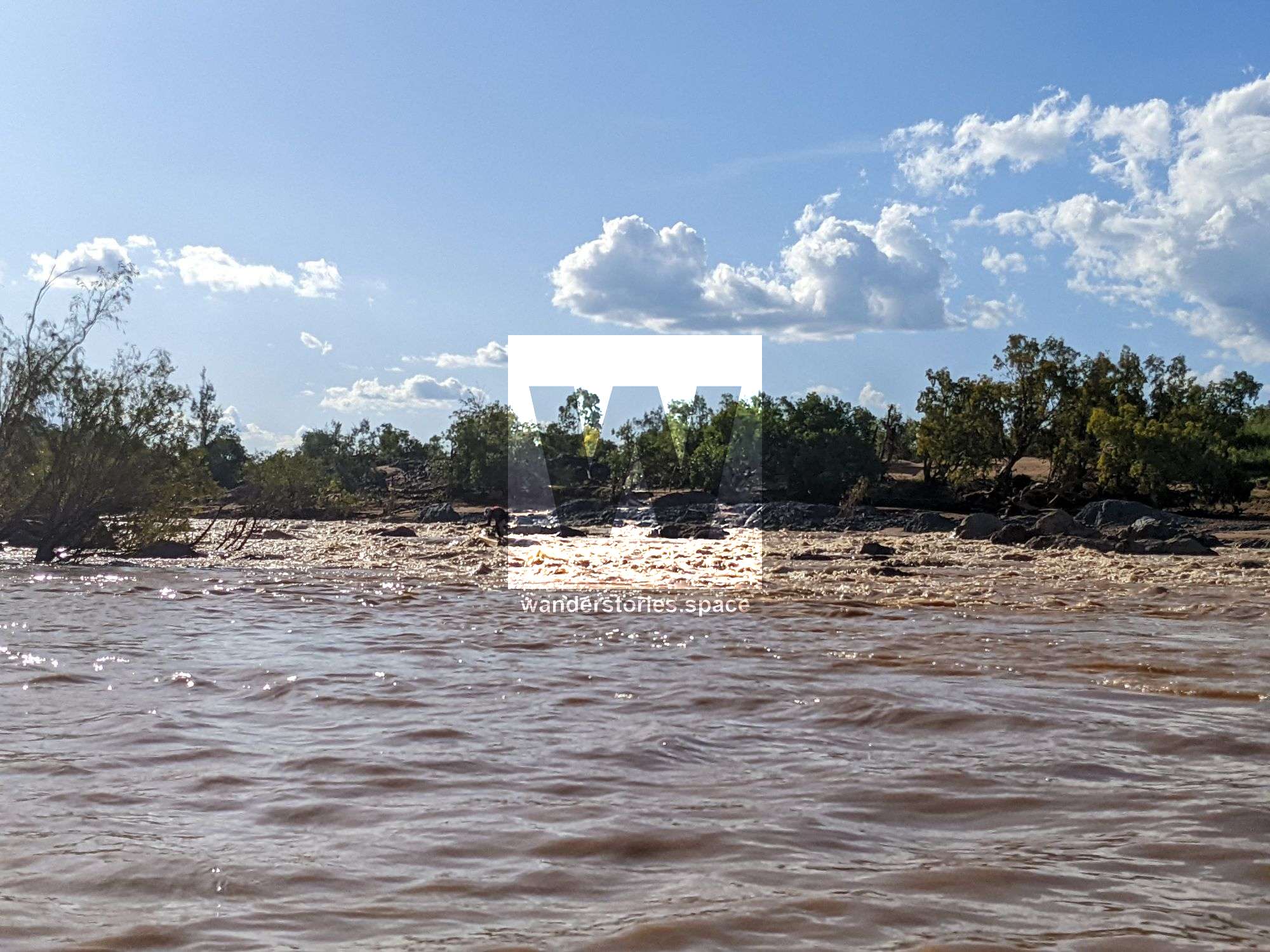
Some of the Burdekin River rapids
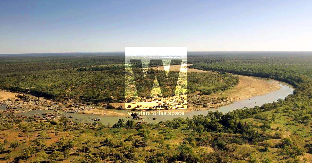
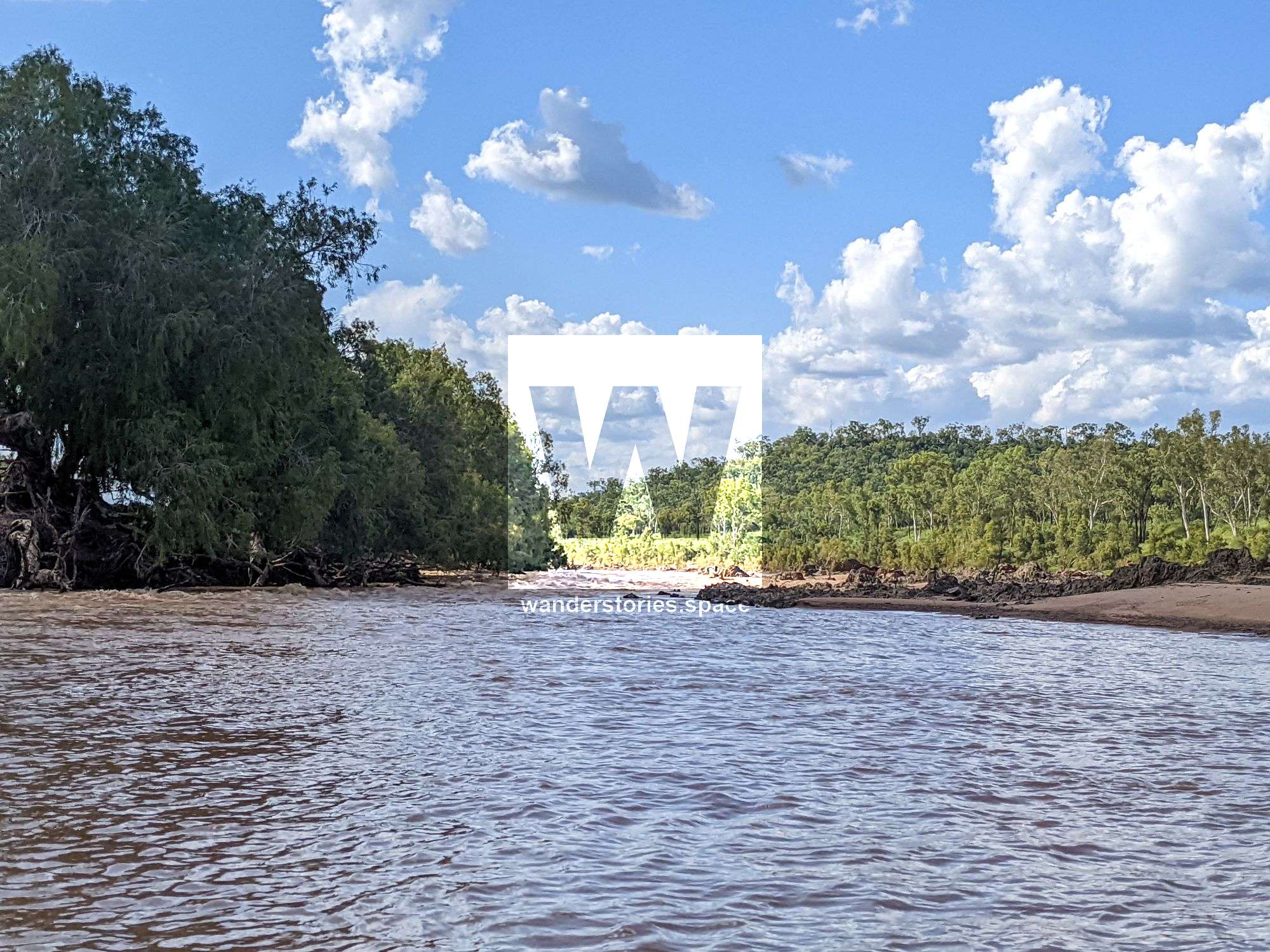
There are many entry points and exits, and each section of the river has its own perks, from the lush and gentle ponds of the Valley of Lagoons to the rapids below Battery Bridge.
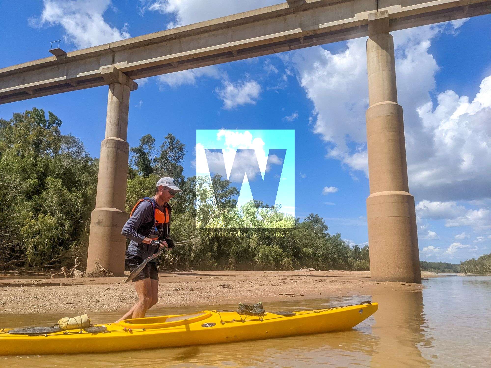
Public access put-in and take-out points are the Clark River bridge on Gregory Development Rd, the bridge on Hervey Range Rd (aka Battery Bridge), Fletcher Creek/Dalrymple National Park, Big Bend at Basalt, Charters Towers weir, the bridge on Flinders Highway/Bivouac Junction holiday camp (Macrossan), and Flat Rock campground, depending on how far and how many days you want to go/spend.
Below are the points of entry/exit in more detail:
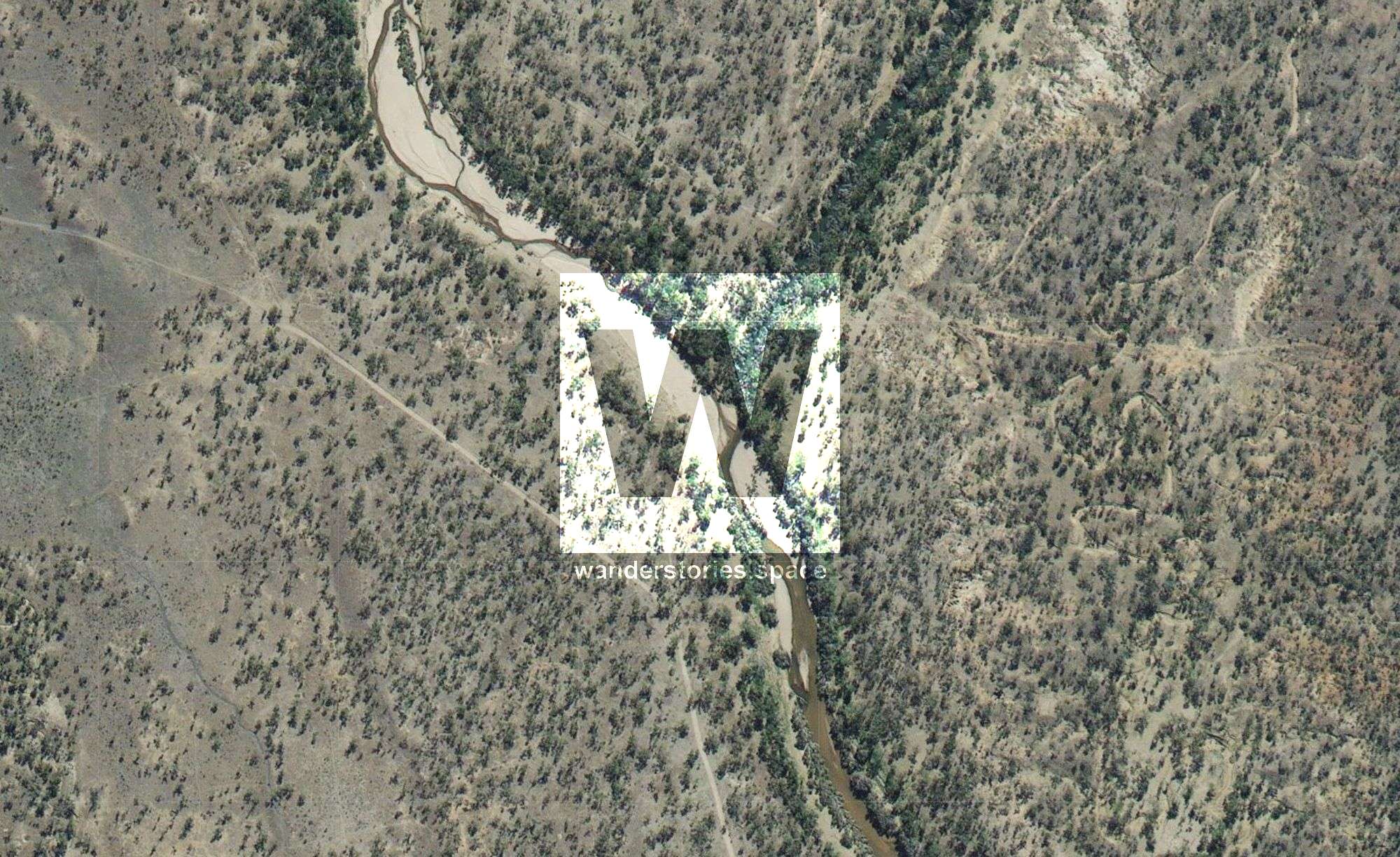
Junction of Burdekin River and Dry River
Wairuna / Valley Of Lagoons / Lucky Downs
Though I haven't paddled upstream of Clarke River junction, there are numerous options for those seeking a wild adventure, e.g., Lucky Downs, Poison Lake Road. You can also access the Burdekin River via Conjuboy Road and Dry River. Dry River is an open sandy river, whereas Burdekin River is narrow and has many trees and water. This section involves a lot of trees and vegetation and only starts to open up after the junction of Gray Creek.
Junction of Burdekin River and Gray Creek
Gray Creek
Like the Clarke River approach, Gray Creek is an open, primarily sandy creek until you reach the Burdekin River.
Clarke River
Clark River is shallow, and you'll need to walk in ankle-deep water for most of the 5-6km until you get to the Burdekin. This is a very sandy river, and you will likely walk the kayak, at least for some sections. You could also drive along Mt Fox Road towards Blue Range Station to launch directly into the Burdekin River. At the water levels we paddled at, we had to drag our kayak across the sand in some sections of Clarke River.
Running River
This has been done from below Running River Gorge, but you can also put in at the Bridge of Zig Zag Station. Be mindful of strainers (trees).
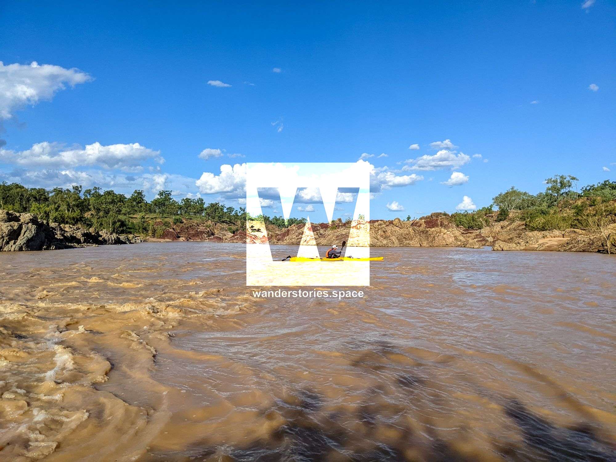
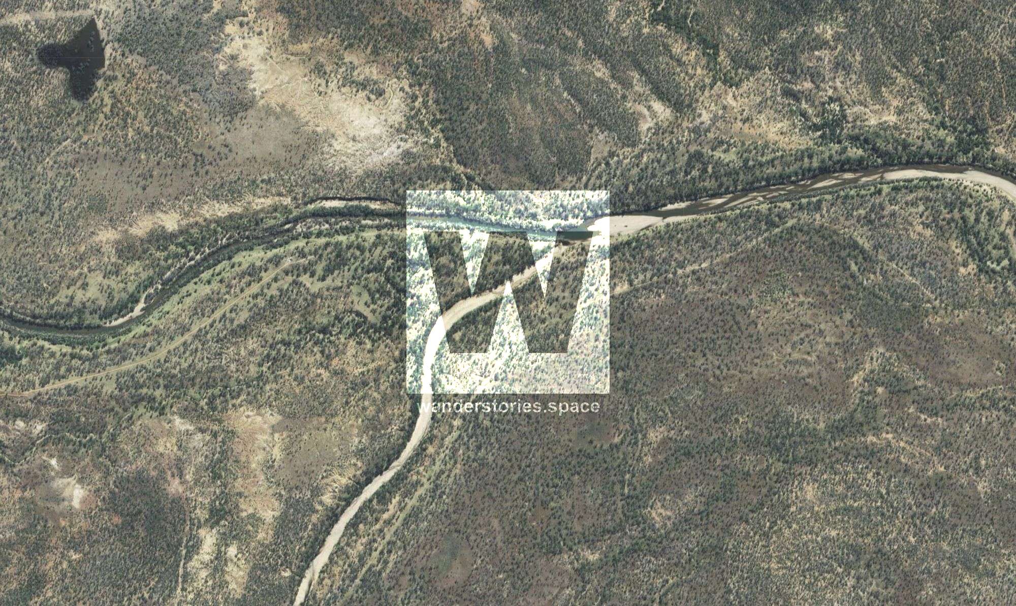
Battery Bridge (Hervey Range Road)
Battery Bridge on Hervey Range Road is probably the most commonly put-in spot where paddlers generally take out at Big Bend. The water levels here can indicate how good the run will be. Around 1.5-2m is a good level. If paddling above 2 m, you must be careful in the gorge right at the start—not for beginners.
Star River
Although we have not done this one, it looks like a great option.
Fletcher's Creek (Dalrymple National Park)
This sandy bend makes for an excellent spot to take out.
Big Bend
Several places along the bank near Big Bend do not have steep cliffs.
The Weir
There is about 8km of calm water (no flow) upstream of Charters Towers weir. The Charters Towers weir park is sometimes closed when there's a lot of water, so take out upstream at Big Bend. It is not recommended to paddle the section below the weir. Beware of the weir and, of course, the crocodiles. DO NOT PADDLE THE WEIR as it would act as a low-head dam—low-head dams are often colloquially known as "drowning machines."
Bivouac Junction Holiday Camp, Fanning River
Bivouac Junction Holiday Camp is a paid camping area with access to Fanning River and Burdekin River.
Macrossman Park (near Bivovac Junction), Flinders Highway
A popular overnighter rest area with access to the sandy banks of the Burdekin River.
Flat Rock Camping Area, Flat Rock Rd
Flat Rock is a publically accessible area a bit further downstream from the highway bridge.
Interactive Map
Feel free to contact us for more information about this trip.
This article, and all other articles, are for entertainment purposes only and are not to be used as a guide. Please see our Disclaimer for more information.