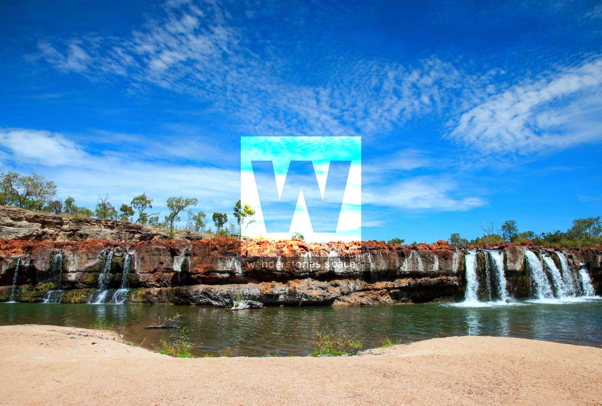
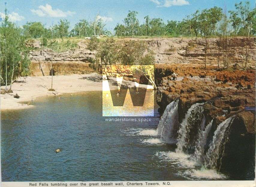
Red Falls, Charters Towers
Red Falls is on Lolworth Creek in the Great Basalt Wall National Park and use to be a popular swimming hole.

Location - Charters Towers region, North Queensland, Australia
Red Falls is on Lolworth Creek in the Great Basalt Wall National Park, 40 km along the Lynd Highway and then 44 kilometres west through a seasonal dirt track that crosses private property. It's no longer accessible to the public due to previous injuries sustained and lawsuits against the private landholder where the falls backup onto. This includes access to the entirety of the Great Basalt Wall National Park which is currently closed to visitors.
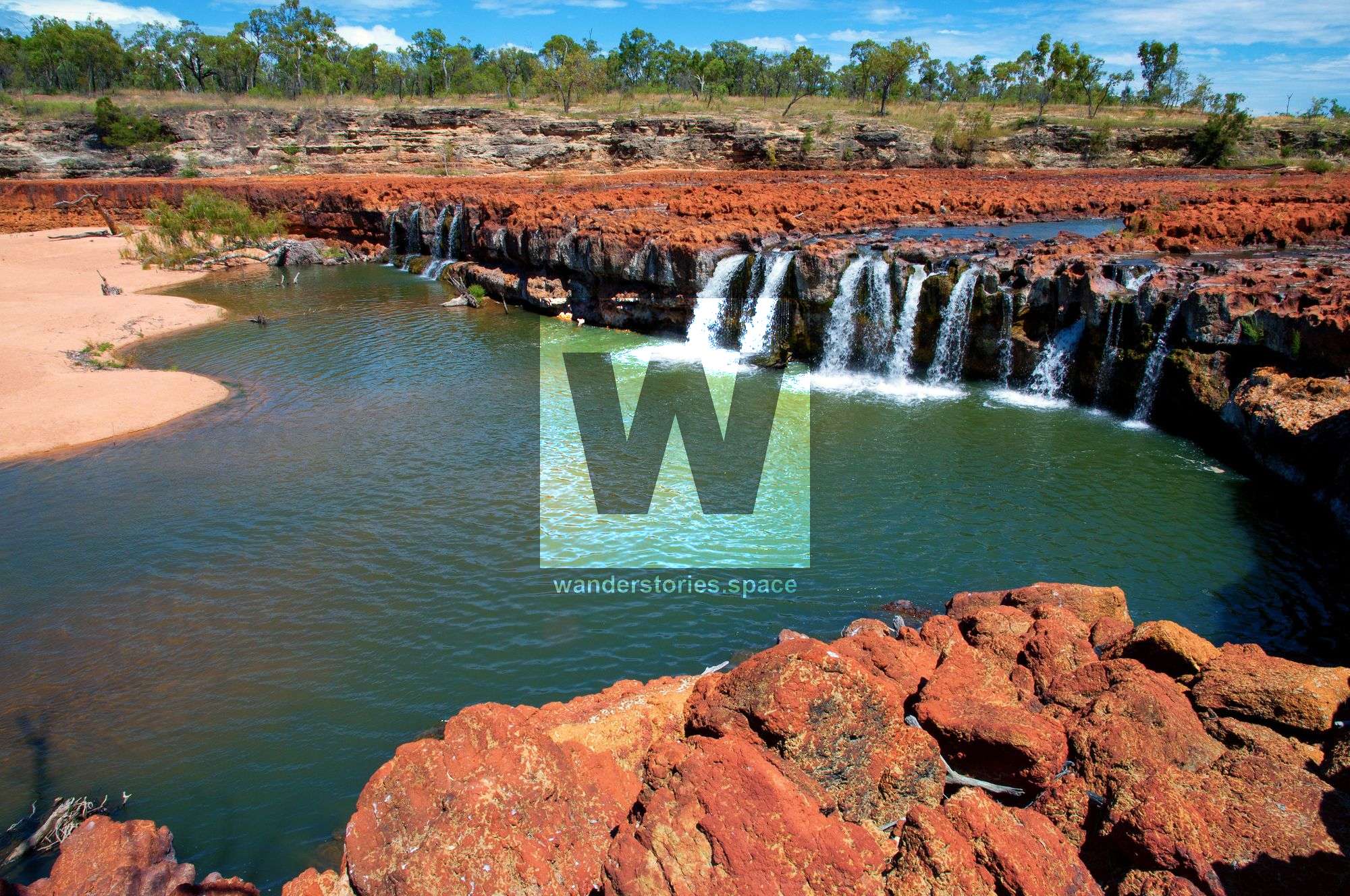
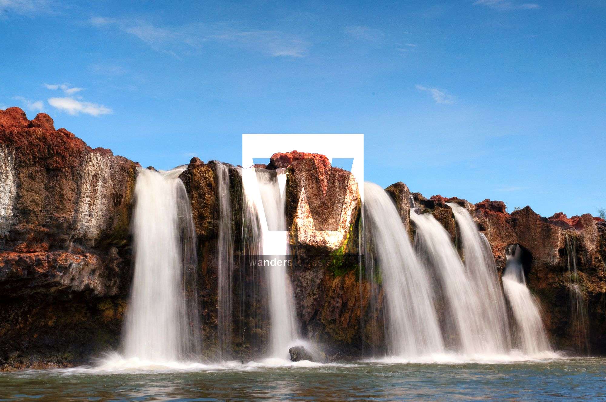
The river runs at right angles to the lava flow; water pours into an olympic-sized swimming hole and then down a sandy creek bed lined with paperbark trees and overlooked by a bush campsite. This area is a wonderful oasis, where cool clear water streams down the two metres high smooth stone walls. The annual rainfall of Red Falls is about 580 mm.
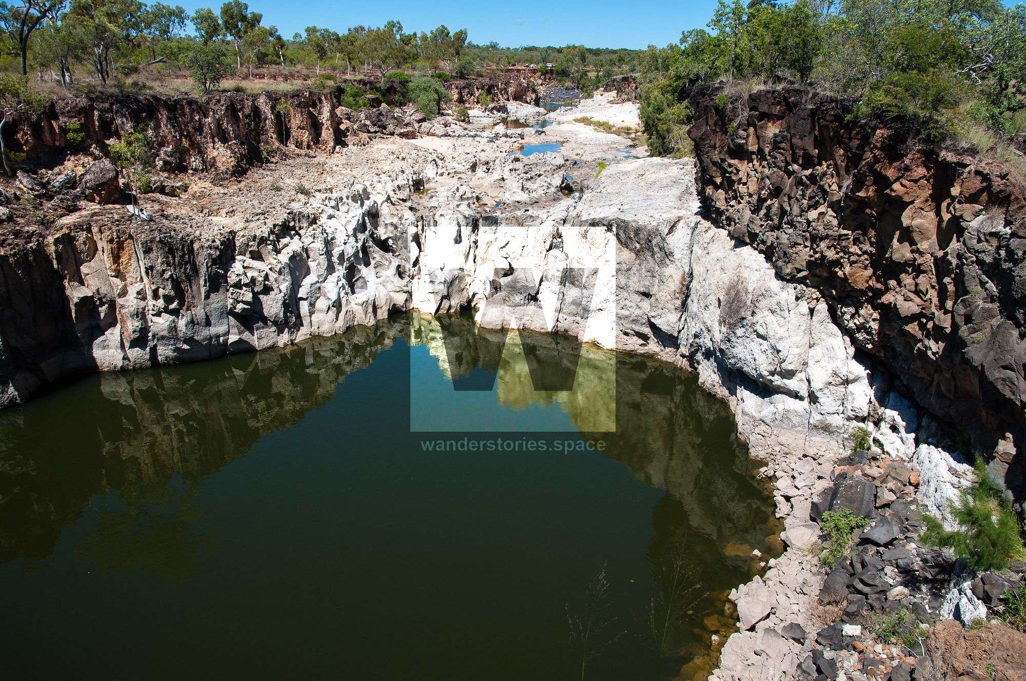
Another 200m upstream is Silent Hole, another swimming hole albeit much longer. You'll see that the riverbed is pocketed by the frozen impressions of burst bubbles where gases erupted through the solidifying rock.
White Falls is further upstream of Lolworth Creek.
The 35,200 hectares of land, protected in this Park, are the wildest and the most impassable in Queensland. The Park is named after massive formations of Toomba basalt deposits. The 13,000 years old basalt deposits at the Great Basalt Wall National Park are the youngest basalt deposits in Queensland. These were created during a huge outbreak of lava.
Great Basalt Wall National Park is divided into two sections. Red Falls, the eastern section, takes up about 4700 hectares. The rest, to the west, is the Volcano section, full of the ancient lava flow. Big old fig trees tower among basalt gravel, where they, just as knobble bottle trees, get very little water. Great Basalt Wall National Park protects reptiles and a wide range of birds. In the evening, when animals go out seeking food, visitors may observe them.
Interactive Map
Here's a map of where Red Falls is located.
This article, and all other articles, are for entertainment purposes only and are not to be used as a guide. Please see our Disclaimer for more information.