The Ross River Parkway
The Ross River is an iconic water source that winds its way through the suburbs and out through the city with pathways that runs along both banks, birdlife, and the amazing sunsets.

Location - Townsville, North Queensland, Australia
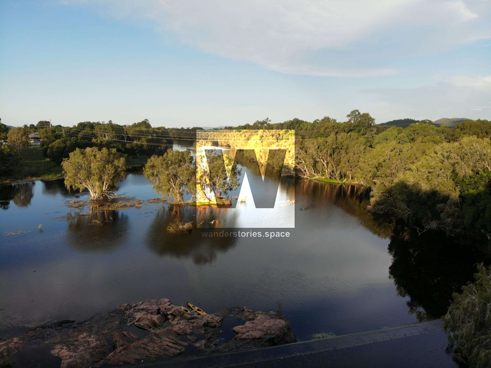
The Ross River, "Cal'bee'dee'ra" (Galbidira), is an iconic water source that winds its way through the suburbs and out through the city. One of the best things about the Ross River is the birdlife and the sunsets with glimpses of Mount Stuart, Castle Hill, and Frederick Peak as you walk or paddle. The river has water all year round due to the weirs (Gleeson's weir, Black School weir, Aplin's weir). In flood, some have tubed down the creek from the park to the next park - do not go down the weirs. Activities include wildlife & bird watching, water skiing, swimming, paddling, cycle, running, walking along the pathway, and fishing, boating, & crabbing at the estuary. Note that their are harmless freshwater crocodiles in the Ross River and deadly estuarine crocodiles downstream from Aplin's weir.
The Ross River Parkway is a continuous stretch of public open space that runs along both banks of the scenic Ross River. High-quality recreation facilities are dotted throughout, and the parkway's more than 30 kilometres of shared walkways connect them together. The shared riverside pathway system now makes it possible to go by foot or bicycle all the way from Townsville's central business district to the Upper Ross River. A variety of recreation circuits with varied lengths to suit everyone's tastes are created by major footbridge and road bridge linkages over the river. The Townsville City Council and the Queensland Government jointly support the Ross River Parkway project, which is emerging as one of the best recreational parkway networks in regional Australia.
Thousands of individuals commute to work every day by walking, jogging, or cycling thanks to Townsville's wonderful weather and way of life. Many more people spend their leisure time skating, utilising scooters, rollerblading, or walking their pets. Townsville's pathways and shared routes are being used by an increasing number of people, thus it is important to ensure that everyone knows how to do so safely.
The Riverwalk overlooks the beautiful Ross River and is a great place to view the prolific birdlife in this area. A 3-metre wide pathway runs along the river and provides numerous opportunities to enjoy its natural beauty. After taking a stroll, all the family can enjoy the nearby barbecue facilities provided or have a game of footy in the beautifully landscaped open space.
Interactive Map
Download the Ross River Parkway Guide:
Wetlands Circuit
Distance: 5.9 km
The Wetlands Circuit, which departs from Aplin's Weir, travels through the Ross River's tidal stretch downstream of Aplin's Weir and offers views of the mangrove and salt couch ecosystems. The 5.9-kilometer circuit connects the Murray Sporting Complex, Sherriff Park, and Aplin's Weir Rotary Park as recreation nodes. At Murray, there is a skatepark and a dirt jump area for BMX bikes. Distance markers offered as part of the 10,000 Steps programme are included on the Circuit.
Aplin's Weir Circuit
Distance: 5.3 km
Between Aplin's Weir and the Nathan Street bridge, the freshwater portion of the Ross River is traversed by the Aplin's Weir Circuit. This well-known circuit, which is 5.3 kilometres long, was the first to be finished. Weir Park, Rossiter Park, and Aplin's Weir Rotary Park are all connected by the pathway. A botanical garden emphasising the palm family called The Palmetum is located next to the parkway (no riding of bicycles in the Palmetum please). Additionally categorised as a 10,000 Steps circuit is the Aplin's Weir circuit.
Federation Circuit
Distance: 7.2 km
The Federation Circuit, which spans the upper Aplin's Weir and Gleeson's Weir pools between the Nathan Street bridge and the Federation Footbridge, is the longest individual circuit at 7.2 kilometres. Along the river banks of the circuit, there is abundant native riparian vegetation, particularly in the neighbourhood of Riverside Gardens. The Riverside Lodge Community Center and a viewpoint with a view of Gleeson's Weir are additional amenities. Currently, a small portion of this circuit runs parallel to Moondarga Drive and Ross River Road. This part could be rebuilt inside the riverside open space in the course of future development.
Riverway Circuit
Distance: 3.7 km
The newest of the four distinct circuits was produced with the building of the Motorway bridge. The Ross River's Black Weir pool is traversed by the Riverway Circuit between the Federation Footbridge and the Motorway Bridge (the bikeway is beneath the motorway). The Riverway arts and recreation complex and Kingfisher Lagoon are notable attractions on this circuit.
Bicentennial Park Section
Distance: 4.6 km one way
The golf course, Bicentennial Park, and Lou Litster Park are all within this 4.6 kilometre stretch of pathway that connects the Ross River at Bowen Road to the edge of the CBD at Boundary Street. Future construction will provide a direct connection to the CBD's core. Sandy Crossing offers views of mangrove populations in addition to the tidal river and creek systems that run throughout this region.
Fairfield Waters Section
Distance: 1.6 km one way
The pathway continues for 1.6 kilometres along the southern bank of the Ross River within the recently constructed neighbourhood of Fairfield Waters, downstream from the Bowen Road bridge to the perimeter of the Department of Primary Industries Research Station. Additional opportunities to view mangrove and salt flat ecosystems are provided by this tidal stretch. Take the connecting trail along the freshwater lagoon system in Fairfield for a chance to see waterbirds.
Booroona Trail
The Booroona Trail offers the perfect opportunity for people to get closer to their environment with its attractive boardwalks, peaceful seating areas and harmony with the surrounding environment. The walking trail has improved the local river area dramatically and has also helped to foster a sense of community along the Ross River. Residents and visitors can enjoy the walking trail by accessing it from Upper Ross River Road at Apex Park or Loam Island.
Ross Creek: "Cal'ghimg'a" (Galgimga).
This article, and all other articles, are for entertainment purposes only and are not to be used as a guide. Please see our Disclaimer for more information.