Rupin Pass Trek
If there is a classic trek in India, it has to be the Rupin Pass. Rupin Pass is a high altitude pass across the Himalayan mountain range in state of Himachal Pradesh, India. This trek is like an orchestra, building up momentum with surprises in scenery every hour or so.

Skill Level - Easy to Moderate
Distance - 29 km
Elevation - 4,650 m (15,250 ft)
Location - India
Traversed - From Rupin Valley, Uttaranchal, to Sangla Valley, Himachal Pradesh, over the Dhauladhar Range
Overview
The Rupin Pass is a must-do trek in Himachal Pradesh, traversing the Himalayas. Originating in Dhaula, Uttarakhand and concluding in Sangla, Himachal Pradesh, the tour takes you through isolated Himalayan terrains at 4,650m.
Scenic Highlights
The trek offers ever-changing landscapes, with the Rupin River as a constant companion. You'll marvel at the azure river waters and the iconic three-tier waterfall. As you ascend, the scenery shifts between barren rock or snowfields, culminating in a crossing of a frozen scree slope before descending into the valley beyond.
Difficulty and Duration
Classified as moderately challenging, the trek typically involves 3-6 hours and 4-10 km of hiking daily. Physical fitness is crucial due to the diverse terrain, which includes ill-defined trails, rocky and wooden pathways, glaciers, icy inclines, and snow-covered expanses.
Trail Conditions
Expect variations in trail conditions, including slippery mud, scree, and hard-packed snow. Notable sections include the climb to Rati Pheri and a steep ascent through a gully to reach the pass. Adequate cardio and lung capacity are essential. Along the route, you'll encounter white rhododendrons and lush green meadows.
Trailhead Options
Two primary access points to Rupin Pass exist. The first is Gosangu, the last roadhead in Himachal Pradesh, commonly reached via Shimla and Rohru. The alternate entry is Naitwar, accessible from Dehradun via Dhaula.
Regardless of the starting point, the first camp is generally Jhaka, the "hanging village." It's your final chance to restock supplies and observe local life before venturing further.
The Rupin Pass Trek
Interactive Map
Day 1: Arrival at Dhaula
Altitude: 5,100 ft (1,554 m)
Time: 10-11 hours' drive
Pickup: 6:30 a.m. from Dehradun
Special Notes: The campsite in Dhaula is situated beside a river.
Dhaula serves as the starting point for the Rupin Pass trek. Nestled at 5,100 ft (1,554 m), this tranquil hamlet comprises a handful of houses and marks Uttarakhand's last road head.
Transport to Dhaula begins from Dehradun Railway Station and is an extra charge. The drive takes roughly 10 hours, meandering through picturesque mountain roads and dense forests.
Day 2: Dhaula to Sewa
Altitude: 6,300 ft (1,920 m)
Time: 6 hours
Distance: 11 km
Water Sources: Rupin River
On Day 2, the trek takes you from Dhaula to Sewa. This stretch gains altitude, moving from 5,100 ft (1,554 m) to 6,300 ft (1,920 m).
The trek lasts about 6 hours and covers a distance of 11 km. The day starts with a moderately steep climb followed by a more comfortable walk with minor elevations and declines. Water can be refilled from the Rupin River en route.
The trail begins in the village and soon ascends to offer panoramic views of the Rupin River bed and surrounding villages. Further along, the path snakes through orchards of apple and apricot trees.
A roadside eatery offers a welcome break. Run by a multi-talented woman, it's the only place to refresh before reaching Sewa.
Your camp for the day is Sewa, notable for its unique temple. It reflects a blend of local and Kinnaur architectural styles, influenced by its proximity to the Himachal border. The temple is dedicated to Karna from the Mahabharata and showcases intricate Kinnauri carvings and historical artifacts. To delve deeper into the temple's architectural history, consider reading "Temple Architecture of the Western Himalaya: Wooden Temples" by Omacanda H.
Day 3: Sewa to Jiskun
Altitude: 7,700 ft (2,347 m)
Time: 5 hours
Distance: 8 km
Water Sources: Limited; carry sufficient water from Sewa
The journey from Sewa to Jiskun elevates from 6,300 ft (1,920 m) to 7,700 ft (2,347 m), covering 8 km over roughly 5 hours.
The initial 3 hours are relatively straightforward, followed by a steep 2-hour ascent to Jiskun. Ensure you carry enough water from Sewa, as reliable water sources disappear about an hour before Jiskun.
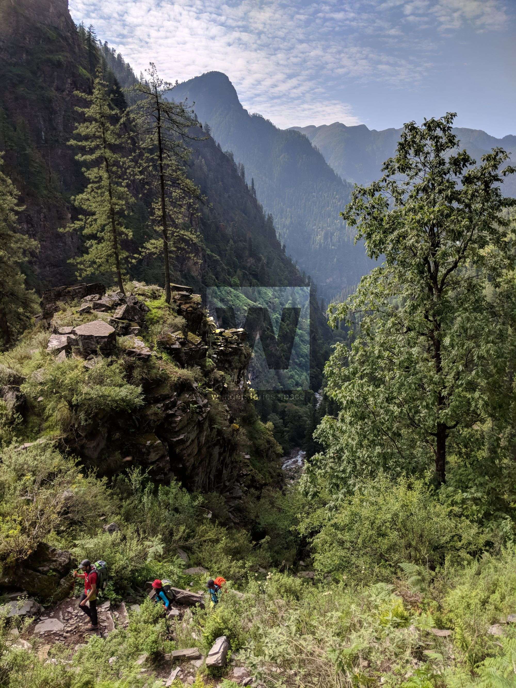
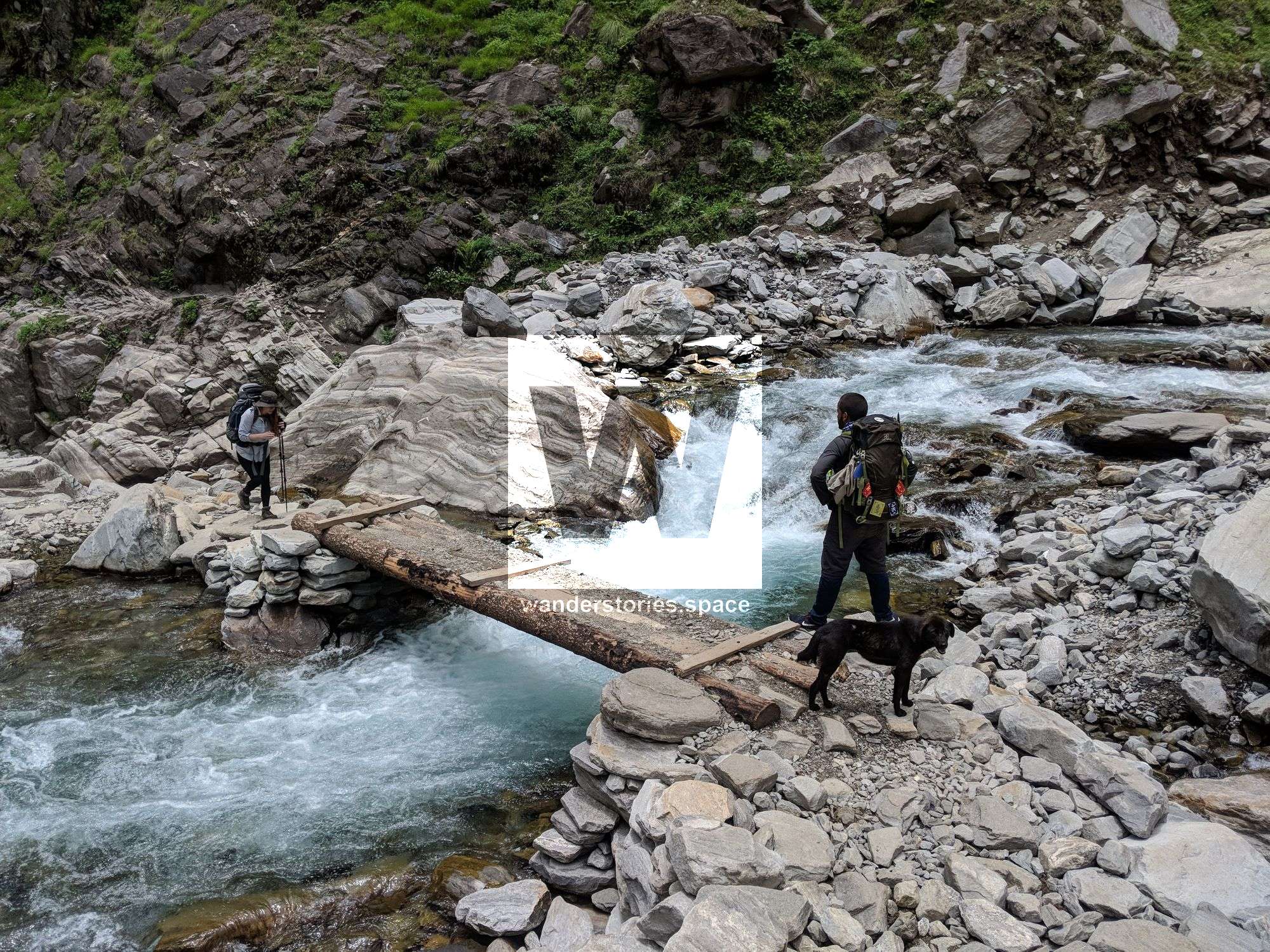
The trail starts with a descent through dense forests, eventually opening up to the Rupin riverbed. Here, you'll trek on the river for the first time. After crossing several creeks, you'll reach a small bridge that marks the boundary between Uttarakhand and Himachal Pradesh. A brief rest spot, Haldi Khad, can accommodate several tents and is situated along a flat trail leading to the roadhead of Gosangu.
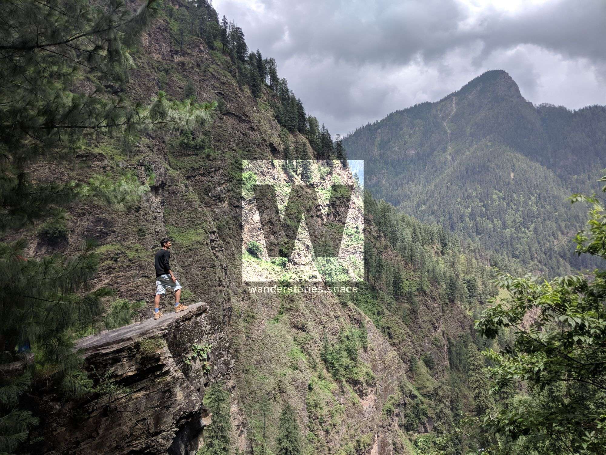
Beyond Gosangu, anticipate a challenging mix of steep climbs and level walks. The trail eventually narrows and clings to steep mountain slopes, offering spectacular views of the glistening Rupin below.
As you traverse the trail, you'll encounter a serene waterfall cascading down from an unseen source above, offering a great photo opportunity and a refreshing break.
Past the waterfall, you'll cross a fast-flowing stream called Raj Gad—this is an ideal place for a brief rest. From here, it's a long one-hour climb to Jiskun, with the trail forking shortly after crossing the stream. Take the upward route to reach your destination.
Special Note: Expect a few precarious overhanging trail sections; trekking cautiously is advised.

Day 4: Jiskun to Udaknal
Altitude: 10,100 ft (3,078 m)
Time: 6 hours
Distance: 8 km
Water Sources: Limited; refill at Jhaka and rely on Rupin River afterwards
On Day 4, expect to ascend from 7,700 ft (2,347 m) to 10,100 ft (3,078 m). The 8 km trek will take around 6 hours and offers a mix of terrain.
The trail starts with an hour's descent, followed by an hour's steep climb, levelling off at times until you reach the fir forest. From there, it's a steep descent and a gentle walk to finish. Plan to carry sufficient water, though you can refill at Jhaka, 3.5 km from Jiskun. Beyond Jhaka, the Rupin River will be your water source.
From Jiskun, your first sight is the hanging village of Jhaka, which seems to defy gravity by clinging to the mountainside. The path to Jhaka is lined with a lush forest of deodars and walnuts, eventually opening up to an awe-inspiring rocky trail. Jhaka itself is a no-meat zone, respecting local beliefs.
After Jhaka, you'll enter a striking fir forest where towering blue pines dominate the scenery. Shortly after, you'll encounter a snow bridge over the Rupin River, an unexpected and breathtaking sight. (Note: In some years, the snow bridge may not be present, but an alternate route exists.)
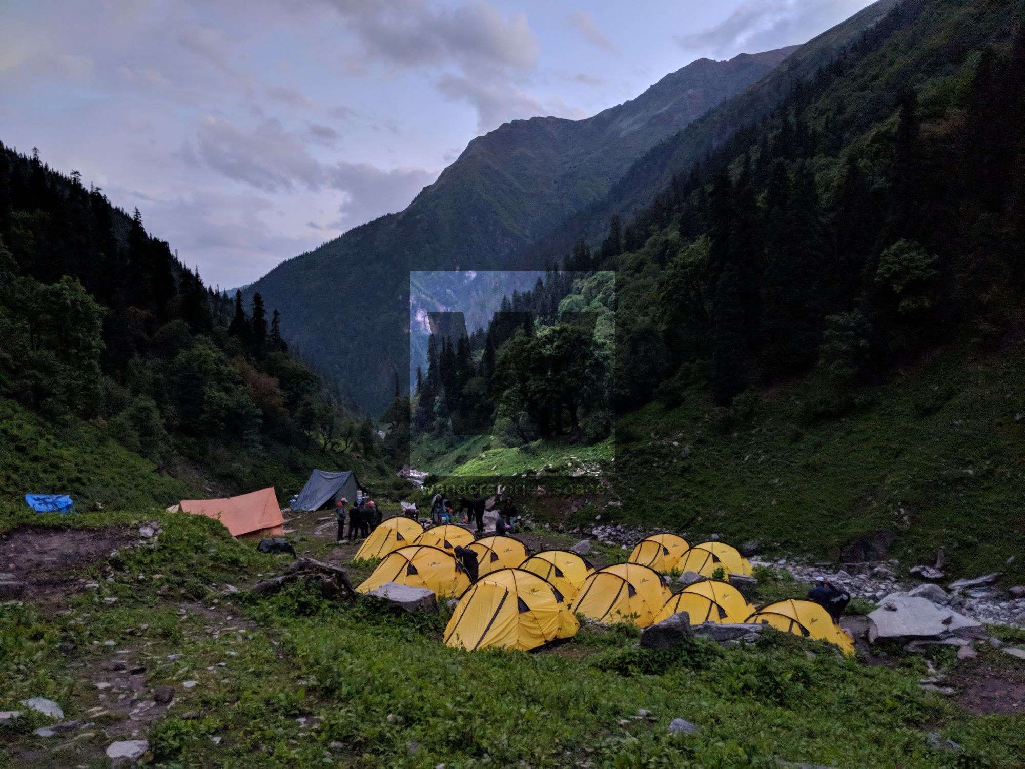
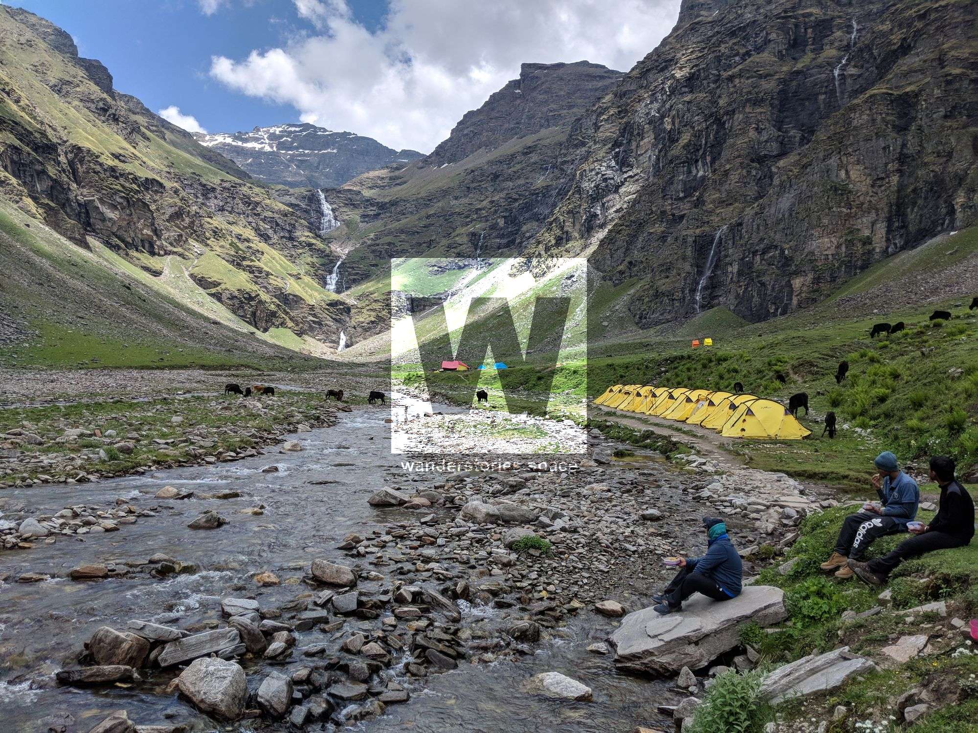
The last portion of the trek takes you through a narrow path flanked by the Rupin River, leading to various potential camping spots. One such spot is Burans Kandi, a grassy field highlighted by a creek, making it a picturesque place to camp, albeit often populated by grazing cattle.
Special Note: Be prepared for varying terrains, including narrow paths, rocky slopes, and snow patches. As the trail can be strenuous, ensure you're well-equipped and well-hydrated.
This day promises a variety of experiences, from challenging ascents to awe-inspiring natural sights. Make sure to pace yourself and take in the stunning scenery.
Day 5: Udaknal to Dhanderas Thatch (Lower Waterfall Camp)
- Altitude: 10,100 ft (3,078 m) to 11,700 ft (3,566 m)
- Time: 5 hours covering 6 km
- Trek Gradient: Easy to moderate; slow incline with tricky parts at the snow bridge.
- Water Sources: Bring enough water, though refills are possible from the river.
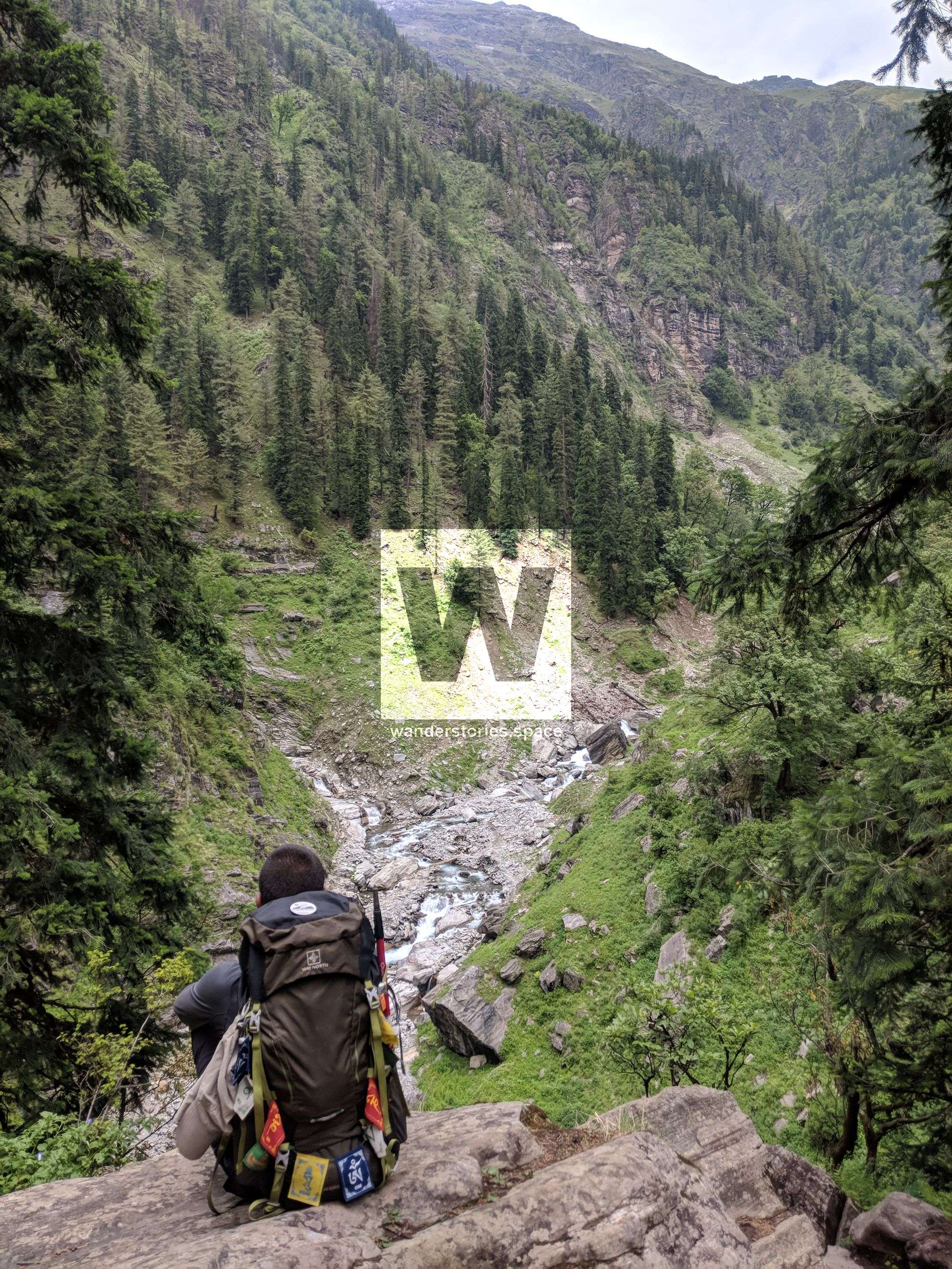
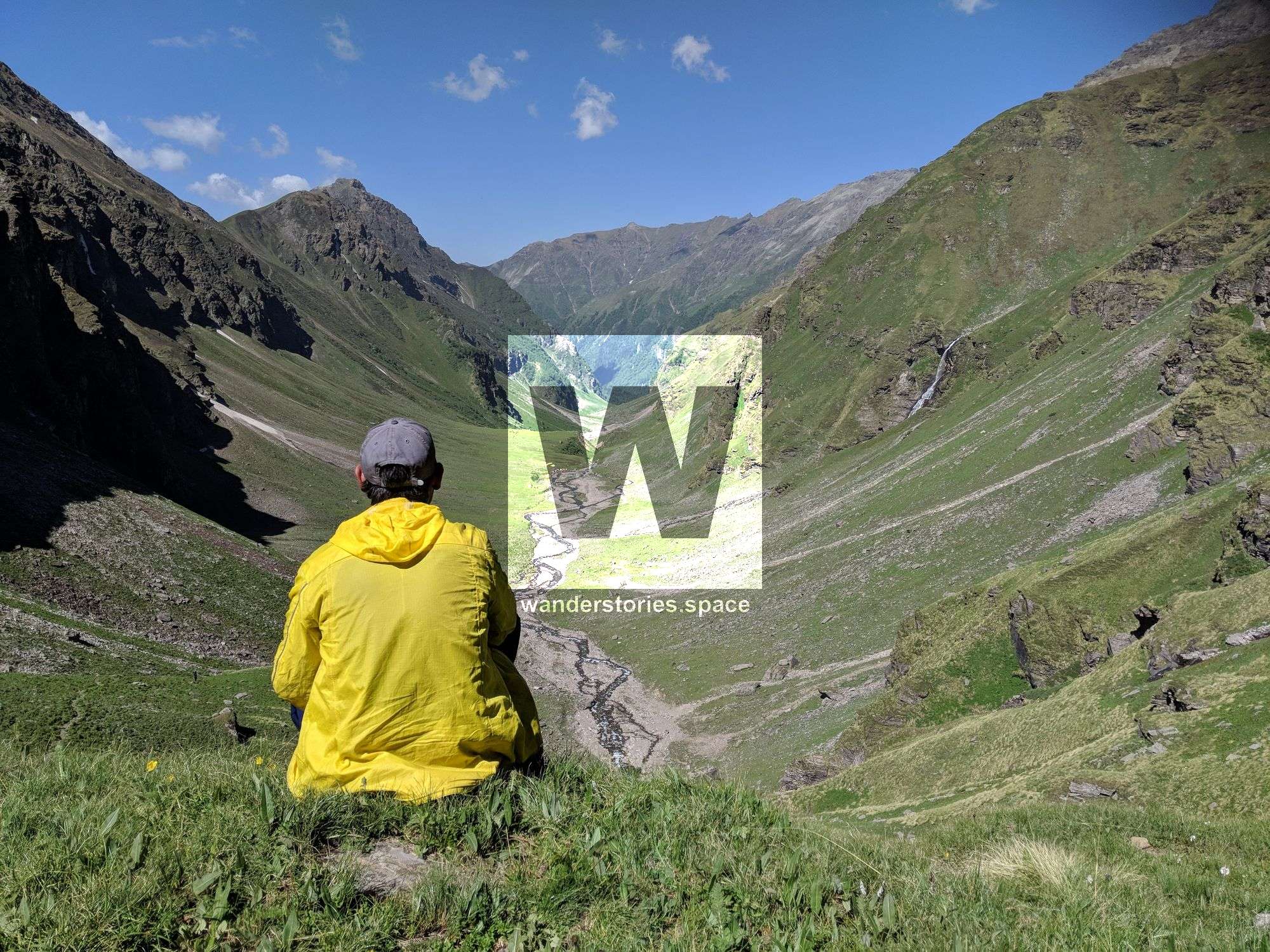
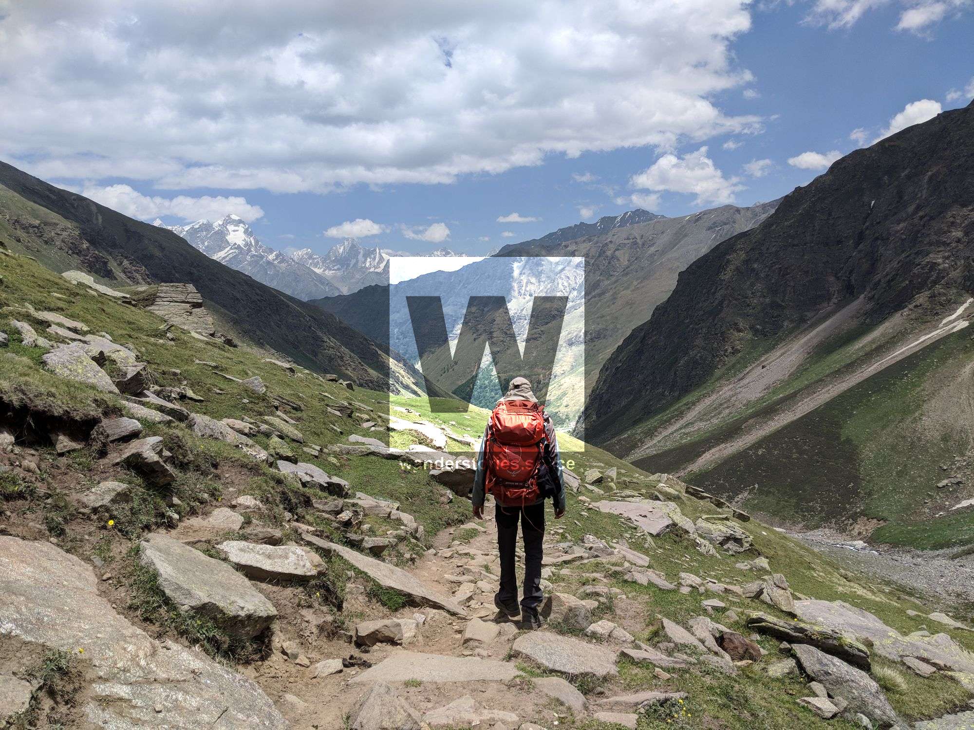
As you ascend, dwarf rhododendrons welcome you, adorning the trail in shades of white, pink, and purple. The Rupin River runs alongside, offering scenic views of mini waterfalls. A clearing presents a sight to behold: a tranquil island amid the Rupin, framed by Silver Birch trees. The grand finale? Your first glimpse of the stunning Rupin Waterfall in the distance.
The journey weaves through forests and lush meadows punctuated by snow bridges over the Rupin. Silver Birch trees, renowned for their sacred leaves in mythology, are common along the trail. As you reach a high vantage point, the U-shaped valley reveals cascading waterfalls merging into the Rupin, set against a backdrop of sprawling green fields dotted with marigolds.
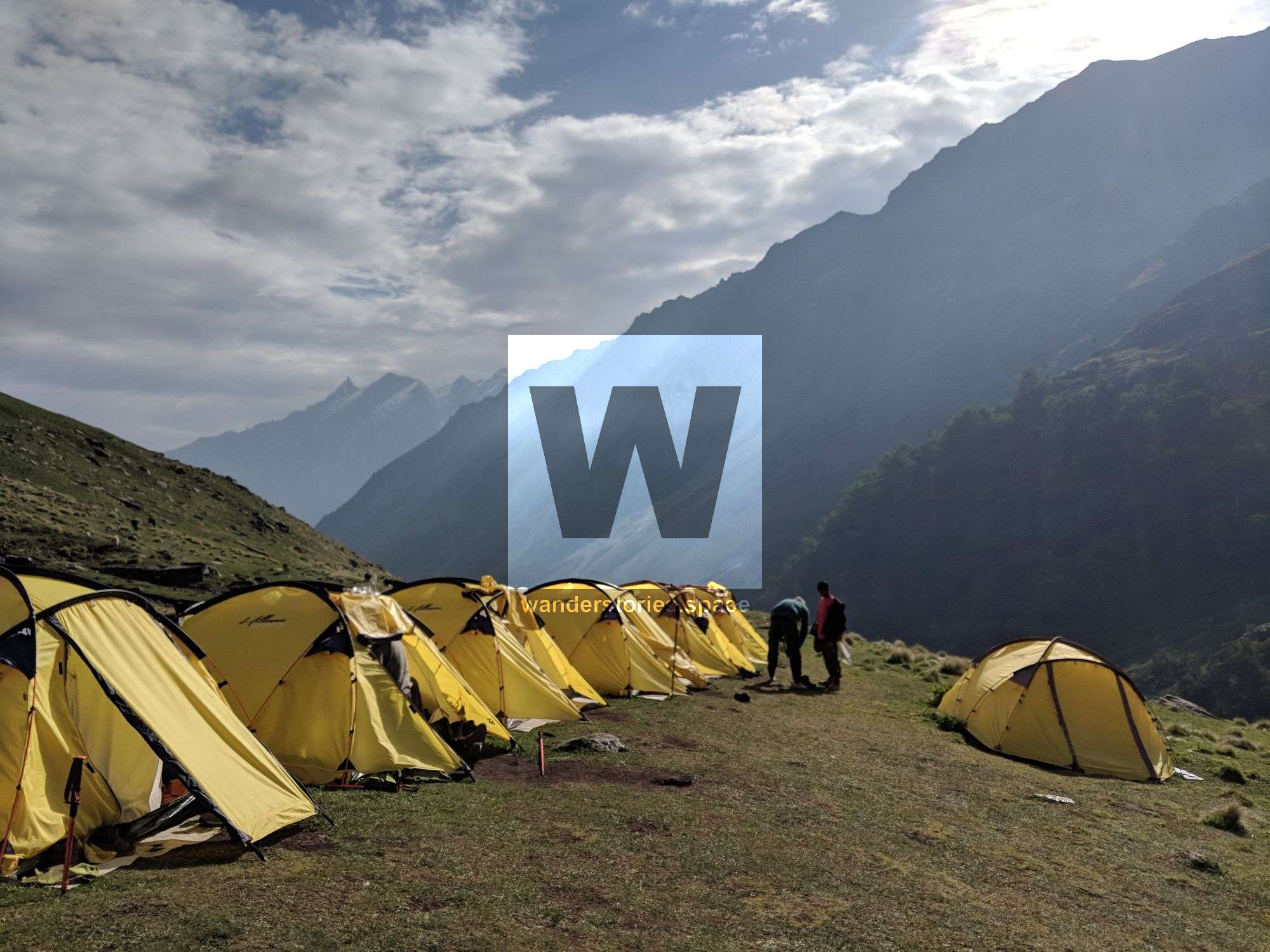
The day concludes in a dramatic arena of nature. Dhanderas Thatch lies in a valley bowl, surrounded by cascading waterfalls and the towering Dhauladar Range. The area is replete with crystal-clear streams, making water readily available. The spot is so idyllic, it's where you'll pitch your tent for the night.
Day 6: Acclimatization Day at Dhanderas Thatch
- Location: Lower Waterfall Campsite
- Altitude: 11,700 ft (3,566 m)
- Activity: Rest and acclimatization
Tip: Use this day to rest, hydrate, and enjoy the surrounding cliffs and waterfalls. Acclimatization is crucial for the days ahead.
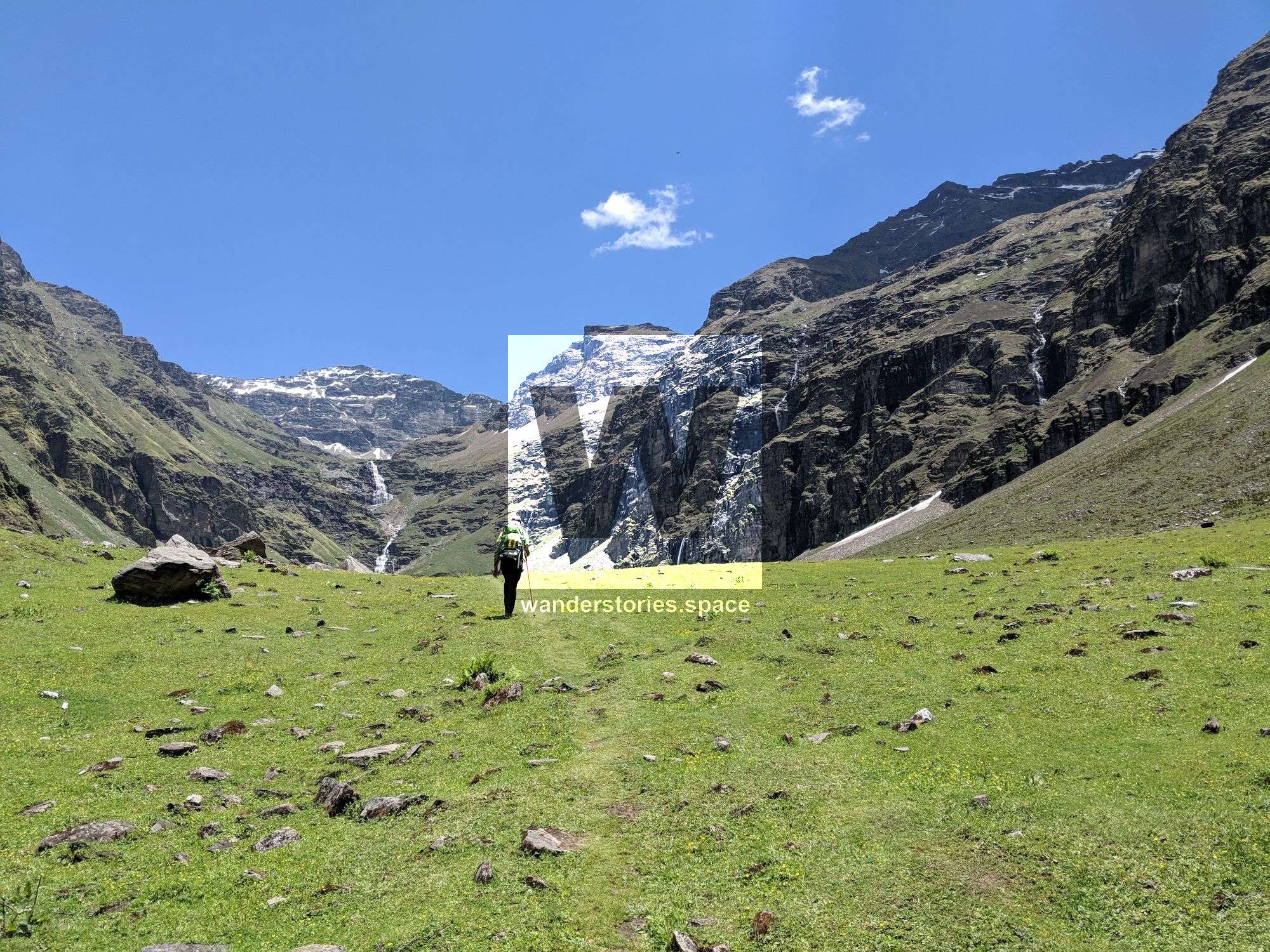
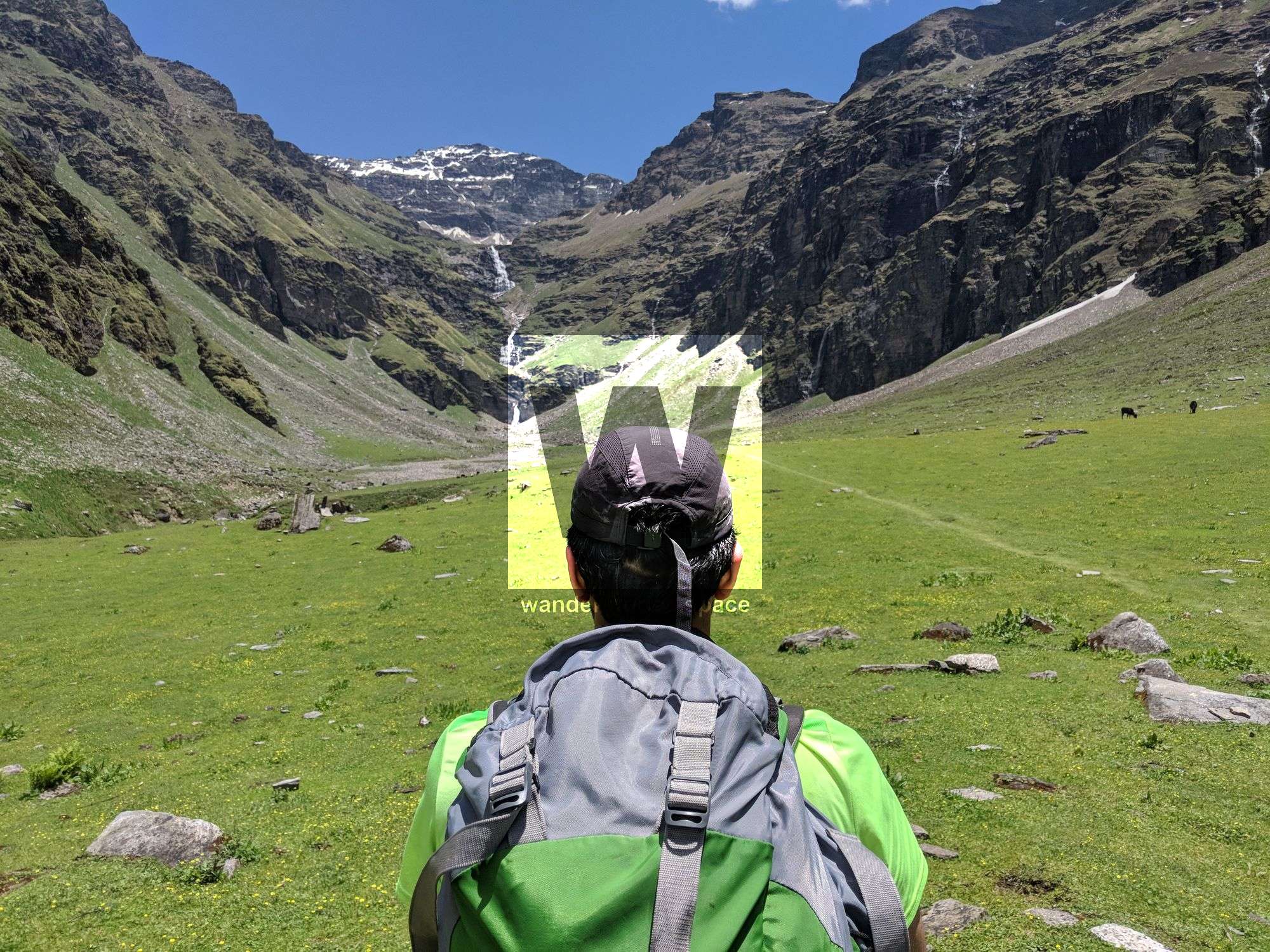
Day 7: Dhanderas Thatch to Upper Waterfall Camp
- Altitude: From 11,700 ft (3,566 m) to 13,100 ft (3,993 m)
- Time: Approx. 3 hours
- Distance: Not specified
- Difficulty: Moderate; continuous climbing, tricky around snow patches
- Highlights: Climb to the top of the waterfall, snow bridge over Rupin, vast meadow at the top
Tip: Carry sufficient water and refill at streams. A trekking pole or ice axe can be invaluable for negotiating snow patches and steep climbs.
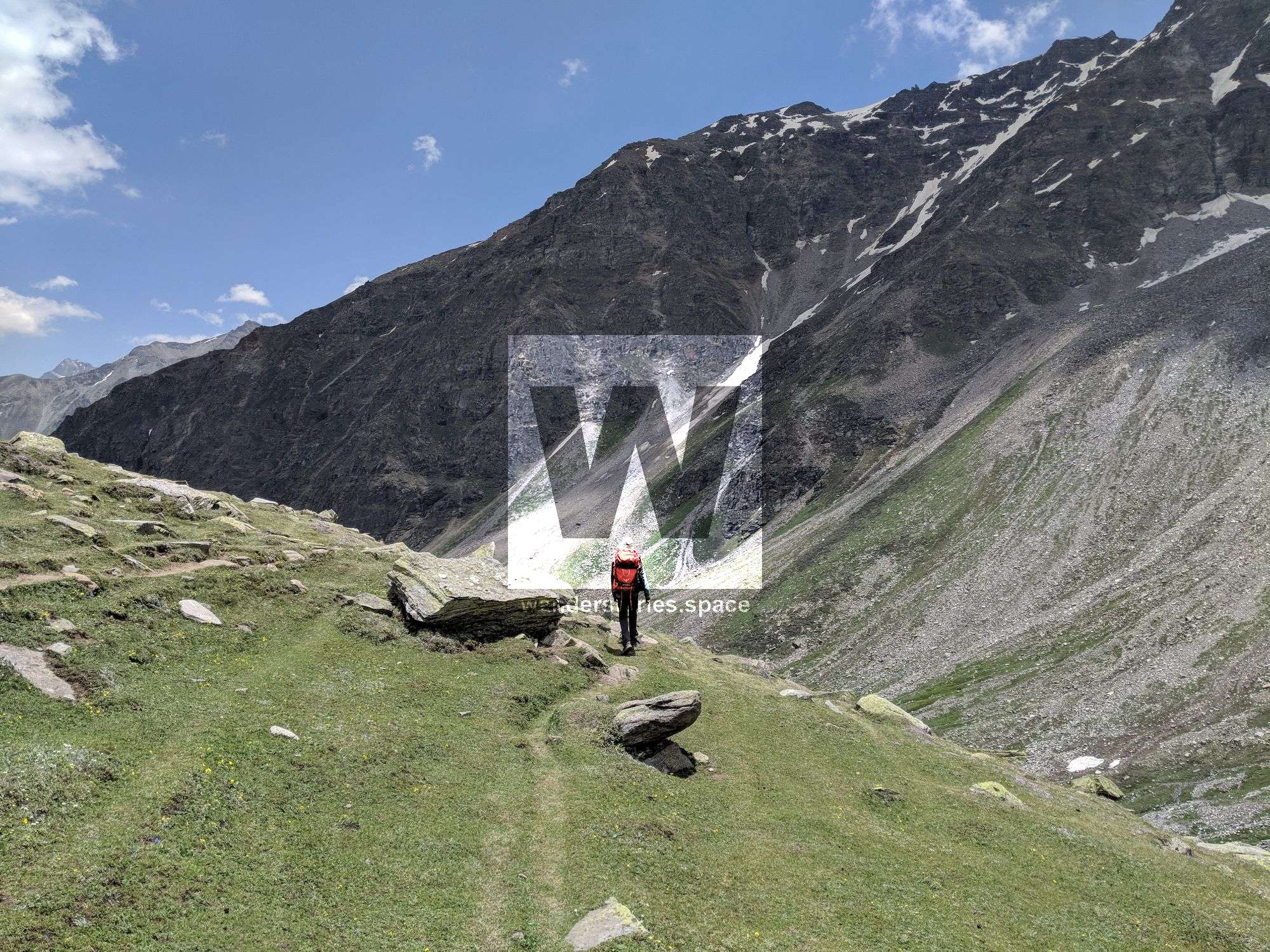
This segment serves as a prelude to the Rupin Pass crossing and is instrumental in acclimatizing. The altitude gain is substantial, hence the importance of the acclimatization the day prior. On Day 7, your climb to the top of the waterfall offers jaw-dropping views and a critical acclimatization opportunity for what lies ahead.
The trek becomes more technical, requiring careful navigation of snow patches and possibly the use of ice axes for step-cutting on snow or ice, particularly at the base and top of the waterfall. This phase is not just physically demanding but also requires solid mental preparation.
Upon reaching the top of the waterfall, you'll be greeted by a vast, flat meadow contrasting sharply with the dramatic ascent just completed. The converging streams here combine to form the Rupin, marking the culmination of this segment of your trek.
Given the altitude and technical aspects, ensuring that you're well-prepared in terms of equipment, physical conditioning, and acclimatization is essential for a successful and enjoyable trek.
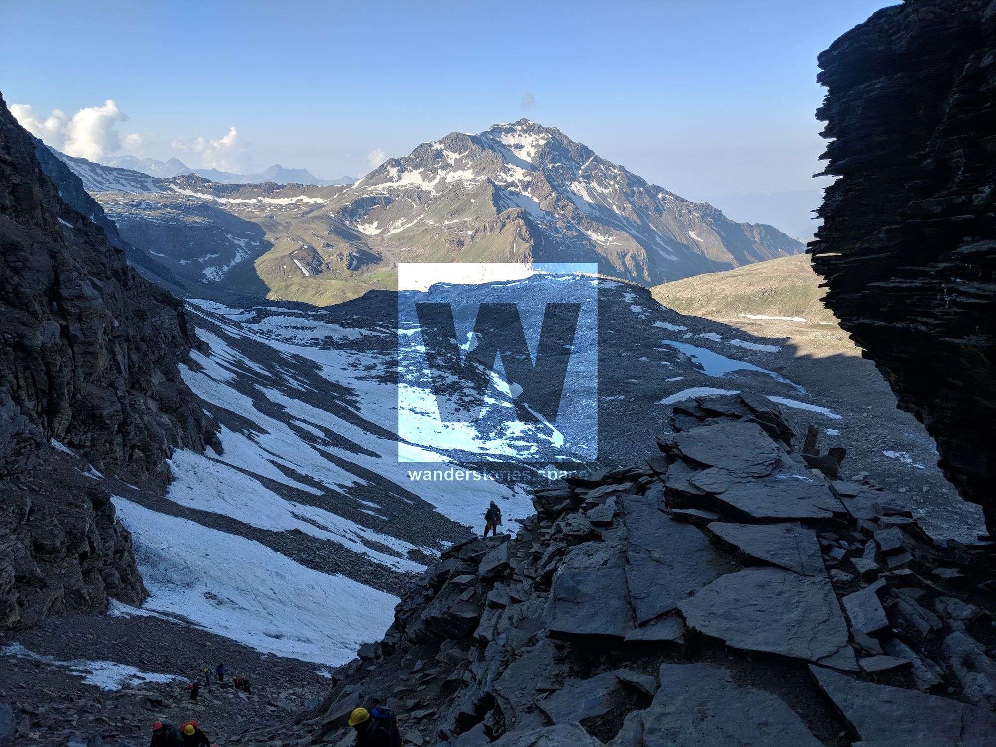
Day 8: Upper Waterfall Camp to Rupin Pass via Rati Pheri, Continuing to Ronti Gad
- Altitude: 13,100 ft (3,993 m) to 15,380 ft (4,688 m) to 13,100 ft (3,993 m)
- Time: 10-11 hours
- Trek Gradient: Difficult; steep incline to the pass and steep decline afterwards.
- Water Sources: Stock up on water before leaving camp. Another opportunity at Rati Pheri one hour in. Limited sources beyond.
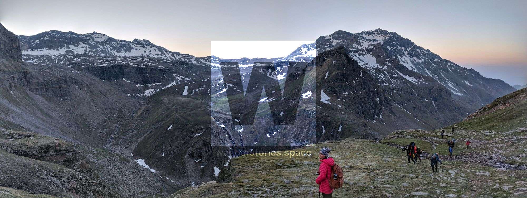
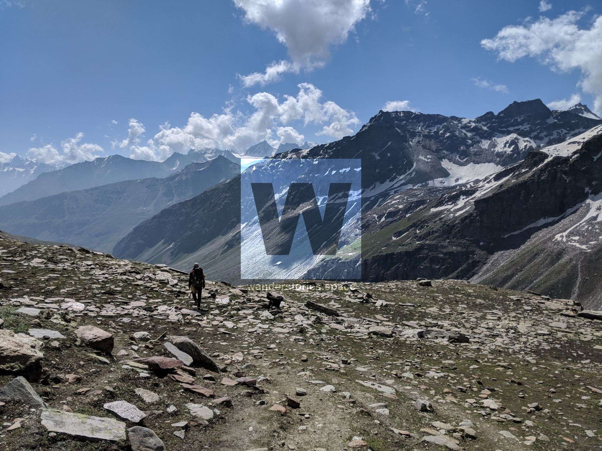
Embark before dawn, aiming to leave by 5:00 am. Take breakfast for the energy you'll need later. Today is both strenuous and thrilling, marking the longest day of your trek. The initial climb takes you along a snow patch, gaining elevation rapidly. An hour in, the path diverges towards Rati Pheri, a spot to refill water and observe the changing scenery.
The Rupin valley you’ve been following now fades, replaced by the alpine Dhauladar Range. Your surroundings turn into snow fields and alpine landscapes. This is the time to wear gaiters if you have them. As you traverse the snowfields, you'll catch your first glimpse of Rupin Pass, a small break in the Dhauladar ridge.
Trekking across the snowfields is challenging yet manageable. Your focus should remain on the Rupin Pass gully. Footing can be tricky, especially on icy slopes so an ice axe could be helpful. Your guides and porters can mark the route and assist with challenging sections.
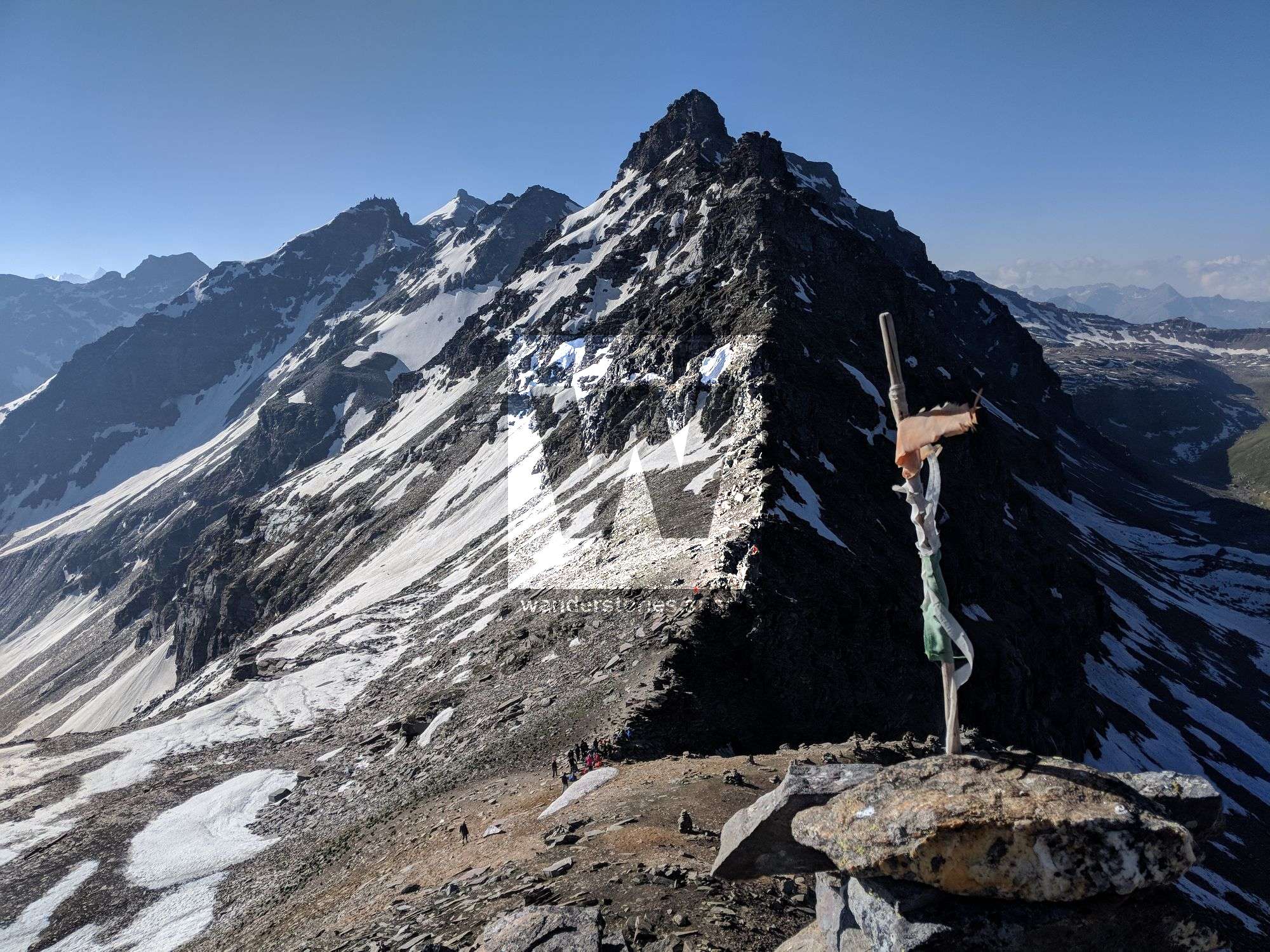
The gully is covered with loose stones and boulders, making the climb tricky. Climbing is exhilarating, and the sight of prayer flags at the top signals your arrival at the Rupin Pass. Once there, the arduous climb feels worth the effort. The climb through the gully usually takes around 15 to 20 minutes.
This day offers a mix of challenge and awe, ensuring it will linger in your memory for a long time.
The Rupin Pass
Stone cairns and vibrant prayer flags mark the ridge line of the Rupin Pass, framed by the sprawling branches of the Dhauladar Range. The view showcases the sharp peaks of the Kinnaur Kailash Range.
The descent on the Sangla side is much steeper than the Rupin. The only viable campsite is in the sprawling meadows below the snowline. The quickest way down is via snow chutes; attempting to walk is ill-advised.
Descending involves three exhilarating slides down the snow chutes, quickly losing about 400 ft in elevation. The rush of sliding brings out the inner child in everyone. After the slides, the slope moderates, and you'll walk over melting snow that feeds into the Rukti Gad stream.
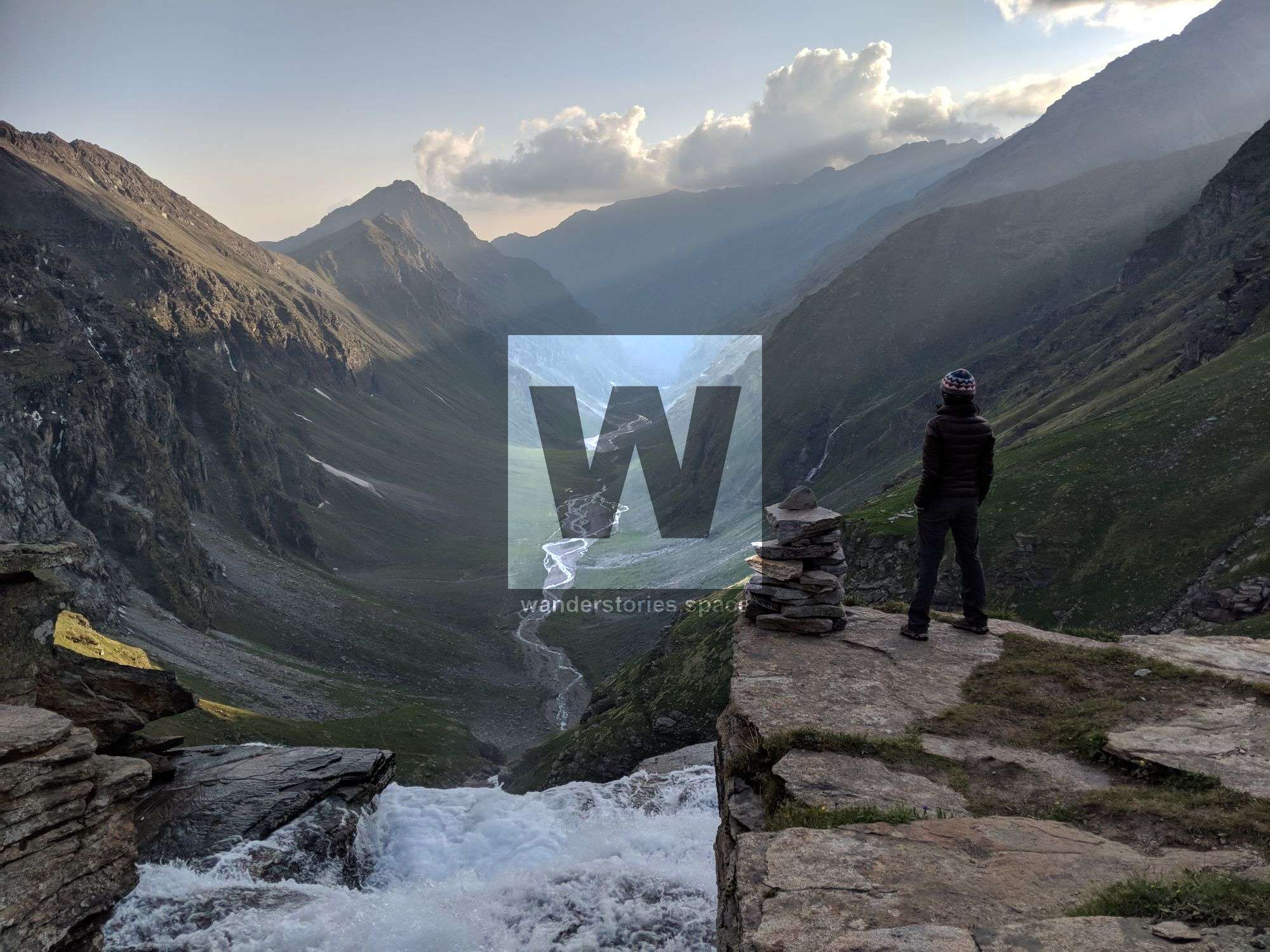
In just over an hour, you'll reach the edge of the snowline. Looking back, the Rupin Pass becomes a distant point on the ridge line.
Expect a steep descent from the snowline to expansive meadows leading to Sangla Kanda, three hours away. A clear, abundant stream is at the base, and even ground around it makes for an ideal campsite. Old campfire remnants help identify this otherwise inconspicuous camping ground at Ronti Gad.
The scenery here varies from the previous meadows, featuring looming, snow-capped mountains. The campsite offers a blend of snowy whites and meadow greens. After a challenging day—starting at 13,100 ft, peaking at 15,380 ft, and then descending back to 13,100 ft—Ronti Gad provides the coldest night of the trek. Settle into your sleeping bags early for a well-earned rest.
Day 9: Ronti Gad to Sangla Via Sangla Kanda
Altitude: 13,100 ft to 8,600 ft via 11,427 ft
Time Taken: 6 hours
Trek Gradient: Moderate to complex; primarily descending
Water Sources: Pack enough water; water taps become available as you near villages
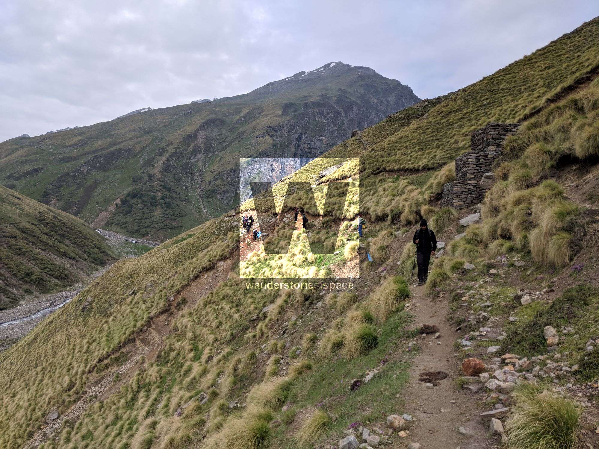
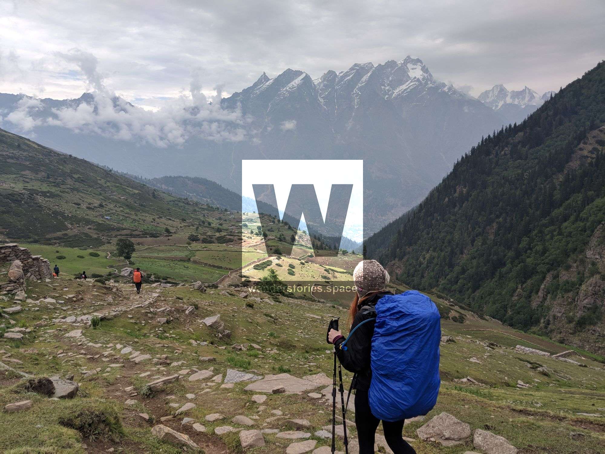
The trek to Sangla is demanding on your knees but rewarding with its shifting landscapes. Start your day not too late to beat the heat near Sangla. You'll get your first glimpse of the Kinner Kailash range and the blue pines of the Baspa Valley.
The initial path is a shepherd’s trail leading to the valley. Multiple trails intersect your way, but most lead to Sangla Kanda. Just avoid the ones heading towards the river. After a drop of over 1,500 ft, the track opens up, offering views of Rukti Gad and the snow-covered Nalgani pass.
The imposing Kinner Kailash range overlooks mountain slopes covered in meadows, peaking above 20,000 ft. This dramatic vista marks a significant shift in the scenic narrative of your Rupin Pass trek.
Reaching Sangla Kanda, you'll see a lake and a village below. The steep descent will have taxed your legs, making the village an excellent place to rest. Villagers are friendly and offer warm cups of tea.
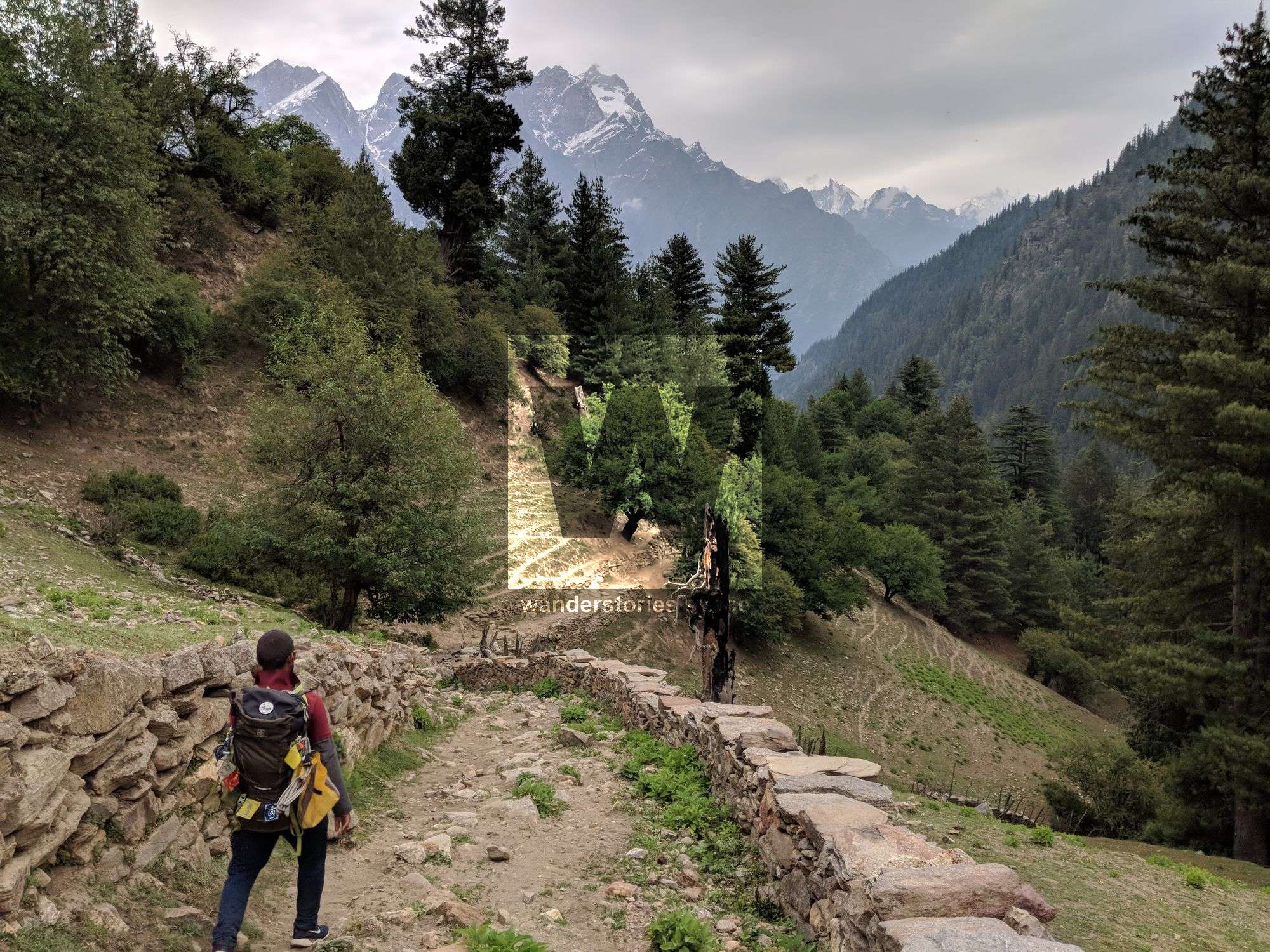
For the final descent, consult villagers for the best trail. Most paths converge around the lake and descend below the tree line. The terrain shifts to a forest of blue pines, and you'll notice a road under construction.
The trail rapidly descends to Sangla, past wooden homes and terraced farms. Blue pines give way to apple orchards, and signs of modern life—telephone lines, cell coverage—indicate you're near Sangla.
After crossing the Baspa bridge, it’s a steep 20-minute climb to Sangla's main road. Ask for directions to the bus stand, where you'll find dining and accommodation options. The last bus to Shimla departs at 5:00 pm, arriving in Shimla at 3:00 am the following day.
Things to take on the Rupin Pass trek
Bare Necessities
- Trekking Shoes: You'll encounter varied terrains, from rugged ground to snowy landscapes. Choose a durable pair of trekking shoes.
- Backpack (40-60 litres): Opt for a sturdy bag with supportive straps and frame.
Clothes
- Warm Layers: Three should suffice. Learn how to layer.
- Trek Pants: Carry two pairs plus one extra for emergencies. Avoid denim and shorts.
- Collared T-Shirts: Lightweight, full-sleeved shirts are ideal for sun protection. Include at least one quick-drying option.
Accessories
- Sunglasses: Essential for avoiding snow blindness.
- Suncap: To protect from the intense high-altitude sun.
- Hand Gloves and Balaclava: Waterproof gloves and a balaclava or woollen scarf.
- Socks: Two pairs for trekking and one woollen pair for evenings.
- Headlamp/LED Torch: Mandatory.
- Trekking Pole: Recommended for balance.
Other Essentials
- Daypack (20 litres): If offloading your backpack.
- Toiletries: Basic hygiene items, but avoid wet wipes.
- Cutlery: Spoons, mugs, and lunch boxes are essential for hygiene.
- Water Capacity: Two litres minimum.
- Plastic Covers: For packing and wet clothes.
Personal Medical Kit
A comprehensive list of medication and first aid items, including antacids, antiseptics, and altitude sickness tablets.
Miscellaneous Tips
- Research for permits and guides if considering self-guided trekking.
- Small notes for transactions; extensive notes might not be accepted.
- Expect breathlessness due to high altitudes.
- Observe hygiene, especially near water sources.
Tales and Activities
- Ghost Tales at Rati Pheri: Add some thrill to your trek.
- Route: Follow the Rupin River and take note of waterfalls. Last shops are scarce.
- Jiskun Village: Ideal for acclimatisation walks and cultural exploration.
- Udaknal and Waterfall Campsites: Great for bouldering and night sky photography.
- Pass Day: Enter Sangla Valley via a 1688m high Rupin Pass.
Environmental Concerns
- Unfortunately, littering is common. Kudos to IndiaHikes for initiating clean-up and education efforts.
Final Note
- Trail conditions vary. Follow well-formed paths.
This article, and all other articles, are for entertainment purposes only and are not to be used as a guide. Please see our Disclaimer for more information.