Three Coconuts Pass (Col des Trois Cocotiers) - Opunohu to Vaianae
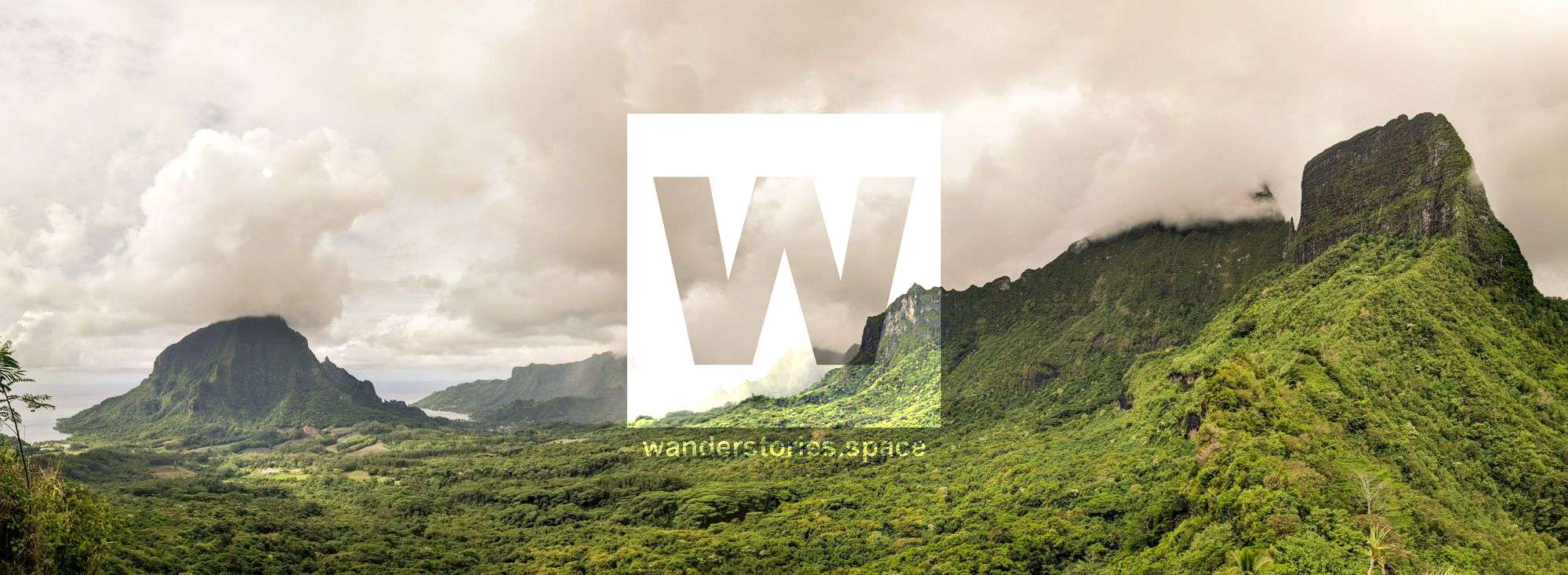
Three Coconuts Pass is Mo'orea's most popular hike. The trail traverses the ancient volcano to towards the pass between Mount Mou'aroa and Mount Tohive'a and provides superb views over Opunohu Valley.

Location - Starting at Belvédère Lookout
Duration - 2 - 4 hours return
Elevation gain - 260 m
Difficulty - Easy
Coconut Trees Pass or The Pass of the Three Coconuts is Mo'orea's most popular hike and as such, touristy. Known as Trois Cocotiers (or Col des 3 Cocotiers) in French. You can also hike a guide. The hike begins along part of the crater to the edge of the volcanic funnel, then climbs to the Pass of the Three Coconuts onwards to a lookout where you may enjoy magnificent panoramic views of the ancient volcanic landscape. Superb views from the ridge between Mount Mou'aroa (880 m) and Mount Tohive'a (1,207 m), as well as other major island summits, and over Cook's and Opunohu Bays and vistas to the south. Don't look for three coconut trees at the pass - two were blown down in an early 1980s cyclone.
Belvedere Lookout, which is a very popular stop for tourists because of the outstanding views. (can also start from Haapiti) Can also link into Lycee Agricole Opunohu.
Mo'orea is considered as the walking island due to its considerable trail network. Mo'orea's most popular hike is the loop through the Opunohu Valley, which follows a well-maintained trail as it climbs to the pass known as Three Coconut Trees Pass. The island of Moorea is the best destination for hiking within the Society Islands of French Polynesia. No other island in the archipelago has as many official hikes with routes clearly marked out on trail maps and on the actual trails. Some of Mo'orea's best hiking routes can be found within Opunohu Valley, where a large network of nine established trails has been built crossing the valley, passing through pineapple fields, and heading up toward passes. Many of these trails can be combined in various ways to form loop hikes that can last an entire day. There is even a way to carry out an Opunohu Valley Loop, which circles around the entire valley.
Craggy mountains covered up with vegetation to the highest peak which rising out from the turquoise bright sea. Although the dry season from March to the end of November is considered as the best travel time it can also rain during these months and the roads turn into slippery and muddy trails.
Difficulties encountered on the hike include dealing with heat and humidity and understanding the unique route markers.
Tahitian chestnut trees (mape trees), Banyan trees, overgrown jungle vines, towering giant bamboo, and pretty African tulip trees, among others.
The trail eventually turns at a junction and heads steeply up the mountainside by means of lengthy switchbacks. You can now see out to the South Pacific Ocean in both directions.
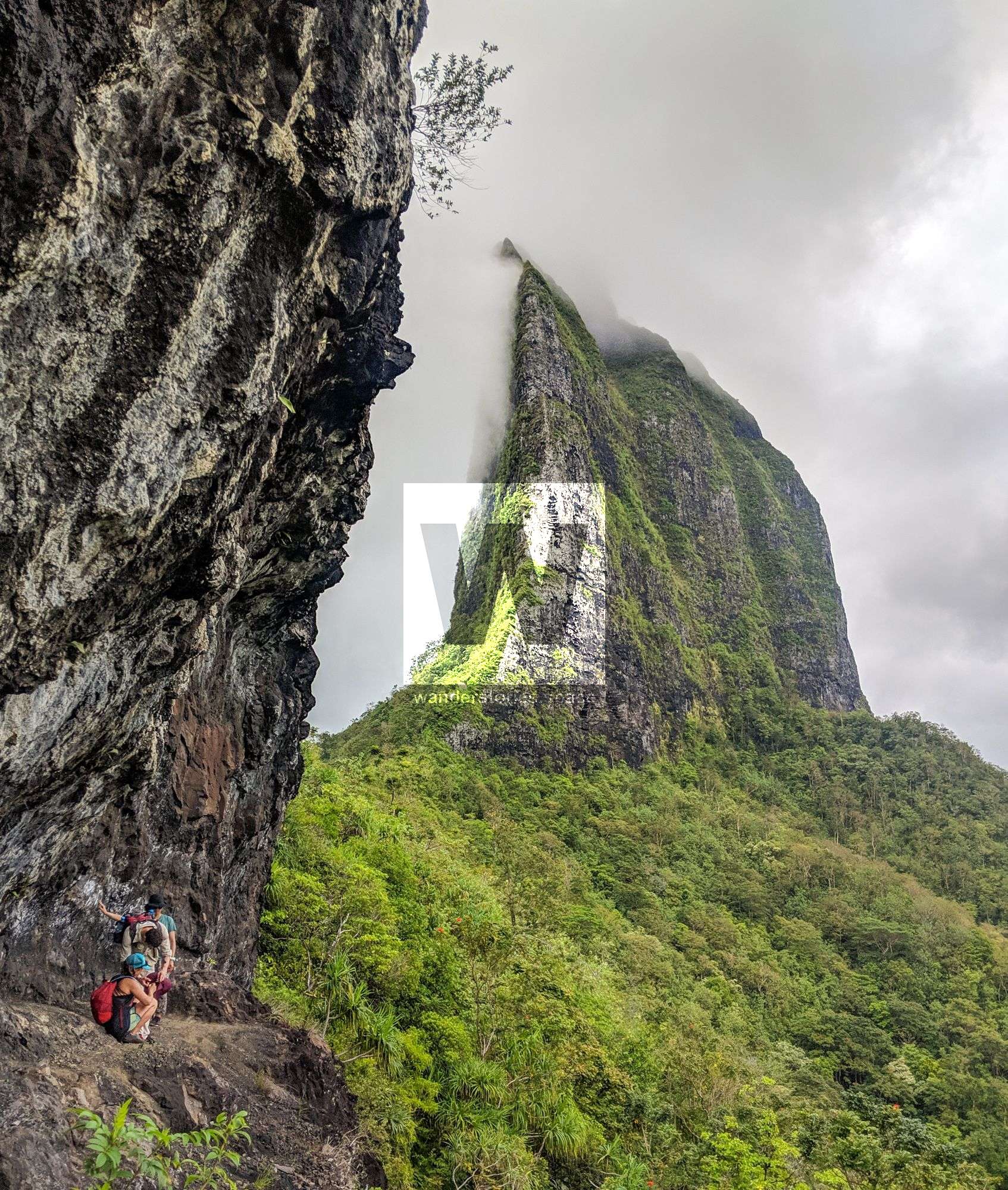
Mount Tohivea is very distinct because it looks like it has muddy lines running down the mountain; These lines are caused by landslides which take place on the mountain slopes. The brush on the mountain does not take root very well due to having very little soil depth on nearly vertical slopes. So when heavy rains hit, both small and large landslides can take place, leaving lines of bare soil afterwards. You will also see waterfalls cascading down the slopes during rain.
You'll cross a few freshwater streams before starting a moderately difficult climb up to the ridge. The views from here are very similar to those in the Vaiare to Paopao hike - just from the other side of the same ridge.
Interactive Map
Although there are lot of paths to take to get to the pass, below is the most common route taken.
This article, and all other articles, are for entertainment purposes only and are not to be used as a guide. Please see our Disclaimer for more information.