Tongariro Alpine Crossing
The Tongariro Alpine Crossing is one of the best one-day hikes in New Zealand and has plenty of colourful and beautiful scenery throughout the hike.

Location - Tongariro National Park, North Island Island, New Zealand
Distance - 19.4 km one way from carpark to carpark
Time - 6-8 hours one way
Difficulty - Grade 5, moderate to difficult
Total elevation gained - Approximately 700 m
The Tongariro Alpine Crossing is one of the best one-day hikes in New Zealand and is very popular. It has plenty of colour and beautiful surroundings throughout the walk. I highly recommend this hike to anyone traveling the North Island. It is alpine environment so you need to take precautions. The best time of year to do this hike is October to April; the days are longer and the chance of encountering snow is much lower.
Highlights
- Mangatepopo Hut
- Soda Springs
- South Crater
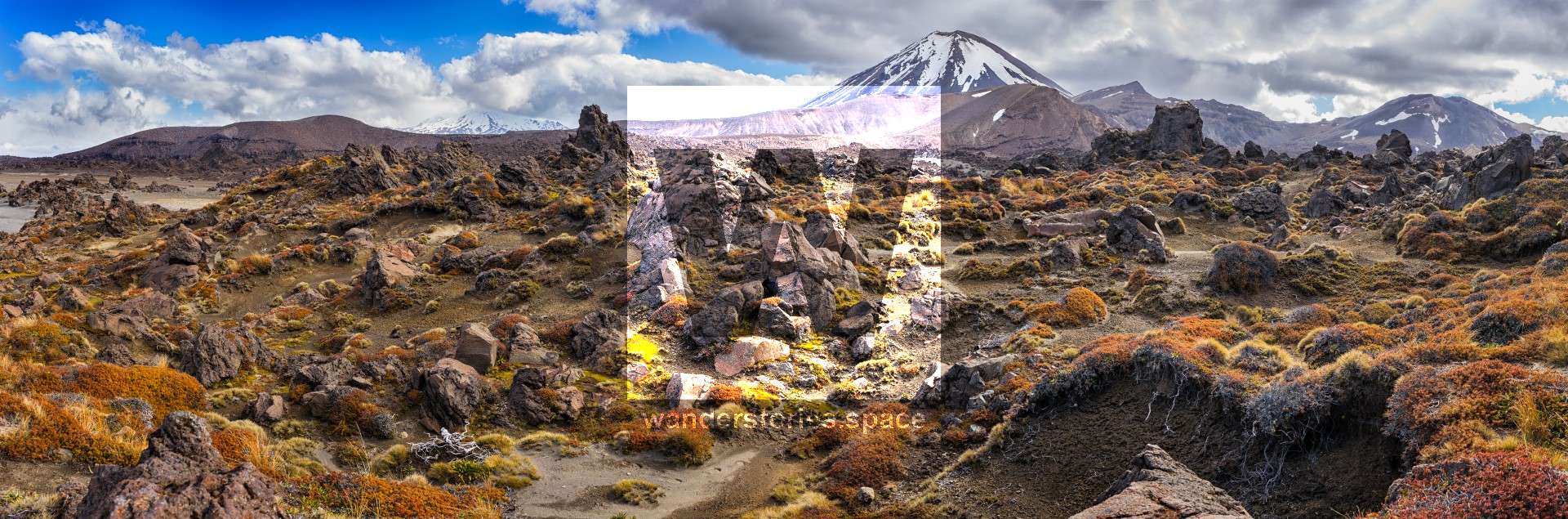
- Mt Ngauruhoe (Mt Doom from LOTR)
- Mt Tongariro
- Red Crater
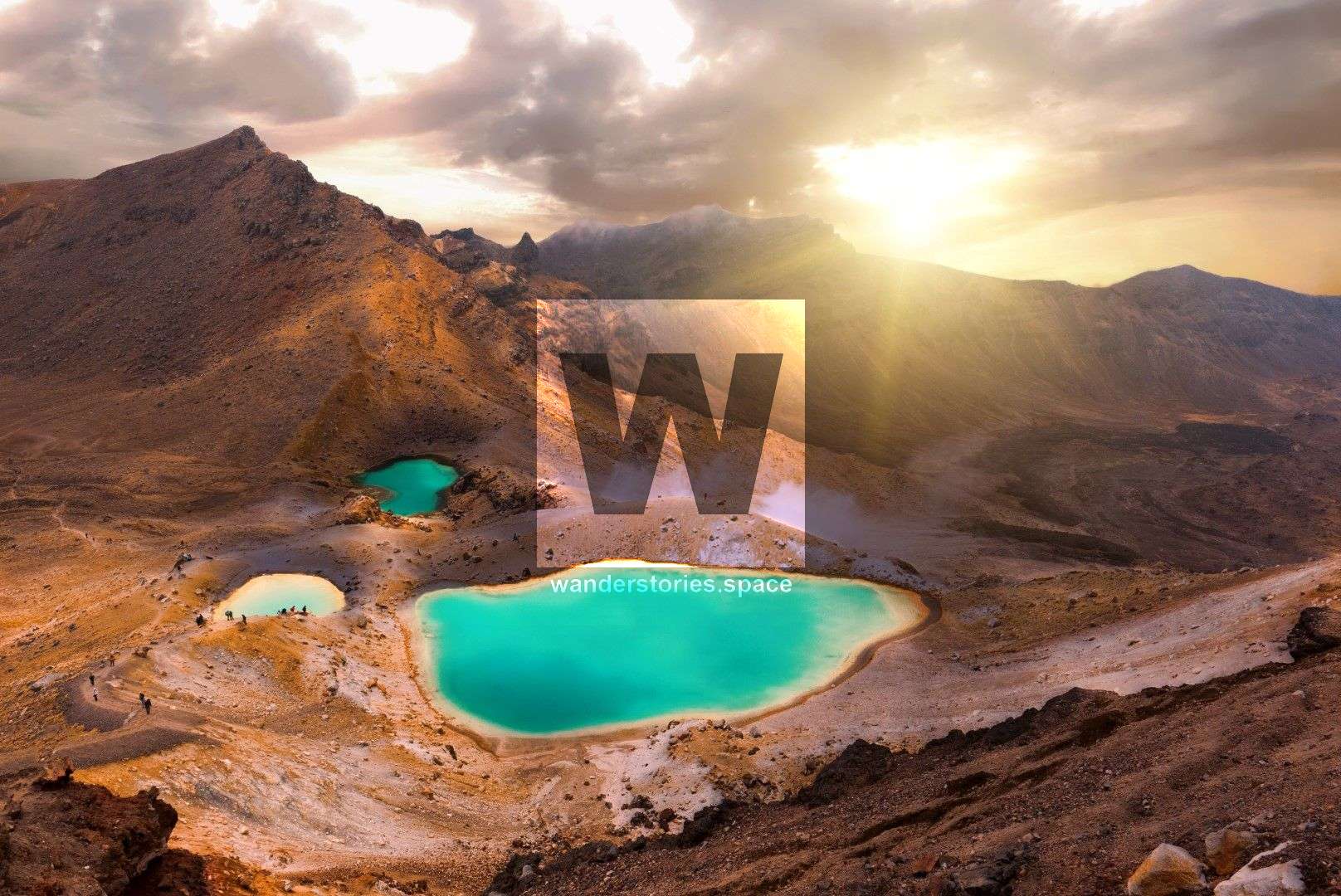
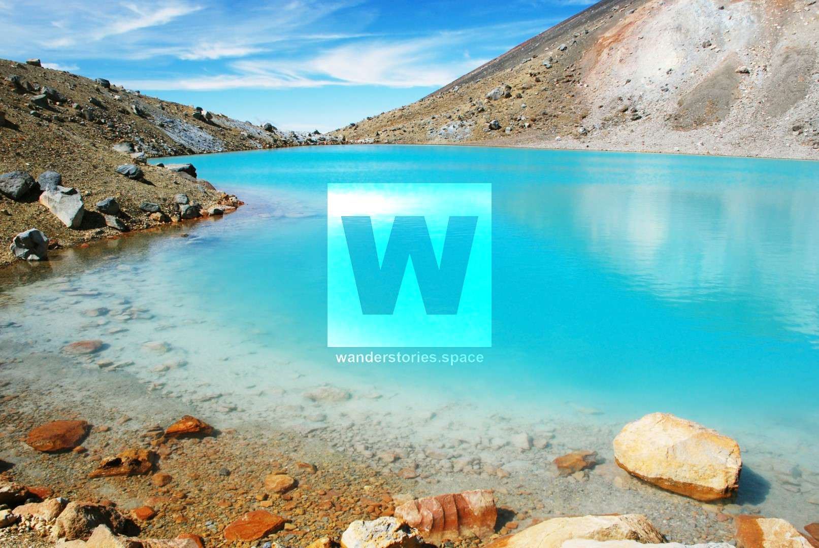
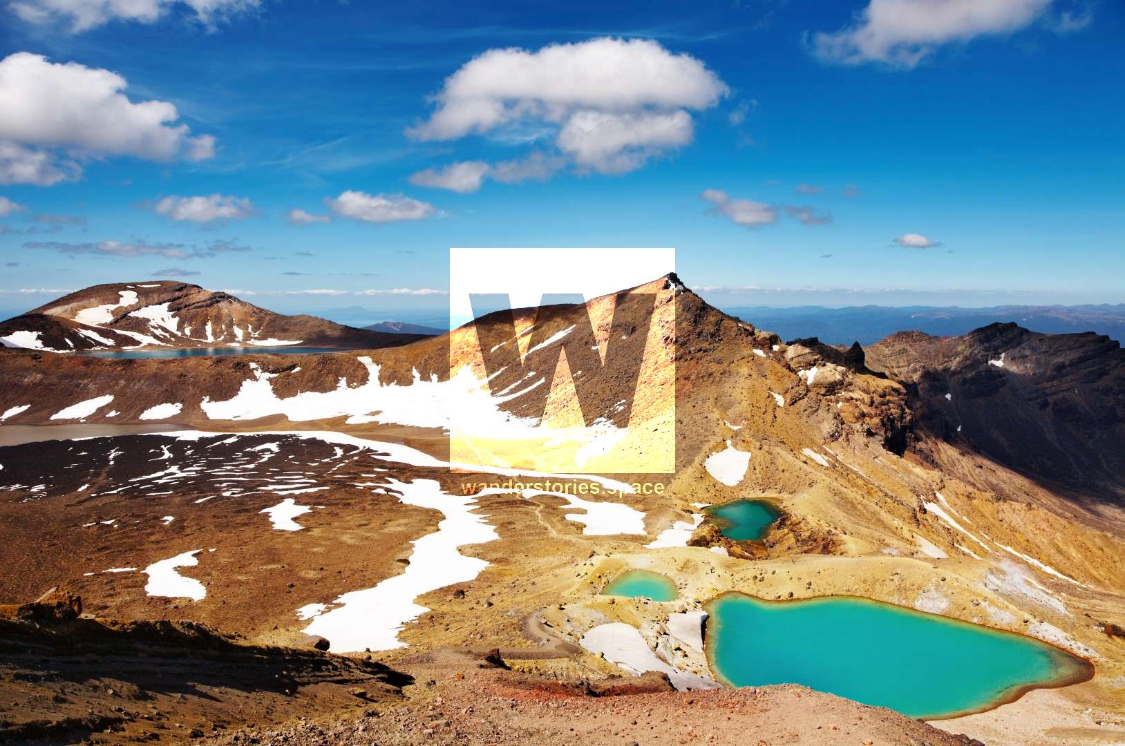
- Emerald Lakes
- Central Crater
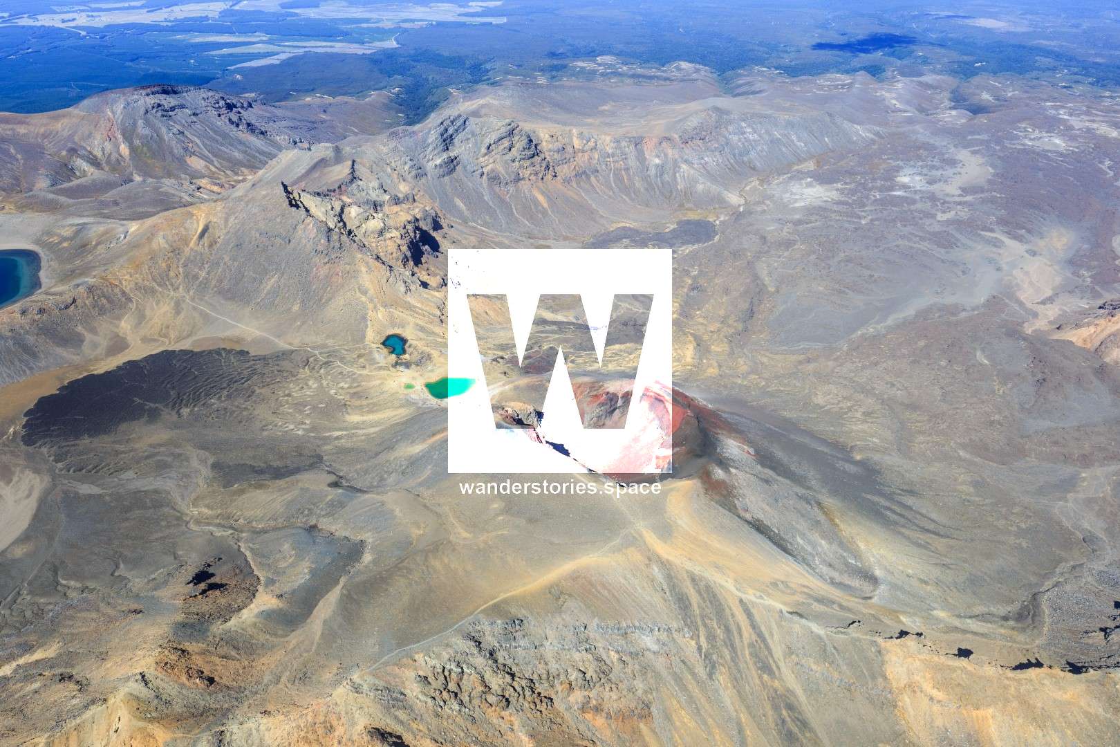
- Blue Lake
- Te Maari Crater
- Mangatepopo Valley
- Ketetahi Hut
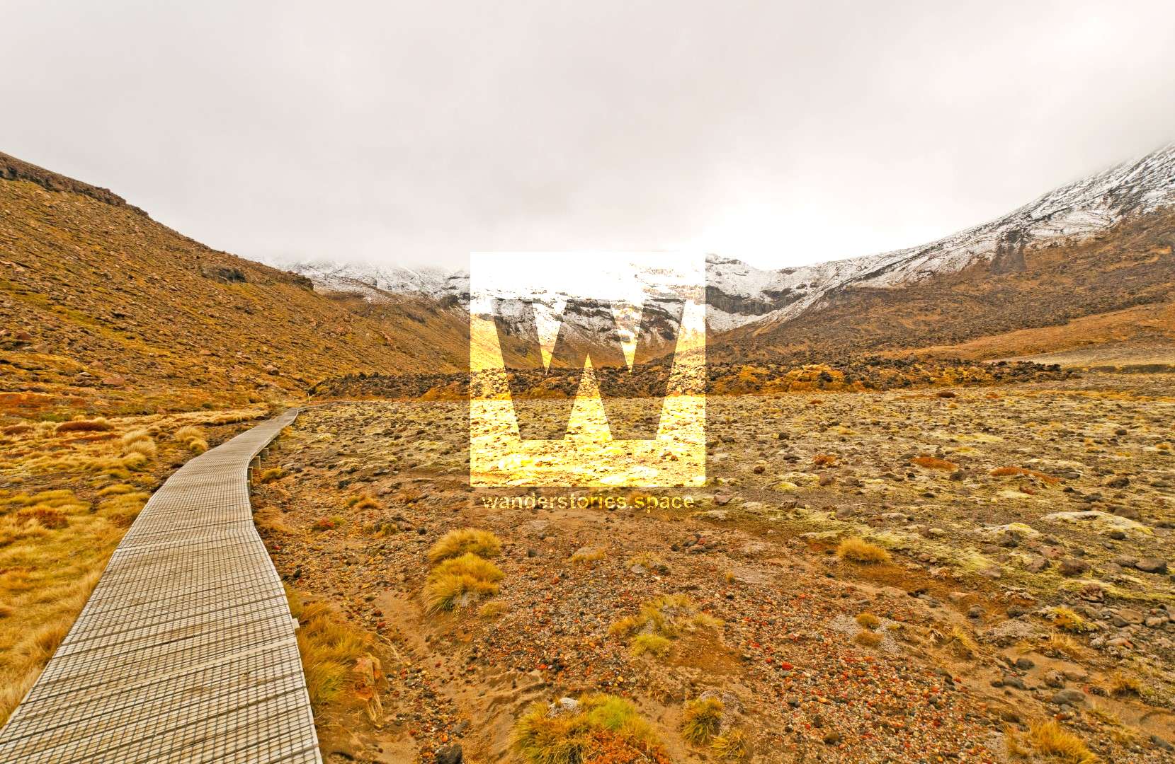
This is a weather dependant walk. It's considered moderate to difficult and it takes about 6-8 hours to hike. It travel 19.4 km from carpark to carpark with a total elevation gained of approximately 700 m. Although the hike is considered to be hard, do not let this deter you as it's a very pretty and different environment.
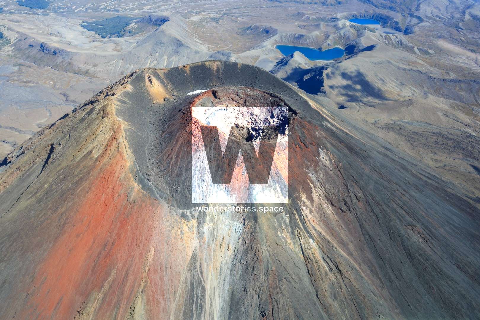
Mt Ngauruhoe is a beautiful mountain but it's a dangerous walk to the summit due to the rocks flying past your head dislodged by hikers uphill from you. Many people are seriously injured from this hike every year.
Mt Tongariro is also another beautiful peak to summit, though National Park have close this track as people were getting lost and going to far and ending up in dangerous places. Off-track, the Te Mari remains await. In 2012, Mt Tongariro erupted and throwing rocks and spewing ash from the Te Mari craters. The Ketetahi hut, within 1.5 kilometres of the crater, was significantly damaged by falling debris. Impact craters and the hut itself has holes through the roof, the floor and the bunks inside it.
The walk goes through barren lands of rock and rubble. You'll see the fuming Red Crater and the Emerald Lakes which have gained their brilliance partly from dissolved minerals that have been washed down from a thermal area nearby. The smell of sulphur is very strong in the area.
Blue Lake is spectacular with black streams from the Ketetahi thermal springs and tall grasses. Te Maari Crater last erupted in 2012.
What to bring
- Wet weather gear (windproof and waterproof clothing)
- Warm clothing
- Snacks & food
- 3 litres of water per person
- Good hiking boots
- Sun protection
How to get there
The are two directions to take this track either starting at Mangatepopo Road off of Highway 47 or at Ketetahi Road off Highway 46. You can park in one of the parking lots and have a shuttle drive you to either end but this needs to be pre-booked!
There's thousands of hikers each day that walk this section of the Tongariro Circuit, so it's best to wake up early to catch the first shuttle. Sleep close by the night before to get an early start. I believe that a self-contained vehicle is the best way to see New Zealand and allows you to camp virtually anywhere. Use WikiCamps to find Freedom Campsites. There's one less than 30 minutes away. Tongariro National Park Village also has accommodation available.
Interactive Map
Here's an interactive map of the crossing
This article, and all other articles, are for entertainment purposes only and are not to be used as a guide. Please see our Disclaimer for more information.