Undara Lava Tubes - Undara Volcanic National Park

Undara Volcanic National Park is the traditional country of the Ewamian Aboriginal people. This park contains the remains of one of the earth's longest flows of lava originating from a single volcano. Caves within this lava tube are fertile pockets in which rainforest plants and animal species thrive.
Interactive Map
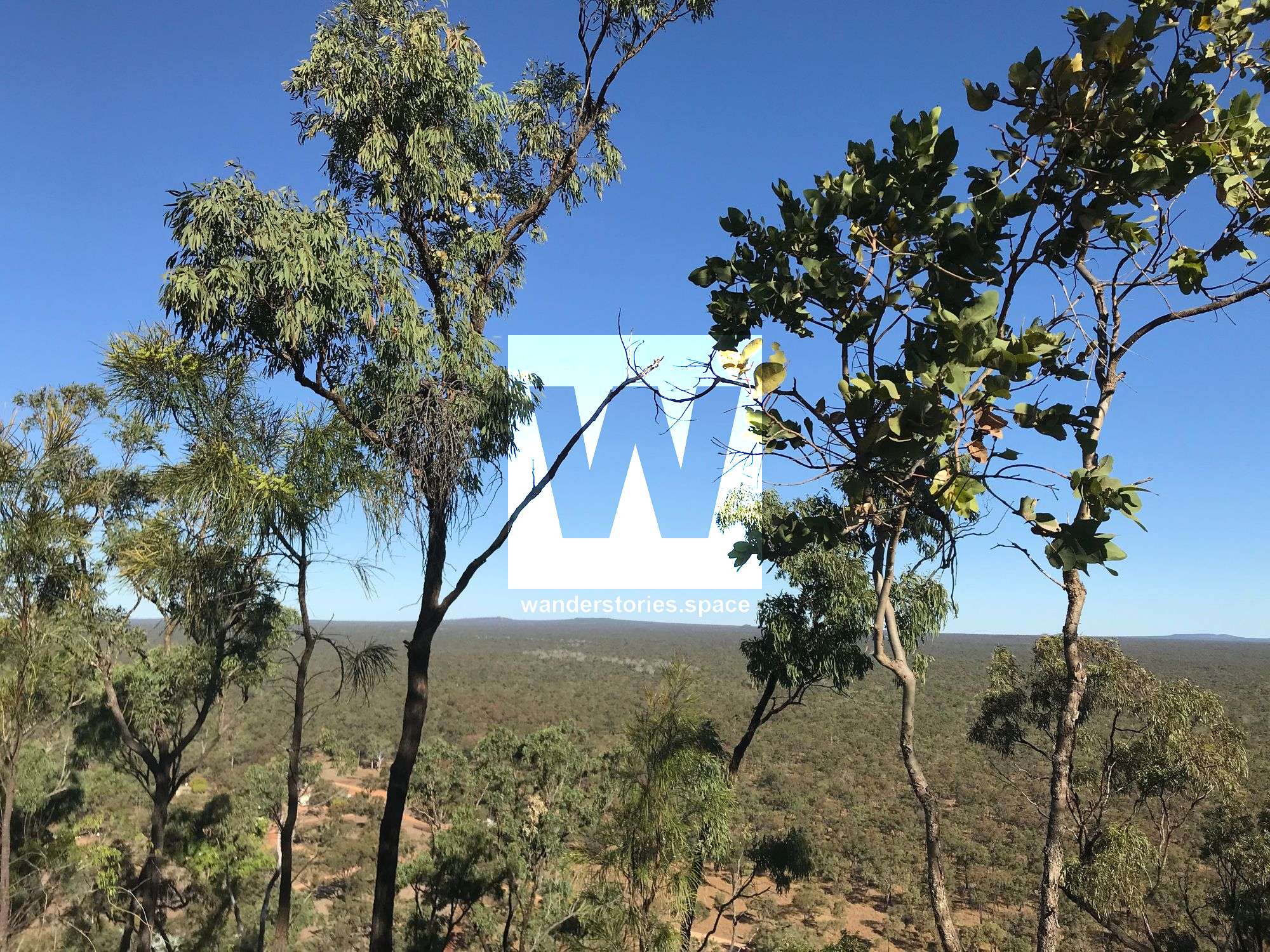
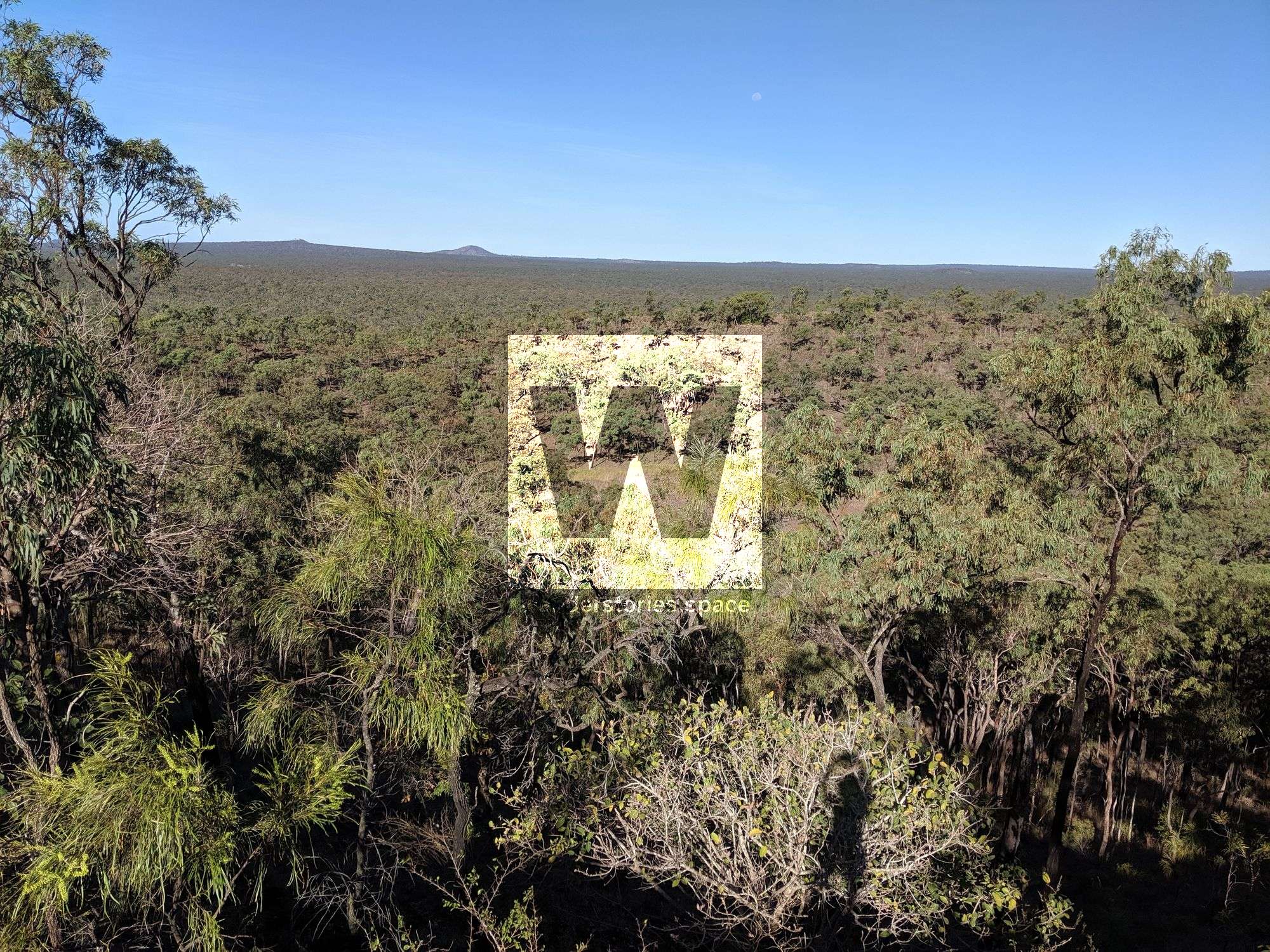
On the western slopes of the McBride Plateau, open woodlands give way to the vast open spaces of the savanna. In Undara Volcanic National Park, rich volcanic basalt soils, covered in a sea of seasonal grasses, conceal the Undara lava tube. This geological tunnel of global significance extends under a ribbon of remnant dry rainforest.
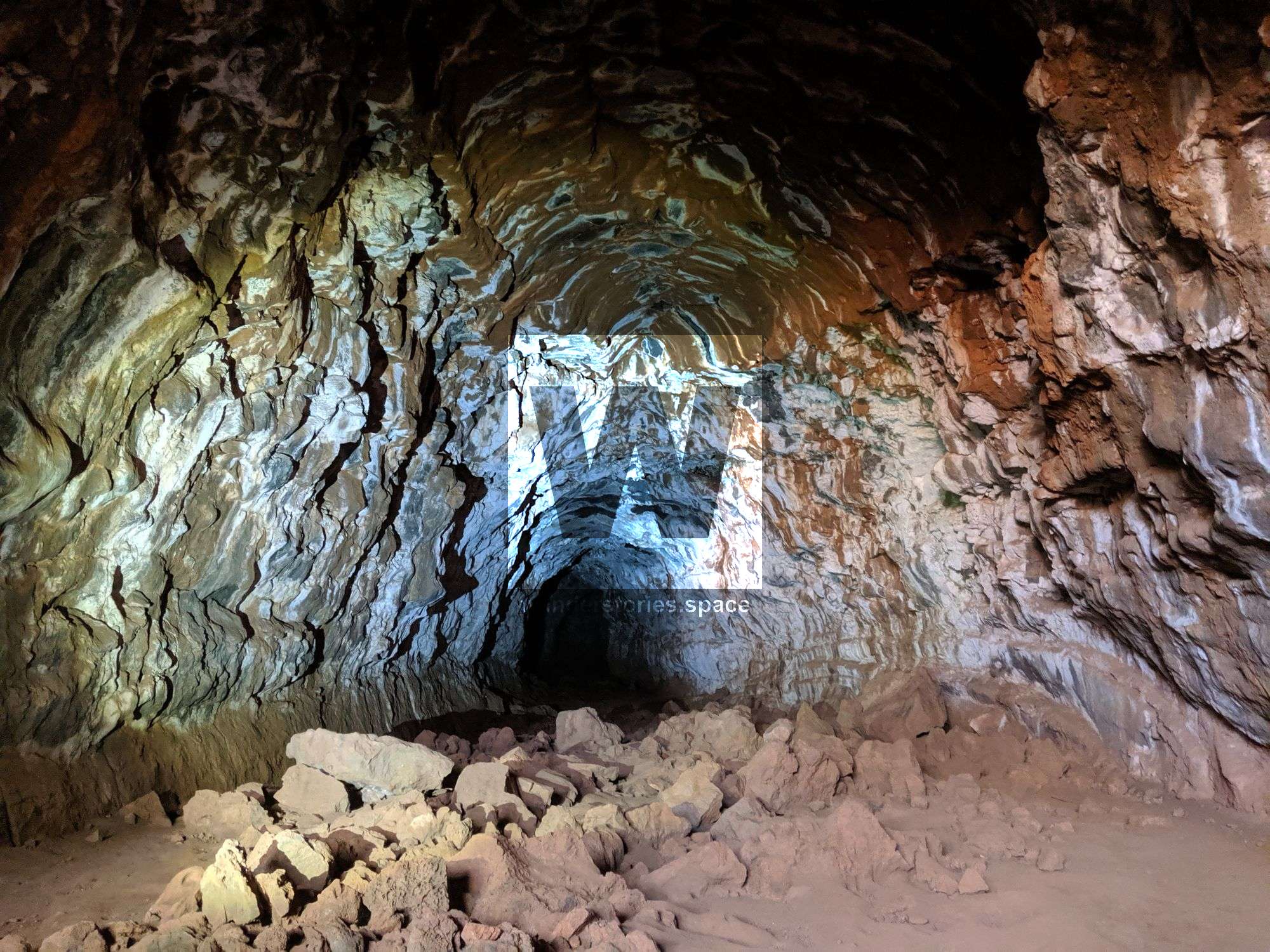
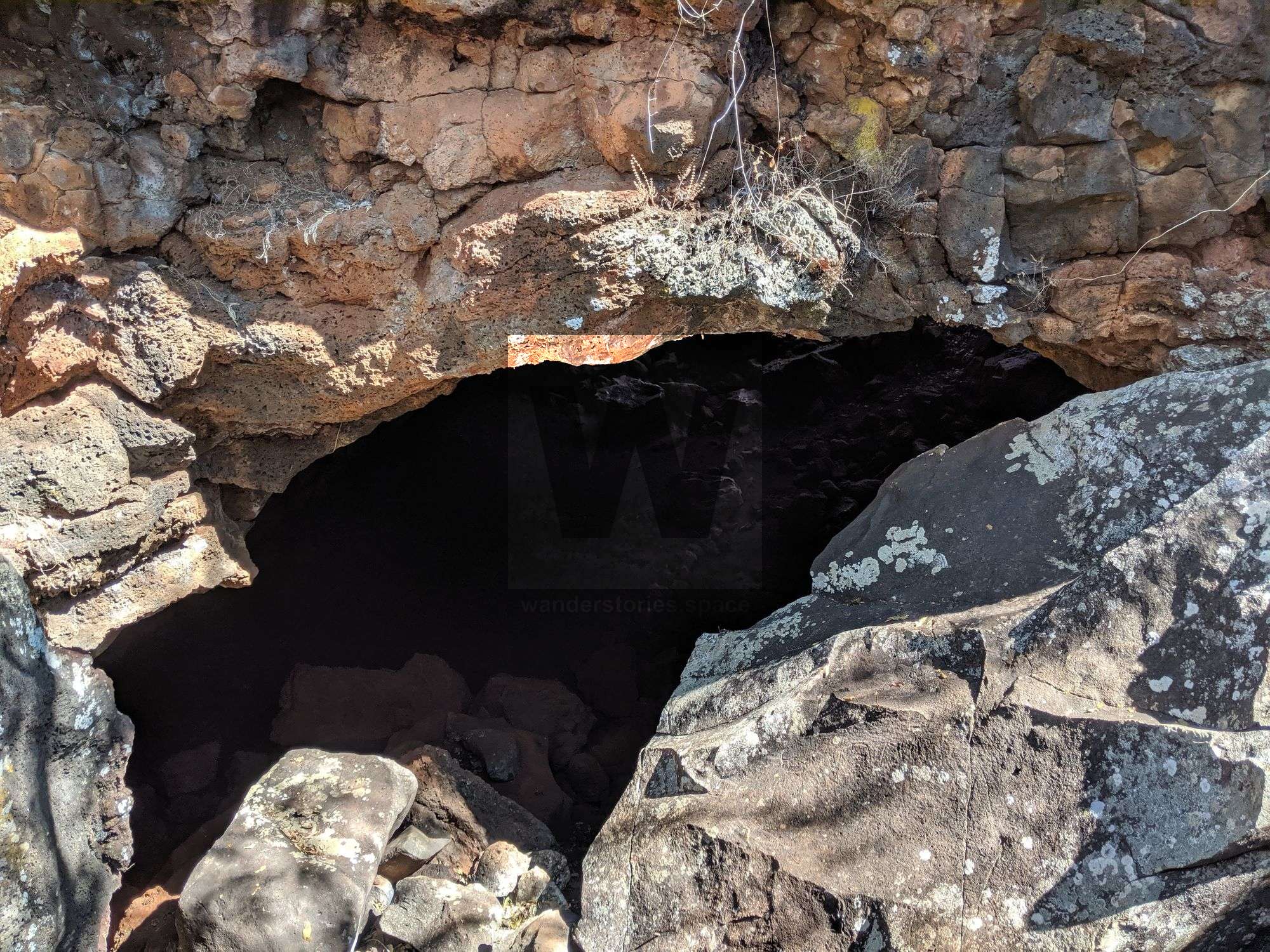
"Undara" is an Aboriginal word meaning "long way". The park protects one of the world's longest lava tube cave systems. About 190,000 years ago, a large volcano erupted violently, spewing molten lava over the surrounding landscape. The lava flowed rapidly down a dry riverbed. The top, outer-layer cooled and formed a crust, while the molten lava below drained outwards, leaving behind a series of hollow tubes.
Semi-evergreen vine thicket grows in the moist, sheltered entrances to some of the lava caves. The roofs of some tubes collapsed, creating ideal conditions for the dry rainforest to grow and wildlife to shelter. Rock wallabies, insectivorous bat colonies and owls roost here in the cool. Birds shelter in the fruit-filled canopy, and predators lurk in the tumbled basalt terrain to complete the food chain.
Undara Volcanic National Park is open 24 hours a day. Temporary seasonal closures may be encountered. In very wet periods, sections of caves may be flooded and closed to visitors. To protect breeding bats, access to the Wind Tunnel Complex and Barkers Cave is restricted from November - February.
The weather at Undara Volcanic National Park is hot and humid and can be very wet from late October through to late March. September and early October are generally dry and hot. The drier, cooler months of April to August are the preferred time to visit.
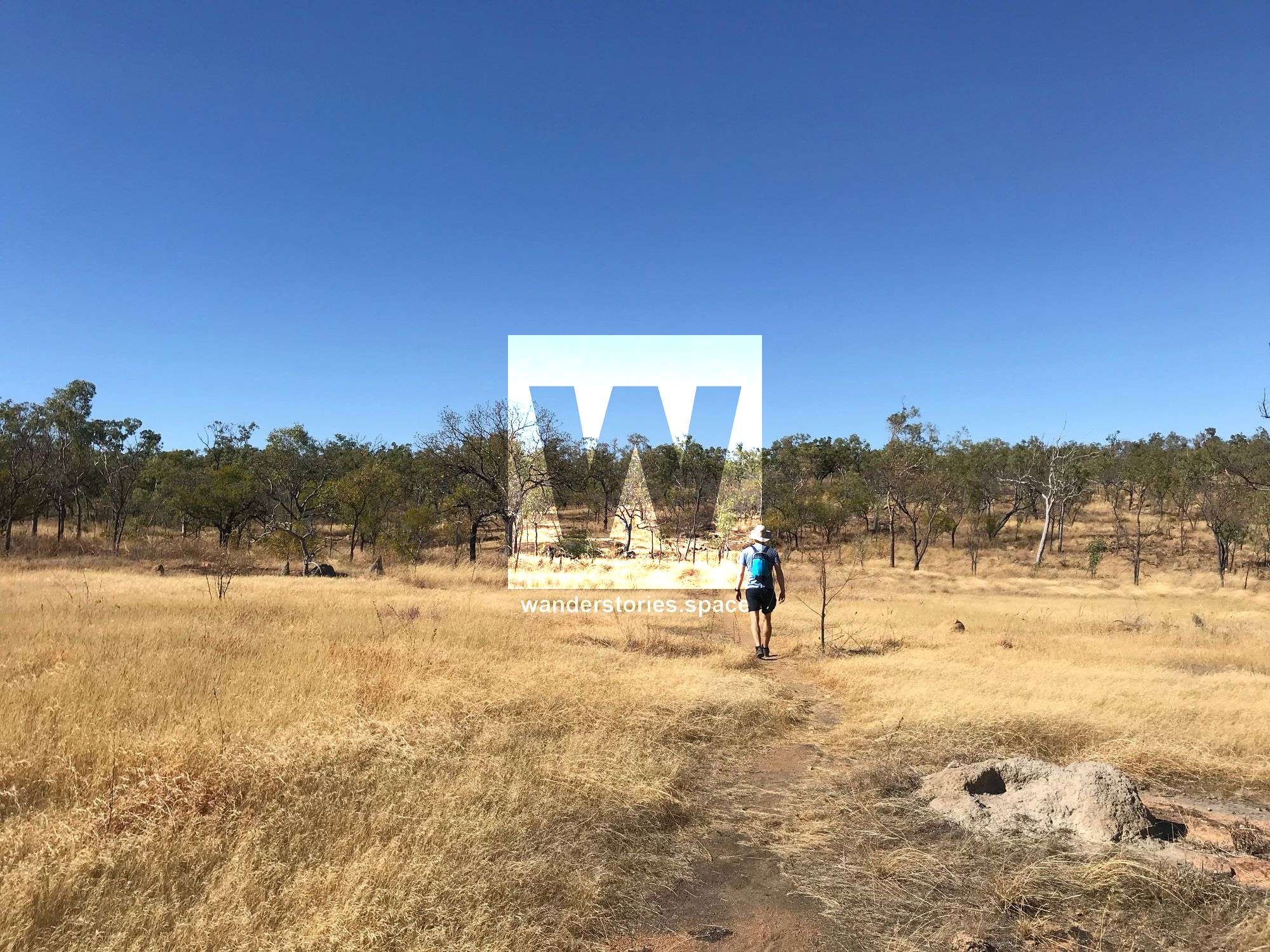
Undara Volcanic National Park offers a range of walking opportunities ranging from 2.5 km to 12 km return. The small climbs to lookouts and bluffs are on graded tracks. If you have your own mountain bike, you will find most of the tracks easily accessible. You must sign out at Reception when you depart for your walk and take an appropriate amount of water with you. When you return from your walk, please sign back in at reception so they know you have returned safely. If Reception is closed, please sign in at the Saloon Car Bar. Be realistic about your walking abilities and ensure you choose a track that suits your skills and that you bring appropriate gear.
Kalkani Crater rim walk
Grade: 3
Distance: 2.5 km return
Time: allow 1.5 hours of walking time
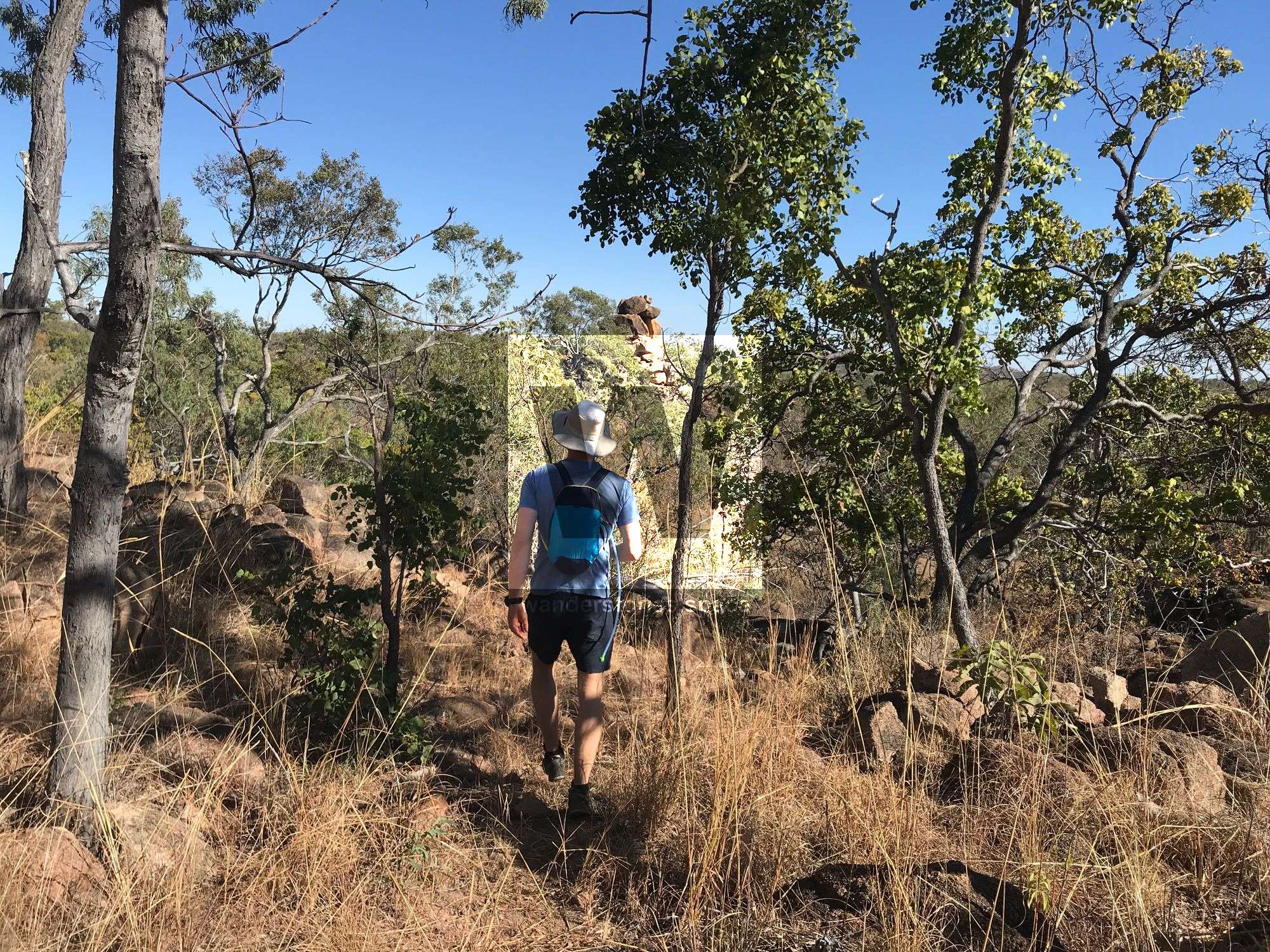
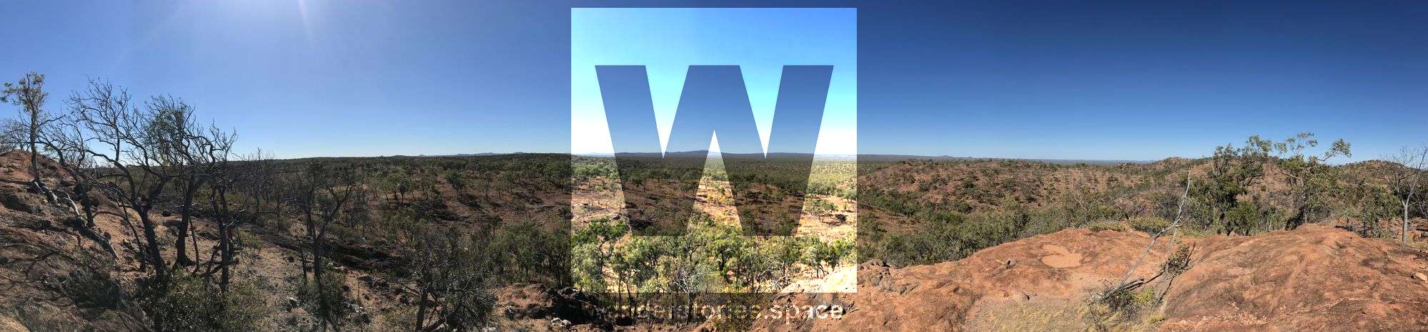
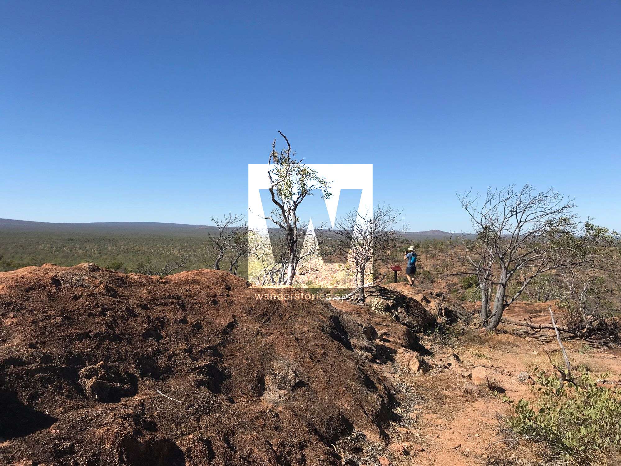
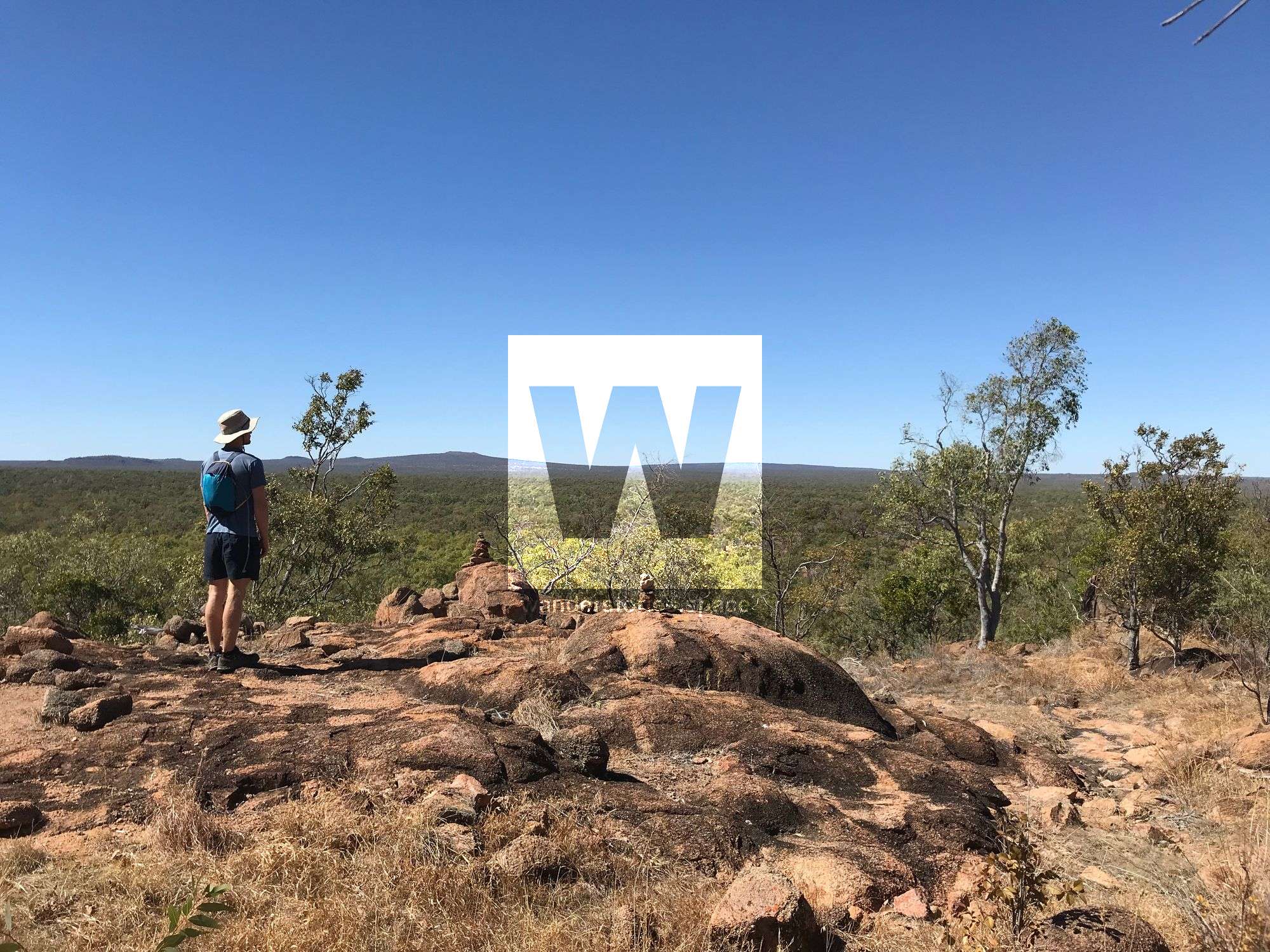
Starting from the Kalkani day-use area, this self-guided walk climbs to the saddle of the Kalkani Crater and around the eggcup-shaped rim. Enjoy the views across the lava plains and other volcanic vents. Look for the distinctively darker vine thicket following the lava flow from Undara Crater. Signs on this track explain the explosive geology of the area, including the origins of the variety of volcanoes seen from the walk. Mountain bikes are not permitted on this track.
Bluff Walk & Bluff Circuit
Bluff & Back:
Grade: 2
Distance: 1.5km return
Time: 30 mins return
Buff Circuit:
Grade: 2
Distance: 2.3km return
Time: 50 mins return
This walk starts at reception and climbs the small granite knoll SW of the Lodge. Take the left fork at the Atkinson's Lookout Track intersection. You have magnificent views over the wooded lava plains from the summit to many of the region's volcanoes. From The Bluff, you can return along the same trail to the Lodge or continue on the Bluff Circuit When this trail meets the Swamp Track. Keep left and return to the Lodge along the swamp edge.
Atkinsons lookout trail
Grade: 3
Distance: 3.8 km return
Time: allow 1.5 hours of walking time
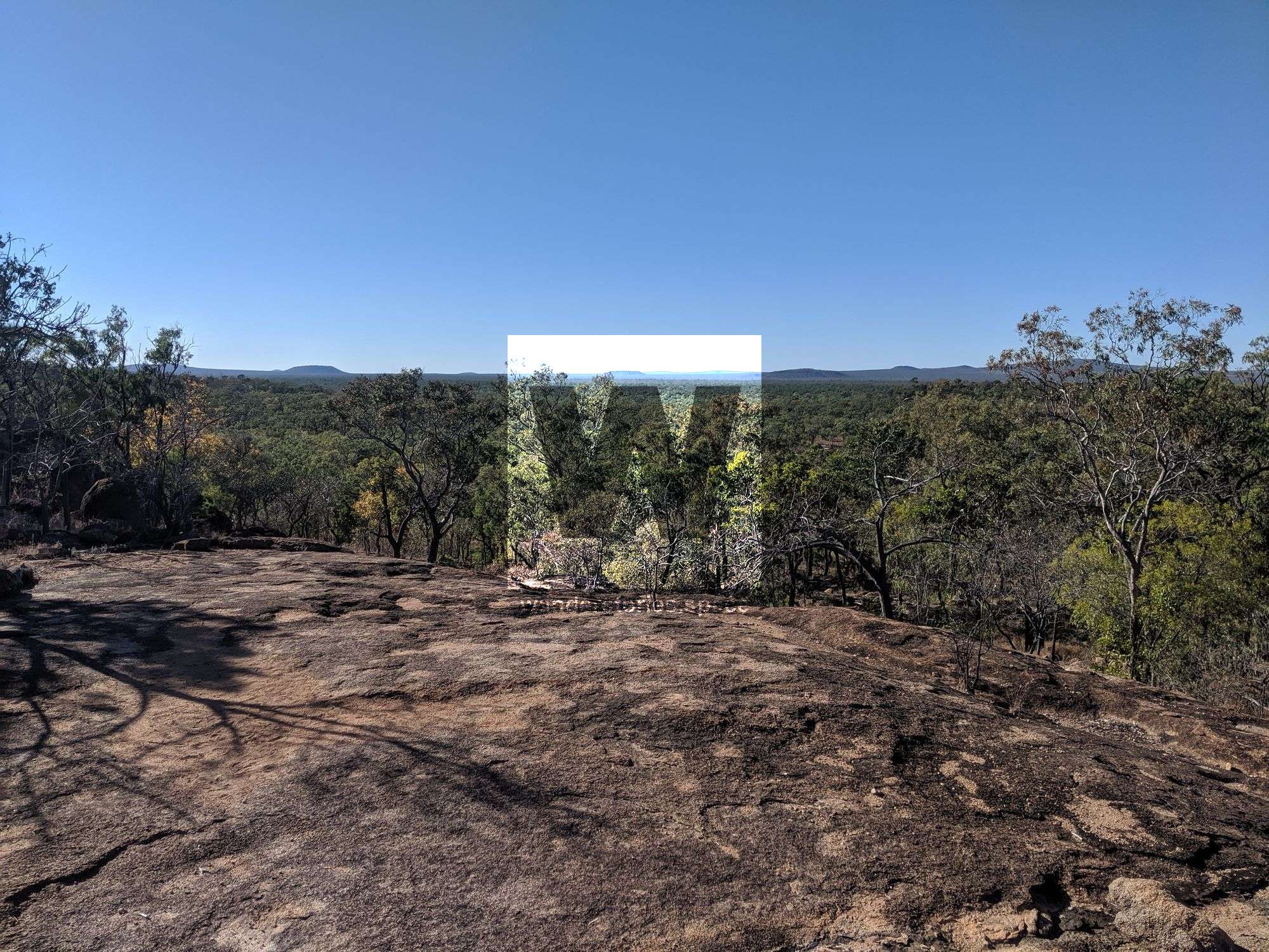
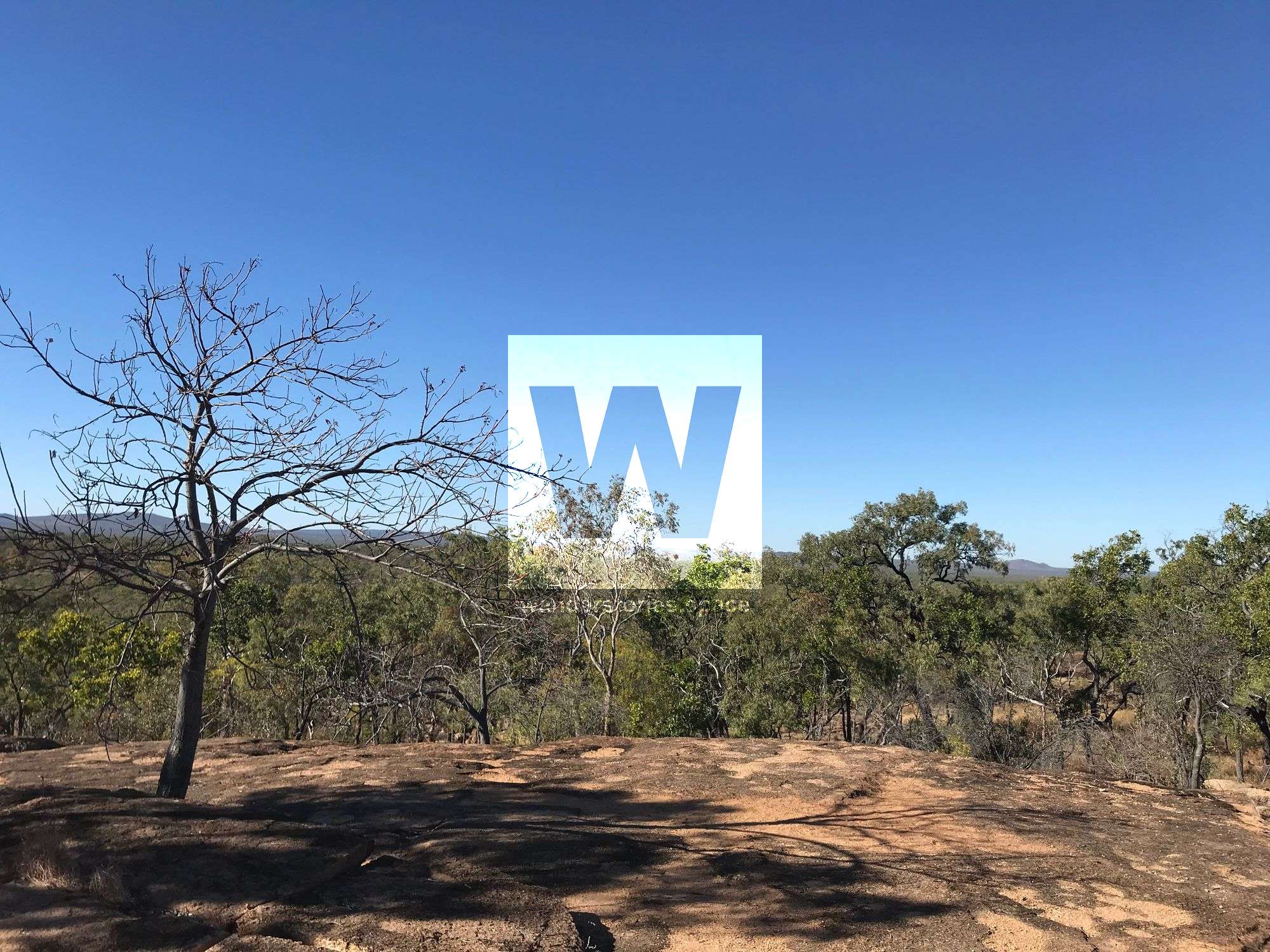
This trail is primarily a walking trail, although mountain bikes are permitted. Starting at Undara Experience, this shared trail passes over a small granite knoll before gently descending to Iron Pot Creek, usually dry in winter. After crossing the creek, the trail climbs west for a short distance towards a second ridge. The trail then turns south and passes through small boulders onto a large south-easterly facing granite slab known as Atkinson's lookout. The lookout has great views south to The Granites and Racecourse Hill, the highest shield volcanic cone in the park. Walkers can return the way they came or continue on to the Rosella Plain lookout trail.
Bush Walk
Grade: 2
Distance: 5.8 km return
Time: 1.5 hrs return
Take the Atkinson's Lookout Trail from the reception area. Take the right-hand fork along the trail at the sign. The trail meanders over granite slabs and gullies with abundant wildflowers in season. After crossing a second service road, the trail swings to the east, crossing grassy plains, the Undara access road and meets the Flat Rock-Circle View Track adjacent to the 100 Mile Swamp. To complete the Bush Walk, turn right and head south along the Flat Rock Circle View Track to the Lodge.
Flat Rock - Circle View Track
Grade: 3
Distance: 8.6 km return
Time: 2.5 hrs return
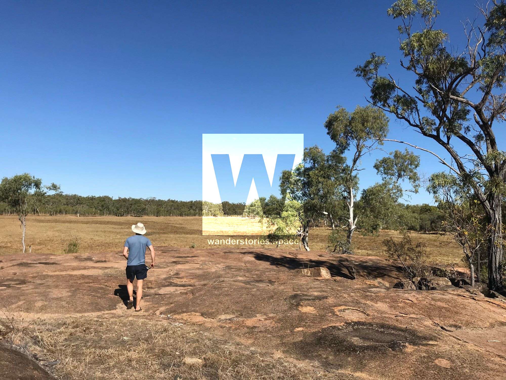
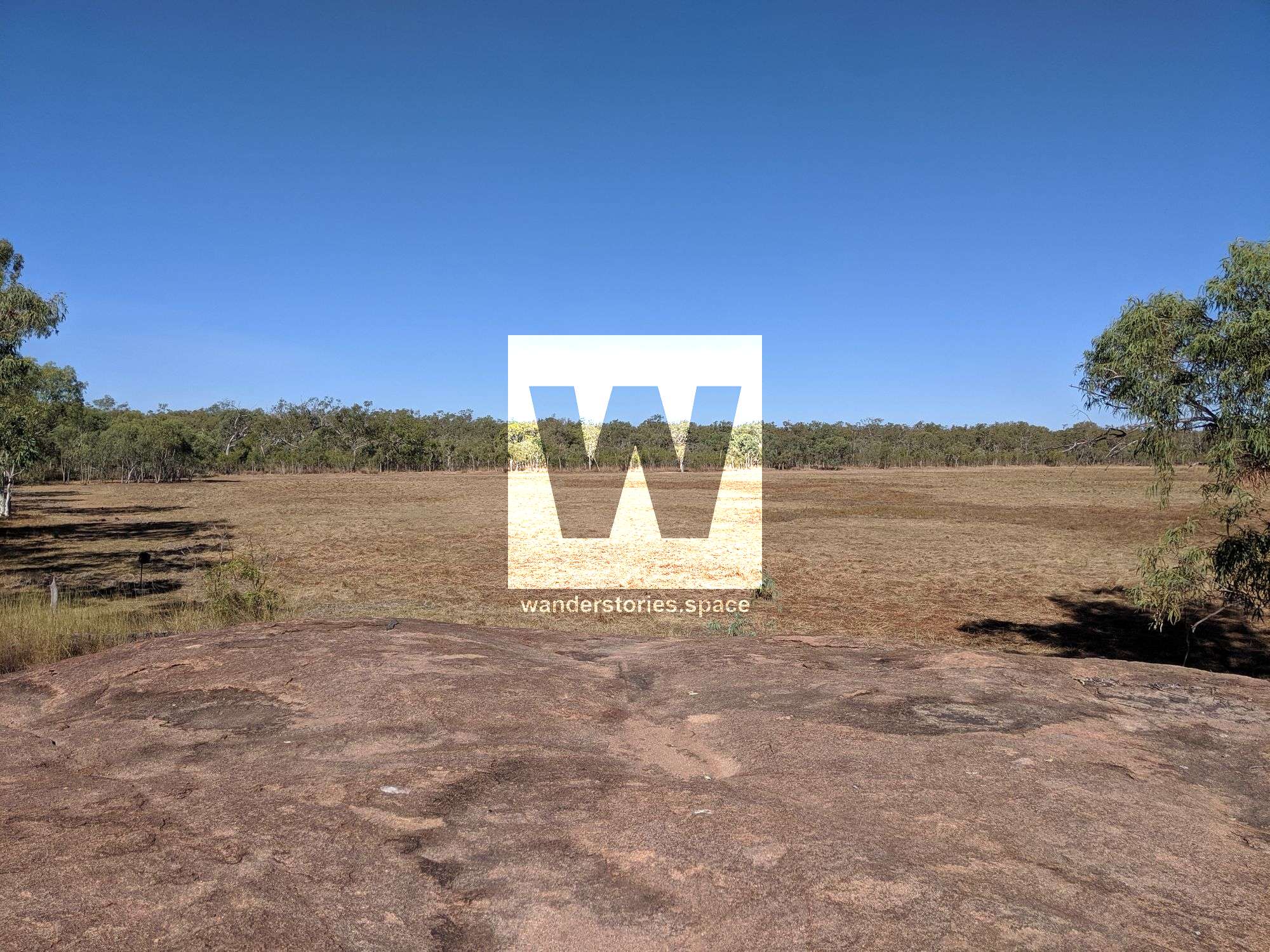
From reception, walk past the Carriages on the path bordered by path lights. The trail then crosses the tour road before arriving at a T-junction. Turn left and head north along the edge of the 100 Mile Swamp. At the next track intersection, continue right. Flat Rock is a lovely flat granite rock with some small water holes on top. Along the Swamp edge, there is often pooled water, an oasis for small birds. Continue around the swamp edge and climb the granite knoll, Circle View. You will be rewarded with a 360-degree view over the lava plains to the distant volcanic cones. Return to the Lodge on the same trail.
Swamp Track
Grade: 2
Distance: 4.6km return
Time: 1.5hrs return
Start this walk from the Flat Rock Circle View track. At this intersection, as marked, turn right and head south along the edge of the 100-mile swamp. After crossing two service roads, the track circles around the southern end of the Swamp and terminates at a semi-evergreen vine thicket-clad basalt ridge. Return to the Lodge on the same track or via the Bluff, returning on the Bluff Walking track.
Pioneer Track
Grade: 2
Distance: 3.6 km return
Time: 1.5 hrs return
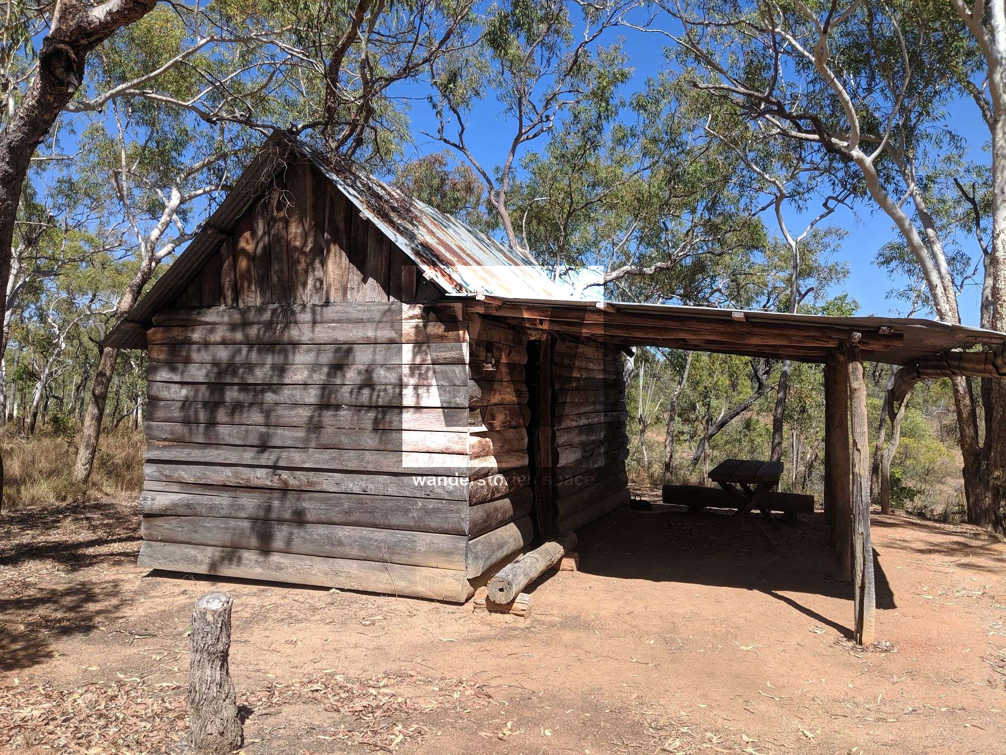
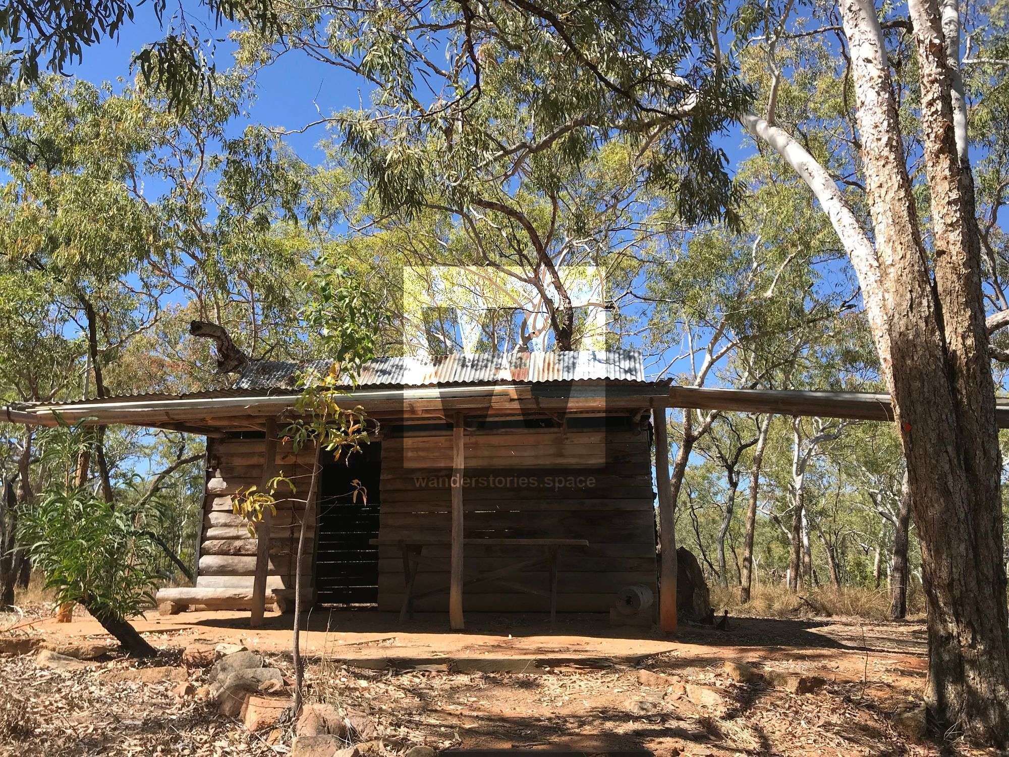
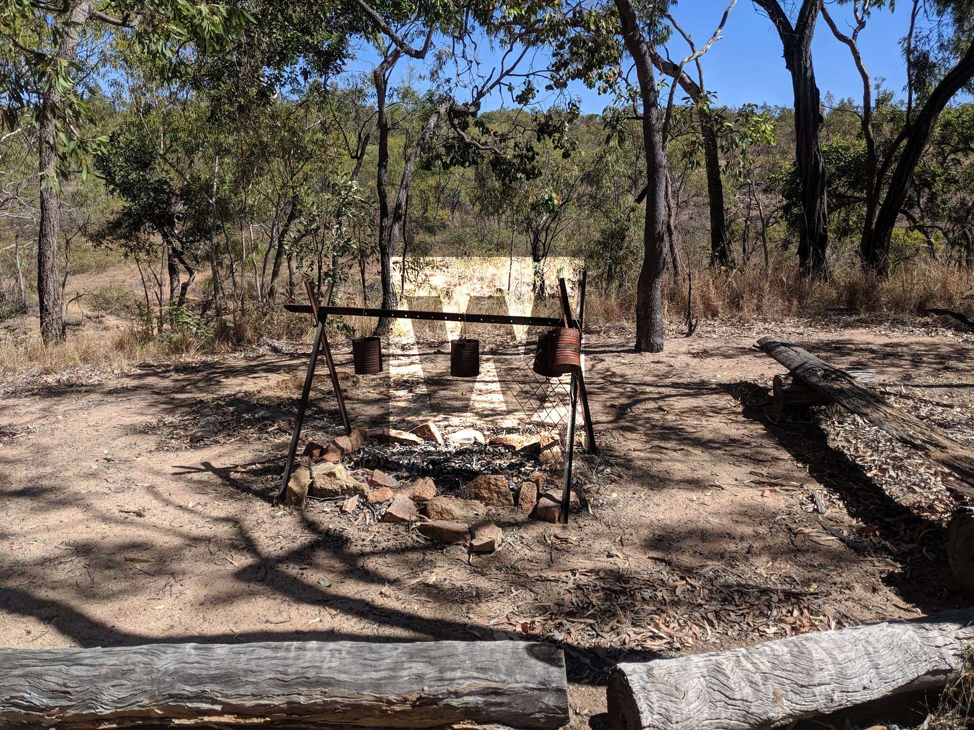
From reception, walk to the Bush Breakfast site and then continue south. This trail follows the route of the telegraph line that was built in the 1870s. Follow the interpretive signage until you reach the Heritage Hut, a replica of an early pioneer dwelling. Return to the Lodge on the same track. Do not continue across the bridge unless prepared for a 6-hour walk.
Castle Rock
Rosella Plains Lookout trail
Grade: 4
Distance: 12 km
Time: allow 4-6 hrs walking time
This trail is primarily a walking trail, although mountain bikes are permitted. Starting from Undara Experience, this trail can be walked in either direction - although the clockwise direction is recommended. Walkers continue on from the Atkinson's lookout trail or walk in a clockwise direction from Undara Experience.
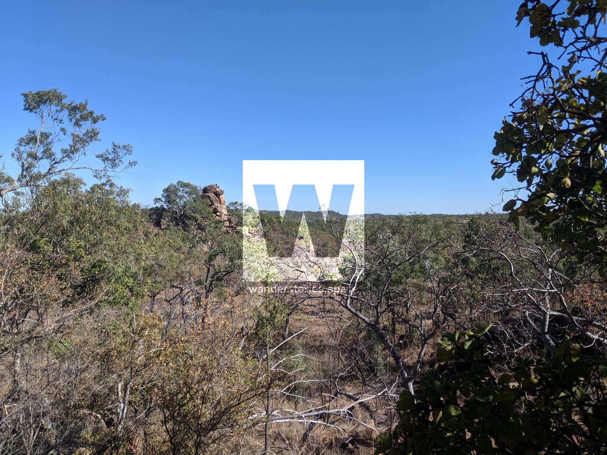
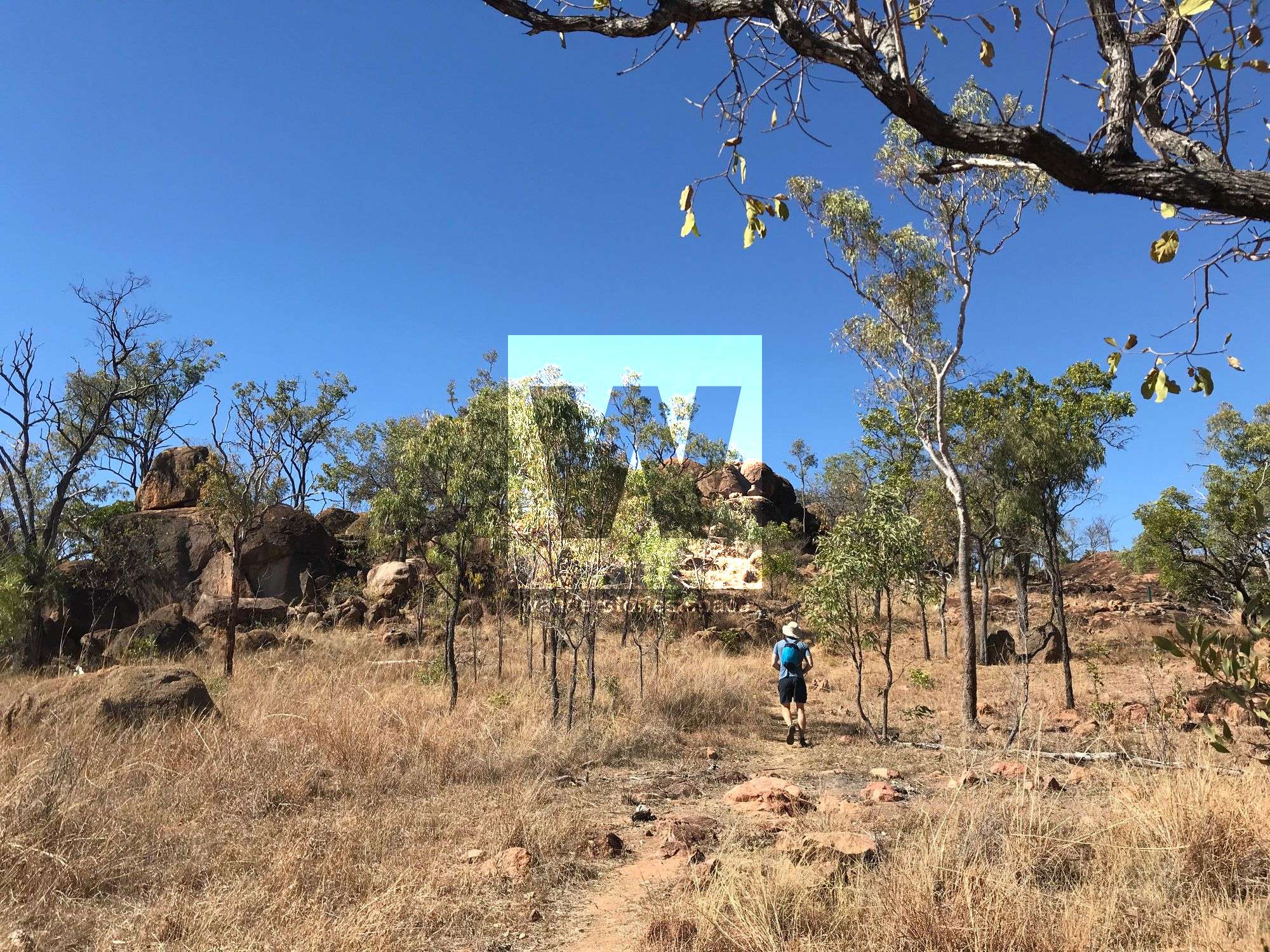
Castle Rock is a granite outcrop, the surface of an exposed granite batholith. Notice that the granite boulders lie in layers and that they are rounded and cracked. The signpost shows diagrams of how a buried batholith becomes exposed over time. In the process, its surface cracks, forming blocks that erode into rounded boulders.
Walking clockwise from Undara Experience, the first 3 km of this trail follows a section of the old telegraph line from Cardwell to Normanton. Original telegraph poles and a replica of a settler's hut can be seen. Information signs along the way introduce the lifestyle of 19th-century pioneers in the area.
From the hut, the trail continues in a south-westerly direction along the lowlands before the short, steep "Cardiac Climb" to Jump Up lookout.
The trail then winds through beautiful granite country with volcanic vistas. Look for the red-flowering native rosella bushes Hibiscus heterophyllus, bright yellow flowers of the kapok tree Cochlospermum gillivraei, and the distinctive, spreading crown of dark green rounded leaves belonging to the Cooktown ironwood Erythrophleum chlorostachys.
The most westerly point of this walk is the Rosella Plains lookout, with fantastic views of the province. From the lookout, walkers can return the way they came or continue for another 6 km to complete the loop via the Atkinsons lookout trail to Undara Experience.
Signs along the track introduce the natural and cultural values of the area, including the geology of the landscape, a variety of plants and animals, and the way of life of the area's Traditional Owners. This track is steep and rocky in some places, and walking boots and gaiters are recommended.
More than 120 species of birds, including the vulnerable red goshawk Erythrotriorchis radiatus, have been seen in the park. Early mornings are best for birdwatching.
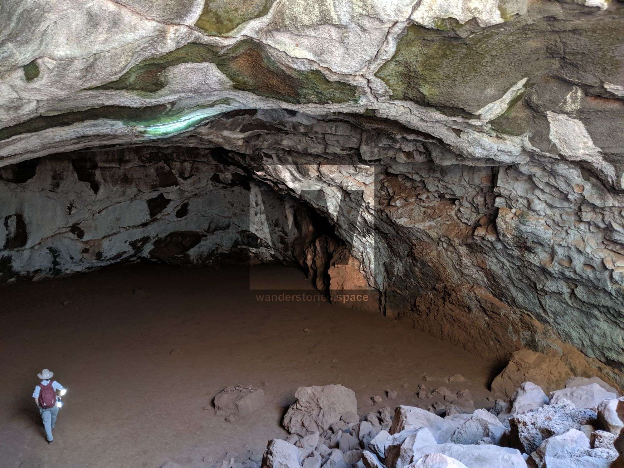
The caves within this park are home to thousands of insectivorous bats. These bats create a spectacular display at dusk as they flock from their dark roosts. Spotted pythons Antaresia maculosa and other predators often position themselves at the cave's entrance to catch the exiting bats.
How to get there
Undara Volcanic National Park is about 300 km by road southwest of Cairns. From Cairns, drive south along the Bruce Highway to Gordonvale. Turn right and follow the signs to the Atherton Tableland, up the Gillies Range. The range road is 19 km long and very winding. Once at the top of the range, continue to Ravenshoe and follow the signs to Mount Garnet. Continue towards Mount Surprise, passing through Forty Mile Scrub National Park (Savannah Way). The turn-off to Undara is 17 km along the Gulf Developmental Road. Travel a further 6 km to a fork in the road. Undara Experience is 9 km along the road on the right-hand side. To reach the Kalkani day-use area, turn left at the fork and travel 6 km on an all-weather gravel road. All roads are suitable for conventional vehicles, although the roads can be corrugated.
If travelling from Townsville, head north along the Hervey Range Developmental Road for approximately 130 km, then turn right onto the Gregory Developmental Road. Travel a further 174 km through Greenvale to the Lynd Junction. Take the Kennedy Highway towards Mount Garnet from here and turn left at the Gulf Developmental Road (Savannah Way). Continue on as above.
Notes
- Access to the lava tubes is only by guided tour. Concealed holes where the tubes have collapsed, a confusing landscape, and high carbon dioxide levels in some tubes make the lava tube area dangerous for visitors without an experienced guide. The Kalkani Crater rim is accessible to the public without a tour guide.
- Camping is not permitted in Undara Volcanic National Park.
- All roads are suitable for conventional vehicles, although the roads can be corrugated. See the Department of Transport and Main Roads for information about road and travel conditions.
- Weather forecasts are available from the Bureau of Meteorology.
This article, and all other articles, are for entertainment purposes only and are not to be used as a guide. Please see our Disclaimer for more information.