Eastern and Western Arthur Range Traverse
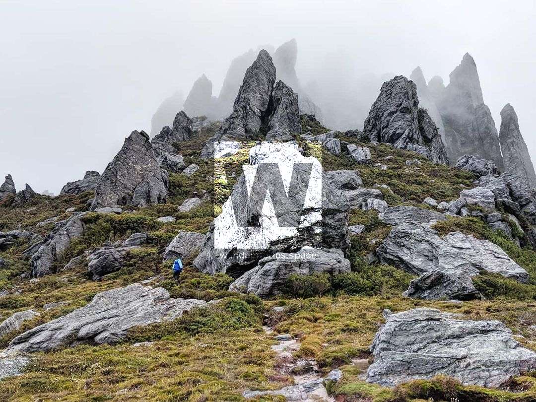
Located in Southwest National Park, the Western Arthurs Ranges feature 22 significant peaks and 30 lakes as a result of glaciation in the area in recent ice ages.

Location - Southwest National Park, Tasmania, Australia
Distance - Approximately 79 km loop depending on the route (shorter if you take the Moraine K Track)
Duration - 5-7 days depending on routes, skills, and fitness
Grade - 5, difficult and strenuous, and required good navigational skill
Type - Remote, on and off-track bushwalking with some scrambling/climbing
Located in Southwest National Park, the Western Arthurs Ranges feature 22 significant peaks and 30 lakes as a result of glaciation in the area in recent ice ages. While this has been frequently referred to as Tasmania's greatest trail by bushwalkers for its breathtaking landscape features, it is also one of the most dangerous for its extreme and rapidly changing weather conditions and varied technical terrain.
This article is currently being written. If you have any questions or would like more information about this area, please reach out and contact us.
Interactive Map
This is a challenging multi-day hike with many steep gully ascents and descents, often closer to a rock climb than a hike, where each day becomes more technical, exposed and slightly less obvious to navigate.
Begin the Western Arthurs Traverse by hiking to Lake Oberon and Junction Creek. This area has become a more popular area for day hikers, so if you are feeling fit and have the time you can push on to Lake Cygnus on the first day to escape the potential crowds. From this point on the track is nothing but adventure.
The peaks in the range create their own weather and any hiker should be equipped with topographic maps, warm/wet weather clothing, PLB, and the experience and knowledge to navigate steep and rugged terrain. Over the 5-7 days most visitors require to complete the circuit you will certainly be tested both physically and mentally. But if you are blessed with even a few moments of clear blue skies from the range you will be happy you've done it.
Port Davey - N of the Narrows to Melaleuca and the South Coast Track
Federation Peak
This article, and all other articles, are for entertainment purposes only and are not to be used as a guide. Please see our Disclaimer for more information.