White Mountains National Park
White Mountains National Park is home to spectacular white sandstone bluffs, gorges, and brilliant wildflowers that can be enjoyed from May to September.

Location - Hughenden region, North Queensland, Australia
White Mountains National Park is located northeast of Hughenden and southwest of Charters Towers. It is home to spectacular white sandstone bluffs, gorges, and brilliant wildflowers that can be enjoyed from May to September. This rugged wilderness is 112,000ha and features spectacular white sandstone bluffs and gorges, and diverse plants and animals. A further 12,000 ha are contained in a resource reserve on the eastern boundary of the park.
The park protects 14 different ecosystems in the Desert Uplands bioregion, making it one of inland Queensland's most botanically diverse parks. Lancewood forests, open woodlands, laterite pastures, heathlands and spinifex grasslands are spotted around the white sandstone outcrops, sand dunes and sandy flats in the Cann's Camp area. Brilliant wildflowers and a host of animals are found throughout the park.
The park is a vast arid landscape for most of the year. When season conditions are favourable, however, it comes alive in winter with a colourful display of wildflowers. The headwaters of three major catchments exist within the park. Water flows through several smaller streams into the Burdekin River and then to the east coast. The Flinders River flows north into the Gulf of Carpentaria. Water also flows through the channel country of western Queensland, eventually feeding into Lake Eyre in South Australia. White Mountains National Park is a major recharge area for the Great Artesian Basin.
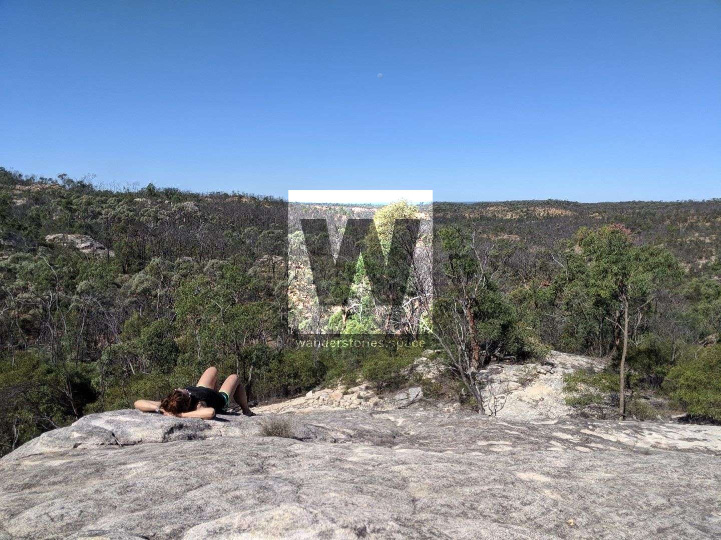
Burra Range lookout
Distance: 10 metres (located on the side of the Flinders Highway where it crosses the Great Dividing Range)
Time: 1 minute
Part of the Great Dividing Range, this lookout provides a view over the white mountains sandstone ridges and offers a glimpse of what this national park entails - steep gorges, lancewood forests and white sandstone shelves and peaks. sandstone heath and large deposits of lateritic stone.
Sawpit Gorge lookout
Distance: 8 km return from the national park entrance
Time: allow 15 mins driving time
The road to the lookout passes through sandstone heath and large deposits of lateritic stone litter the landscape. The drive can be particularly picturesque when the parks - native plants are in flower - from May to September. Sawpit Gorge is the headwaters of the Warrigal Creek system, which flows into the Cape and then Burdekin rivers.
Cann's Camp Creek camping area
Distance: 10 km from the national park entrance
Time: allow 20 mins driving time
Cann's Camp Creek camping area is a partially-shaded quiet camping area in open woodland. A composting toilet is provided and campfires are permitted (conditions apply). When dry, the camping areas are accessible to four-wheel drive vehicles with care. During the wet season (usually November to April), the road may be boggy and inaccessible.
Cann's Camp Gorge Lookout
Driveable
Cann's Camp Canyon
See the remote White Mountains guide for more information.
Poison Valley, Torrents Creek, & Big Swamp
Distance: 28 km return from the national park entrance
Time: allow 1 hour driving time
A four-wheel drive is required to get through to Poison Valley. This road travels through open eucalyptus woodland, acacia scrub and heath and is surrounded by the rugged hills that form part of the Torrens Creek catchment. The valley takes its name from the heart-leaf poison bush Gastrolboum grandiflora that is common in the area. This plant contains the poison mono sodium fluoroacetate, more commonly known as 1080, the chemical compound used as a pesticide since 1942. The road ends above the banks of Torrens Creek, the most northerly stream running into Lake Eyre. Many creek crossings in the Poison Valley and Cann's Camp Creek area. White Mountains Resources Reserve adjoins the park to the east.
Also, see the Remote hiking in White Mountains National Park article.
Interactive Map
See also the National Park map.
Notes
- Make sure you have enough fuel to get there and back as there aren't any nearby fuel stations.
- Domestic animals are not permitted in the national park - they disturb native wildlife.
- Everything in the park is protected - leave everything as you found it.
- Rubbish bins are not provided. Do not bury rubbish, take it with you when you leave.
- Toilet facilities are provided.
- The creek only flows for part of the year so visitors have to bring all their own water.
- Protect water quality. Don't use soap, toothpaste or detergent in freshwater creeks and waterholes. Wash yourself and your cooking utensils at least 50m from freshwater.
- Limit the spread of weeds and pathogens by ensuring clothes, shoes, gear and vehicles are clean and free of seeds before arriving at the park. Remove, wrap and place seeds in your rubbish.
- Avoid driving on unsealed roads during and after heavy rains (usually November to April). Only drive on formed roads as driving off-track damages the environment.
This article, and all other articles, are for entertainment purposes only and are not to be used as a guide. Please see our Disclaimer for more information.