Windin Falls
Windin Falls is located the Wooroonooran National Park and is the stunning reward for a relatively easy 12 kilometre, 90-minute hike through the rainforest.


Location - Woonooroonan National Park, Far North Queensland, Australia
Difficulty - Grade 4, on-track
Distance - Approximately 14 km return
Time - Allow 3-6 hours return
Windin Falls is located in the Atherton Tablelands, Tropical North Queensland and is the stunning reward for a relatively easy 90-minute hike through the rainforest of Wooroonooran National Park.

What is so special about Windin Falls? It could be the sweeping landscape, the infinity pool, the size of the waterfall, the shady walking track or the fact that there are not many people. Whichever way you look at it, Windin Falls is awesome.
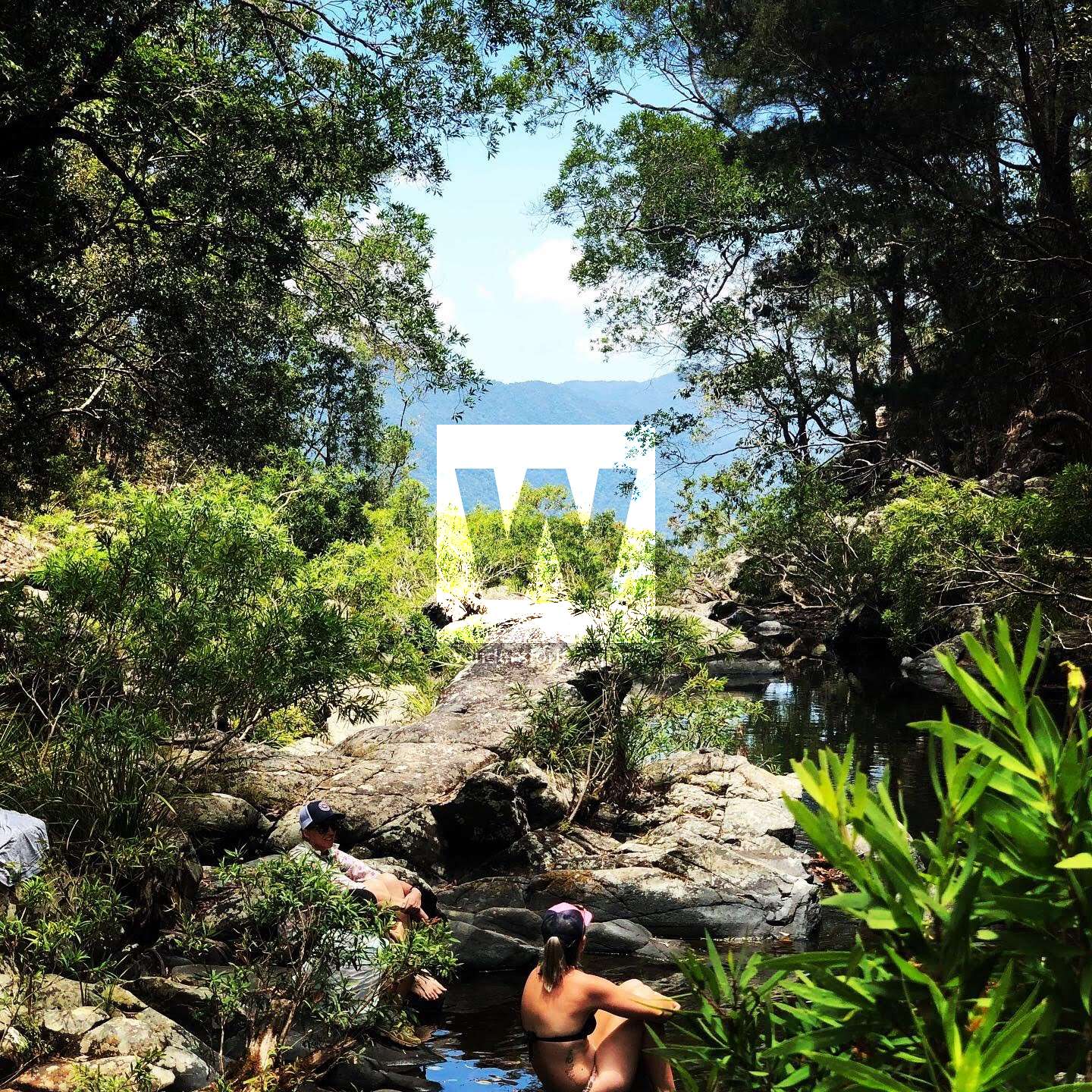
Windin Falls is a picturesque area the 90-minute walk in each direction is easy but it does include at least one steep descent. Experience the Wet Tropics World Heritage Area with its rainforest and open woodland habitat.

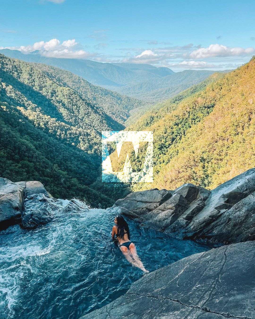
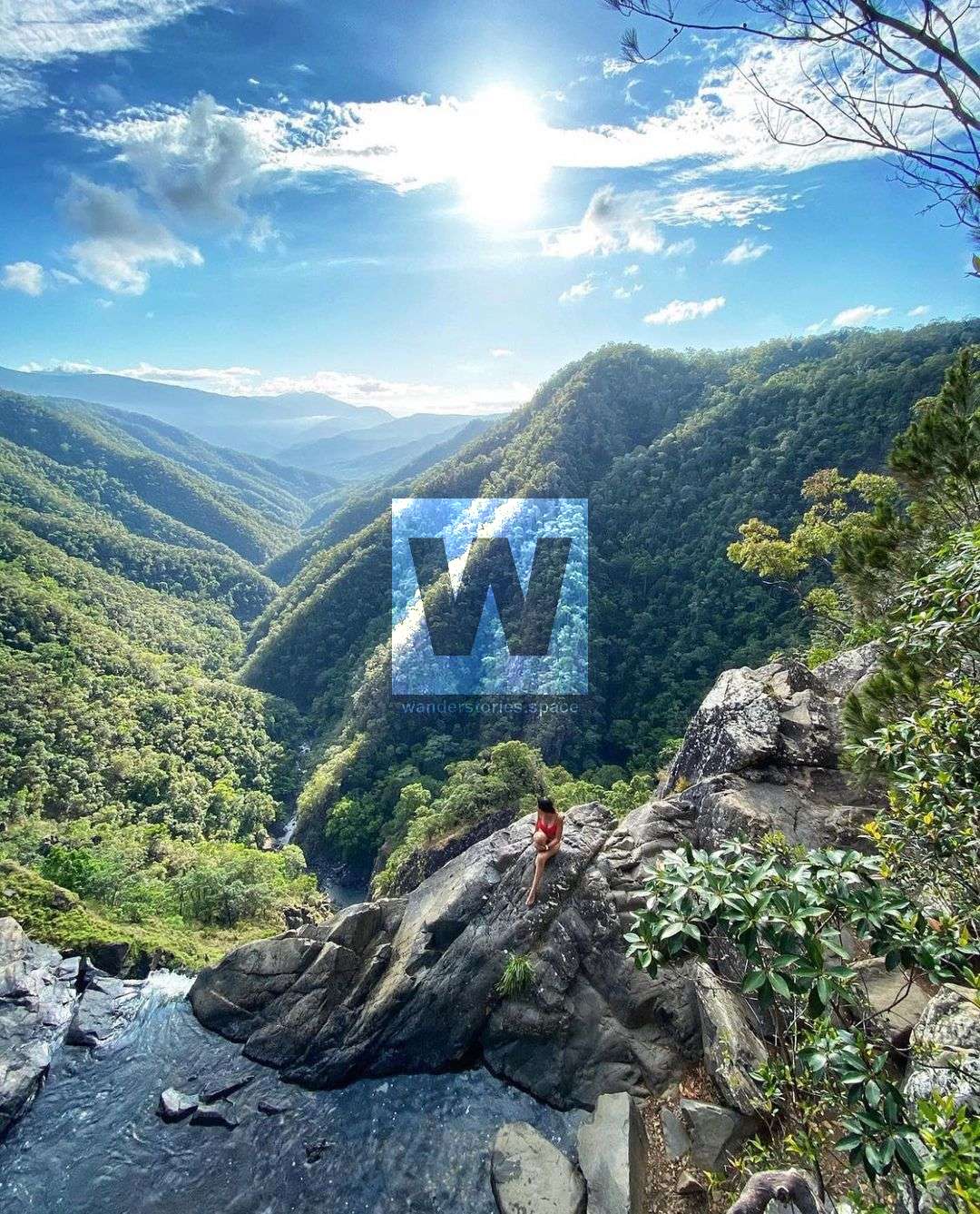
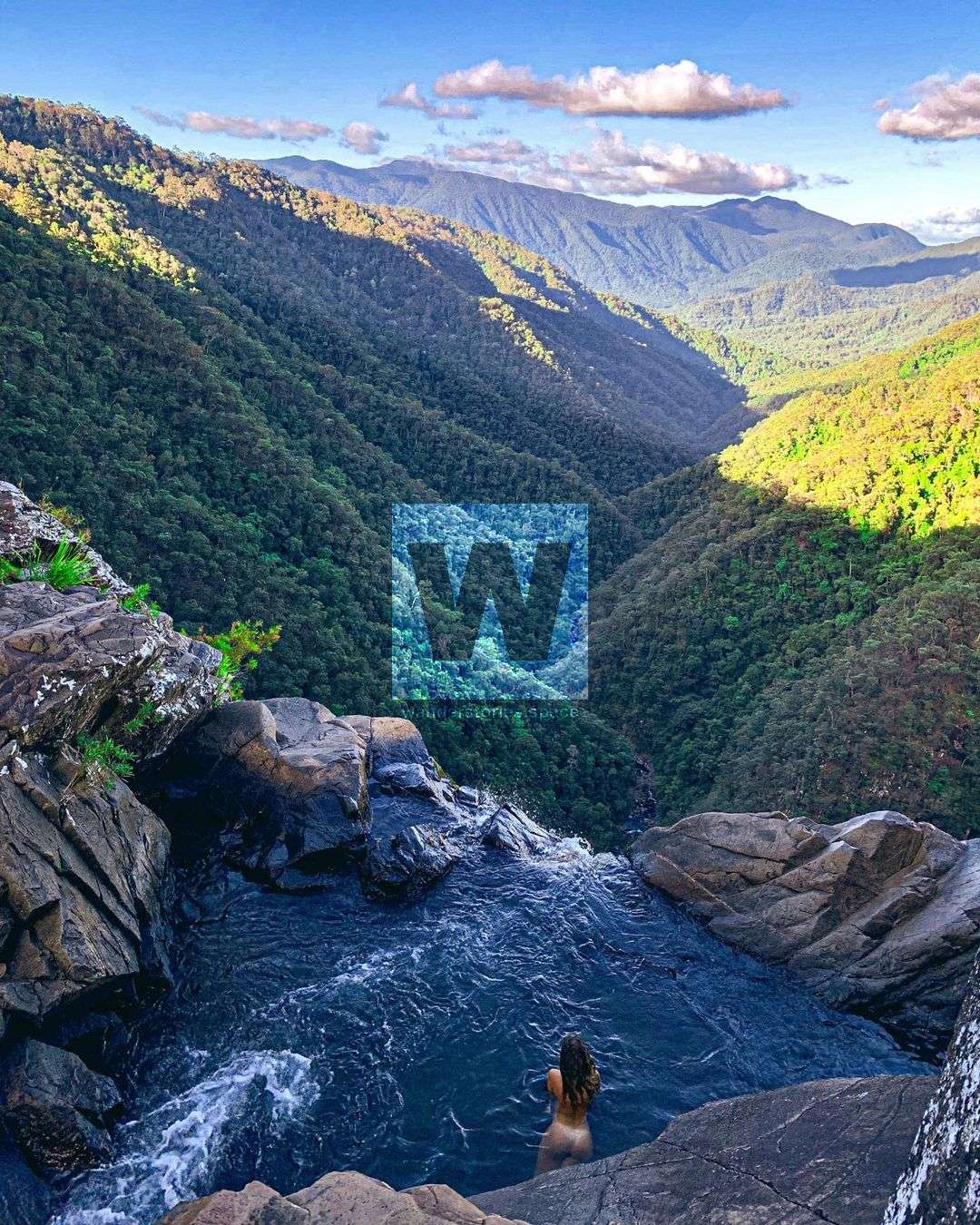
A stream cascades gently into a number of small pools, the highlight of which is a small pool at the very edge of the cliff, the natural infinity pool where you can swim, but with the recent attention the last few years, it can quickly get crowded. Be cautious near the edge of the falls and do not go too close for safety reasons. The infinity pool looks down the Mulgrave Valley and far in the distance, you can see the Mount Bellenden Kerr range.
The vegetation varies from the lush rainforest with towering lumber to wet sclerophyll forests of casuarina. It is a beautiful hike.
Interactive Map
How to get to Windin Falls
The starting point is in the car park accessed by a turn off from Topaz Road. Other points of interest in the park include the Mount Bartle Frere hiking trail and Lamins Hill Lookout. Turn off onto the Old Cairns Track and follow it until you reach a fork in the road just after the Lamin's Hill Lookout. There are two options, both options will take you to the start of this hike.
Option 1: Take a left at the Gourka Road intersection then drive for about 4 km until you reach the gate which marks the start of the Gourka Track Trailhead.
Option 2: Right is slightly longer though I find it more scenic than left. Left will take you to the Eastern track and right will take you to the Western track which is also near the start of the Bartle Frere track.
Mountain bikers, this is where it gets a bit tricky: lifting your bike over the gate is the first challenge. The Old Cairns Track is easily navigable for hikers though mountain bikers will be challenged by eroded deep ruts. Riders should avoid the wet season at all costs.
About 4 km from the gate take a sharp right-hand turn marked by orange flagging tape at the time the writer visited and a sign onto a steeply descending single-track.
What to bring
- Water
- Camera
- Lunch
- Hiking boots
- Towel
- First aid kit / PLB
Basic hiking gear will suffice here as it’s really nothing too challenging. Just make sure you have enough water in case you get lost. Which would actually be a pretty difficult thing to do.
Notes
- Leeches after rain
- The trail can be quite muddy in the wet season
- Gympie-Gympie plants are present
- The Windin FallsTtrack doubled as a 4WD track
Also, see Caribou Gorge and Caribou Falls.
This article, and all other articles, are for entertainment purposes only and are not to be used as a guide. Please see our Disclaimer for more information.