Cape Bowling Green
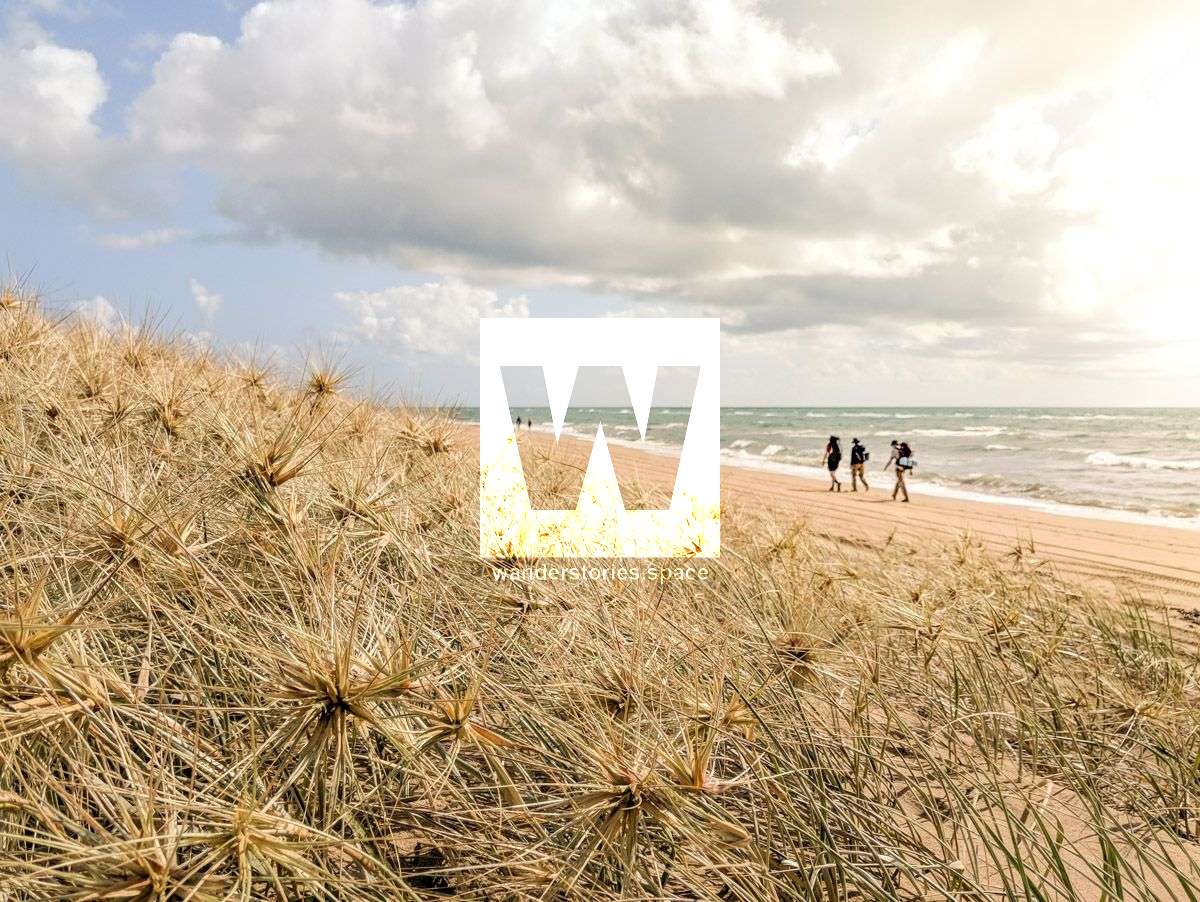
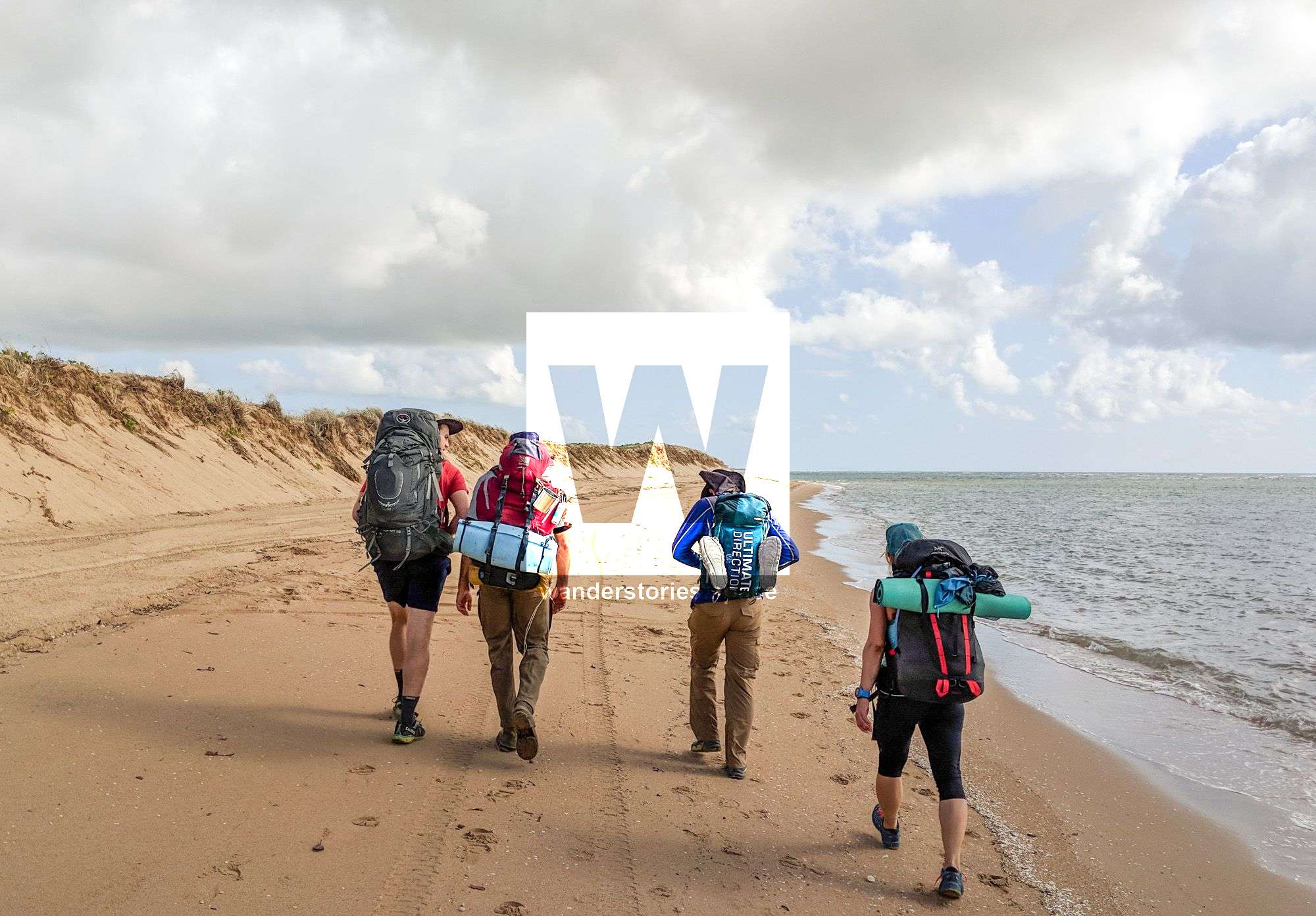
This one's for all the beach lovers out there. Sharks, dingoes, no drinking water and kilometre after kilometre of sand spit ensure that this walk will be more adventurous than most other beach walks. Go remote, have your own private beach getaway and visit an active lighthouse.

Location: Bowling Green Bay National Park, North Queensland, Australia
Distance: 40 km (day one 25 km, day two 15 km)
Duration: Including minimal breaks, two days (day one, 10 hours; day two, 6 hours)
Grade: 3/4
Best time of year: May to October, avoid cyclone season, stinger season, and summer
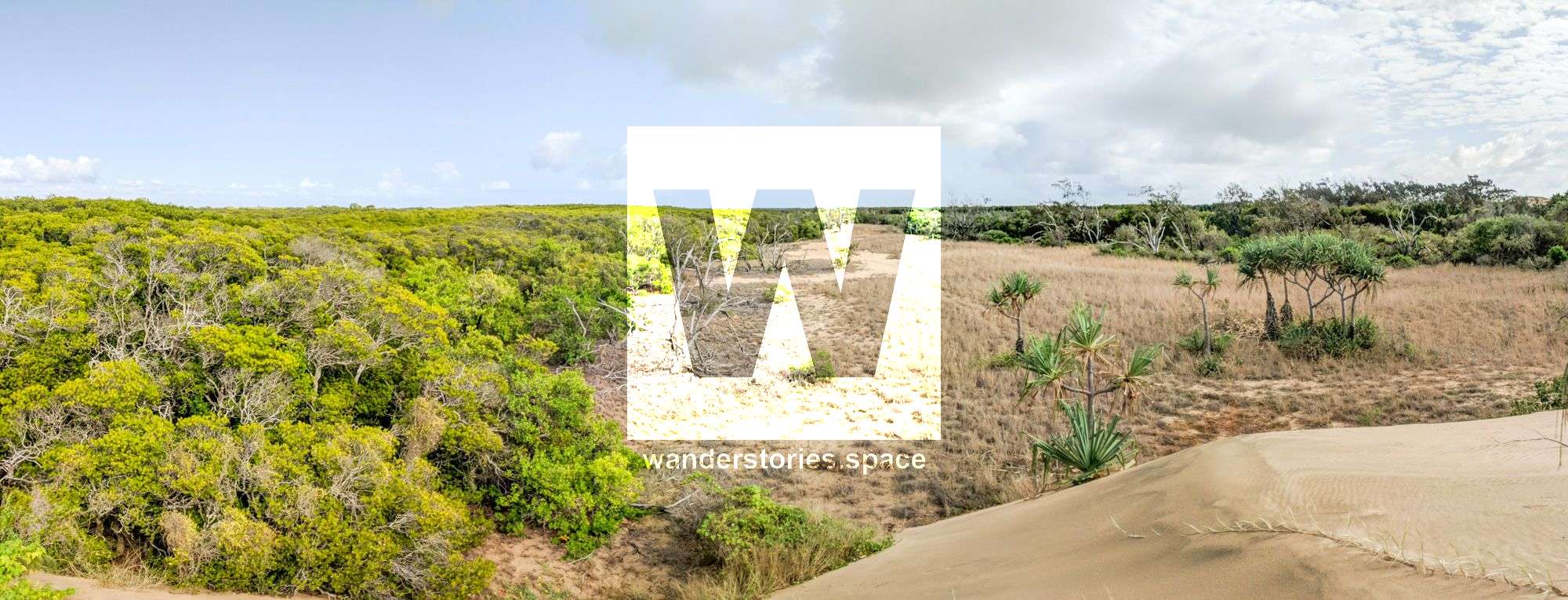
Environment: Coastal sand spit, beach front, mangrove wetlands
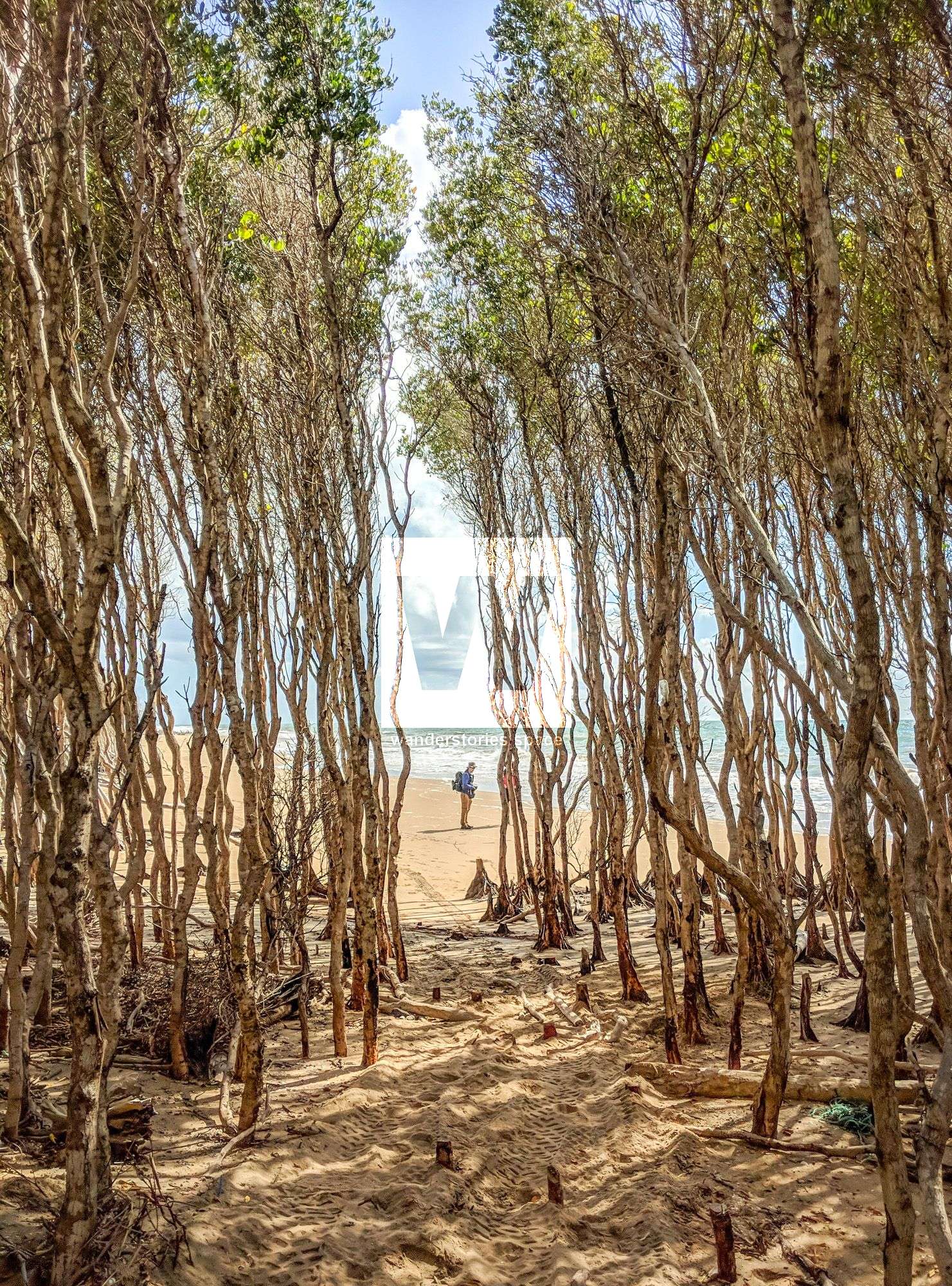
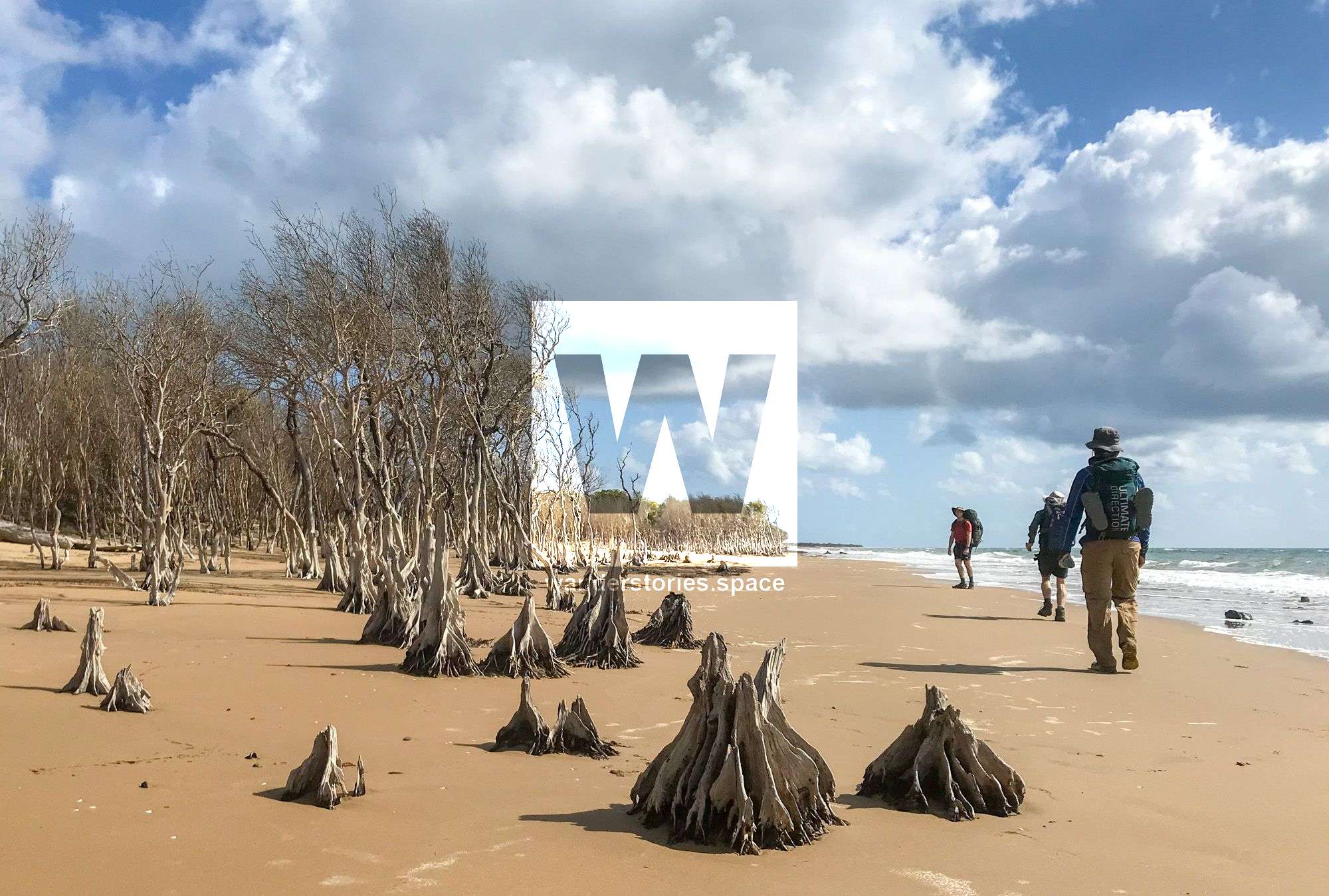
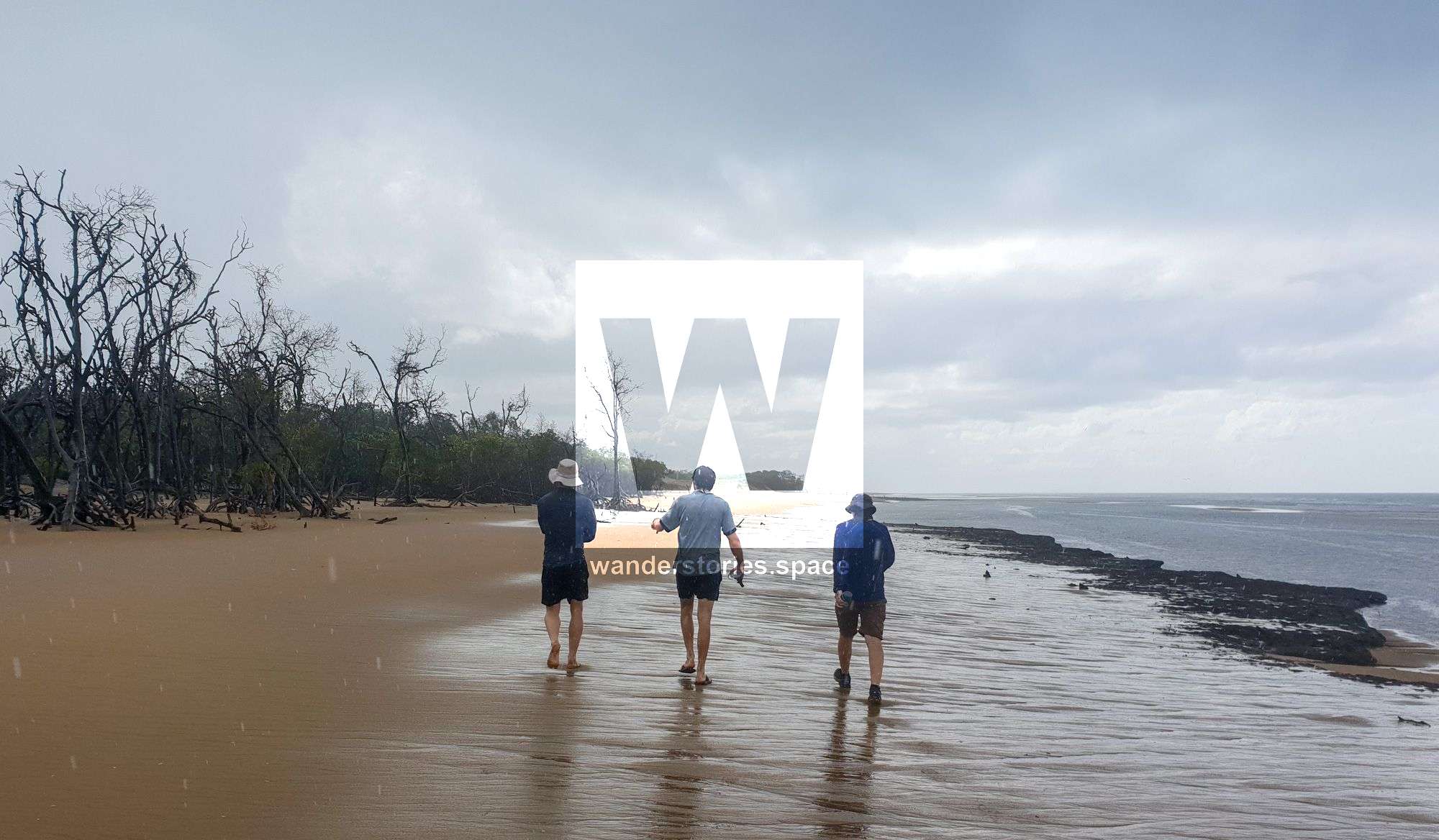
This one is for all the beach lovers out there. Go remote and have your own private beach getaway. Visit an active lighthouse at the end of the headland, near the base of the sandspit. See in your own eyes all the rubbish washed up onto the shore. Sharks, dingoes, no drinking water and kilometre after kilometre of sand spit ensure that this walk will be more adventurous than most other beach walks. It's not just a boring beach walk, this hike will take you through different terrains as you navigation through dead mangrove forests and the sand spit. It's an interesting beach with human rubbish littered throughout.
Over 4000 years old and still growing, this 22 kilometre long sandy cape is a place for local Quad bikers, fishermen and boaters to explore on their weekends; though not many venture too far from home. The north shore current has been depositing the sand over many years creating this lengthy headland ending with a long low sandspit and wetlands habitat. Cape Bowling Green is a truly remarkable spit that extends 22 kilometres out into the sea. It is north of Ayr and is reached through the tiny community of Alva 16 kilometres from Ayr. Much of the spit is less than 1 kilometre wide.
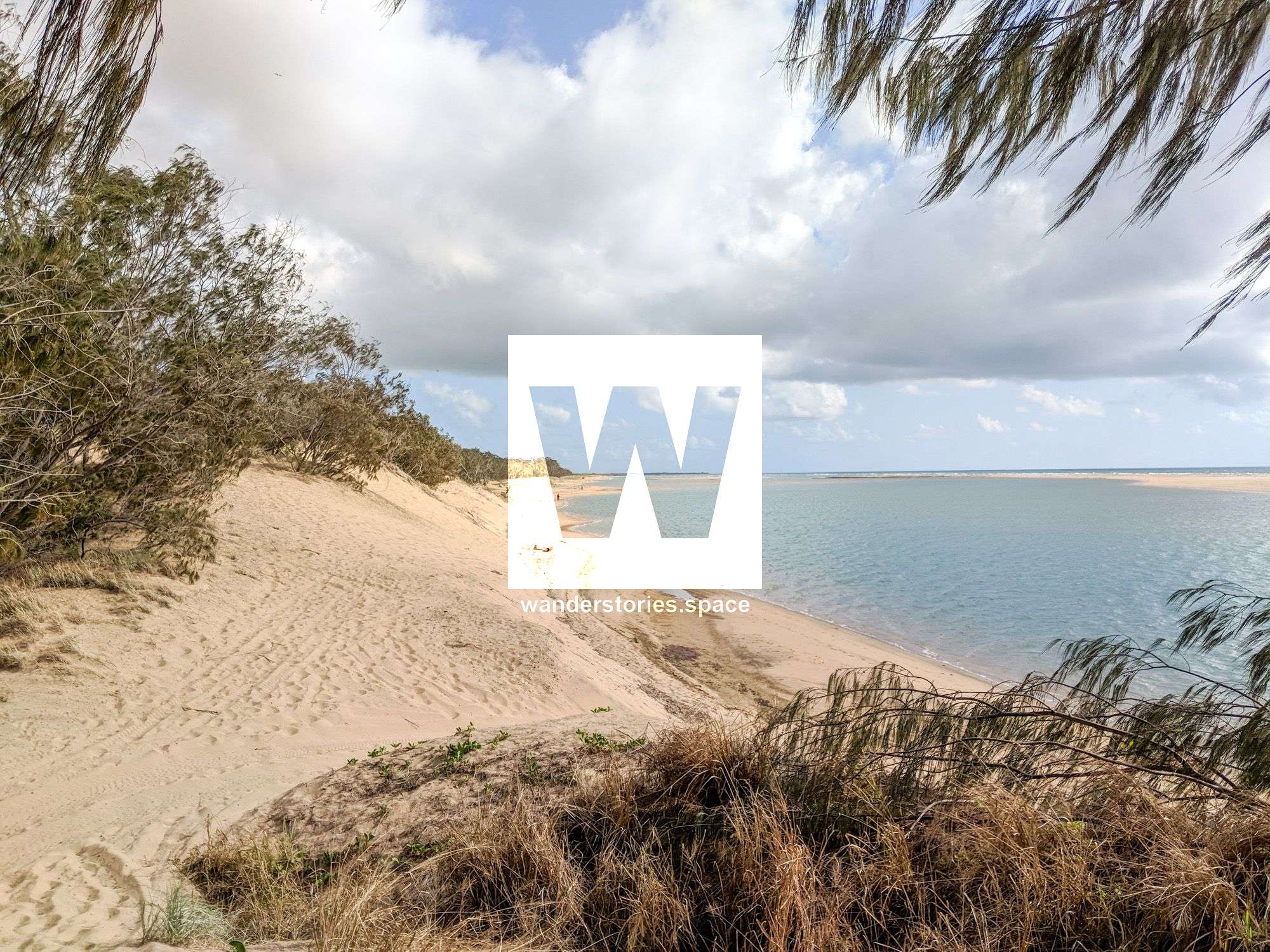
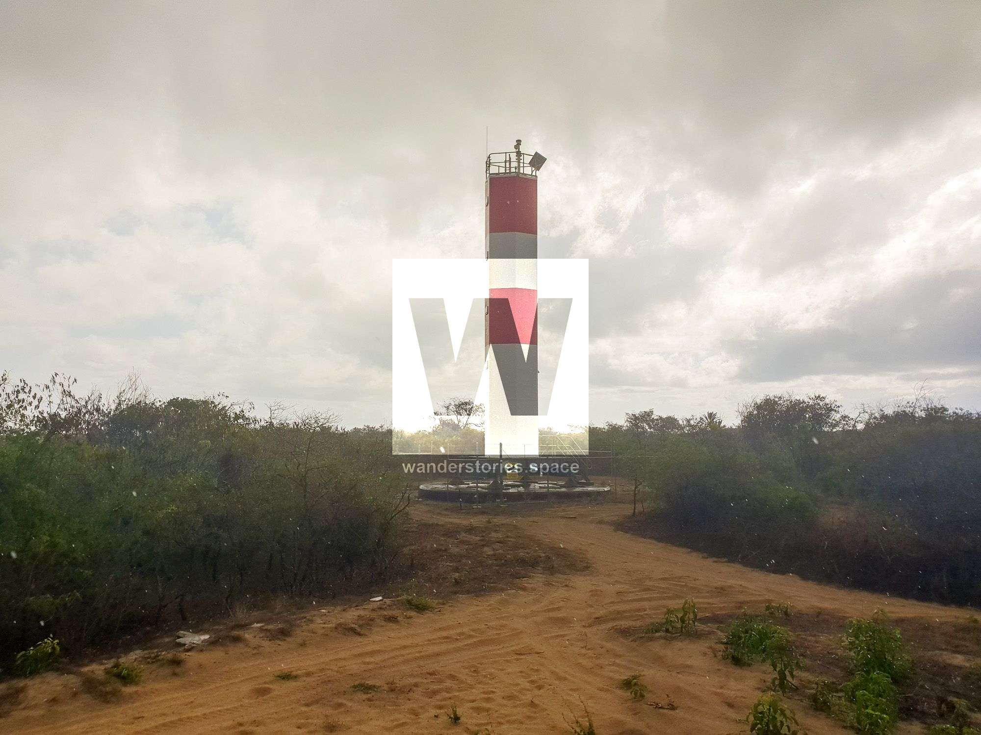
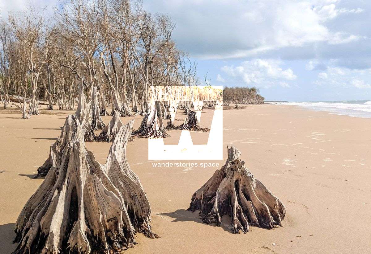
Many ships wrecking at Cape Bowling Green necessitated the construction of a lighthouse at the cape which is home to a diverse array of coastal wetlands. The diversity and extent of wetlands, including the wildlife it supports, has led to large parts of the bay being listed as a Ramsar site, a wetland of international importance, under the Ramsar Convention. Mangroves line the western shore and cyclone-battered beach makes up the eastern side. In many places, mangroves have been screwed out of the sand by past cyclones. The vast mangroves could well be home to crocodiles.
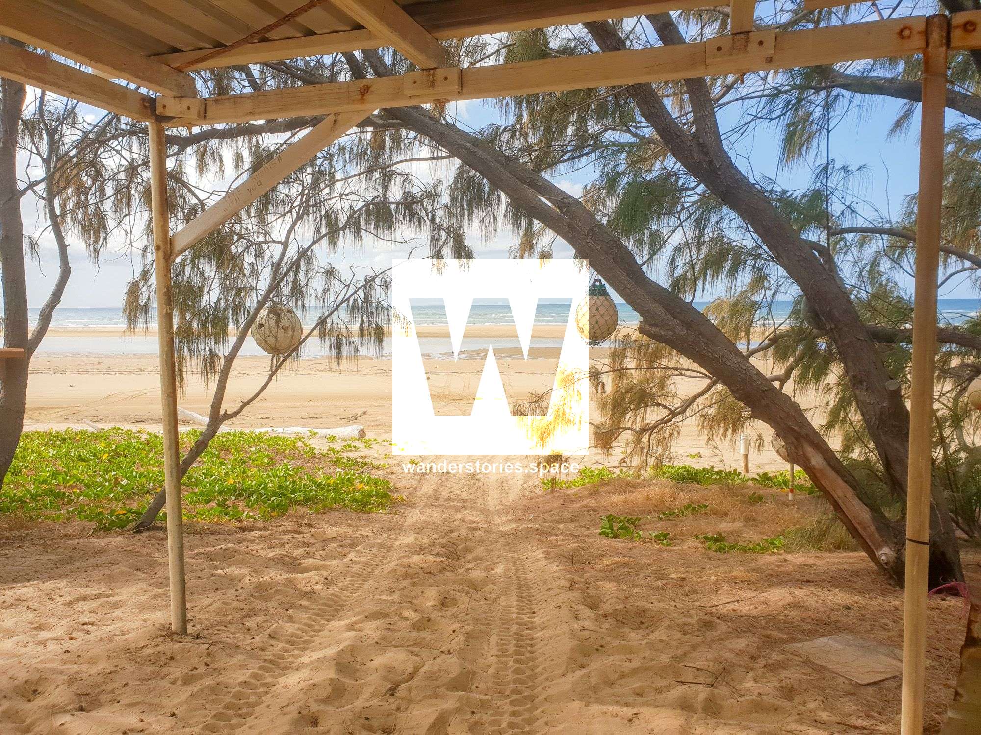
The walk is recommended as an overnight trip and for safety reasons you should camp away from the mangroves. Preferably camp north of the lighthouse, 15 kilometres from Alva. The light is a modern automatic one; the original was removed. Some 200 metres west of the light is the restored grave of a family member of a former lighthouse keeper. The grave used to be east of the light but has been moved because of beach erosion. Before setting off, ensure you are totally self-sufficient, especially with water and sun screening. Knowledge of tide times could be useful, as walking is easier at low tide. Signs at the outset at Alva banning camping relate to Alva and not to the cape.
THE PLAN
Day One
- Walk the east side beach for the long 15 kilometres to the light and grave, then preferably go a little further to set up camp.
- Take a walk without the packs for the remaining 5 kilometres to the remote and magnificent cape tip. You feel as if you are on some mid-Pacific coral atoll. There is no vegetation to be seen anywhere. Swimming may be unwise near the tip as currents appear strong, sharks and crocodiles. Marine stingers may also be present during the wet season. During the infrequent cyclones, the sea evidently washes right across the last couple of kilometres of the sand spit. You can opt to miss out on the last 5 kilometres and stay at base camp, set up a tarp or find a tree to get some shade and read a book.
Day Two
On the second day, you need to retrace the 15 km to Alva beachfront. No doubt the experience of this coastal wilderness will long be remembered.
WHAT TO TAKE
- Backpack
- Tent or bivvy or sleep under the stars!
- Sleeping mat & Sleeping bag
- Food and snacks for the days (1 x breakfast, 2 x lunch, 1 x dinner)
- 2 x 3 litres of water carrying capacity minimum. Recommended 4 litres of water per day. The only thing worse than carrying water is running out of water.
- First Aid Kit & PLB
- Inscent repellent
- Spare clothes for the trip home
- Tarp for shade (optional)
- Camping Permit
WHAT TO WEAR
- Sun protection (A wide-brimmed hat, long sleeve shirt, long pants)
- Sunscreen SPF 50+
- Appropriate footwear
POTENTIAL HAZARDS
- Swimming may be unwise near the tip as currents appear strong, sharks and it's NQ so crocodiles...
- Heat exhaustion, heat stroke, dehydration, and sunburn.
- Possible cold temperatures at night (15°C)
INTERACTIVE MAP
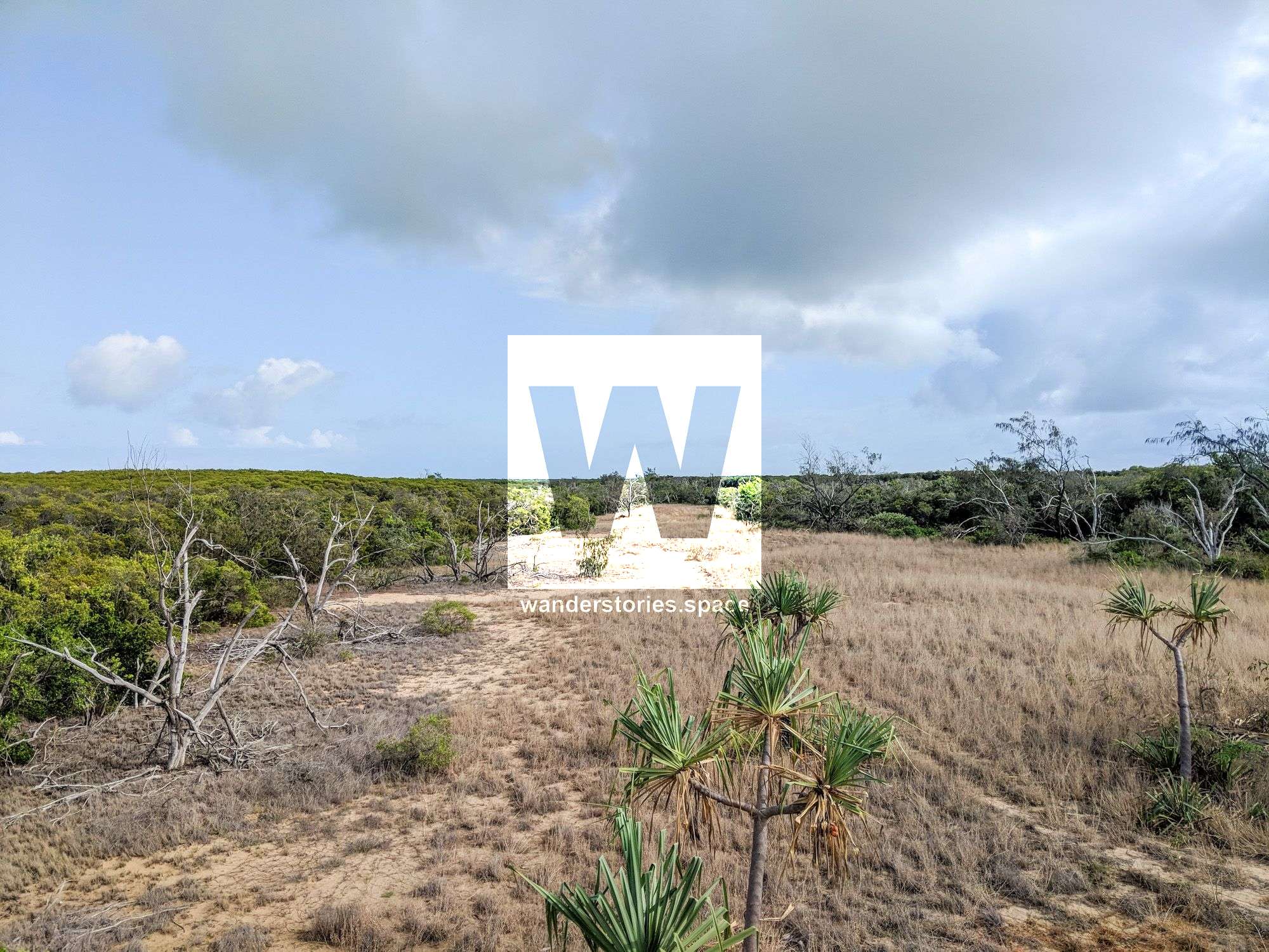
ENVIRONMENT AND VEGETATION
Bowling Green Bay and Cleveland Bay are also protected as Fish Habitat Areas and Dugong Protection Areas. Wetlands in Bowling Green Bay include seagrass meadows, mangrove and saltmarsh communities, as well as brackish and freshwater swamps. The site is internationally important in the migration of marine turtles, shorebirds and terns. It is also nationally and internationally important for several threatened species, including marine turtles, dugongs, inshore dolphins and waterbirds. Bowling Green Bay provides vital habitat for a range of species, with some of the largest colonies of fish feeding birds in eastern Queensland occurring there. Fresh and saltwater interact in Bowling Green Bay. Tidal waters push inland to form estuarine deltas. During flood conditions, freshwater from the nearby Burdekin and Haughton rivers flow into the bay, reducing the salinity of the water. The site’s multitude of habitats fit together in a complex, constantly changing mosaic influenced by these water flows. Some plants that usually thrive in very different levels of salinity grow side by side here.
This article, and all other articles, are for entertainment purposes only and are not to be used as a guide. Please see our Disclaimer for more information.