Things to do at Cape Pallarenda
Townsville Town Common Conservation Park and Cape Pallarenda Conservation Park borders the ocean and is full of places to go and things to do for those who love a breakaway from it all. Discover secret beaches and venturing deep into mystical forests without a worry.

Location - Townsville, North Queensland, Australia
Distance - 500 metres to 10+ kilometres depending on route
Duration - 30 minutes to several hours depending on route
Difficulty - 3/4, easy
Approach - 9 km, 12 minutes from Townsville City
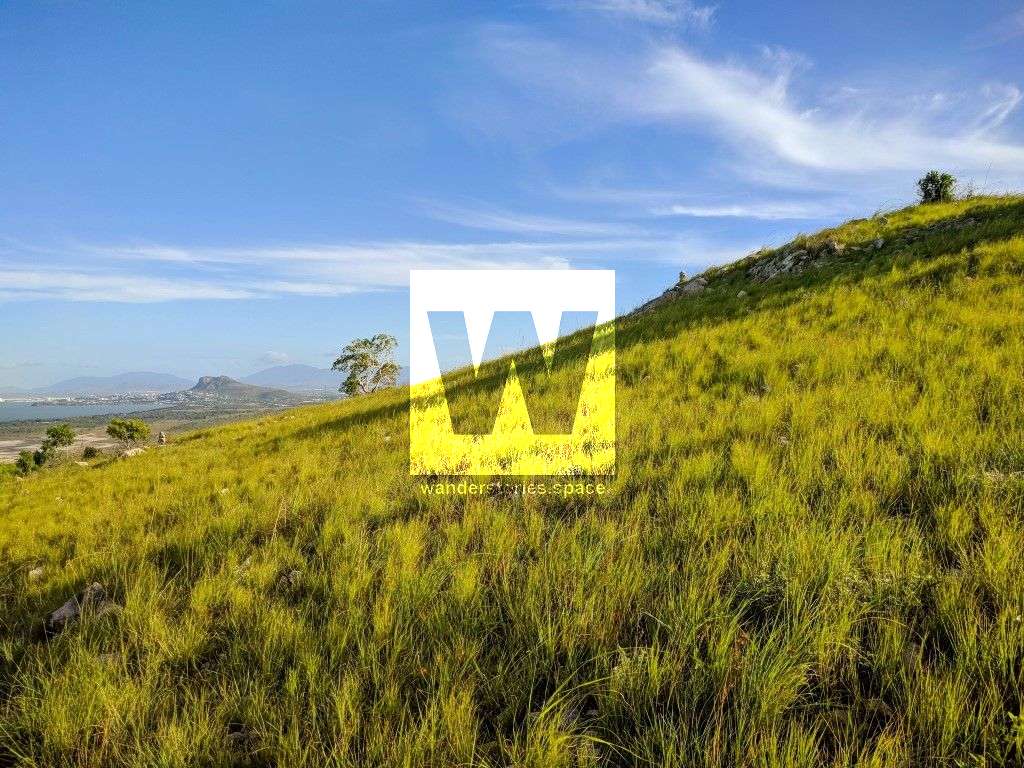
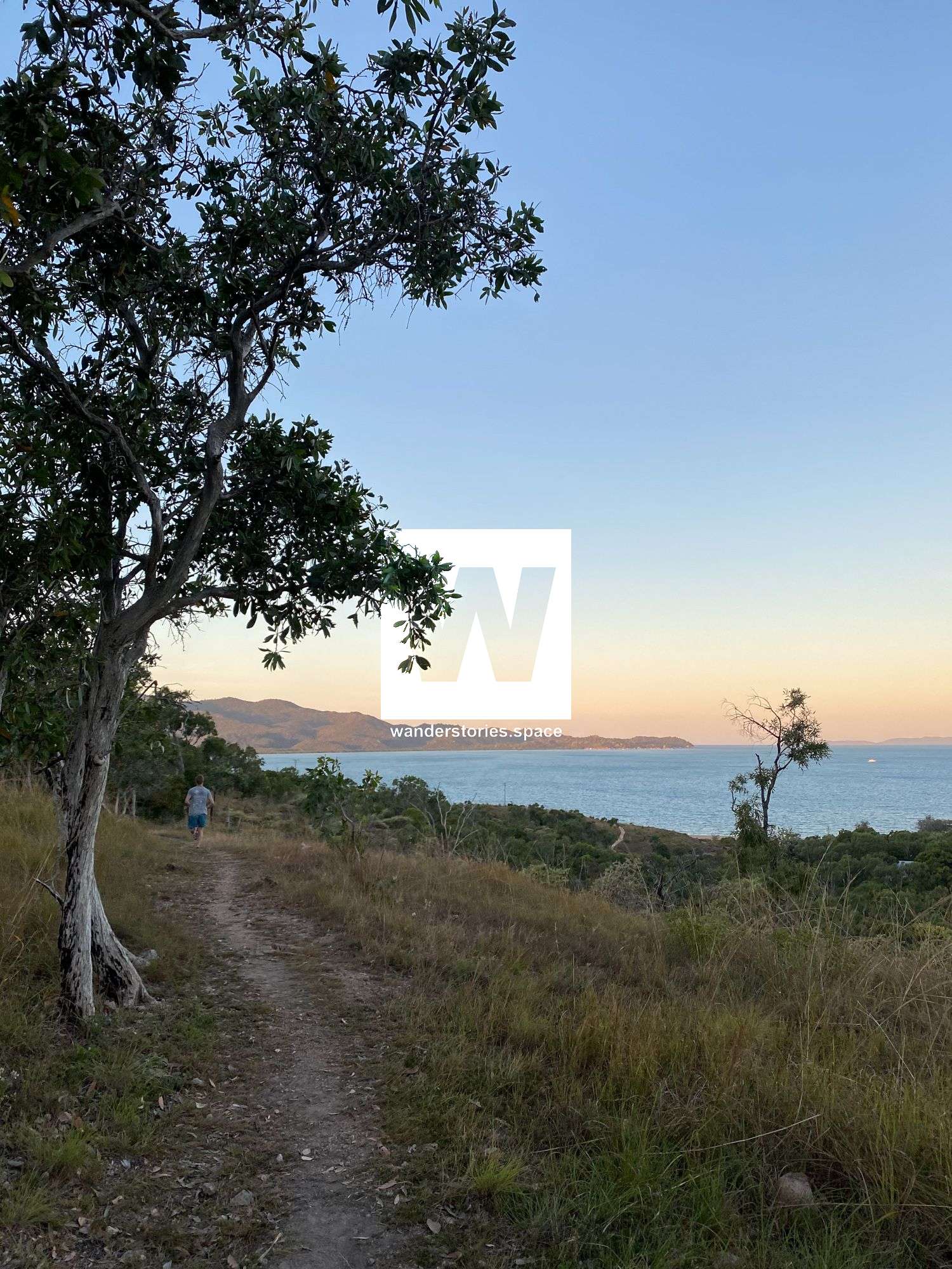
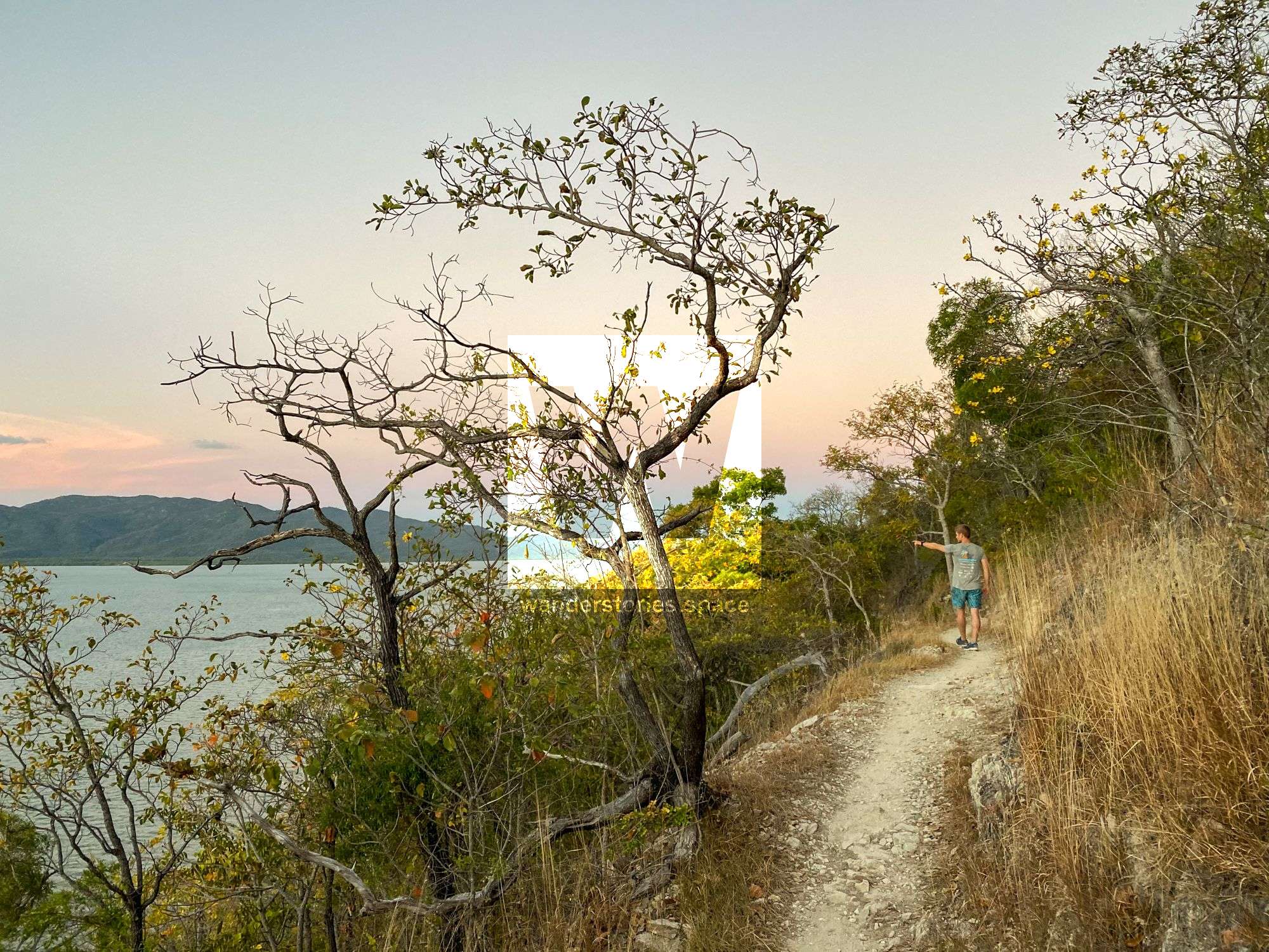
Manbarra Land of the Wulgurukaba people. Townsville Town Common Conservation Park and Cape Pallarenda Conservation Park border the ocean and are full of places to go and things to do for those who love a break away from it all. From Rowes Bay through to the tip of Cape Pallarenda, this area has it all: Recreational trails spanning mountain tops, sandy beaches, and coastal wetlands. Visit this area, absorb some fantastic views, and enjoy nature-based recreation close to Townsville City Centre. Set in a landscape of open woodland and rocky shores, the park protects various animal and plant life and is a gateway to the recreational Cape Pallarenda trails.
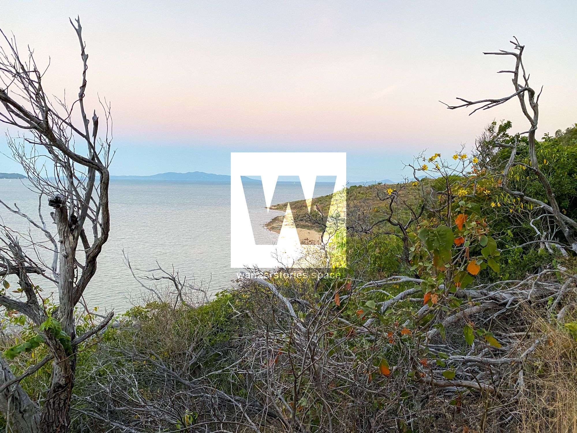
Cape Pallarenda - Photo credit Neil Olsen
Mountain bike riding, rock climbing, bushwalking, bird watching, wildlife viewing and plant identification are a few of the activities here, and discovering secret beaches and venturing deep into mystical forests without worrying about losing your way.
Townsville Town Common Conservation Park is six kilometres north of the Townsville city centre. Vehicle access to the bird-watching areas is via the main entrance on the turn-off from Cape Pallarenda Road. The gate at this entrance is open from 6.30 am to 6.30 pm daily. Automatic gates allow vehicles to exit at any time.
The best time of the year to visit Town Common is between April and June, after the wet season, when wildlife and birds, including wallabies, magpie geese, brolgas, and quite a few birds of prey, are abundant.
Both cycling and hiking through the park are popular activities. However, you must bring plenty of drinking water, wear sun protection (e.g., a hat and long-sleeved shirt and pants), and wear appropriate footwear. Remember to bring insect repellent as you may encounter a few mosquitoes, especially at sundown.
There are various treks throughout the park. Some are short, while a few are long and can be strenuous for some. The walks can be a few hours long, and general fitness should be a consideration. Since the area is reasonably open, there is a nice breeze to keep temperatures very comfortable most of the year.
On these walks, you will encounter birds, insects and possibly a snake and wander through patches of coastal vine scrub, eucalypt forest and open grassland on the ridgetops. The Lagoon and Freshwater Trails skirt the wetlands, passing Tegoora Rock (Croc Rock is nearby) on their way north. The wetlands are seasonal, so the roads may be closed during the summer rainy season, and parts of the track may be underwater or overgrown.
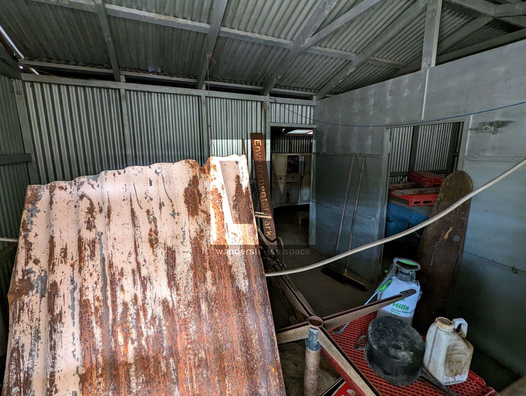
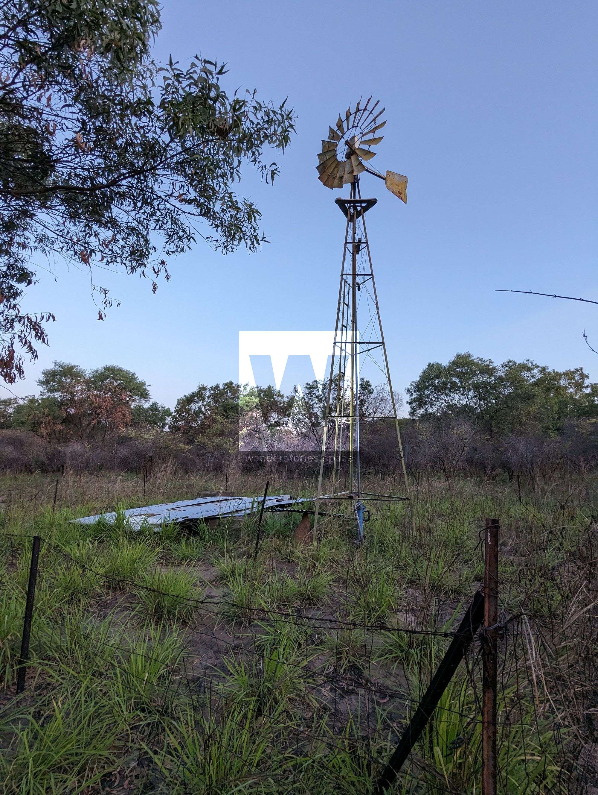
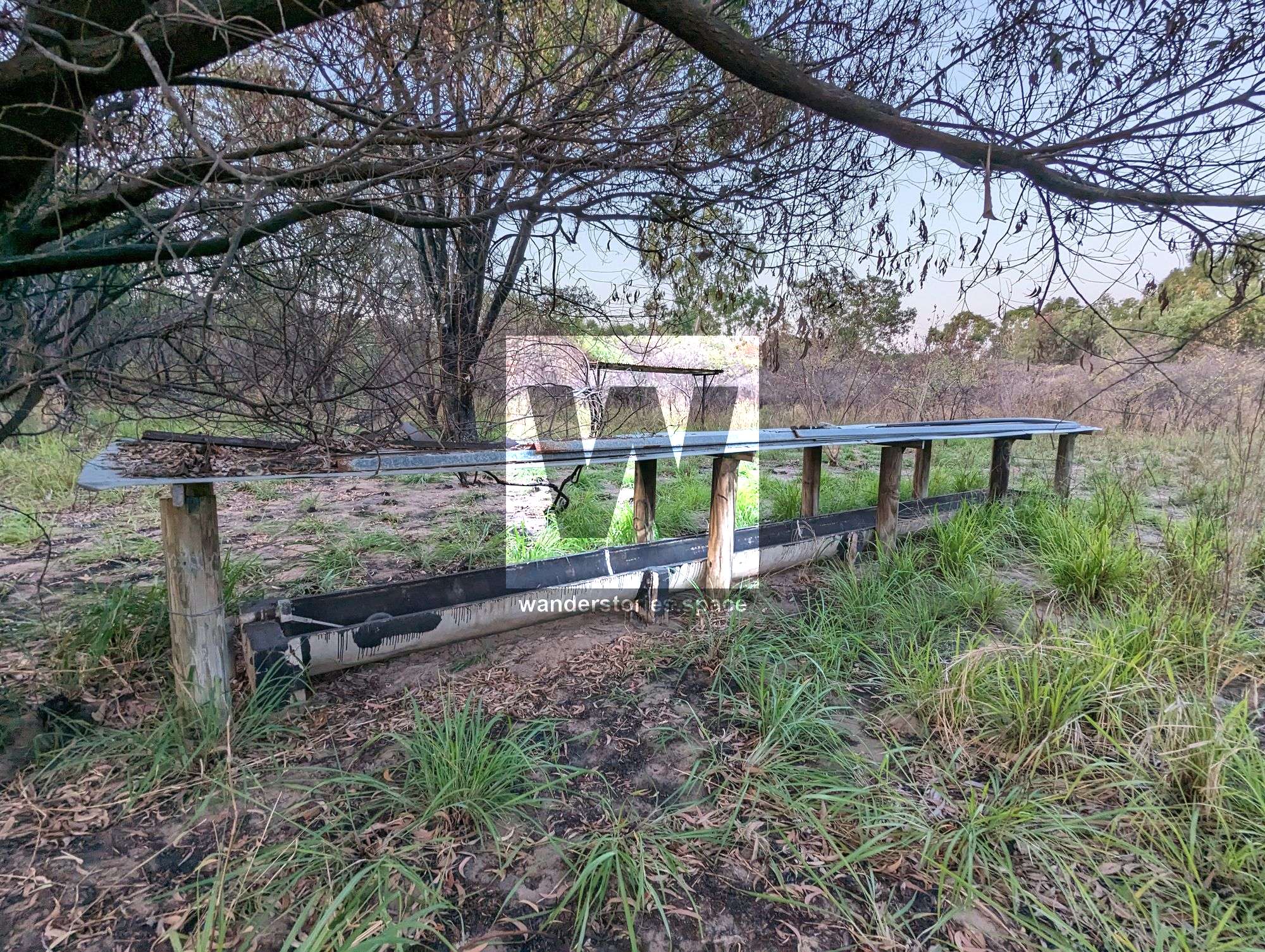
Even if you're not into long walks, there's something for everyone: fishing, boating, BBQs, playgrounds, WW2 history and even an unofficial naturalist beach, it can all be experienced. There are plenty of interesting shells washed up along here, which is fun for beach walking. Low tides are preferable for exploring. The area was used as a Quarantine Station and a network of cattle and horse stations. You can still see the remains of windmills, water troughs, fences and old roads.
Both Lagoon Trail and Freshwater Trail are park maintenance roads and run alongside the wetlands. They are very easy going, and walkers and mountain bike riders share these trails.
Trails
Lagoon Trail
Distance: 4.6 kilometres one-way
Time: allow 2 hours of walking time
Starting at the intersection of Freshwater and Shelly Beach trails or opposite Walter Nesbit Park at the end of Cape Pallarenda Road, this trail follows the edge of Freshwater Lagoon at the southern base of Many Peaks Range. The trail can become boggy after wet weather.
Freshwater Trail
Distance: 3.6 kilometres one-way
Time: allow 2 hours of walking time
Starting at the intersection with Shelly Beach and Lagoon trails, or 1.2 km along the eastern end of the Lagoon trail, Freshwater passes through coastal sand dune vegetation, crosses the dam wall of Freshwater Lagoon and provides access to the Freshwater and Jacana bird hides.
Carambil // Many Peaks Trail, Mount Marlow Range
Distance: 5.7 kilometres one-way
Time: allow 3 hours of walking time
Track grading: 3, Formed track. It may have some obstacles and have short, steep tracks and many steps.
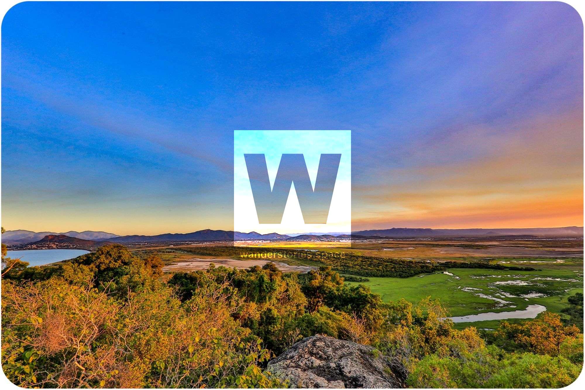
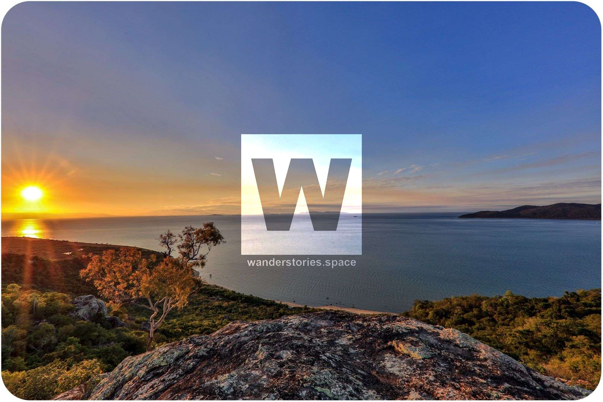
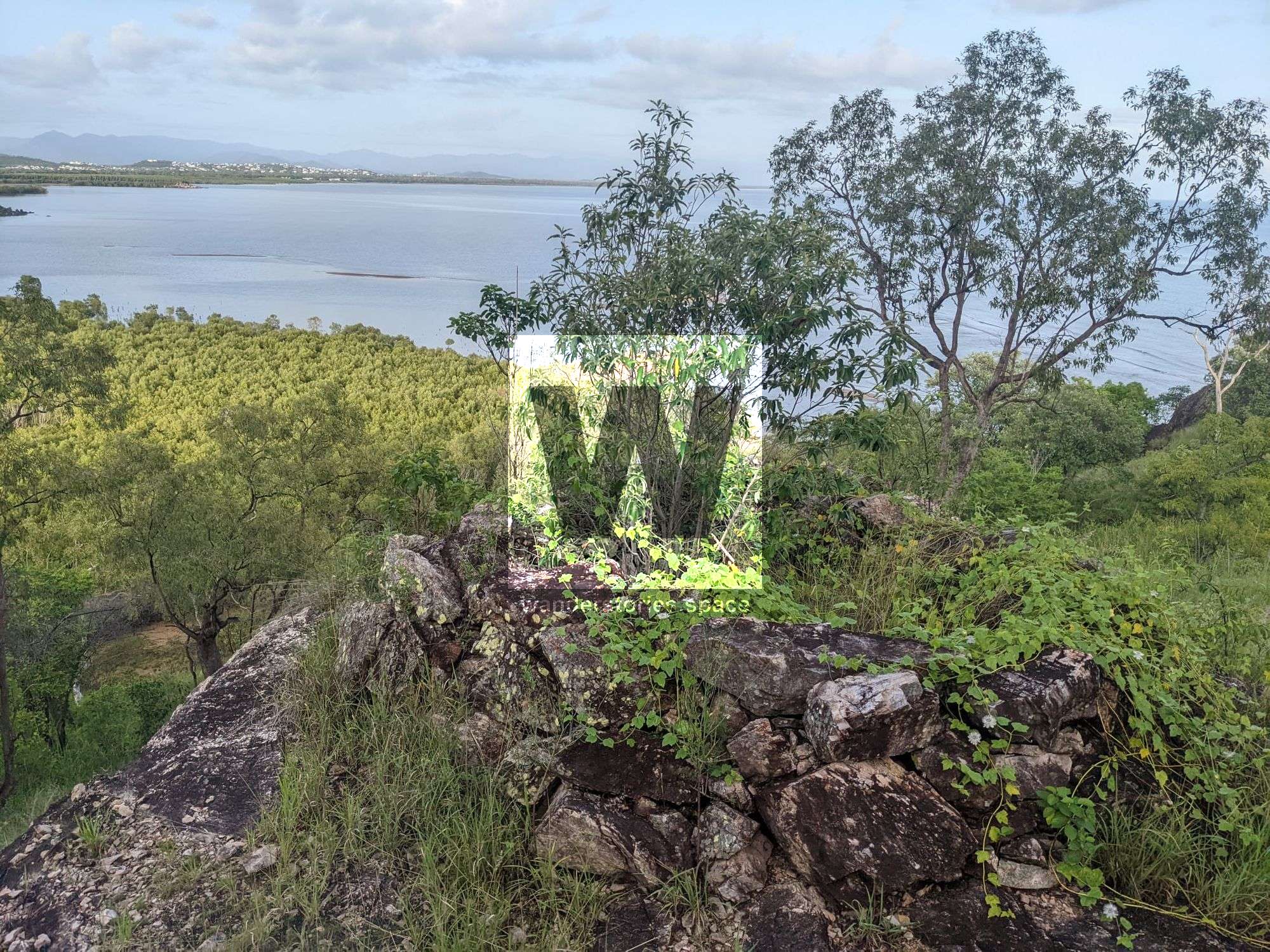
"Car-am-bil" is the Aboriginal name for the area. The walk has spectacular views over the Town Common wetlands and coastline. Many Peaks Track has several lookouts overlooking the airport, Town Common wetlands, Tegoora Rock, Castle Hill, Palm Island Group, Magnetic Island, and surrounding beaches. The trail takes you up to the summit of Mount Marlow (213 metres) and descending through vine thickets and woodland towards the wetlands and into the old Bald Rock car park. There is a bit of shade along the way, which is excellent in this climate! You will also pass by Bald Rock and Tegoora Rock. Tegoora means "thunder" in the Coonambella language.
The trail starts at Bald Rock on the west or 450 metres along the east end of the Lagoon. In some areas, it can be indistinct, and walkers must follow the orange trail markers.
It is suggested to walk from Pallarenda Park, and then you can choose to return via the Lagoon trail, which is the easiest; the Freshwater trail is a little longer but still easy walking on level ground, or the Under the Radar trail, which is the longest; you'll need to give way to mountain bikers. This creates a more interesting circuit.
Rowes Bay to Shelly Cove, Pallarenda
Distance: 800 metres one-way
Time: allow 1 hour
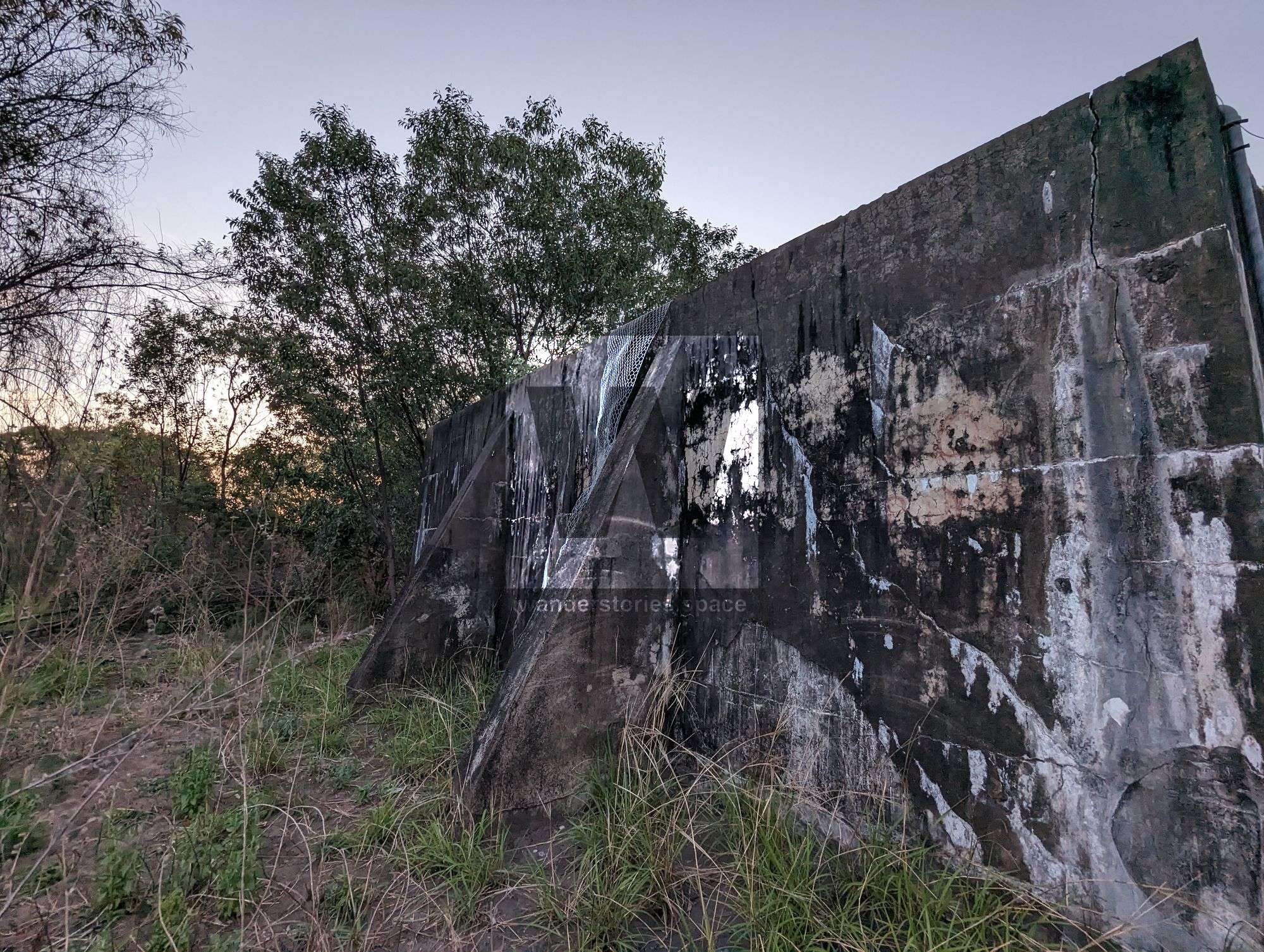
This short walk will take you past The old jetty (remains), World War II forts and gun emplacements, and then down into the unofficial naturalist beach. These WW2 structures are worth the walk and provide an excellent place to sit, relax and take in the view.
Forts Track
This track ascends the ridgeline, where you can find more bunker ruins and witness some stunning views, as well as the opportunity to explore the historical ruins. The trail ascends the ridgeline to the radar tower. There is a link track that takes you down to Under the Radar track.
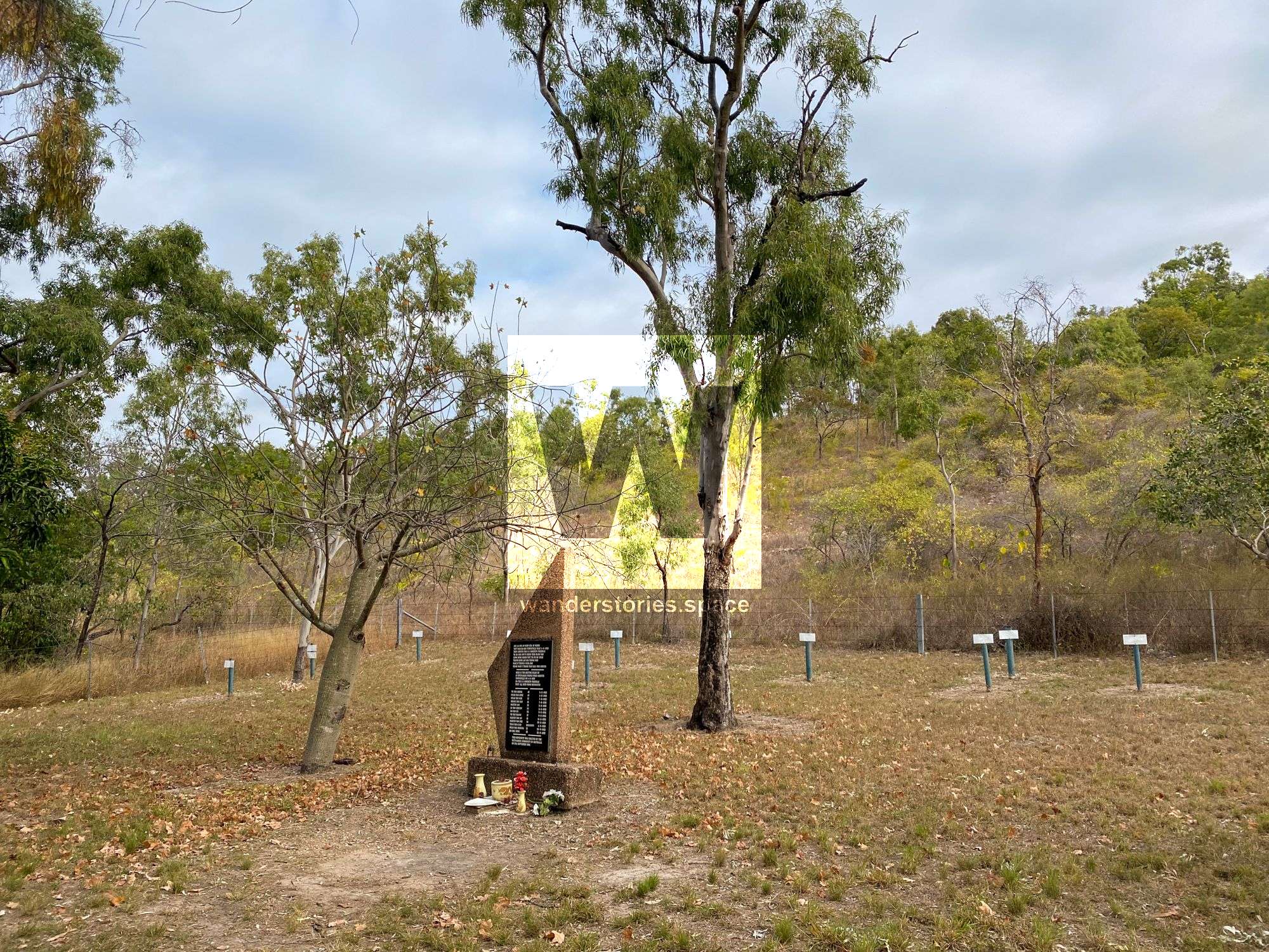
Graves Circuit
The Grave Circuit
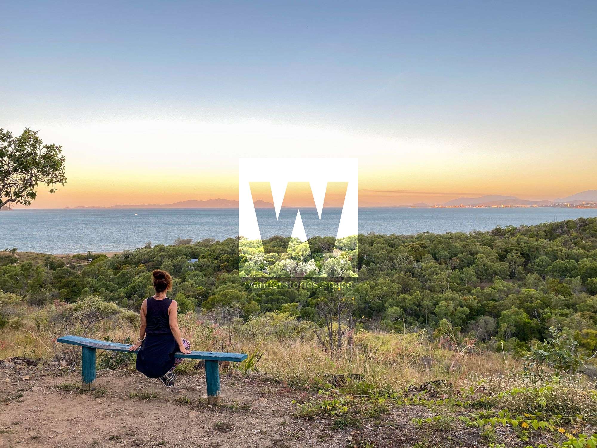
There is also a short loop track here that takes you past the historic Quarantine Station and gravesites. The trail then ascends the stairs leading to the old weir. Continue to follow the track past a viewpoint with a bench seat and finish at the Forts Track.
A perfect circuit is to start walking on the lower graves circuit, up past the old weir, and then ascend to the forts. Then, walk uphill and take the next trail along the link track to under the radar. From UTR, walk back via Shelly Cove. Alternatively, skip the graves track and start walking up the forts.
Other short walks
The Rowes Bay Wetlands Boardwalk
This short but beautiful boardwalk circuit is separate from the QPWS-managed parks and is instead located on Townsville City Council land.
Forest walk
This walk is 1.7 kilometres return and follows the edge of Barramundi Waterhole and is shaded by melaleucas, eucalypts and acacias. In the cooler parts of the day, this is a good area for viewing forest birds such as honeyeaters and kingfishers.
Payet's Tower bird hide
This bird hide is two stories high and requires a few stairs to reach the viewing platform. It's the first bird hide you get to on the Town Common Road and provides excellent views across the wetlands, perfect for the photographer.
Melaleuca viewing area
This viewing point looks across the wetlands, perfect for photographers. It is possibly named after the melaleuca trees nearby.
Pandanus viewing area
This viewing platform is just a pullover area with the path in front of the barrier being overgrown. It's possibly named after the Pandanus plants beside the railings. From this viewing area, you can see the wetlands clearly from ground level and the old WW2 structures. There is scant documentary evidence to elucidate the history behind these two concrete structures. What we know is pieced together from the recollections of some Townsville locals. It's believed that these bunkers were erected after the Second World War, serving as both shelters and vantage points for ground personnel managing gunnery targets.
Freshwater bird hide
From Freshwater Car Park, the 120-metre one-way trail brings you to Freshwater Bird Hide that overlooks Freshwater Lagoon. a haven of birdlife, perfect for the photographer.
Jacana bird hide
This walk is 450 metres one-way and takes you to a bird hide overlooking Freshwater Lagoon. It's an excellent place to spot nesting and foraging waterbirds.
Wetland walk
This walk is 850 metres return and meanders through the melaleuca forest within a seasonal wetland.
Other Trails
Shelly Beach Trail
Distance: 8.2 kilometres return
Time: allow 4 hours of walking time
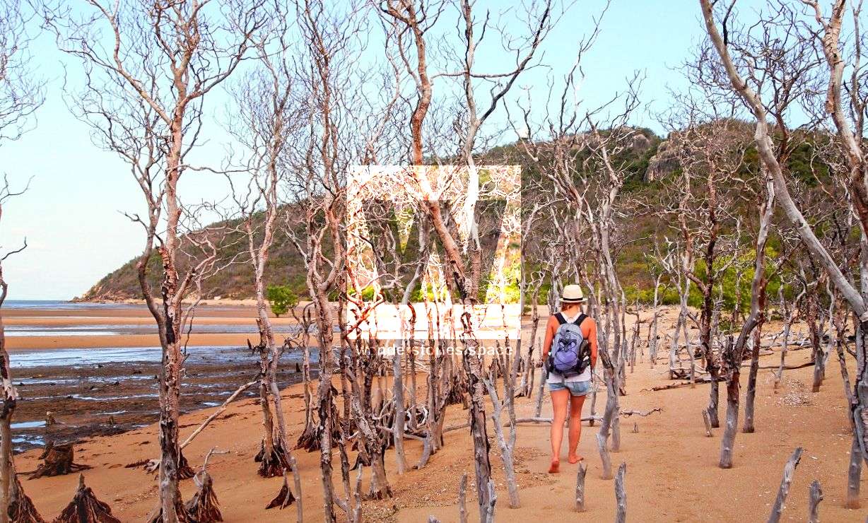
Shelly Beach is accessed via Shelly Beach Trail or via continuing past Shelly Cove at low tide. Following the edge of a large marine plain, the Shelly Beach Trail leads through coastal woodland before finishing at the western end of Shelly Beach. The northern part of this trail, towards the beach, is soft and sandy and can be physically demanding.
Under the Radar (Mountain Bike Trail)
Distance: 11 km one-way
Time: allow 5 hours of walking time or 1.5 hours of riding
This narrow, two-way trail is designed for cross-country mountain biking. Walkers must be alert and considerate of mountain bike riders approaching from either direction. It provides excellent views of the islands to the north and the Coral Sea beyond and crosses the northern and western slopes of the Many Peak Range. UTR (Under the Radar) is relatively easy but has rough surfaces and some steep sections.
At its eastern end, the trail begins 700m along the Shelly Cove trail, and at its western end, UTR begins 500m along the Shelly Beach trail in Townsville Town Common Regional Park. There is also a link trail that leads to Smedley's trail (see map).
Smedley's trail
Distance: 6.8 kilometres circuit
Time: allow 3 hours of walking time
Accessed via a link from UTR (6.6 km from the eastern beginning of UTR) or 2.8 km from the beginning of the Shelly Beach trail. This circuit winds around Smedley's Hill, taking in panoramic views over the Town Common wetlands, Bohle River and the Coral Sea to the north. It is a challenging but rewarding ride with steep sections, rock obstacles, rock armoured corners and optional B lines rated as difficult. WWII 'sangars' were constructed of loose rocks dotted all over Smedley's Hill and Many Peaks Range. The sangars were used by the soldiers who kept watch for any approaching Japanese.
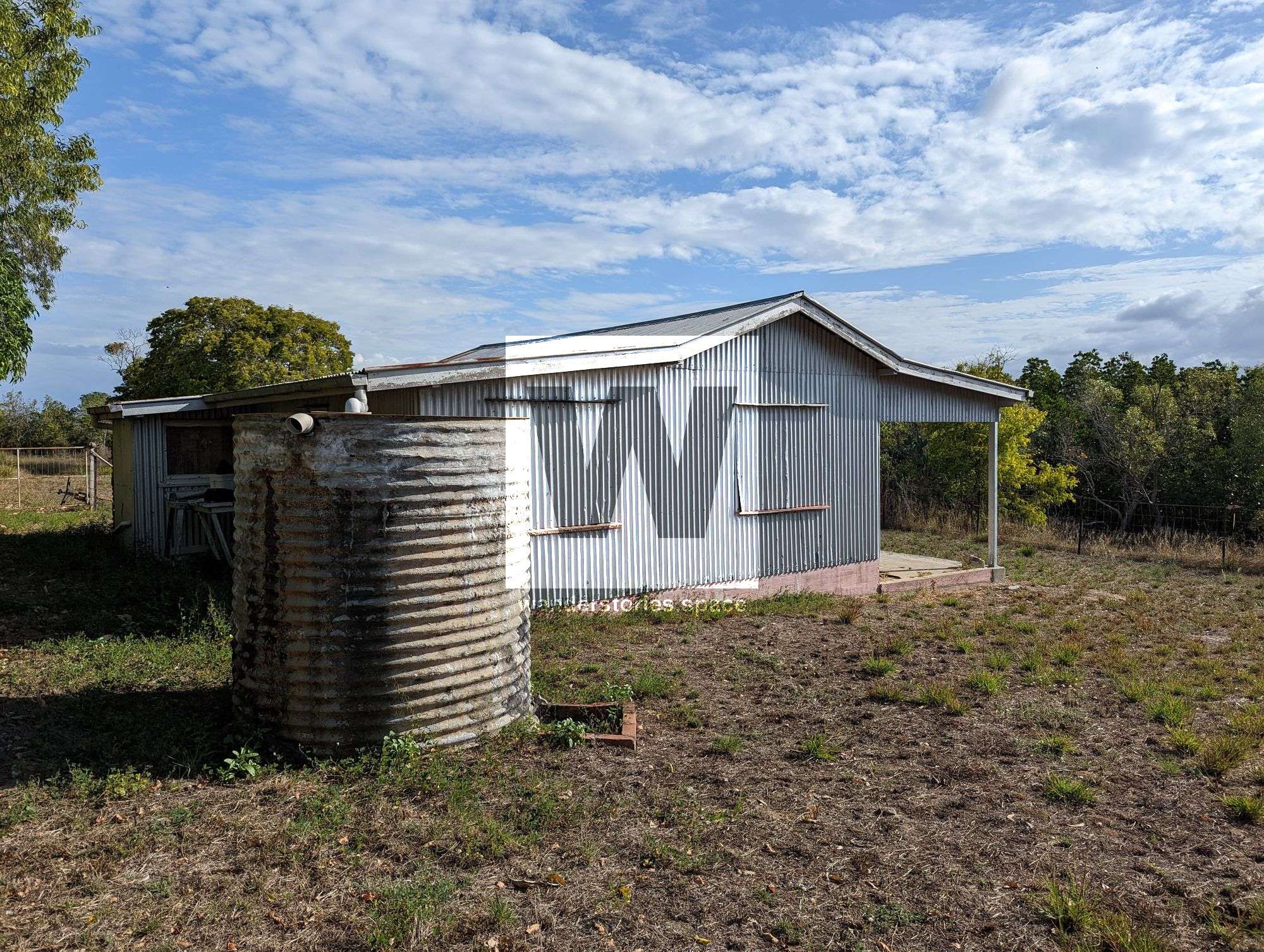
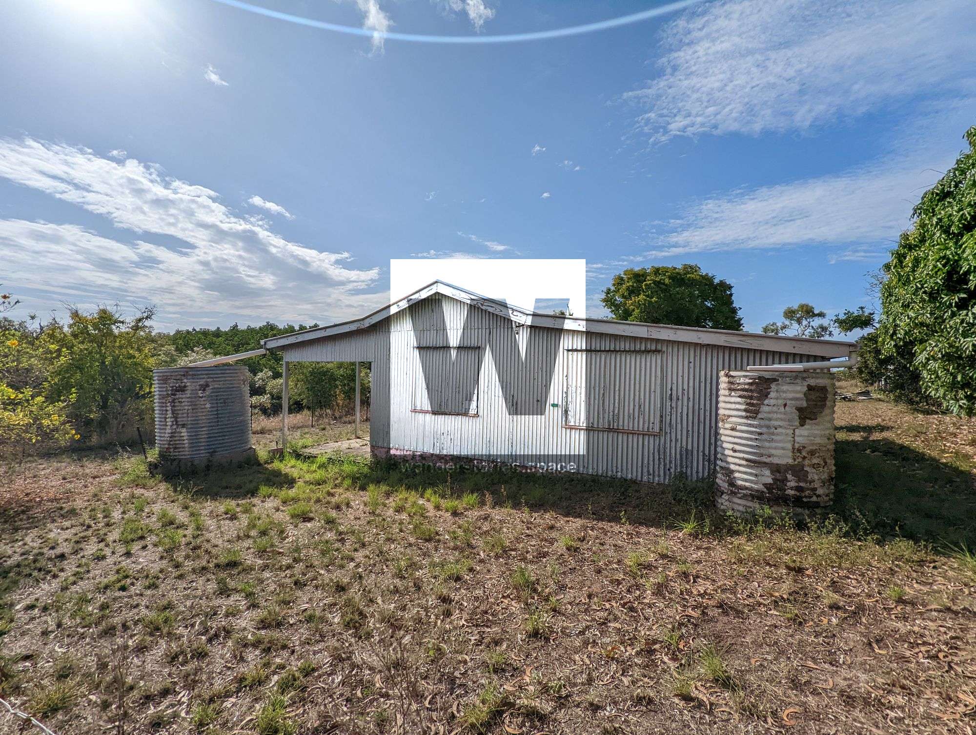
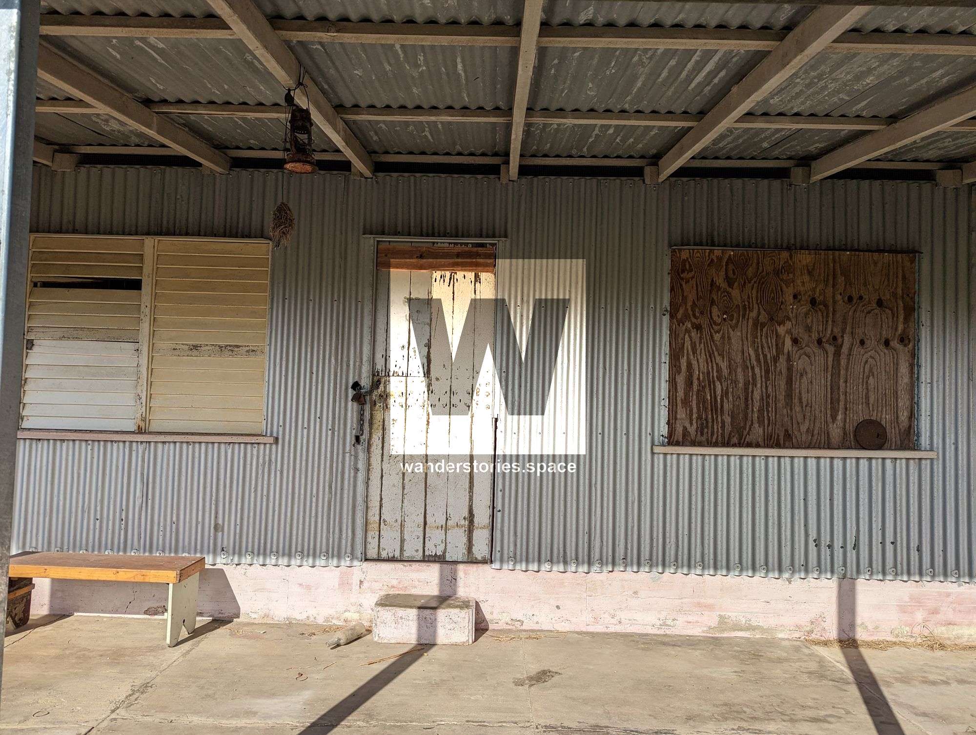
Smedley's homestead
Smedley's homestead
These buildings are located near Smedley's Hill and the Bohle River and have been registered by the Australian Heritage Commission as part of the National Estate. The homestead complex was established in the 1800s on leasehold land occupied by members of the Smedley family, who were part of a minor commercial fishing community-based at Shelly Beach.
This complex represents the type of building construction typical in the area more than a century ago. The buildings also symbolise the community's lifestyle which lived and worked in this area. This site is a part of Queensland's heritage.
The Great Shelly Loop
This trail is a great loop circuit for the more adventurous. Walk along the Shelly Cove trail and follow the beach to the main bay - best at low tide. Cross the stream and continue along the beach, passing a shelter and crossing another stream. Walk back along Shelly Beach Trail towards Townsville and join in with Lagoon Trail. See the interactive map below:
Interactive Map
See also the Townsville Town Common Conservation Park map and the Cape Pallarenda Conservation Park map.
Geology
The Town Common wetlands and lowlands were shaped over millennia by sand dune formation and water drainage mechanisms, such as erosion and sedimentation. The Bohle River encircles Town Common to the west, the Coral Sea to the northwest and east, and Townsville Airport (Garbutt) to the south.
The terrain is largely flat and at sea level, except for Mount Marlow in the Many Peaks Range, located in the suburb's northeast. At 213 metres, Mount Marlow is the highest point. The western section features a floodplain crisscrossed by mangrove-lined tributaries of the Bohle River.
Shelly Beach is situated on the northern coastline of the area but is not publicly accessible by vehicle - QPWS gates.
History
Residential areas in the suburb extend only three streets away from the beach and are bordered by undeveloped land. Access is via Cape Pallarenda Road, which runs northward along the coast from Rowes Bay. To the north lies the Cape Pallarenda Conservation Park.
The area is primarily undeveloped, and a significant portion is within the Townsville Town Common Conservation Park. Developed land in the southeast includes a golf course, the abandoned Garden Settlement Aged Care Village on Cape Pallarenda Road, and a park. In August 2016, Blue Care, the organisation running the aged-care village, announced plans to relocate the residents to a new facility in Mount Louisa. The golf course utilises treated wastewater from the Mount St John Wastewater Treatment Plant for irrigation.
Town Common was officially designated as public land in 1869, four years after Townsville's establishment. A section of the wetlands became a sanitary reserve in 1900, and a pasturage reserve was set up in 1914.
The suburb was officially named and restricted on 12 June 1992. Before this, it was known as Cape Marlow. The name Pallarenda is thought to have been coined by naval officer George Poynter Heath in 1864, possibly influenced by castaway James Morrill, who had lived with local Indigenous people.
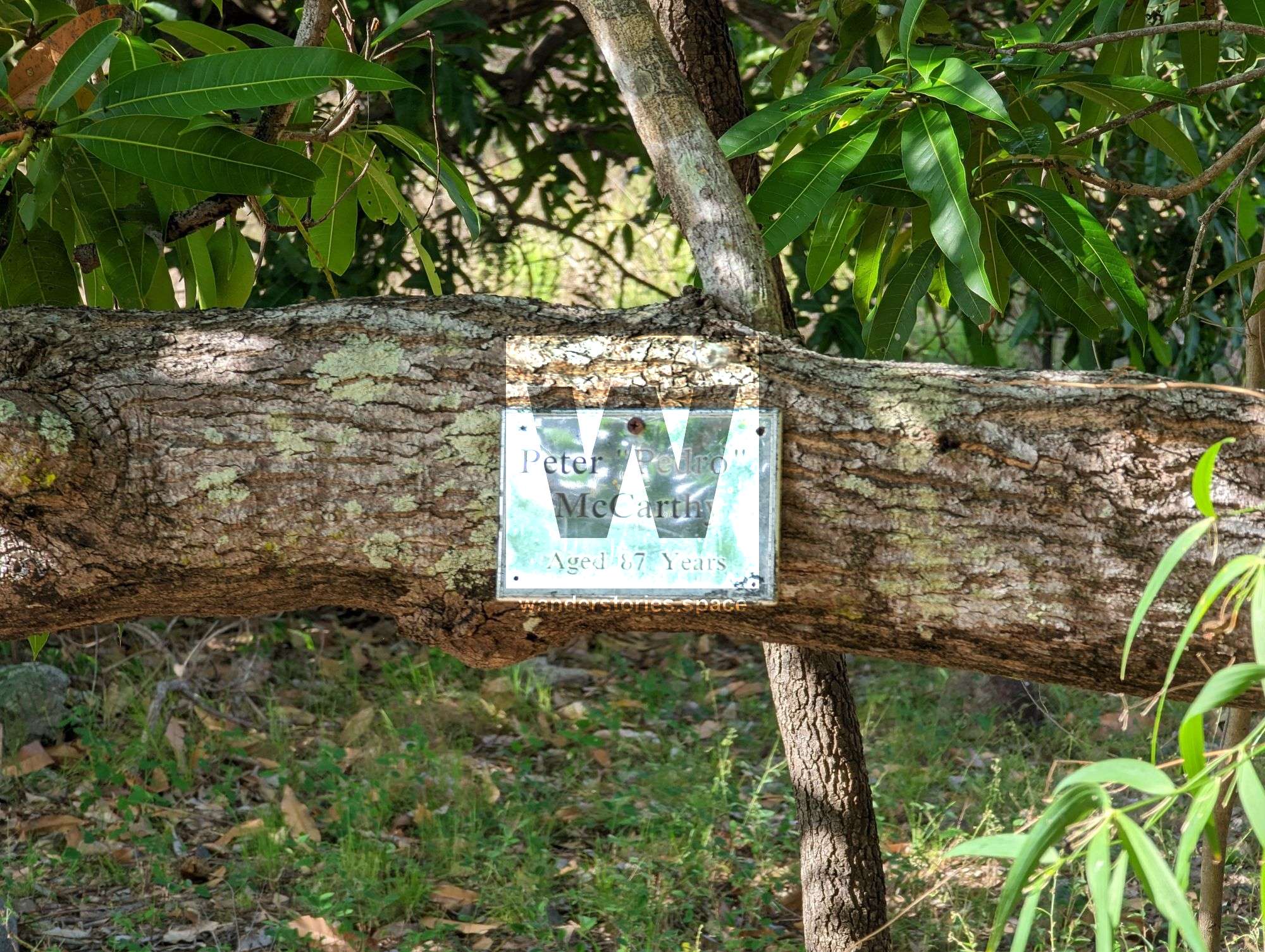
Pallarenda is home to several sites listed on the Queensland Heritage Register, including the Cape Pallarenda Quarantine Station Environmental Park.
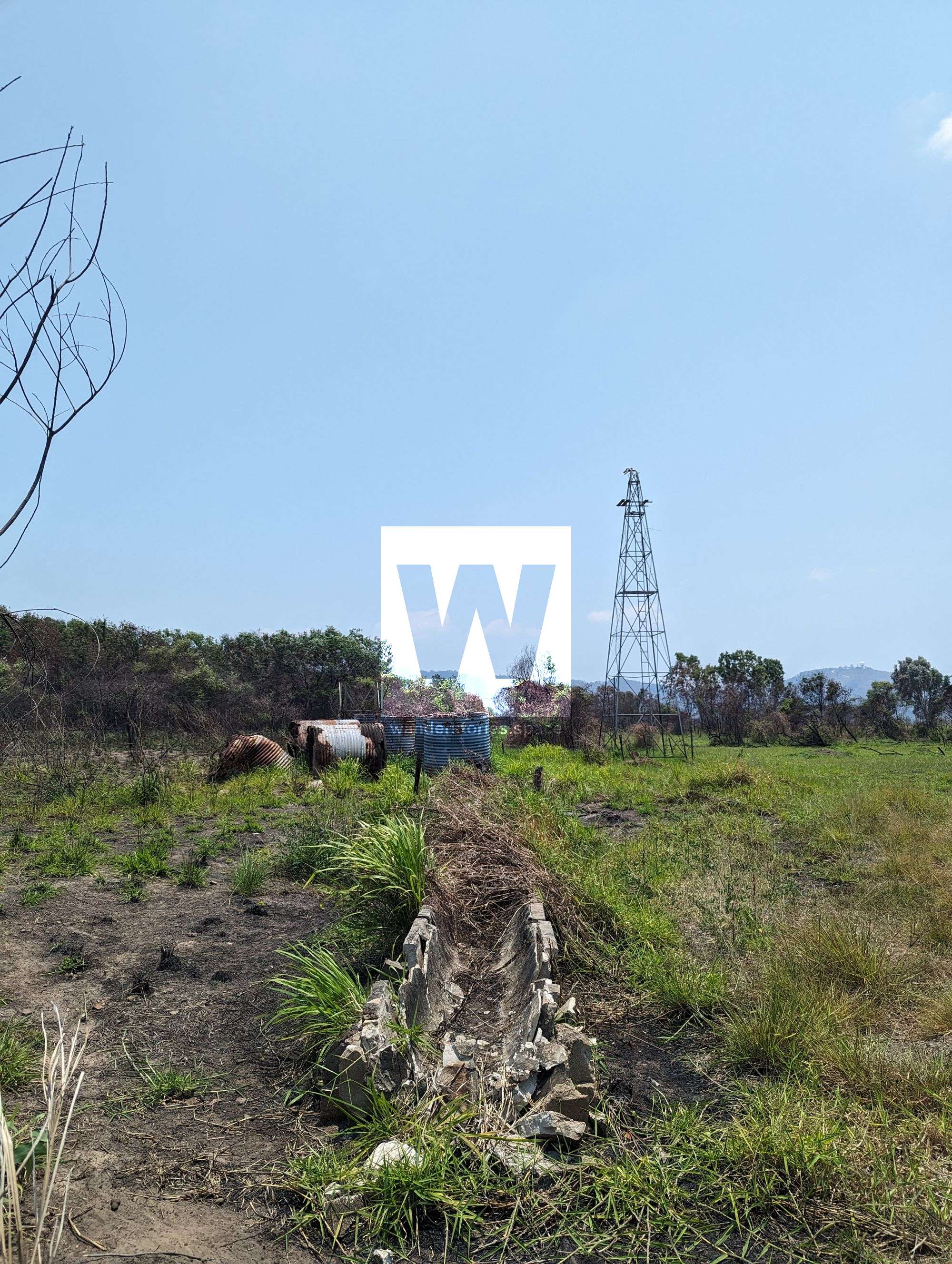
Today, you can still see the network of horse and cattle yards and the remains of windmills, water troughs, fences, and old roads.

Abandoned Cattle Yards & WWII Sangars
Notes
Cape Pallarenda is a Marine Park Zone A, so you must check on limits with fishing. At the time of writing, the limit was one line per fisherman and certain bag limits on crabs, oysters, etc. Remember that domestic animals are not allowed in this park. Please note that camping is not permitted in Cape Pallarenda Conservation Park.
Those metal tower structures located in the wetlands - which can be seen from many vantage points - are Airservices Australia High Frequency (HF) radio antennas.
Kapoks (Cochlospermum gillivraei) are deciduous trees growing on the rocky hill-slopes beside Alligator Creek. They break out in brilliant yellow flowers after the dormant winter months. Leaves then follow before the flowers form large seed pods that eventually split open, revealing a mass of white fluffy seeds. During the early settlement of Australia, these soft seeds were used to stuff pillows and mattresses.
Dangerous stinging jellyfish (stingers) may be present in the coastal waters at any time but occur more frequently in the warmer months. If you do enter the water, a full-body lycra suit, or equivalent, may provide a good measure of protection against stinging jellyfish and sunburn.
Remember to be crocwise, as it's crocodile country.
This article, and all other articles, are for entertainment purposes only and are not to be used as a guide. Please see our Disclaimer for more information.