Homevale National Park

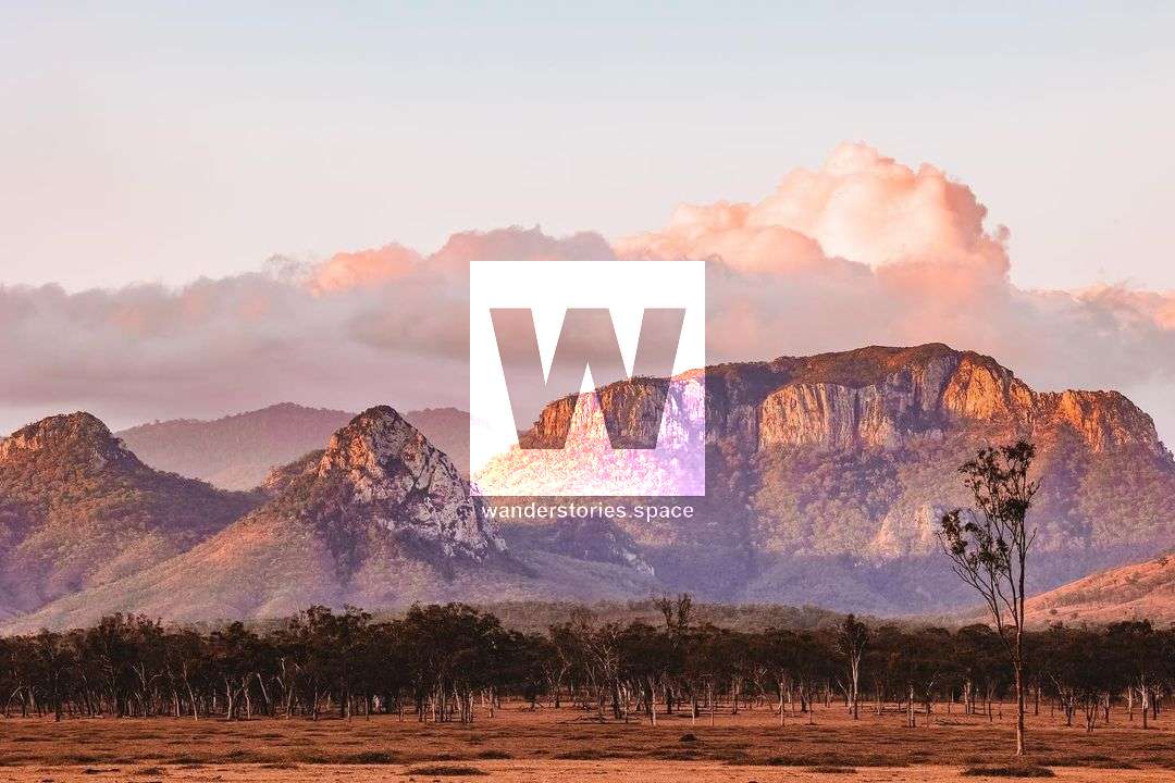
North of Nebo, by 50 kilometres, is Homevale National Park. Views of a wide, barren terrain sculpted millions of years ago are punctuated by dramatic cliffs, peaks, and spires. The park safeguards important fossil sites, brigalow, and open woods.
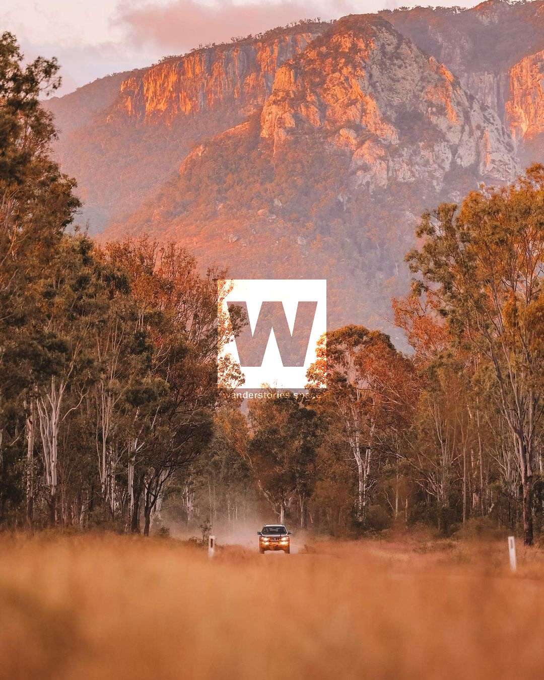
Here, cliffs, peaks, and spires are common. Older basalt rocks were covered in lava by a series of eruptions thirty million years ago, producing strong granite formations. Basalt eroded more quickly throughout time, leaving behind the magnificent Diamond Cliffs, Marling Spikes, and Sydney Heads that you see today.
These volcanoes, which formed throughout the Bowen Basin, also created gold deposits and excellent basalt soils that now support a wide variety of plant life. Open grassy woodlands, notophyll vine forests, dry softwood scrub, open eucalypt forests, and brigalow-belah communities are some of the plant groups that can be found in Homevale.
With fossils from the Permian epoch, significant fossil locations are also found (280-225 million years ago).
Mackay Highlands Great Walk (Eungella - Mount Britton)
Distance: 56 kilometres one way
Duration: 3-5 days
Grade: Moderate to difficult.
The 56-kilometer-long Mackay Highlands Great Walk can be completed in three to five days. It is advised for seasoned walkers with good levels of fitness. Discover palm groves and rain forests, peaceful country roads, rural communities, cliffs, and peaks. Prior to trekking this track, it is advised that you get in touch with Queensland Parks and Wildlife Service.
Drive 15 kilometres one-way from Moonlight Dam to Mount Britton (20 minute drive). Only four-wheel drive vehicles should use this gravel road. Please keep an eye out for walkers in shared areas. You can reach Mount Britton, a former gold mining settlement, after a little drive. All of the buildings are gone, but Isaac Regional Council keeps the street signs on the original routes and provides old photos so you can see the village in the 1880s.
Experience Mount Britton's gold rush history firsthand. At Mount Britton, a once thriving gold mining town founded in 1880, you can follow in the footsteps of the gold rush pioneers. The historic grid of streets is peppered with interpretive signs that keeps the memory of what once was present even though the structures are long gone.
This a conveniently located spot provides the chance for day trippers or independent campers to pull up, rest, and see more of the area. Water, picnic shelters, and a toilet are available in the large, grassy site, which has neither taxes nor time restrictions. At Mount Britton, you can unwind while reliving a fascinating past, light a campfire, and experience magnificent sights in the morning.
The surrounding landmarks, that explorer William Landsborough named in 1856, can be seen clearly from a lookout above camp, including Mount Britton, the weathered trio of rock spires known as the Marling Spikes, and the stunning Sydney Heads, which feature sheer cliffs that glow with vivid yellow and red hues as the sun rises and sets.
Interactive Map
History
Ludwig Leichhardt, who travelled through the region that is now known as Nebo for the first time in 1845, was followed in 1856 by William Landsborough, who gave the majority of the nearby features their names. When the town was surveyed in 1865, Fort Cooper was given legal status. However, due to popular demand, the name was changed to Nebo in 1923, in honour of Nebo Creek.
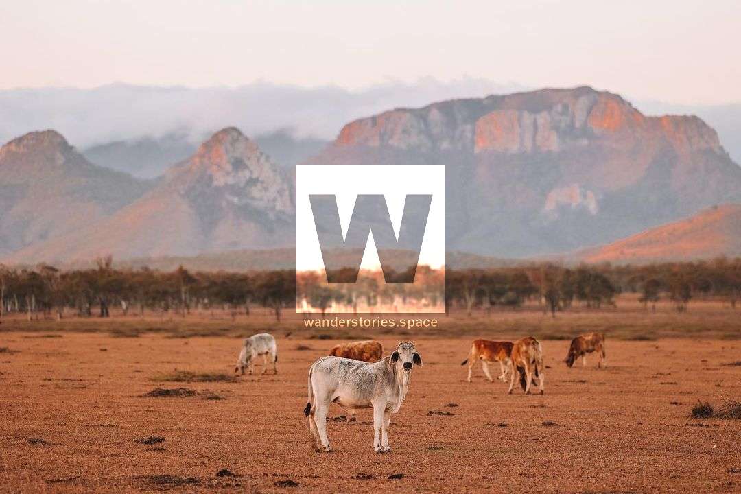
Sheep were Nebo's main crop in the early decades, but as the region proved unsuited for sheep, they were replaced with cattle. Cattle were driven by drovers to the Mackay market until the 1940s. Overnight camps were situated along the route, which is roughly where the Peak Downs Highway is now, throughout this multi-day journey.
In the past, many of the outstanding race, stock, and thoroughbred horses that were bred in and around Nebo were exported to the Indian army. With the Nebo Showgrounds serving as the host location for several events throughout the years, including the Nebo Rodeo, campdrafts, cutting, barrel racing, polocrosse, and pony club activities, the strong connection to horses and horse sports remains today.
Camping
Camping is permitted at Mount Britton for the self-sufficient camper. Moonlight Dam camping area is located on the edge of Moonlight Dam for a small fee. It's a quiet area and a popular place for birds to drink at dusk. Moonlight Dam offers classic camping facilities with water and toilets. Open fires are not permitted.
Mount Britton (715m), The Marling Spikes (650m), Sydney Heads (915m), Mt Adder (695m), Boundary Fap Mtn (675m), and a few other mountains the bordered nearby, like Borders Epsom State Forest, Crediton State Forest, Homevale Resources Reserve. See also Homevale Conservation Park and Homevale Resources Reserve.
This article, and all other articles, are for entertainment purposes only and are not to be used as a guide. Please see our Disclaimer for more information.