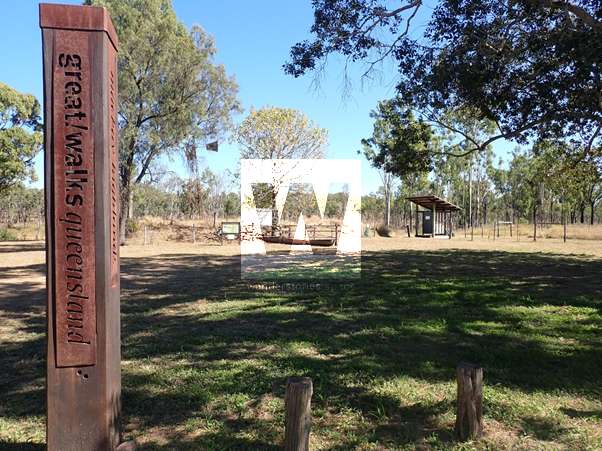
Mackay Highlands Great Walk
The Mackay Highlands Great Walk, which starts at the township of Eungella, 80 kilometres west of Mackay, is a medium-to-hard multi-day hike through wet rainforest, farming communities, dry eucalypt woodlands, and a mountain range.

Location - Mackay Highlands, Eungella National Park, North Queensland, Australia
Grade - 5, difficult, recommended for experienced bushwalkers only
Distance - 56 kilometres, one way (north to south)
Time - 3-5 days, one way
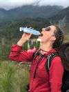
The Mackay Highlands Great Walk, which starts at the township of Eungella, 80 kilometres west of Mackay, is a medium-to-hard multi-day hike through wet rainforest, farming communities, dry eucalypt woodlands, and a mountain range. While sections of the walk can be broken up into several smaller segments, as day trips, the entire walk can be completed as a single hike over several days using the well-maintained camping facilities along the way. This trip can be done at a relatively fast pace, as reflected in the descriptions below, or at a more relaxed pace by adding an extra night at Broken River and at Moonlight Dam.
The earlier sections of this hike are frequented by plenty of day-hikers, as these areas are close to Eungella and Broken River townships. The subsequent sections, however, are far less busy, involving few, if any, encounters with other people. These latter sections are also long and strenuous, requiring careful preparation and a high fitness level. After leaving Broken River, mobile phone reception also becomes quite patchy with the best reception likely to be found at the camping area at the top of Denham Range. Therefore, it's good to have a physical map, GPS, or maps on your device that are available and accessible offline.
The Mackay Highlands Great Walk also has a dedicated website that is managed by Queensland Parks, and several guides, including Derrick Stone's Walks, Tracks & Trails of Queensland's Tropics (2018), also feature this walk. While these resources provide important and helpful information, as well as historical insights and notes about native flora/fauna, supplementing the information that is already in the public domain with more detailed track notes here will certainly be helpful for future walkers.
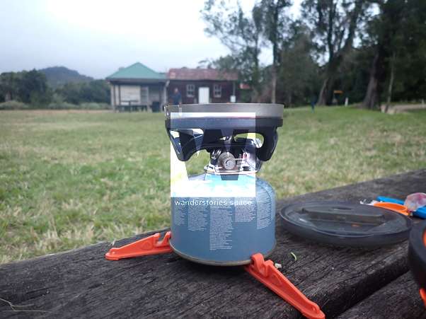
Note that campsites must be pre-booked in advance on the Queensland Parks website. It is also important to note that, because this is a one-way walk, a ride back to your vehicle in Eungella is needed at the end of the walk. There have been tour companies based in Mackay offering this service for roughly AU$300-AU$400. This seemingly steep price tag factors in the need for the tour operator to drive out from Mackay and then drive approximately three hours from the end of the walk back to Eungella. Make sure you arrange this service in advance, as careful planning is needed on the last day of the hike to make the rendezvous point by the prearranged time. Alternatively, it is possible to organise a car shuttle by leaving a second vehicle at the Mount Britton end. Again, plan ahead.
Interactive Map
Queensland National Parks Map (PDF)
The Great Walk
Day 1: Eungella to Crediton Hall, via Broken River (~22.2 km)
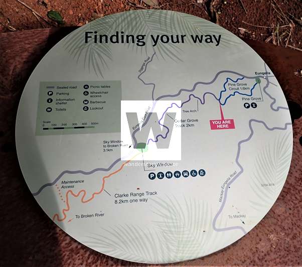
The walk commences at the township of Eungella on the well-marked Pine Grove Circuit, which is accessed near the back of the Eungella Chalet. This is a popular track with families and can be done as a loop returning back to the vehicles if just taking a short walk. Or, this segment can be followed to the start of Cedar Creek Trail to continue the rest of the Great Walk.
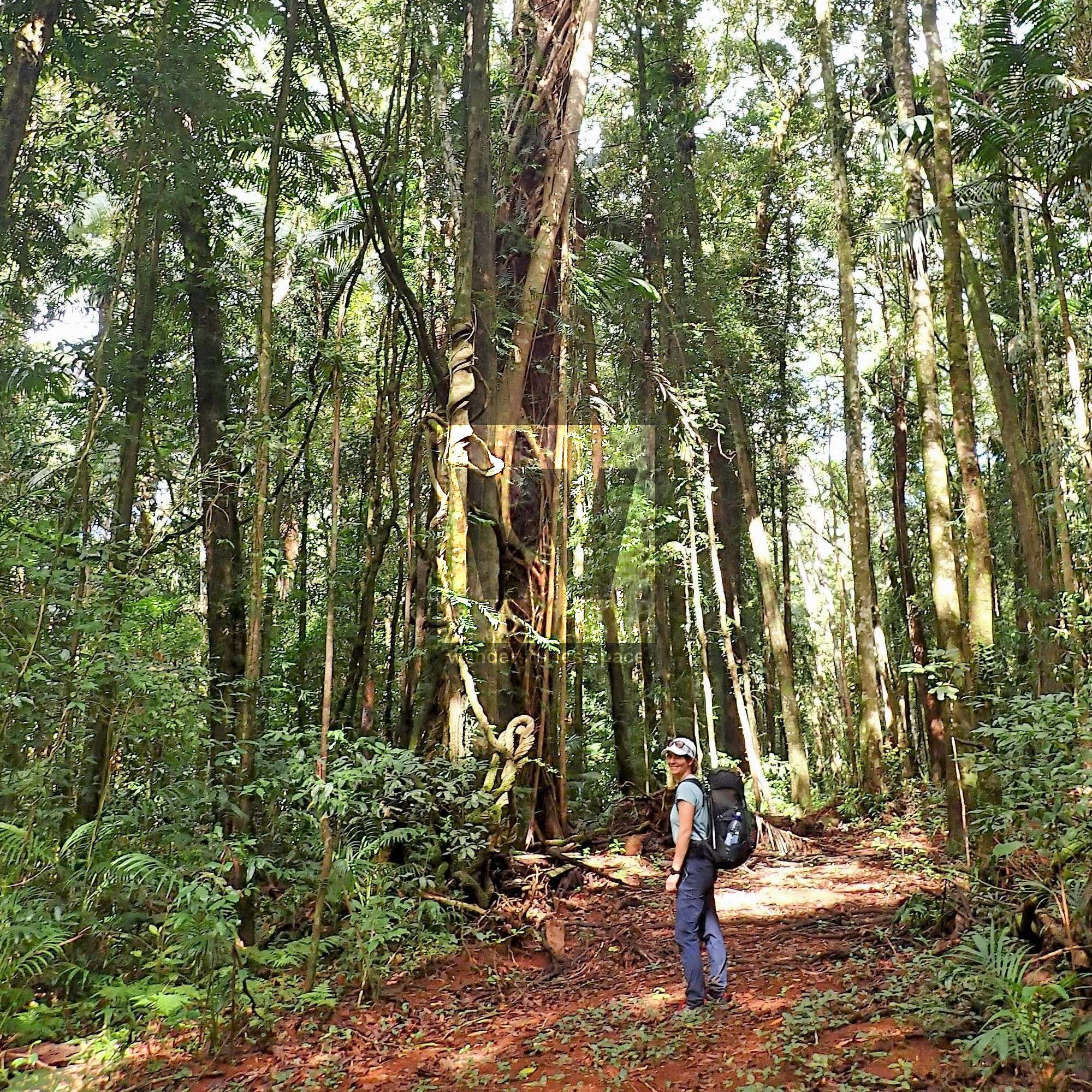
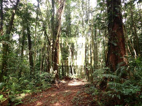
Cedar Creek Trail winds through lush rainforest toward a popular picnic spot with BBQ and toilet facilities; this location, called Sky Window, is off the main road to Broken River. If the weather is clear, the track offers glimpses through the rainforest down to the valley to the East. This part of the track can be very muddy after rain, with some seriously squelchy sections made worse by the heavy foot traffic. Be mindful of your footing, especially if it has been rainy, but enjoy listening for the calls of eastern whip birds that can be heard around this area.
From Sky Window, the track follows the road for a few hundred metres before plunging back into the rainforest at the start of the Clarke Range Track toward Broken River township. After walking another 8 kilometres or so, the sound of rushing water heralds the emergence of the track onto the Broken River, where there is an easy crossing to the other side. At this point, there is an intersection; the track to the right follows the river downstream to the Broken River picnic area. If you take this route, look for the platypus after going under the road bridge. This is also a good spot to stop for a rest. The Platypus Lodge Restaurant and Café serves cake and coffee as well as their popular "Yodel Burgers", which make for a welcomed energy boost after 10 kilometres or so of walking.

A night can be spent camping/staying in other accommodation here at Broken River, or keen hikers can continue on to the campground at Crediton Hall. If camping at Crediton Hall is your plan, an early start from Eungella is recommended.
To get to the start of the Crediton Creek Trail (toward Crediton Hall), some backtracking along the river is required. There are several prominent signs, however, which make the track choices along the way very clear.
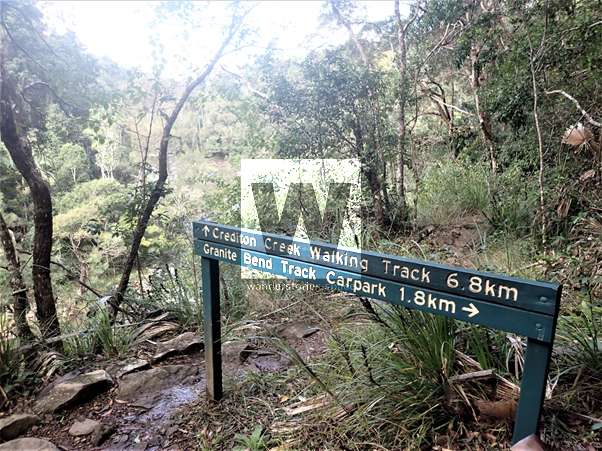
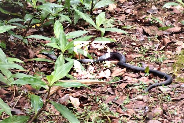
The Crediton Creek Track is far less popular than the earlier tracks and follows the course of the river through wet rainforest for about 7 kilometres in a roughly east/south east direction. Note that after rain, this section has a lot of leeches. Be prepared with some good insect repellent. Look out for snakes as well.
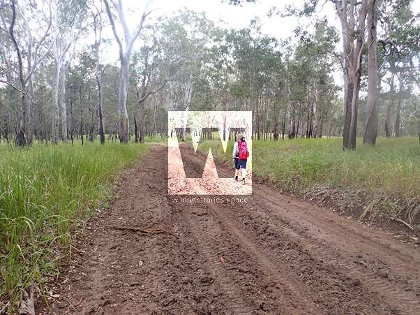
The Crediton Creek Track finally comes to an intersection at Wishing Pool Circuit. The two options end up joining further along the track, but the "inside" track is shorter, and the choices are well-marked. After about another kilometre or so, the track emerges onto a dirt road. A little further along the road, the vegetation changes to less dense eucalypt forest and farmland. The sweeping views across rolling green farmland are a welcome change after a whole day spent in the dense rainforest.
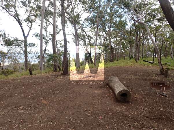
The track along the road continues for another 3-4 kilometres before reaching the old Crediton Hall building, which is located in a small, grassy park with basic facilities (i.e., toilets, picnic tables, and a rotunda). Sections of the grass can be quite wet and muddy, and mist is common in the mornings. The area can also be quite cold and even frosty during the winter months. There are some helpful and interesting information boards that explain the history of Crediton Hall, and the silence is punctuated by an occasional car or tractor and the mooing of dairy cows.
Day 2: Crediton Hall to Denham Range (~19.5 km)
Upon departing Crediton Hall, the track heads south for about 3 kilometres along Up River Road through farming country. This leads to the start of the rainforest section of the track to Denham Range. The entry to Crediton State Forest is near private property and is well-signposted, but upon entering the forest, it is fairly easy to lose the trail. Keep an eye out for the trail markers and/or pink marking tape on trees throughout this section.
This track winds in and out of the rainforest into grassy farmland in sections. A narrow, undulating rainforest track then emerges onto a much wider flat section of the track surrounded by dense forest. The walking gets a lot easier in this section, but be mindful of snakes, as they can be quite prevalent here.
The track finally emerges from the forest onto Cockies Creek Road where Great White Tank presents a welcomed water source. Care should be taken to treat the water before drinking, however. If it has rained recently, the road can be very muddy in parts and impassable to most vehicles.
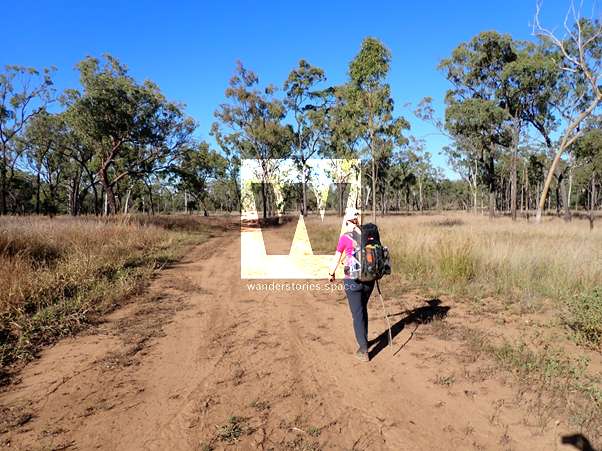
The road then heads roughly south, undulating up and down for what seems like a very long way, with the vegetation changing from rainforest to eucalypt forest, with wet grassy sections. Plenty of cattle can be seen and heard around this section of the track, and some may be occupying the road, too.
The junction at Crediton and Mia Mia Road presents a suitable place to stop for lunch. Look for the sign indicating the direction to Denham Ridge. The road then continues further south, past another junction with an old logging track and finally bends to the west for a couple kilometres before the Denham Range Campground is reached.
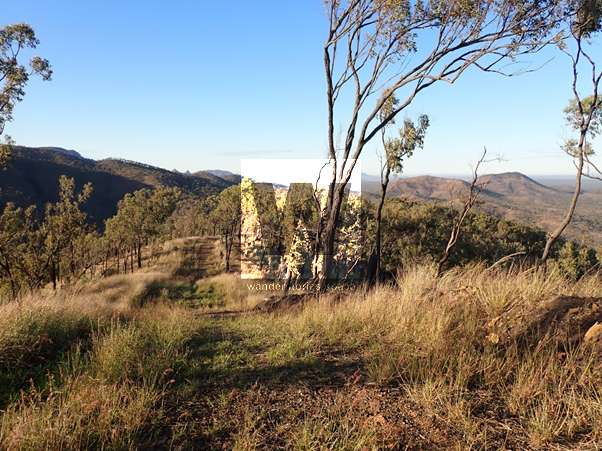
The campground entry is very clearly signposted, and there is another water tank, large flat sites with fire pits, and rewarding views off the range to the south-west. The campground also has a drop toilet and information boards. After a long, hard day of hiking – note that this segment of the trip cannot logically be divided into two days – this is a very welcoming and comfortable campground to enjoy for the evening.
Day 3: Denham Range to Mount Britton, via Moonlight Dam (~21.5 km)
From Denham Range Campground, the trail continues north west along Cockies Creek Road. Reference maps and contour lines, and look out across from the top of the range to get an idea as to the direction and distance to take during this segment of the trip.
After a few kilometres, the track turns left off the road onto the historic and famously steep, but well-marked, Dray Track. The Dray Track descends the range in a series of steep undulations, and the gravelly surface makes some of the steep parts unstable underfoot. The descent down Dray Track also marks the final element of the dramatic transition in the hike from the wet rainforest to dry eucalypt woodland.
The road at the base of the range continues along the flat for several kilometres through dry, eucalypt woodland, rounding some interesting hills, including one festooned by bottle trees. Another water tank is passed along the way providing another opportunity to refill water bottles.
Then, the road leads to Moonlight Dam, where there is a grassy area to rest, a drop toilet, and another water tank. Moonlight Dam is accessible by car from Turrawulla Road, and it is possible to camp here for a night before heading on to Mount Britton.
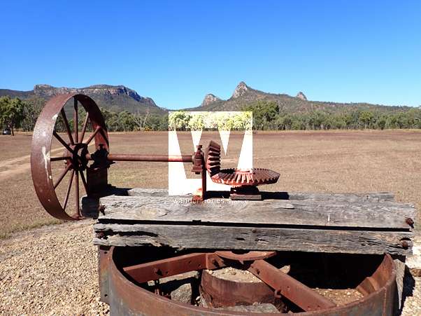
From Moonlight Dam, follow the management track east for about 5 kilometres toward the historic gold mining township of Mount Britton. This dry and sunny road is mostly flat. Once the track reaches a left turn onto a bitumen road, this marks the final stretch of walking north toward the historic site of the town. This is an interesting end to the walk, as the long-abandoned township boasts a series of well-maintained displays, old equipment, and informative signs, which is against the dramatic backdrop of the Diamond Cliffs and Marling Spikes.
Here, you will either coordinate with your prearranged ride back to your vehicle in Eungella or utilise your car shuttle. At this point, you can also drive up the road to the beautiful Broken River Mountain Resort for a well-earned shower, hot meal, and restful sleep.
A pack of Tim Tams or a glass of wine might be needed after this Great Walk.
This article, and all other articles, are for entertainment purposes only and are not to be used as a guide. Please see our Disclaimer for more information.