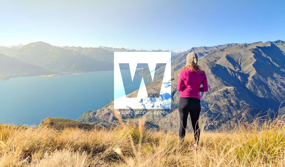
Views of Lake Wanaka and Lake Hāwea from Isthmus Peak
Offering similar views as Roy's Peak, this walking track takes you cross the undulating ridgeline to Isthmus Peak (1385 m). The track overlooks Lake Wanaka and Lake HÄÂwea, with great views of the Southern Alps.

Location - Wanaka, South Island, New Zealand
Distance - 16 km return via same track
Time - 5 to 7 hours
Difficulty - 4, intermediate
Mountain Biking - Grade 5
Walk or mountain bike this track to Isthmus Peak (1385 m) and cross the undulating skyline ridge. The track overlooks Lake Wanaka and Lake HÄÂwea, with great views of the Southern Alps/Kā Tiritiri o te Moana.
See also Roy's Peak.
How to get there
Access is from Stewart Creek carpark - off SH6, north of Lake Hawea township and 30 minutes drive from Wanaka. Take care parking and crossing the road - this is a busy carpark beside the highway. From the carpark, follow the poled route on the true right of Stewart Creek, until it joins a 4WD track. From here a steep, rocky climb winds upwards to a skyline ridge. On reaching the ridge, a sign points to the Isthmus Peak track on the right, and on the left, the ridge track to the conservation area. The track along the tops traverses a number of unnamed peaks.
You can mountain bike these tracks but on many sections you will have to dismount and push your bike.
Know before you go
The weather can change rapidly in New Zealand. Hypothermia is a real risk even in summer. Be prepared by having warm, windproof clothing and the appropriate footwear. Whiteout conditions caused by snow or low cloud may be present.
This area has terrain that can produce avalanches that cross the track, usually from May into November. View avalanche information and the terrain rating for this track.
This track crosses private land. Respect the landowner's livestock and property. Stay on the marked track until you reach the conservation land, leave gates as you find them and use stiles where provided. Livestock can be unpredictable; keep your distance at all times/go around if necessary.
No camping until the conservation area boundary.
There is no public access beyond the conservation area. Return to the Stewart Creek carpark by the same route.
These tracks are annually closed for fawning between 20 November and 20 December.
Interactive Map
What to take
- Water (~2L)
- Snacks
- Shoes
- Camera
- Jumper or a jacket (it's windy and cold at the top)
- Sunscreen & hat
Activities
- Photography
- Hiking
- Meditation
- Picnic with a view
This article, and all other articles, are for entertainment purposes only and are not to be used as a guide. Please see our Disclaimer for more information.