Hiking up to Roy's Peak
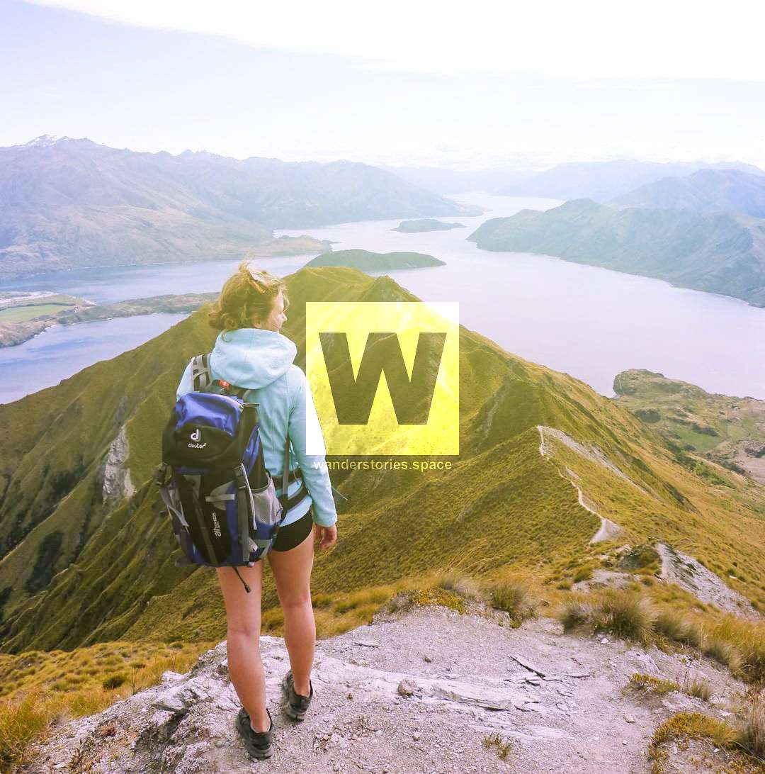
Roy's Peak is just outside Wanaka is not to be missed. This hike offers stunning views of Lake Wanaka and Mt Aspiring. It's a steady and long winded slog up the side of the mountain but the views are spectacular.

Location - Wanaka, South Island, New Zealand
Distance - 16 km return via same track
Time - 5 to 7 hours
Elevation Gain - 1,578 m
Difficulty - 4, intermediate
The South Island of New Zealand is notorious for outdoor hikes, non-stop adventure and captivating scenery, it's hard to fit it all in but the half-day hike up Roy's Peak just outside Wanaka is definitely not to be missed.
This hike offers stunning views of Lake Wanaka and Mt Aspiring. It's a steady and long winded slog up the side of the mountain. You should aim to climb on a clear day for the optimum views.
See also Isthmus Peak.
How to get there
Just a short ten-minute drive outside Wanaka central, you will come across the car park for Roy's Peak walk on the left-hand side. Once parked up, climb over the fence and follow the well formed gravel path up the mountain.
There's a bathroom at the bottom on the right-hand side and none further on.
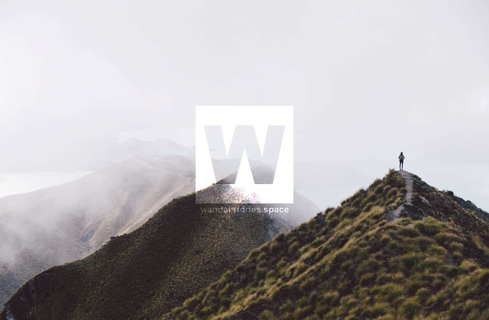
The walk itself is a steady climb which takes between 5-7 hours. The path zig-zags up the side of the mountain. At each turn the view just gets better and better until you reach an ideal photo spot putting you right on the ridgeline.
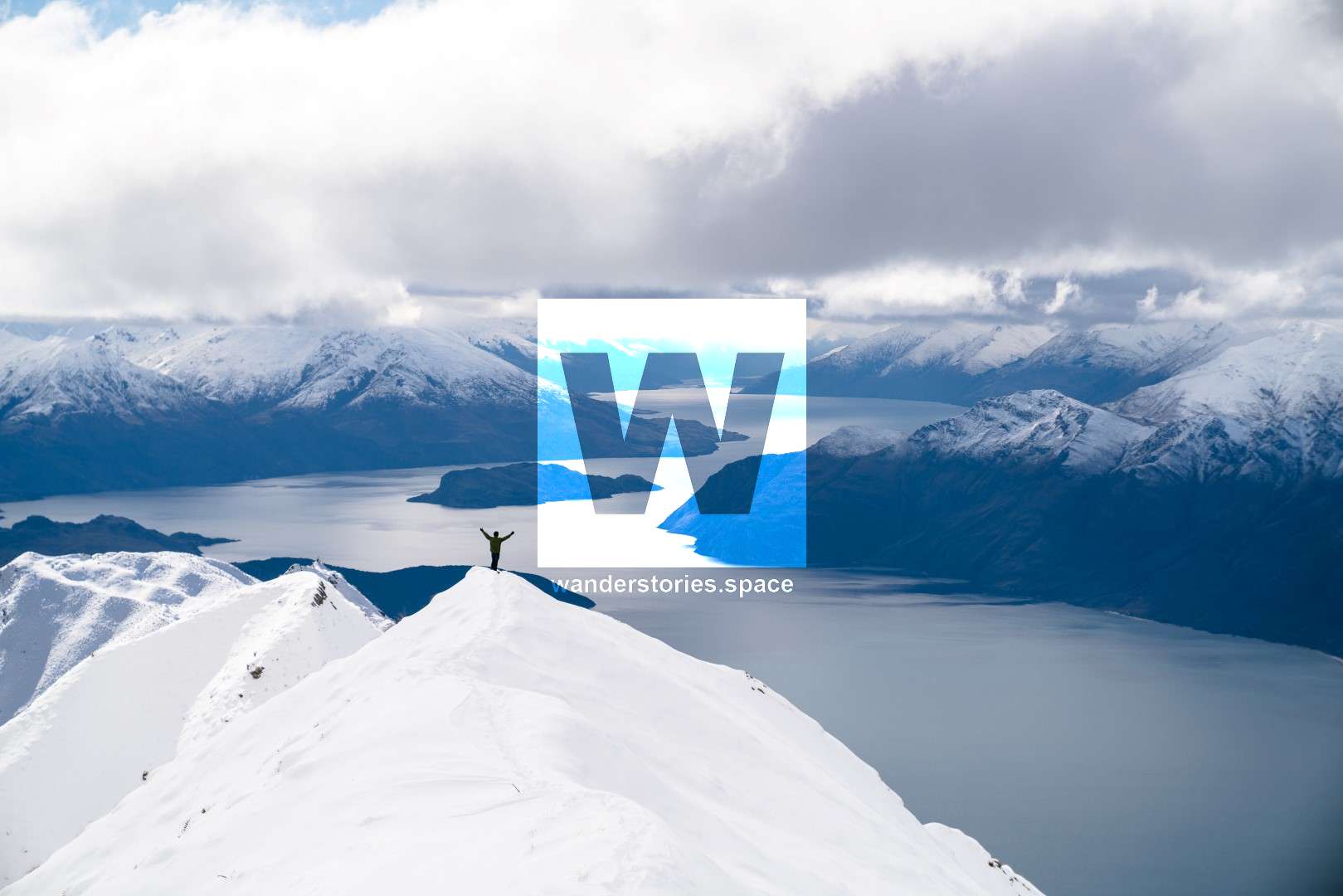
Just when you think the view can't get better, continue the climb to the summit where you will be rewarded with breathtaking panoramic views of the snow-capped mountain ranges (even in summer) and a better view of the magnificent Lake Wanaka.
Be sure to pack a a few snack and some water so you can stop and take in the spectacular views at the peak.
The best part of the track is walking down the ridgeline from the summit. Most people do not do this as it's scary and dangerous. But if you have good coordination, foot placement and experience, you should have no trouble.
Interactive Map
What to take
- Water (~2L)
- Snacks
- Shoes
- Camera
- Jumper or a jacket (it's windy and cold at the top)
- Sunscreen & hat
Activities
- Photography
- Hiking
- Meditation
- Picnic with a view
This article, and all other articles, are for entertainment purposes only and are not to be used as a guide. Please see our Disclaimer for more information.