How to get to Karnak Falls
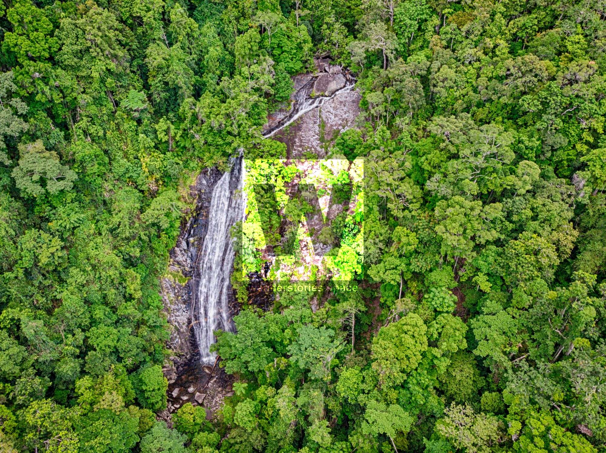
Karnak Falls is an 80-metre high waterfall that is a tributary of Little Falls Creek, which is located near the starting point of Devil's Thumb (Manjal Jimalji) Track. This area is just north of Mossman Gorge and just south of Daintree, all within the stunning Far North Queensland region.


Location - Daintree National Park, Far North Queensland, Australia
Difficulty - Grade 5
Distance - 2.6 km one way
Time - allow 4-8 hours
Karnak Falls is an 80-metre high waterfall that is a tributary of Little Falls Creek, which is located near the starting point of Devil's Thumb (Manjal Jimalji) Track. This area is just north of Mossman Gorge and just south of Daintree, all within the stunning Far North Queensland region.
Fun fact: Miallo, Rocky Point, Wonga, and the surrounding communities are supplied with water from Little Falls Creek in the Whyanbeel Valley. This water is treated at the Whyanbeel Water Treatment Plant located at Karnak Road, in Karnak.
How to get there
Whether coming from the north or south, navigate to Whyanbeel Road. Then, drive for another 4 kilometres until you cross Whyanbeel Creek bridge. At this point, turn on to Karnak Road, which should the second road on the left toward the Karnak Playhouse. Continue to the Devil's Thumb (Manjal Jimalji) trailhead, and park off to the side of the road.
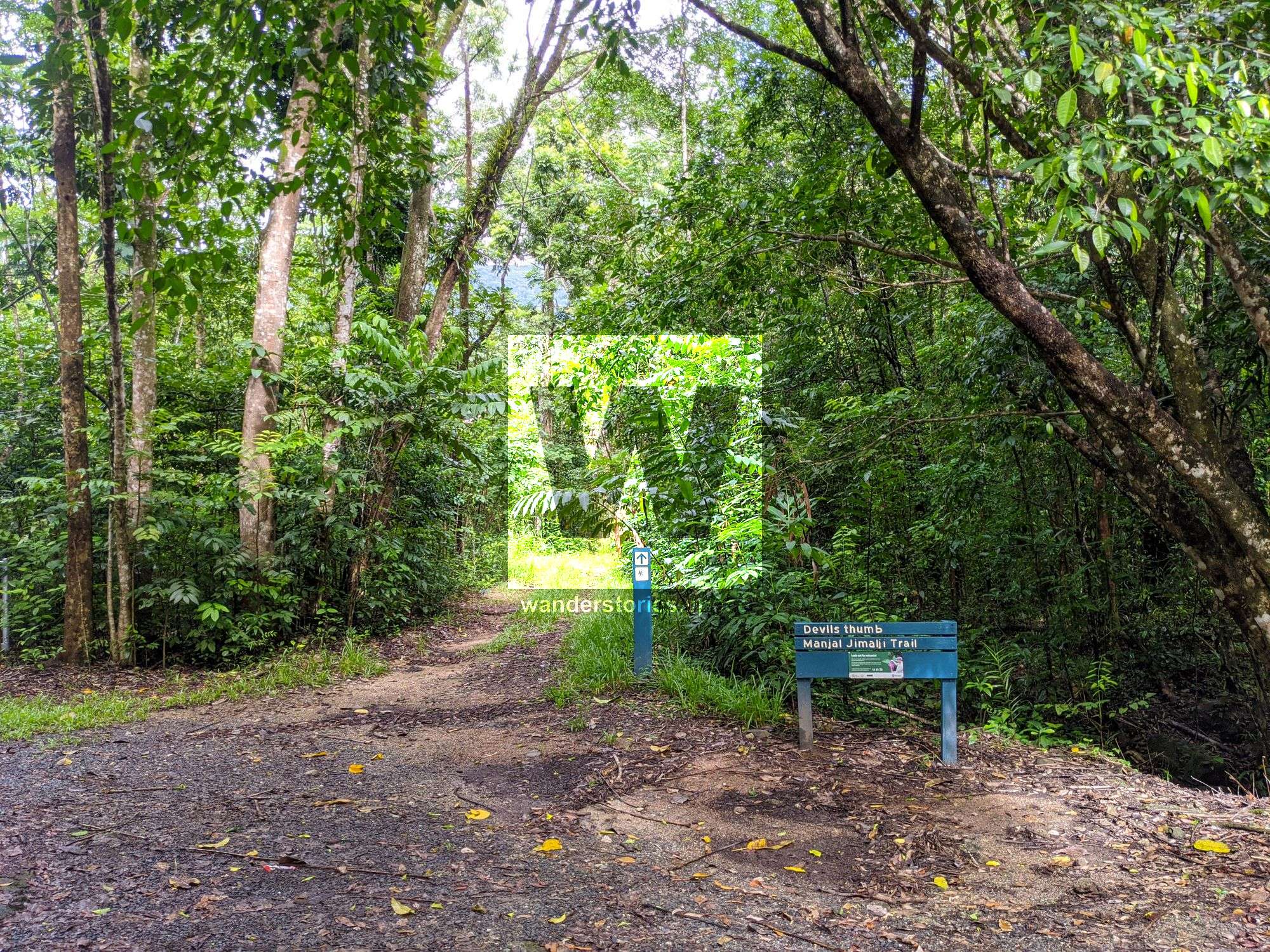
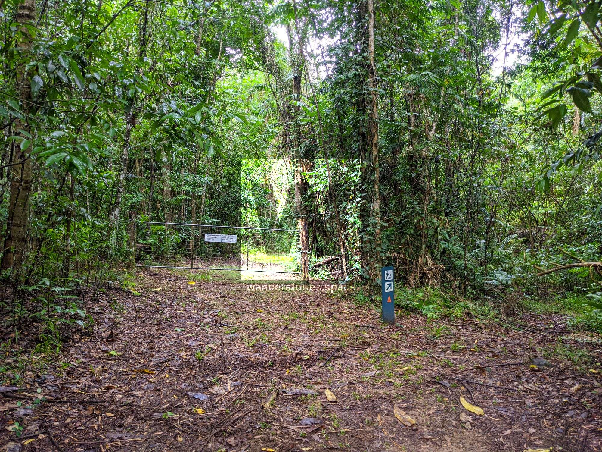
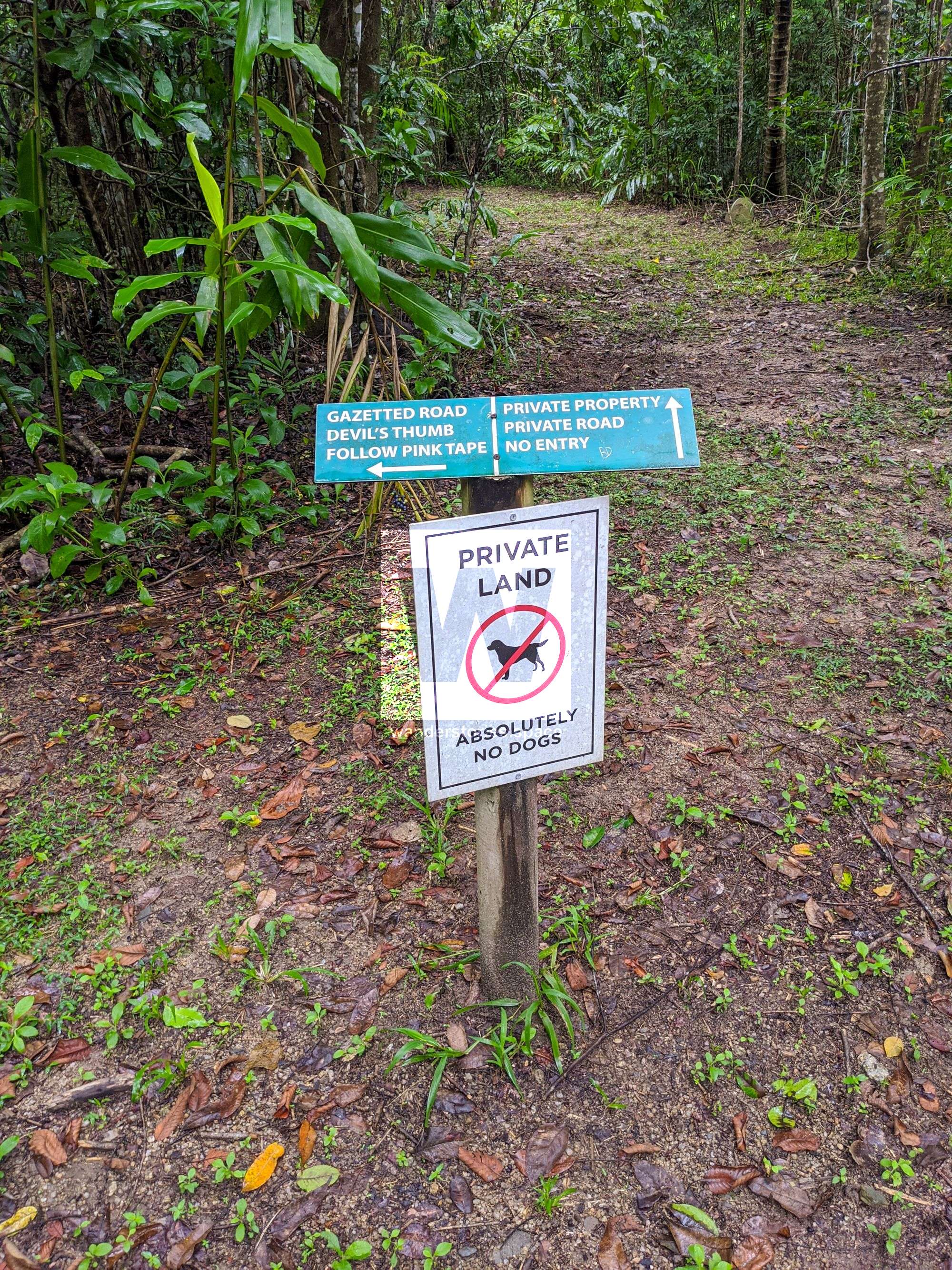
Follow the Devil's Thumb (Manjal Jimalji) Trail for approximately 100 metres until you reach the creek. The rest of the hike will be off-track. Rock hop up the creek for approximately 600 metres until you reach a weir.
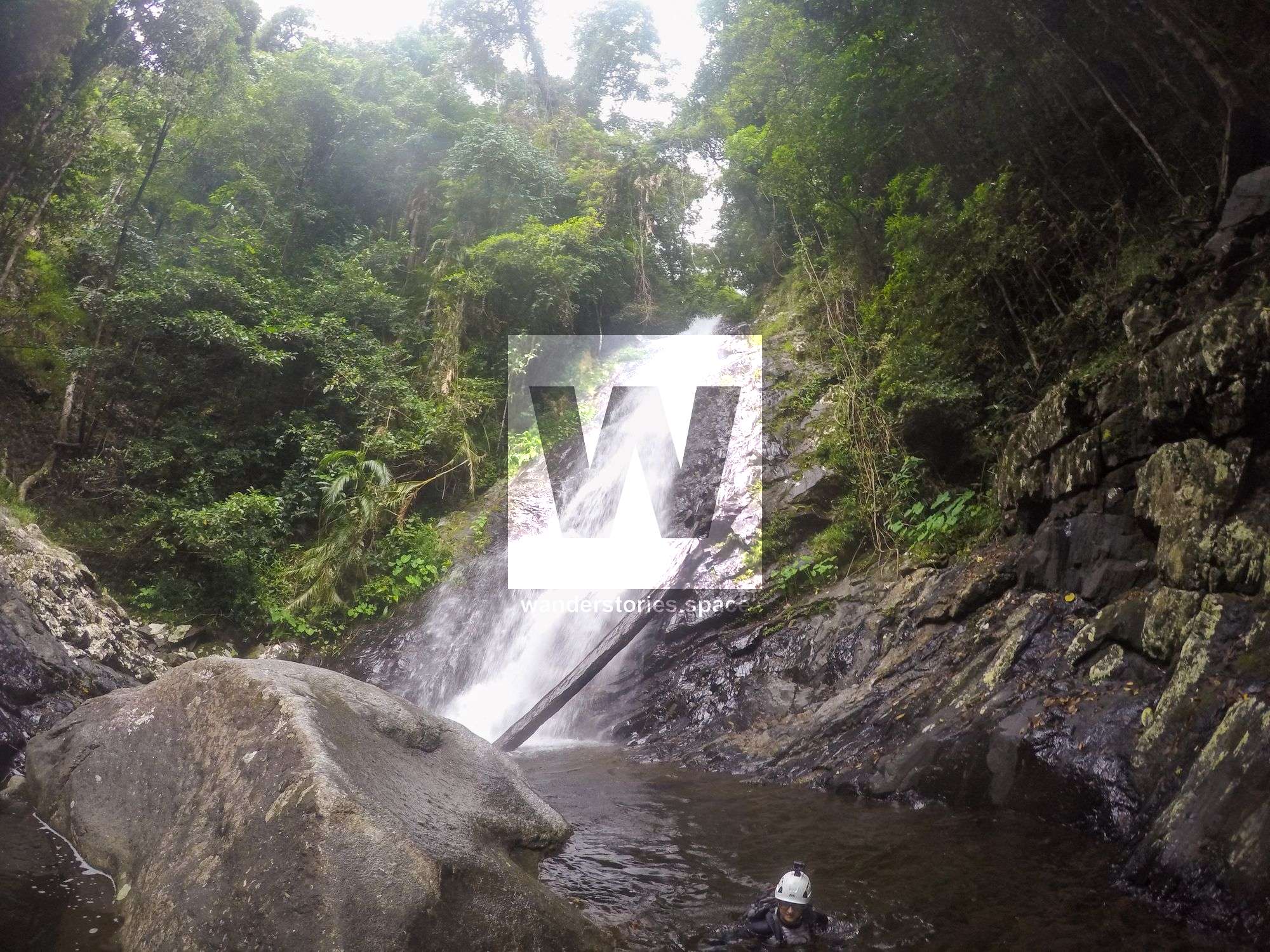
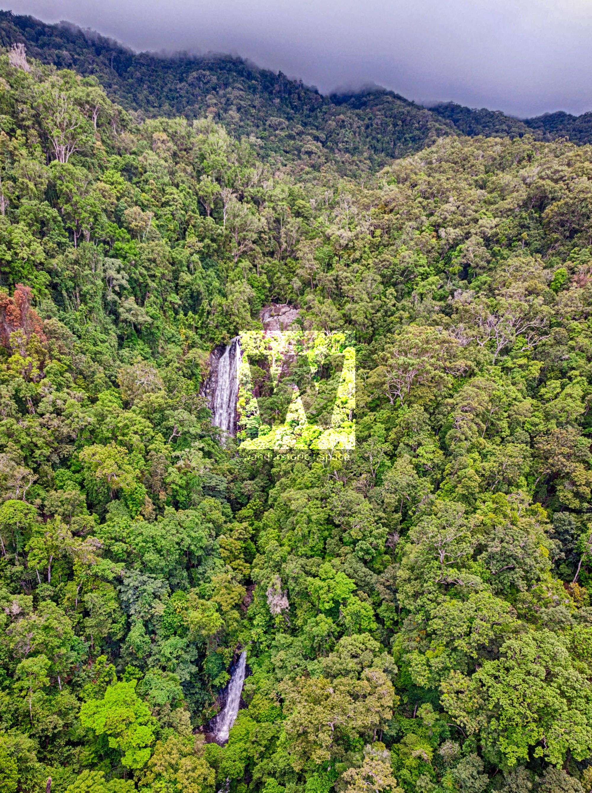
After you reach the weir, continue rock hopping for another 2 kilometres until you reach a 30-metre high waterfall. But don't stop here. This is just 'False Falls'.
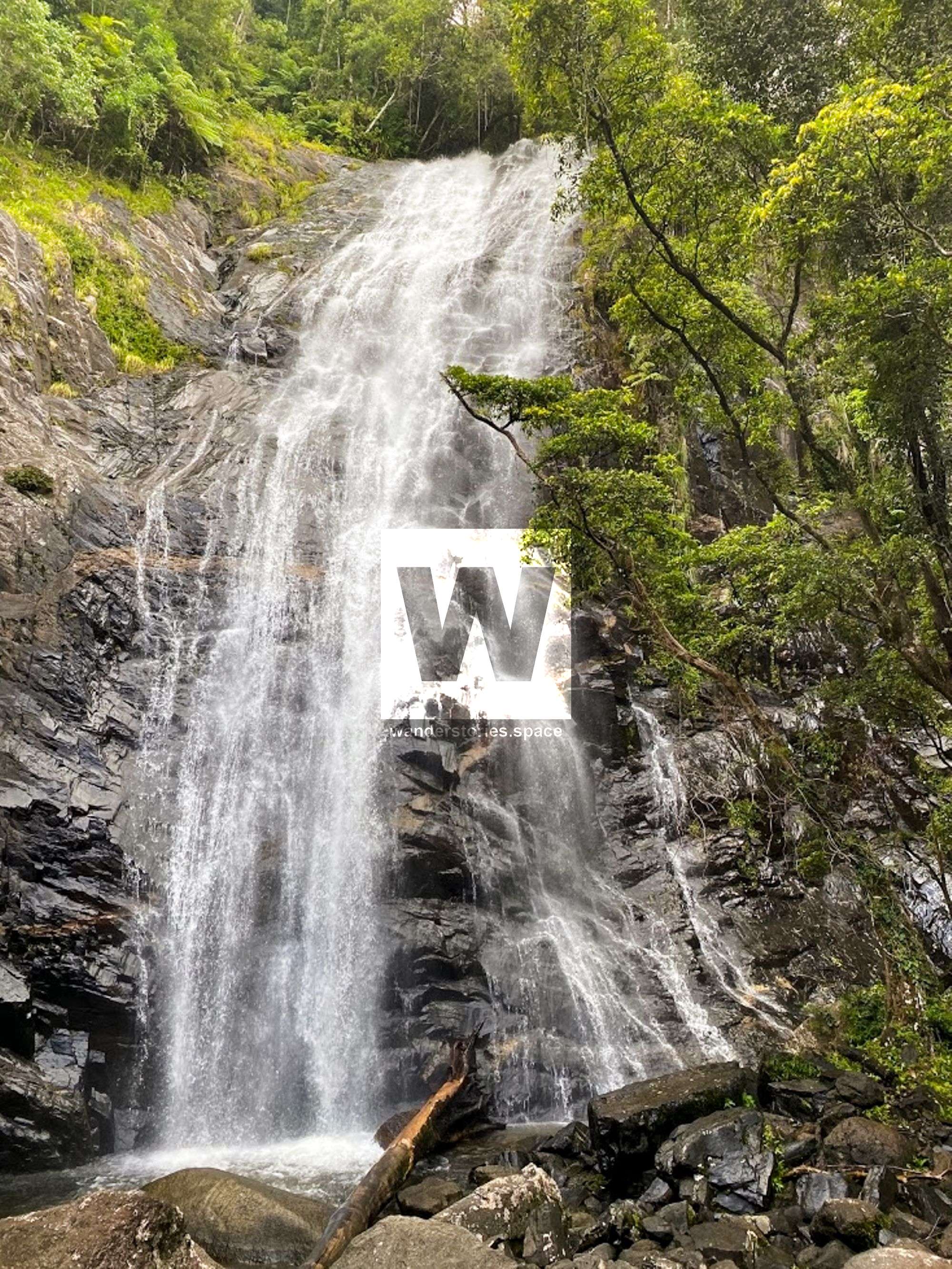
Climb up the right side and around False Falls, and then rock hop for another 250 metres until you arrive at Karnak Falls. These falls are impressive with their volume and width. You will not be disappointed!
Alternatively, an easier route is to hike up the track and then cut across to the falls - see map below.

See also High Falls, which is nearby.
Interactive Map
What to bring
- Long pants and long sleeved shirt are recommended (protection from sun and vegetation)
- Appropriate hiking shoes, noting that the rocks are slippery
- 2-3 L of water or a way to treat the water from the creek if refilling
- Snacks, lunch
- A dry bag to keep electronics dry
- Camera and/or phone
- First aid kit and PLB (or equivalent)
- GPS and navigation tools
As these areas around Cairns become increasingly popular, we will need to be more diligent in practicing our Leave No Trace philosophy. Be mindful of disturbing the flora and fauna, and keep your impact to a minimum. Please take everything you bring back home with you (i.e., pack it in, pack it out). If you find rubbish, please pick it up, and hike it out. Let's take only photos, memories, and other people's rubbish, and leave only light footprints... and, of course, a cleaner environment.
This article, and all other articles, are for entertainment purposes only and are not to be used as a guide. Please see our Disclaimer for more information.