Kennedy Falls, Upper Yamanie Creek, Mount Thorn, & Mount Sullivan
Kennedy Creek Falls is located in Girringun National Park and is a 6.1 kilometre hike following and old road.

Location - Girringun National Park, Far North Queensland, Australia
Difficulty - Grade 3, on-track
Distance - ~6 km return to Kennedy Falls; 23 km return to Mount Thorn
Time - Allow 2-3 hours return
Elevation gain - Approximately 215 metres
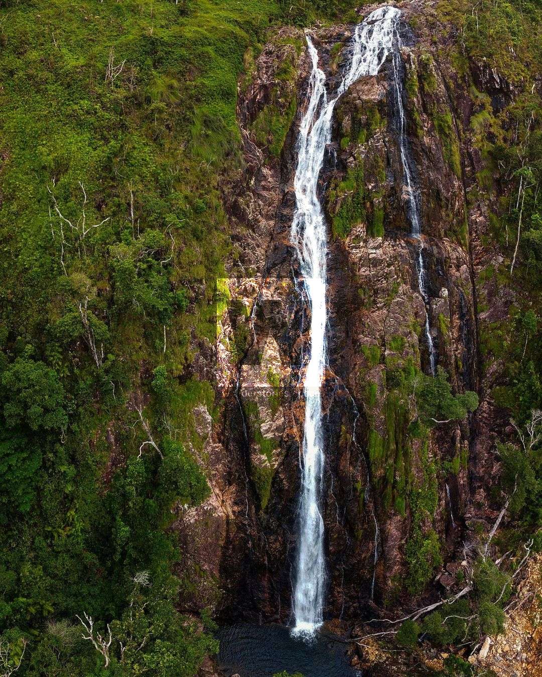
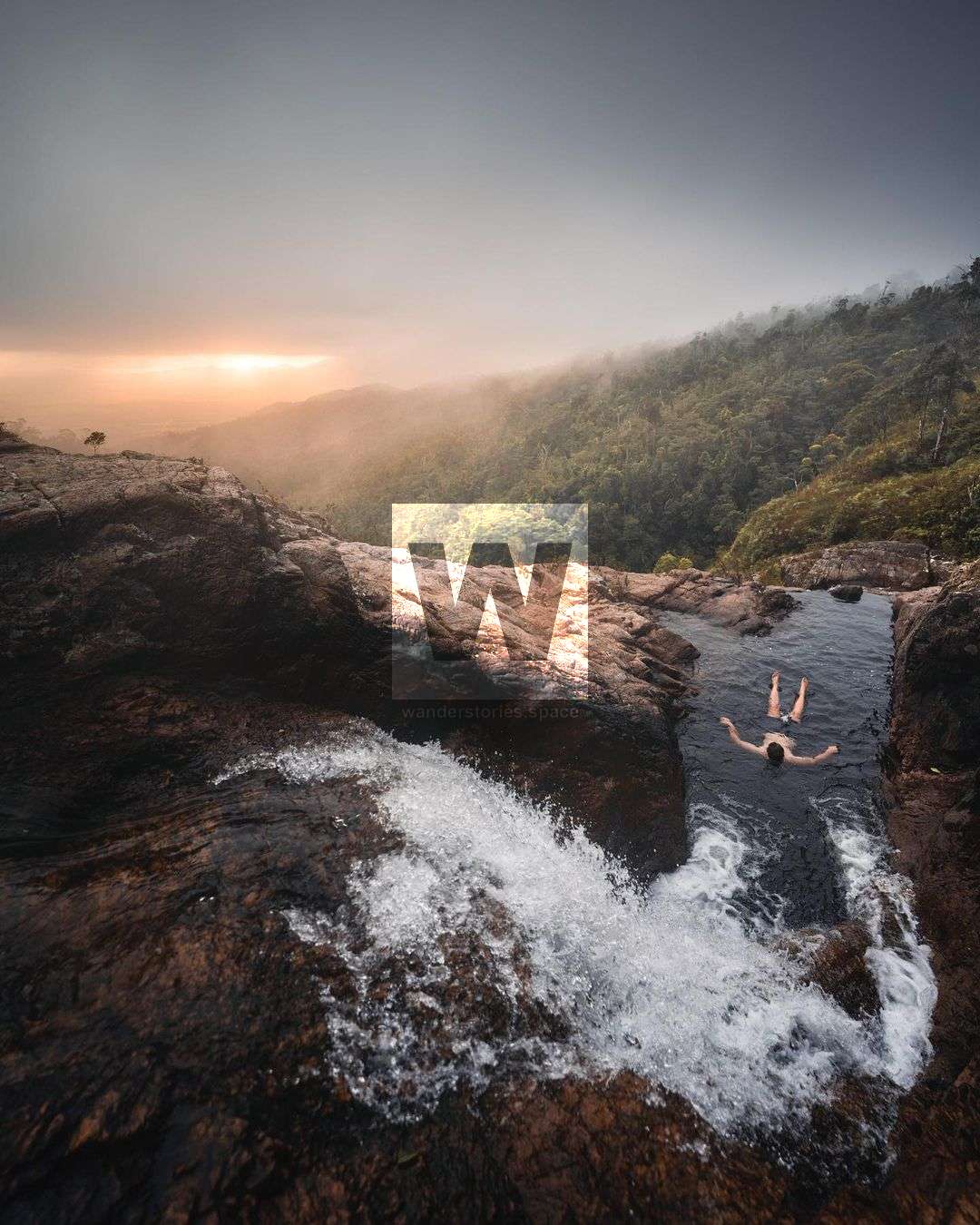
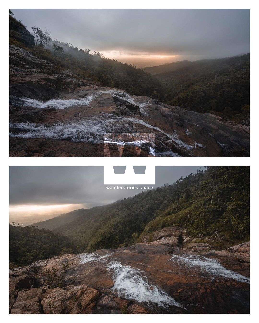
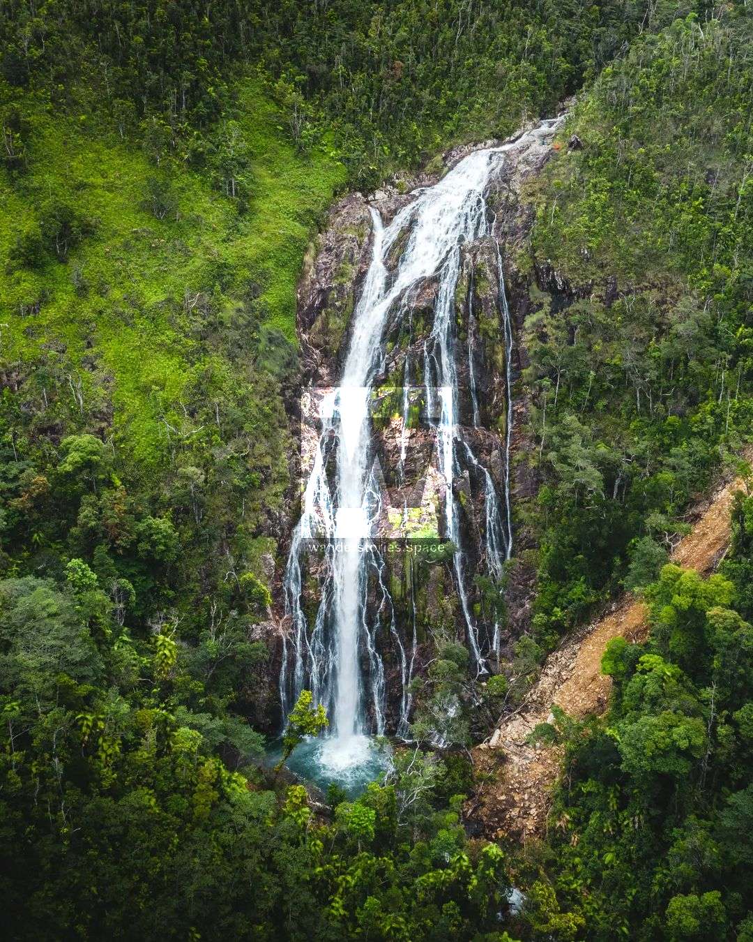
Kennedy Falls, or Kennedy Creek Falls, is located near Cardwell on the Kirrama Range in Girringun National Park. A lacework of streams flows from the Kennedy Range across the floor of the valley through the national park and out to the Great Barrier Reef Lagoon the vegetation along these stream banks form an essential wildlife corridor between the coast and the range.
How to get to Kennedy Falls
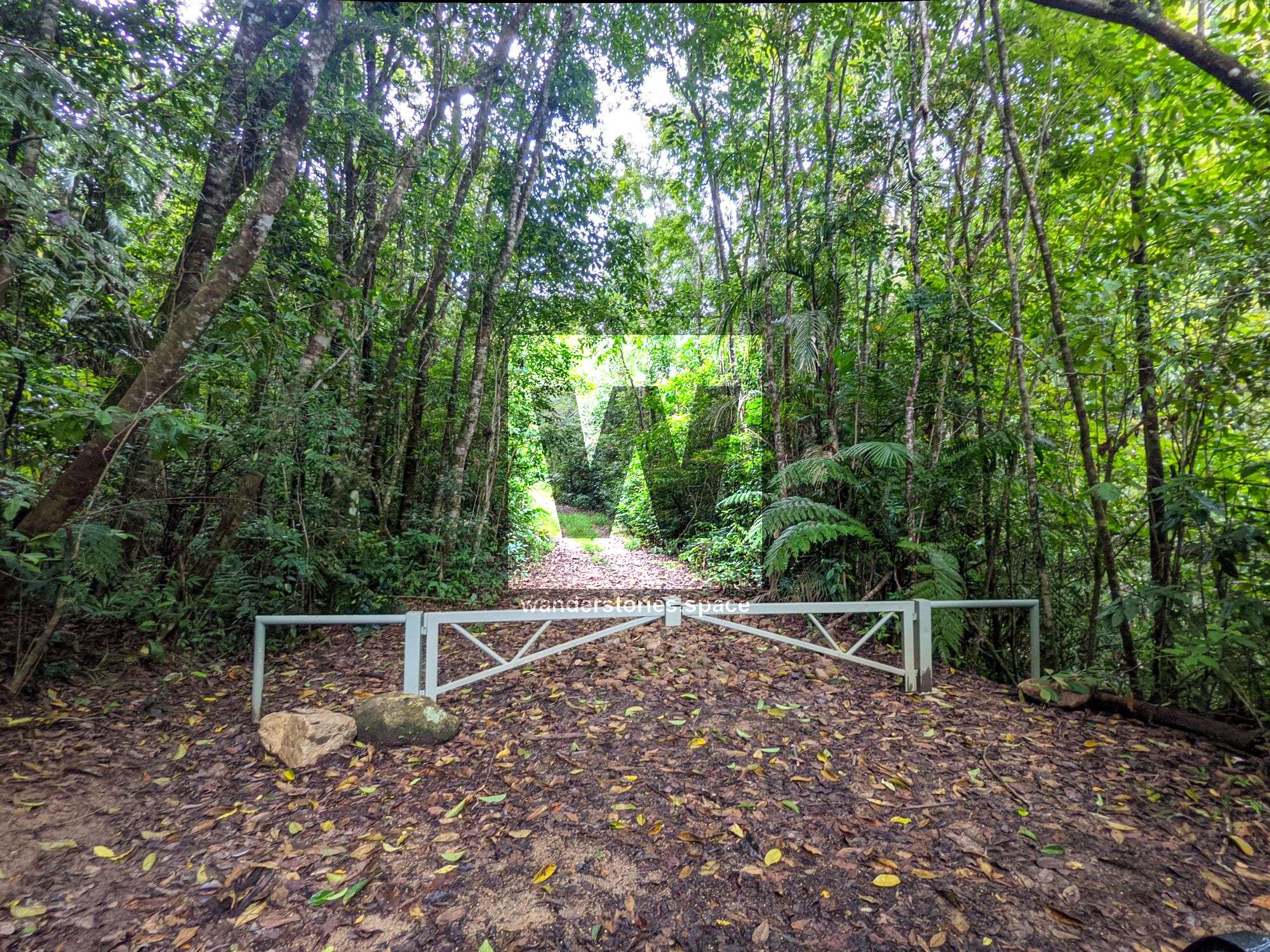
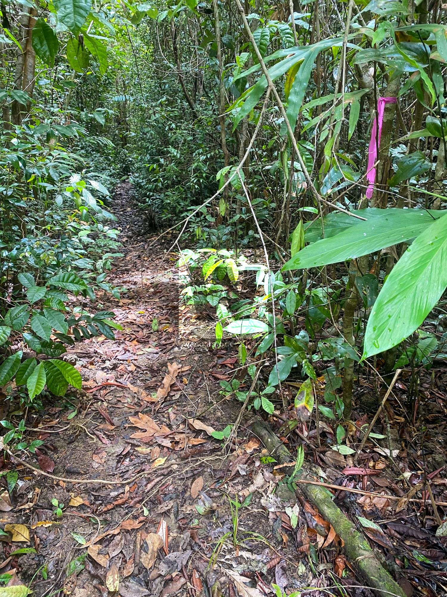
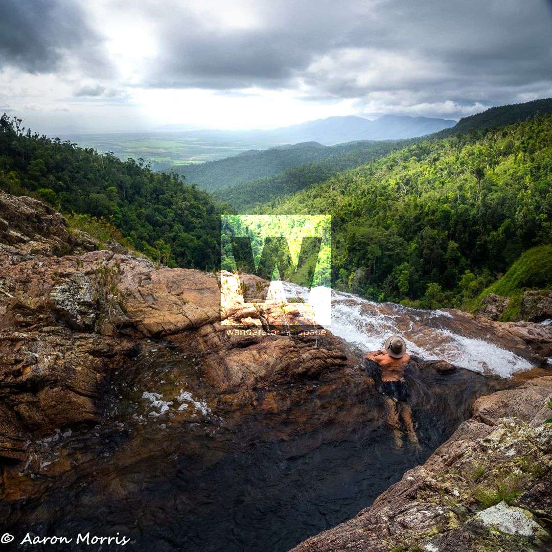
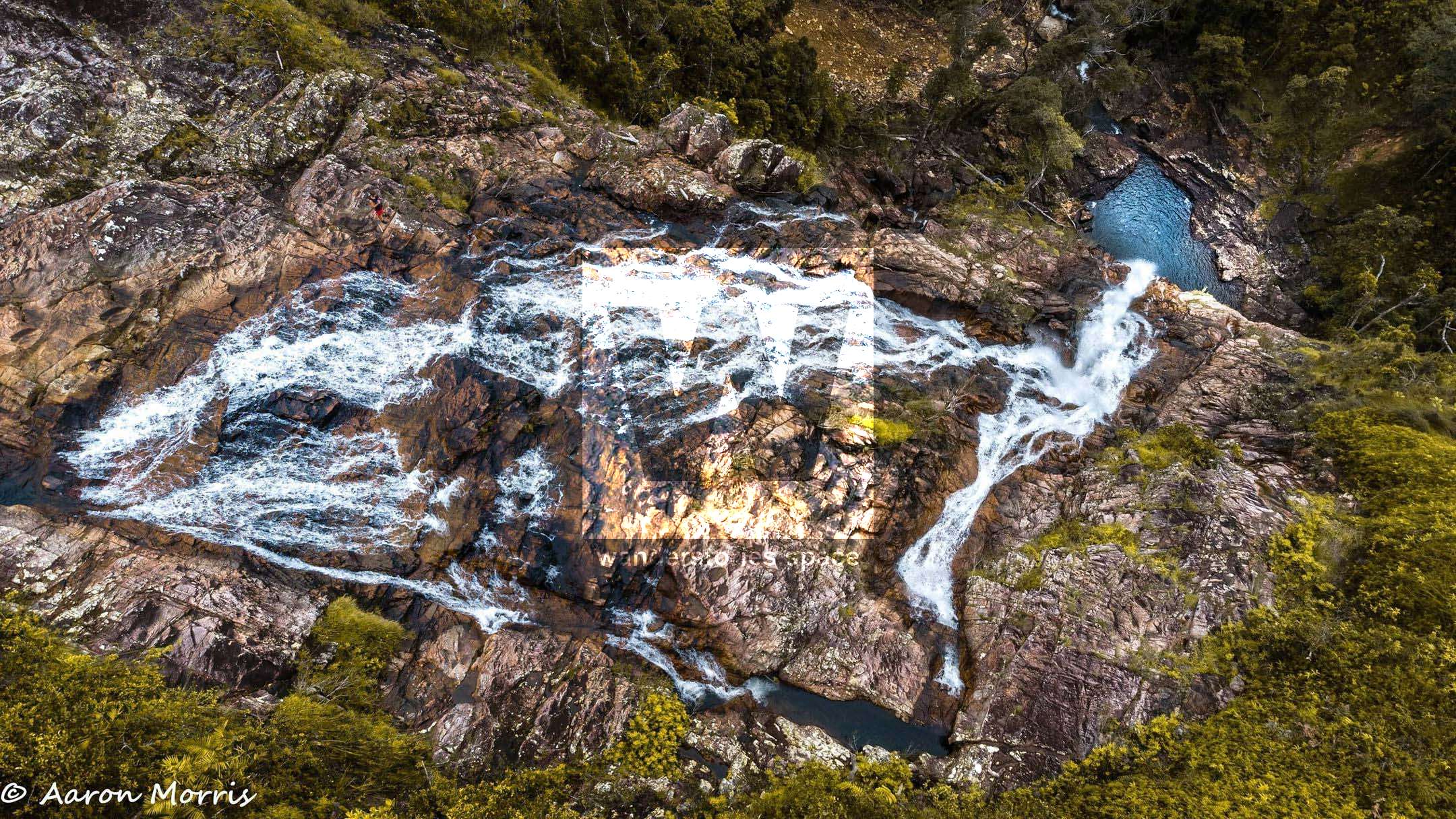
Kennedy Falls is a 6-kilometre hike following an old road and then on single-trail for the last kilometre but is still well-marked and easy to follow. The track takes you to the creek where it's just a short stroll down to the top of the falls. Enjoy a dip in the infinity pool before returning via the same route, or you may like to continue on the main track.
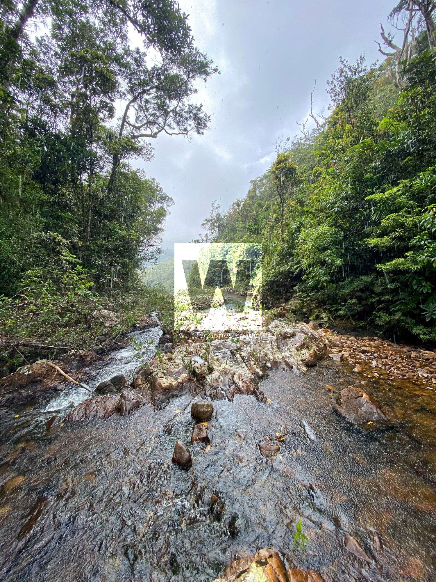
After visiting Kennedy Falls, continue on the trail to get to upper Yamanie Creek (there is also a waterfall 2.5 km downstream), Mount Sullivan (945 m), and Mount Thorn (945 m). The full out and back trip is approximately 23 kilometres. The off-shoot to Yamanie Creek is worth visiting for a swim and to refill water bottles.
Notes
- There are no other water crossings apart from Kennedy Creek which is close to the trailhead.
- The trail starts off in the rainforest then slowly changes to sub-tropical and dry eucalypt forests.
- Leeches are present after rain
- Track narrows for the last kilometre
- Snakes along the trail
- Wear appropriate footwear
Interactive Map
Flora and Fauna
The tall, wet eucalypt forests of the elevated areas of the Kirrama Range provide habitat for yellow-bellied gliders. Yellow-bellied gliders live in groups, feed on sap and are said to have the loudest alarm call in the tropical forests. The presence of two eucalypt species is essential for yellow-bellied glider populations of the tropics. The Red mahogany Eucalyptus resinifera is tapped for its sap and large rose gums Eucalyptus grandis are used as the main den tree. The yellow-bellied glider habitat is restricted to a narrow band between rainforest and drier woodland ecosystems.
One of Australia's most endangered species lives in the remaining eucalypt and melaleuca Coastal Woodland below. The Mahogany glider is a shy nocturnal gliding possum. It lives in den hollows of mature trees, feeding on nectar pollen saps and insects in the coastal Woodlands. It is thought that there are few as 1500 to 2000 animals remaining in the wild.
The Wet Tropics are home to approximately 30% of Australia's orchids. Their evolution has enabled them to live in a variety of niches including growing on trees (epiphytes), rocks (lithophytes) and in the ground (terrestrials). Some species have lost their chlorophyll and ability to derive energy from sunlight. This means they must rely on saprophyte fungi to provide food.
This article, and all other articles, are for entertainment purposes only and are not to be used as a guide. Please see our Disclaimer for more information.