Lord's Table Mountain & Anvil Peak
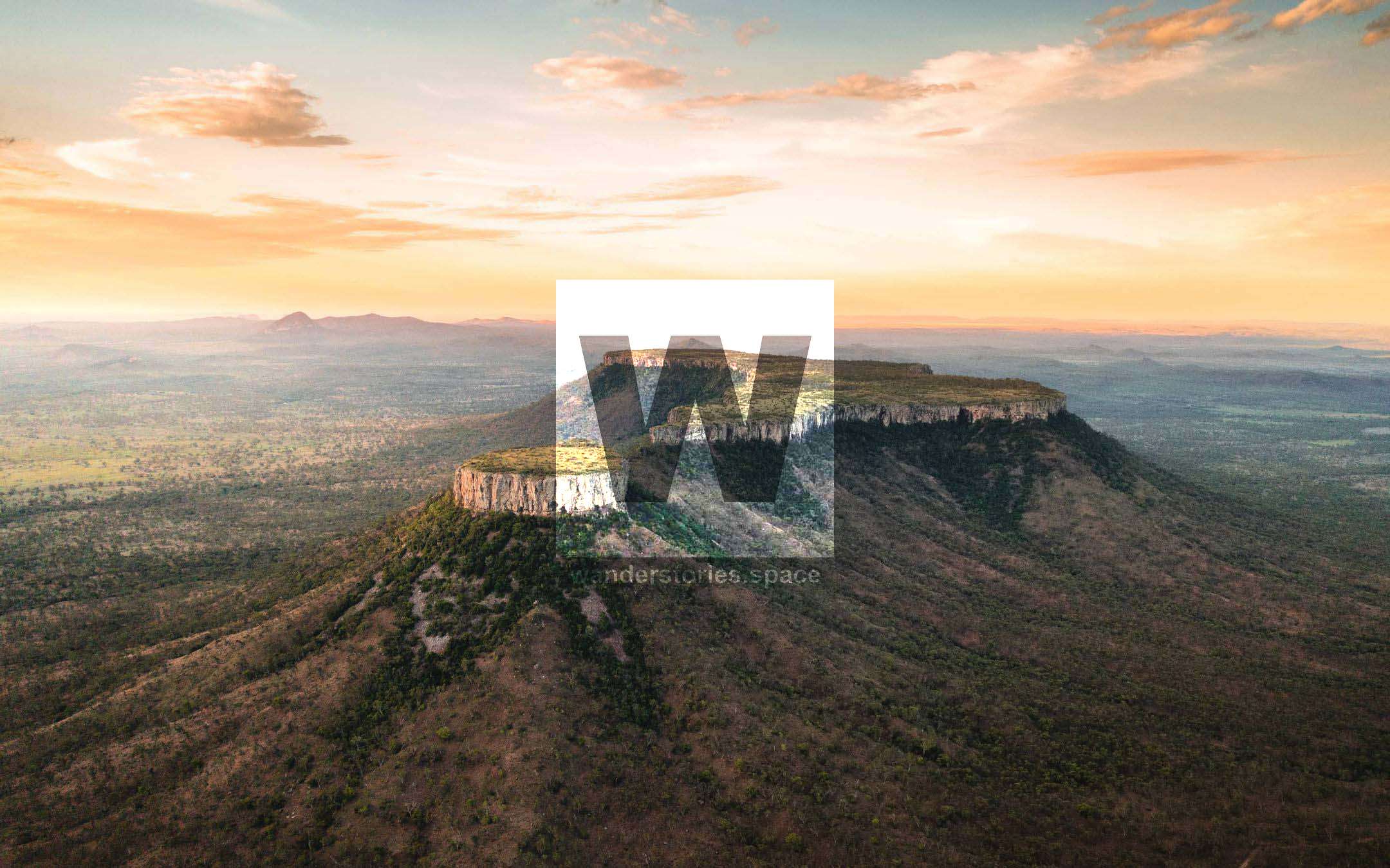
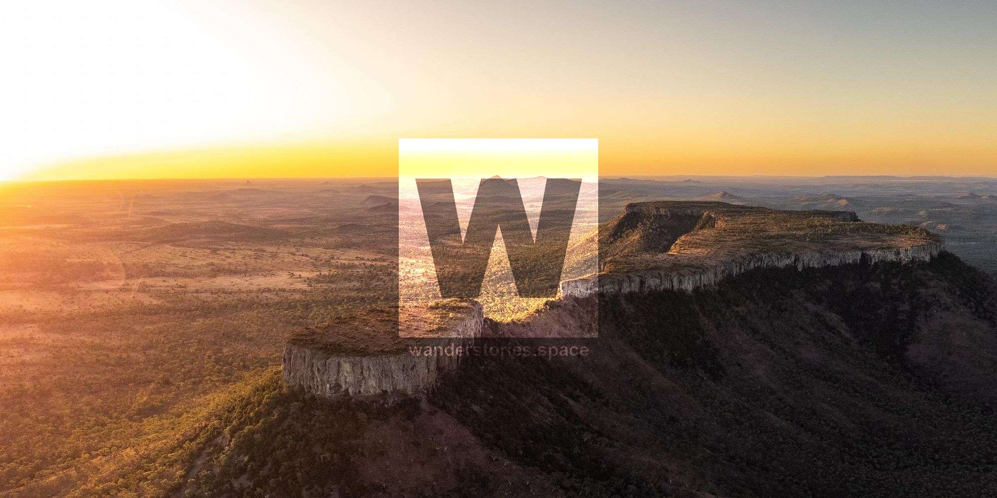
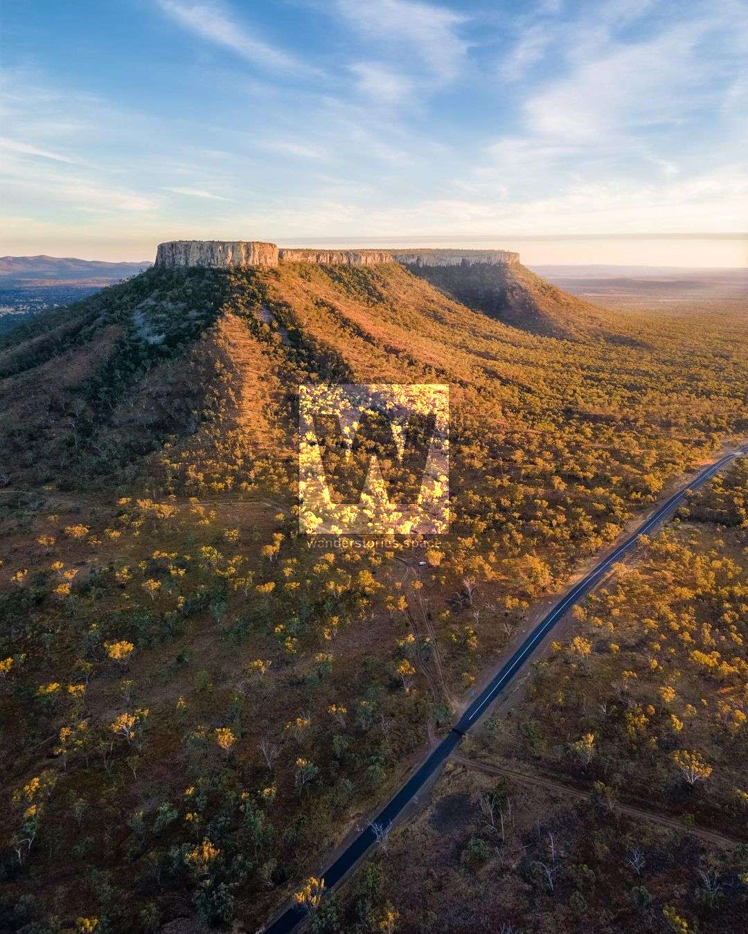
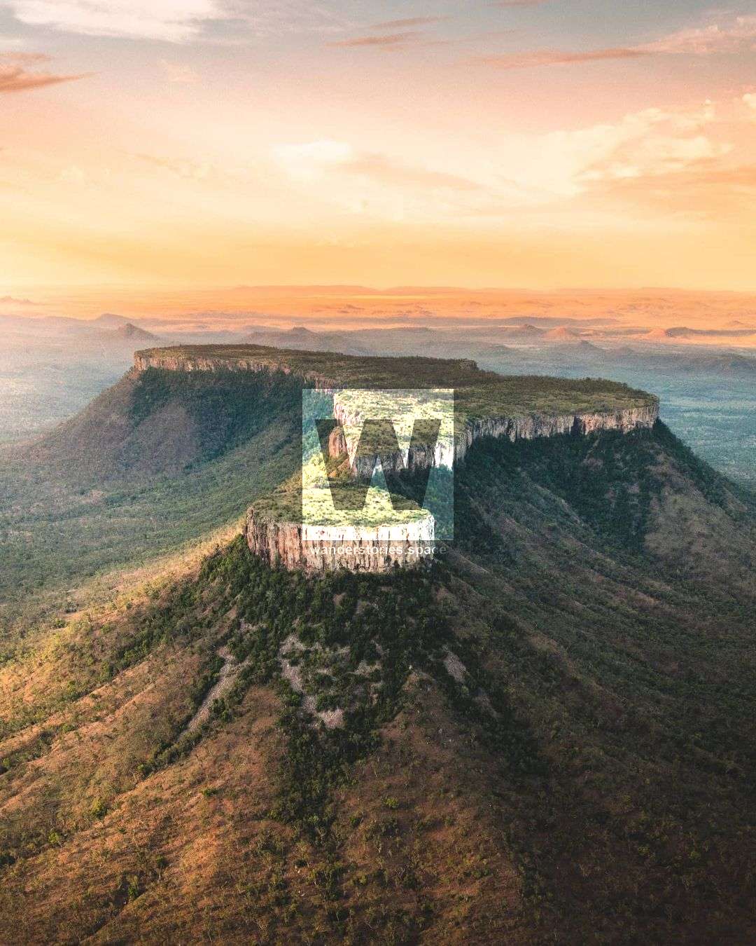
Lord's Table Mountain and Anvil Peak are distinctive peaks centrally located in Peak Range National Park. These impressive peaks have a 320-metre high flat-topped plateau and provide grand views across the landscape, ideal for sunsets and astrophotography.

Location - Peak Range National Park, Isaac Region, Central Queensland, Australia
Distance - ~5 km return depending on route and where you go at the summit
Duration - allow 3-4 hours
Grade - 4
Total ascent - ~400 metres
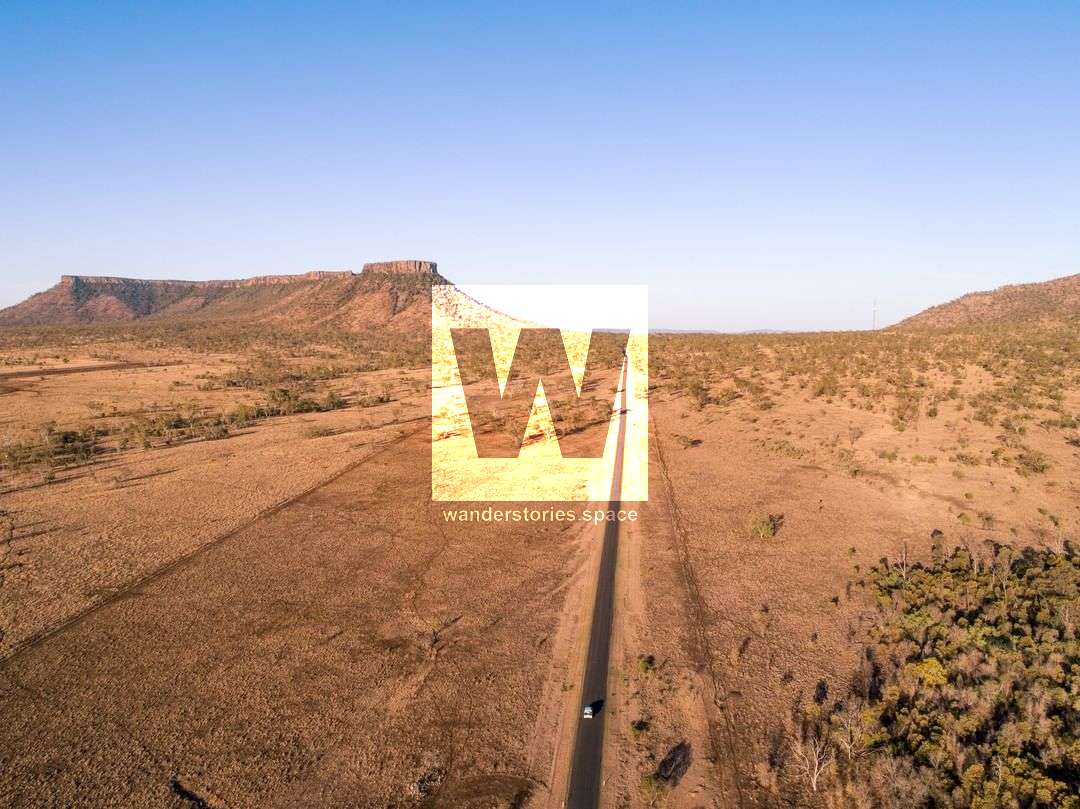
Access - Access is via Huntley Road/Dysart Clermont Road (-22.682598, 148.018745)
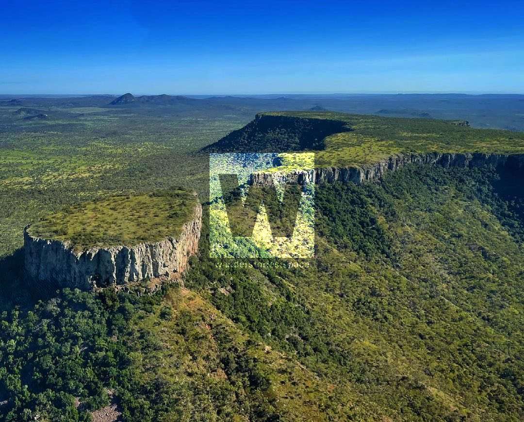
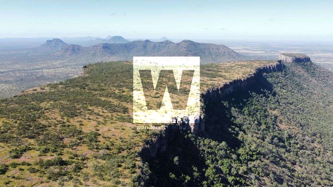
Lord's Table Mountain (745 m) and Anvil Peak (737 m) are both distinctive peaks centrally located in Peak Range National Park between Clermont and Dysart. They are also referred to as "Table View Mountain" and "Table Top" and can be seen from a distance from most inland road trips. This 761 hectares section of the national park supports the largest area of dry rainforest in the Peak Range. Lord's Table Mountain is a 2.3 kilometres long, 320-metre high flat-topped plateau with Anvil Peak being the highest point at the southern side of the mountain. It's a great place for day trips and there is a rest area with a picnic table at the base of the mountain.
Bordering Lord's Table Mountain Nature Refuge, these iconic peaks were named on the Ludwig Leichhardt expedition in 1845. Many of the peaks were named after people on the expedition. The area is made up of open grasslands, eucalypt woodland, dry vine scrubs, and mallee eucalypt trees. Trachyandesite (trachyte and andesite) and basalt flows make up the cliffs with the reddish-brown basalt filled with gas bubbles.
The best time to do this hike is in the winter months late in the afternoon when it's cooler and to watch the sunset. It's also a great place away from light pollution to see the Milky Way and for astrophotography.
The summit provides views south to Hodgson Range, Gilbert's Dome (735 m), Charley's Peak (625 m), Brown's Peak (805 m), Eastern Peak (635 m), and Little Peak (435 m) and views to the north of Little Wolfang Peak (425 m), Mount Donald (755 m), and Mount Walker (375 m), so of which are partially obscured.
How to get to Lord's Table Mountain and Anvil Peak
Access to the mountain is by vehicle via Huntley Road. Be sure to check the conditions of Huntley Road at your local information centre prior to your trip. Access can also be gained via Peak Downs Mine. Drive along the road and park on left before the usually dry creekbed. You can also park at the pullover on the main road and walk in along the dirt road. There are no official walking tracks, just rough trails with worn footpads.
Interactive Map
Lord's Table Mountain
After parking, walk to the dry creekbed on your right and follow this up to the base of the mountain before heading right around the base. Find a break in the cliff line to where you can easily scramble up the tabletop plateau. Fixed rope is tied in places to assist with your ascent. It's not recommended that you trust your life to these ropes as the ropes may have perished.
If you want to enjoy the views, circumnavigate the cliff line atop of the mountain as it's worth the views. The highest point, the summit, is on the southern end.
Return via the same route being careful of loose rocks and scree.
Anvil Peak
Anvil Peak is less trafficked but still provides a rewarding view back to Lord Table Mountain. Anvil Peak is approximately 380 metres in length and is the southern extension to Lord Table Mountain. Summiting this peak is possible using fixed ropes to assist your ascent, however, these ropes are weather, are of unknown age, and should not be trusted with your life.
Notes
- There's mobile phone reception at the summit and in other places.
- These peaks are best hiked in winter. Temperatures can exceed 40°C in summer months and this little shade. Remember to drink plenty of water on your hike.
- Use good footwear and be careful when scrambling and when around cliff edges.
- There's plenty of birdlife around the peaks so keep that in mind when flying drones. And there are plenty of gold orb spiders.
This article, and all other articles, are for entertainment purposes only and are not to be used as a guide. Please see our Disclaimer for more information.