Mount Dalrymple & Mount David
Mount Dalrymple is located on the Clarke Range in Eungella National Park northwest of Mackay and is the highest mountain in Central Queensland rising to 1258 metres above sea level.

Location - Mackay Highlands, Eungella National Park, North Queensland, Australia
Grade - 5, difficult, recommended for experienced bushwalkers only
Distance - ~16 kilometres return from either approach
Time - 4-8 hours depending on level of fitness
Mount Dalrymple is located on the Clarke Range in Eungella National Park northwest of Mackay and is the highest mountain in Central Queensland rising to 1258 metres above sea level. You'll feel like you're on top of the world at Mount Dalrymple. It's a long climb, but you are rewarded with truly magnificent views of Eungella Hinterland.
There are two trails to the summit:
- The western approach via Dalrymple Road or
- The southern approach via Finch Hatton Gorge
Both trails are similar distances of roughly 16 kilometres return.
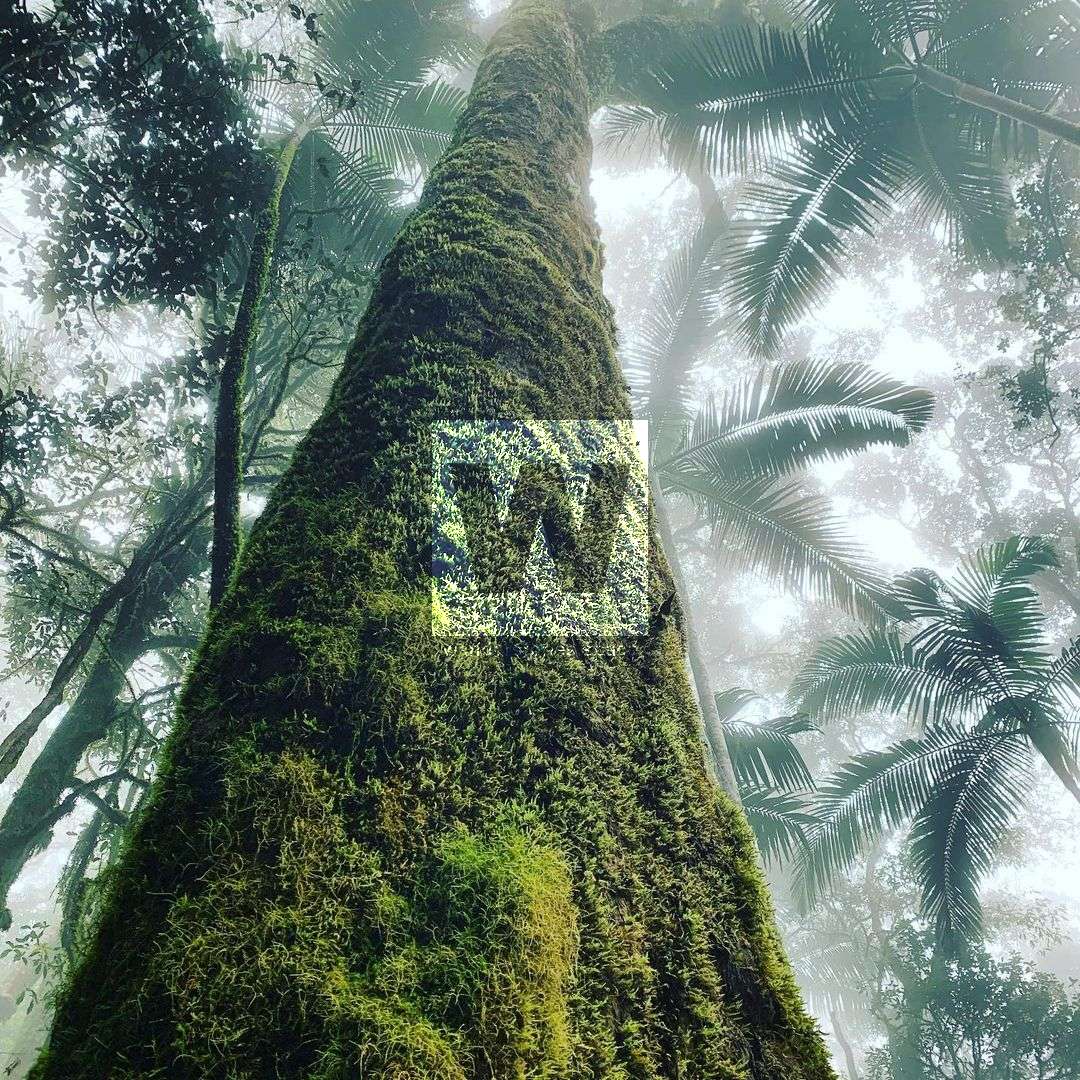
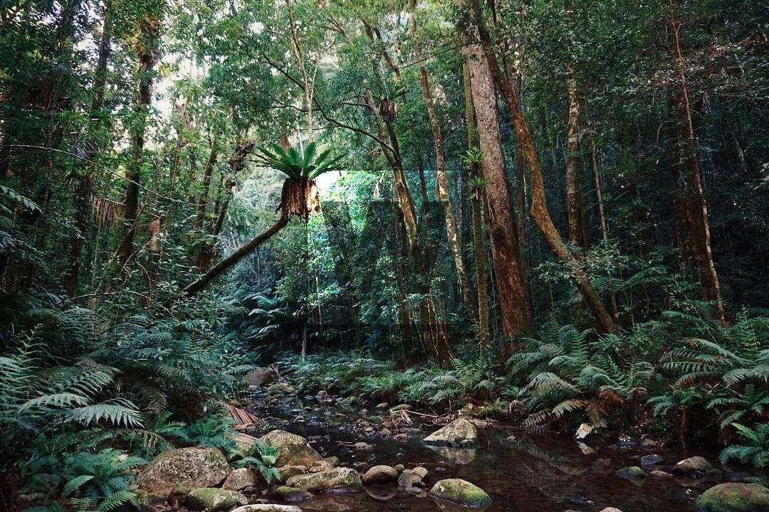
There are numerous deep creek crossings on the western approach which should not be attempted after heavy rain. It's a long and challenging hike through thick rainforest and steep terrain. Many people have said that the trail, although less elevation gain, is similar to Mount Bartle Frere - similar duration, intensity, weather, and, everyone's favourite, leeches.
The Western Approach
Distance - ~16 kilometres return
Time - 4-8 hours
From Eungella, drive north on Dalrymple Road for approximately 30km until you bear the end. There is plenty of room to park vehicles but be mindful not to block access to the private properties nearby. The trail is near the end of Dalrymple Road (-21.035190, 148.596398) and has a small National Park sign next to it with some pink flagging tape.
Walk along the maintained track keeping the pink flagging tape insight. Note that there are some old bits of flagging tape that may be misleading. Download the GPX file from the interactive map below.
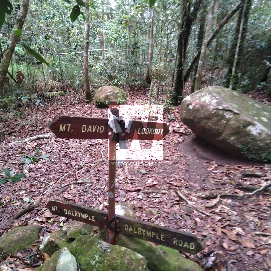
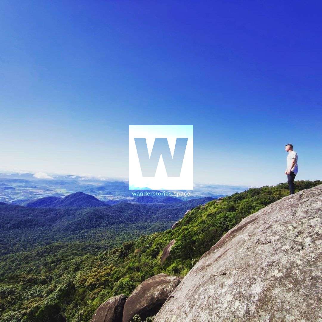
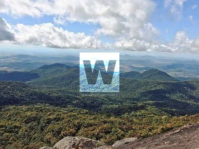
Photo Credit: @menzies1991 & @jar_hos & @helinatoivanen
Soon you'll pass the junction with Mount David splitting off Mt Dalrymple track. Although this trail is approximately 900m in length one-way, it isn't well-walked or well-marked and is overgrown. The summit of Mt David provides grand views where you can take in the stunning Pioneer Valley when you reach the top!
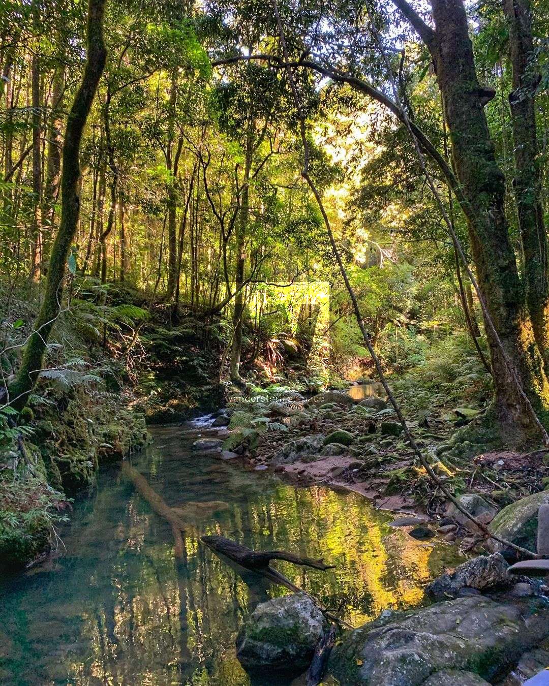
It's approximately another two kilometres to the summit of Mount Dalrymple from this junction. The trail undulates over the ridges and creeks. You will see old signs along the way with the last creek crossing sign advising "Last Water". Refill and enjoy the primordial setting before steeply ascending the trail to the summit.
@mackaythroughoureyes & @peak.freakz.au & @clazzzzztv
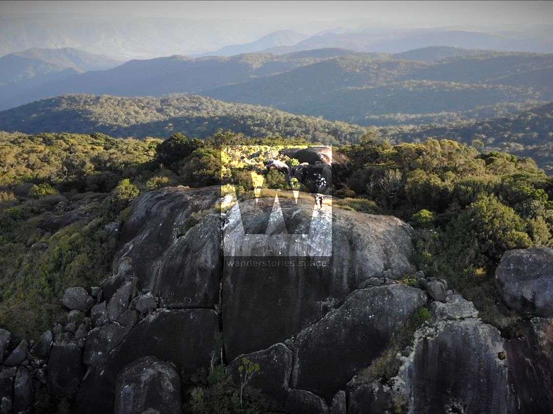
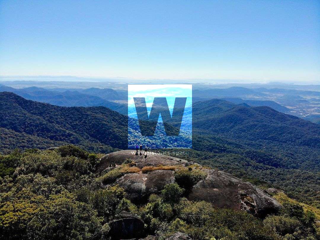
At the summit, you can scramble atop the boulders to get an incredible 360-degree unimpeded view of the surrounding Eungella National Park and out to the ocean near Mackay.
The western trail to Mount Dalrymple was established in October 1971. There is a plaque commemorating the efforts by the Mackay Bushwalking Club glued onto the granite boulder at the summit. A little black box geocache has a notepad and emergency water.
Return via the same route or continue down on the southern trail as a throughwalk - car shuttle required.
@elpho_
The Southern Approach
Distance - ~16 kilometres return
Time - 4-8 hours
The southern trail via Finch Hatton Gorge is similar in distance to the western trail but with an additional 300 metres of elevation gain. The Finch Hatton Trail starts from the end of Gorge Road (-21.069915, 148.637217) north of the township of Finch Hatton.
The track starts briefly along the track to the waterfall but soon deviates up the ridge before the turnoff to the Wheel of Fire. The trail takes about 4-5 hours to ascend and there is no water along the trail. However, there is a sign ~100 metres below the summit that advisors "last water" but this is only after rain or in the wet season.
There are a few places along the way where you can peer out and glimpse a view, especially from a spectacular rock formation 3/4 of the way up. The view from the summit is breathtaking with a large granite platform providing 360-degree views. There are a few small flat places below the granite for small tents.
Interactive Map
Tips & Notes
- The track is quite well-marked but it's recommended to take a GPS with the GPX file loaded on. While walking, keep an eye for the next marker.
- There's plenty of wildlife, including wild boars.
- There are plenty of leeches after rain, so consider using insect repellent.
- Lawyer cane is present in this area.
- It is recommended to wear long pants, hiking boots, and long socks. Also, pack a windshield/jacket for the windy summit.
- Be mindful around cliff edges, especially when it's clouded in.
- Mount William is also nearby.
This article, and all other articles, are for entertainment purposes only and are not to be used as a guide. Please see our Disclaimer for more information.