Mount Spec
Mount Spec (995 m) is the highest peak in the immediate area of Paluma Village and the second highest in Paluma Range National Park. Because so much mining and logging activities centred around the Mt Spec area in the late 1800s, there exists a rich history.


Location - Paluma Range National Park, North Queensland, Australia
Distance - ~15 kilometres return
Duration - Allow 3-4 hours
Grade - 3, medium
Mt Spec (995 m) is the highest peak in the immediate area of Paluma Village and the second highest in Paluma Range National Park. Because so much mining and logging activities centred around the Mt Spec area in the late 1800s, there exists a rich history and a lot of interesting information here. When mining and logging had ceased, Mount Spec National Park was proclaimed in 1952 and included in the World Heritage Wet Tropics Area in 1989.
It's all in the name
Surprisingly, there is no definite authority as to the naming of Mt Spec. There are several theories as to the origin, however, and the most likely explanation is that the name is derived from the name of a pack horse.
Right through to the early 1900s, tin and provisions were taken to the top of the mountain along Jacobson's Track by pack horse teams. One of the horses in a particular team is said to have had a white star or speck on its head and was called Old Speck. Because of its characteristic markings, this horse was the first to be seen as the team came around the mountain. Because the miners and packers got use to seeing the characteristic markings of this horse, they started applying the name to the mountain itself. Mr. E.A. Rankin, who rode Old Speck when tin scratching, was amongst the first to discover that this area could produce metal of saleable quantities.
Another theory suggests that the name came from a camping spot – Cloudy Clearing, the first name of Paluma Village – where pack teams emerged from Star Valley.
Another theory yet suggests that Mt Spec was named after Arthur Benham and his party struck tin in 1889 and said it looked like a good "Spec".
Another theory suggests "the spec," a sailing vessel hauling 164 tons of tin, arrived in Sydney in 1856 via New Caledonia trading along the east coast of Australia.
The final theory came from Benham family history, where Ilma Dance claims that there were two mountains that they mined – Mt Certainty and Mt Spec (speculation???). Ironically, they found no payable tin at Mt Certainty, but had success at Mt Spec.
Mapping of Mt Spec
During World War II it was rumoured that the Japanese bird-watching clubs that had been coming to northern Australia for many years had better maps of the northern coastline of Australia than the Australian defence forces.
Detailed maps of these high peaks were essential during war times, since they posed a hazard to Australian and American aircraft. Indeed, planes did crash during bad weather when visibility was poor. Examples can still be seen today on Hinchinbrook Island and on peaks in the Mt Elliot area.
Mapping these peaks was no easy task. Soldiers from Australia's 5th Field Survey Company (originally called the Second 1st Field Survey Company) surveyed many of Queensland's coastal peaks to establish their exact positions and heights. Although aerial photography was used back then, quality depend on the weather. If an area was covered by a cloud when a photo was taken, that area was blank, as far as surveyors were concerned. As well, it was hard to maintain a straight-line flight. So, aerial photos that were produced by separate runs may have substantial overlap, which was needed to a certain extent, or gaps may be evident, which also meant more blank areas on maps. In these cases, "ground truthing" was used to supplement aerial data and to establish exactly which peaks, valleys, and watercourses were in the blank areas.
Because the 5th Field Survey Company was a Queensland Company, many of its recruits were drawn from regional areas rather than Brisbane. Some had been fellow students at boarding schools like Nudgee College in Brisbane, which made many of them lifelong friends. Having recruits from a rural background was beneficial because these men were often timber or property workers. Their skills with an axe and saw and their physical abilities were ideal for the arduous task of scaling these peaks to help accurately map them.
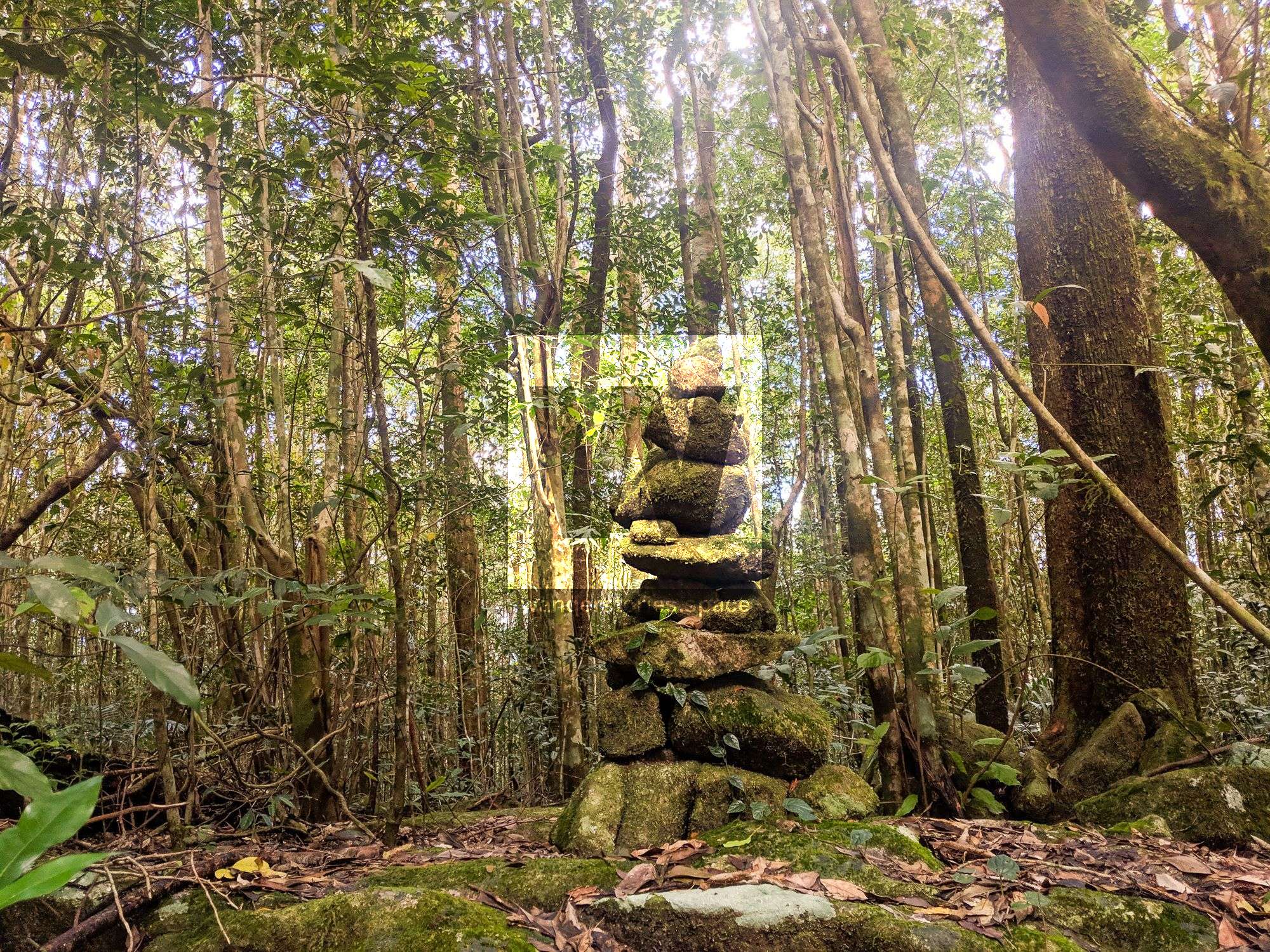
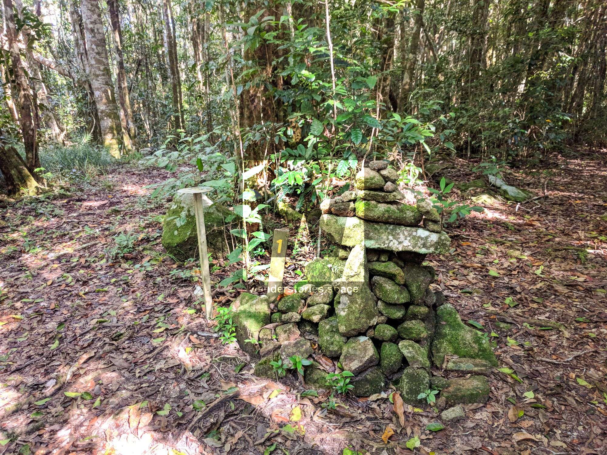
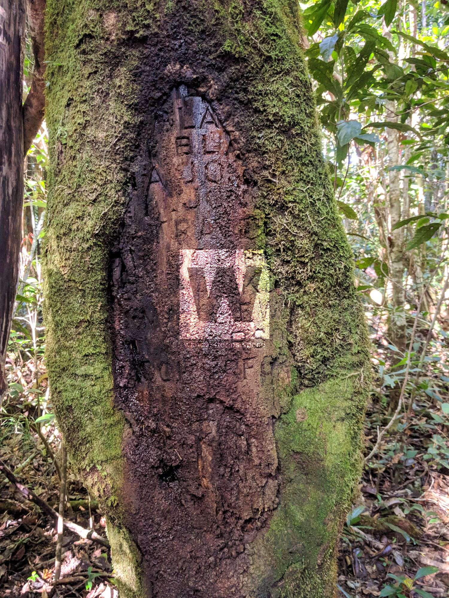
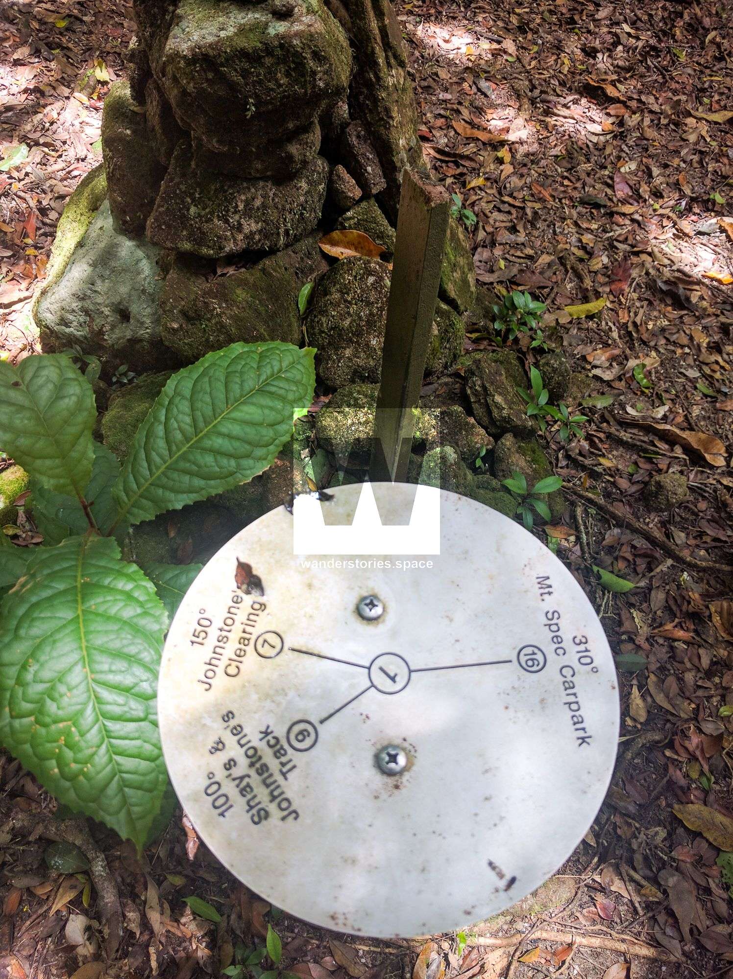
Some cool features
One of the Paluma Tracks leads right up to the summit. There, you can find a shield on a tree with some interesting information.
| Visible in 2006 | Actual name | What is known |
| 1 Bla | Possibly Ned Blain | Father of Milton Blain who joined the Unit at Gladstone in 1942 |
| 2 Blac | Probably Bill Black | Jack of all trades from Rockhampton or Mt Morgan. Vehicle driver. |
| 3 A Jon | A A Jones | Originally from the Airforce. Called "Ack Ack Jones" based on initials, did clerical & outside work. |
| 4 K Jon | Ken Jones | Father of Ack Ack Jones and Max Johnes. Originally from Tully Area. |
| 5 Trave | Ken Travers | Warrant Officer, therefore a bit older than others in the group. |
| 6 HF Powell | Bert Powell | Very precise and neat driver. Older brother Bob was the Quatermaster. |
| 7 R Walker | First name not known | Nothing known |
| 8 J Matthews | Joe Matthews | From Julia Creek, knew lots of outback stories eg "One chop Usher". |
| 9 Lowerson | First name not known | Nothing known |
| 10 Comerford | Ted Comerford | Very strong and nuggety - very good with an axe, jack of all trades. |
List compiled by Peter Brock, Townsville 2006, with kind help from Milton Blain, Jim Brock, Win Kenner, Joe Matthews, Lloyd Twine, Pat Walsh.
Getting there
Since the Paluma Trails network is so extensive, there are many options to summit this mountain. An interactive map is available in the Paluma Trails article. The easiest way thought is via the Paluma Dam. Then, follow the old logging roads from the south east end. Walk and then walk some more through the shade of the rainforest.
Interactive Map
What to take
- Mozzie spray
- Comfortable footwear and clothes.
- 1-3 L of water and maybe some snack
- A good attitude, and low expectations
This article, and all other articles, are for entertainment purposes only and are not to be used as a guide. Please see our Disclaimer for more information.