Paluma Maps

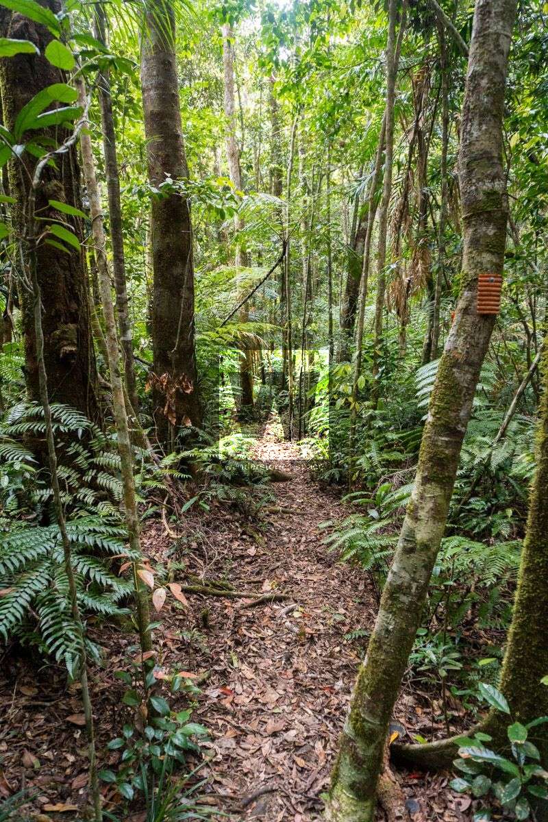
The Paluma region has over 100 km of walking tracks from the Bluewater track south of the Village to Jourama Falls ranging in short to multi-day hikes. Most of these walks follow old logging roads or mining tracks around the village and Paluma Dam. These trails have been re-established and maintained through the dedication of local resident Wilfred Karnoll and a small team of volunteers. We are under the belief that these trails are in the process of being formally incorporated into the National Parks track system. See our trail maintenance report to see which trails are open and clear.
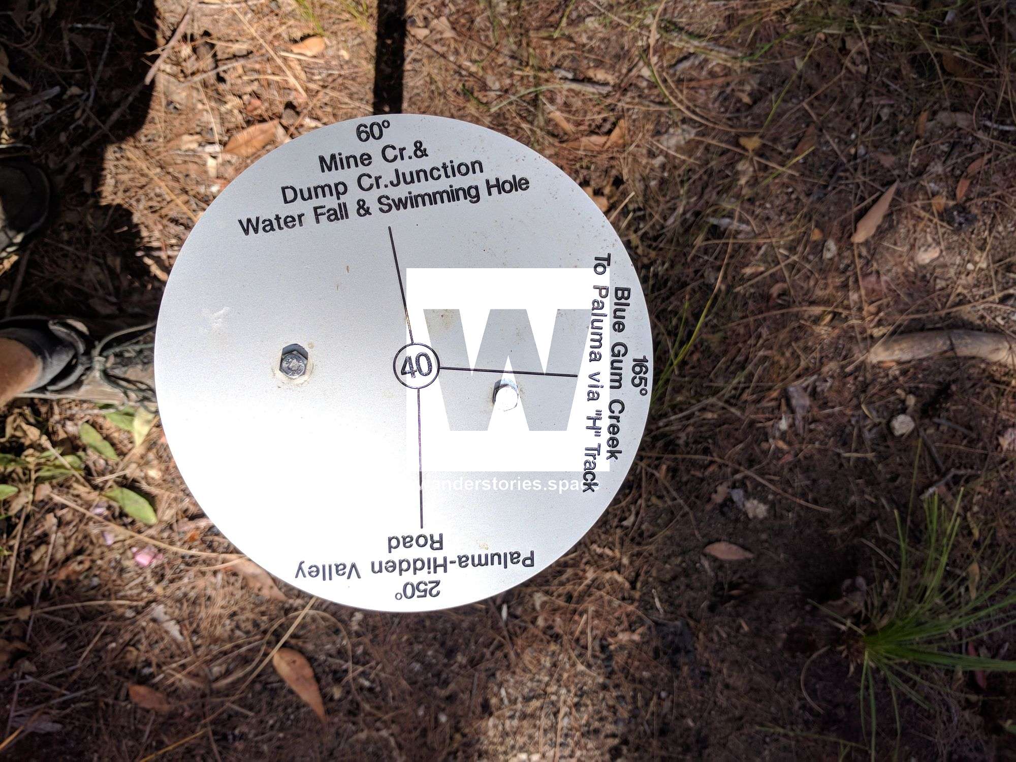
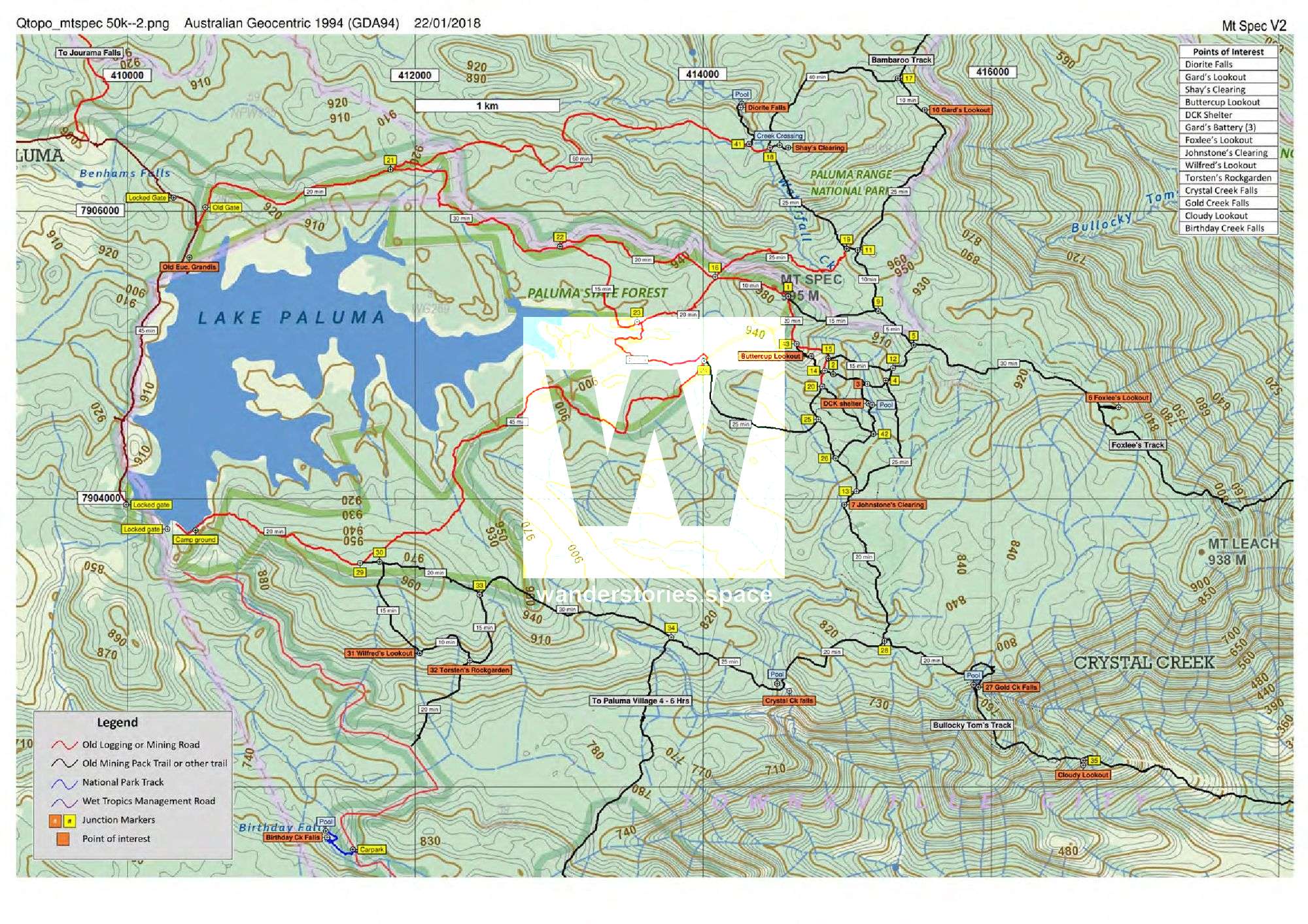
The Paluma Tracks have markers at each junction. They are assigned a unique number with labels of the points of interest in each direction with their compass bearings to help with navigation.
For the tracks south of Paluma township, see the PRB Track article.
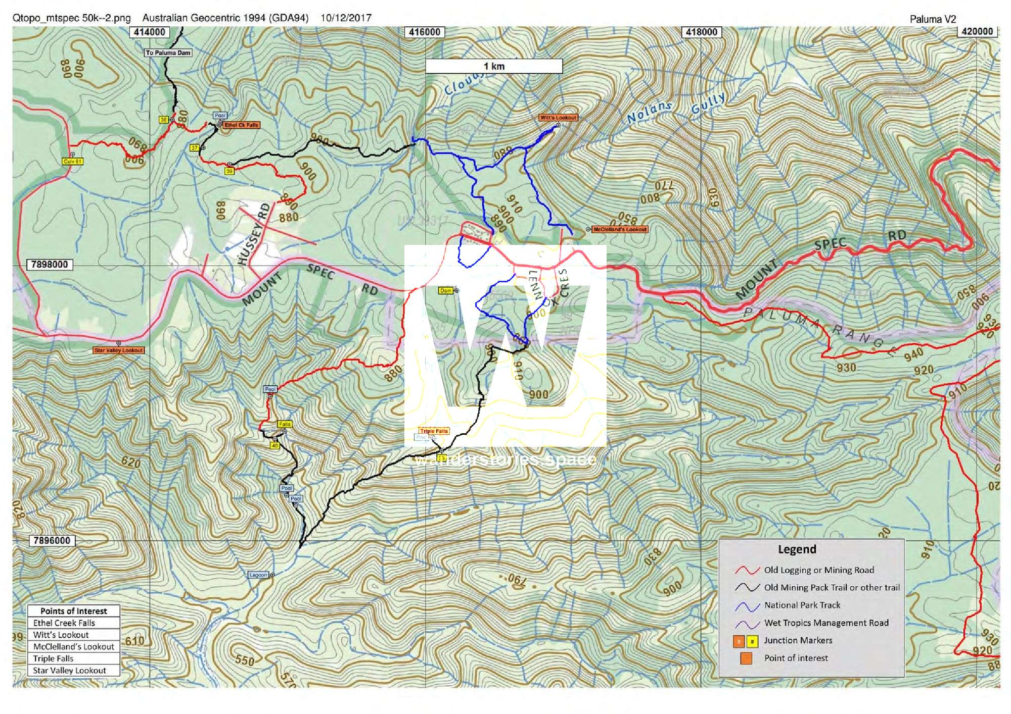
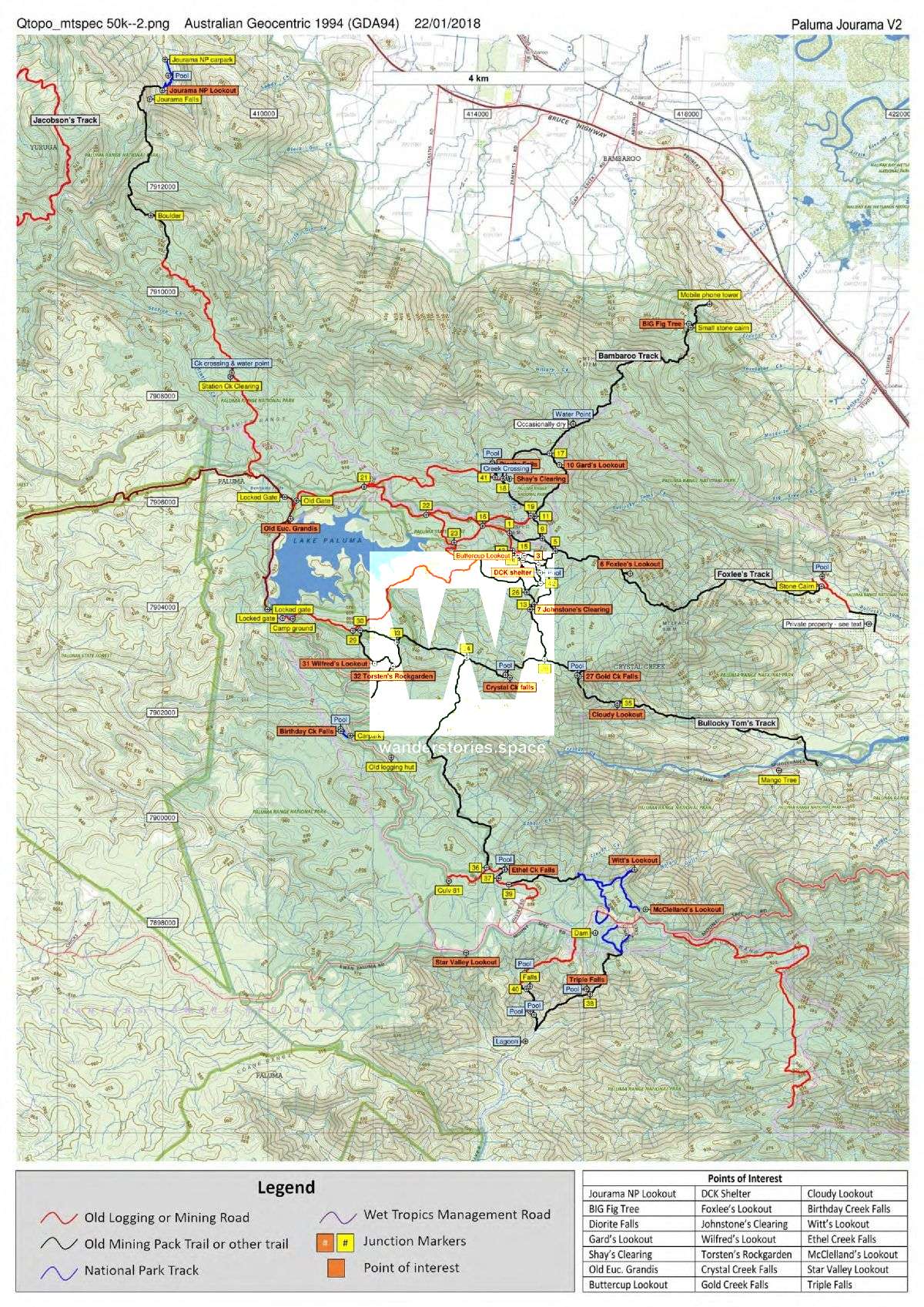
Maps are available for download in KML and GPX files - Garmin-compatible files suitable for GPS units. The maps are also available for download in PDF format for printing.
Printable topographical maps download (PDF)
Interactive Map
Here's an interactive map of the maintained tracks on the Paluma Plateau, around Paluma Township and Paluma Dam (also known as the Mount Spec area). These trails take you through the spectacular wet tropics rainforests that include many breathtaking views along the way.
Click the icons on the left to download the KML and GPX files.
For more information about Paluma, see paluma.org.
This article, and all other articles, are for entertainment purposes only and are not to be used as a guide. Please see our Disclaimer for more information.