Quartz Backpacking Circuit

This bikepacking journey from Townsville to Ravenswood return, covers both a bit of history and outback natural beauty. This 265 km circuit is designed for the adventurous cyclist, weaving rugged landscapes and historic towns. This ride offers a blend of challenge and discovery.
Interactive Map
Townsville to Ravenswood
Distance: 130km
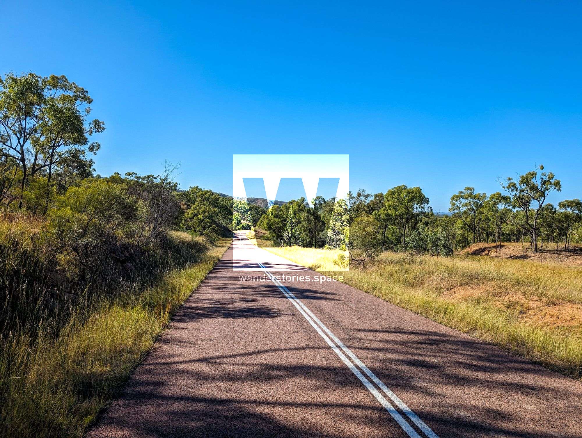
From Townsville, ride along the Flinders Highway towards Charters Towers for 95km. Pass Woodstock, Reid River rest area
Shortly after the long slog up the Mingela range, take a left to Mingela and then lightly travelled Burdekin Falls Dam Road. After 40km, you'll arrive at Ravenswood township.
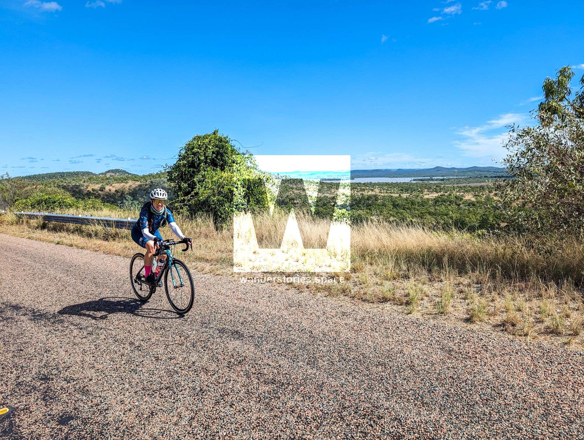
Burdekin Falls Dam Road
Ravenswood to Townsville via Ayr
Distance: 135km back to Townsville
Ravenswood, a rural town in Queensland's Charters Towers Region, embodies a rich tapestry of history centered around its gold mining heritage. Since the discovery of gold in 1868, Ravenswood flourished, at one point housing nearly 5000 residents and boasting 48 hotels during its peak in the late 19th and early 20th centuries. Despite experiencing a decline in population following a mining downturn and World War I, the town has preserved several historic buildings that echo its prosperous past. In recent years, the mining sector has seen a resurgence, sparking growth in the local population and economy. Ravenswood remains a significant historical and cultural site, offering insights into Australia's mining history and serving as a living museum for visitors and historians alike.
Side Trip - Burdekin Dam
Distance: 80km one-way
A journey to the Burdekin Dam from Ravenswood offers an angulating side trip for those exploring the region, particularly if continuing southwards on the Bicentennial Trail. Water is available at the Dam's campground. This scenic ride traverses rugged outback terrains, showcasing one of Australia's largest dams. Be sure to stop off at the Lookout.
Side Trip - Ravenswood Lookout
This viewing point provides a lookout over Ravenswood and the Mine.
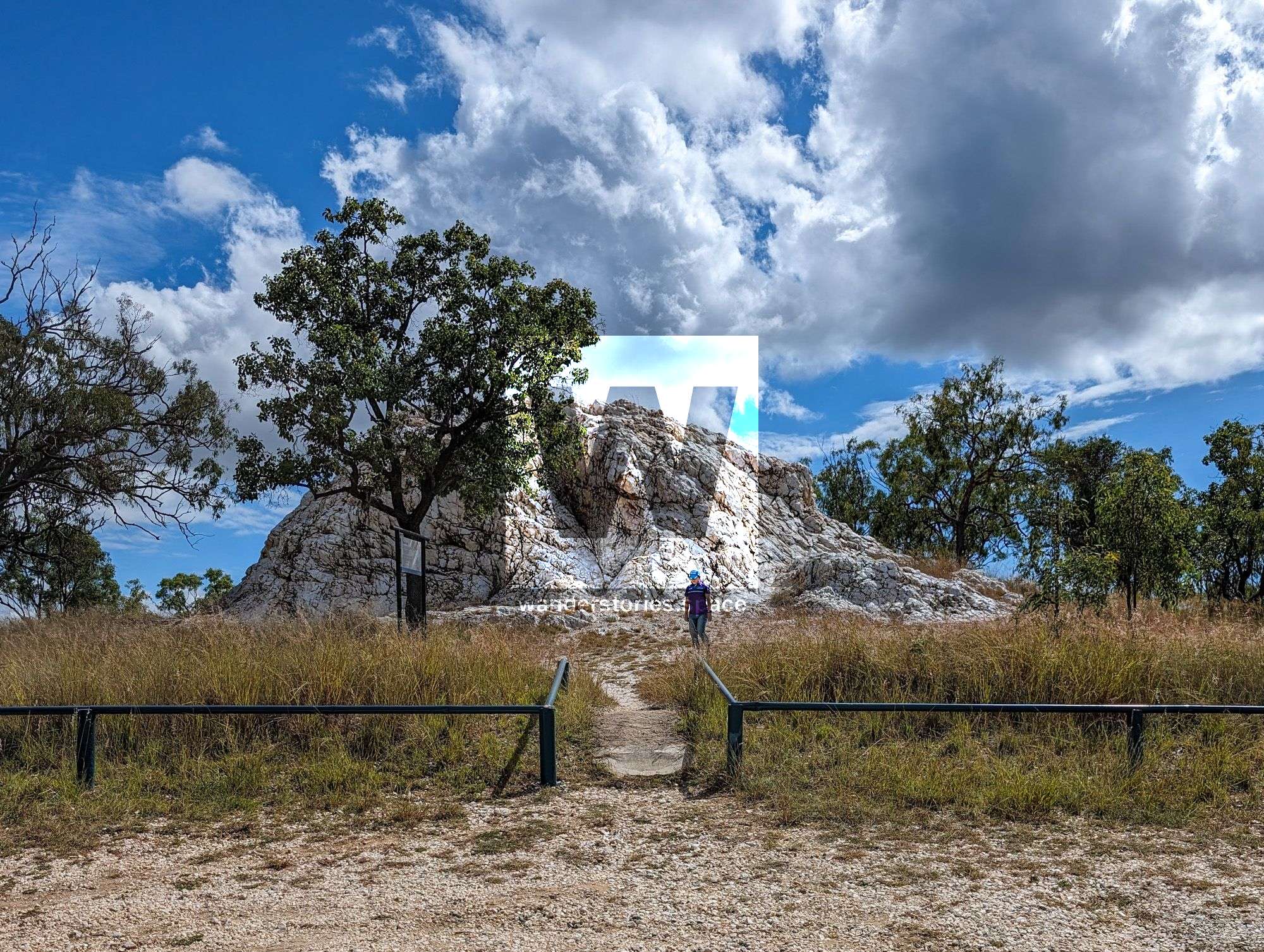
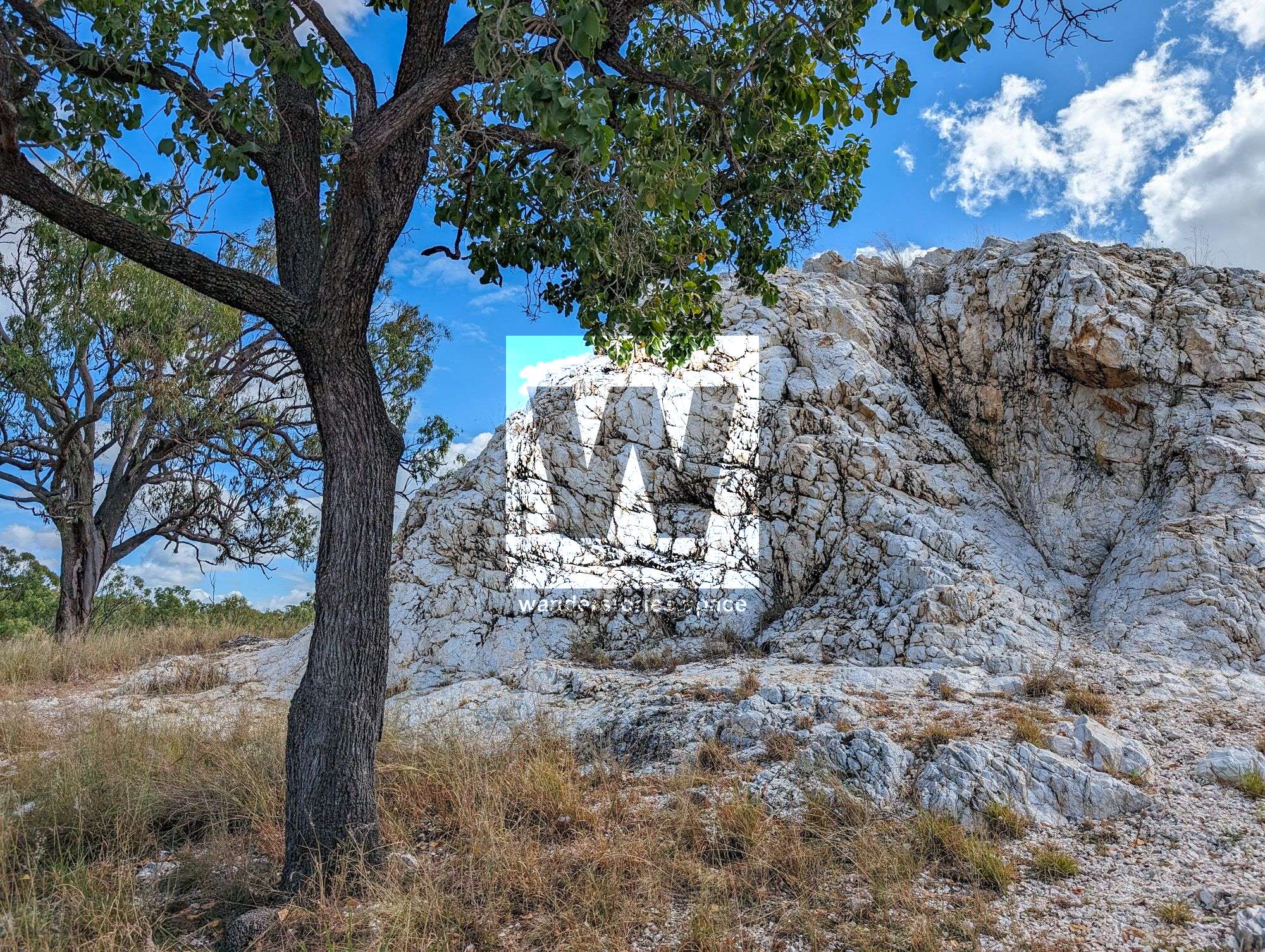
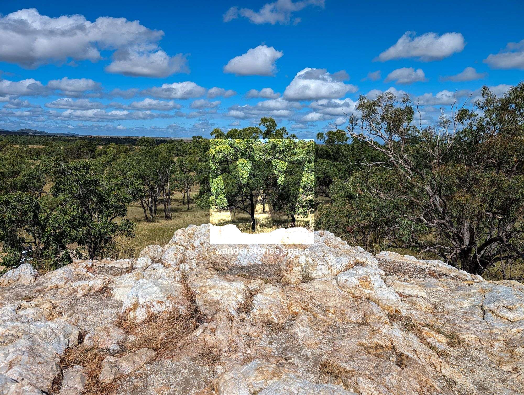
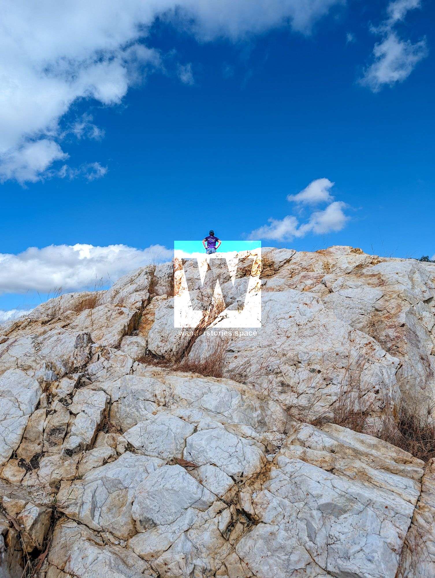
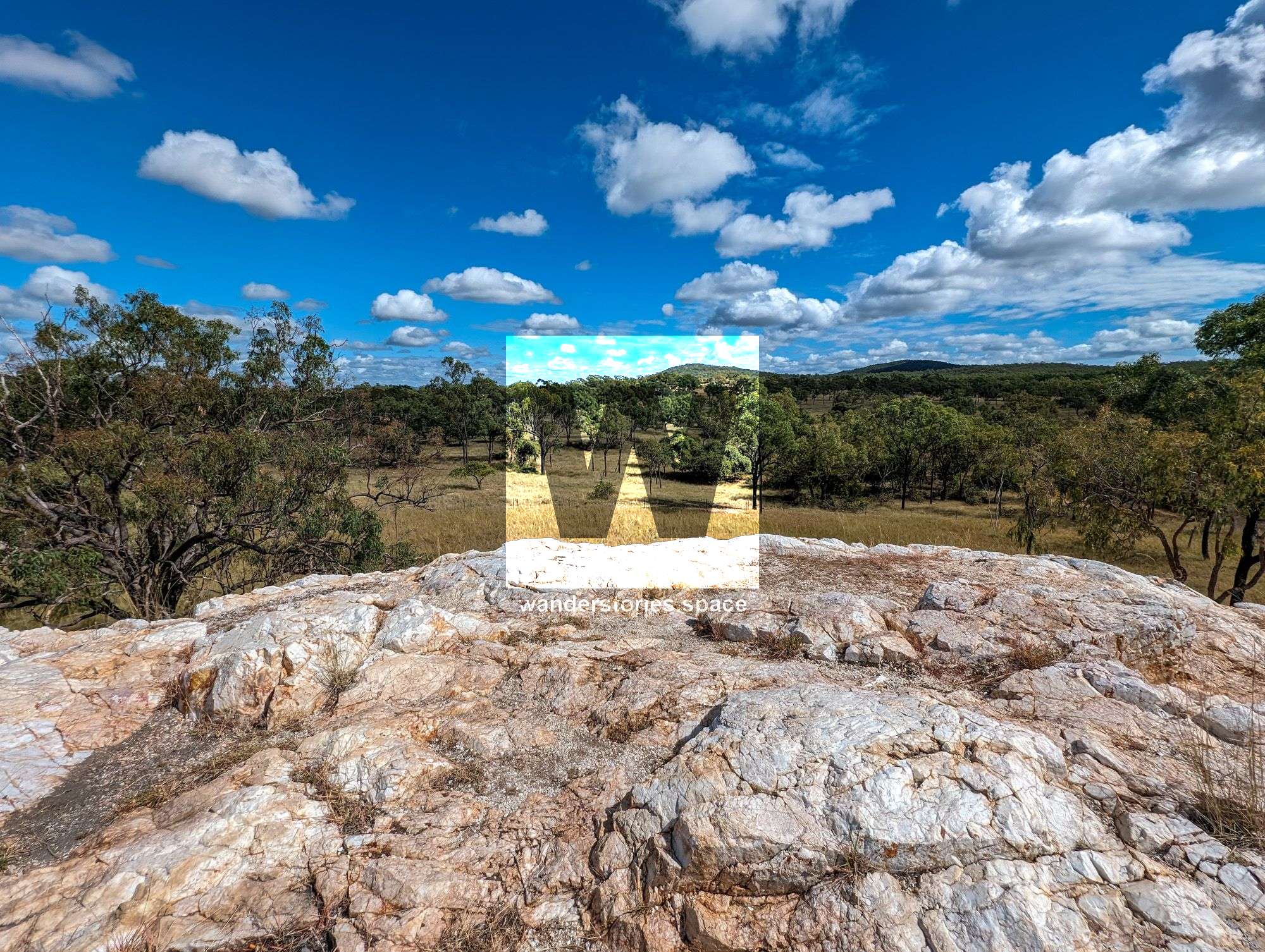
White Blow
Side Trip - White Blow
Distance: 500m one way
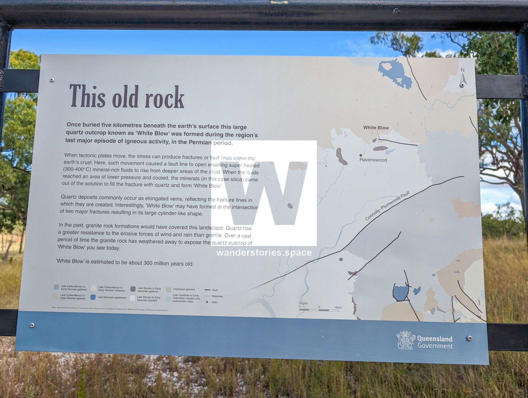
White Blow Conservation Park, located in Queensland, Australia, is renowned for its unique geological feature known as White Blow. This large quartz outcrop stands approximately 15 meters high and 45 meters wide, making it the largest among several quartz formations in the area. Quartz blows such as this are formed through earth movements that create fractures, allowing mineral-bearing fluids to pass through. When the pressure or temperature decreases, silica—present in the fluid—precipitates and fills these fractures, eventually forming the quartz mass seen today. The formation of White Blow at the intersection of two fracture zones suggests a more extensive opening, leading to its significant size compared to other nearby quartz deposits found in regions like Mount Isa and Georgetown.
In terms of biodiversity, White Blow Conservation Park provides a vital habitat characterized by open woodlands dominated by ironbark trees with a lush grassy understorey. This environment supports a variety of wildlife, including frilled lizards (Chlamydosaurus kingii) and sand goannas (Varanus gouldii), which thrive among the warm rocky outcrops. Additionally, the park is a hunting ground for predatory birds such as black-shouldered kites (Elanus axillaris) and wedge-tailed eagles (Aquila audax), which patrol the skies in search of small mammals and reptiles. The park’s natural landscape offers a serene retreat for nature enthusiasts and serves as a critical ecosystem for the region’s flora and fauna. Visitors to the park can explore the striking quartz formations while enjoying the rich natural history and scenic beauty of this protected area.
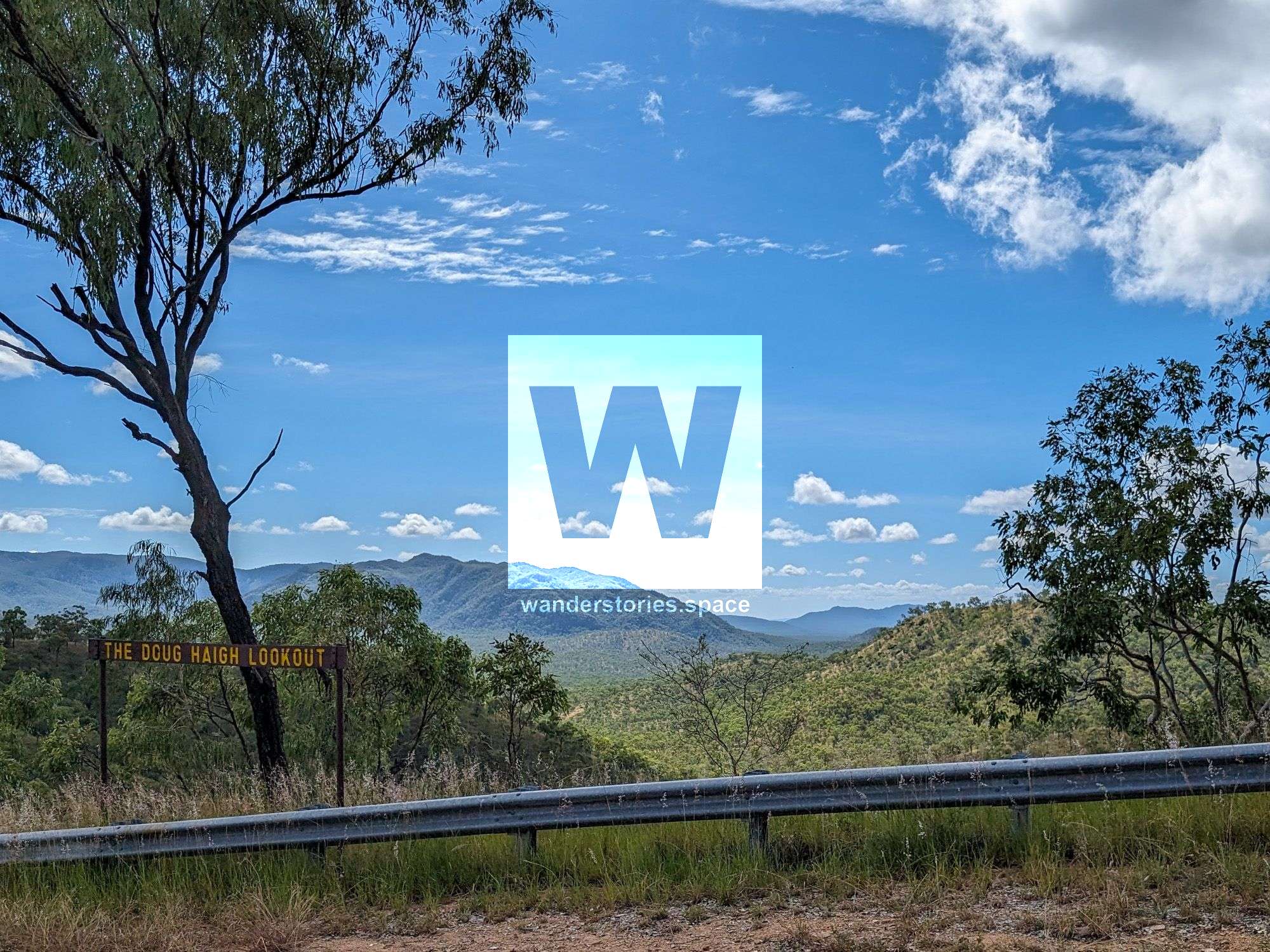
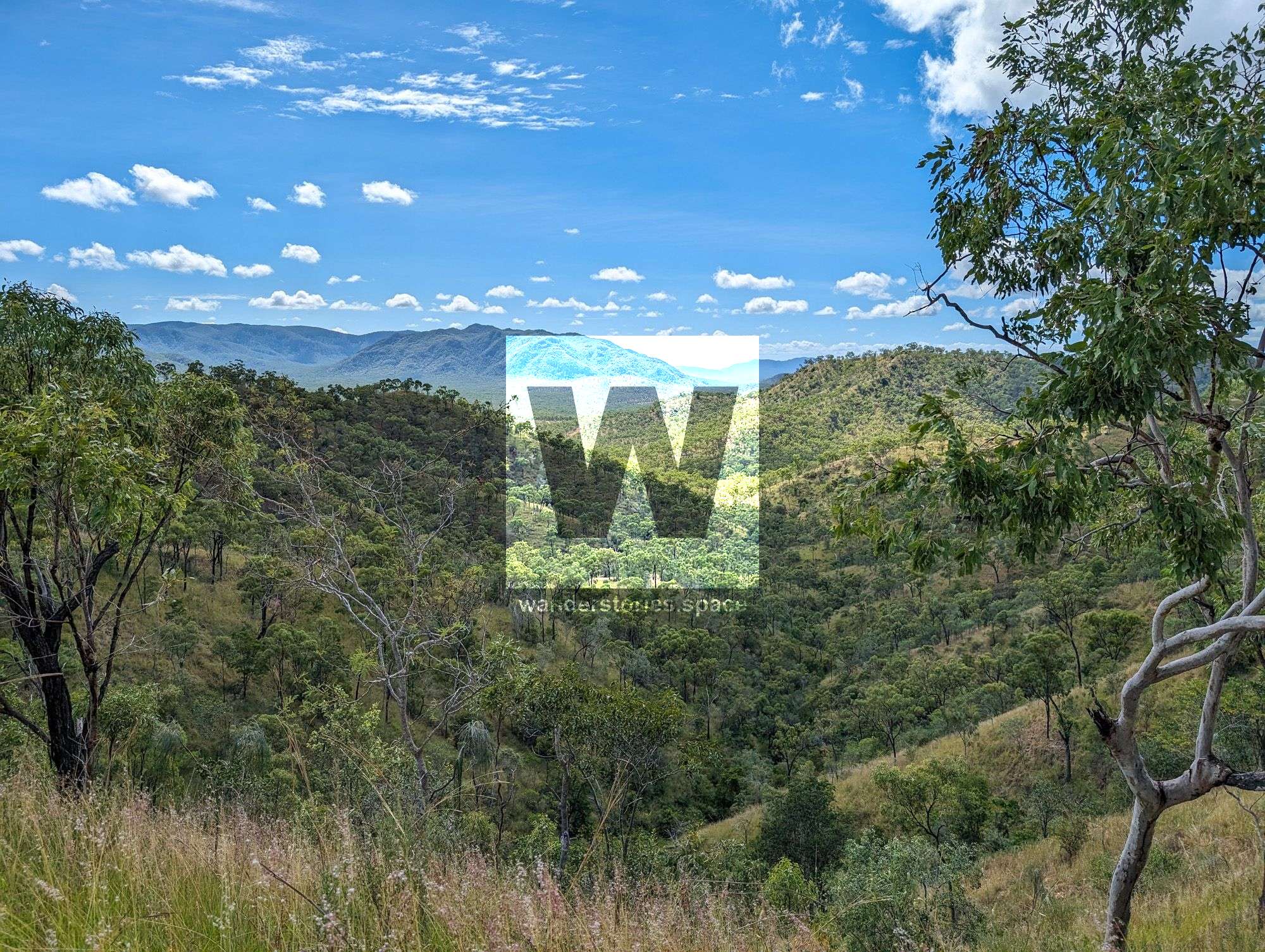
The Doug Haigh Lookout
The Doug Haigh Lookout
The Doug Haigh Lookout is a scenic spot located along the Ayr-Ravenswood Road, offering expansive views of the surrounding countryside and beyond. Named after a local figure, Doug Haigh, the lookout provides a panoramic vantage point that is popular with both locals and tourists. Visitors to the lookout can enjoy sweeping landscapes that include agricultural fields, natural bushland, and the distant outlines of mountain ranges. The lookout is a quick stop for those travelling between Ayr and Ravenswood, serving as a nice lunch spot or to stretch the legs and perhaps capture some photographs of the stunning vistas.
The last section of this route takes you through the cane field of Clare and Ayr surrounds before navigating around Mt Elliot in Bowling Green Bay National Park.
Notes
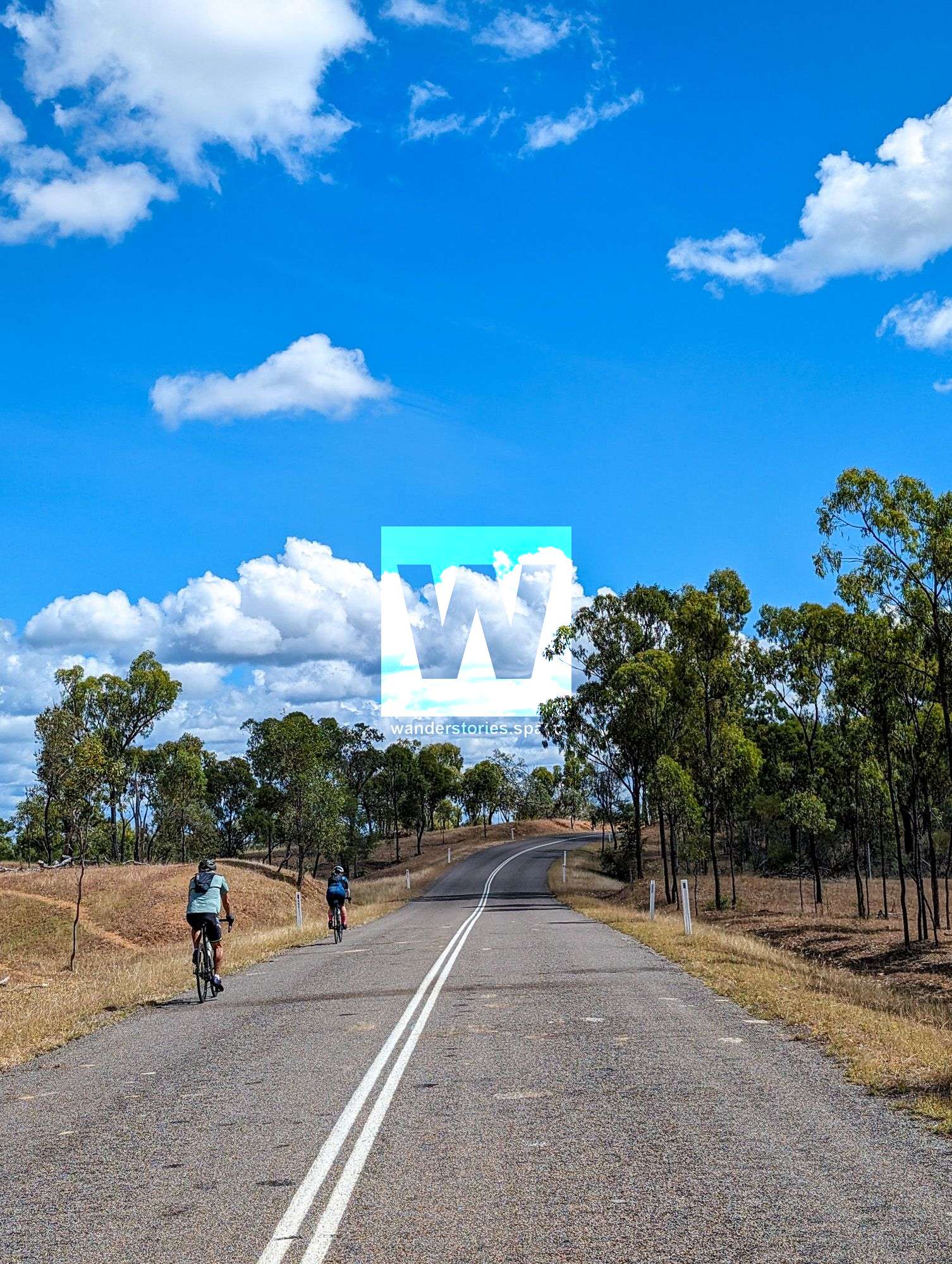
- The ride covers a fair bit of bitumen and some gravel dirt roads.
- This route is remote and water is hard to come by. You will need to be fully self-supported.
- There are several places for accomodation along the way and can be broken up into several days. This includes Reid River rest area, Mingela, Ravenswood (Showgrounds camping & hotels).
This article, and all other articles, are for entertainment purposes only and are not to be used as a guide. Please see our Disclaimer for more information.