The Black Hole Track, Waterview Creek
This loop circuit has a lot of variation in landscape and vegetation. The track start by walking to the Jourama Falls Lookout where you will admire the tiered waterfall system.

Location - Paluma Range National Park, North Queensland, Australia
Distance - approximately 9 km circuit
Time - allow 8 hours
Grade - 4
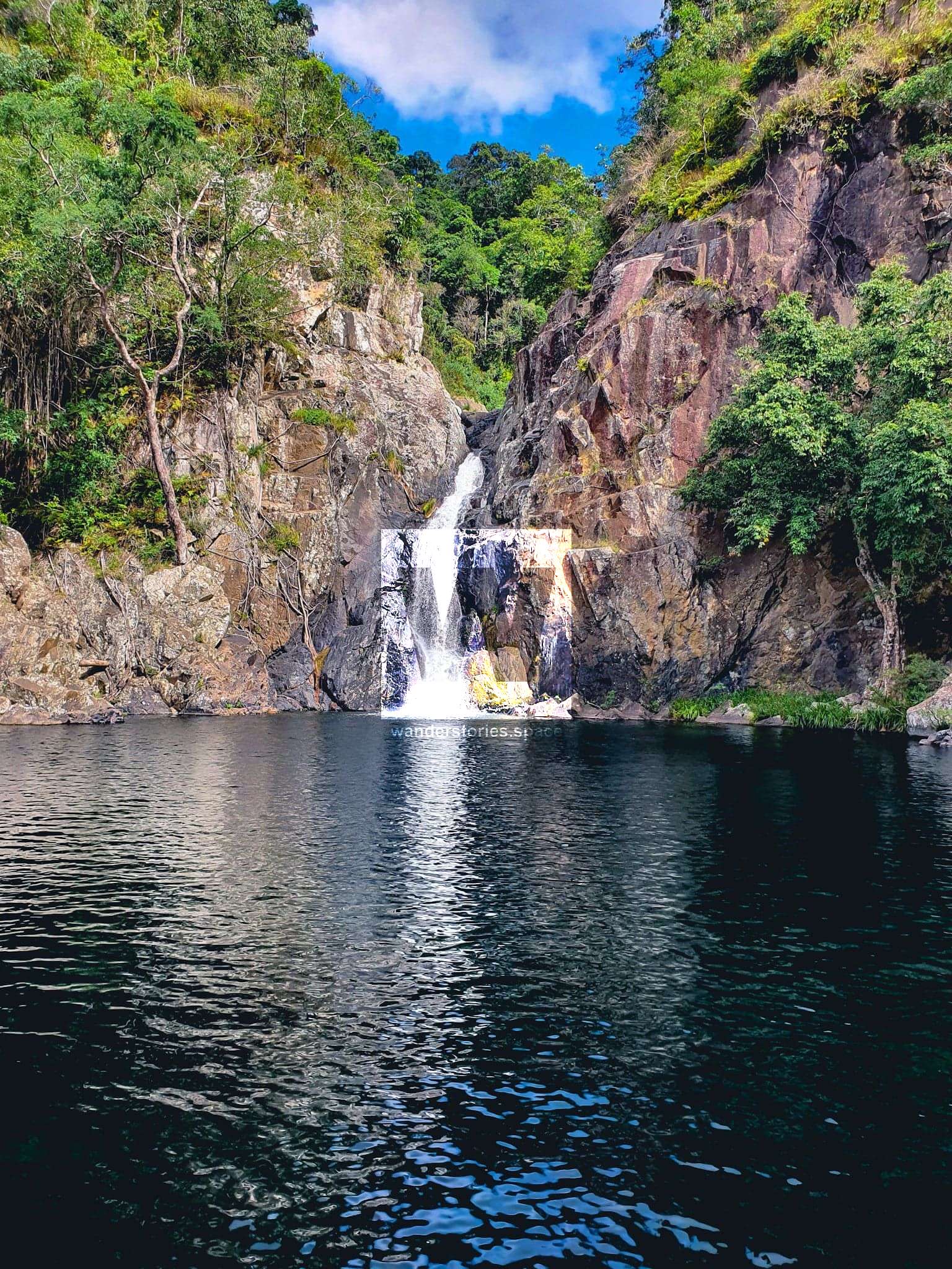
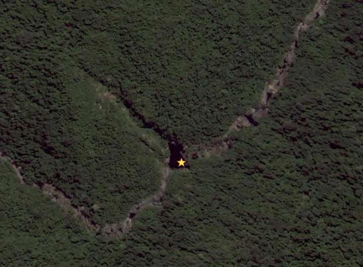
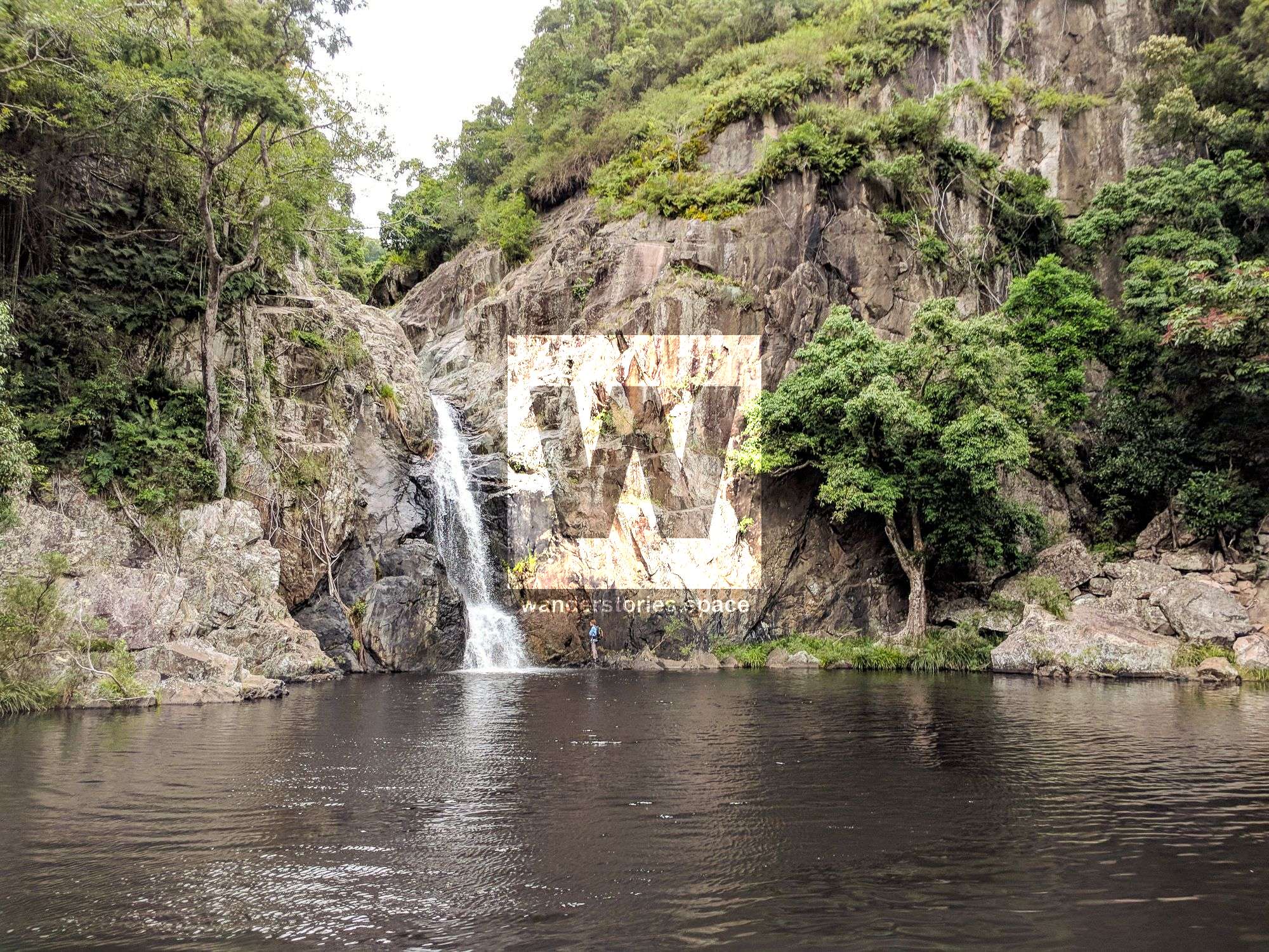
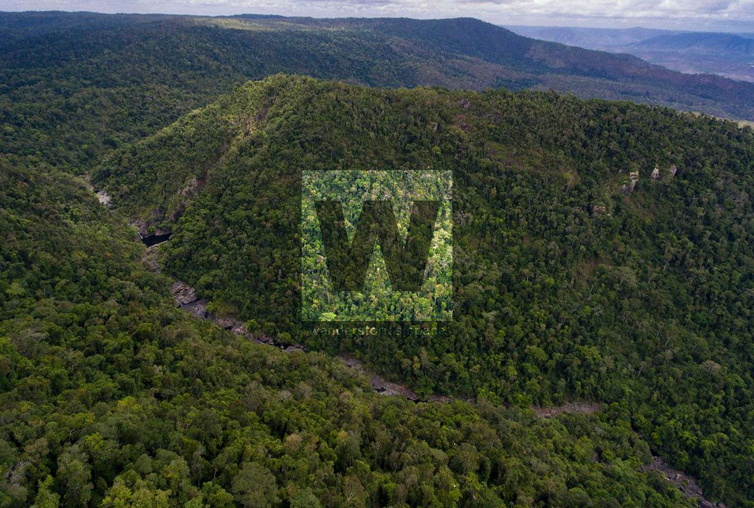
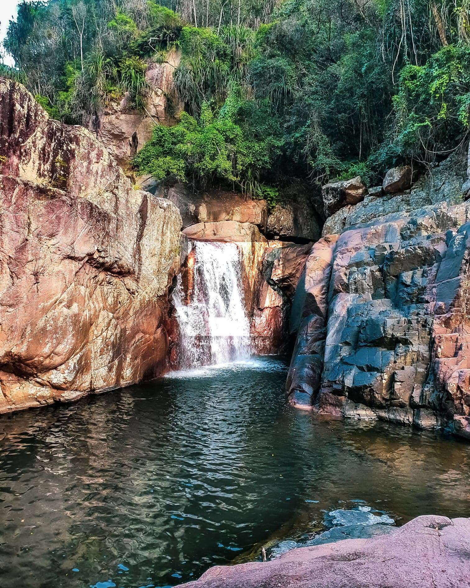
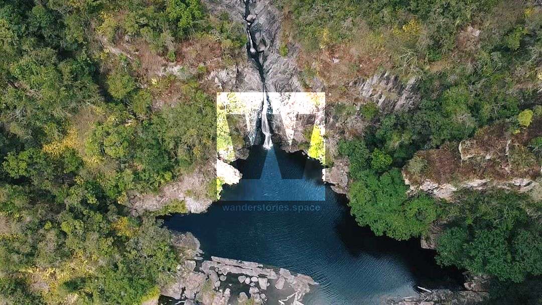
The Black Hole consists of a deep swimming pool and a waterfall. It was named by Luen Warneke due to the dark image of the deep pool produced on aerial imagery. This loop has a lot of spectacular views and traverses a variation in landscape and vegetation. You start by walking to the Jourama Falls National Park Lookout and admiring the tiered waterfall system from below (1.1 km). Then ascending the ridgeline through the bushlands and rewarded by views from 'the campsite' ledge (+0.5 km). Contouring around the valley and down into Waterview Creek arriving at the top of Jourama Falls (+0.6 km). Allow 1 hour to reach the top of Jourama Falls.
Take in the views from the top of Jourama Falls before continuing along the track ascending through the rainforest. At the Black Hole Track junction (+1.5 km), take a right and descend back down into Waterview Creek Valley and you will soon arrive at The Black Hole swimming hole (+1 km). The Black Hole pool appears dark because of its depth which is approximately 25 metres deep.
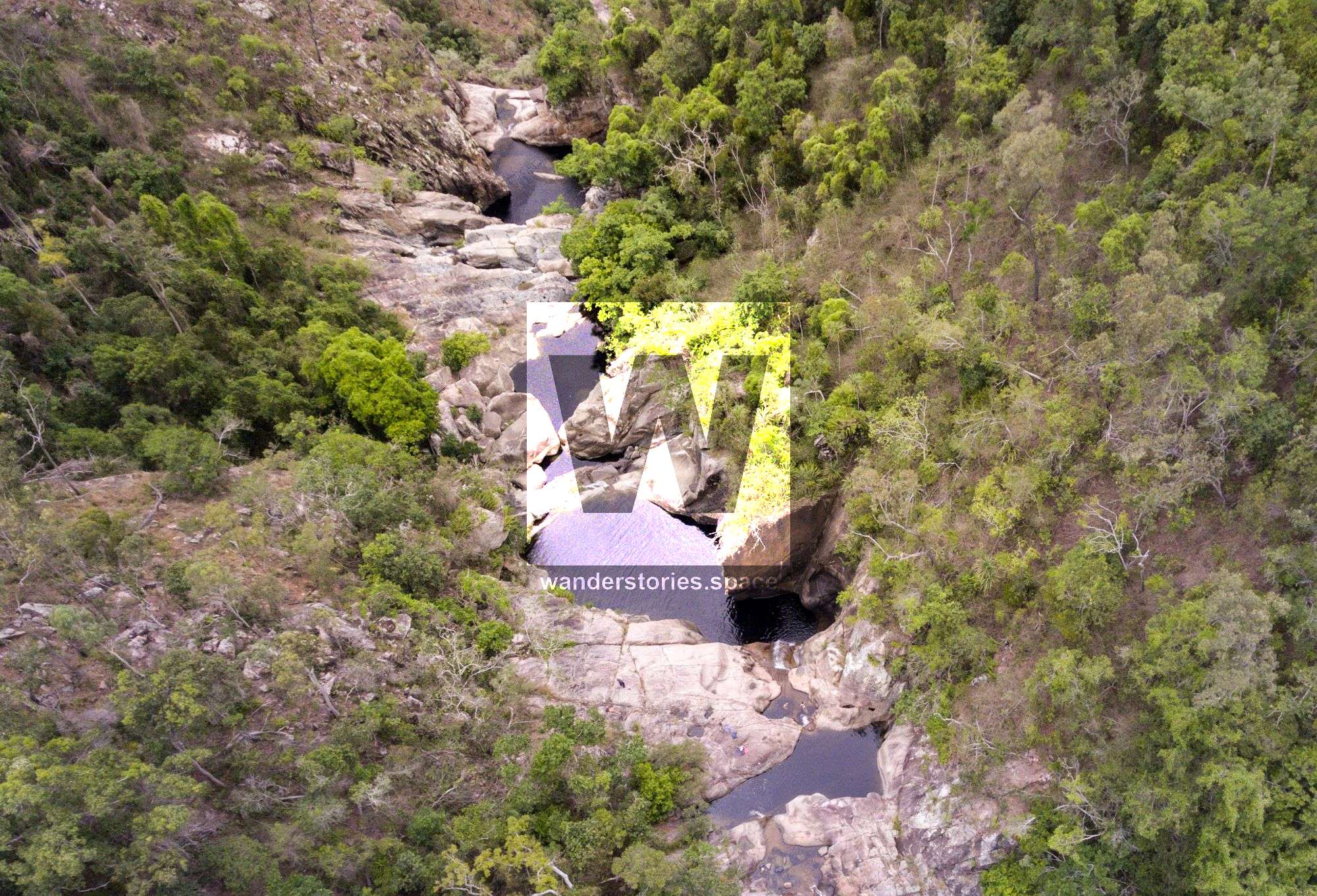
From The Black Hole, you now have the option to rock hop down Waterview Creek to the top of Jourama Falls (+2 km) – or return via the same route OR ascend the track to Paluma.
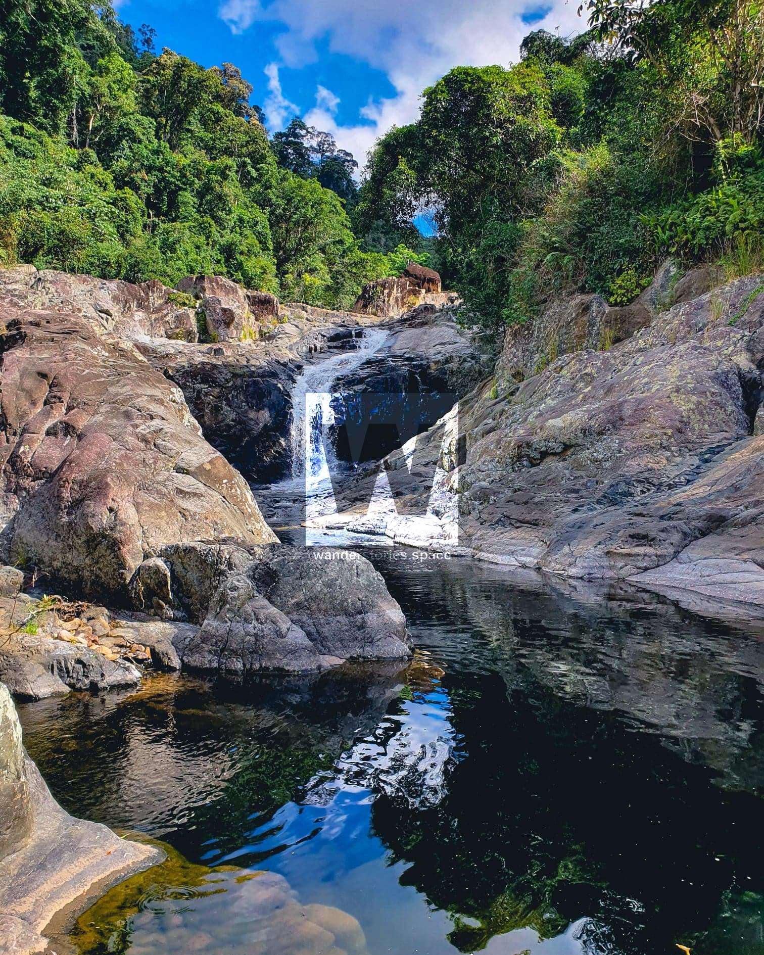
If you choose to rock hop down Waterview Creek, you will pass several pretty waterfalls along the way. Once you have arrived at the top of Jourama Falls, take the track back down to the National Park Lookout – the same way you came up (+2.2 km).
Interactive Map
We have several articles on Jourama Falls and The Black Hole and how to get there from several different routes.
This article, and all other articles, are for entertainment purposes only and are not to be used as a guide. Please see our Disclaimer for more information.