Thorsborne Trail - South to North - a hidden treasure

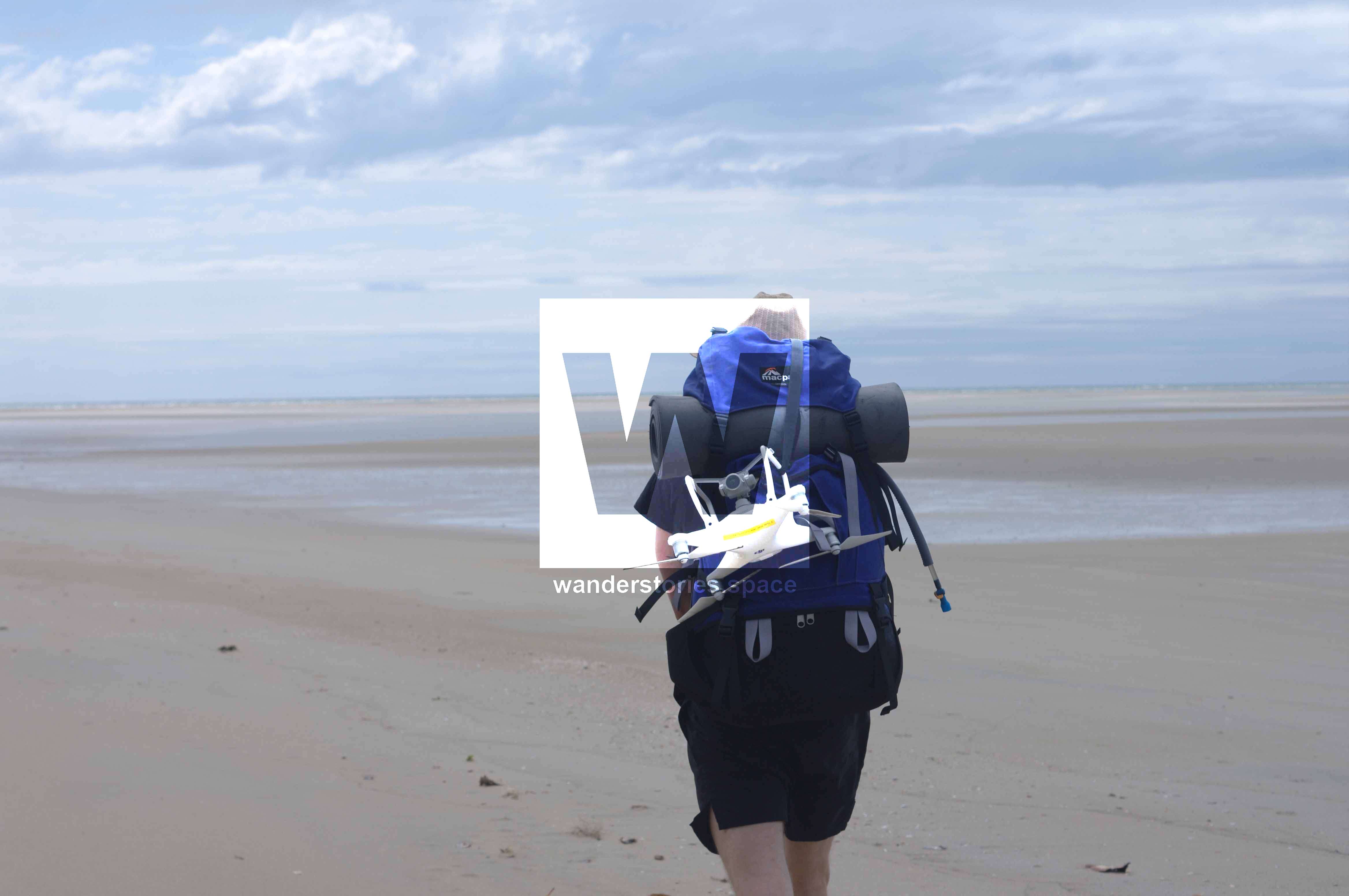
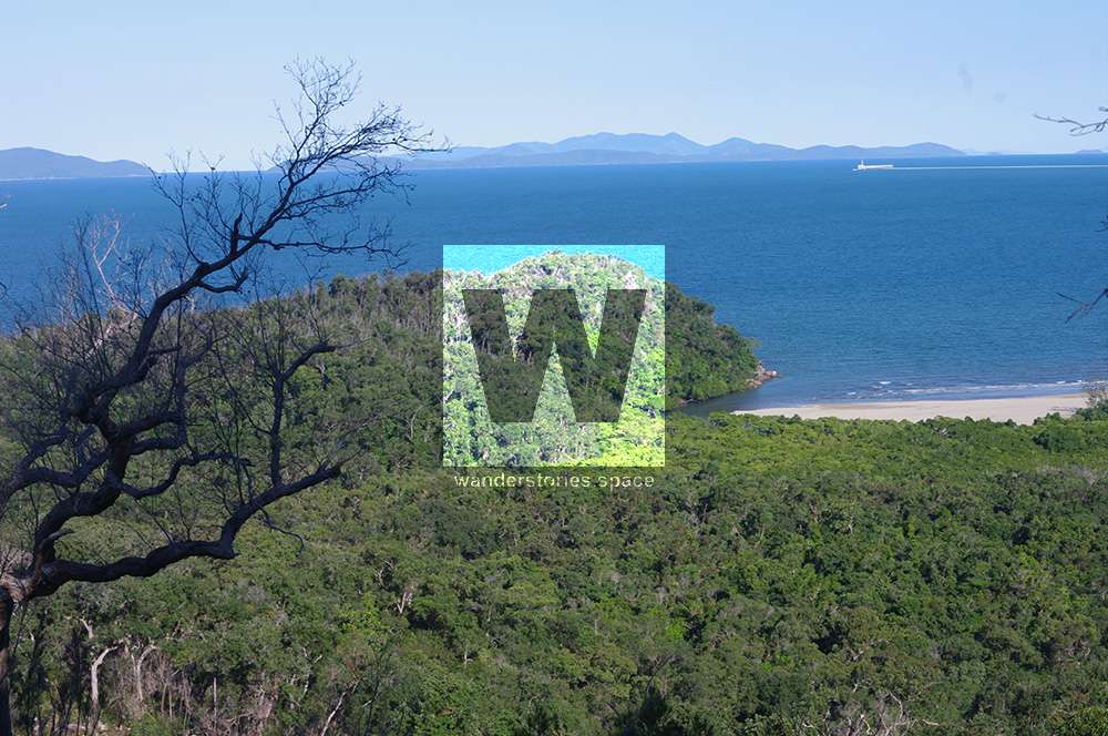
So last weekend we finally packed our bags and went out to Hinchinbrook Island for four days to hike the Thorsborne Trail. I had never done a multi-day hiking before and was a little nervous, as well as excited. There is nothing on the island other than stunning nature and wildlife (including crocodiles). It really gives you an idea of how our planet might have looked before we started building streets, houses and cities. So you have to be fully self-sufficient. Therefore the packing and planning took us some time. In the end our packing list looked like this:
What to bring
- Backpack
- Sleeping bags
- Sleeping mats
- Water purification method [Boiling, UV, Filter, Chemical] - we took tablets but didn't end up needing them
- Freeze dried food packs
- Oats or muesli
- Snacks (apples, Oreos, Haribo, nuts)
- Gas burner, adapter, gas bottle
- Toothbrush and toothpaste
- Two bowls, two sporks
- Lightweight cooking pot
- Plastic bag for rubbish
- SLR
- Phones
- Drone (DJI Phantom 4)
- Mini battery bank
- First aid kit
- Headlamp
- Some string or rope
- Hinchinbrook Island tide timetable
- Map of Thorsborne Trail
- Hat
- Sunscreen
- Insect repellent (definitely needed!)
- Biodegradable toilet paper
- Microfibre towel
- Watch - for when phones are flat (need for timing low tide crossings)
- Lightweight tent
Luen's backpack weighed just over 17 kilos and mine 13 kilos. We packed very lightly and only took the necessary things and despite my concern that I would get super annoyed with carrying a heavy bag, I was fine (most of the time); a good quality backpack helps as well. We saw some people though, carrying bags about 25+ kilos and they did not seem to enjoy the hiking as much.
How to get there
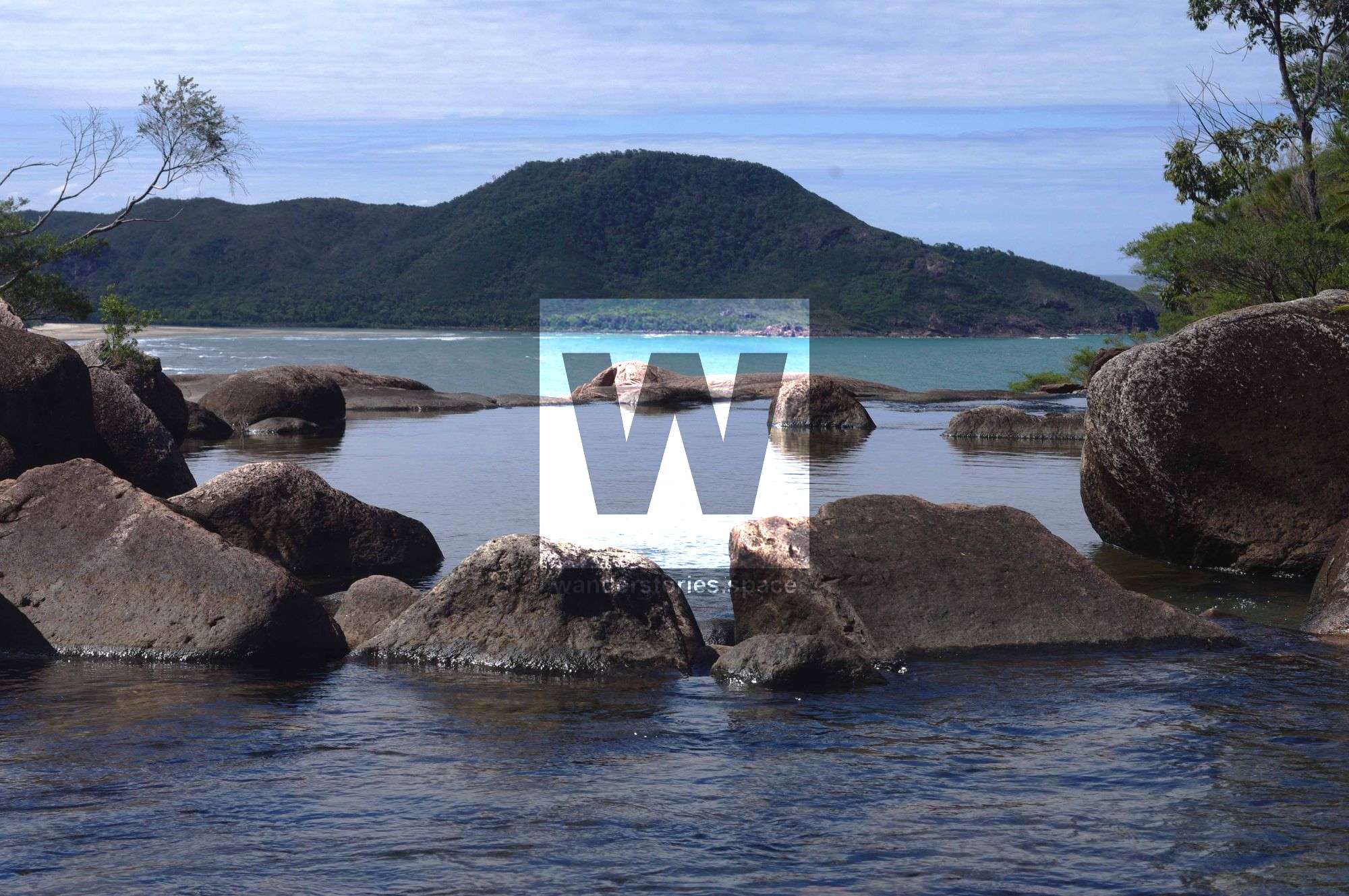
Only 43 people are allowed at a time on the trail so it is necessary to book in advance. Further we arranged our ferry ride to the island with Hinchinbrook Island Cruise which costed $190 per person. But all the preparation and even the fairly expensive ferry ride was definitely worth it. The Thorsborne Trail was the most beautiful trail I have ever hiked and one of my top experiences in Australia.
We left our car in the free, long term carpark at Port Hinchinbrook near Cardwell and took the ferry to George Point. We hiked the trail from south to north, finishing at Ramsay Bay - which is opposite to how most people walk the trail but worked out great!
What to do
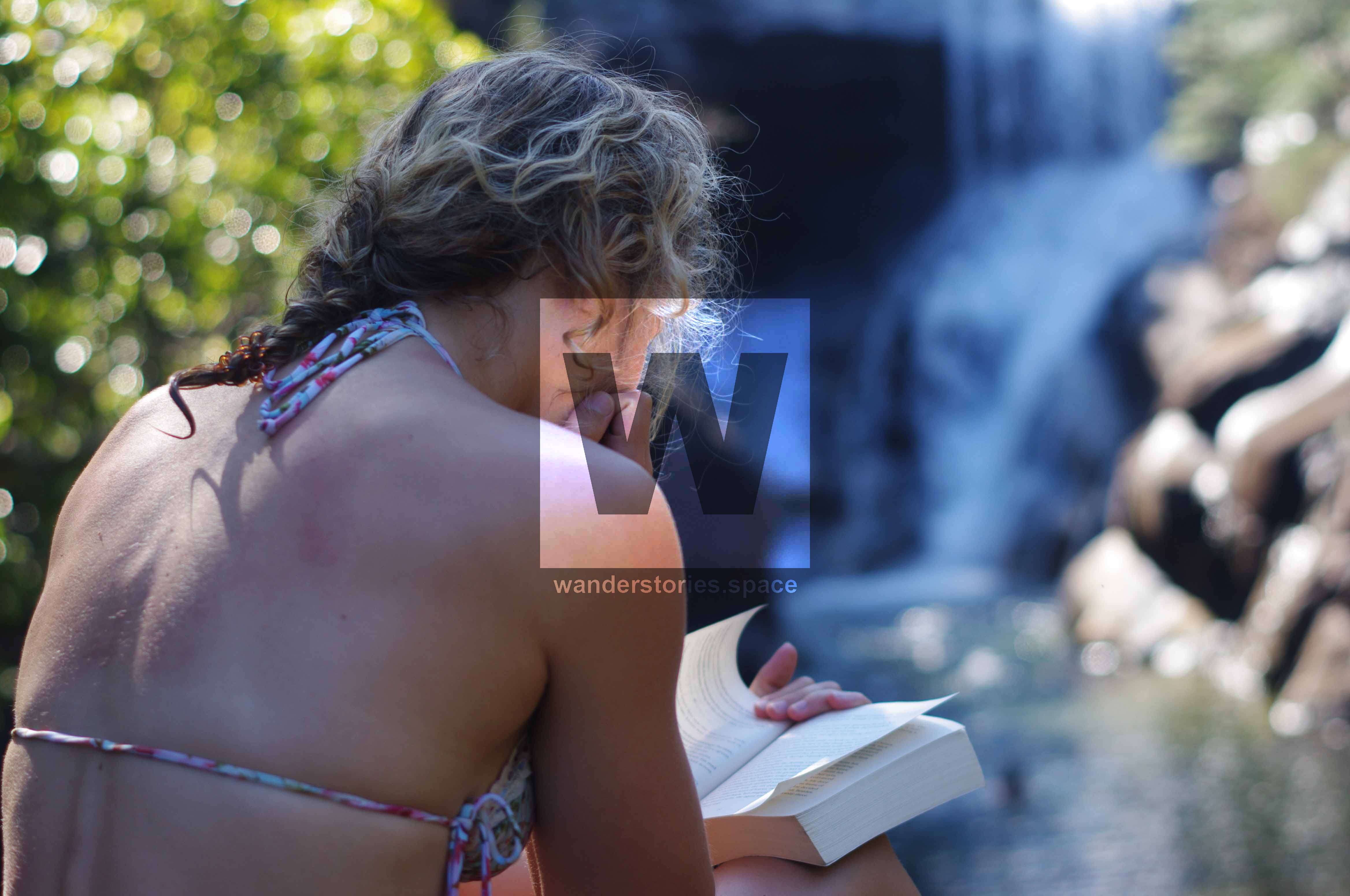
Well, of course hiking! But apart from that: swimming underneath waterfalls, drinking from crystal clear creeks, relaxing on the beach and exploring nature. The trail leaves enough time to enjoy all it has to offer without rushing too much. I even managed to read a few pages of my book.
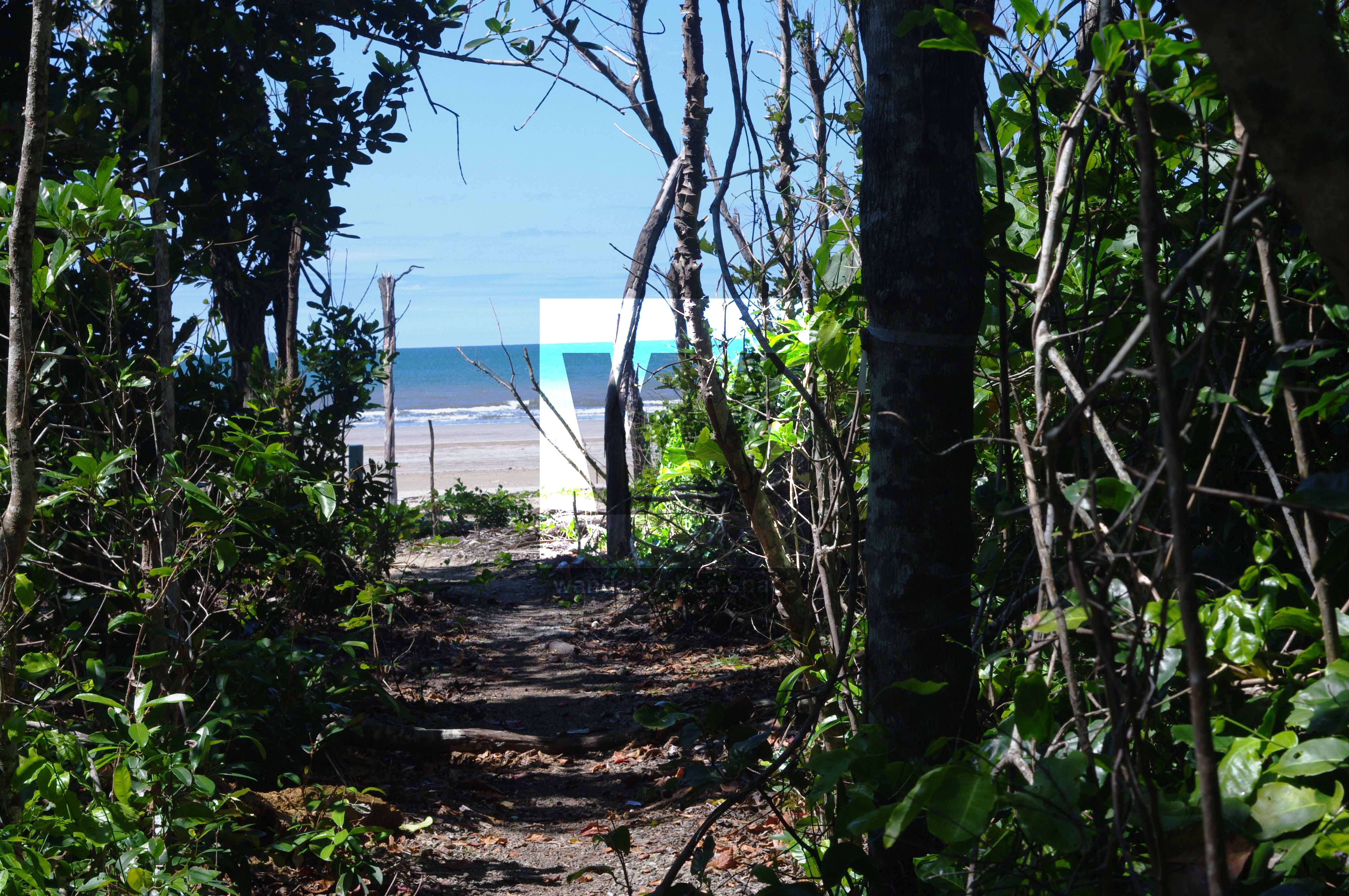
As mentioned before, we went from south to north starting at George Point. The whole track is a 32 kms along the island's east coast.
Our 4-day itinerary looked like this:
Day 1: George Point to Sunken Reef Bay
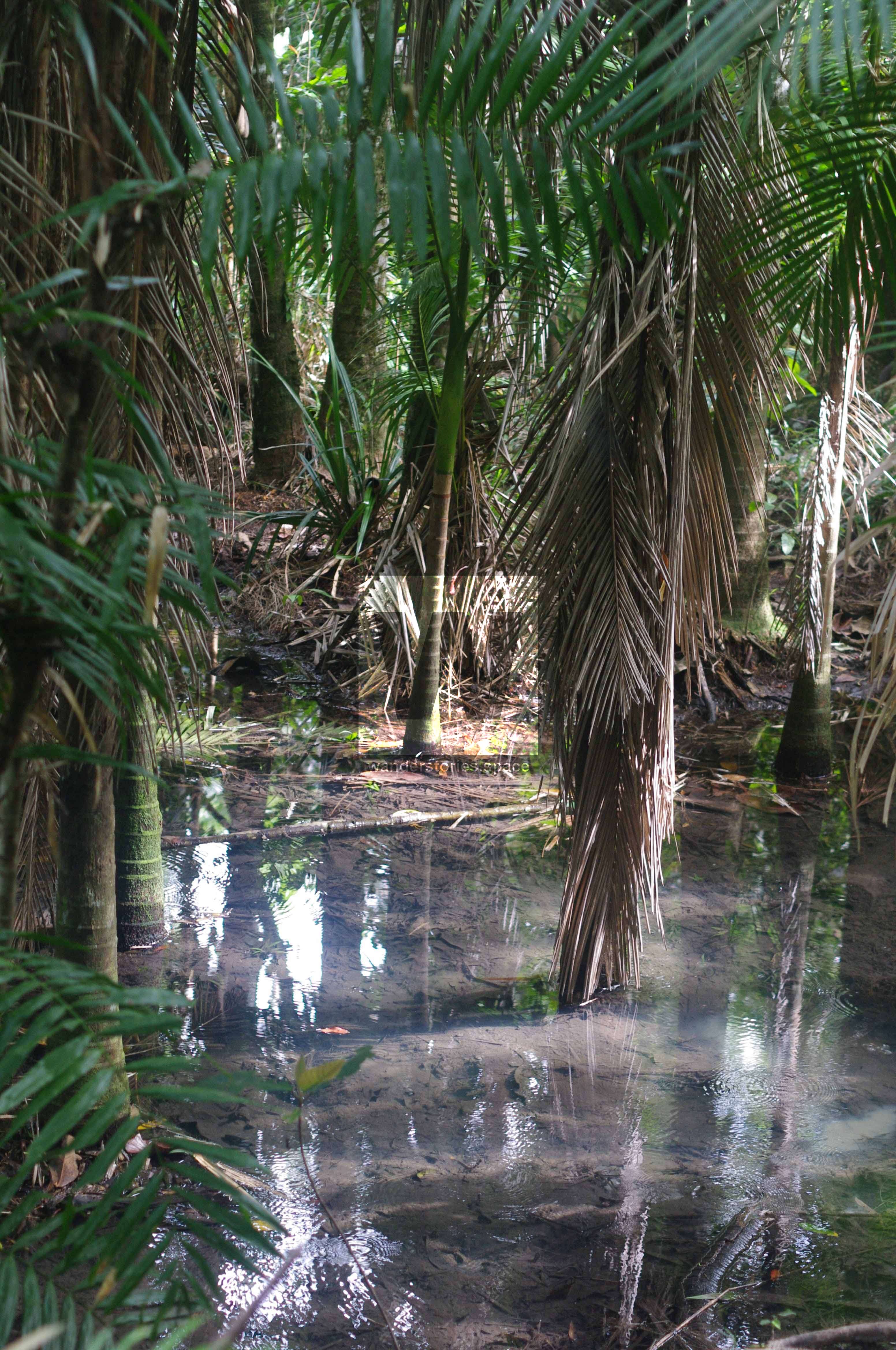
On our first day we were picked up by the boat around 9.30am. After a more than one hour boat ride we got to George Point and started our hike. The first 5 km were a stroll along the beach which took us less than an hour. After we had a short snack we then went on into the rainforest where we had to cross a few creeks. Which Luen managed elegantly, balancing on logs and rocks. I got across as well. The track was still fine and not too difficult and it was nice to walk in the shade. Watch out for nasty wait-a-whiles (lawyer cane) though.
After 45 minutes we got to Mulligan Falls where we originally planned to stay the night. After we relaxed at the falls, swam and had lunch though, we decided to go on to Sunken Reef Bay. Well, I would have been happy to stay at Mulligan Falls - far enough inland so I did not have to fear any crocodiles. On the other hand Luen felt like some more hiking and so we went on.
Getting to Sunken Reef Bay probably took us about another hour. Half an hour to get to Diamantina Creek and from there on roughly half an hour to get down to the Bay; which was slightly overgrown. I got a little annoyed with my bag and the idea of waking up next to a crocodile. Crocodiles really were my biggest worry about the hike; I probably should not have researched so much about them in advance.
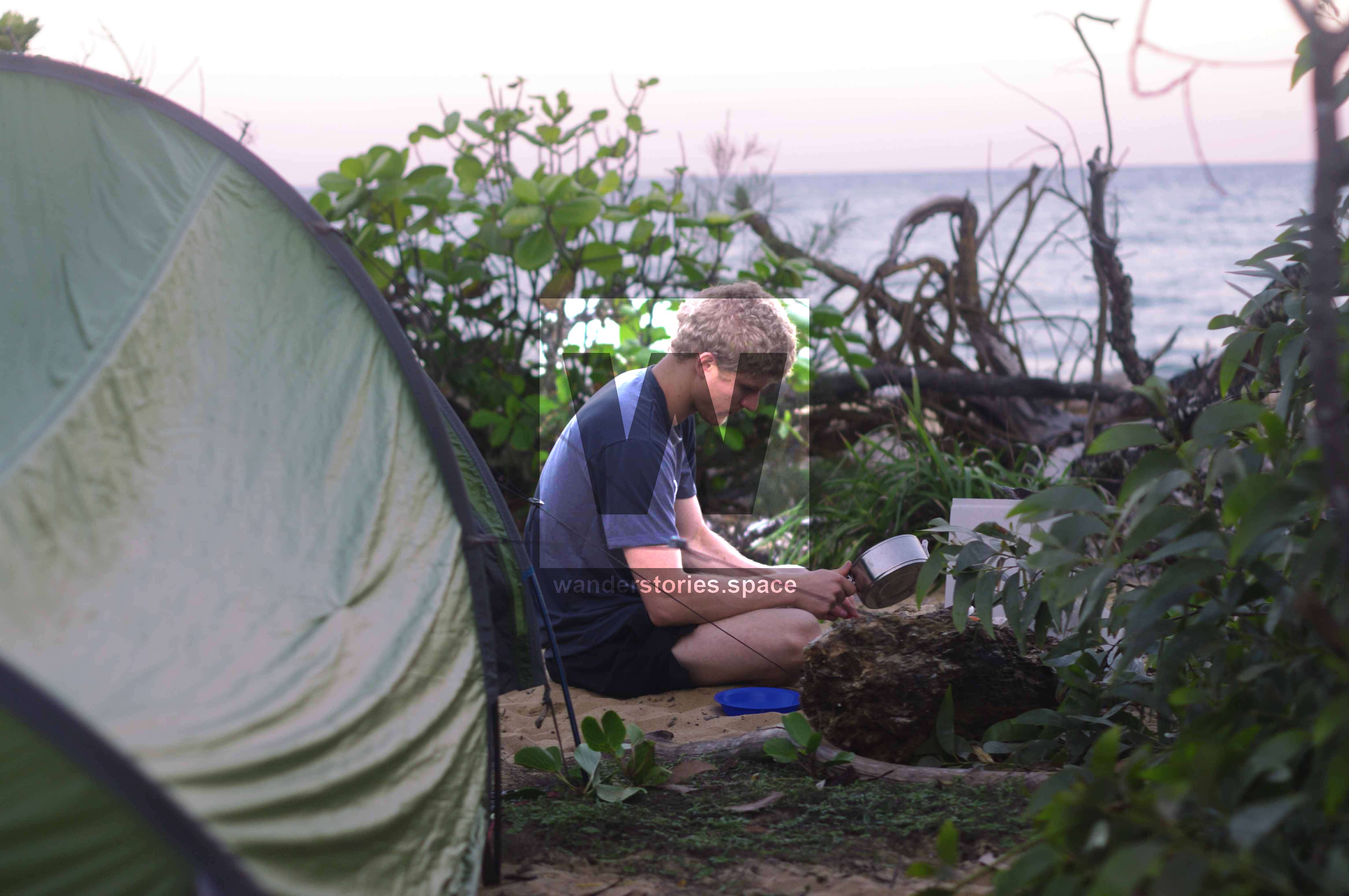
It turned out that crocodiles shouldn't be our problem though. Once we set up camp and started cooking we got company. Luen noticed them first, some little bold rats wanted to steal our food - which was right next to us.
As I am naturally not the biggest fan of rats, I was not willing to share. Especially not our Oreo's. And while Luen tied all our food bags up to a tree with a string that we had luckily taken, I protected our food armed with a big branch making loud "ssshhh" noises. They were only half impressed and kept coming really close. Luckily they were small though, and if it would not have been for them trying to eat our food I might have found them cute.
After all our food bags were tied to the tree - looking a bit spooky, we still had rats running around our tent the whole night. Unsurprisingly, I did not sleep very well as I was convinced the rats would chew through our tent and wanted to sleep in my sleeping bag, which I was not willing to share either.
Luckily they didn't, however they chew a hole in the plastic package of our stove and adaptor. Oh well, enough about rats, take some rope or string if you are going to sleep at Sunken Reef Bay as there are no food boxes. It is a stunningly beautiful campsite however and the other people camping there did not see any rats.
Day 2: Sunken Reef Bay to Zoe Bay
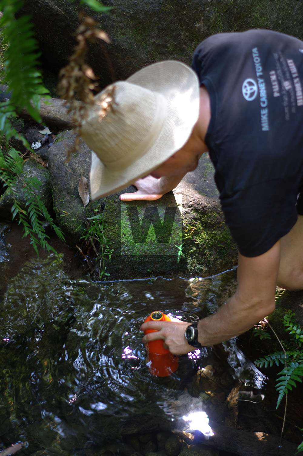
Day 2 was probably our favorite day. After we tried making pancakes on our little gas stove which more turned into mushy half cooked mush, we continued on, making our way to Zoe Bay. At our first stop we filled our bottles up with some creekwater. It tasted absolutely great! Which I did not expect. I also have to admit that I have never drunk water fresh from the stream before, so it was a cool experience for me.
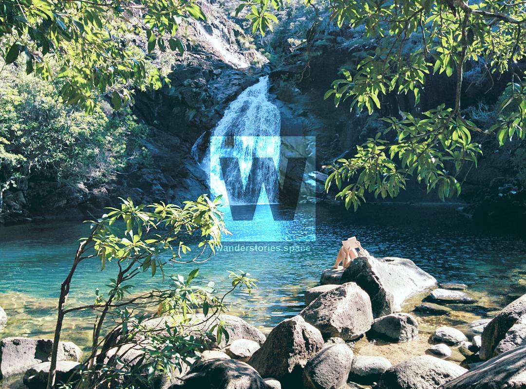
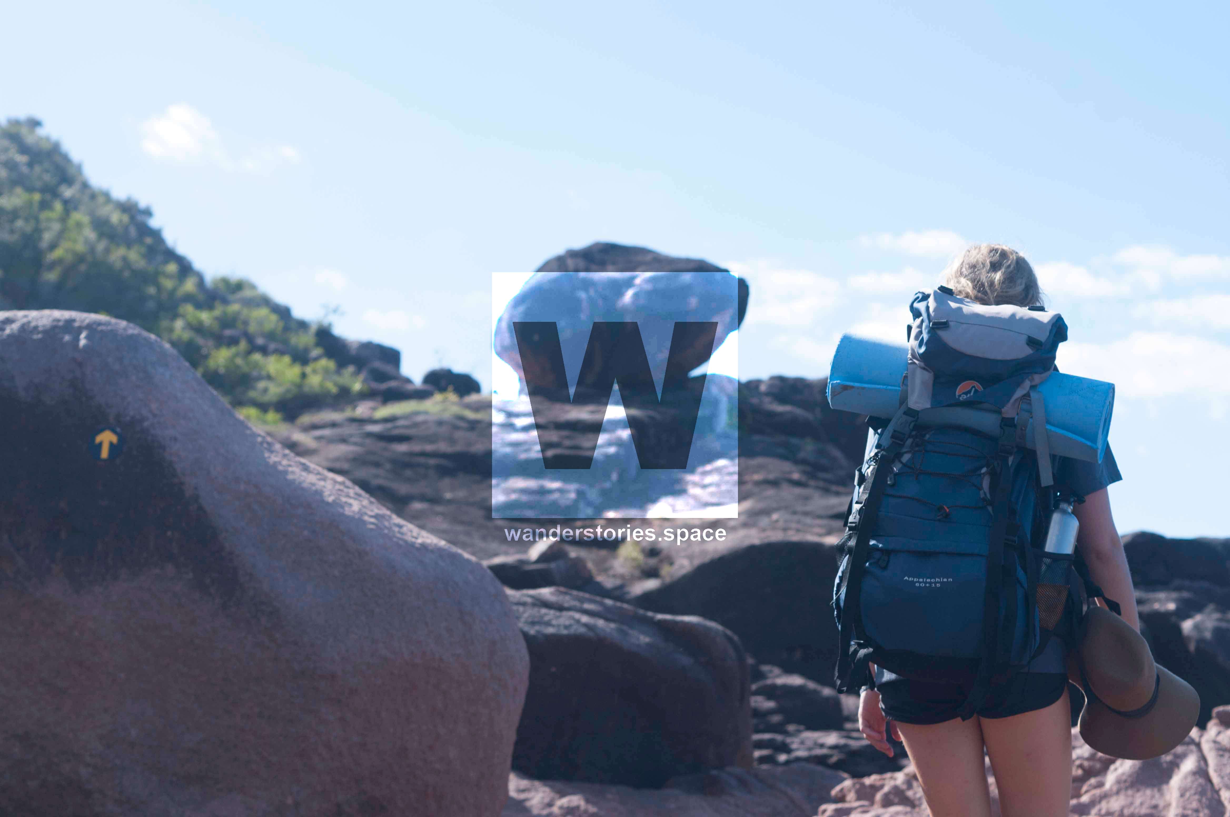
It was a lot of up and down hill on the second day but we got some great views over the island and the distance was not too long. We stopped again for lunch just before Zoe Falls which we did not realize were so close! After Lunch we got to the top of Zoe Falls from where we got some amazing views. When we had admired the view long enough we went down the steep section to the falls. At one point you have to use a rope to get down.
We stopped at the falls which we first had to ourselves for at least two hours. But when a large day group from Orpheus Island resort arrived we ventured on to the Zoe Bay Campground which was only another 10 minutes away. The first thing we did there was to put all our food in rat proof boxes! Ha! Then we went for a stroll down the beach and eventually started cooking our freeze dried food. We even had apple pie for dessert. It turned out surprisingly nice.
Day 3: Zoe Bay to Nina Peak
Day 3 was our longest hiking day. We planned to make it all the way from Zoe to Nina Bay. The day started with a nice walk along the beach but soon went into the wet rainforest and mangroves swamps. We were warned before that it would get muddy but we hopped from log to log and stone to stone, trying to keep our feet dry. Luen won with only his right toes getting wet, I lost with both my feet getting muddy. Oh, well.
The trail then went along Banksia and Little Ramsay Bay where we stopped for lunch and enjoyed the ocean views. We then rock hopped our way around Boulder Bay getting to Nina Bay.
At Nina Bay we originally planned to stay the night but reading the trail description for the next day:
"the trail then enters a mangrove forest where stands of red-flowered black mangrove Lumnitzera littorea and spotted mangrove Rhizophora stylosa occur. It is best to cross the creek at low or half tide."
Looking at the tide timetable we decided to go further so that we could cross the creek at half tide.
For me it was not so much getting wet and muddy that worried me but more what tends to live in the mangroves. So after Luen cracked us open a few fresh coconuts, we continued until Nina's Peak. Which he had to do even though the tide was coming in. This turned out to be just the right decision.
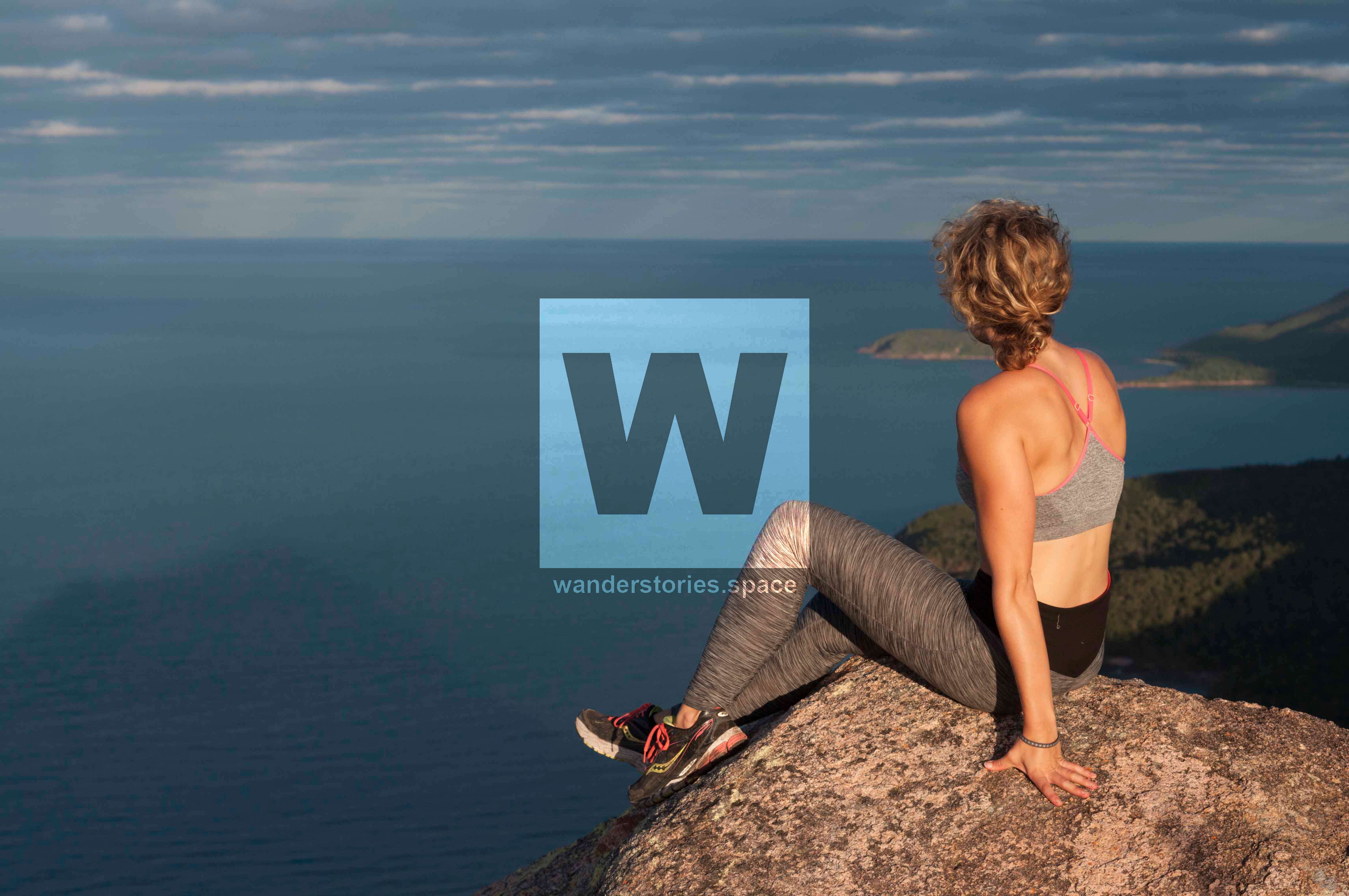
We arrived around sunset and climbed up Nina's Peak where we witnessed a great view across the island and a spectacular sunset.
Since I had seen some rats on our way up to the peak, we again tied all our food to a self-made and slightly unstable construction. We then cooked dinner, enjoyed another apple pie for dessert and went to sleep. Luen was out like a light while I tried to convince myself that 1) crocodiles never go up a hill so far inland and 2) the rats hadn't chewed through our tent the other nights, so they wouldn't do it this night either.
Day 4: Nina Peak to Ramsay Bay
On our last day we got up early to make sure we would make it for the ferry pick up at 9.30am at Ramsay Bay. We needn't have worried however, the trail was just another hour and we spent two more hours at the beach waiting for the boat. The last part of the trail was short and easy but I didn't mind.
My legs were sore from the long hike the day before and I also began to slightly look forward to getting back into civilisation. Once the boat arrived at the boat ramp we were warned to not step too close to the water's edge because otherwise we might magically disappear. Hearing this from a "no-worries" Australian skipper seemed somewhat serious to me and I stayed well away from the edge. It was a short 20 minute boat ride back to the mainland then.
Where to go for good coffee!
Okay, not this time. I could not go anywhere for coffee, but Luen cracked us some fresh coconuts at Nina Bay and we drank the coconut water and ate the flesh with a view onto the ocean. Tops the coffee. Once back in Cardwell, we had a coffee and some lunch though. While it was an amazing experience to be out in nature, I was also glad to be back in civilisation after a few days.
You might even bump into a fellow hiker carrying 25+ kilos who has a coffee percolator who is willing to share a cup.
A few last tips
We would recommend a three nighter as it's super relaxed this way and you can take all the natural beauty in; However the walk can be done in one full day - not recommended. Watch out for tide times when crossing some creeks like Mulligan Creek, the creek in between Nina Bay and Nina Peak and the one on Little Ramsay.
I recommend South to North, like we did, because you won't be able to do that direction for much longer. They will change the hike to one directional from North to South and increase the numbers on the Island. You may also need to book well in advance to get a place on the island in peak season. Use the bin lockers provided to avoid have all your food eaten by native rats.
Check the weather before you go as well. Remember to print out the tide times and the map before you go. You won't need a compass or a PLB as it's walked very frequently but if you have the room or want to go up Mount Bowen they are good to have. Good luck. It's a magical island and highly recommended.
Interactive Map
This article, and all other articles, are for entertainment purposes only and are not to be used as a guide. Please see our Disclaimer for more information.