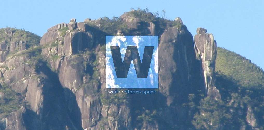
Mount Bowen
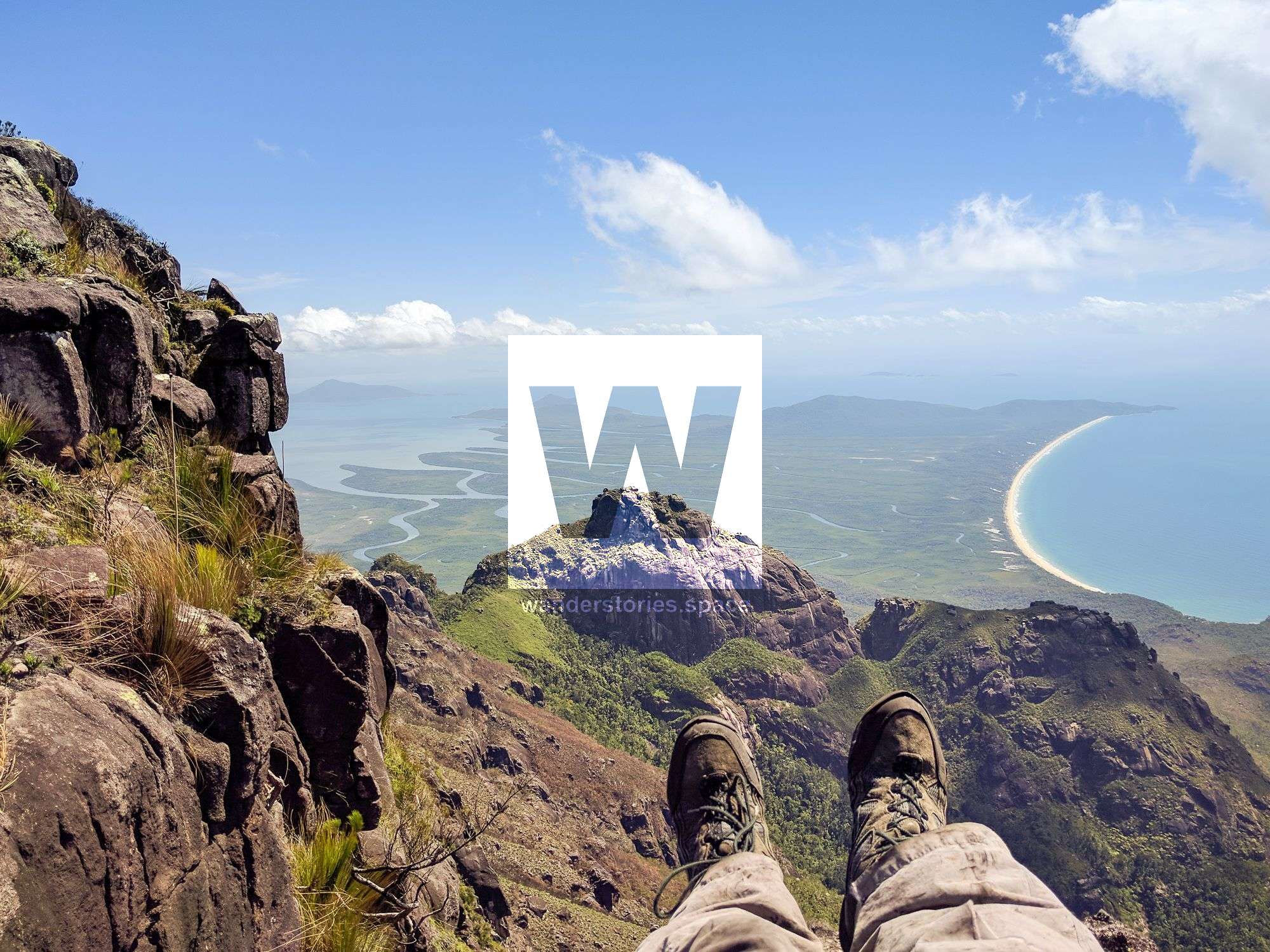
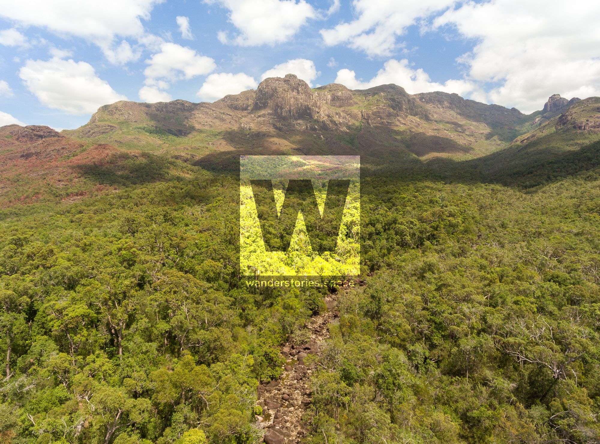
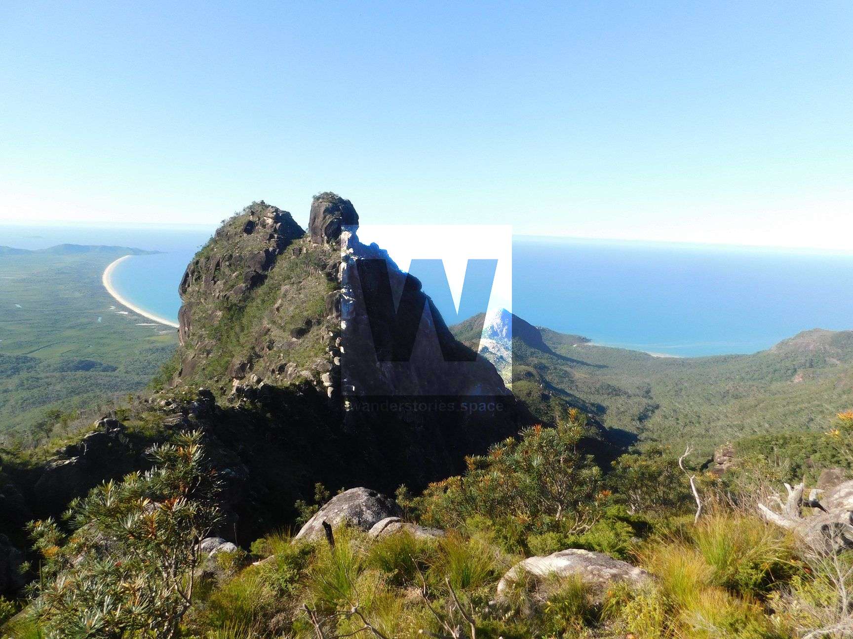
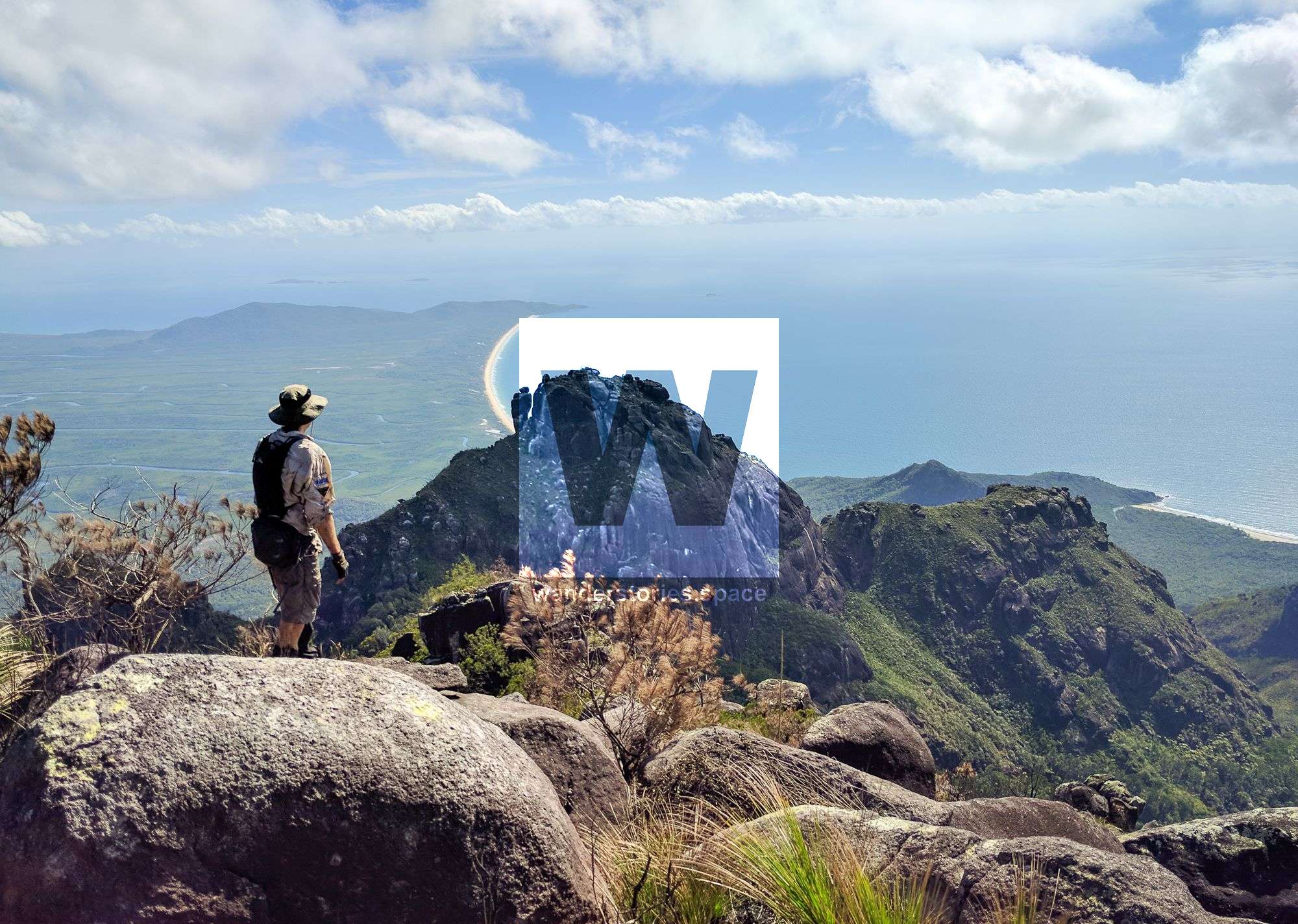
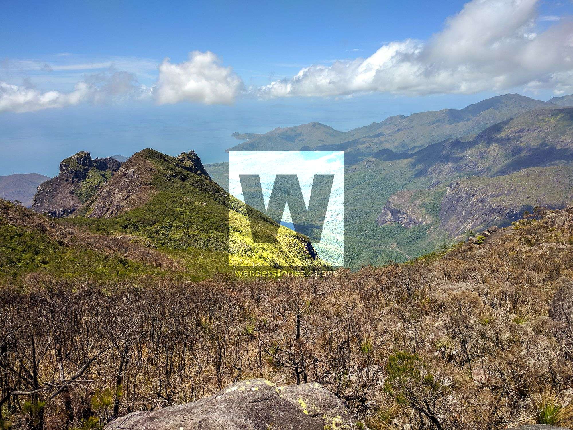
Hinchinbrook Island may be one of the most attractive adventure destinations in North Queensland, largely because it feels like an untouched, lost Jurassic world. Mount Bowen, rising 1,121m above sea level, may be its most popular peak (excluding Nina Peak), and summiting requires quite a hike.


Location - Hinchinbrook Island National Park, Queensland, Australia
Distance - Approximately 6 km one way from Little Ramsay Bay (not including the zig-zagging through creeks and around vegetation)
Time - A multi-day trip but has been rumoured to be done in one day
Grade - 5, difficult and strenuous
Type - Remote, off-track bushwalking
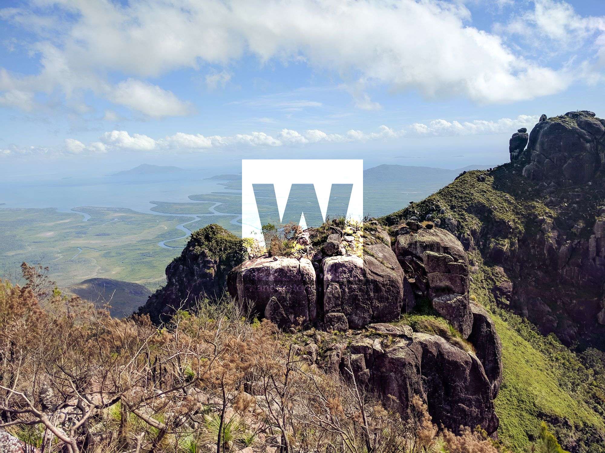
Many will agree that Hinchinbrook Island is one of the most attractive adventure destinations in all of North Queensland. This may be largely because Hinchinbrook feels like an untouched, pristine, lost Jurassic world. Although it welcomes climbers with driving rain and cold mist, and mangroves guard its western shores, rough seas the eastern, strangely, those who have fallen in love with Hinchinbrook vie at the opportunity to experience more. Plus, the island lies only a couple of kilometres off the Queensland coast, not far from Cardwell and Lucinda. Traditional homelands of the Bandjin and Girramay people, this place is known as Munamudanamy.
There are many things to cover in this article, so here are some quick links to sections of this article:
History, When To Go, The Routes, Warrawilla Creek Route, Pineapple Ridge Route, Nina Creek Route, The Ridgeline Route, Fingers Ridge, Gayundah Creek/Ridge Route, Missionary Creek, North Saddle, Wart Saddle, Pineapple Saddle, North Peak, The Prophet, The Fingers, The Wart, Pineapple Peak, Essentials, Saftey, Interactive Map.
Mount Bowen, rising 1,121 metres above sea level, may be the most popular peak on the island (excluding Nina Peak), and summiting requires quite a hike. Only the most serious hikers have dared to climb this monster, and not all attempts have been successful.
Brief History
Mount Bowen received its first European ascent by Romeo Watkins Lahey in the early 1930s. A cane farmer had also claimed to have made an ascent from Missionary Bay at the same time independent of each other but it is generally accepted that the farmer's ascent did not occur. However, there is no doubt about the ascent by Lahey. Lahey commenced his climb along a ridge starting from the head of the inlet of Gayundah Creek on the western side of the island. Lahey is also well known for his campaigning to have Lamington National Park gazetted earlier in the century.
When to go
Summiting Mount Bowen depends on the route you take and weather conditions, which can change quite suddenly. The best time of the year to do this hike is after the wet season (i.e., June - September) because it's not too hot, but there's still enough water in the creek.
Most that do this hike camp at the North Saddle, which requires a special mountain permit (i.e., because numbers are controlled/monitored), not just for human safety, but largely to protect the fragile, heath vegetation that covers most of the area. Any group wishing to hike in the mountains will need to apply – in writing – to Queensland Parks and Wildlife Service (QPWS) at least a few weeks in advance. This is all the more reason to remember to be low impact and embrace the "Leave No Trace" and "Pack it In, Pack it Out" philosophies.
How to get there
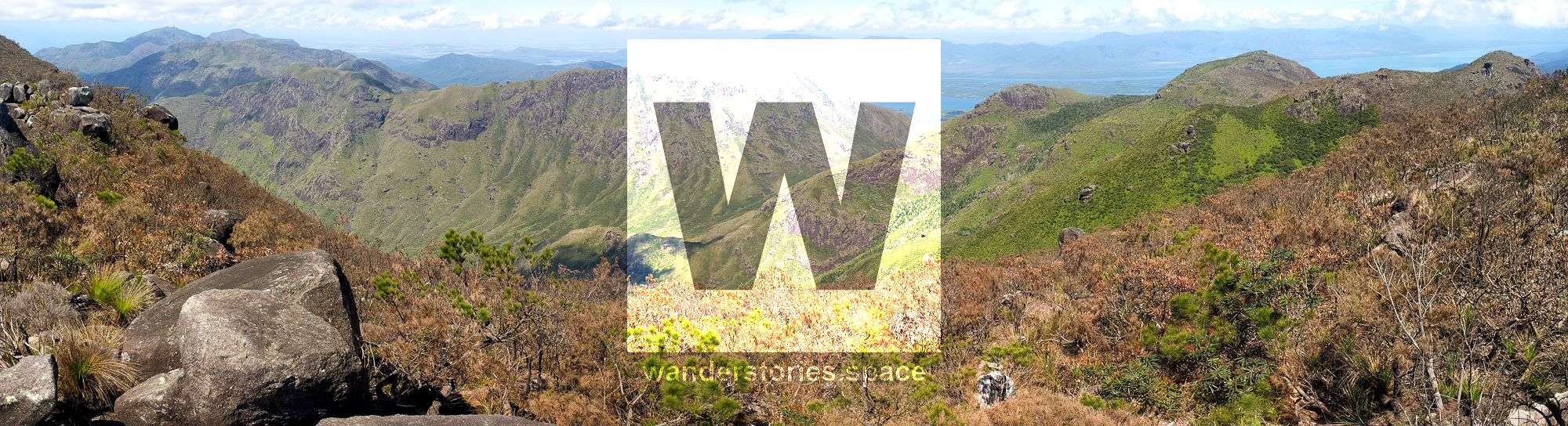
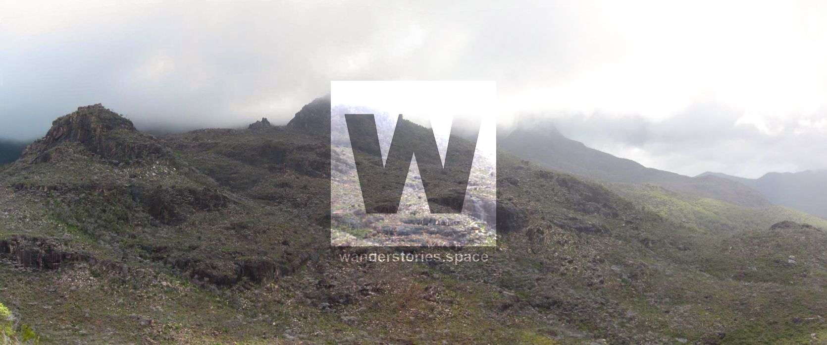
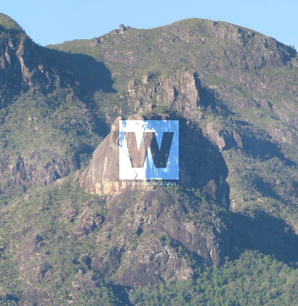
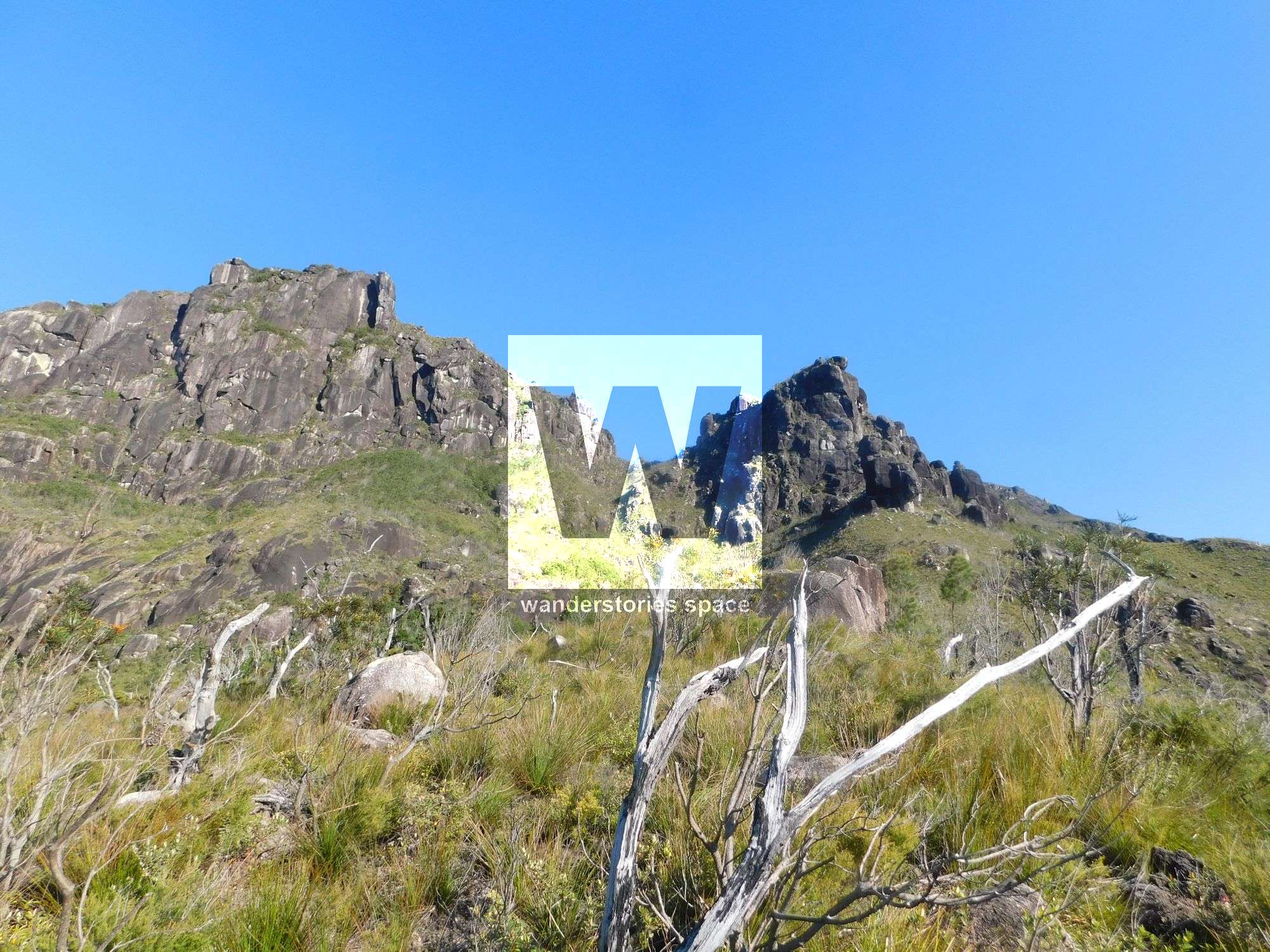
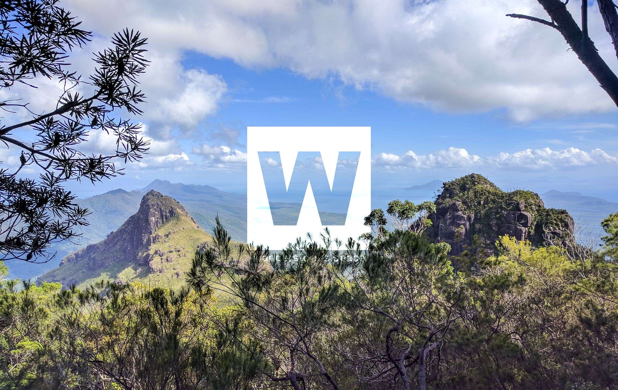
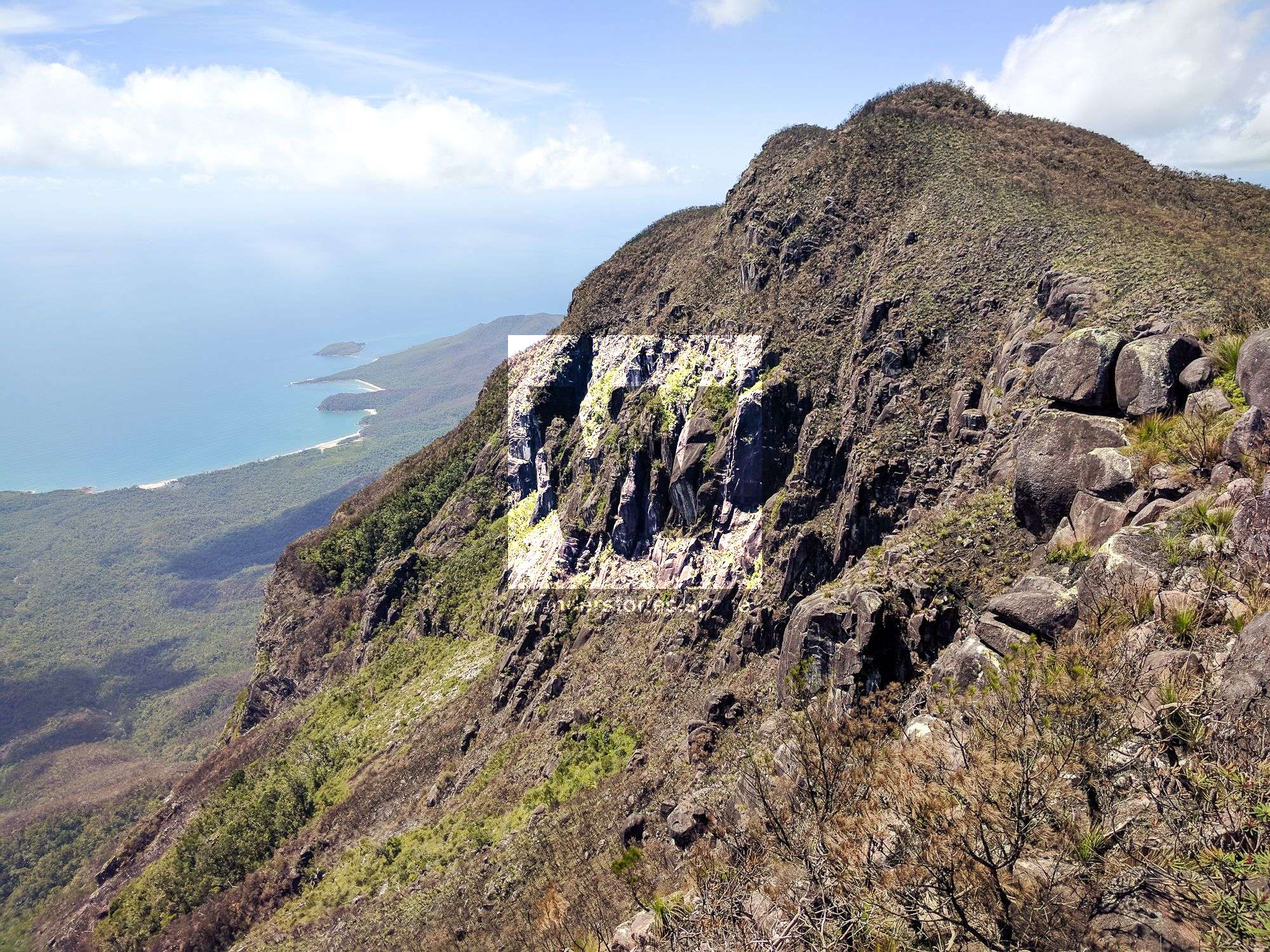
Mount Bowen is best climbed from one of the eastern ridges or creeks. Because of the dense vegetation sometimes encountered, it is often advisable to follow the creeks for as long as you can and only venture onto those ridgelines high up on the mountain once you are well above the major cliff lines. However, some of the lower ridges offer superb views of both the peaks and the coastline; therefore, it may very well be worthwhile to endure the discomforts to enjoy such views.
The two main routes taken up Mount Bowen are Warrawilla Creek and Pineapple Ridge, but some trek up via Nina Creek and some via The Thumb, all of which are described below. However, the Warrawilla Creek route is, by far, the most popular and, of course, is also the easiest.
Warrawilla Creek Route
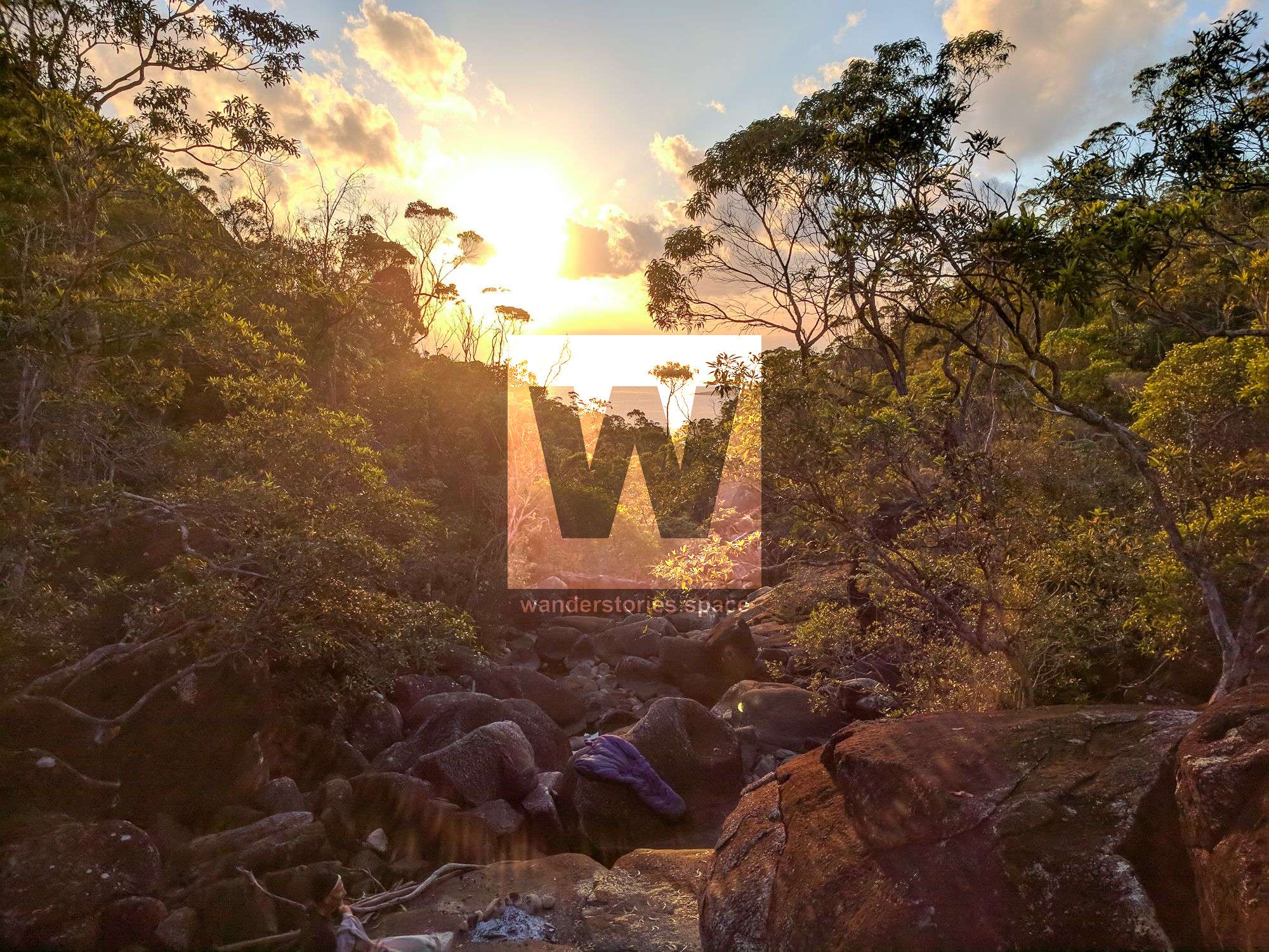
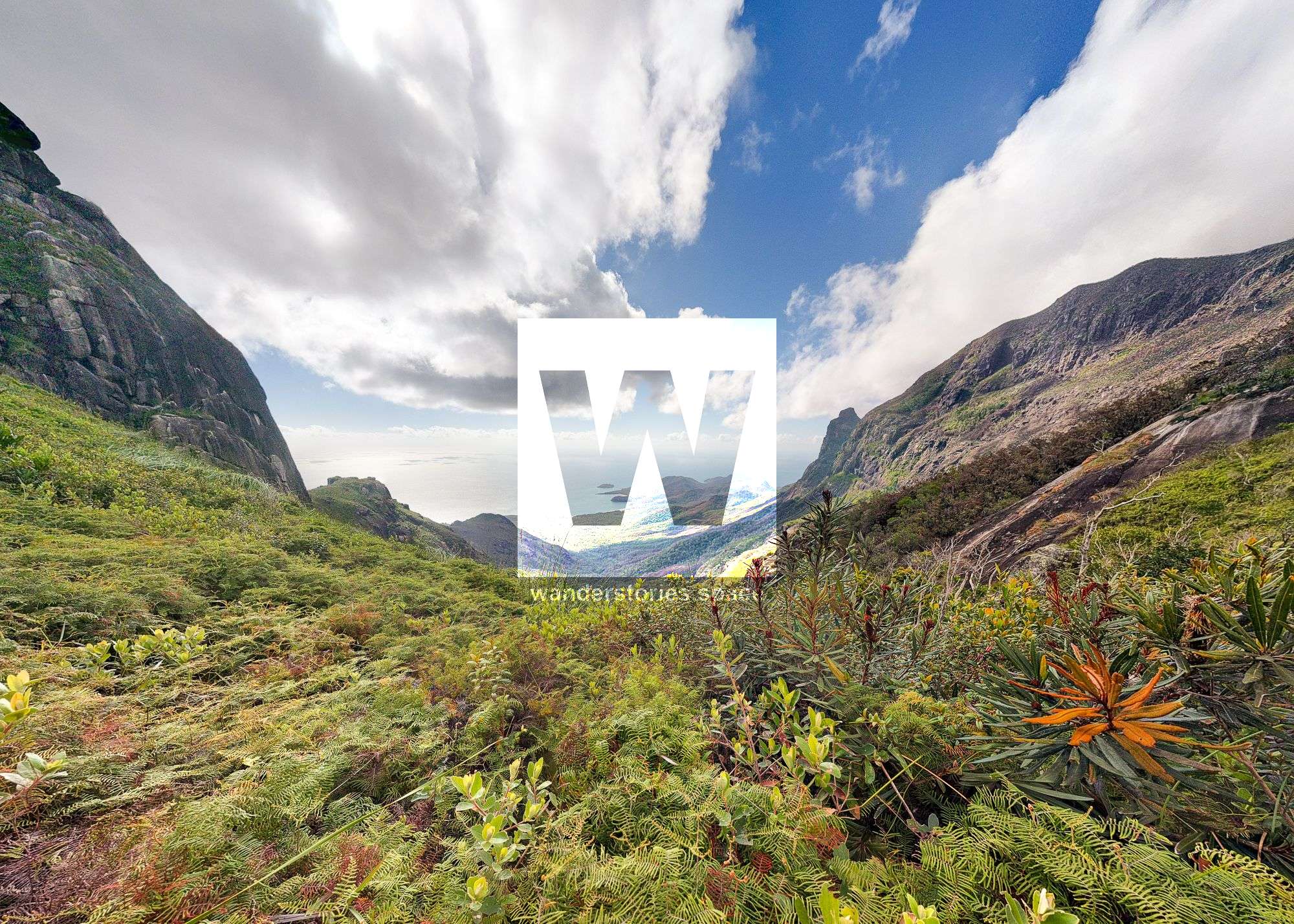
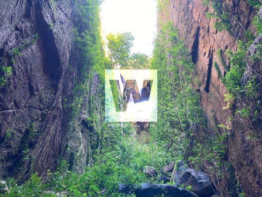
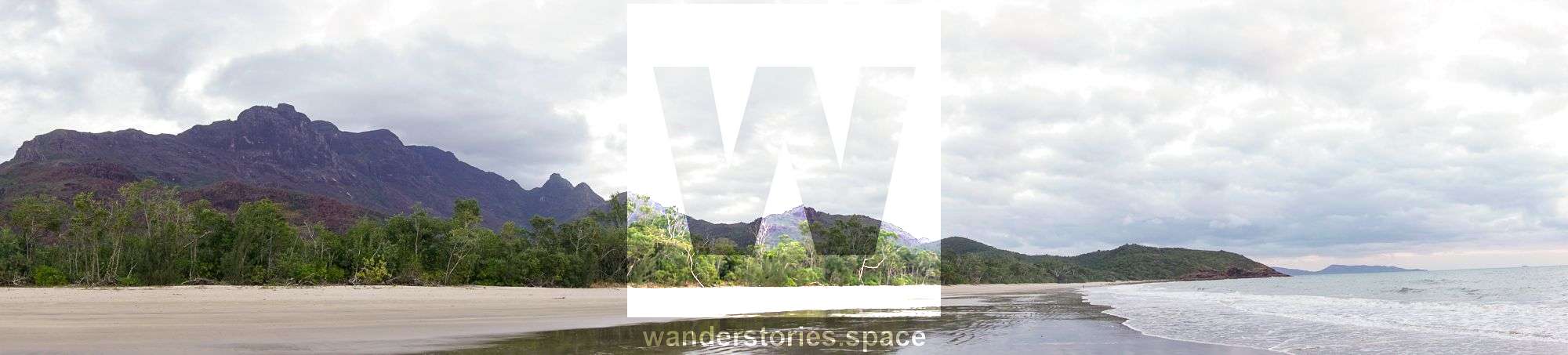
The most popular and potentially the easiest route to Mount Bowen is by starting at Little Ramsay Bay and then heading up Warrawilla Creek. The terrain allows for relatively easy walking, albeit with a lot of rocks. Via Warrawilla Creek, it's a long way of rock-hopping over mid-sized boulders that can be challenging with heavy backpacks if you're doing the trip as an overnighter/multi-dayer, which is the most common way. There are numerous rock pools in the creek's lower reaches that those who are camping at Little Ramsay Bay use for fresh drinking water. Navigation may be a problem where the creek forks. There are a few rock cairns at creek junctions along the way to keep you on track. Note that other adventurers may have placed flagging tape along the way, but those markers may not always be in the right location or marking the best route choice.
If you're dropped off at Ramsay Bay (at the northern end of the island), you will need to walk two hours south along the Thorsborne Trail to Little Ramsay Bay. From Little Ramsay Bay lagoon (next to the camping area), follow the rough track on the northern side, upstream and alongside the dry creek.
Approximately one kilometre (~45m a.s.l.) from Little Ramsay Bay, choose the right-hand branch of the two parallel creeks. If you choose the left-hand creek (Anti-Thumb Creek), you may find yourself inadvertently scaling the face of Mount Bowen instead of your intended route and amongst thick vegetation. Choose wisely!
At the next junction, approximately another kilometre upstream (~2 kilometres, ~120m a.s.l., from Little Ramsay Bay), you will need to take the left fork, keeping to the main creek. Otherwise, you will be heading up to Fingers Ridge. Again, choose wisely!
In the creek's upper reaches, the terrain becomes quite steep, and from there forward, avoid all southern branches, and ascend the main creek bed under the slopes of the North Peak.
Once you reach the last fork, cairns and flagging tape will become prevalent. The path is well-worn from other hikers over the years; so, it's easier to follow from here. The creek becomes narrow, and the vegetation closes in as you approach the North Saddle.
Before you set out, see the interactive map at the bottom of the article.
North Saddle
There's enough room at the saddle to fit one or two small tents, but tarp and/or hammock camping could allow for more people. Water is available at the eastern (Missionary Creek - approximately 15 minutes) and/or western (Warrawilla Creek - approximately 10 minutes) watersheds of the North Saddle.
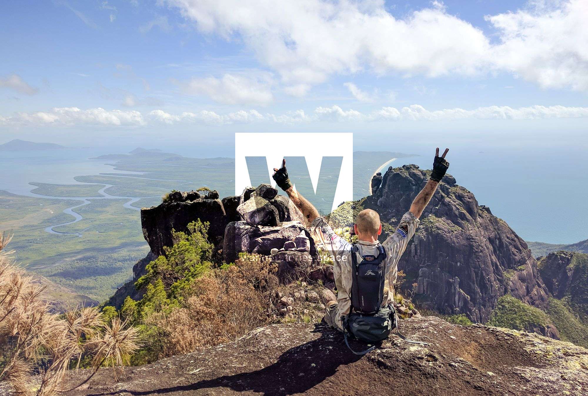
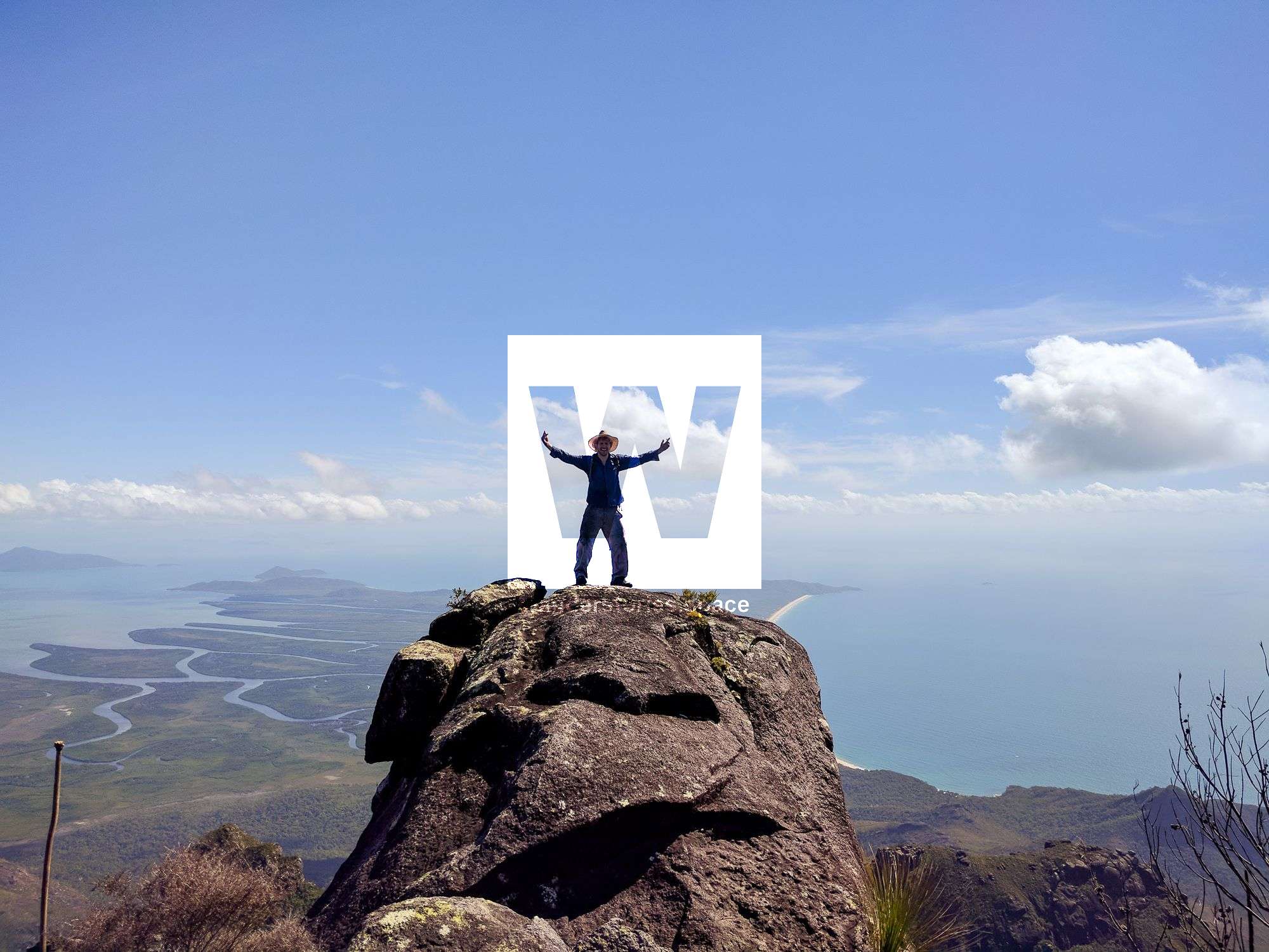
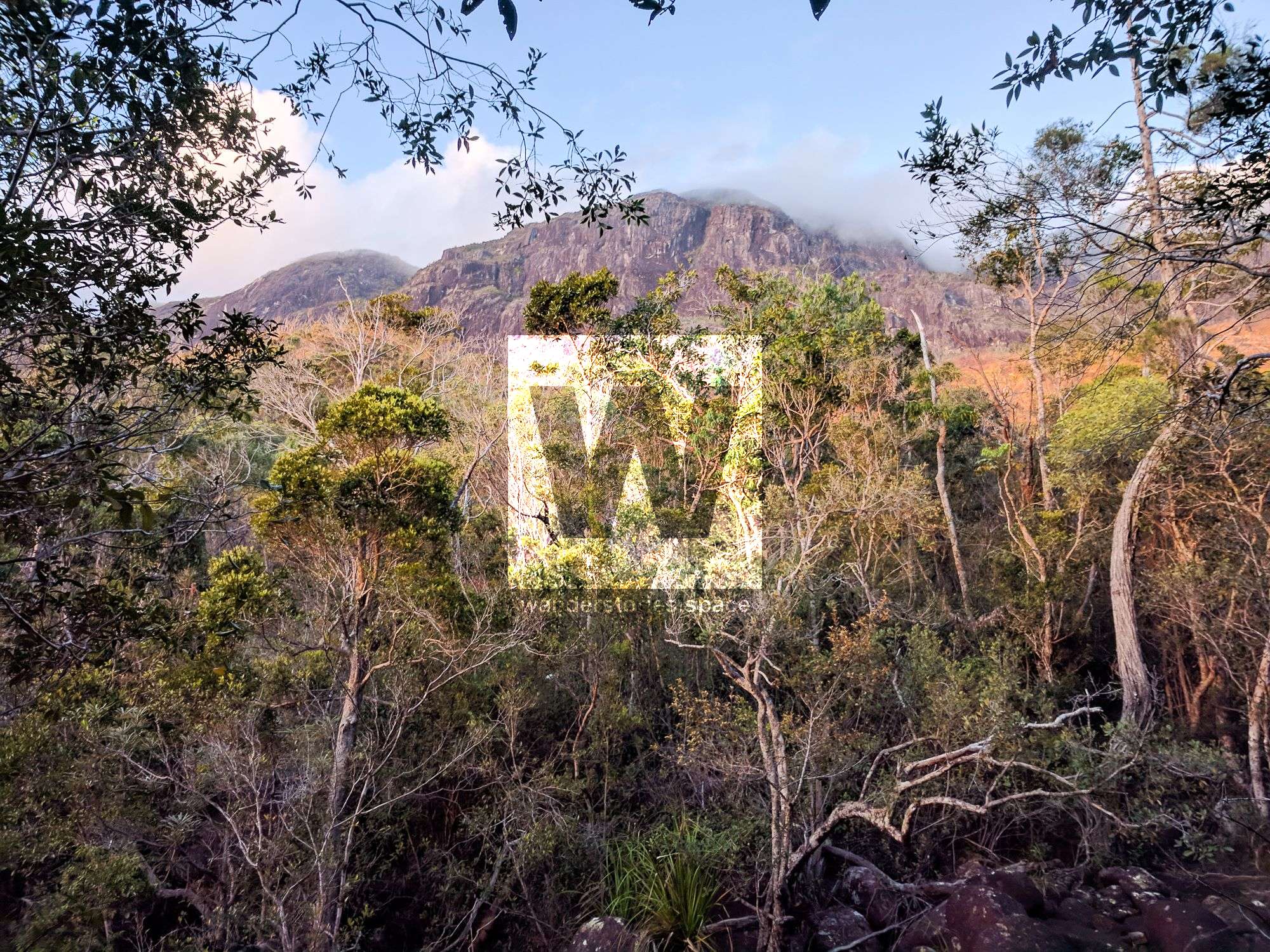
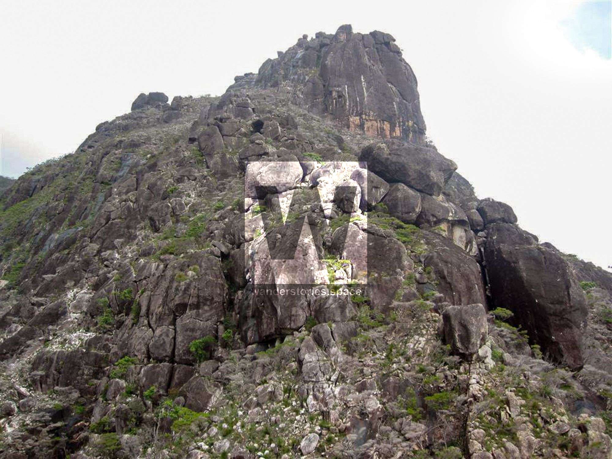
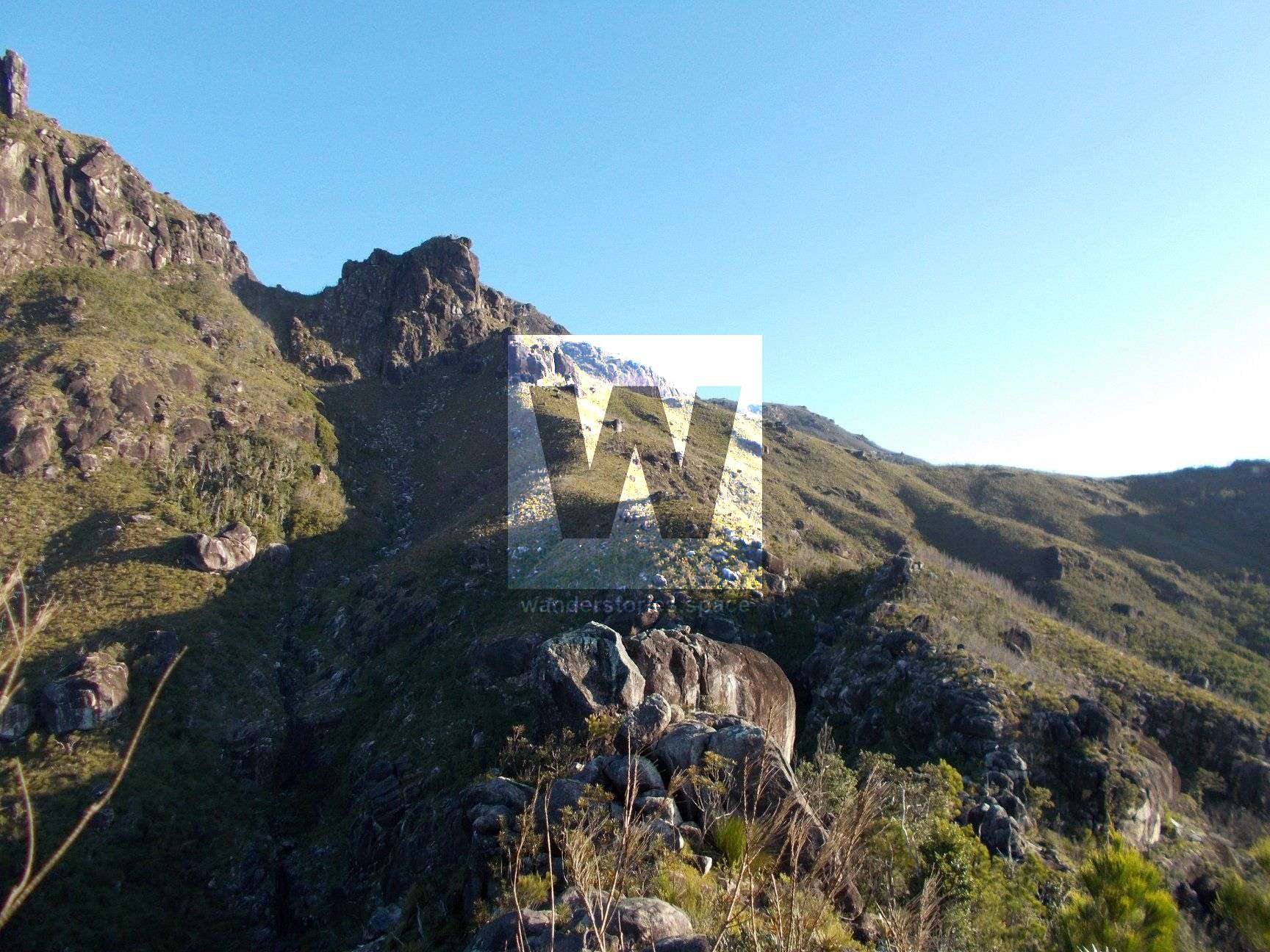
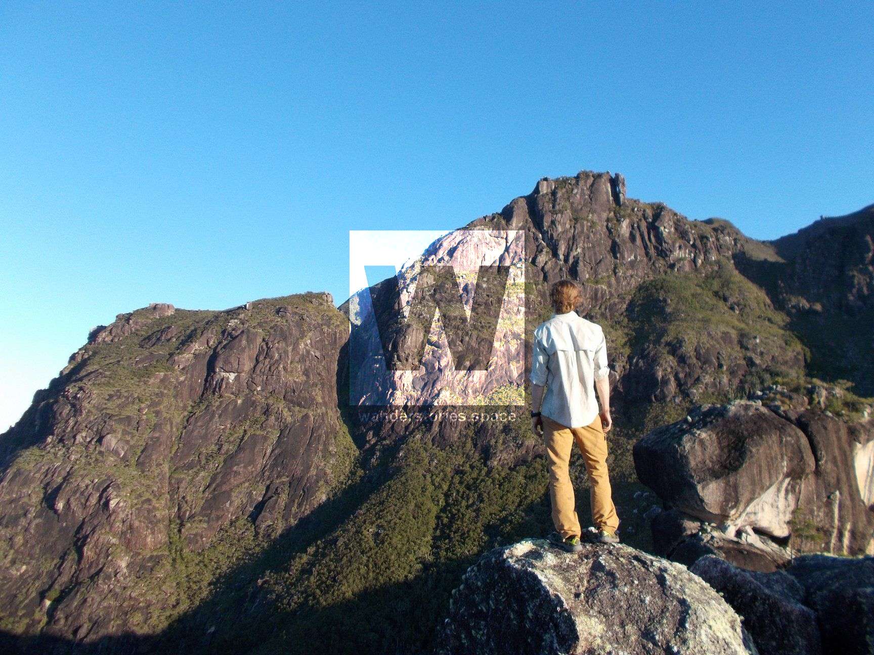
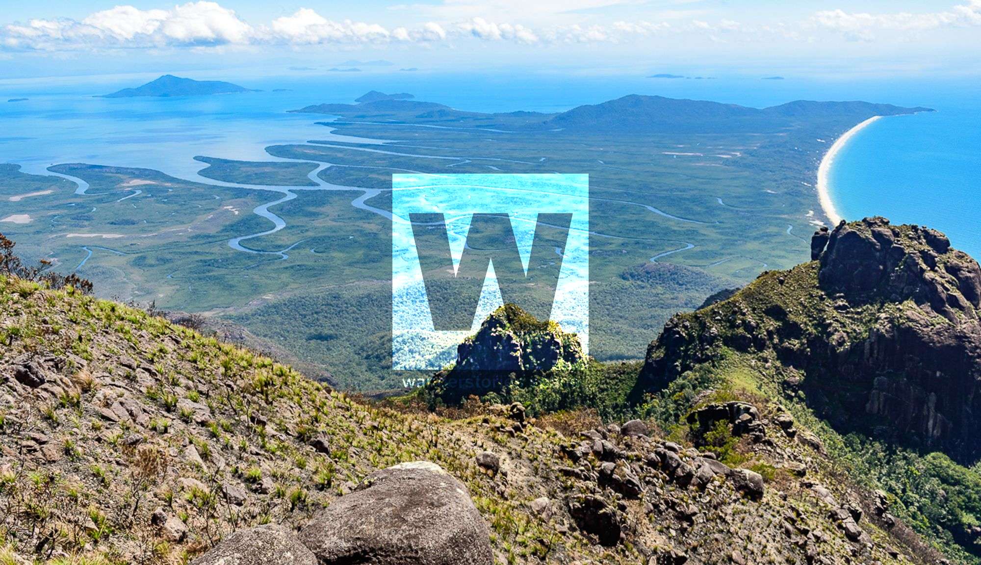
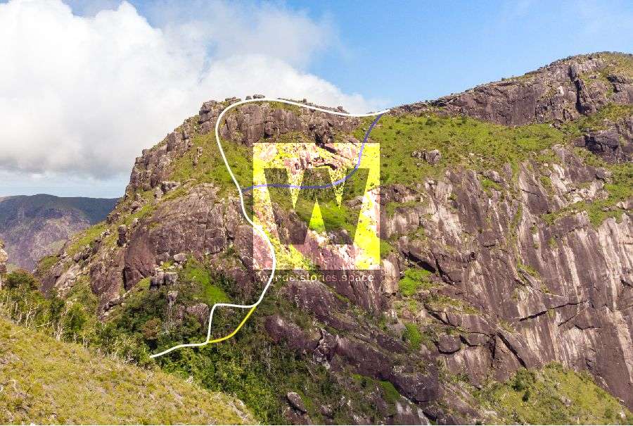
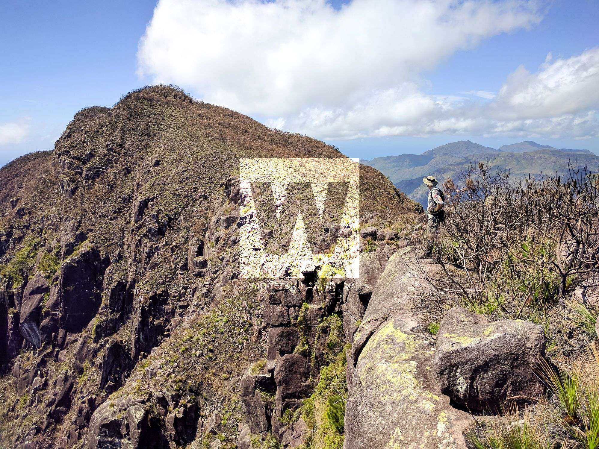
From the North Saddle, follow the ridge through open, scrubby forest to the south and up onto the main summit ridge. This route is a lot easier after it has been burnt-off; so, you may want to check the park alerts, and plan your trip after back-burning has occurred. Then, traverse several false peaks and pass through thick banksia trees before Mount Bowen reveals itself. You will know you've reached the summit, as you will see a prominent rock cairn.
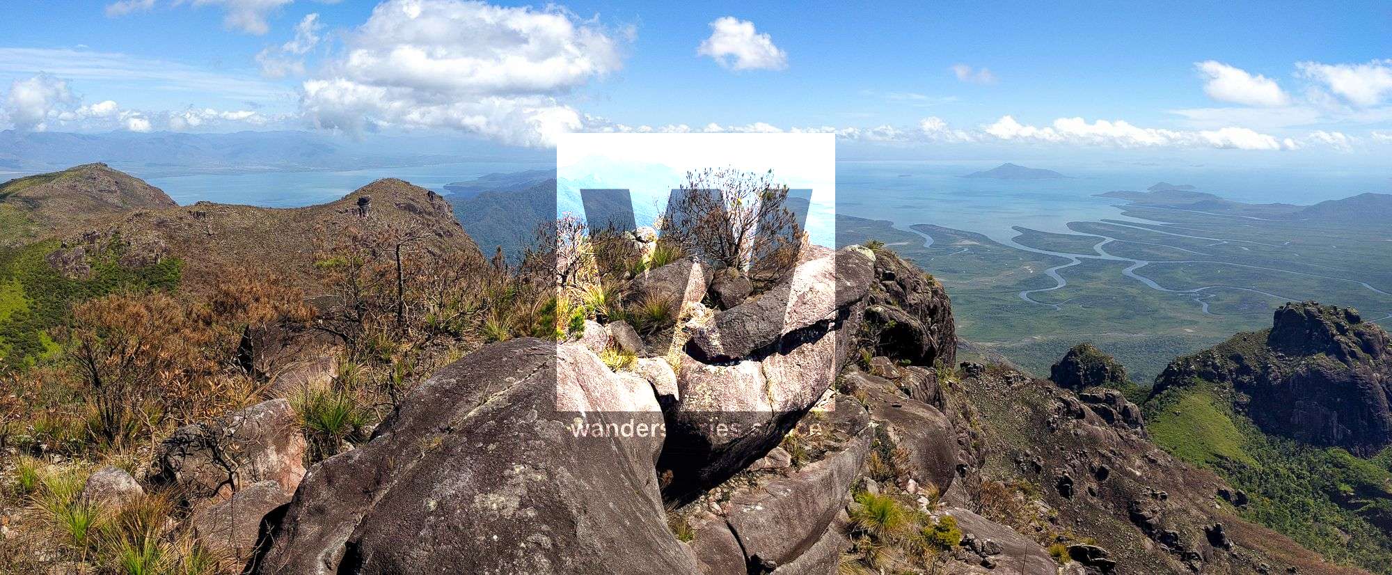
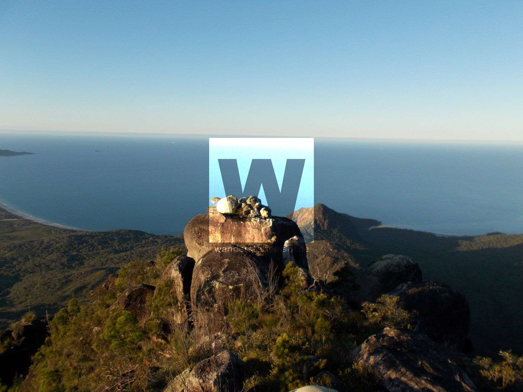
The summit is a fairly flat, rocky slab, but the sparse vegetation allows you a glorious 360-degree view.
It's important to note that there is not much shade atop Mount Bowen, but you may find a flat rock or two to set up a tent and just below the summit are a few larger trees that could suit hammocks.
At the summit, you'll find a geocache where previous adventurers have shared their stories. Take a moment to write in the logbook and share your adventure as well.
From Mount Bowen, you could then continue on to The Thumb.
Pineapple Ridge Route
The northernmost and probably the second most popular route to Mount Bowen is via Pineapple Ridge. This route is harder than the Warrawilla Creek Route but easier than the Nina Creek Route.
Starting at Blacksand Beach (north) or Nina Bay (south), navigate your way up to the saddle. Via the Nina Bay option, you can get to Pineapple Ridge quickly after climbing up from Nina Creek into the saddle on the west side of Nina Peak.
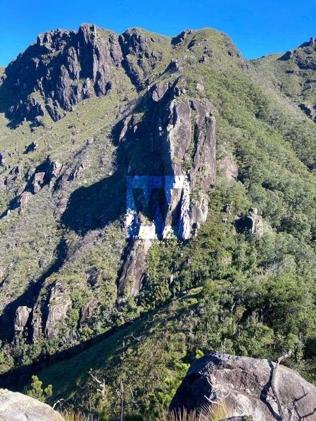
Continue on to traverse Pineapple Ridge toward Pineapple Peak while navigating around sheer cliff faces, loose rocks, and through thick, scrubby vegetation. Once the ridge has been gained, the route follows the crest climbing up to pass the southern side of Pineapple Peak.
Pineapple Peak
It is possible to backtrack to check out the summit if you are keen. As you pass Pineapple Peak, the route follows the ridge southwest to the spacious Pineapple Saddle. Continue down to Pineapple Saddle.
Pineapple Saddle
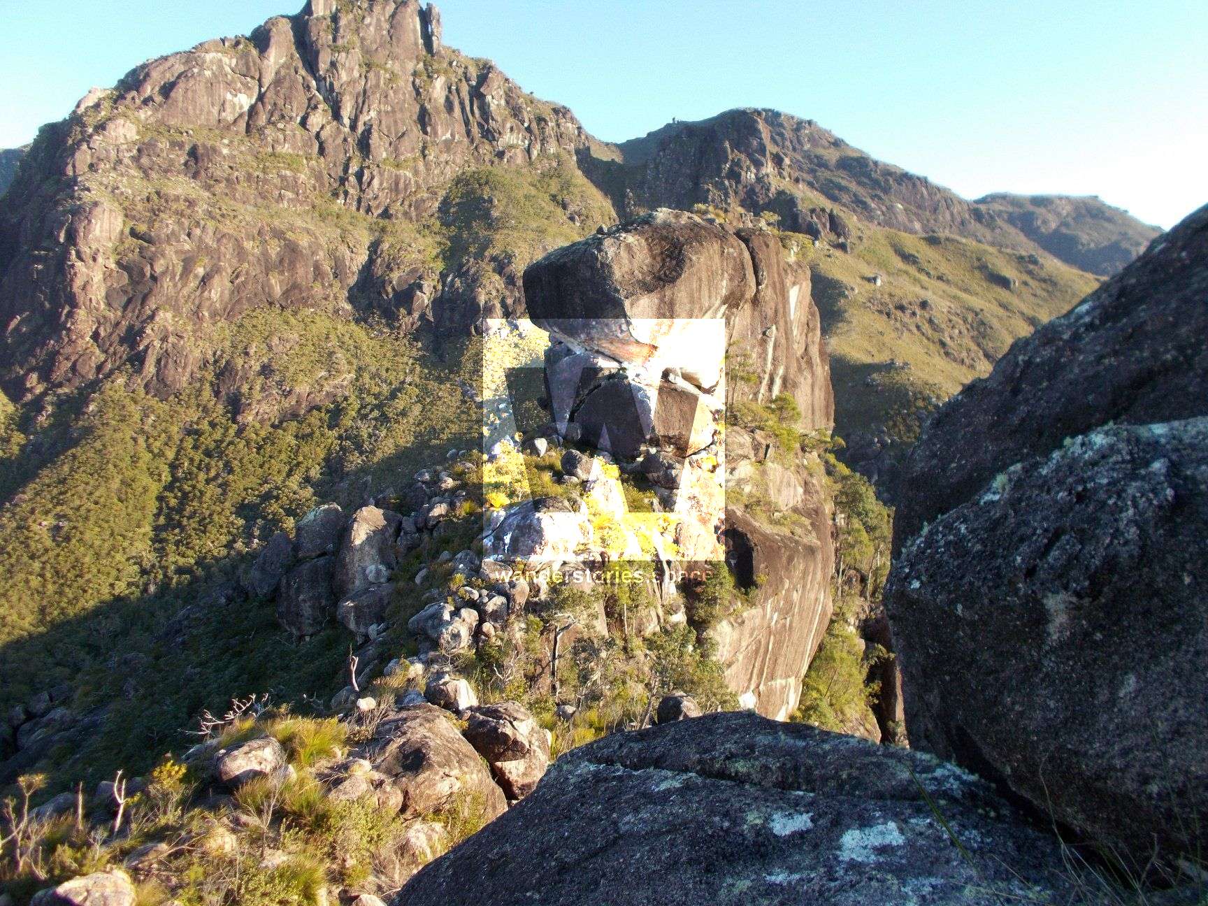
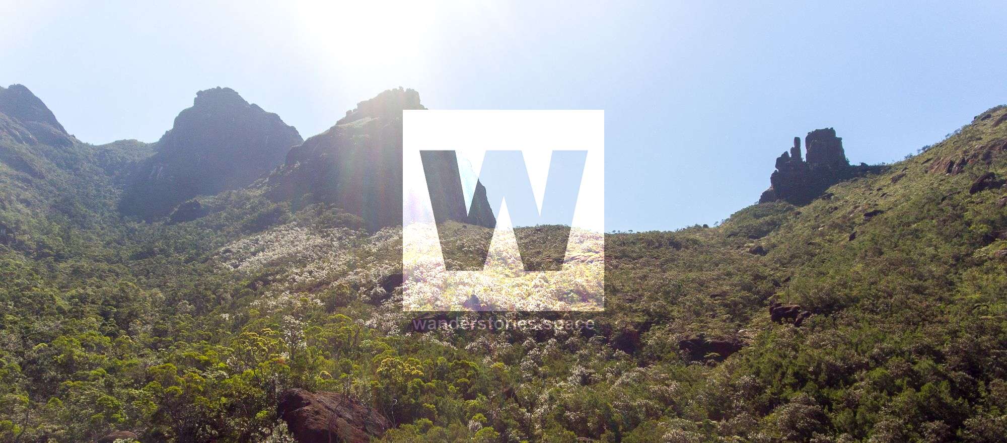
At Pineapple Saddle, you can find water from the eastern (approximately ten minutes) and/or western (approximately 15 minutes and less steep) watersheds. Beyond Pineapple Saddle, climb the ridgeline toward The Wart rock formations, which you will see head-on, where you will then want to follow the contour around it to the east (left) and then south (up) toward the Wart Saddle.
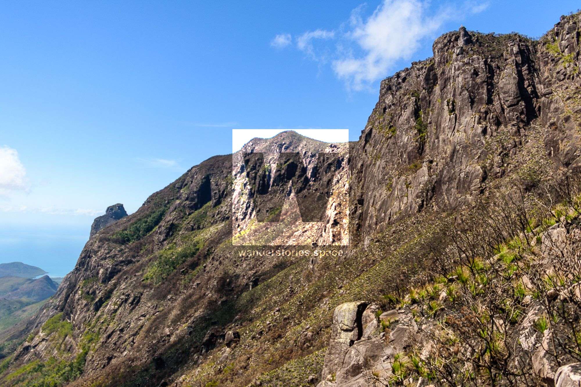
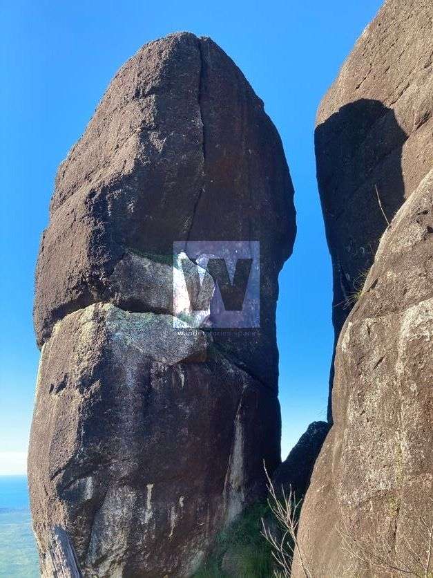
Traditionally, it seems that on Hinchinbrook Island at least, some natural features have been given names relating to the human body. Hence there is The Thumb and The Fingers. Noticing this trend in 1971, Robert Rankin gave the name "The Wart" to an obnoxious rocky obstruction just below North Peak at the top of Pineapple Ridge.
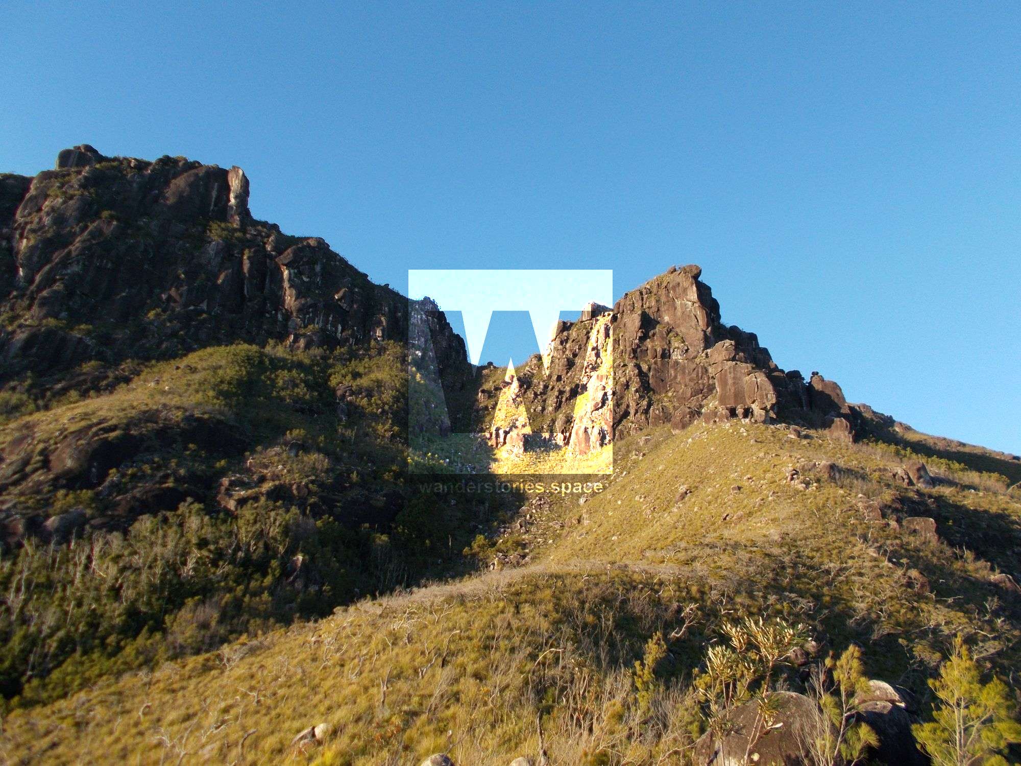
The Wart and Wart Saddle
The Wart's namesake is due to it being a very difficult obstruction if tackled directly. From the Wart Saddle, you will see The Wart rock formations on your right and The Prophet and North Peak on your left. Wart Saddle offers a smaller camping area than the nearby saddles and water is much harder to obtain here but can be for thirty minutes on the northern watershed or at the North Saddle watershed.
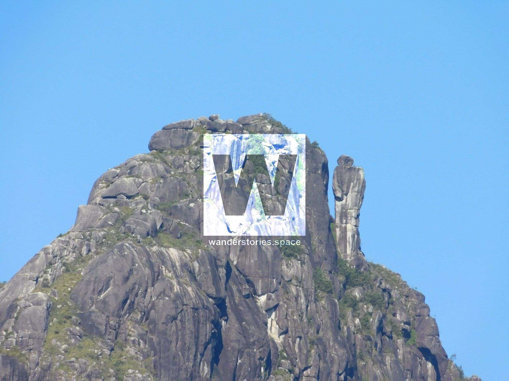
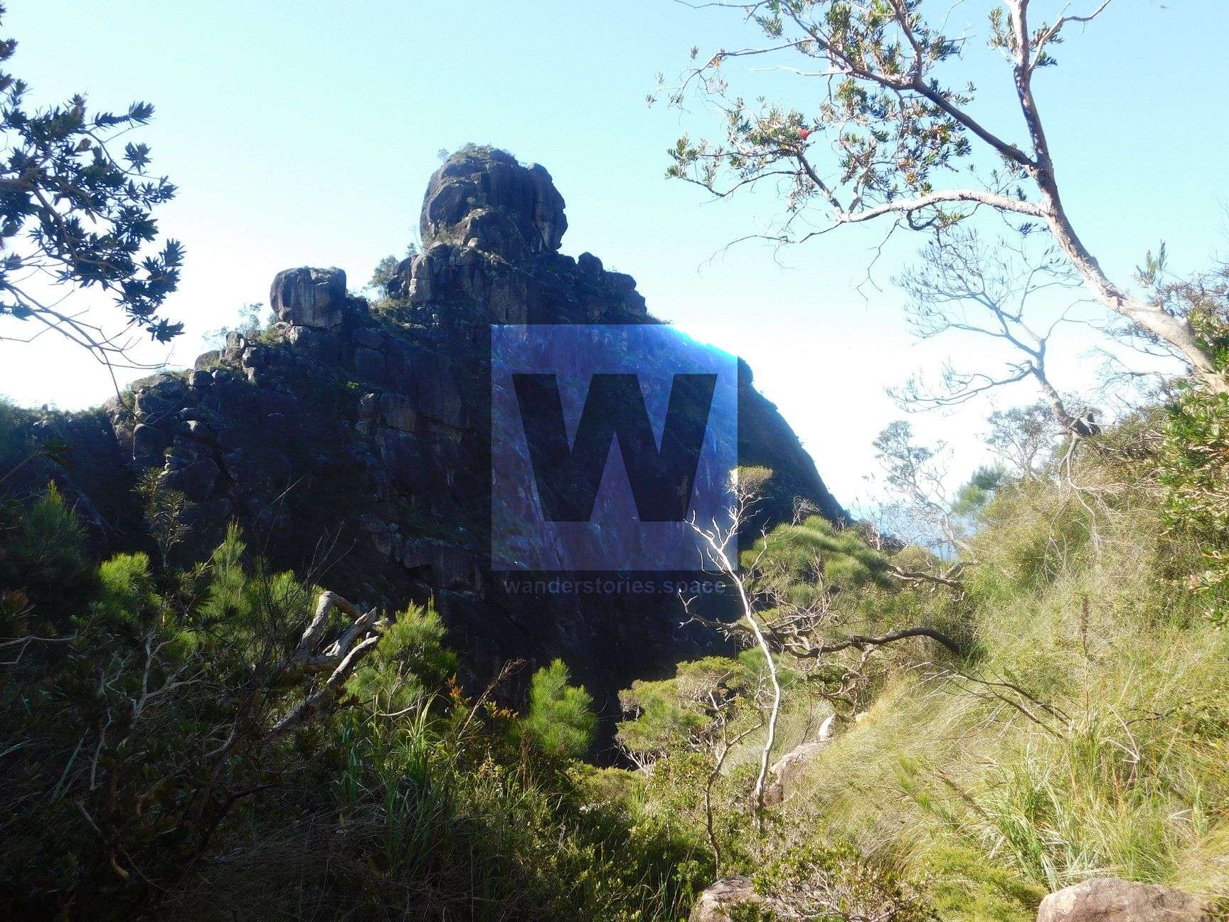
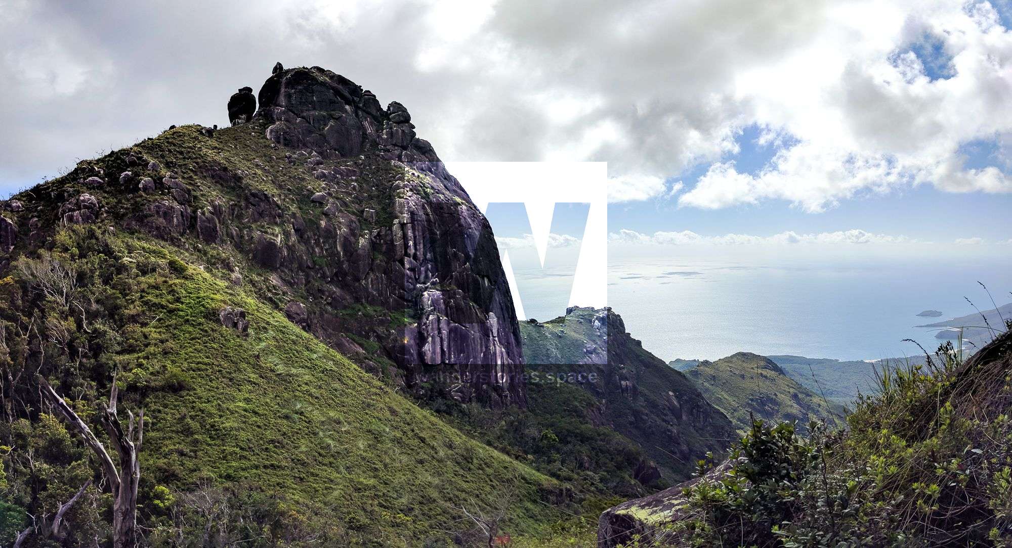
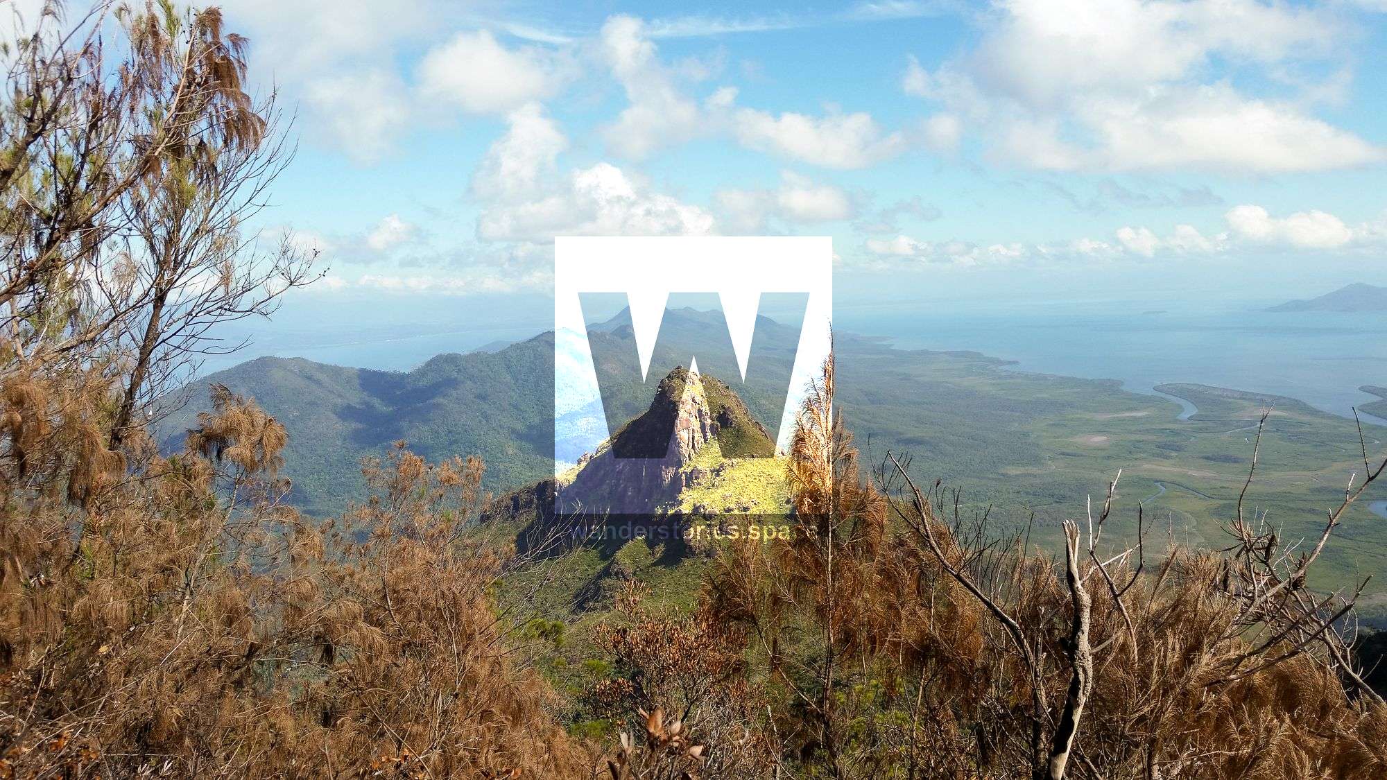
North Peak and The Prophet
The Prophet is an amazing freestanding rock formation on the North Peak. Narrower at the base than the top, and the "small" boulder at the top does make it look a bit like a human form. Don't let the photos fool you, the prophet is BIG; some of the little plants nearby are trees.
If you have an eager eye, you may see a coin that was placed in a notch in a rock between The Prophet and North Peak. Some say this may have been put there by Robert Rankin, an earlier adventurer who is still well known for his books on the area. Take a moment to rest here and experience the well-deserved views to the north and especially the view at the gap between The Prophet and North Peak.
Climb past North Peak to the North Saddle where you can obtain water from the western creek (Missionary Creek) approximately 10 minutes downstream and eastern creek (Warrawilla Creek) approximately 15 minutes.
As you approach the North Saddle, you will encounter tall, thick ferns; this vegetation will force you to lift your legs seemingly up to your head with each step. But, it's worth it.
From the North Saddle, the route joins the popular and well-defined track up Warrawilla Creek. Continue to summit Mount Bowen, as per the Warrawilla Creek Route instructions above.
Nina Creek Route
Nina Creek gives direct access to the Bowen Massif above Pineapple Peak in the vicinity of The Wart, but the upper reaches of the creek are steep and exposed.
Nina Creek is probably one of the least travelled of all of the routes to Mount Bowen, as the vegetation becomes quite thick as you gain elevation. From Pineapple Saddle, continue as per the Pineapple Ridge Route instructions above.
The Ridgeline Route - Mount Bowen via The Thumb
There are several routes up The Thumb, but one of the most popular is via Thumb Creek. Regardless of the route you take, once you reach the Thumb Saddle, you will need to head up the ridge to Mount Bowen. From south to north is more difficult than north to south due to the steepness and vegetation.
From Thumb Saddle, contour northeastwards around the cliffline taking the first left up a vegetated gully. Take an immediate right a few meters up and traverse around the base of the next cliffline (continuing straight up left will result in thick fern and cliff).
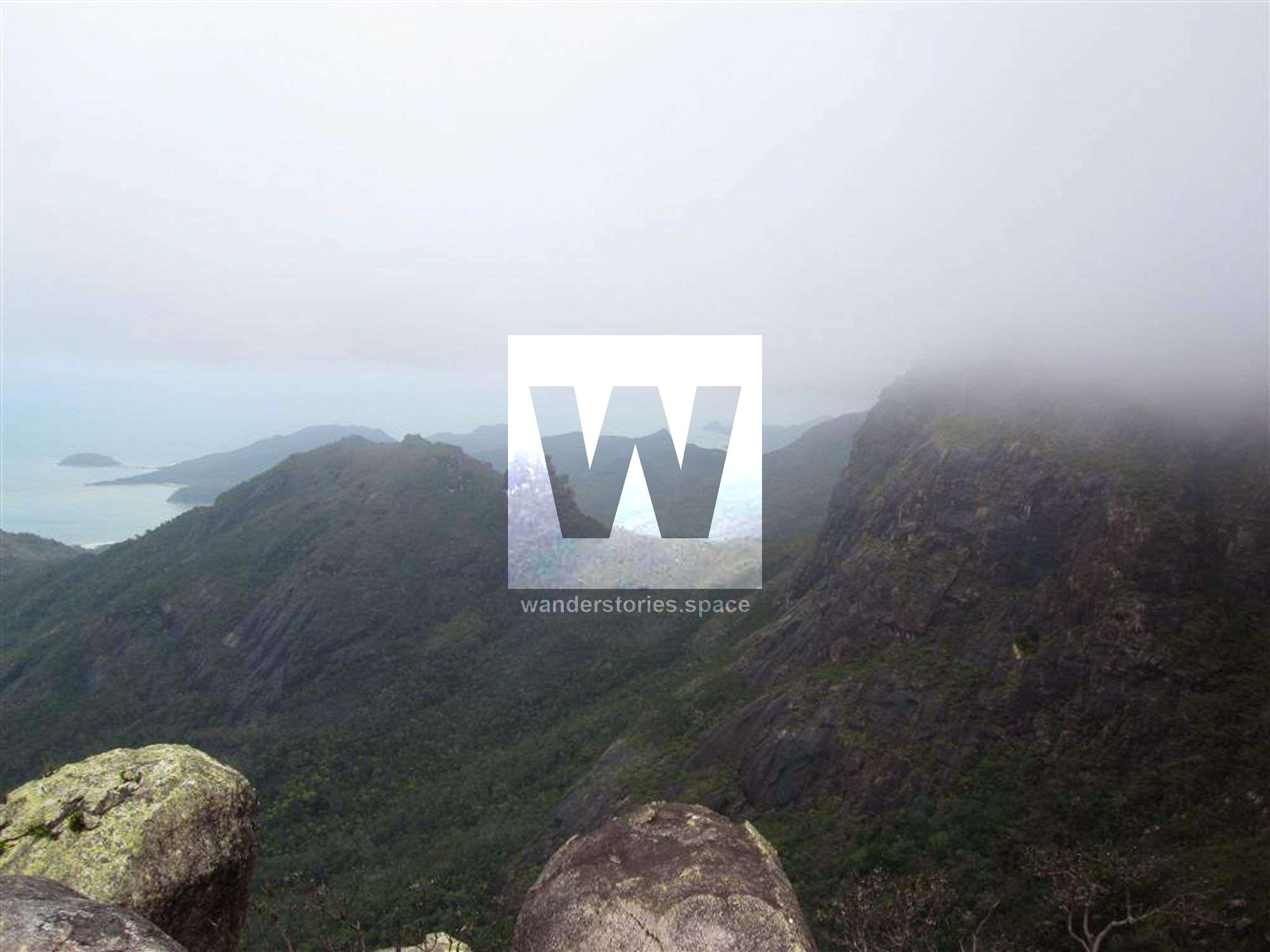
The track is less obvious here and the going is subsequently slower and is rarely done. It is fairly steep and well-vegetated which may be the hardest part of this route. Follow the cliff around to where you can rest on top of an open rocky slab overlooking The Thumb. This point also provides grand views down towards Zoe Bay.
Continue up through the thick vegetation to the rocky outcrop of the lower reaches on the South Peak. Locate a short but steep gully leading up to the top of the ridgeline where you can rest on the flat rocky outcrops. Continue along the rocky and less vegetated ridgeline to the South Peak. From the South Peak, continue on a gentle downhill gradient to the saddle, through basika brush, heath, and fern thickets and up to Mount Bowen.
Fingers Ridge and The Fingers
Fingers Ridge is that spectacular rocky spine descending towards the coast from North Peak. The Fingers refers to a rocky outcrop that has the appearance of a hand rising from the heavily vegetated ridge.
The North Peak first ascent was by John Comino, Ian McLeod, Jon Stephenson, David Stewart, and Geoff Broadbent in 1953 who also made the first ascent of the Thumb during this trip.
The first descentists, a team of six people (Peter Reimann, Lou Darveniza, Marion Darveniza, Sue Darveniza, Steve Coleman, and Derek Hedgecock), performed multiple abseils down the North Peak towards The Fingers on August 1968 and at one point used a grass tree as an anchor. The last abseil was onto a big flat chock across a small canyon. It is not known to have been descended a seconding time and the first ascent of this ridgeline is not known to have been accomplished yet...
Western Approaches
There are several approaches to take from the west, including the first European ascent route, Gayundah Creek and ridge. The other obvious route would be to ascend Missionary Creek to the North Saddle and follow the ridgeline from there.
In December 1961, Arthur Rosser, Carol Rosser, Ann Johnman, Ian Currie, and Norwood Harrison from the University of Queensland's Bushwalking Club (UQBWC), successfully traversed from Mount Bowen in the north to Mount Diamantina in the south. The Cairns Bushwalking Club would know more about this trip.
What to bring
- A topographical map and compass (and/or a GPS unit)
- PLB (Personal Locator Beacon) or an EPIRB (Emergency Position Indicating Radio Beacon)
- Water treatment - purifying tablets, etc (water is usually available in the creeks, though only available on the ridges in small rock puddles for approximately two days after rain). Note: on the ridges and high up in creeks near the watershed, plastic tubing is useful to syphon water from these rock crevices.
Saftey
Safety is paramount in these rugged, remote wilderness areas. It's important that people who are considering hiking up Mount Bowen are aware of the risks. Here are some things to consider:
- Loose, chossy landscape and rockfall like that on creek edges. Warren MacDonald lost his legs when traversing over large creek boulders that shifted underfoot; the shift caused the boulders to roll and therefore physically crush his legs.
- Cloud covering – it is easy to navigate the last hour or two to the summit on a clear day but when clouded in, it is easy to become disorientated.
- Navigational error – particularly ascending via creek routes.
- Flash flooding - creeks and streams can rise suddenly and become impassable during and after heavy rain and will take at least twice as long to traverse.
Interactive Map
Here's an interactive map of the Bowen Massif with the routes and POIs.

This article, and all other articles, are for entertainment purposes only and are not to be used as a guide. Please see our Disclaimer for more information.