Turtle Creek
Turtle Creek is a stream that flows off the summit of Mount Halifax into Rollingstone Creek West Branch.

Location - Paluma Range National Park, North Queensland, Australia
Duration - Allow 2-3 days
Distance - ~20+ kilometres
Difficulty - Grade 5
Turtle Creek is a stream that flows off the summit of Mount Halifax into Rollingstone Creek West Branch. The creek was nicknamed by Madoc and Quinn Sheehan, after the tough turtles that eke out an existence in the tiny pools high up in the catchment.. Even though it's only a few kilometres from a national highway, you'll feel totally immersed in remote wilderness and really, you are. It is surrounded by dense rainforest with a high canopy, ferns, palm trees, elk/staghorns etc; a pristine natural environment and is truly spectacular!
The route is a circuit, via Mt Halifax summit that can be walked either clockwise (up Mt Halifax and down Turtle Creek) or anticlockwise (up Turtle Creek and down Mt Halifax). It's a strenuous mostly off-track hike involving rock hopping/scrambling, wading, thick vegetation, high elevation gain and tricky route finding. There is no mobile phone coverage in the creek.
Alternatively, if you are camping at the summit, you can do a day walk down turtle creek and back to the summit. This will take you through beautiful tall forest to a great gorge and swimming hole (6hr return) or go a bit further and visit the major falls another 1.5hr further downstream.
Interactive map
Approach
If you are driving north from Townsville, turn left onto Pace Road (opposite the Balgal Beach turn off) just before you reach the Rollingstone Creek bridge. Drive until you reach the logbook sign-in point for the start of the track. This is where the road ends, and you can park your car here, along the roadside before Pace's gate. Vehicles are not to proceed through Pace's gate, however, as it is private property. Please also note that heavy machinery and wide loads use the road every day. Please park your vehicle far off the road and do not block the gate and observe "No Standing" signs.
Clockwise Route
First, summit Mt Halifax via the track. This in itself is a great walk, climbing steeply through varying vegetation with incredible views to the Palm Group, Magnetic Island, Townsville and Goodwin's Peak. Ensure you bring enough water to get to the summit (2+ litres in summer months). If you are doing the walk in 3 days, Mt Halifax summit is a great place to camp for the 1st night, sunrise can be spectacular from up here! For a 2 day trip, stop for lunch perhaps and keep on going.
From the clearing near the summit follow the sign pointing to the water point, continuing along the track towards Goodwin's Peak through the rainforest for about 600m to a junction and turn right. If you went left, you'd get to Goodwin's Peak.
You're now on The Link Track. Head down steeply following the markers, the track is indistinct in this section. About 150m along the track there is a natural spring at the head of a gully which reliably provides water all year round. From here on, water is plentiful. Continue another 300-400m down to Turtle Creek. Follow the markers to Camp 5, this is where we leave The Link Track, it turns left, up to the next ridge and eventually meets up with the PRB Track.
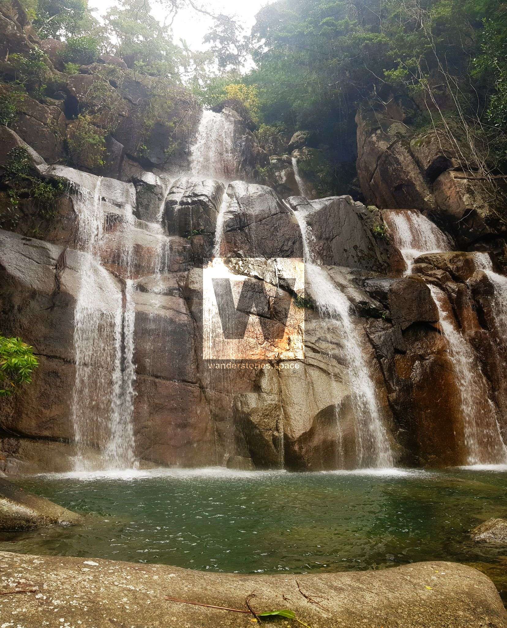
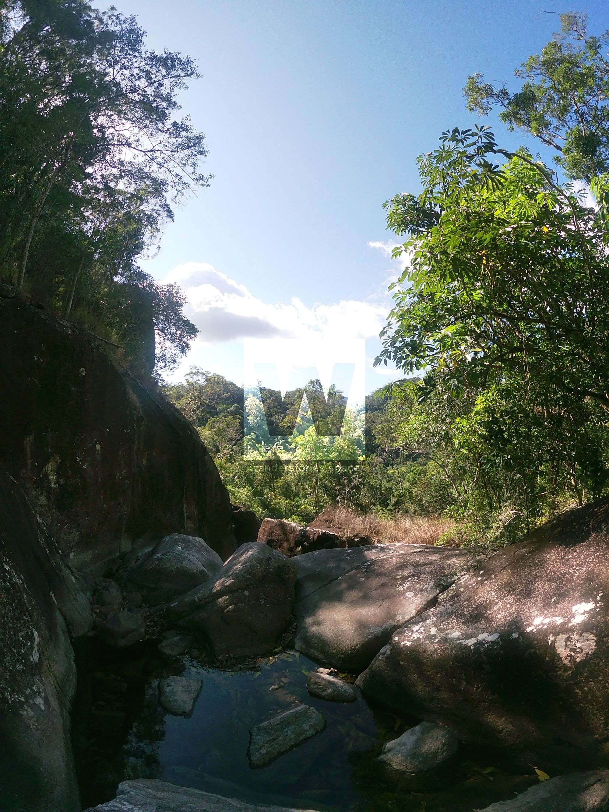
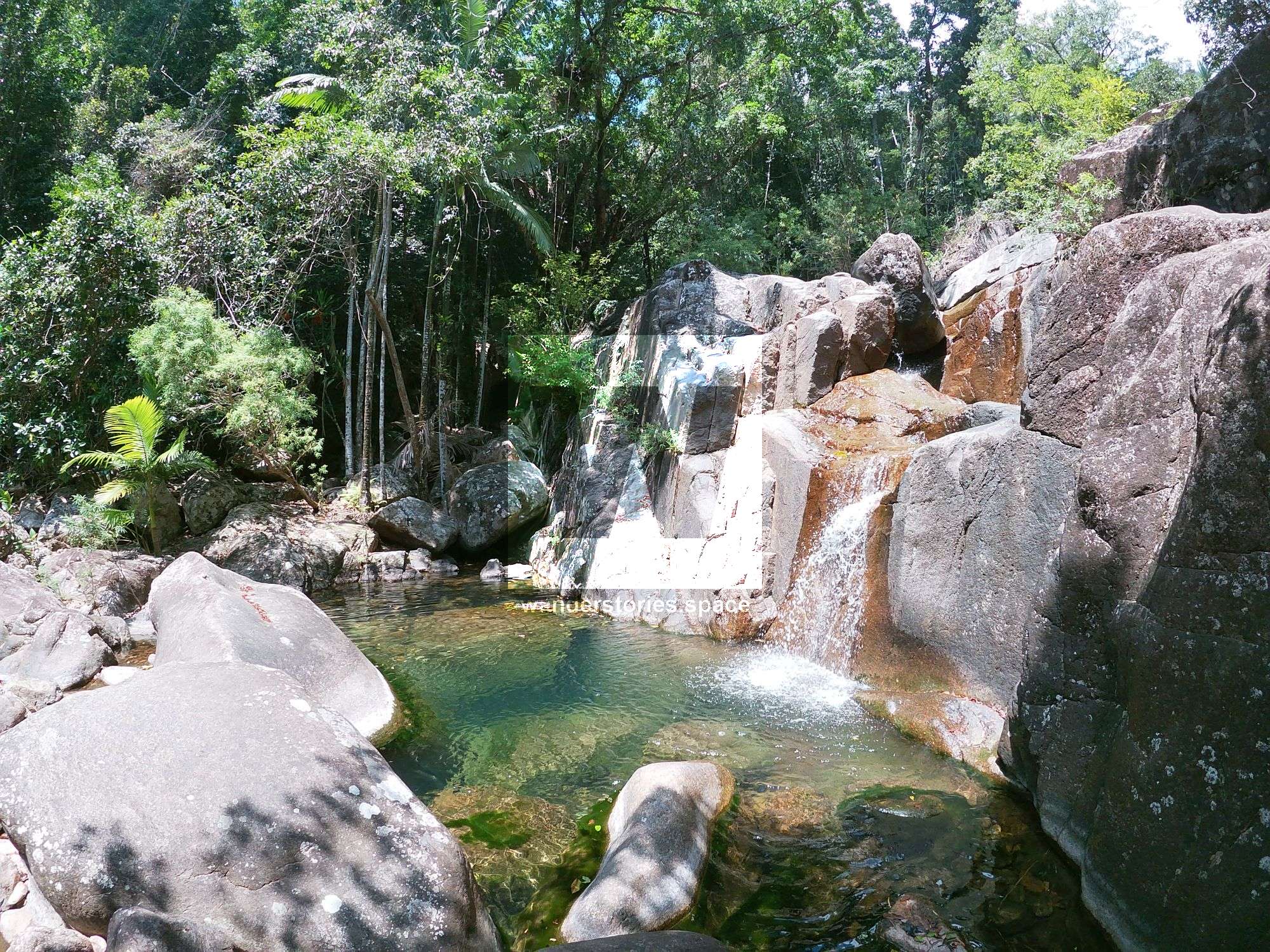
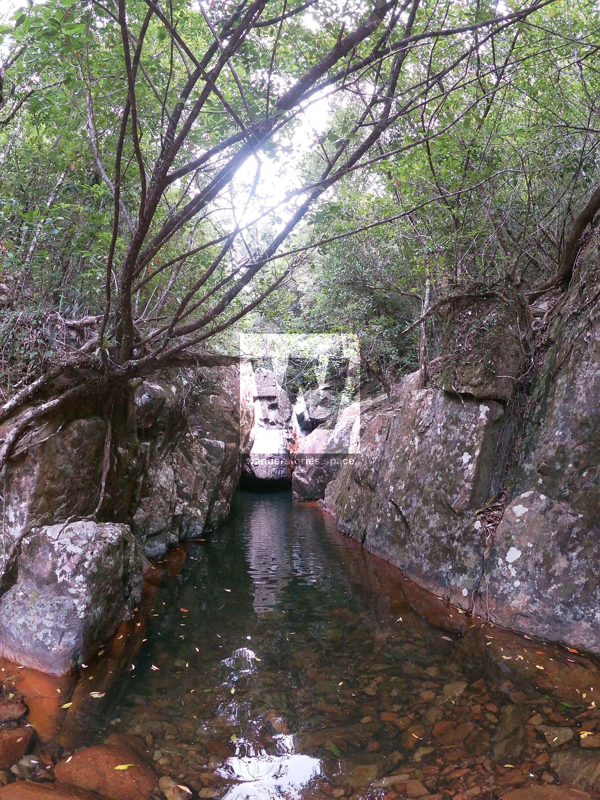
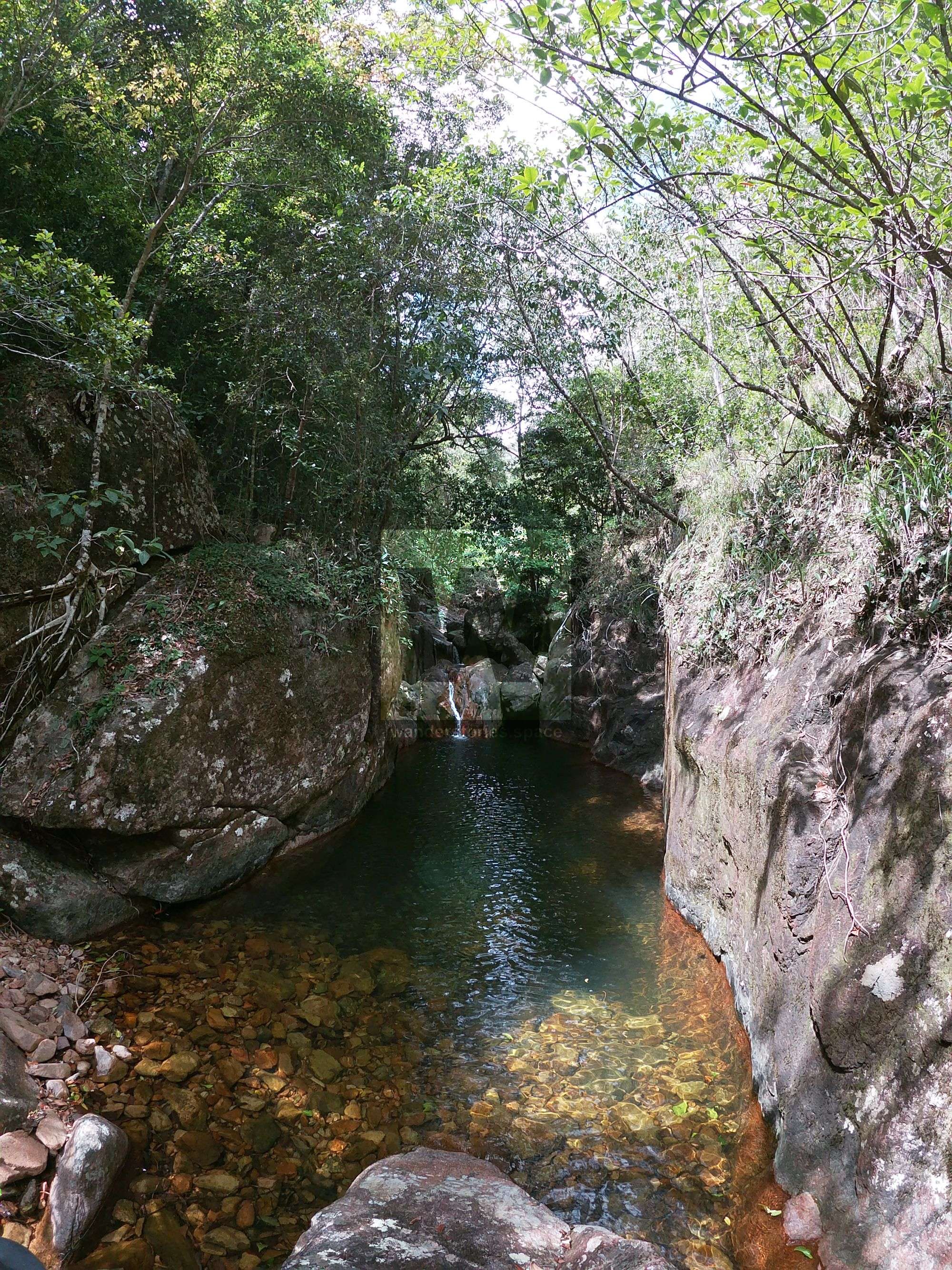
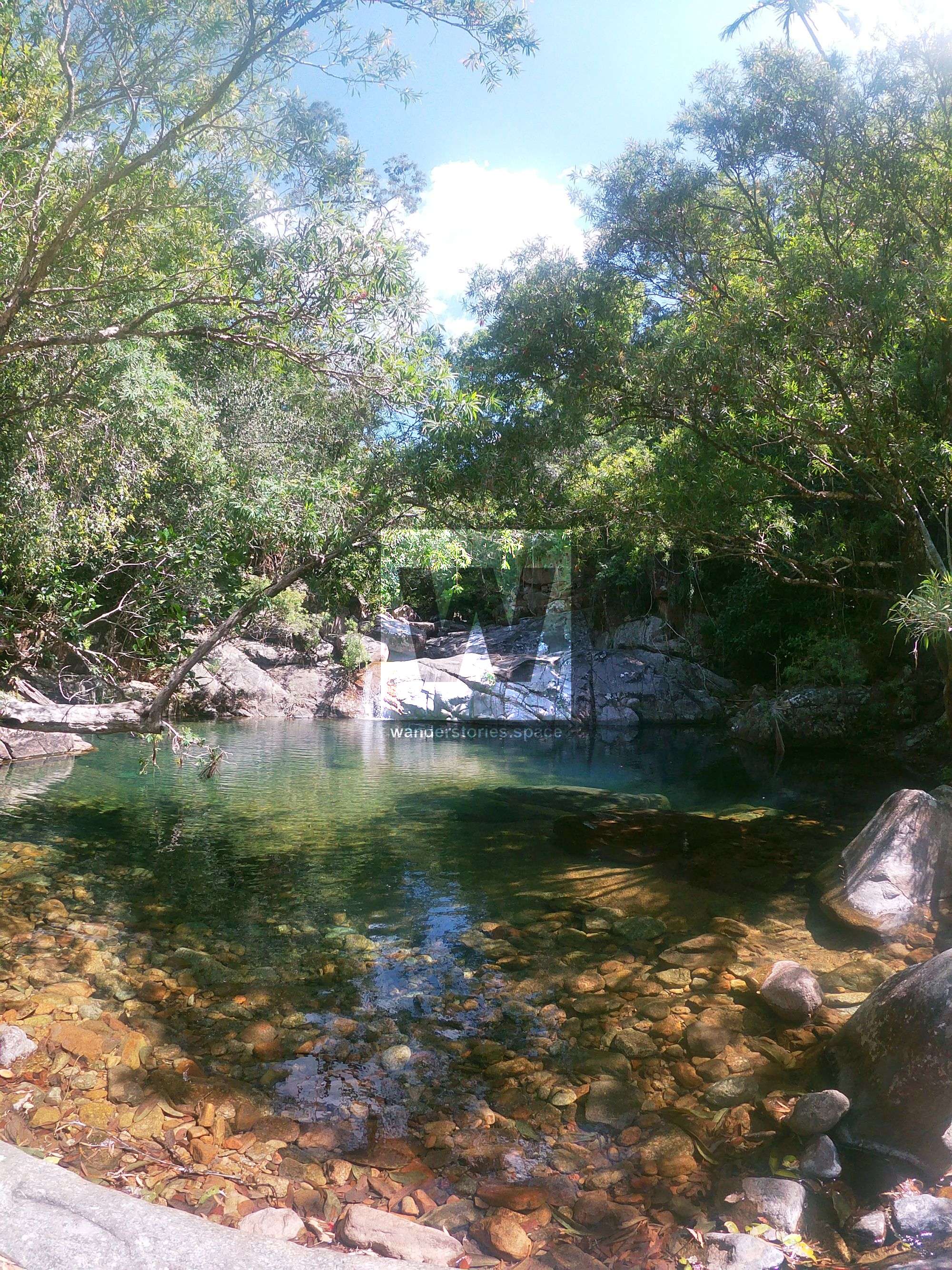
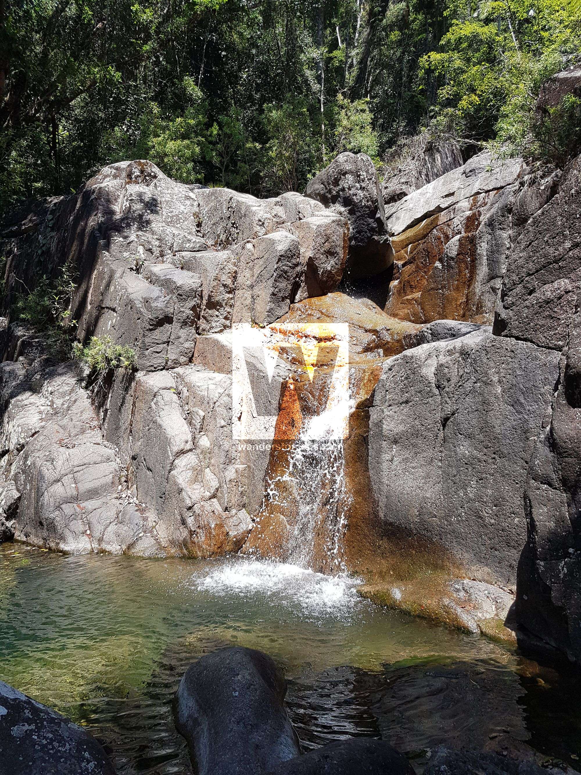
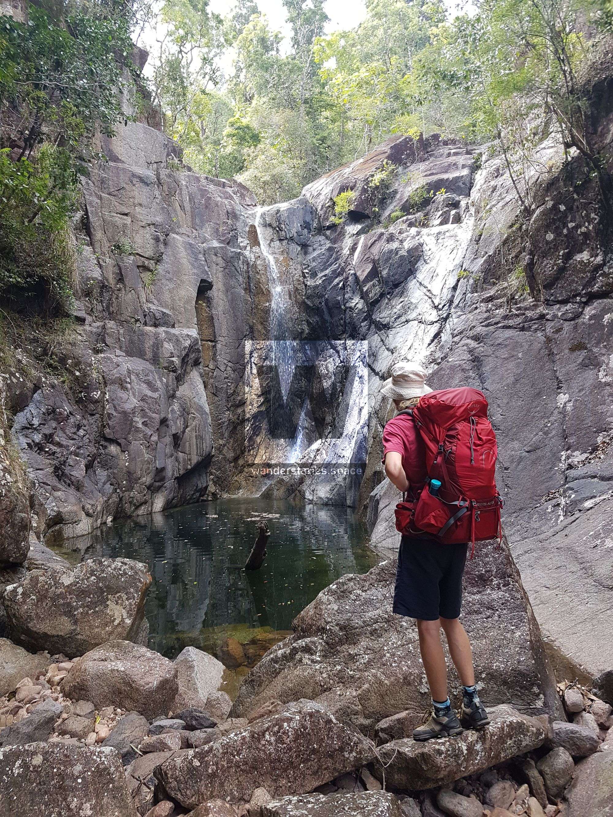
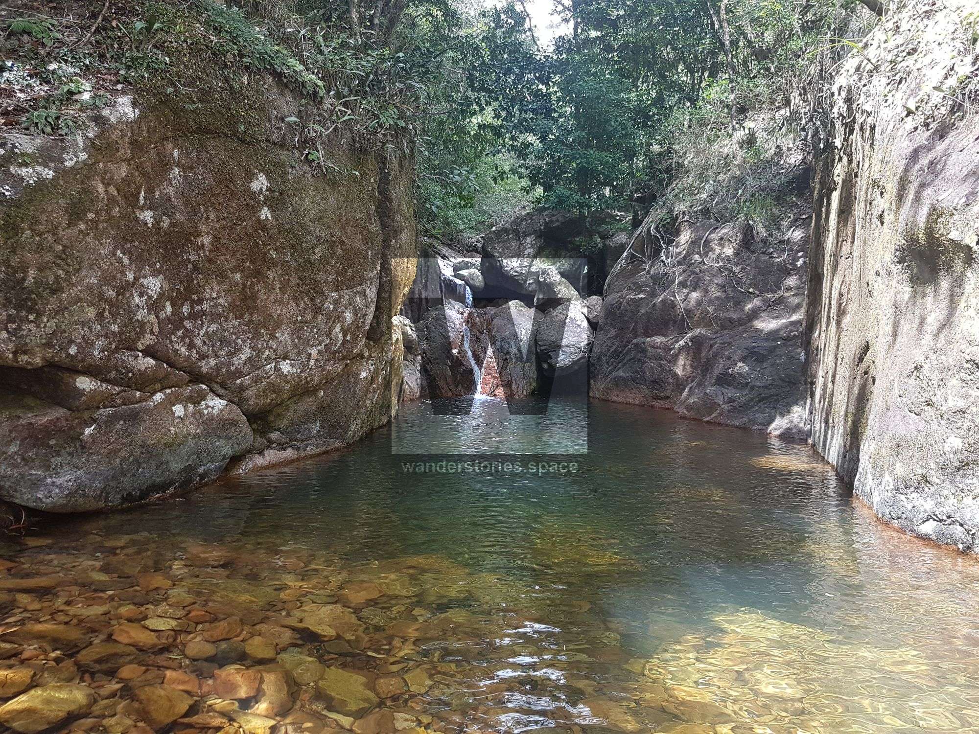
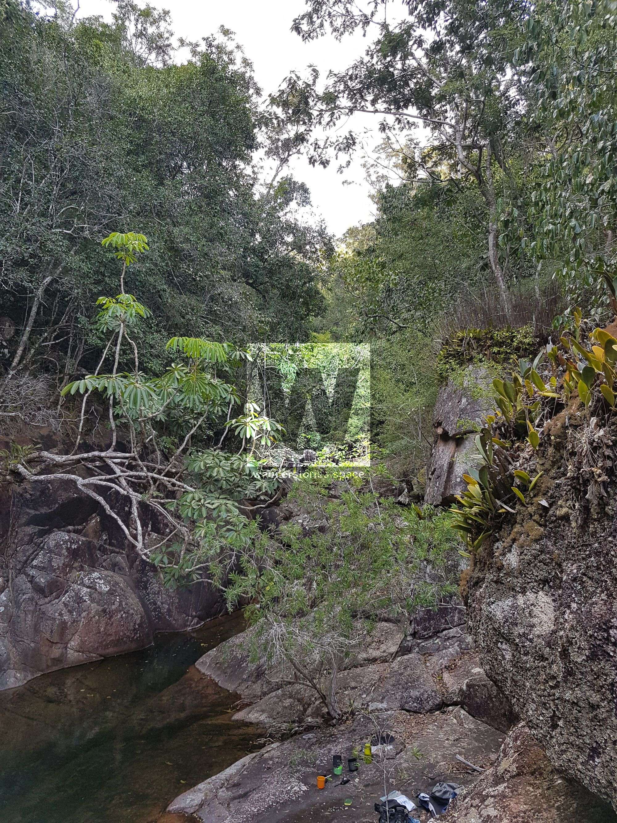
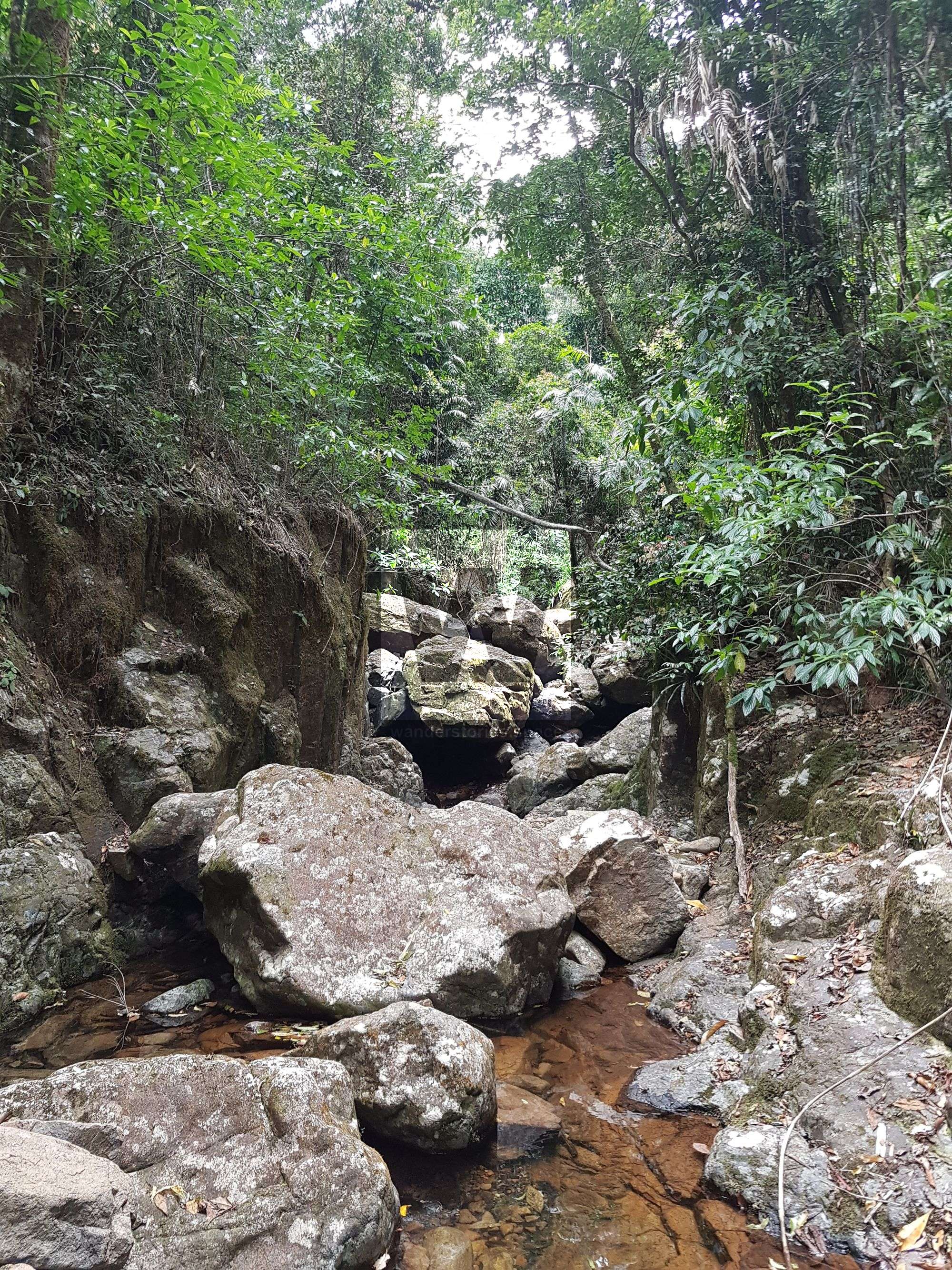
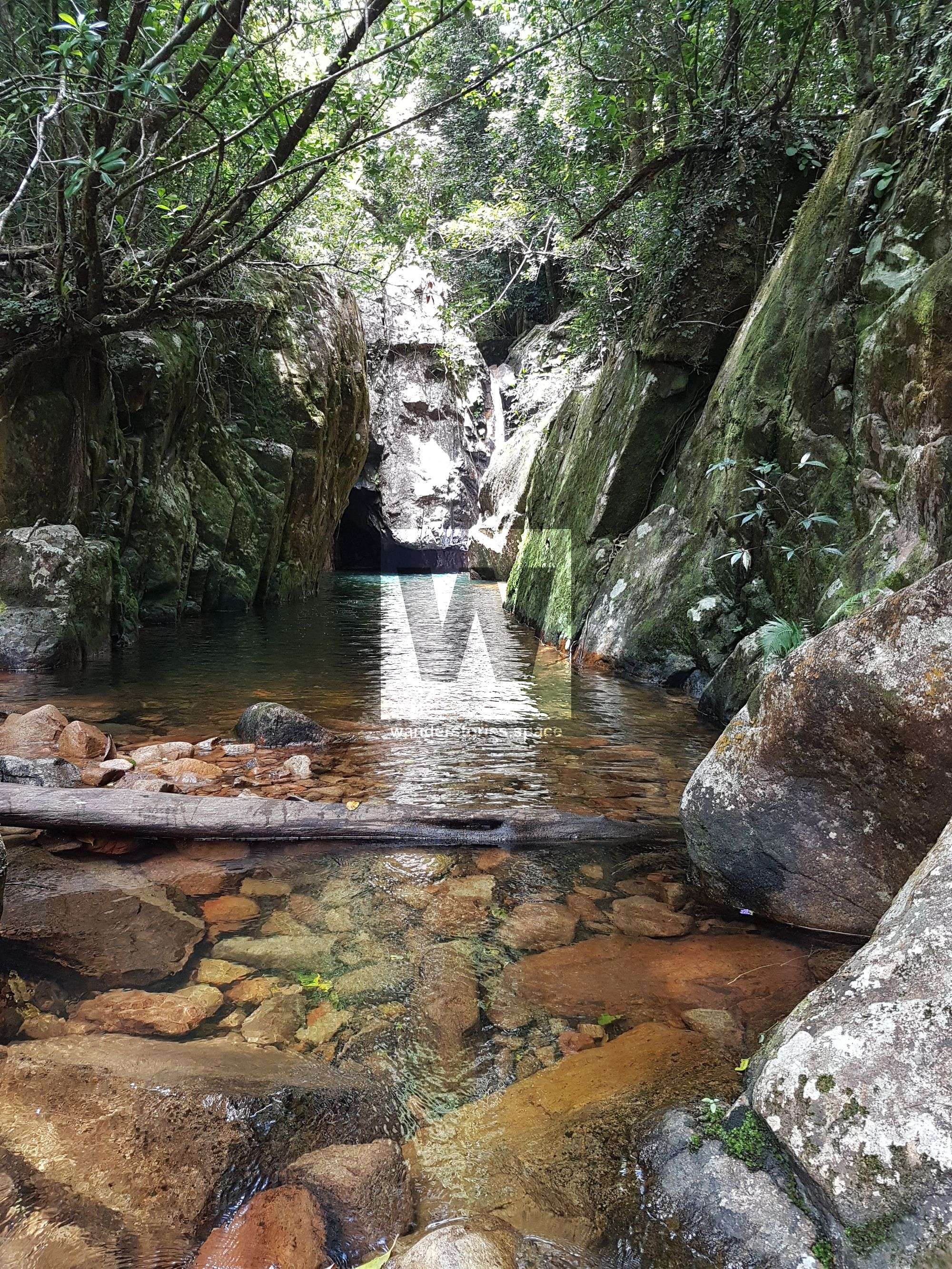
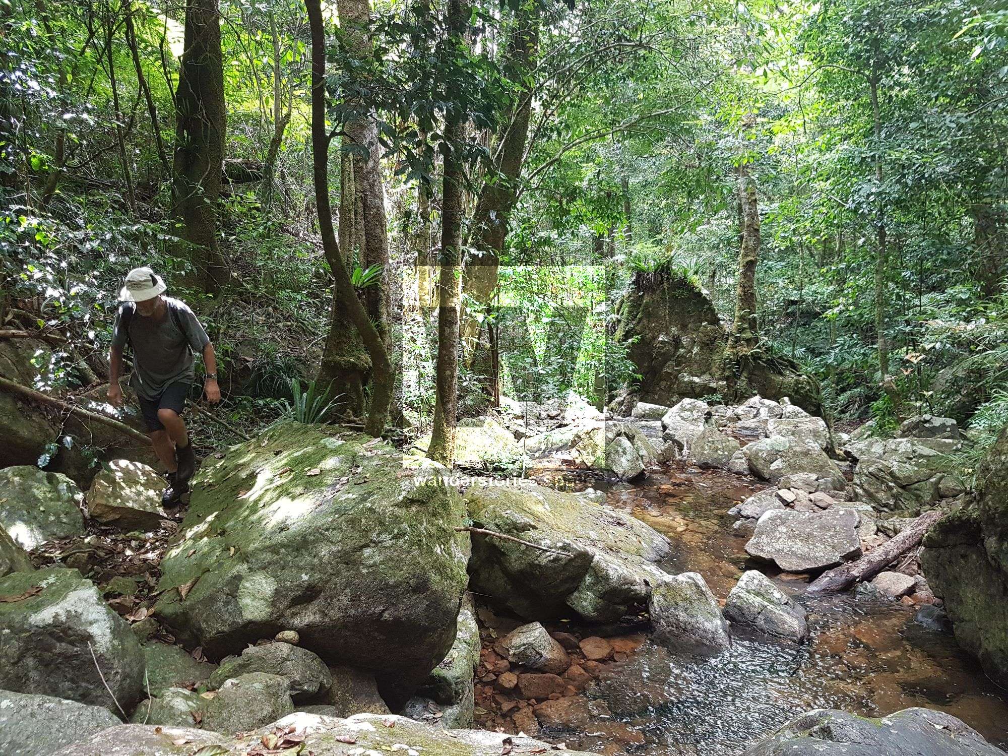
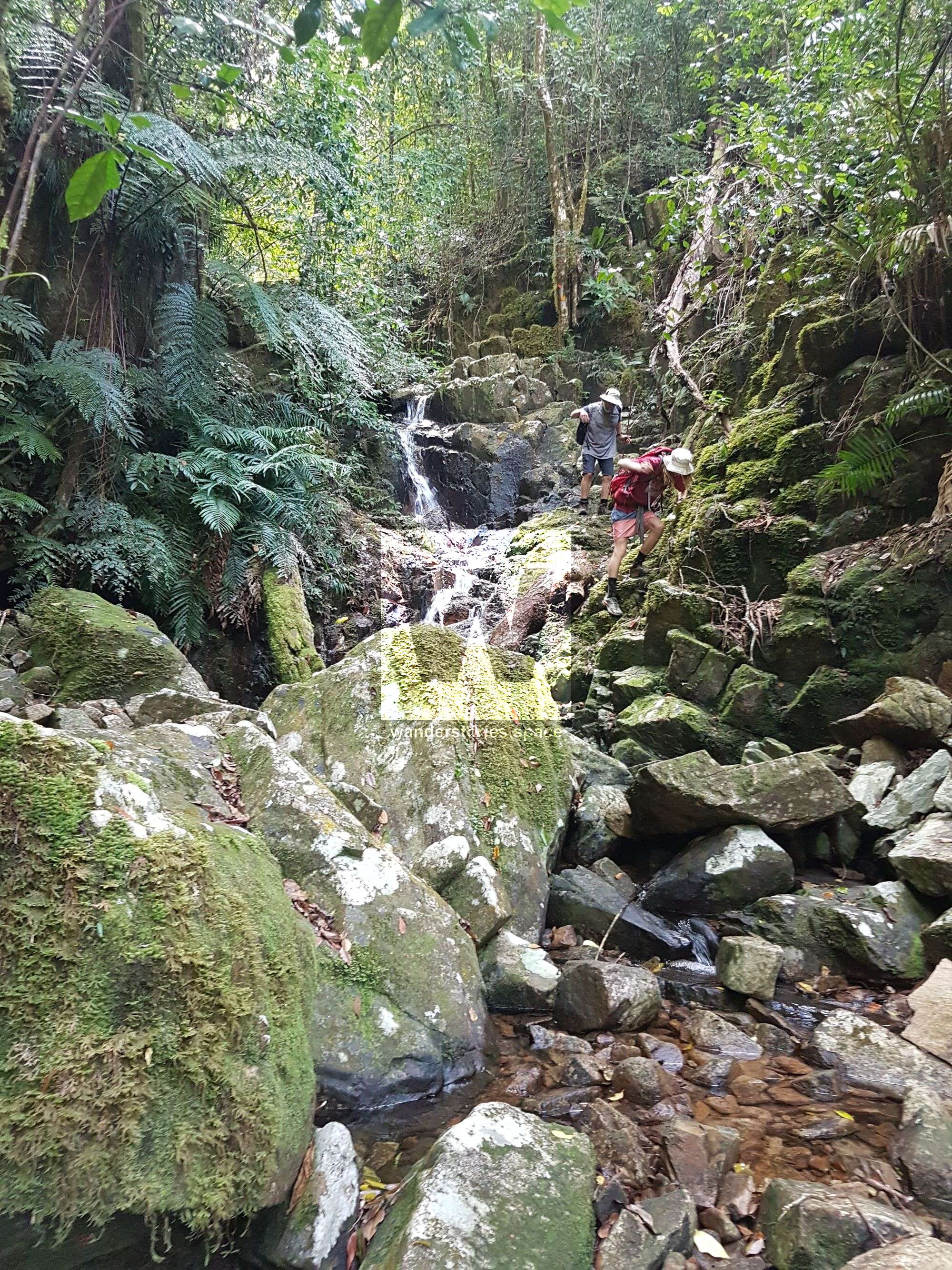
Continue down the creek. From here, there are no tracks and no markers until you leave the creek. There are long flattish, sometimes straight sections which are relatively easy going, broken up by short steep, difficult sections. There are many waterfalls into mini-gorges and rock pools, most of these falls are 2-5 metres in height and are relatively easy to walk around.
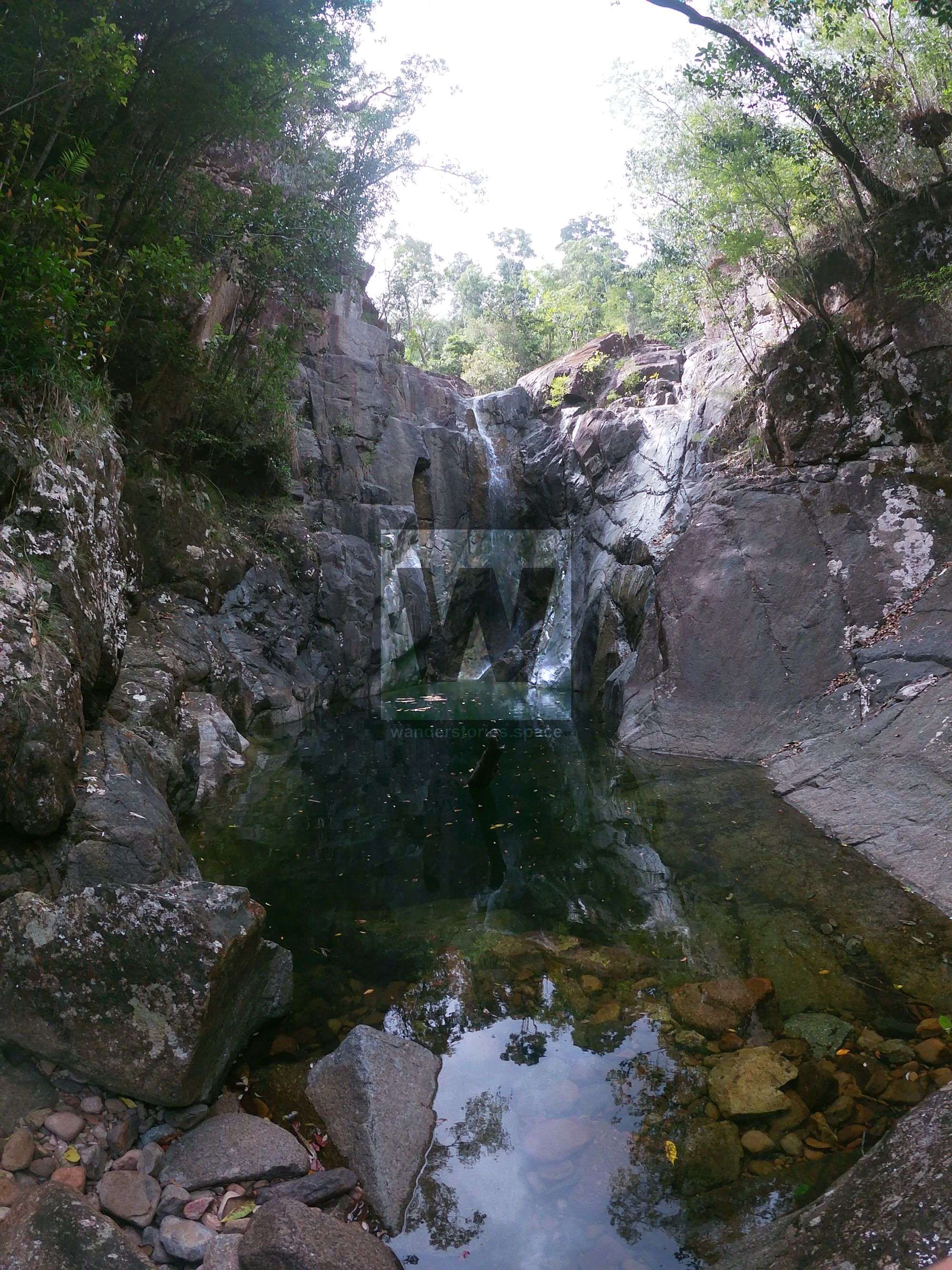
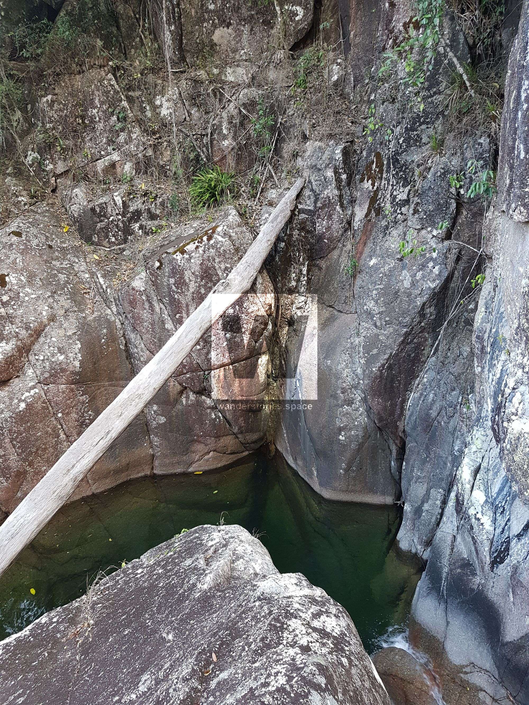
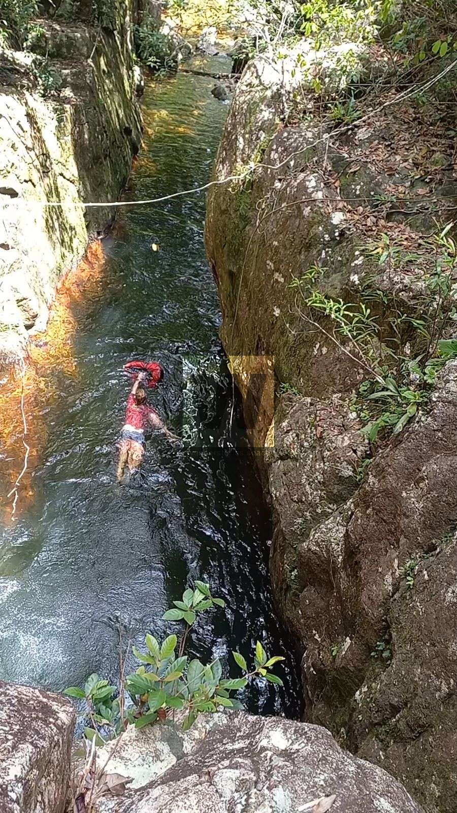
There are 2 larger waterfalls, each over 20 metres that require longer detours through dense rainforest on steep ground. Make sure, once you re-join the creek, venture back upstream to the base of the falls and take in their beauty, they are real highlights of the trip and very few people have ever seen them! Beware, there is also a canyon-like gorge which will need to be circumvented. It's very steep sided and you need to climb out of the creek some way and then parallel it for roughly 150m to get around. Rough locations of these obstacles are indicated on the interactive map. Stay tuned for the canyoning version of this article.
There is a good single-tent campsite on the western side of the creek. It's 20m uphill from the creek, above a nice flat rock section with a skinny, deep pool just before a steep section with massive chockstone boulders. This campsite however is better suited to a 3-day trip because only a very fast group would make it this far in a day. If using hammocks, there are many possible campsites along the flatter sections of the creek. This is also indicated on the interactive map.
Eventually Turtle Creek joins Rollingstone Creek West Branch, this will be obvious because after the junction it is a lot wider. Unless you have prior permission to enter private property (Pace Farm) you must exit the creek no more than 600m downstream of this creek junction and follow the national park boundary which is grassy and scrubby with periodic sections of disused track to Pace Rd and your car.
Anticlockwise
To avoid trespassing on Pace Farm, follow the start of the Mt Halifax track, just before it narrows from road width to singletrack, turn right and follow the national park boundary to Rollingstone Creek West Branch, about 90 minutes. It's a grassy and scrubby route with periodic sections of old track.
Head upstream to the junction with Turtle Creek and take the left branch. There are long flattish, sometimes straight sections which are relatively easy going, broken up by short steep difficult sections. There are many waterfalls and mini-gorges and rock pools, most of these falls are 2-5 metres in height and are relatively easy to walk around.
There are 2 larger waterfalls, each over 20 metres that require longer detours through dense rainforest on steep terrain. Make sure you venture upstream to the base of the falls first to fully enjoy the spectacle, they are real highlights of the trip and very few people have ever seen them! Once you've basked in their beauty, you'll need to backtrack downstream to find a route around them. Almost all obstacles can be bypassed on the eastern side. Beware, there is also a canyon like gorge which will need to be circumvented. It's very steep sided and you need to climb out of the creek some way and then parallel it for roughly 150m to get around. Rough locations of these obstacles are indicated on the interactive map.
There is a good single-tent campsite on the western side, 20m above the creek. Just after the steep, massive chockstone boulders section the creek flattens out again. There is a longer skinny pool with a deep bathtub and a nice flat rock section, above this is the site. This campsite however is better suited to a 3-day trip because stopping here on a 2 day trip would make for a huge second day. If using hammocks (not tents), there are many possible campsites beside most of the flatter sections of the creek.
In the upper reaches you will reach Camp 5, where the route follows part of The Link Track. From here there are markers to follow which, after 200-300m will direct you left out of the creek and steeply up, past a natural spring to the track junction with the Mt Halifax - Goodwin's Peak track. Be sure to resupply with water at the spring as there is no more water until you have descended the mountain. Turn left at the junction and follow the track for about 600m to Mt Halifax summit.
The summit clearing is the ideal spot to camp for night 2 of a 3 day trip. From here descend the track to your car. Mt Halifax
Notes
You need to be self-sufficient in remote areas and rugged terrain, hiking for 2-3 days. The summit of Mt Halifax can be up to 10°C colder than that at sea level, consider this when packing clothing and camping gear.
Ensure you have a map and compass (or GPS), and safety & communications devices like a first aid kit and PLB (or EPIRB/sat phone/Spot/Inreach). This route requires tricky scrambling in exposed and dangerous locations and a high level of climbing/scrambling skill is recommended. Rope/harness/descender and the skills to use them, while not essential for the clockwise route, would make the trip easier. Secateurs are useful to clear a campsite. Other items worth packing: waterproofing/dry bags, string to hang food (rats), insect repellent, water treatment (tablets/filter/iodine),
Hazards: wait-a-while (lawyer cane), stinging tree (gympie gympie), snakes, leeches, spiders, ticks, mosquitoes, slippery rocks, exposed cliffs, dense rainforest.
This article, and all other articles, are for entertainment purposes only and are not to be used as a guide. Please see our Disclaimer for more information.