Wolfang Peak
Wolfang Peak is an intrusive volcanic plug of rhyolite and trachyte and shows the path of flow of basalt lavas on the Briagalow belt Bio Region.

Location - Peak Range National Park, Isaac Region, Central Queensland, Australia
Distance - 2 km return
Duration - 1-2 hours return; depends on how much time you want to spend exploring the many cave systems.
Grade - 5, rough track and a steep scramble
Total elevation - 190 metres elevation gain
Access - Access is via the Peak Downs Highway (-22.541944, 147.828878)
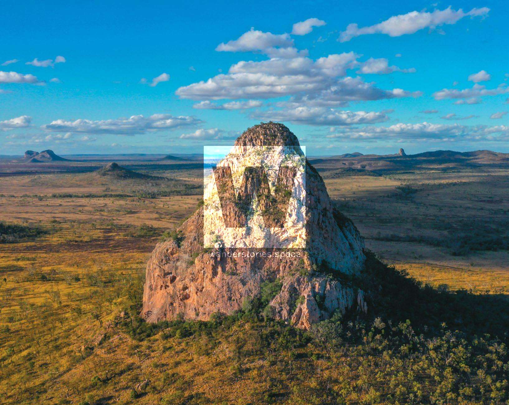
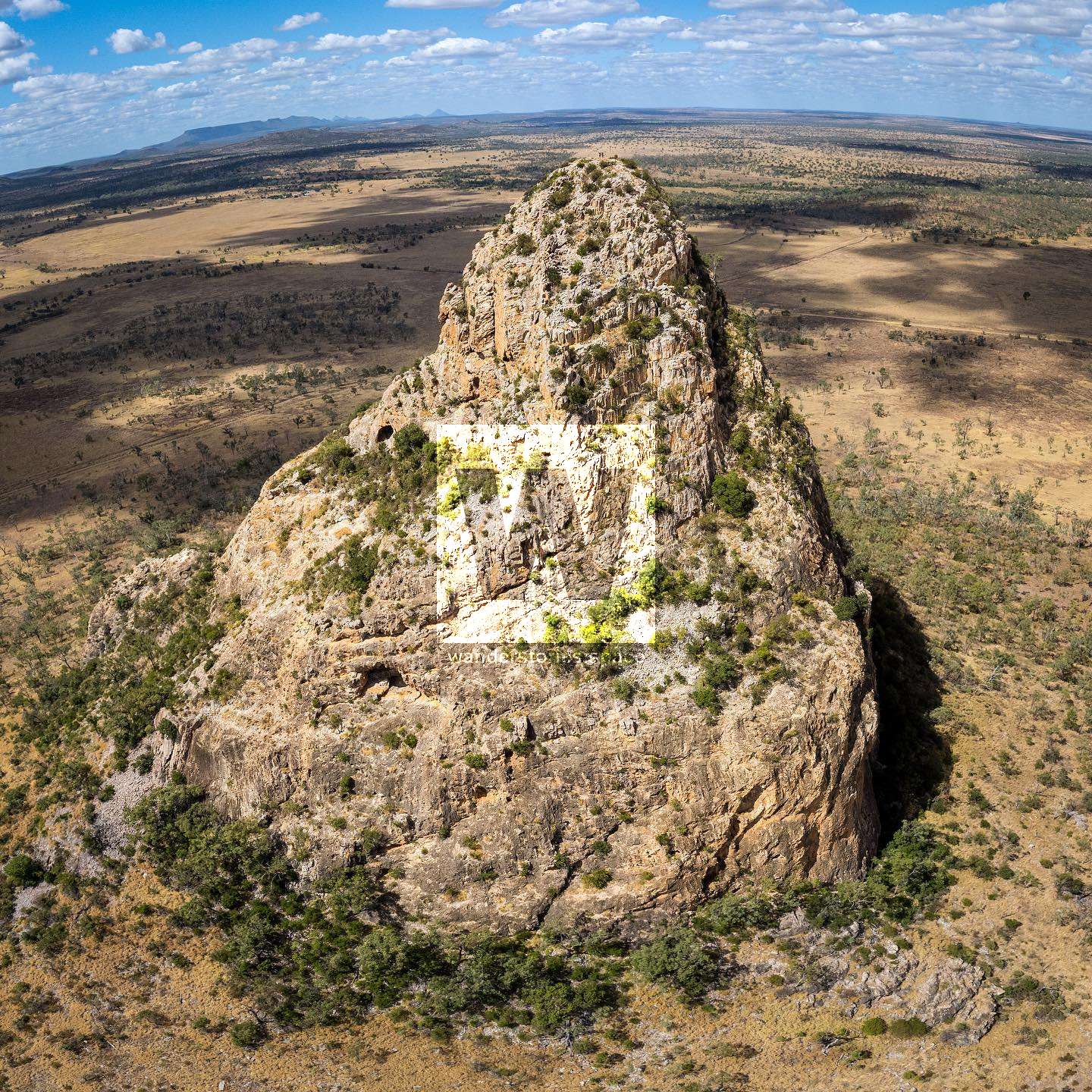
The Peak Range National Park is a string of volcanic formations near Emerald between Moranbah, Clermont, and Dysart. Wolfang Peak is an isolated volcanic fang that consists of intrusive rhyolite trachyte with bands of grey and purple showing the path of flow of basalt lavas on the Briagalow belt bio-region.
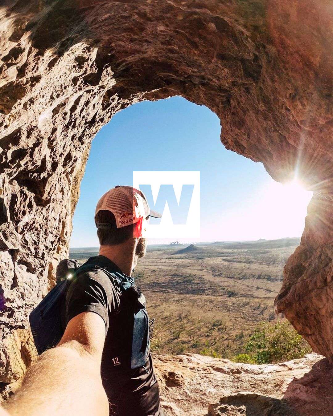
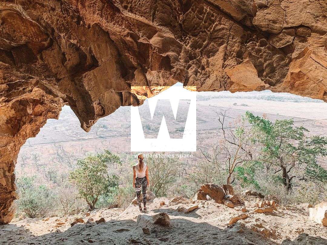
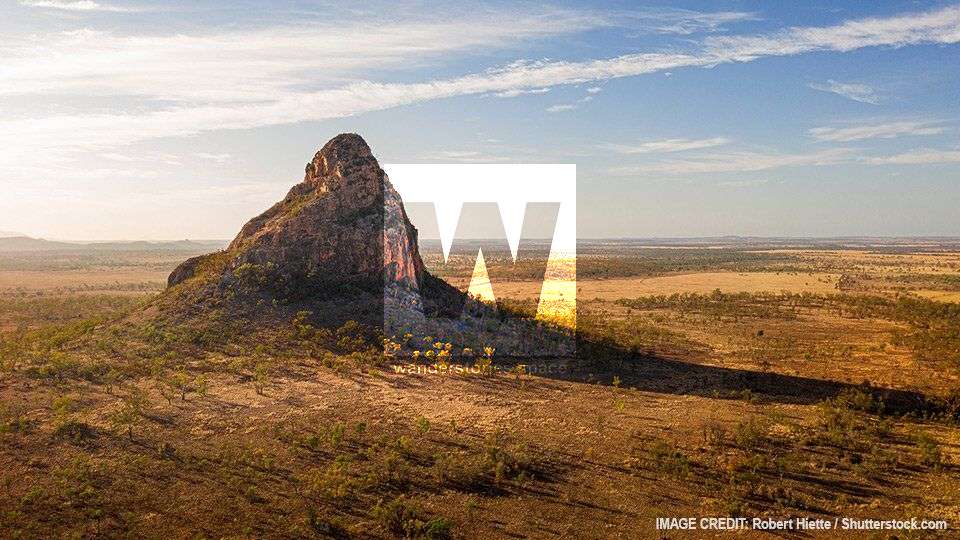
Shaped like a giant fang, this rocky peak is 505 metres above sea level and is the most well-known and most photographed of all the peaks in the area. There are some massive cave formations that are hiked past on the journey, some of which are home to bats.
Ludwig Leichhardt first came across the peak on his 1845 expedition and named it Wolfang Peak. The slope below this distinctive peak is of open grasslands and woodland (Eucalyptus orgadophila). It's a great place to practice astrophotography. Tip: trucks on the highways tend to light up the peak which makes for a great photo. There is also an old windmill nearby.
Interactive Map
How to get to Wolfang Peak
Please note that this area is under grazing lease and access is by walking only from the Peak Downs Highway. It's a 15 minute drive up the road from the Gemini Peaks and just like Lords Table Mountain, it's located right next to the highway.
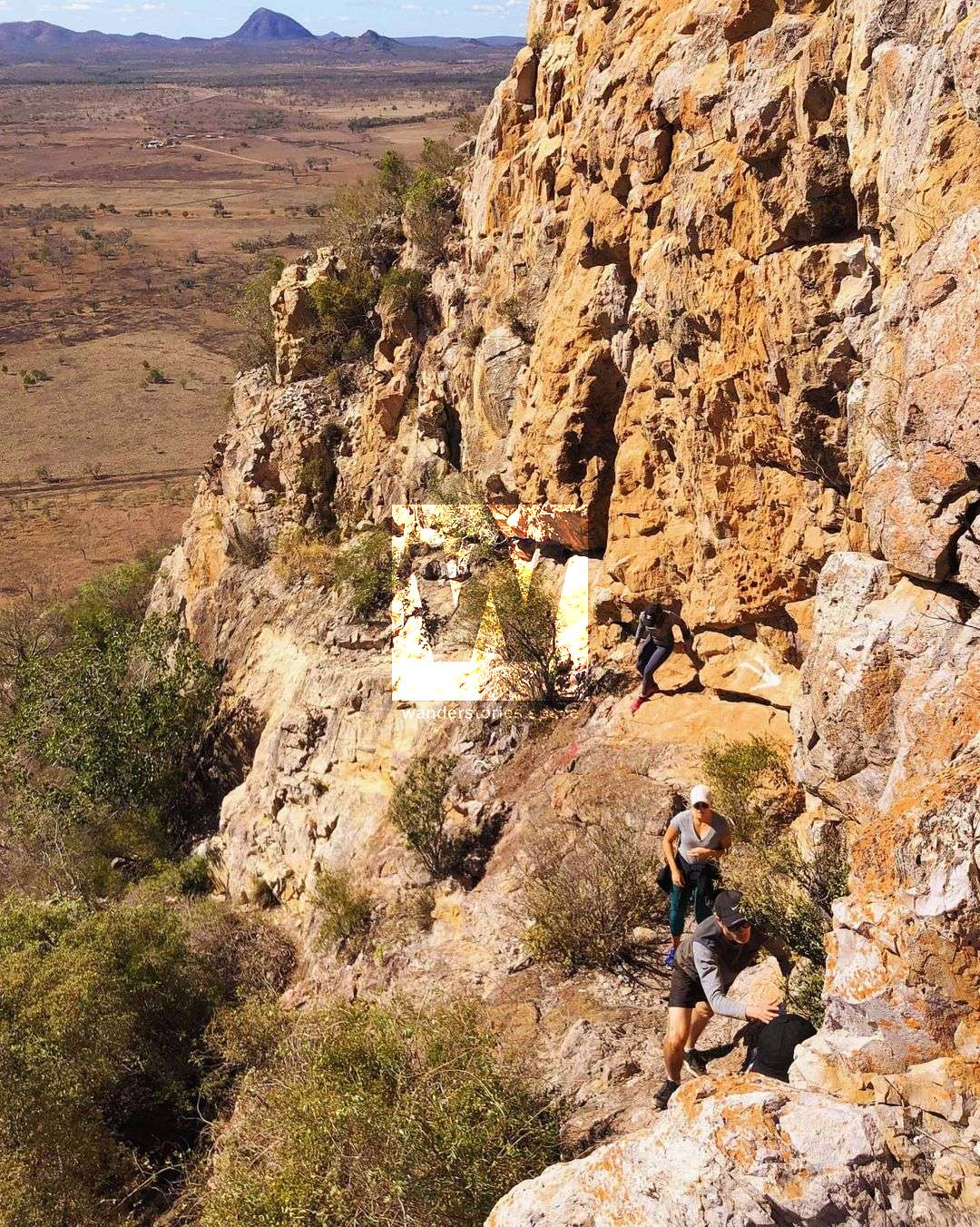
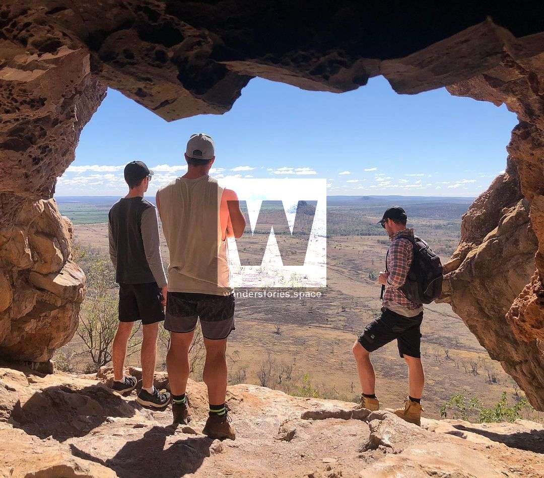
Park by the highway and walk along the fire control lines to near the peak. There are no official walking tracks but there are worn footpads. Walk through the grasslands to the base of the peak. Scramble up the steep rocky peak following the painted red and white arrows that mark the route. "Halfway" is painted in white on the rock. The large cave with graffiti is located about 3/4 of the way up and is a popular photo-taking spot.
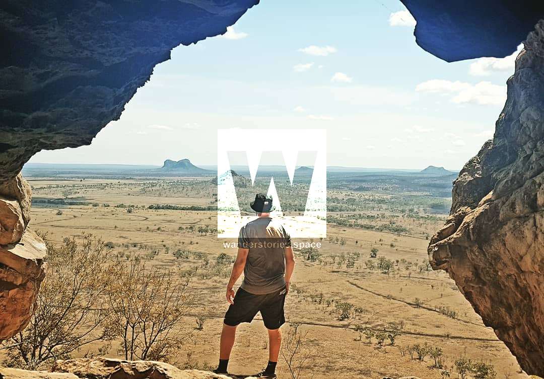
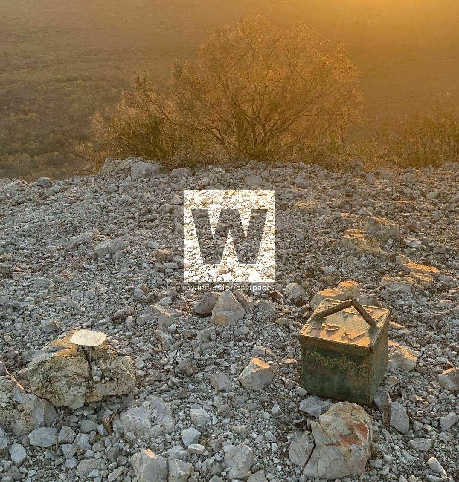
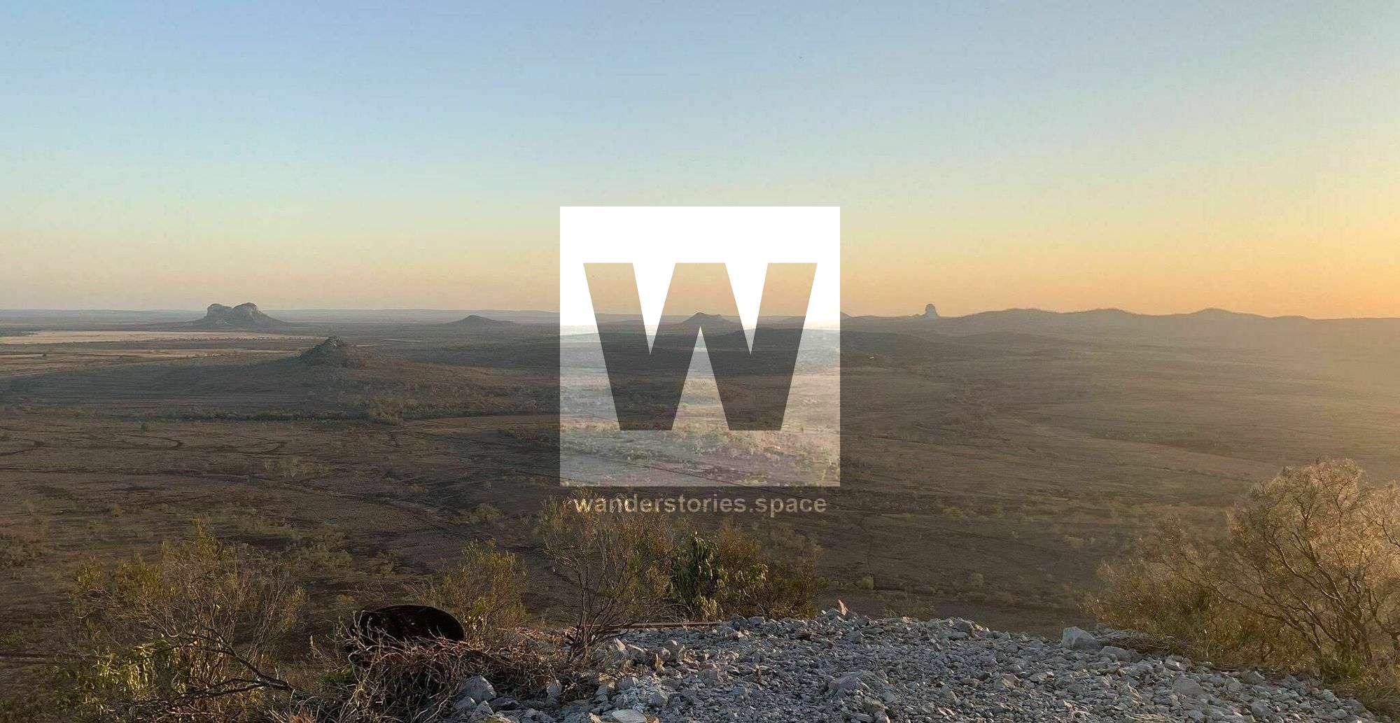
At the summit are the remnants of an old trig point and a steel box geocache and logbook. With views of the surrounding Isaac plains with the Gemini Mountains to the north and Fletchers Awl to the south.
Notes
- There's mobile phone reception at the summit and in other places.
- These peaks are best hiked in winter. Temperatures can exceed 40°C in summer months and this little shade. Remember to drink plenty of water on your hike.
- Use good footwear and be careful when scrambling and when around cliff edges. The rock is decomposing with the surface loose. There have been numerous recorded accidents.
- There's plenty of birdlife around the peaks so keep that in mind when flying drones.
- Keep an eye out for koalas on your hike
This article, and all other articles, are for entertainment purposes only and are not to be used as a guide. Please see our Disclaimer for more information.