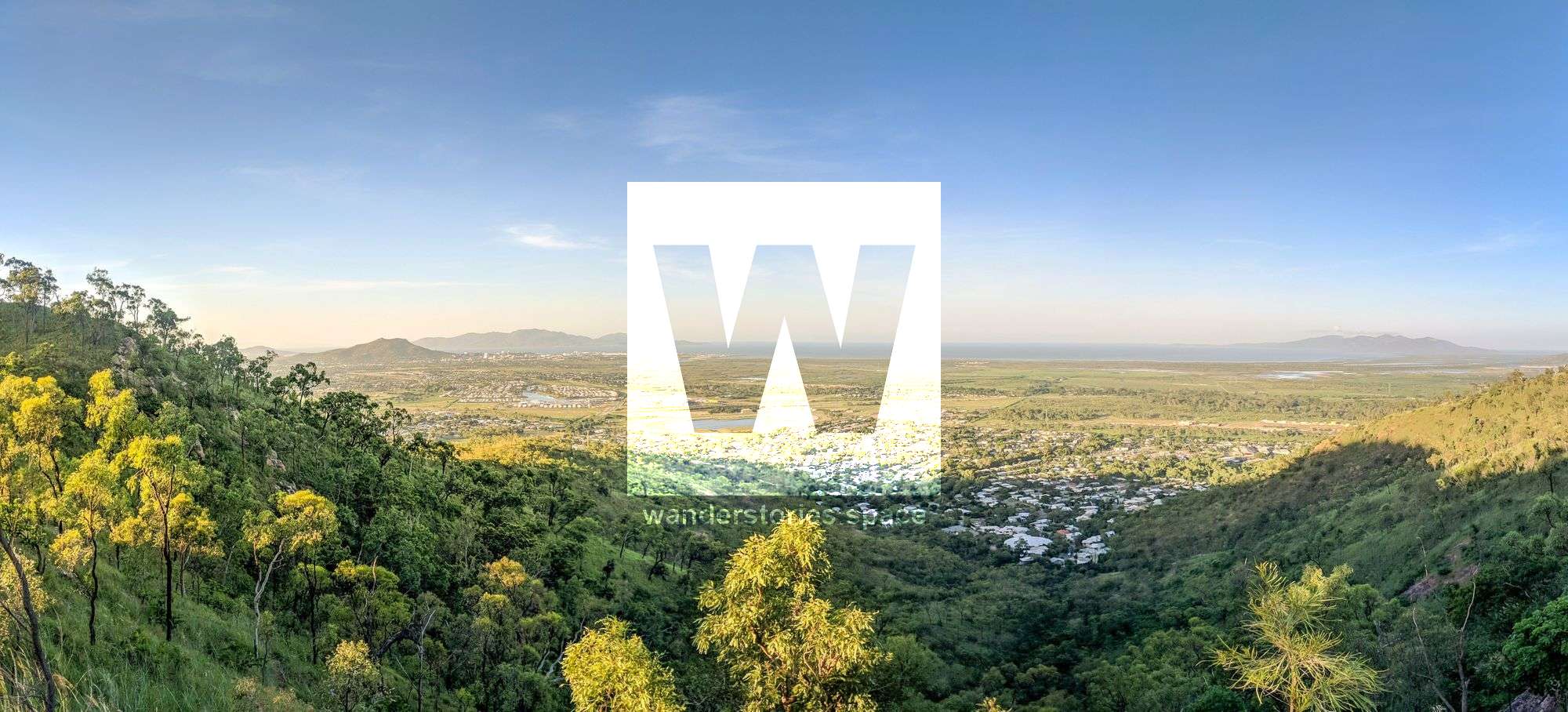
Roseneath and Wulguru Hills
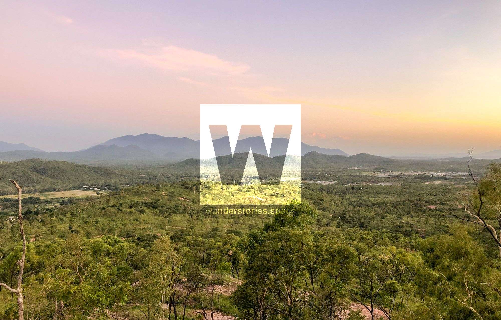
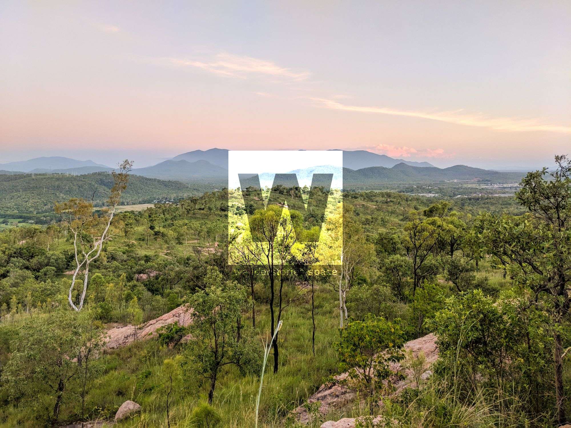
Situation at the base of Mount Stuart, these foothills are a great place to have a walk before or after work and provide stunning sunrises.


Location - Townsville, North Queensland, Australia
Distance - ~4 kilometres depending on route
Duration - Allow 1 hour
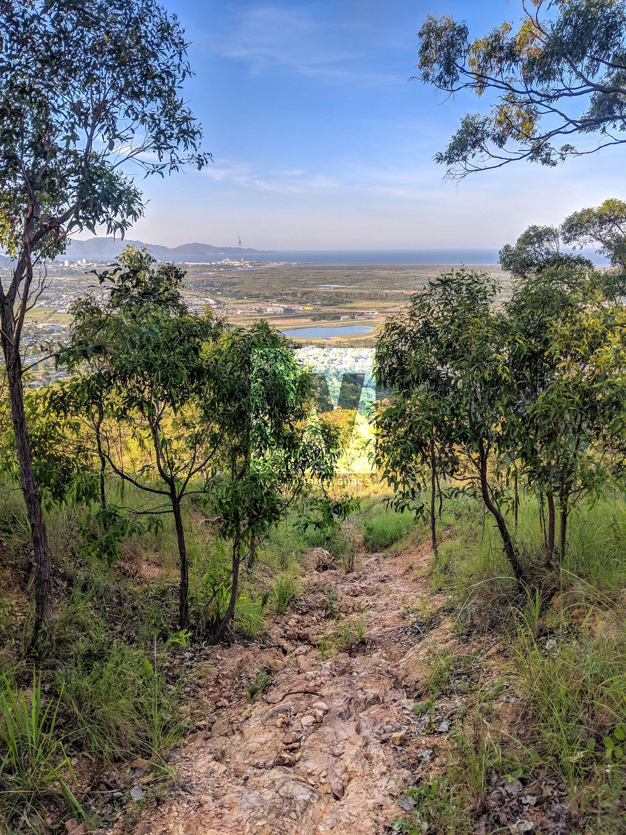
Grade - 4, the track is exposed and washed out with steep sections
Another hidden gem of Townsville for those that love sunrises and sunsets. Situation at the base of Mount Stuart. A great place to have a walk before or after work. Once used by motorbike trials riders, four-wheel drivers, and The Townsville Rockwheelers, the rocky and technical terrain made it a great place to practice your skills.
"Wulguru" is the name of an Aboriginal language and it is thought that the word itself means "windy valley". "Roseneath" is believed to be the name of a local pastoral property before the Great Northern Railway was built in 1880. Wulguru has a number of heritage-listed sites, including former Operations and Signals Bunker.
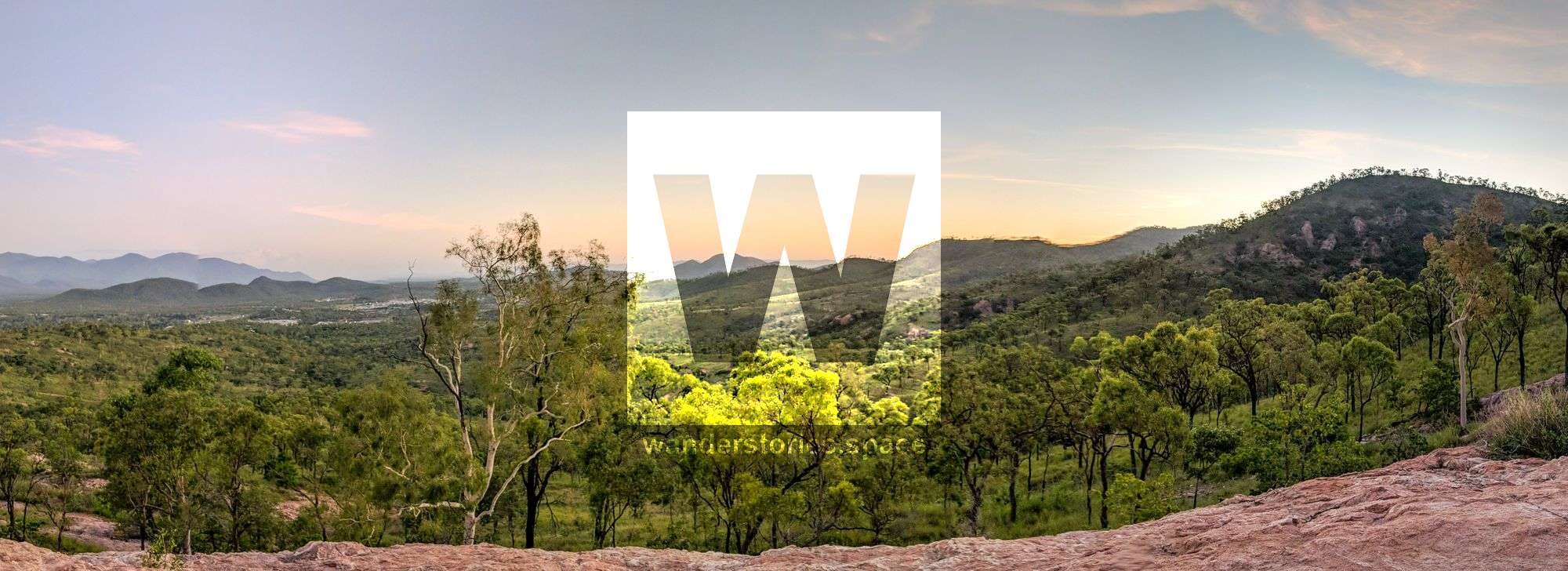
The bushy hills in some areas provide panoramic views of Townsville and Magnetic Island. Most of the upper area is owned by The Australian Army and is fenced-off.
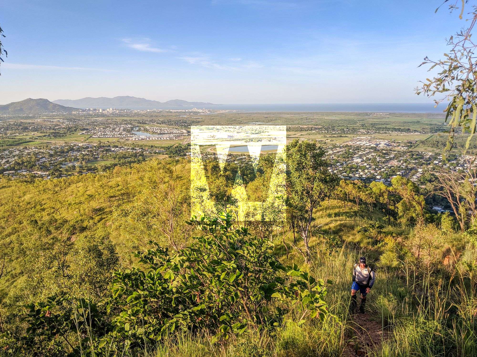
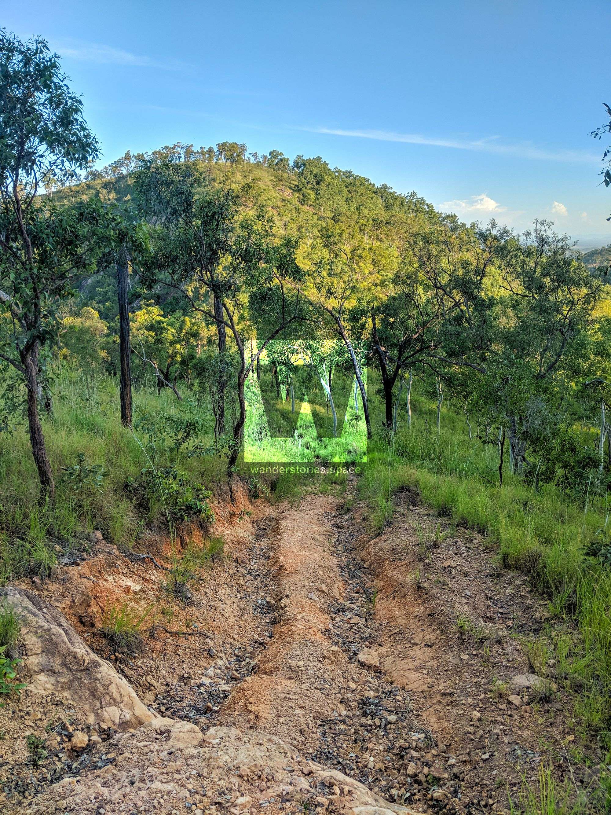
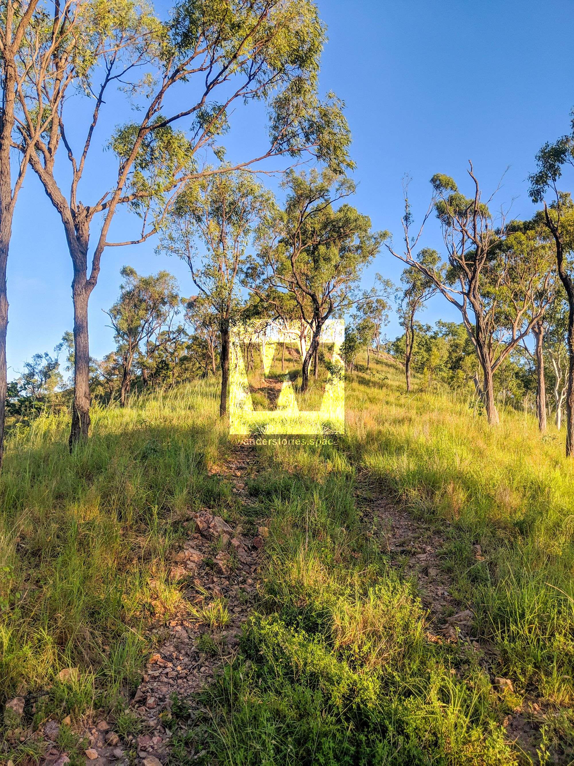
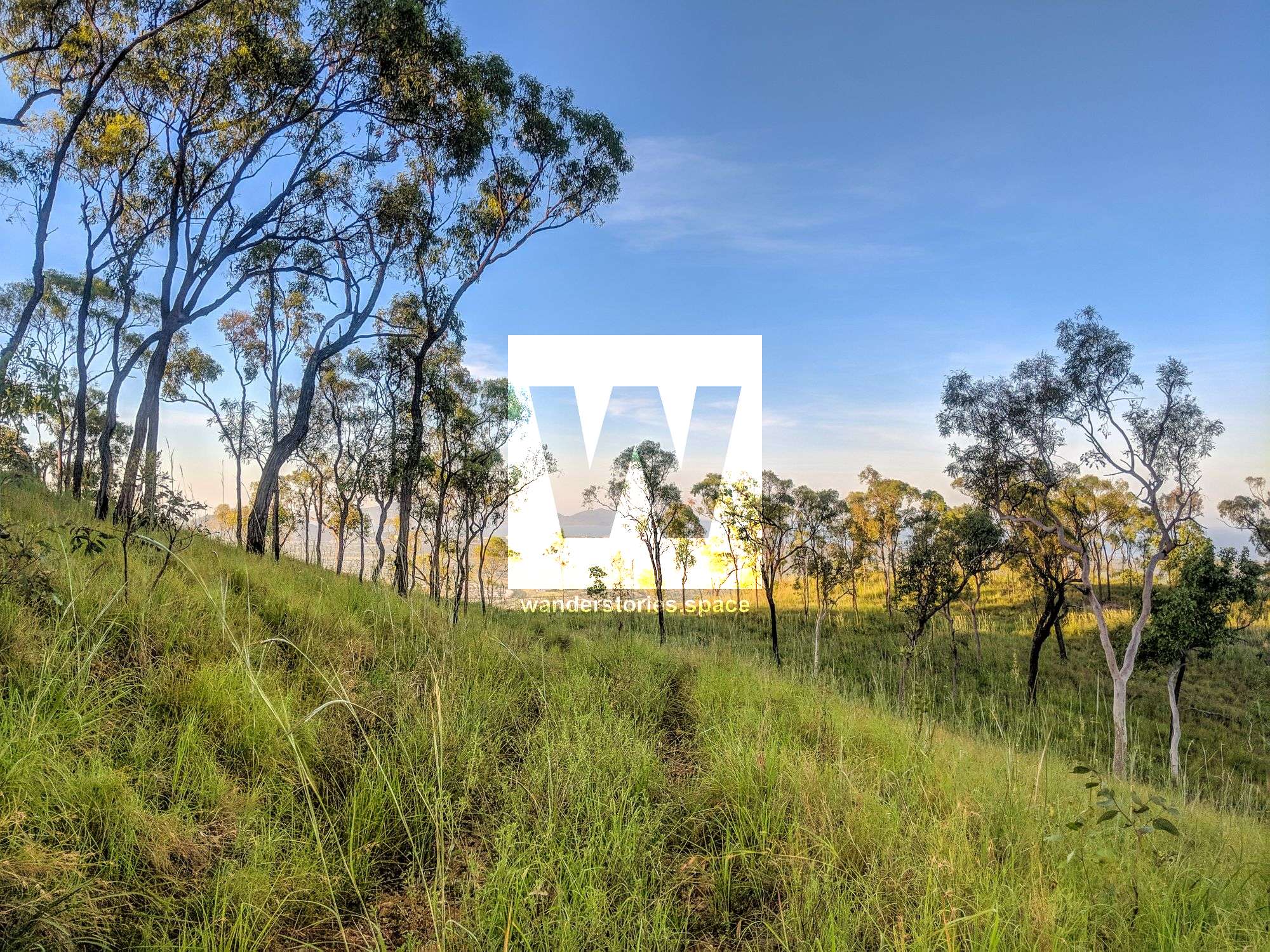
It's similar to Mount Louisa, forgotten with tracks that have been badly eroded and overgrown. There will be some slightly steep inclines and declines.
Interactive Map
There are numerous tracks to explore in the area, albeit overgrown and washed out in places. These days, the area is commonly accessed via the water tank service road (Diamantina Street) which is near the intersection Hynch Street and Bellevue Court.
The Townsville Bushwalking Club walk Stoney Creek as a circuit:
Up Stuart Creek to Florence's Gorge, then along the range/track and down Stoney Creek to the west. Or head down the range to Wulguru.
If you're wandering out around here, The Townsville Pistol Club is close by so be mindful of that.
What's there to see?
- Enjoy the views from many vantage points.
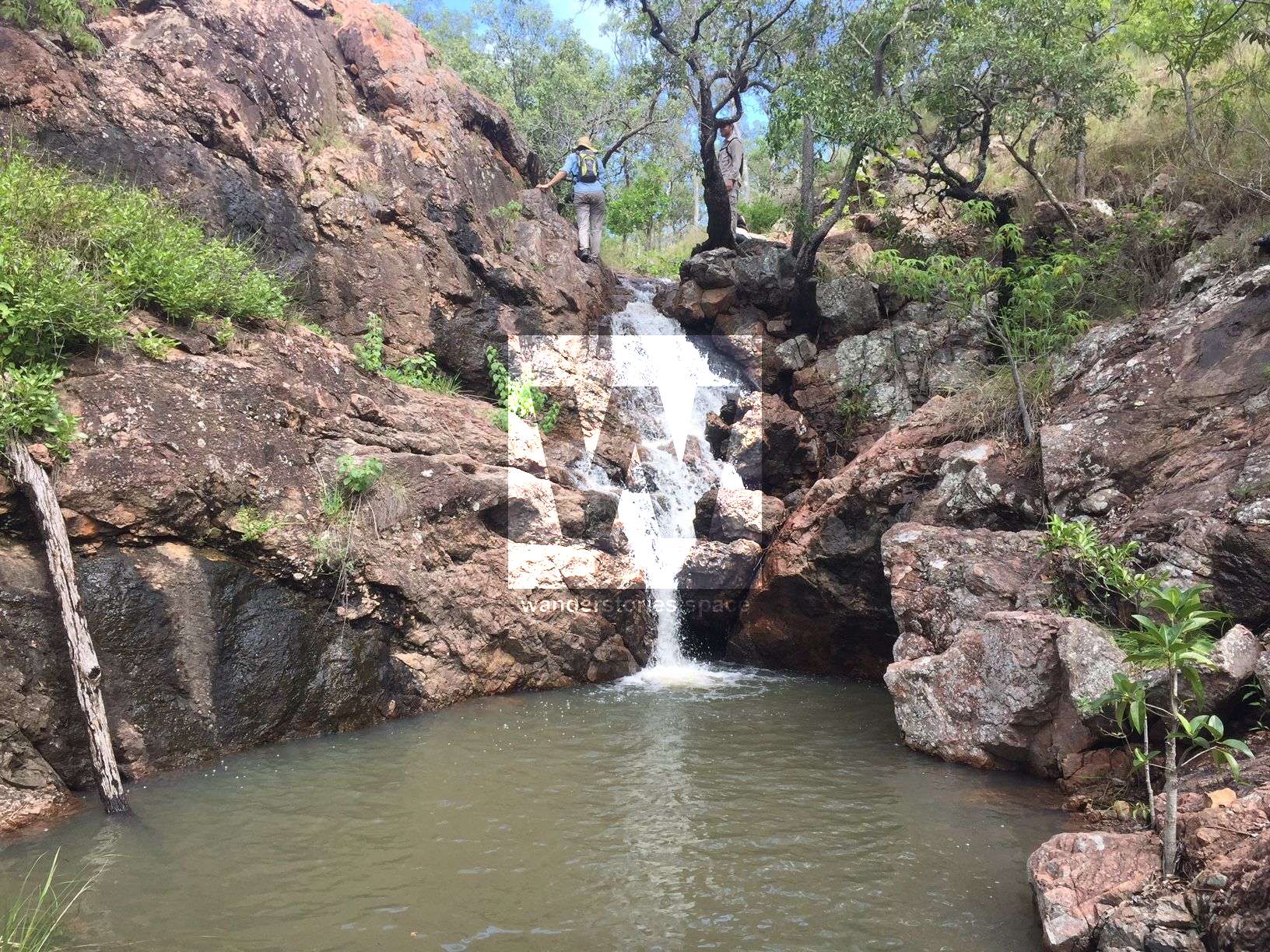
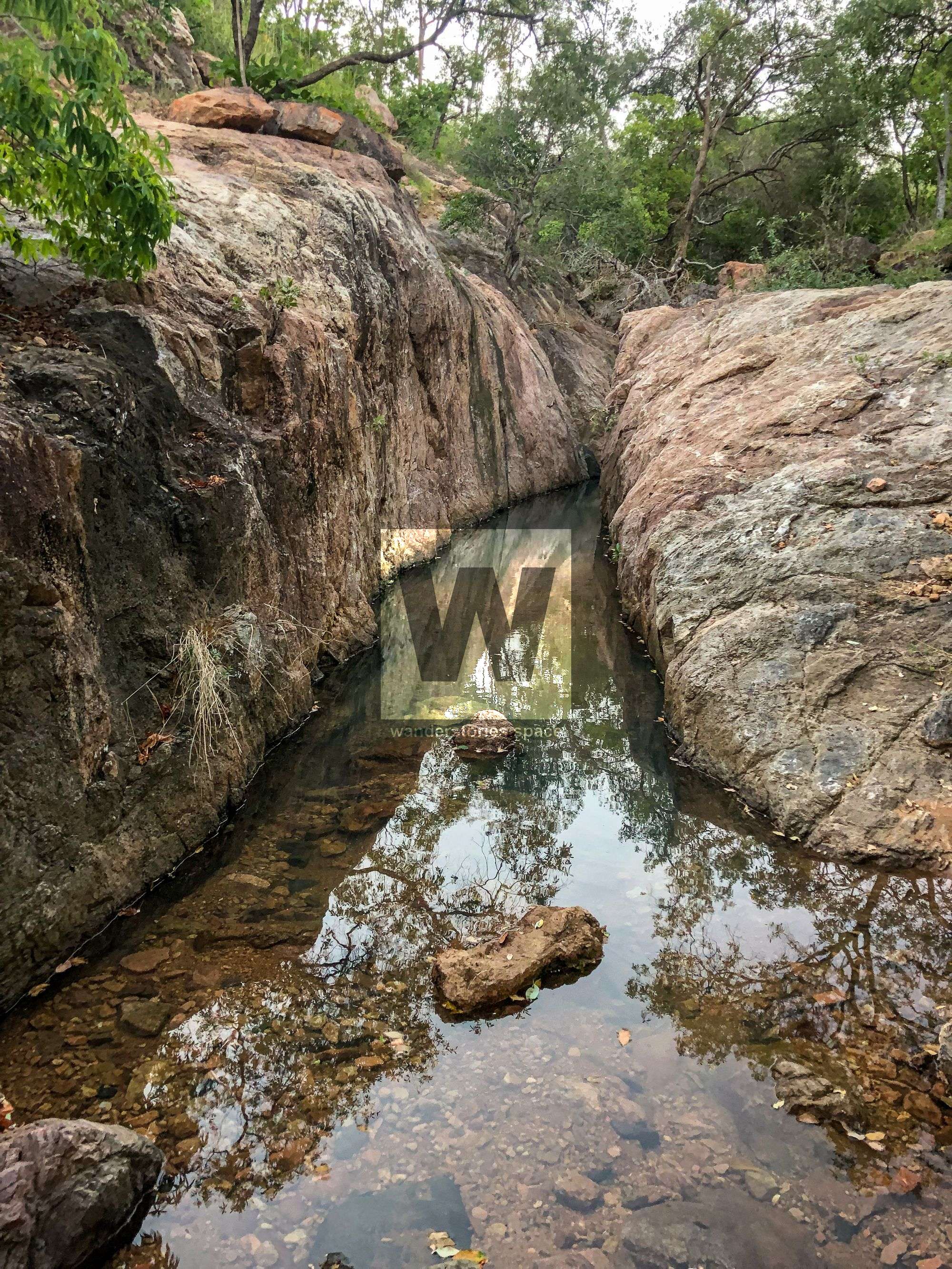
- Florence's Gorge (east fork of Stoney Creek and name comes from The Townsville Bushwalking Club), intermittent streams, and a mini-slot canyon. Above this little gorge are nice cascades but are only good after heavy rain as these streams stop flowing quickly.
- Stuart Creek is a great wet season walk where these intermittent streams come to life.
- Exploring the old four-wheel drive trails.
- The old mountain bike trails (disused, completely overground, and hard to follow).
- Sub Rosa Buttress cliffs.
The old Stuart Cross Country (XC) Mountain Bike Tracks are steep, rocky, twisty and unforgiving with plenty of obstacles to overcome. However, for better riders, it is an excellent riding challenge thought they would need some work these days. There is also a beginner's track in the area which is also challenging for newbie's, again would need work.
What to take
- 2 litres of water (minimum)
- Long pants or gaiters (recommended)
- Headlamp (recommended)
- Camera (optional)
- Snacks (optional)
- Electrolytes (if required)
- First Aid Kit
- PLB (optional)
This article, and all other articles, are for entertainment purposes only and are not to be used as a guide. Please see our Disclaimer for more information.