Mount Louisa Walking Tracks
Once a popular place to ride dirt bikes and four-wheel drive, Mount Louisa is now starting to rival Castle Hill especially with the new, well-constructed walking tracks that have become the locals' favourite after work fitness activity and great spot for a sunset.


Location - Townsville, North Queensland, Australia
Distance - 3.5 km return for the main track
Duration - 1-2 hours return
Grade - 3, easy
Once a popular place to ride dirt bikes and four-wheel drive, Mount Louisa – Aboriginal names "Goo-bal-a-boro" and "Moor-ee-roon" – is now starting to rival Castle Hill. Mount Louisa has also been recently updated, as of October 2020, and now has its very own, well-constructed walking track, which locals are finding to be a new favourite after work fitness activity and great venue for watching the sun set. Indeed, Mount Louisa has been one of the most under-utilised pinnacles within the suburbs of Townsville, perhaps until now!
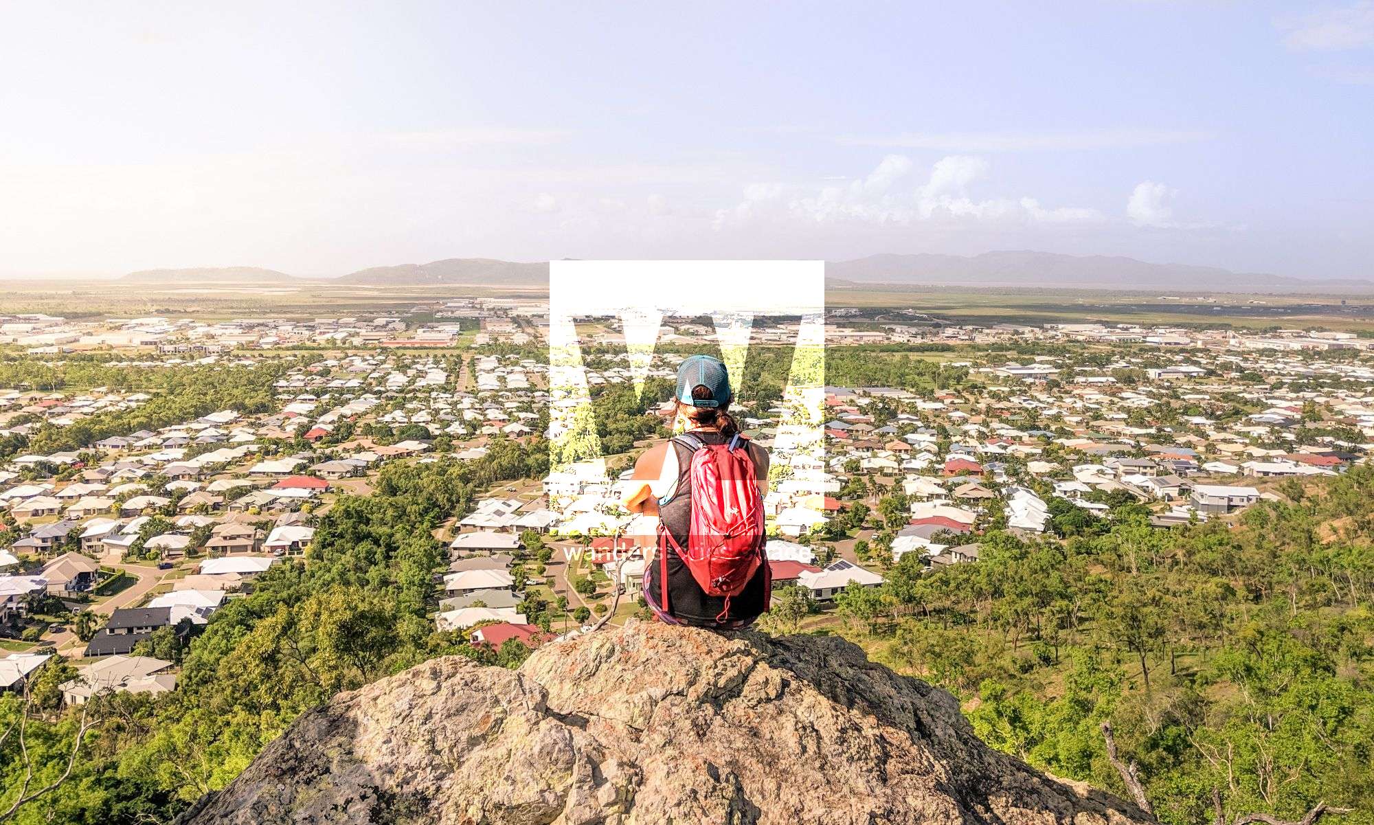
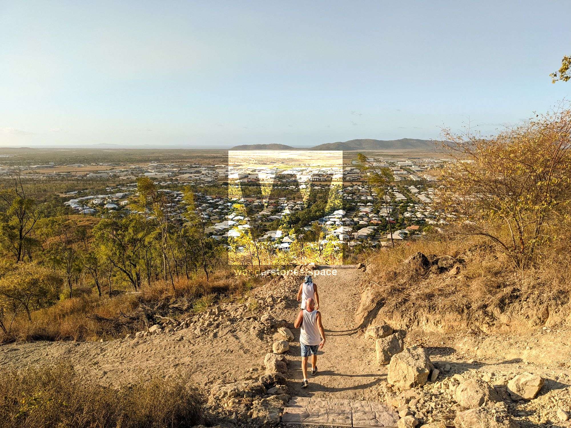
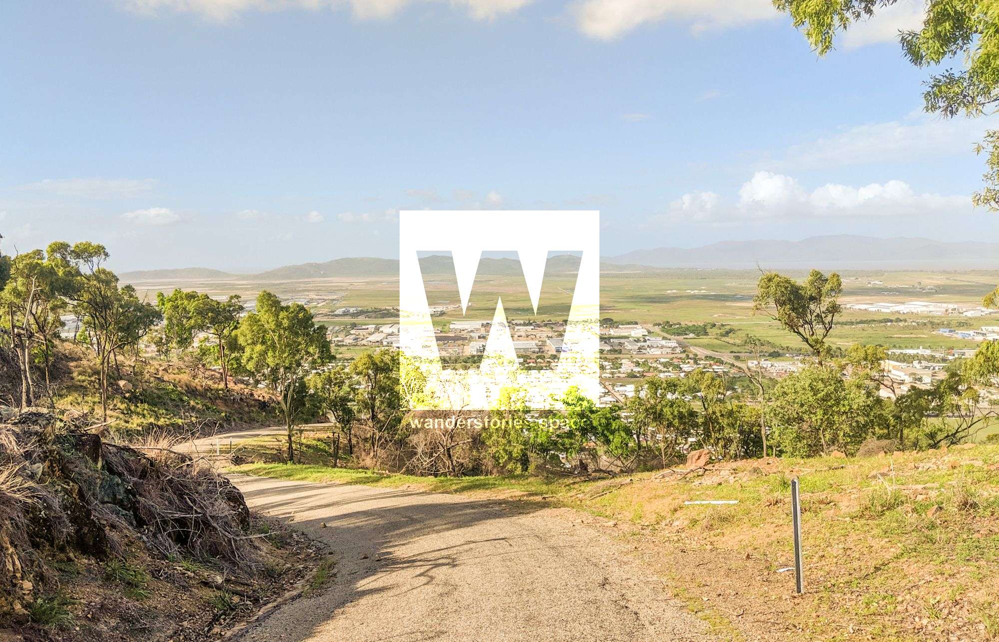
Mount Louisa is one of the highest points in the heart of Townsville, with its main peak (east peak) rising 193 metres above sea level, overlooking the north and ocean side of the city with views of Mount Marlow, Magnetic Island, Castle Hill, and Mount Stuart. Whilst the elevation at the summit of the new walking track is only 160 metres above sea level, the views are still quite remarkable and worth the walk.
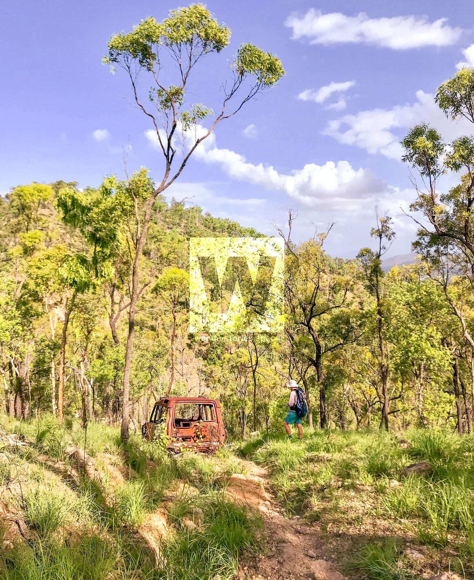
Locals have be walking the Mount Louisa and Cosgrove areas for years, and beyond the new track put in by Townsville City Council, many of the other trails are well-formed from decades of mountain bikers and motor vehicles. You may even see a few burnt and rusty cars, as well as washouts and eroded tracks from a history of use. Today, however, we recommend sticking to the new track, at least on your first visit.
The original trail to the very top was the Mount Louisa Crest Track, which follows the prominent ridgeline and has since been freshly bulldozed into a dirt road. There are several places to start this particular track, but many are overgrown and/or no longer used. The new, well-formed walking track, however, starts quite obviously on the corner of Bayswater Road and Weston Street and is well marked.
Interactive Map
The most popular starting location is at the corner of Bayswater Road and Weston Street (the start of the now official walking track). Other common places to start are at the end of St Albans Road and at the end of Adrian Rise, which takes you easily uphill to the ridgeline track (Crest Track).
The overall masterplan with future proposed track upgrades.
Mount Louisa Bush Walking Track (OFFICIAL)
Distance - 3.5 km return
Time - 1 hour
Grade - 3
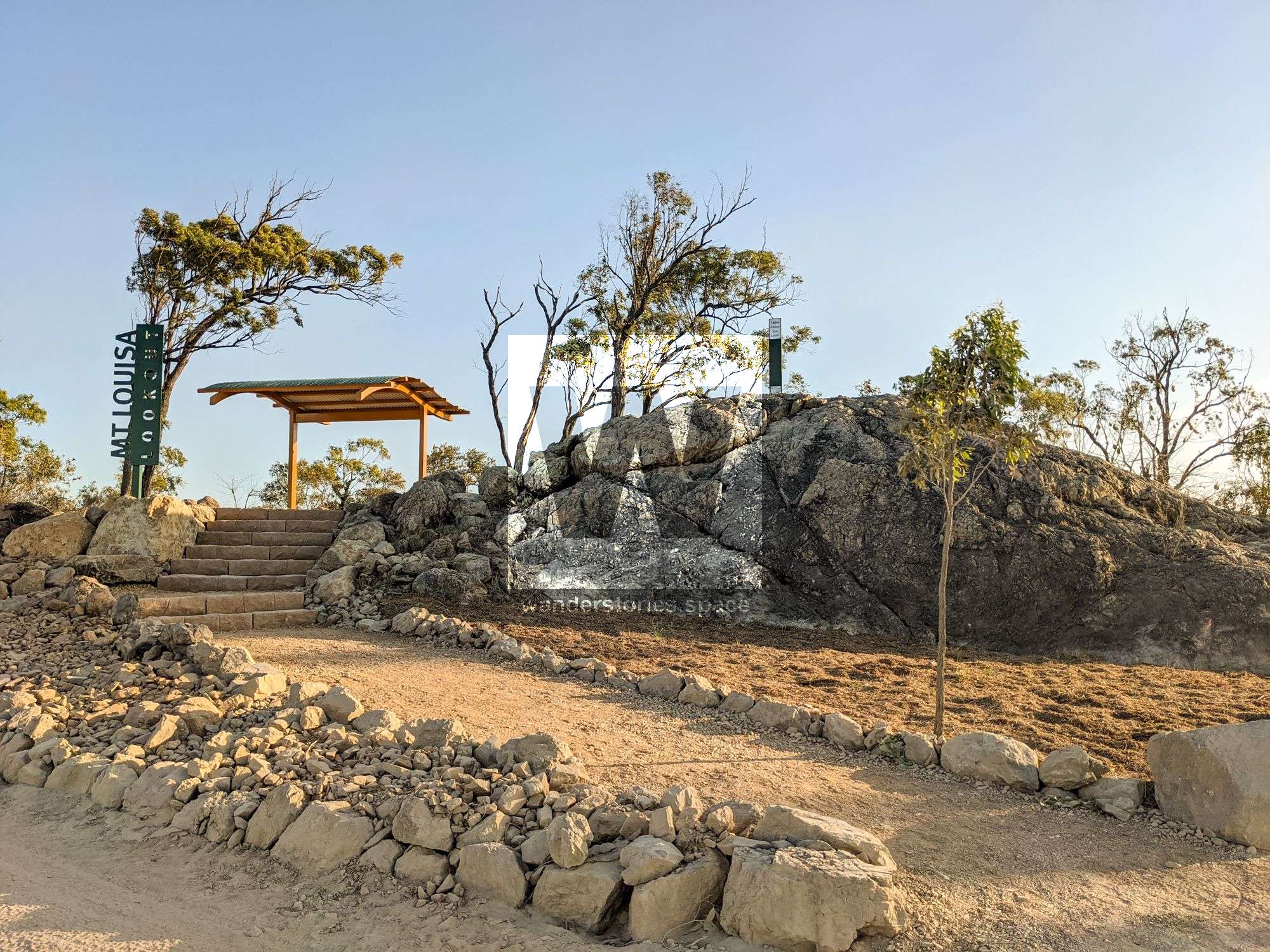
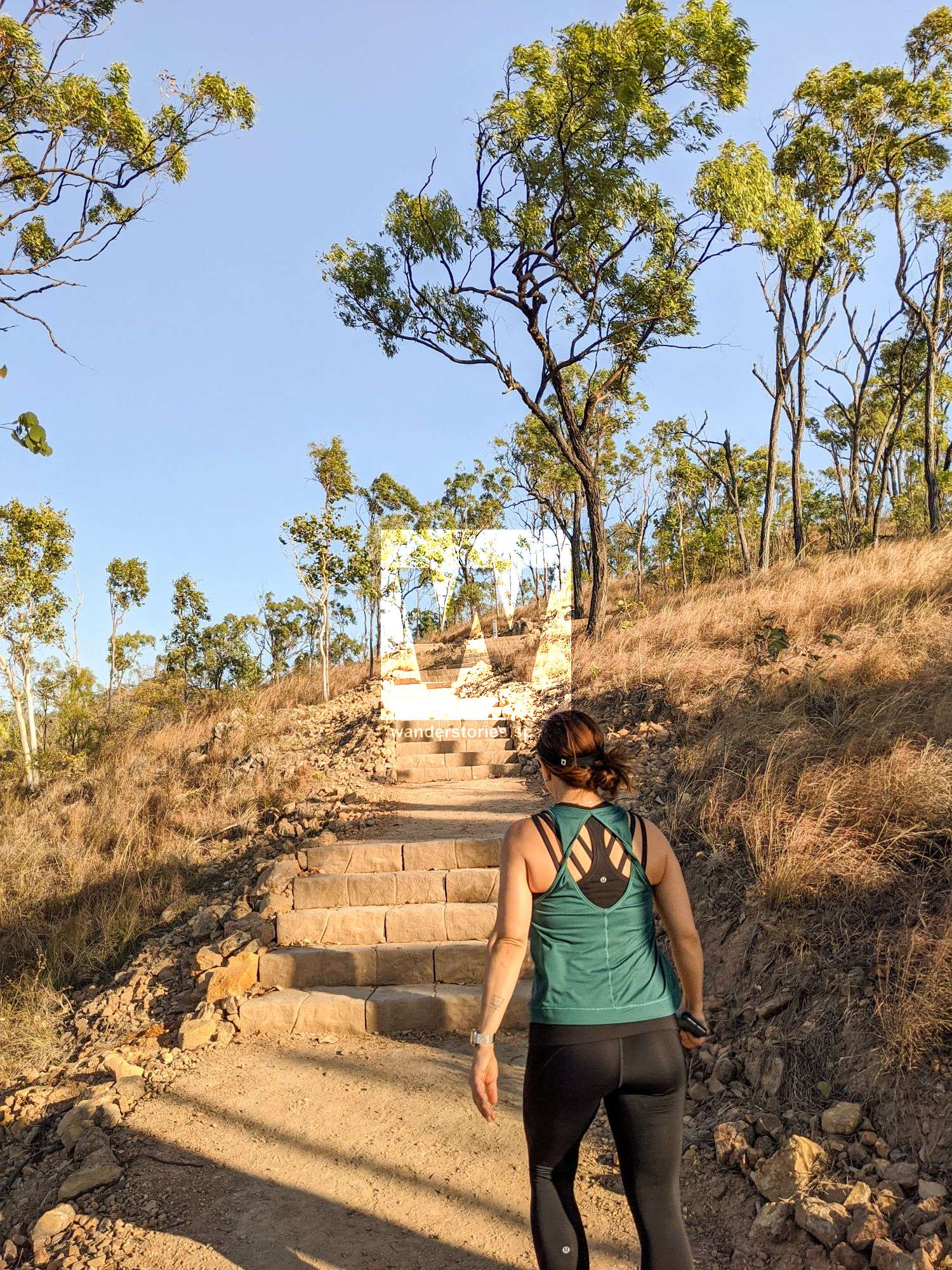
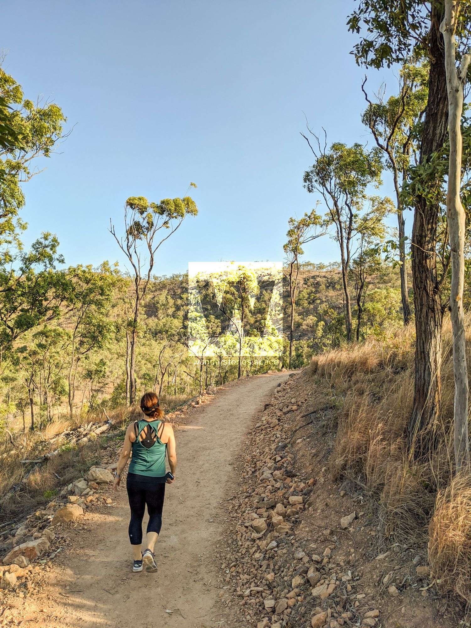
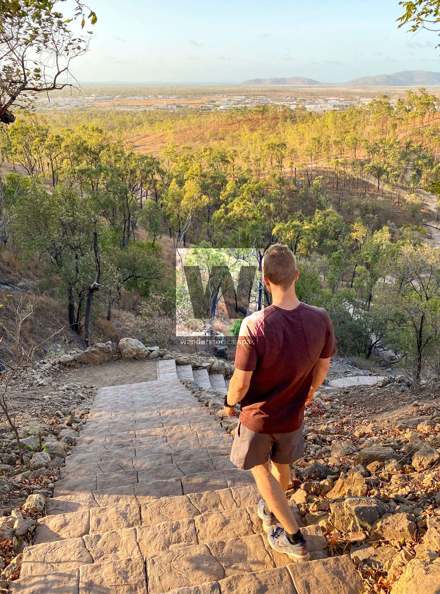
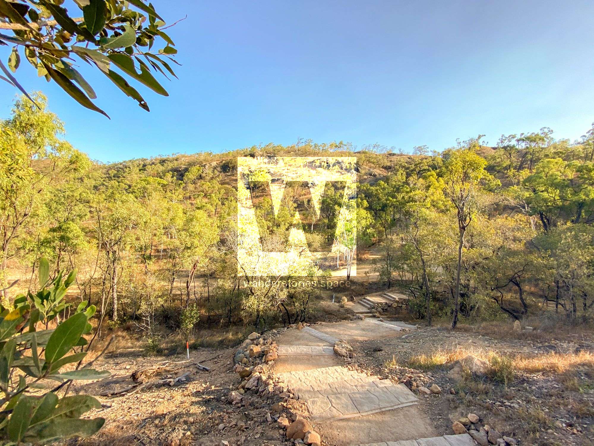
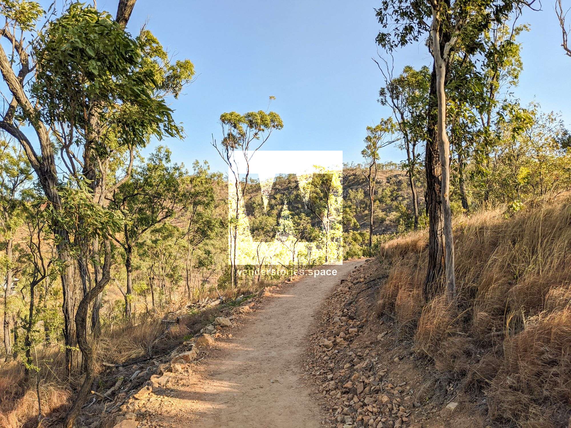
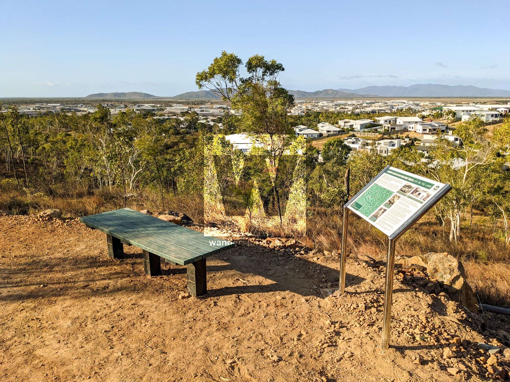
This track is the well-constructed, official bushwalking track that starts on the corner of Bayswater Road and Weston Street and has over 1,700 steps. The track winds its way up the contours of the mountain eastward and then turns to the west and comes back to the summit of one of the peaks (160m). Note that the official summit of Mount Louisa is the most eastern peak (193m). The track then traverses across the top of the cliffs and descends steeply to join back on the orignal track. It's essentially one big circuit loop. Along the track you will find benches, a viewing area with panoramic views of the city, and interpretive signs with great information about the history of the area. This track is perfect for an afternoon walk in the shade and great for enjoying the sunset.
Mount Louisa Crest Track (UNOFFICIAL)
Distance - 6 km return
Time - 1 hour
Grade - 4
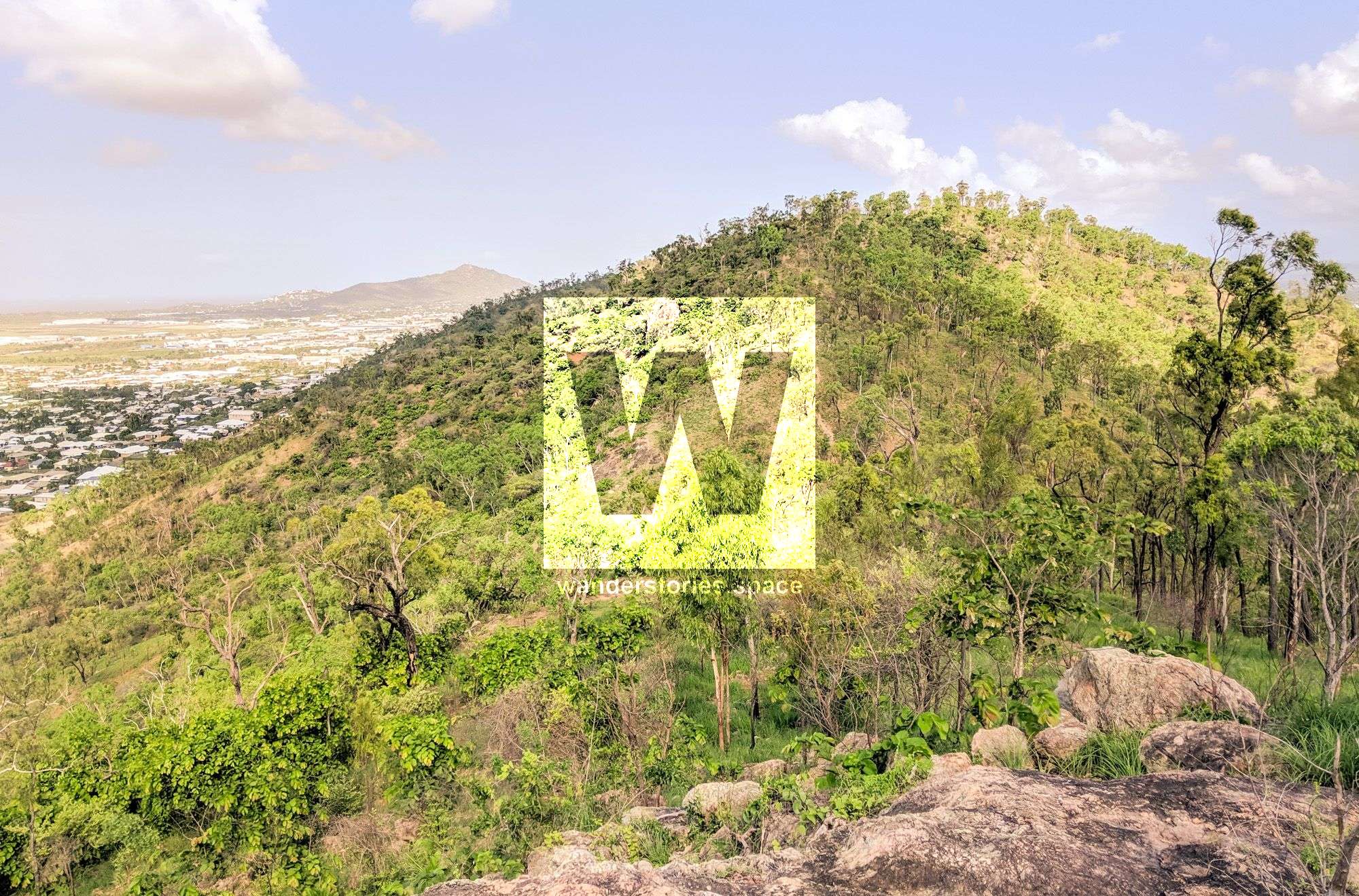
It seems as though not many people know that this fantastic trail even exists! Starting on the service road, near the end of Saint Albans Road and Glasgow Avenue, take the track up the bitumen road, then take a right onto the unmaintained dirt road, then take a left onto the unmaintained single track. It has a relatively steep, but steady, start, then it flattens out to an easier trail taking you onto the ridgeline where there are stunning views of Castle Hill, Magnetic Island, and Mount Stuart – 360 degrees of bliss. Hands down, the best part of this track is the jaw-dropping 360 degree views along the ridge!
Brief History
Both Castle Hill and Mount Louisa was named by the renowned local explorer, Andrew Ball, in 1864. Mount Louisa, in particular, was named after a lady of Andrew Ball's acquaintance.1 In 1885, Charles Price recorded the Aboriginal names for Mount Louisa as "Goo-bal-a-boro" and "Moor-ee-roon".1
During World War II, the suburb of Mount Louisa was used as an extension to the Garbutt aerodrome with a large depot, runway, and station for United States personnel.
Then, for decades, this land belonged to the Fairbrothers family. Thomas and Ethel Fairbrothers purchased the land in 1959 and ran a piggery. Piggeries were common at the foothills of Mount Louisa during this time. An old bacon factory in this area was even converted into one of two family homes.
Mount Louisa was the subject of an early 2019 concept plan for recreational facilities, opportunities that became part of the Townsville open space 2020 masterplan. The plan was expected to make Mount Louisa's ridgeline more accessible and take advantage of its 360-degree views of the city, and it has done just that. The official opening of the Mount Louisa Bush Walking Track was on the 3rd of October 2020, and a new car park has been installed at the corner of Bayswater Road and Weston Street. Another track connecting the Kirwan side is included in stage 2 of this plan.
Notes
- Emergency markers have been installed for your safety at 100m interval along this track. In case of emergency please dial 000 and quote the track name and marker number you are closest to. See also the Emergency+ app.
- Fill up your water at the water fountain at the base of the Mount Louisa Bushwalking Track, as there is no water currently available beyond this point.
- All dogs must be on leashes. Clean up after your pet, as animal waste attracts wild dogs and dingoes.
- All flora and fauna is protected.
- Please stay on the track, as shortcutting causes erosion.
- Please remove all rubbish and/or dispose in the bins provided.
- Bicycles are not permitted on walking tracks.
- Camping, lighting fires, four-wheel driving (4WD), and motorcycling activities are prohibited.
- A permit is required for abseiling, rock climbing, and consumption of alcohol.
This article, and all other articles, are for entertainment purposes only and are not to be used as a guide. Please see our Disclaimer for more information.