Canyoning around Cairns, Far North Queensland

There are several places around Cairns in Far North Queensland to go canyoning that many people don't know about it. Several of the creeks around the area have been bolted where there are no safe natural anchors to rappel from.
Find your local canyoners and ask for beta on the FNQ Canyoning Facebook group.
See also the local commercial canyoning operators - Cairns Canyoning
Here's a listing of canyoning places to explore around Cairns:
Behana Canyon
Apparently, not worth abseiling, easy to scramble and jump. You may want to whitewater kayak it though. If you rock-hop from under the power station bridge, follow upstream as far as you can go. The rocks can be slippery so try to keep your feet dry feet. You will see a perfect vertical drop on the right, that you climb up the left of, only in dry. It's a 30-metre abseil.
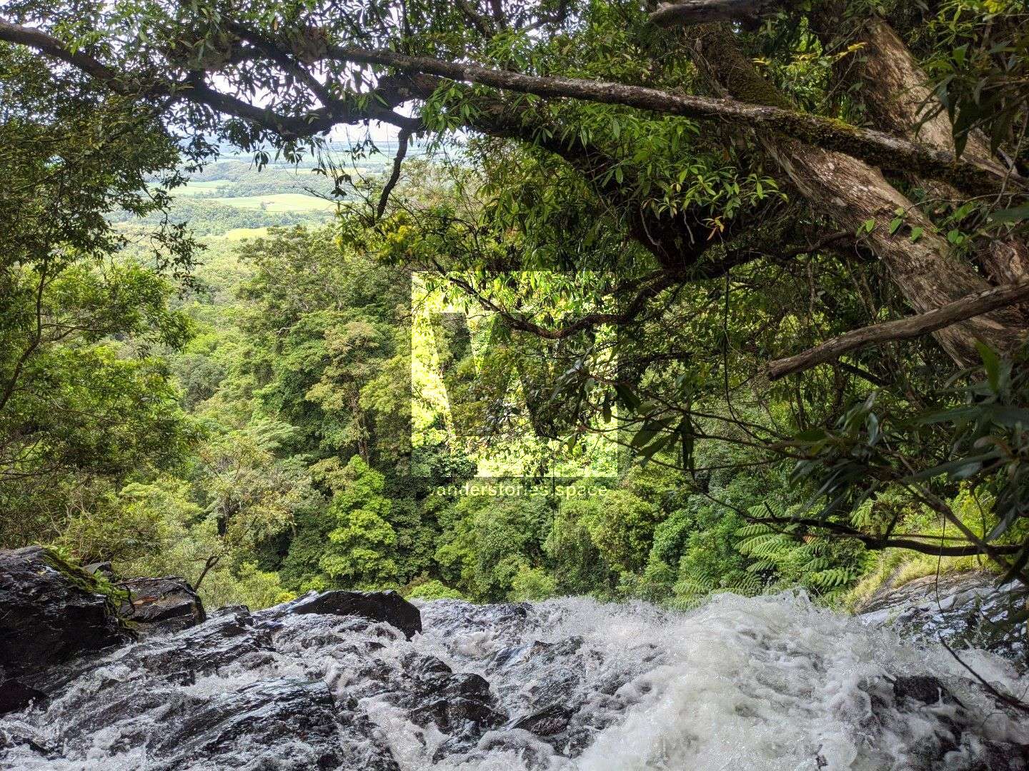
Barron Gorge
Upper Barron Gorge is great. It's can be a bit tricky to get to. Jump into Streets Creek (before the rainforest station at Kuranda). Float and walk about 2.5 km until you come out on a series of weirs. Get out of the creek on the left and follow the high ground for about 200 metres, paralleling the creek. You will see a grassy platform right on the edge of the cliff face. These are a few good large trees for anchors back from the platform. The abseil is 90 metres and overhanging. Once on the bottom, swim across the pool and climb all the way back up to where the weir was. There are heaps of natural stairs.
Surprise Canyon
Flows directly into the Barron.
Stoney Creek Falls
Stoney Creek Falls above the bridge has a nice drop, once you get over the top of the falls, it drops underneath. There are some large trees at the top for anchors. It's a 110-metre abseil.
Ponytail Canyon
Flows directly into the Tully River and Ponytail Falls is a popular place for photographers.
Hartley Creek Canyon
Crystal Cascades Canyon
Commercial. All bolted. Permission/permits may be required.
Spring Canyon
A pretty waterfall.
Karnak Canyon
Worth doing. Located near Devil's Thumb.
Windin Falls
The main falls have been abseiled and then ascended back out.
Josephine Creek
No information on this one.
Babinda Creek
A remote canyon that ends at Babinda Falls.
A Russel River Tributary?
Looks good on aerial imagery. Heard from kayakers that there's a water hazard at the top of one of the falls (~5m in height).
Help fill out this article - contact us.
This article, and all other articles, are for entertainment purposes only and are not to be used as a guide. Please see our Disclaimer for more information.