Paddling The Herbert River
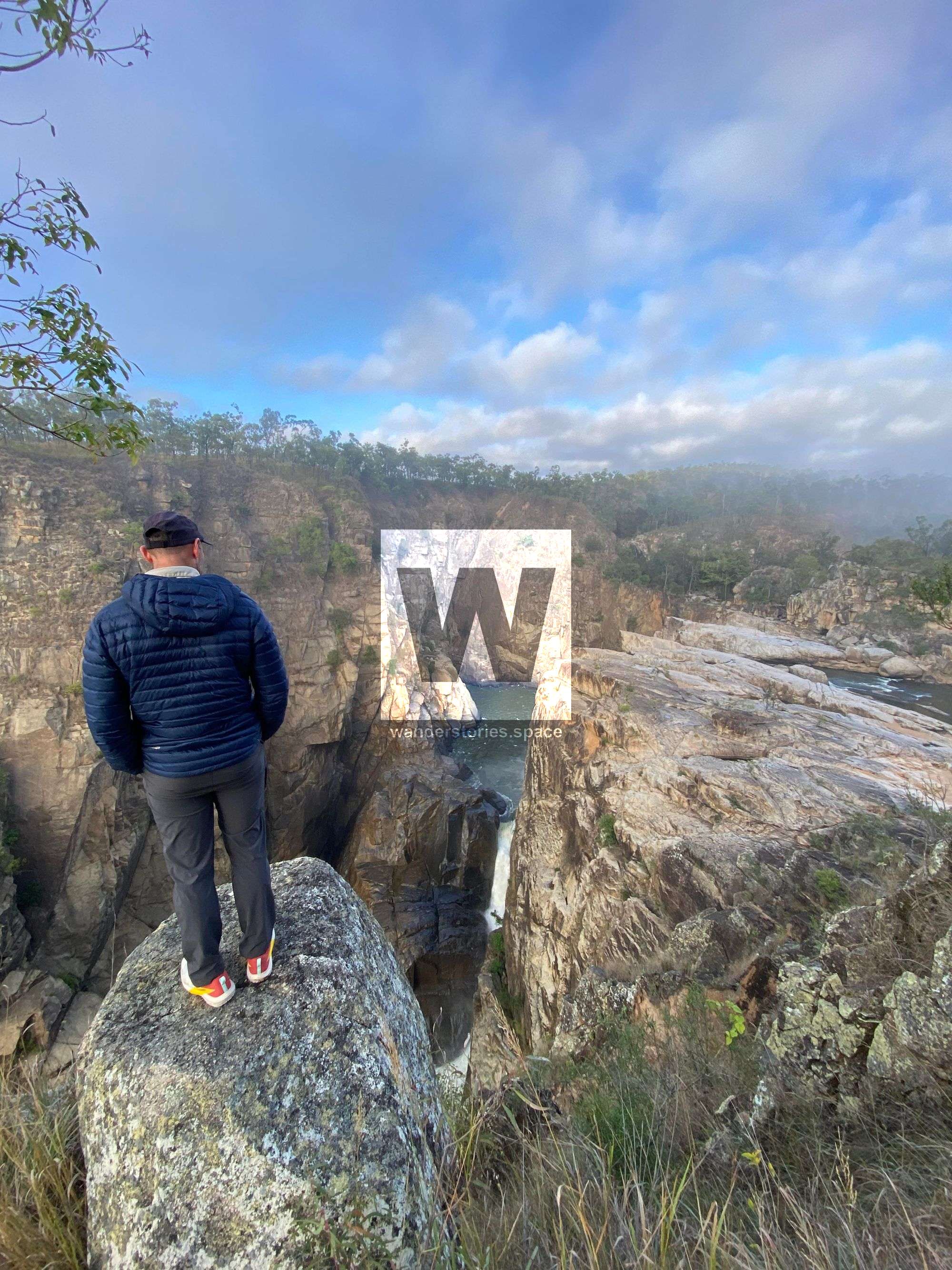
The Herbert River, nestled in North Queensland about 200km South of Cairns, is one of Australia's classic extended river trips, rivalling Tasmania's Franklin. This superb deep granite gorge boasts numerous waterfalls and steep, bouldery rapids and chutes.

Location - Girringun National Park, Far North/North Queensland, Australia
Duration - 1-3 days from Herbert River Falls to Blencoe Creek Junction
Distance - ~30km
Difficulty - Class 3-5(p)
Put in - Herbert River Falls
Take out - Blencoe Falls
Water Levels - Best done at 1.2-1.6m (ideally 1.4m)
Gauge - Glen Eagle Gauge
Overview
The Herbert River is the divider of North Queensland and Far North Queensland and is considered one of Australia's classic extended river trips, along with Tasmania's Franklin River. This superb deep granite gorge boasts numerous waterfalls and steep, bouldery rapids and chutes with a river Grade IV - V(p) that is suitable for whitewater kayaks and rafts.
Best Time to Paddle
The prime paddling season falls around June and July. However, if you keep a close watch on water levels, you may start earlier.
Duration
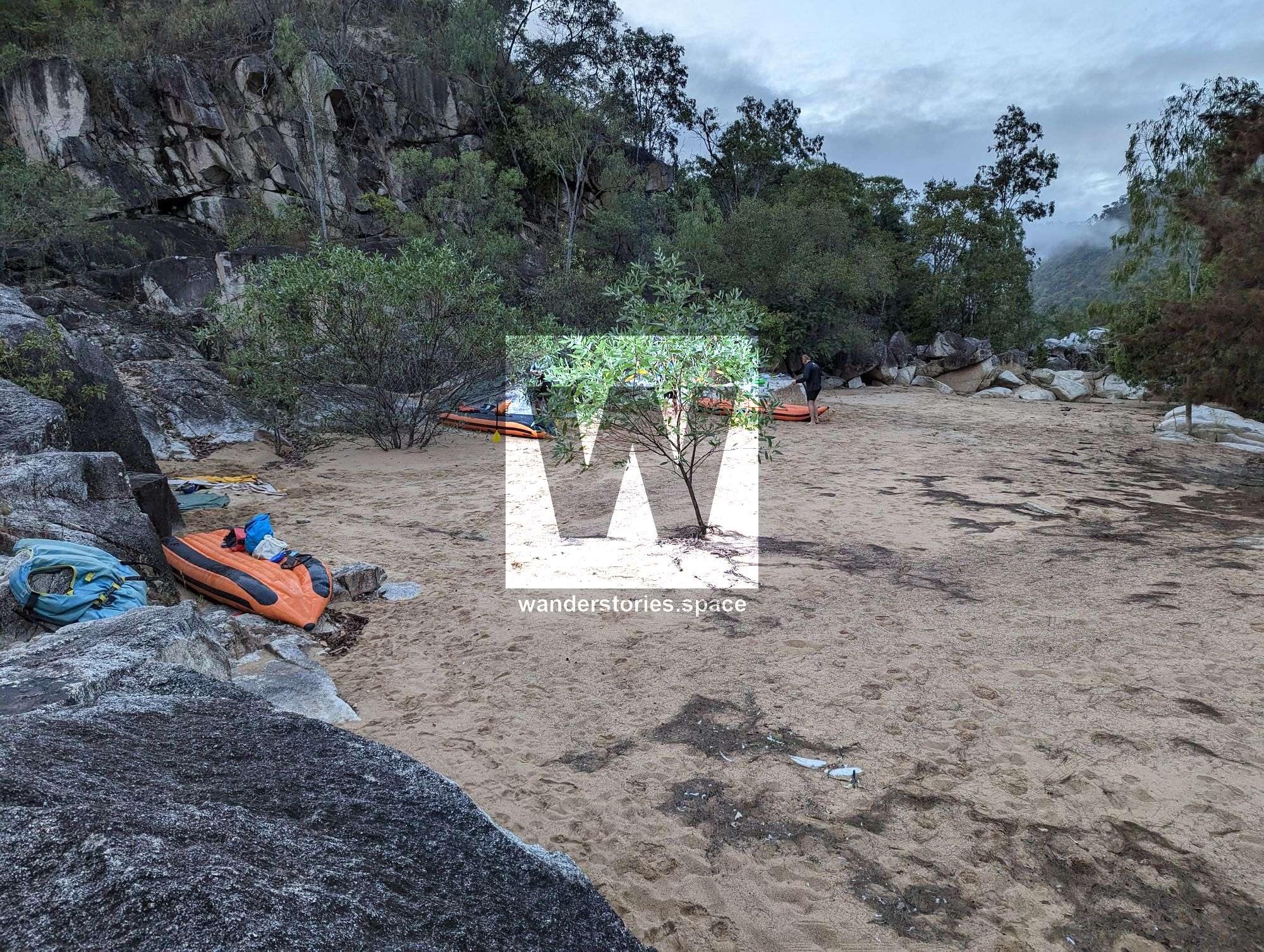
Paddle time varies between 1 to 5 days depending on your pace and the amount of time you take to enjoy the river's stunning scenery, camp, fish, your pace, and/or exploration plans.
Water Levels
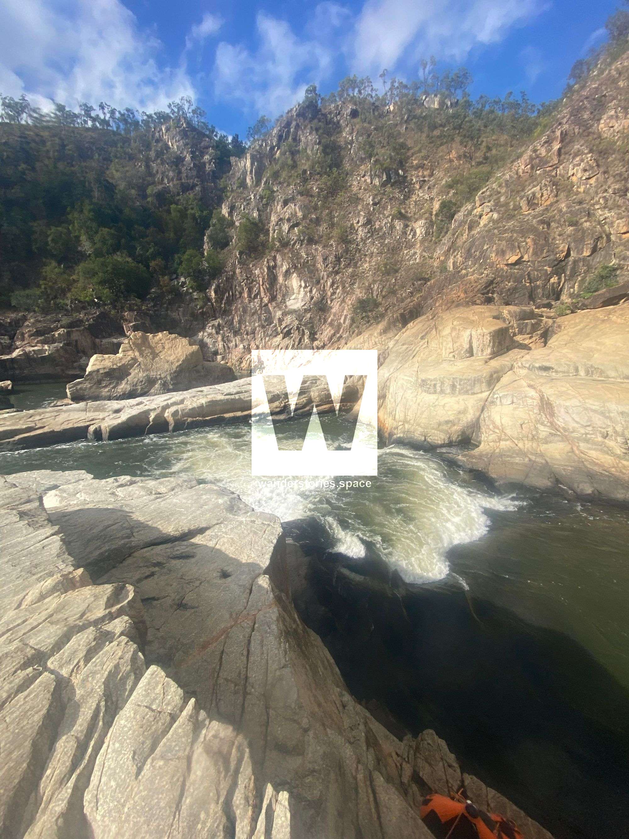
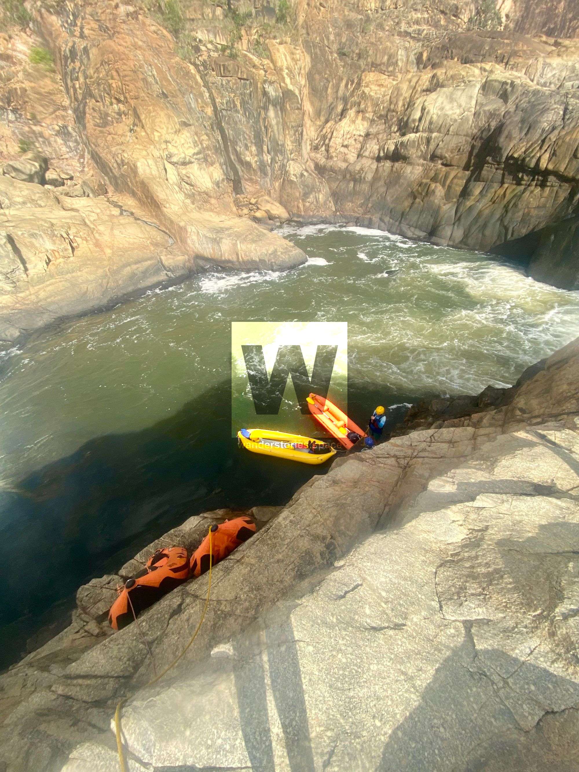
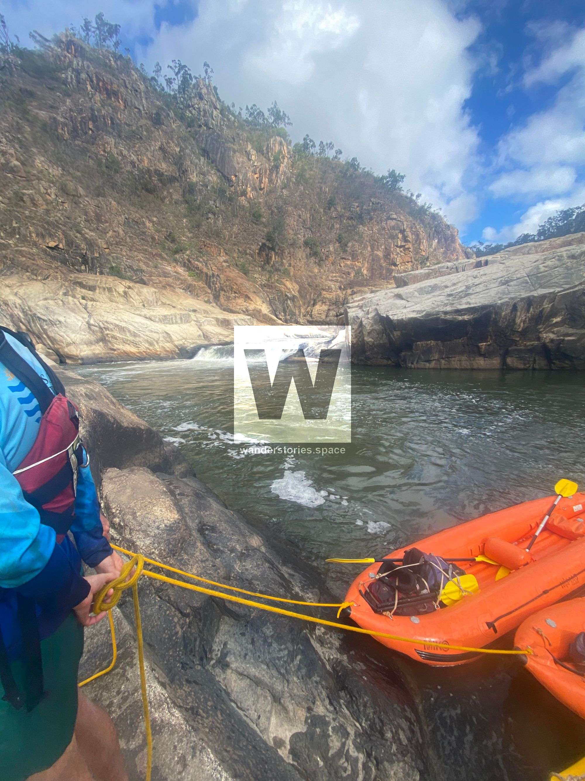
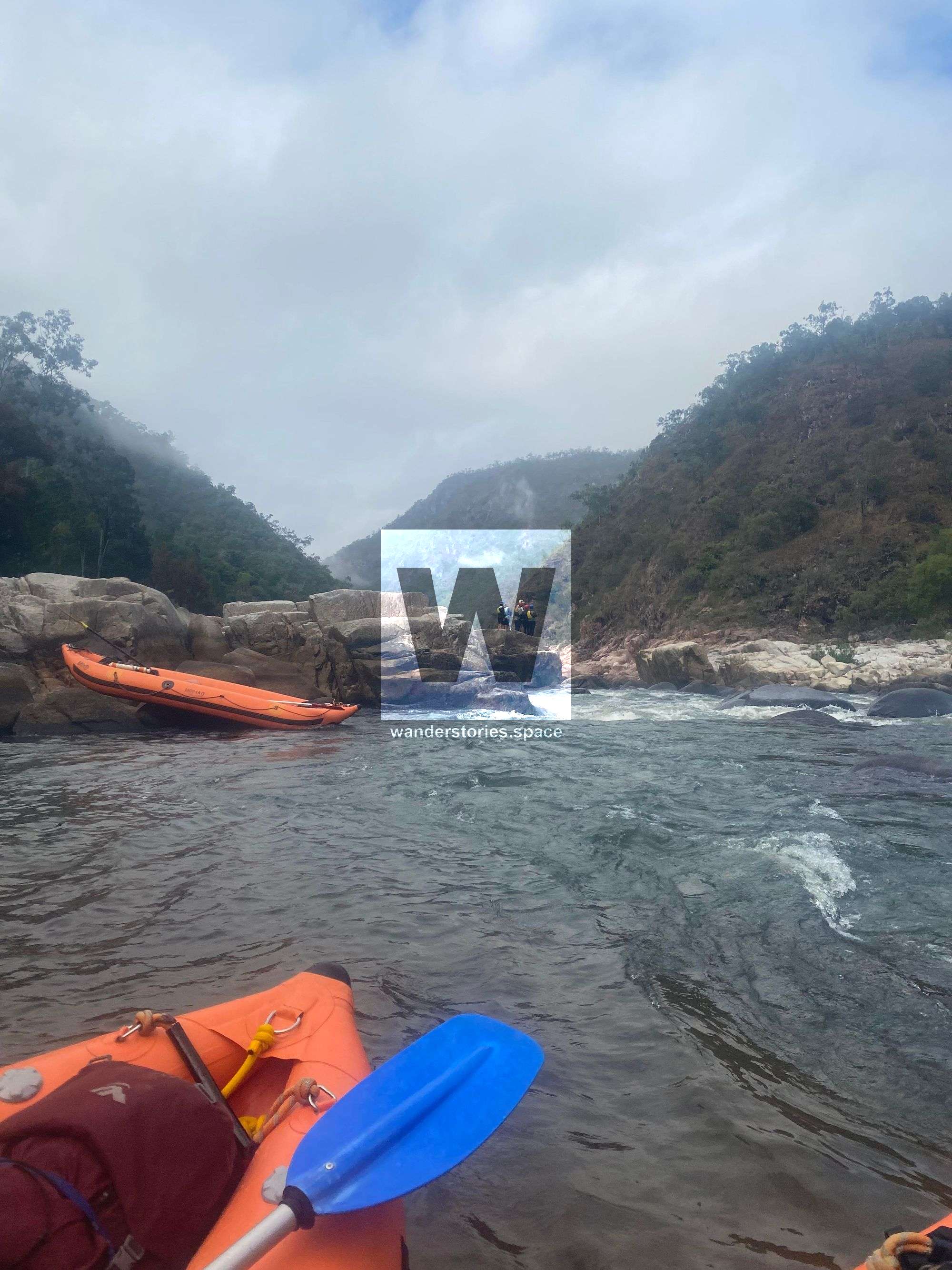
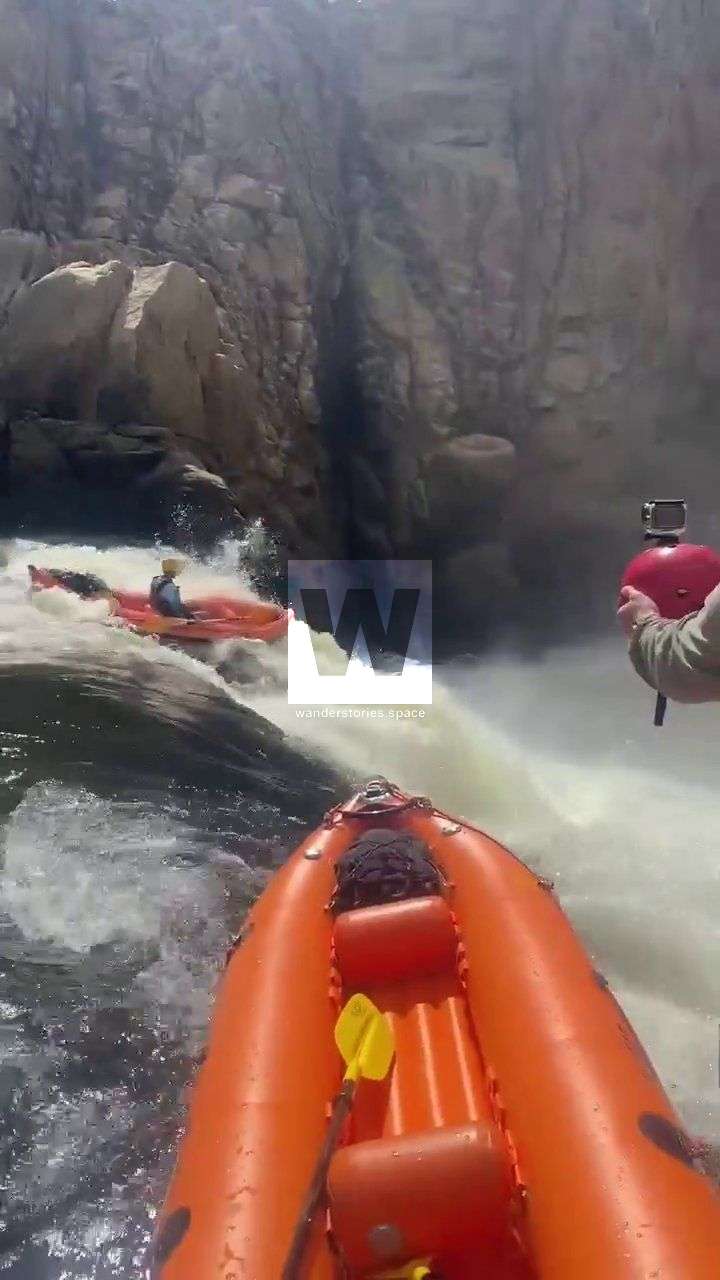
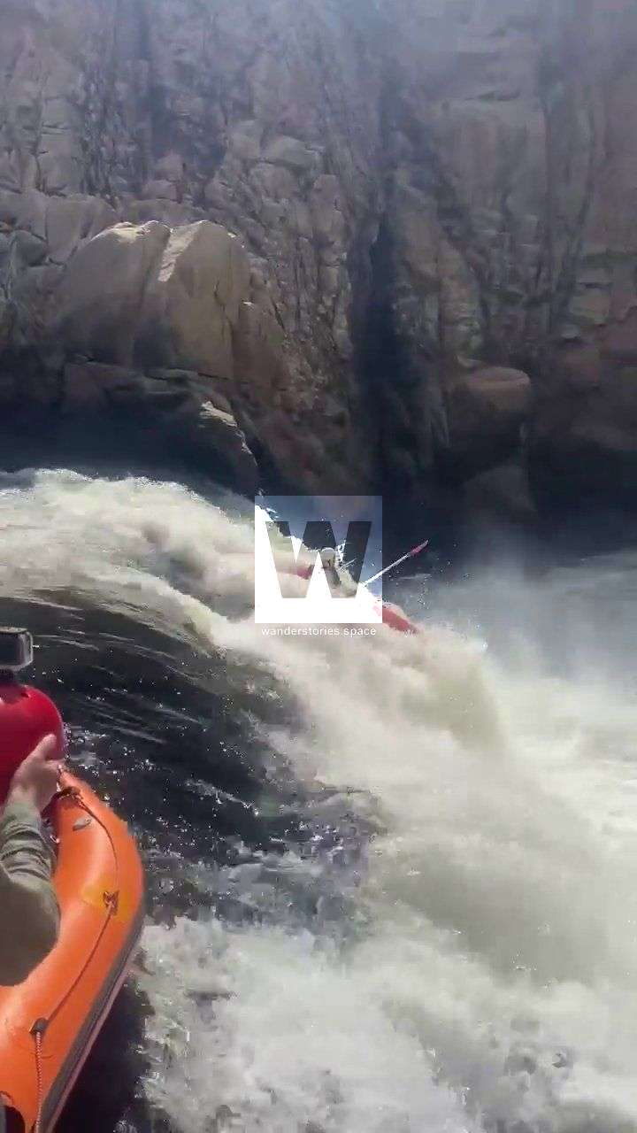
Due to the variable water levels, some rapids and falls may require portaging, especially at high levels. The river level should be between 1 - 2m at the Glen Eagle Gauge and ideally 1.4m for the best experience. However, be aware that below 1.2m, some of the rock gardens become hazardous, too rocky, and require portaging. Above 1.6m, some drops develop retentive stoppers, boils, and sieves and some portages become very difficult at these levels. Especially, portaging around the second fall of the Double Falls can be challenging. Rafters should portage the upper Double Falls on the river left and the second drop on the river right, lowering their rafts into the canyon. Kayakers can portage Double Falls River Right and jump into the lower canyon.
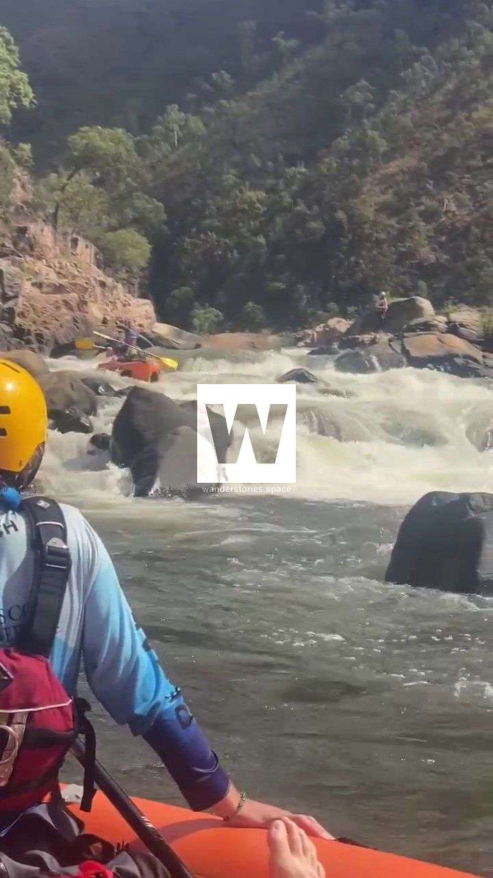
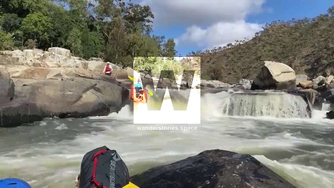
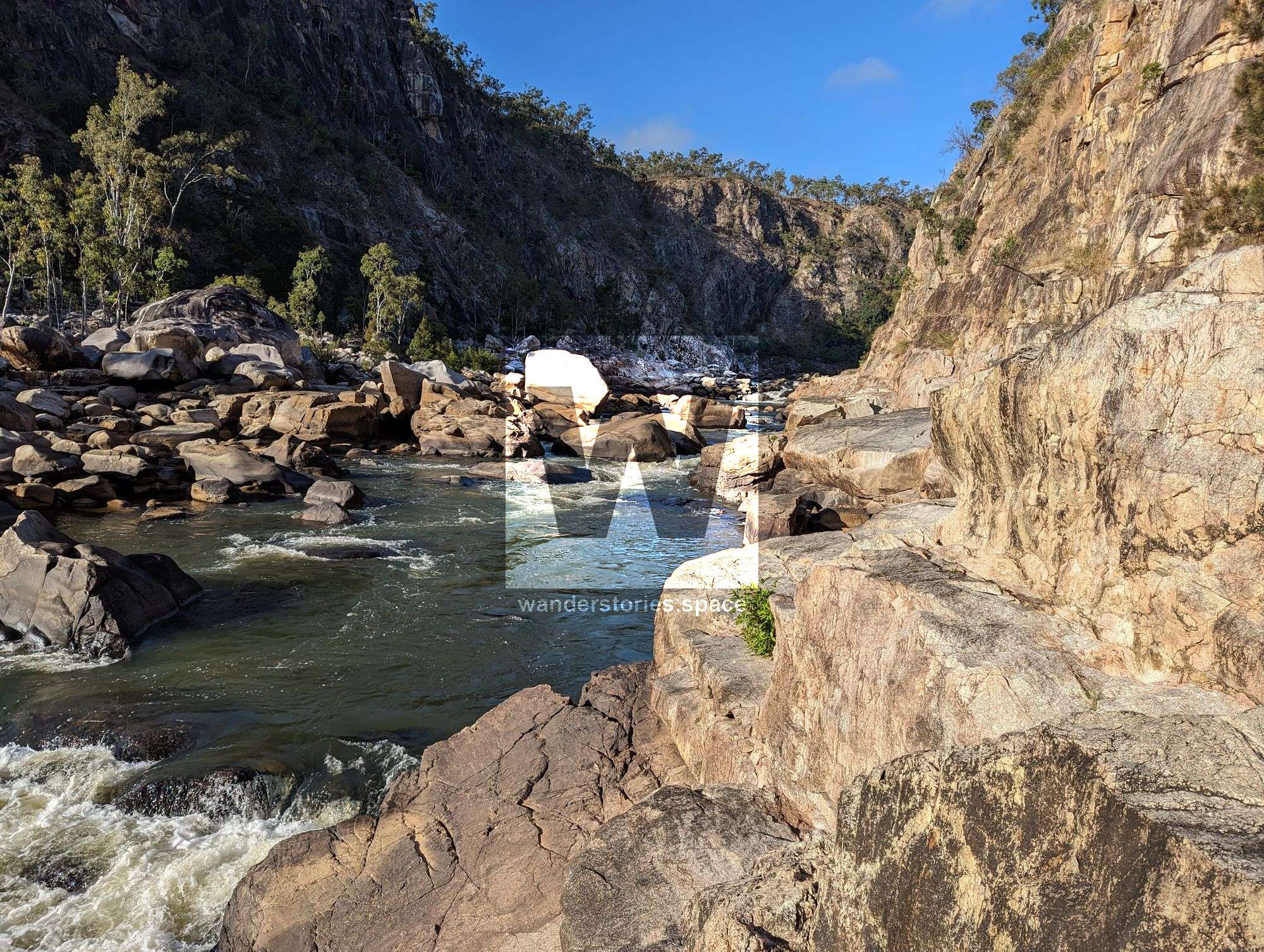
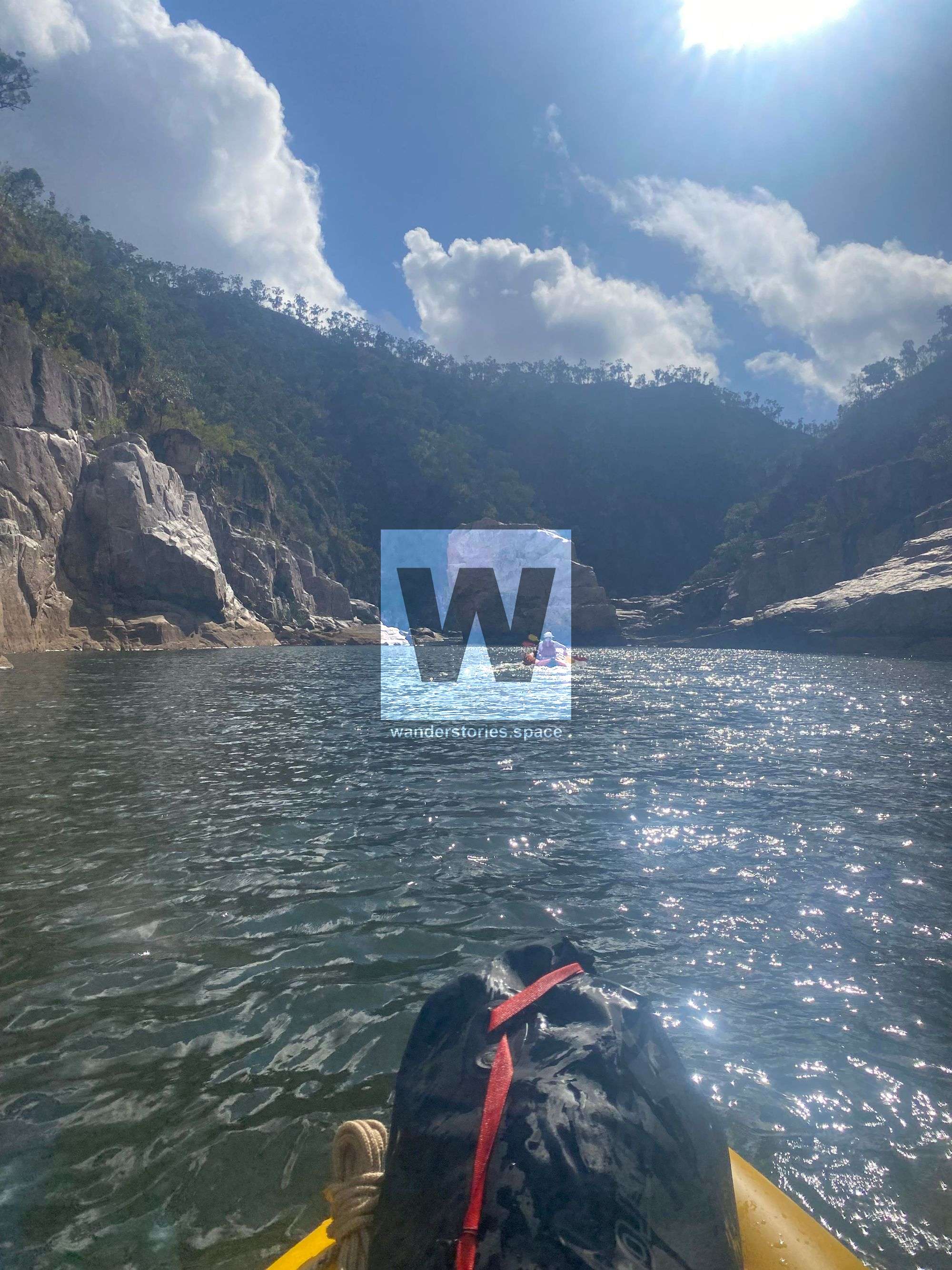
River Character, Rapids, and Waterfalls
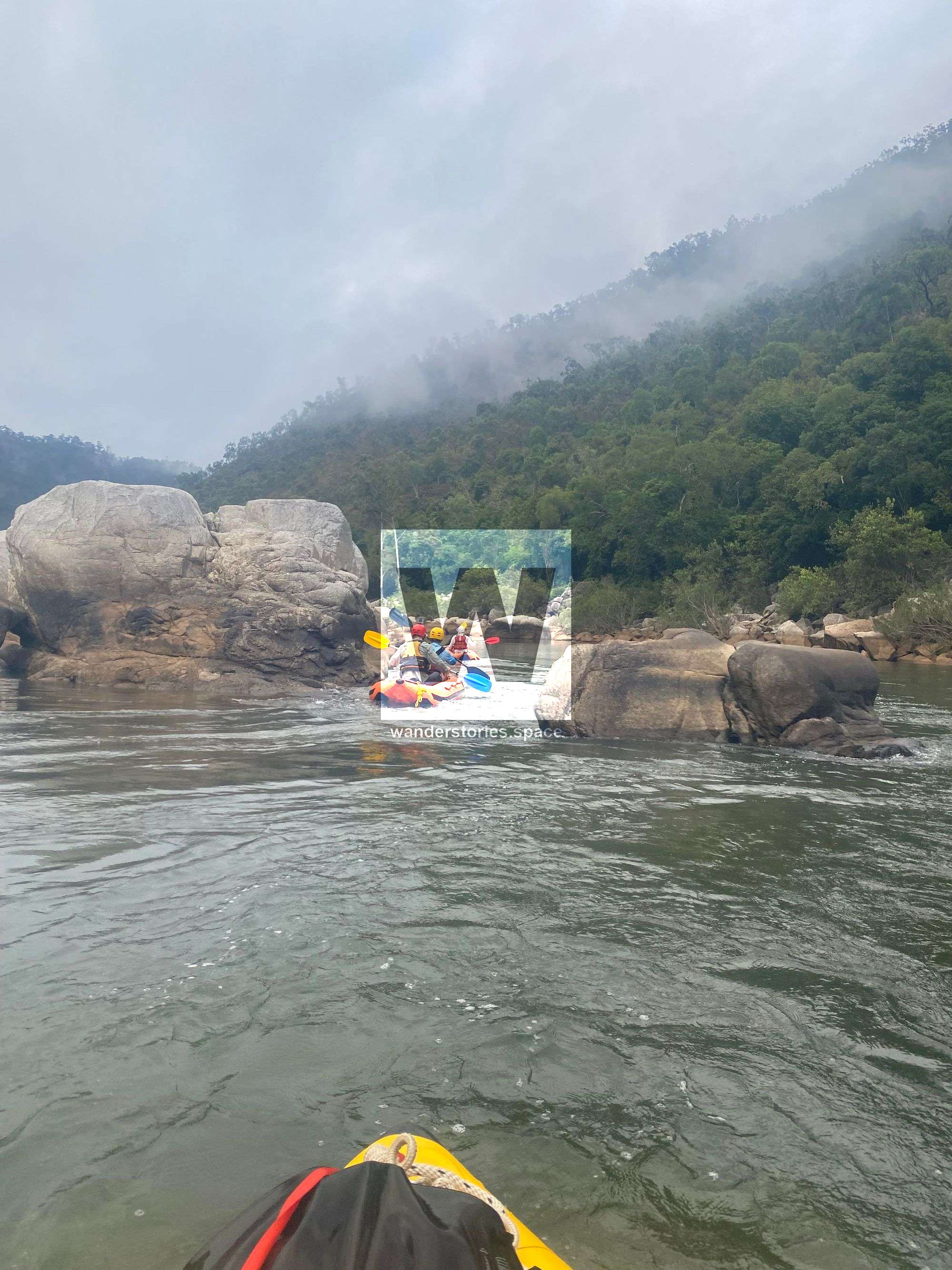
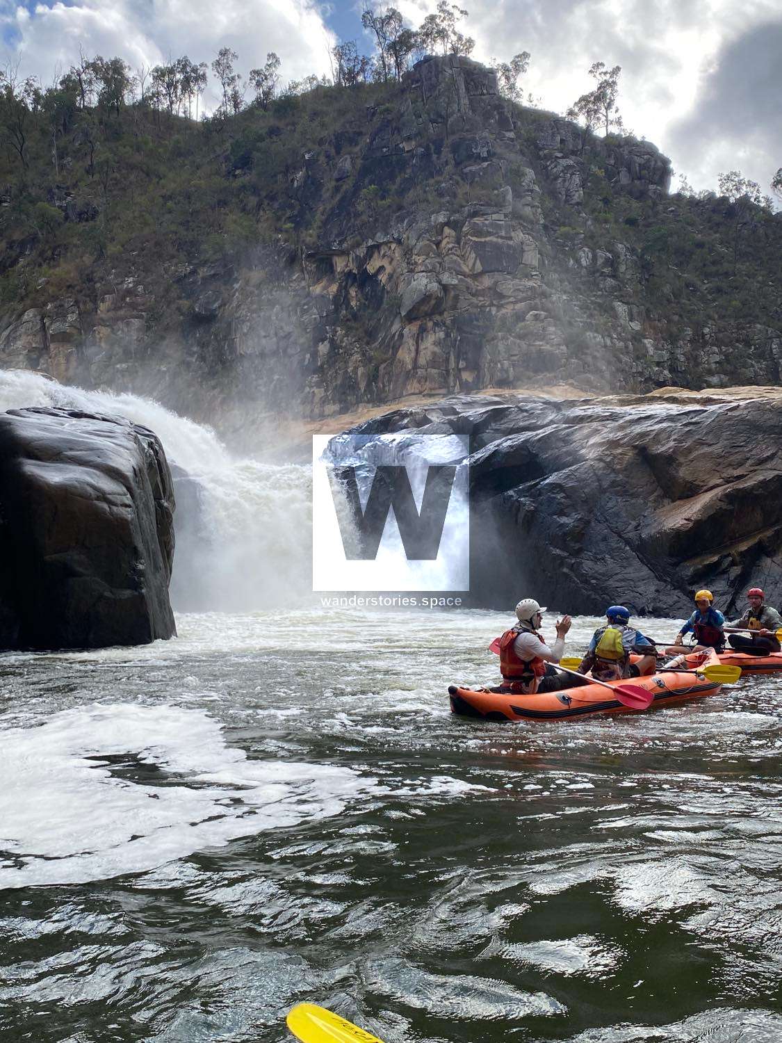
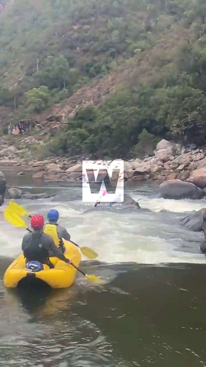
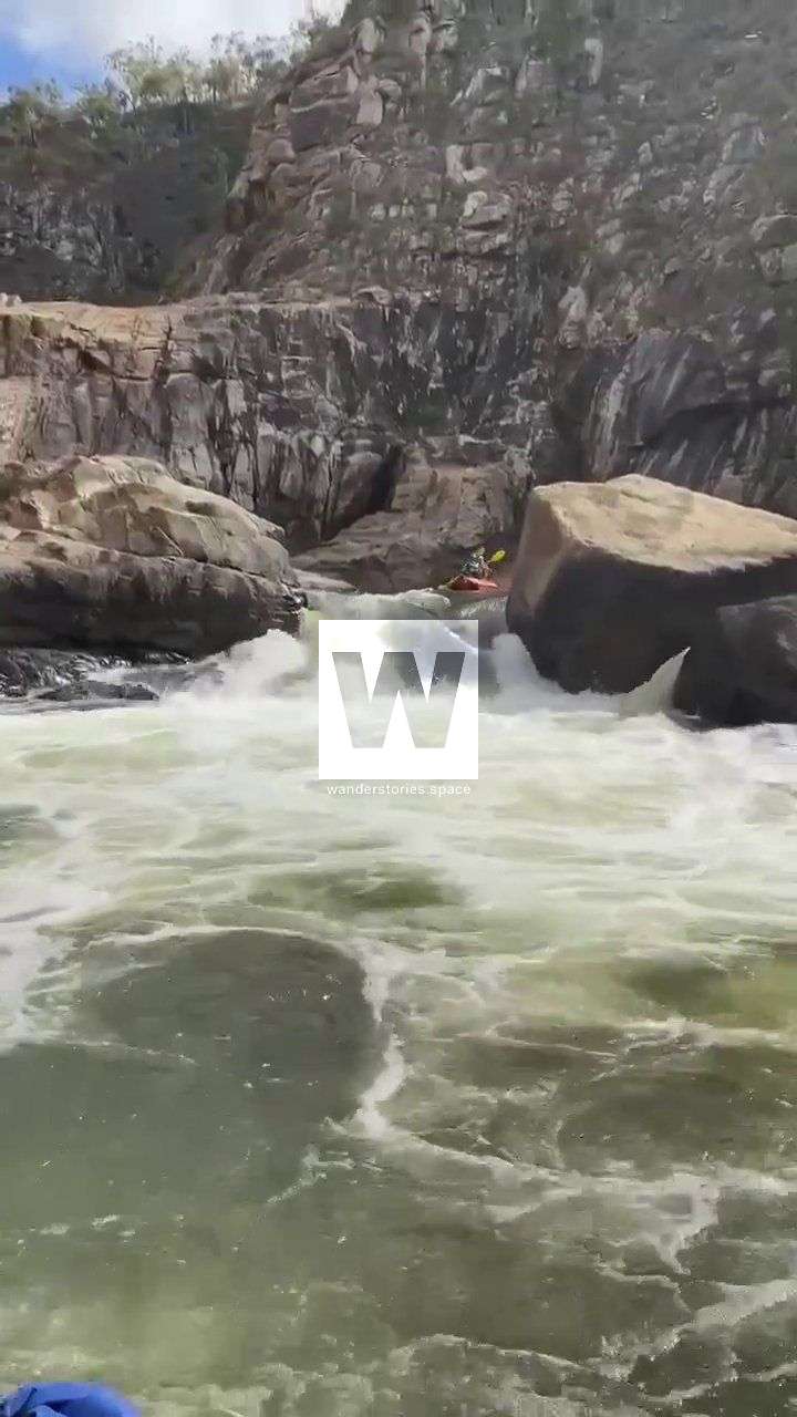
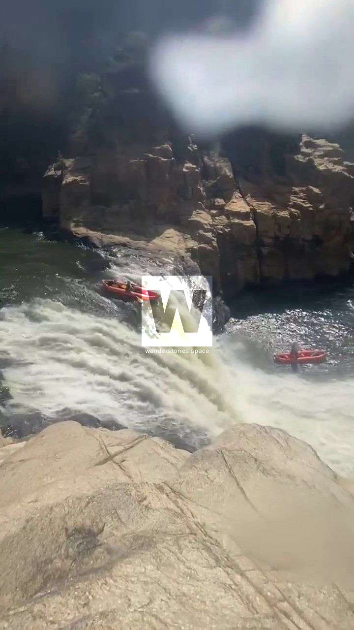
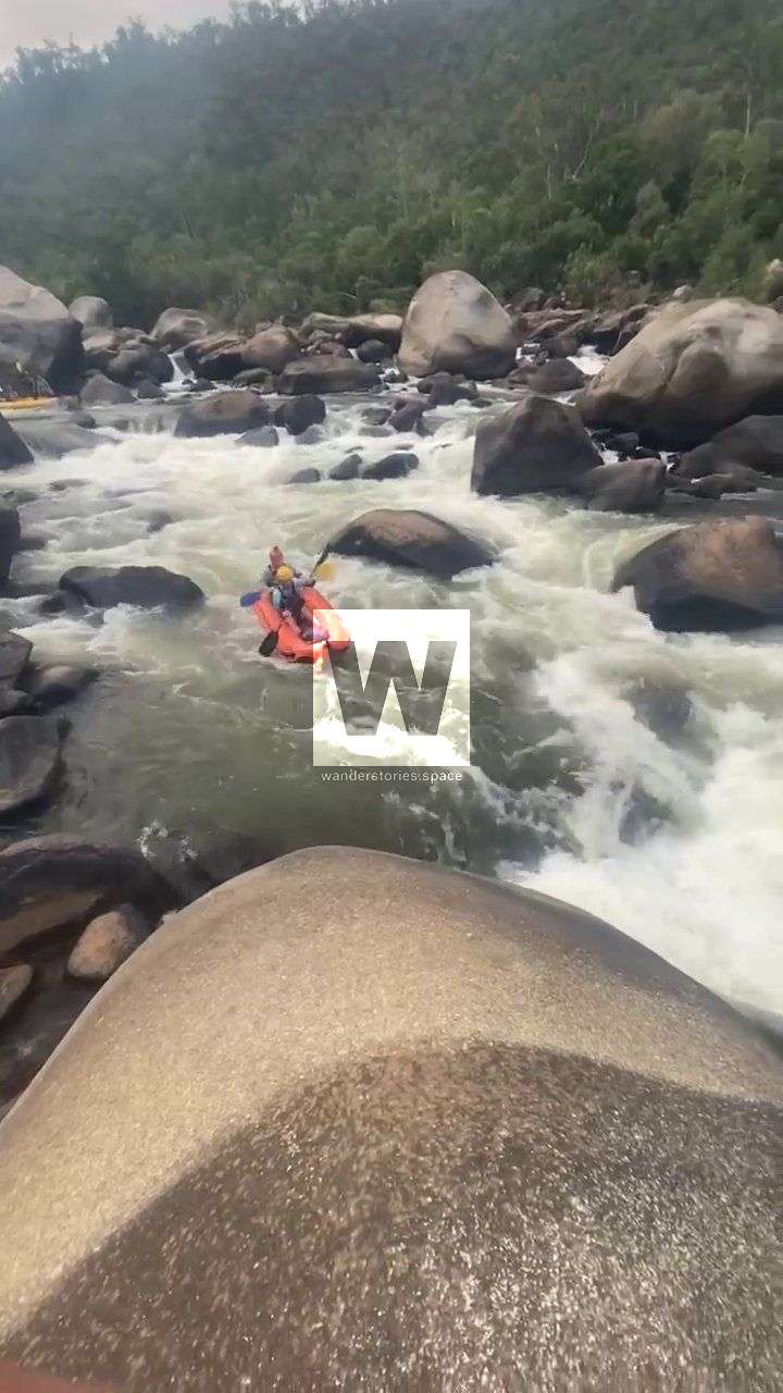
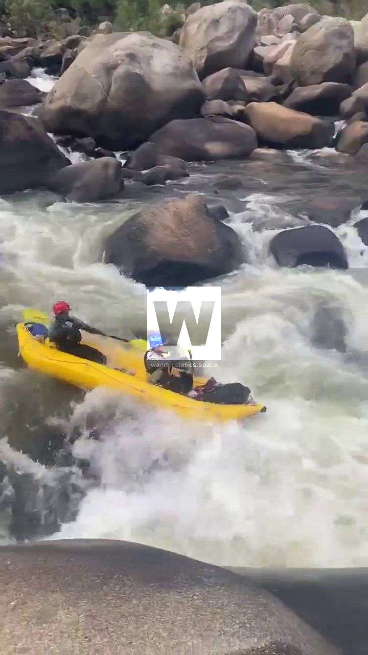
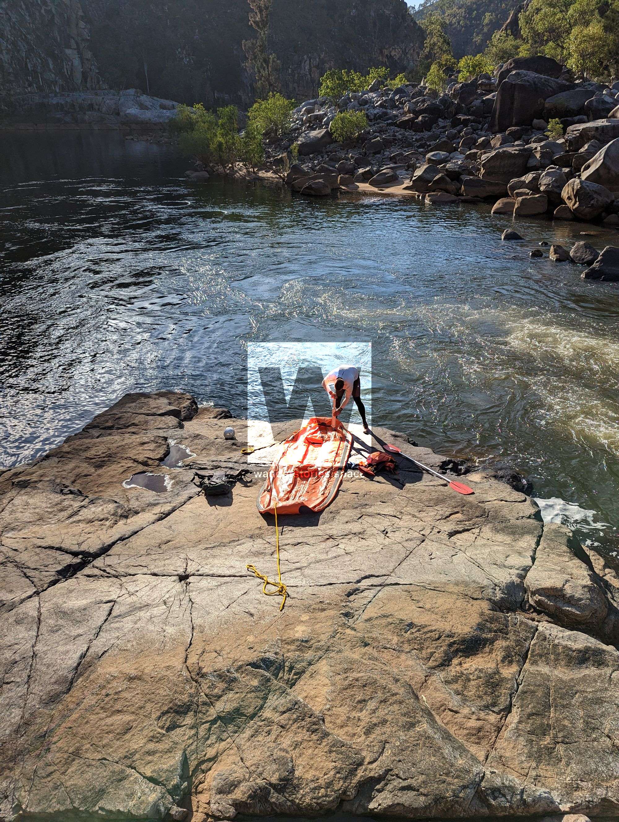
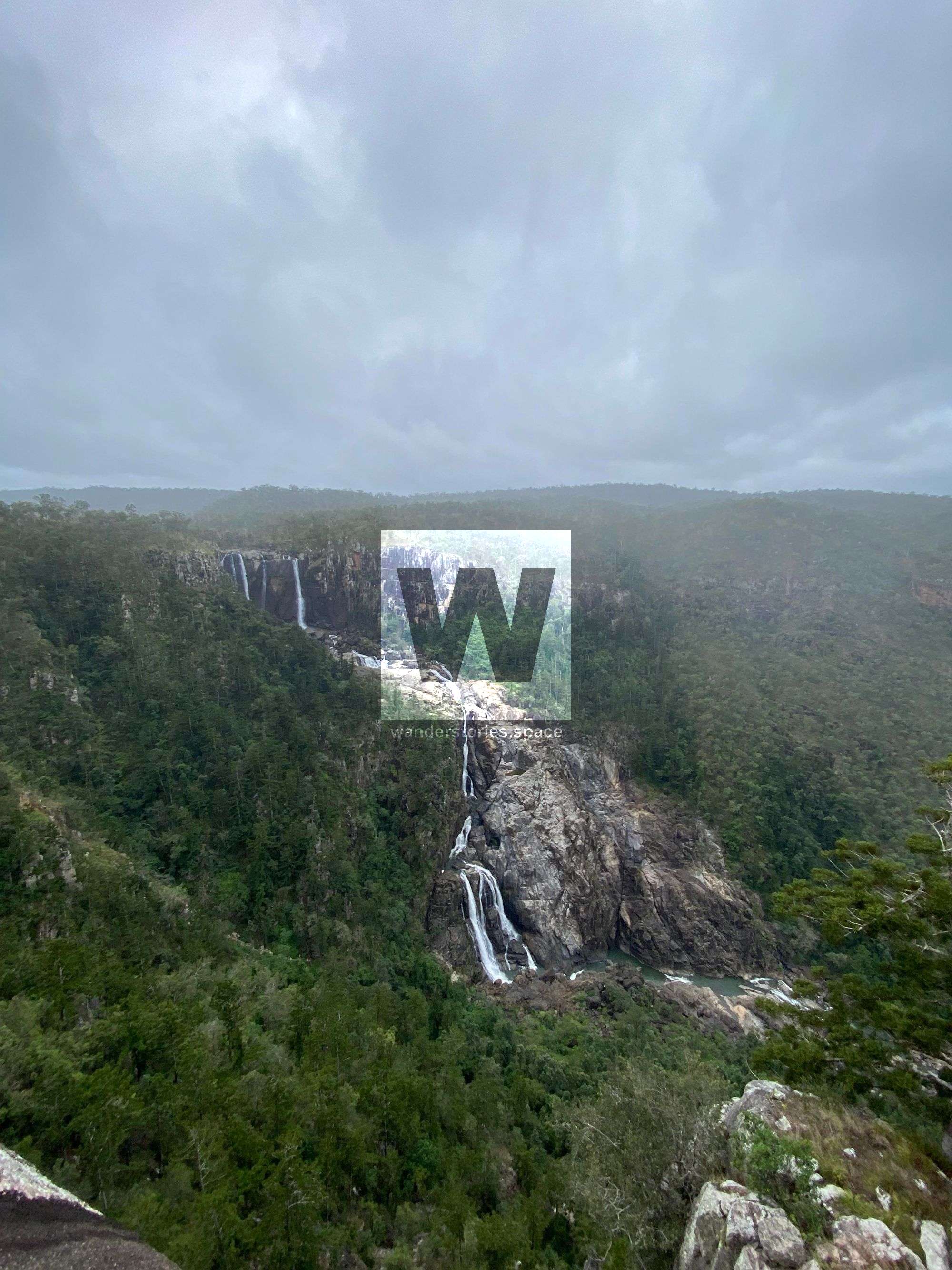
The Herbert River journey offers a diverse mix of scenery and challenges. From waterfalls (like the iconic Dog Leg Falls, Double Falls, and a 6m waterfall just below Double Falls all just below Herbert Falls) to exciting grade 3 and 4 boulder gardens and smaller drops, this journey is far more than a waterfall hucking session. Be cautious of a long class 2 entry rapid leading into a class 5 section. In some places, the river flows between large boulders (sieves) and must be portaged.
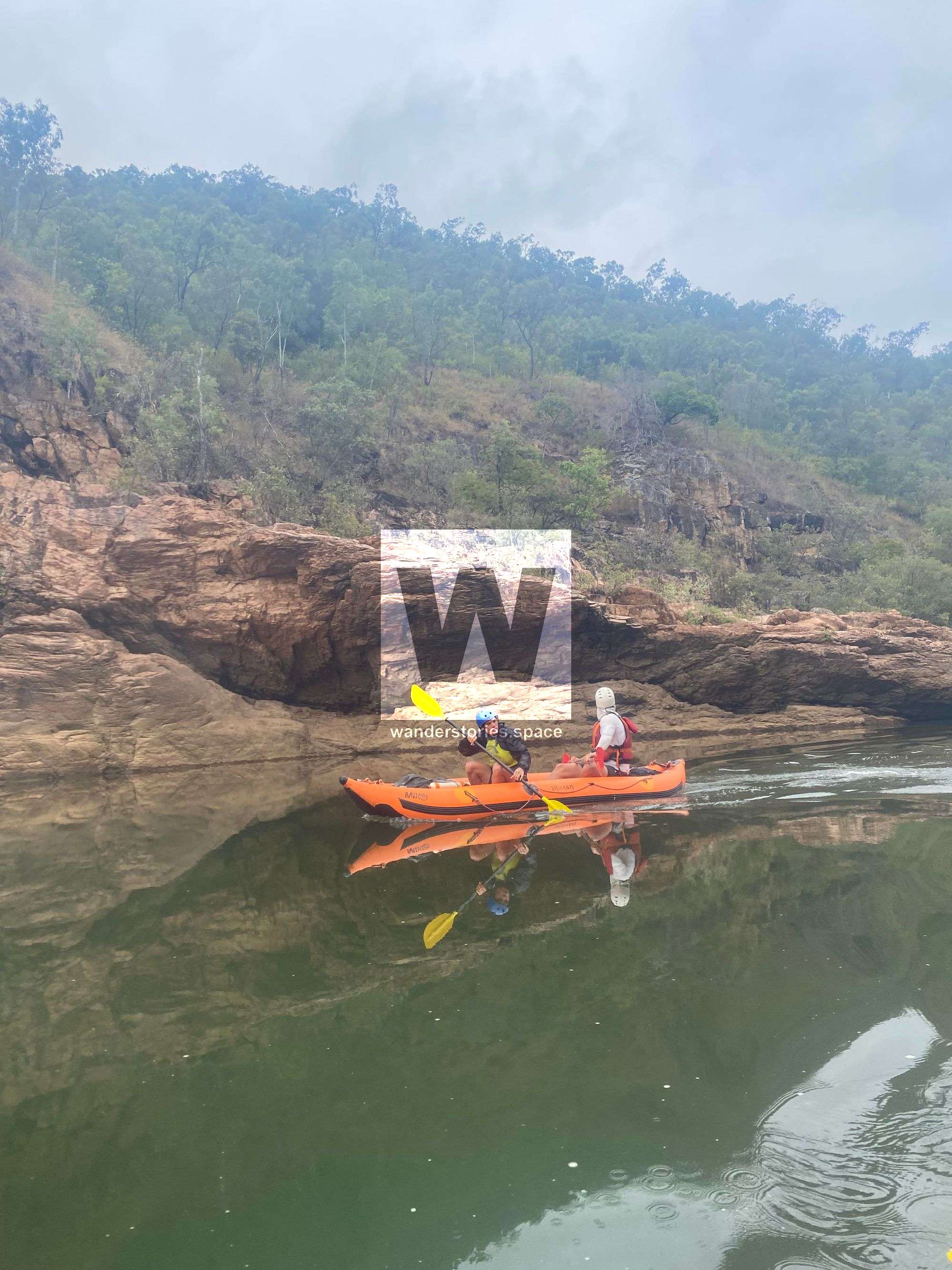
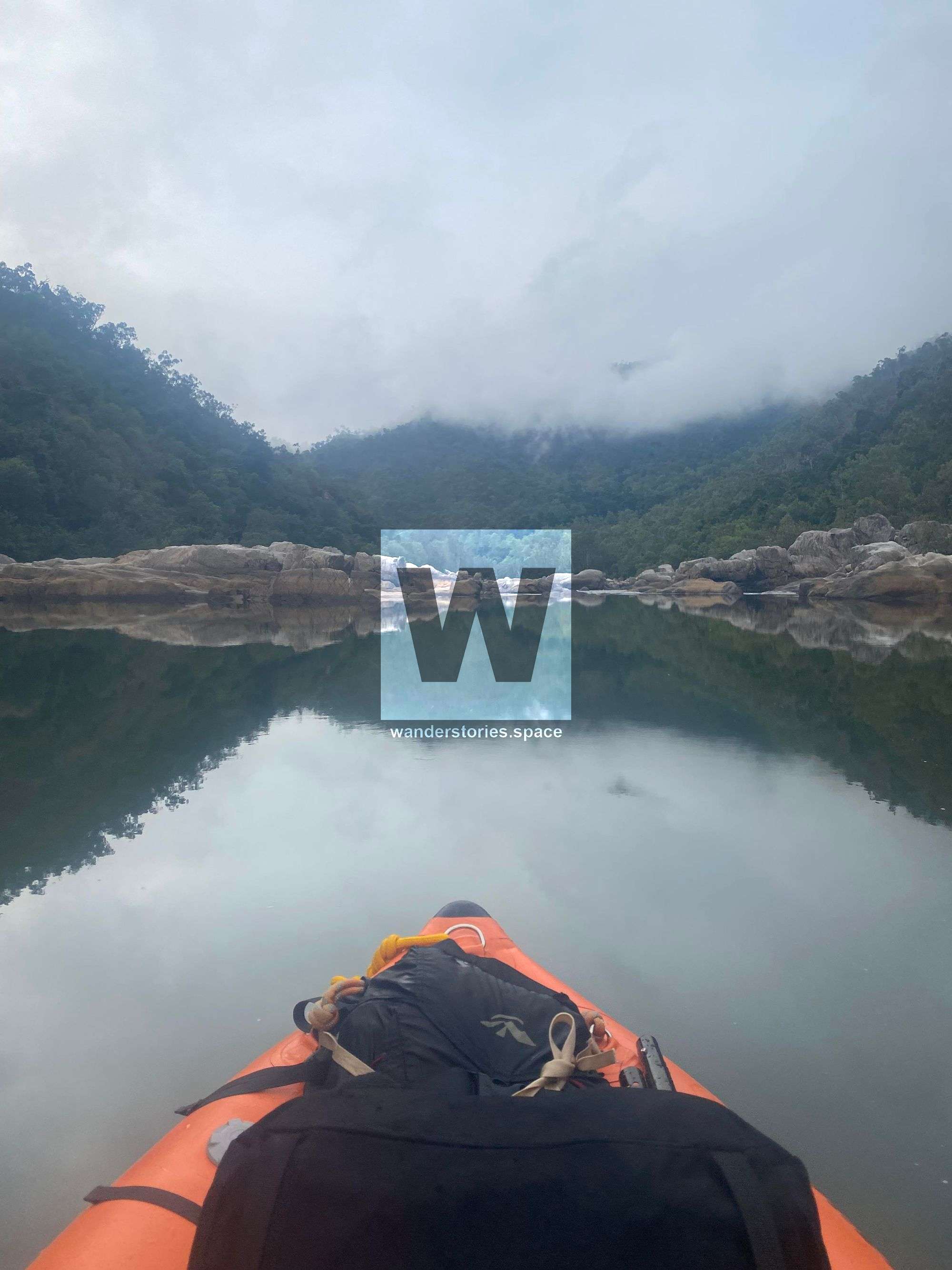
The Herbert River is a deep granite gorge with several waterfalls, steep bouldery rapids, and chutes. Short kayaks, canoes, and rafts are most suitable for this journey. Most of the rapids and waterfalls have been paddled, excluding the Herbert Falls. However, few people would paddle all five waterfalls at high levels. Apart from the waterfalls, there are numerous excellent grade 3 and 4 boulder gardens and smaller drops below Double Falls. Do take caution for a long class 2 entry rapid that leads into a class 5 section.
Access and Shuttle
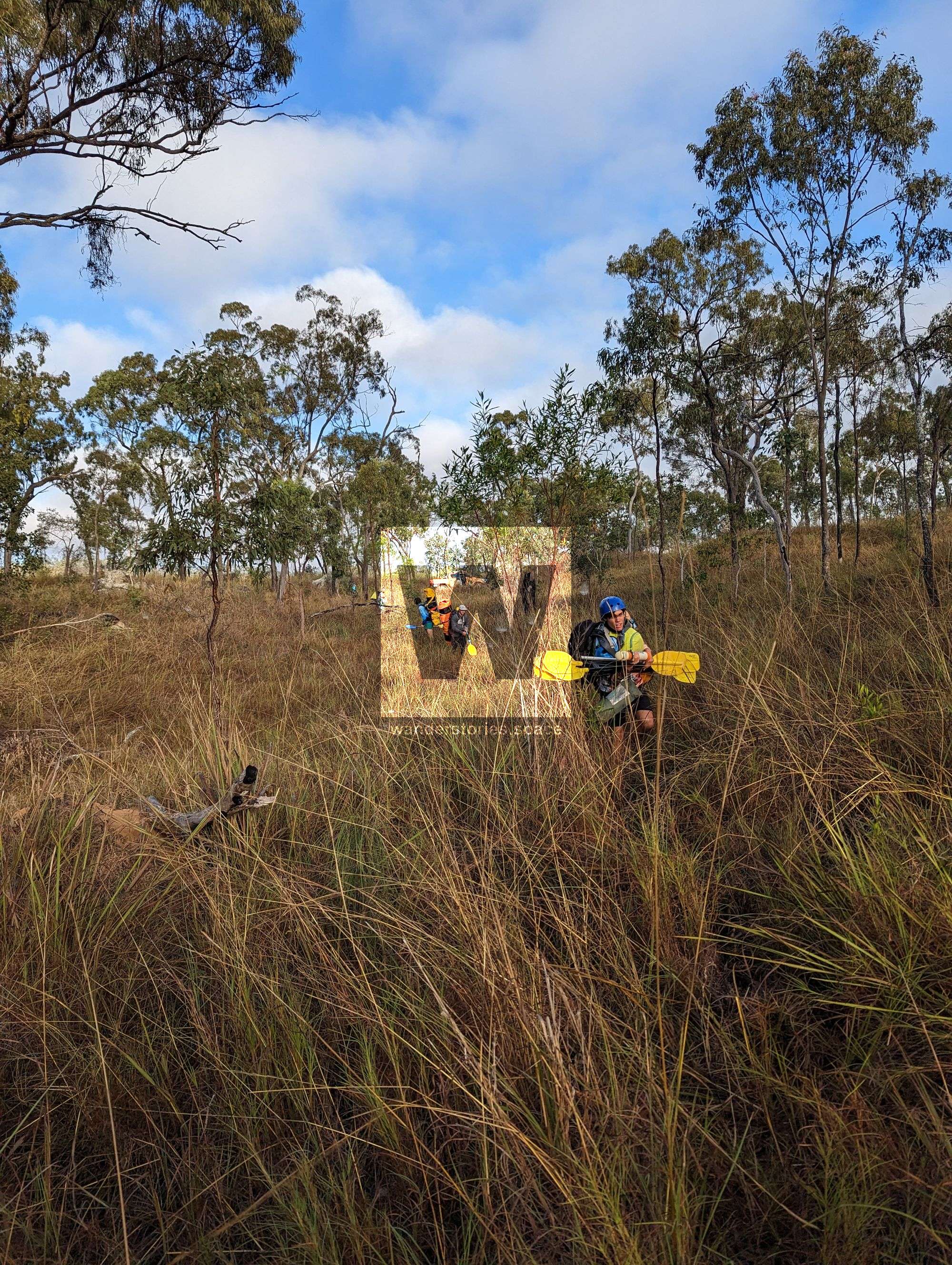
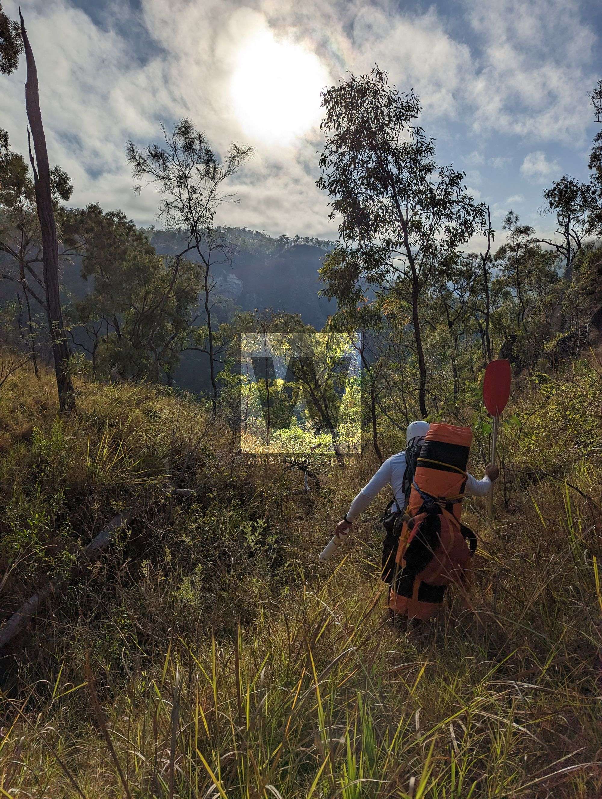
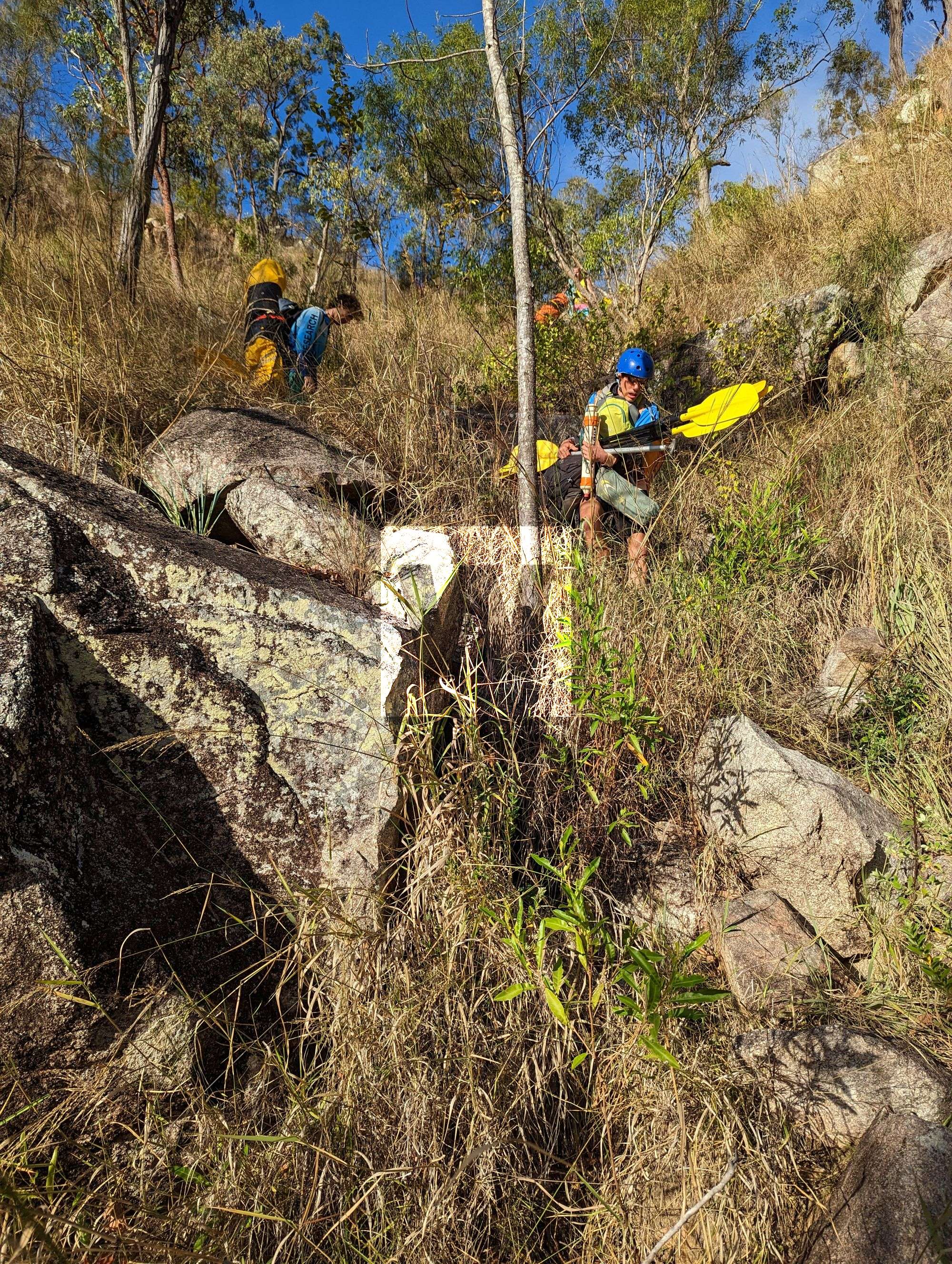
The river is bested accessed from the western side via Goshen Station. Make sure to have adequate maps and aerial imagery. Access to Herbert River Falls requires a 4-wheel drive, and remember to take vehicle recovery equipment. Pay $50 for access via Goshen Station. Sometimes the owners of Gohsen Station offer to do the shuttle for you. The shuttle drive takes about 2 hours on either side and requires a 4WD vehicle. Coastal access is via Kennedy on the Bruce Highway.
Putting in: Cashmere Crossing, Princess Hills, Sand Bar Camp, or Herbert River Falls (ideal).
Taking out: Walk or take a helicopter at the junction of Blencoe Creek and the Herbert River. It's no longer recommended to paddle past Blemcoe Falls to Abergowrie due to saltwater crocodiles. Most people walk out the rough track up the main ridgeline. However, some have hired a helicopter pick-up at the junction of Blencoe Creek and the Herbert River. A nearby station can assist with helicopter takeouts at Blencoe Falls.
Itinerary
For those more familiar with the river, Herbert Falls to Blencoe Falls can be done in 1-2 days. If you want to take your time to enjoy camping, the scenery, and fishing, and inspect the rapids, you could spend a few days from Cashmere to Blencoe.
Cashmere Crossing – Herbert River Falls: 1-2 days (not commonly paddled)
Herbert River Falls – Blencoe Falls: 1-3 days (+1 day for high-level raft portage at Double Falls)
Here are the main points of interest:
Cashmere CrossingSand Bar Camp & Princess Hills- Herbert River Falls (Ideally put in below via Gohsen Station)
- Dog Leg Falls, Double Falls, & 6m waterfall
- Boulder Gardens
- Blencoe Falls take out (Ideally walk out via ridgeline)
Blanket Creek walkers' camp, 'Rock Garden', Big W & BluffYammine Falls Junction. Yammine Pick Up point (Abergowrie)
Interactive Map
Additional Notes
Please be aware that at certain levels, the river flows between huge boulders in the river and must be portaged. You should also note that crocodiles may inhabit the river, so be sure to take the necessary precautions.
This river used to be run as a commercial trip.
When the Kirrama Range road is closed, the car shuttle is much longer and can put in via Cashmere Crossing or Princess Hills.
Due to the cattle and camping upstream, it's recommended to treat your water before drinking, however, most paddlers do not.
White water experiences, swift water rescue, and equipment (e.g., throw bags) are required.
You can check the current river levels at this Bureau of Meteorology's Glen Eagle Gauge.
Contact Piss Poor Paddlers (Cairns group) or NQ Kayakers (Townsville group) for further information.
This article, and all other articles, are for entertainment purposes only and are not to be used as a guide. Please see our Disclaimer for more information.