Magnetic Island Walking Tracks
An extensive 26 kilometre network of walking trails allows you to appreciate the island's natural environment, some of which is protected within the bounds of Magnetic Island National Park with something for everyone.


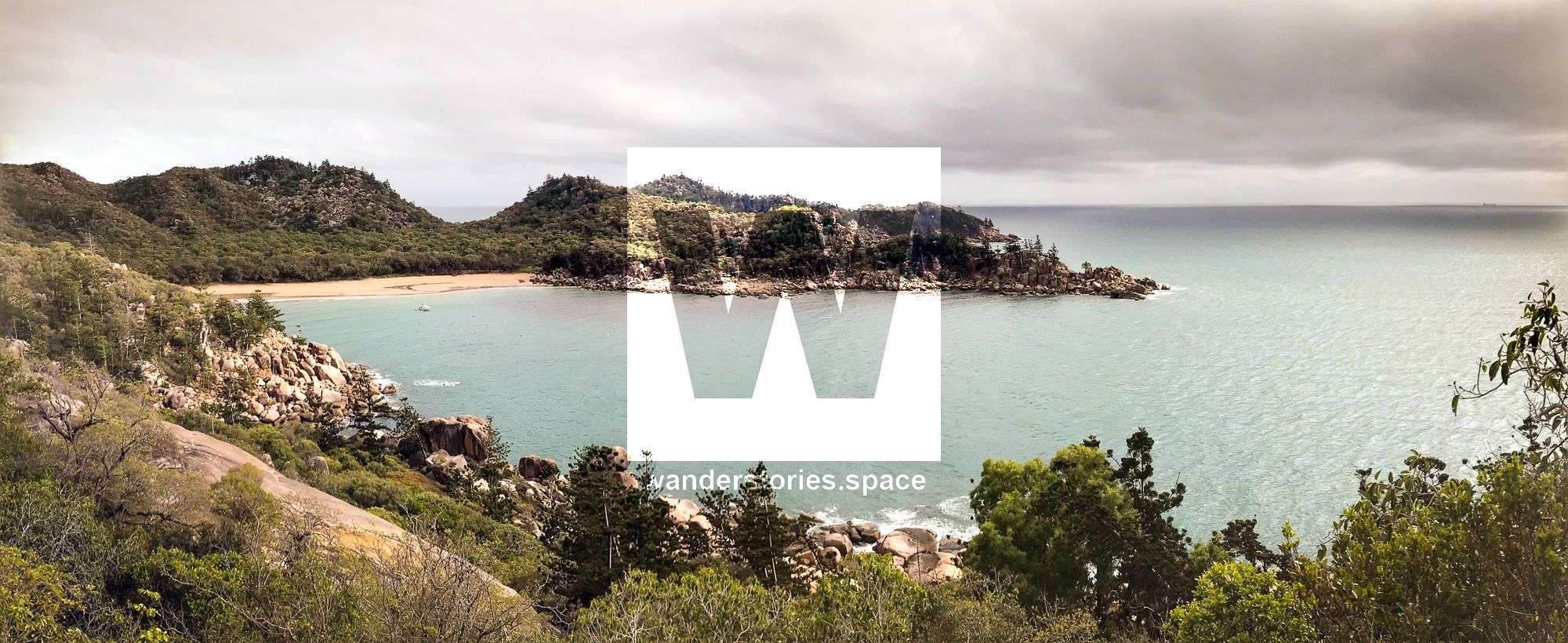
Location - Townsville, North Queensland, Australia
The Aboriginal traditional owners, the Wulgurukaba, or the 'canoe people', welcome you to Yunbenun (Magnetic Island).
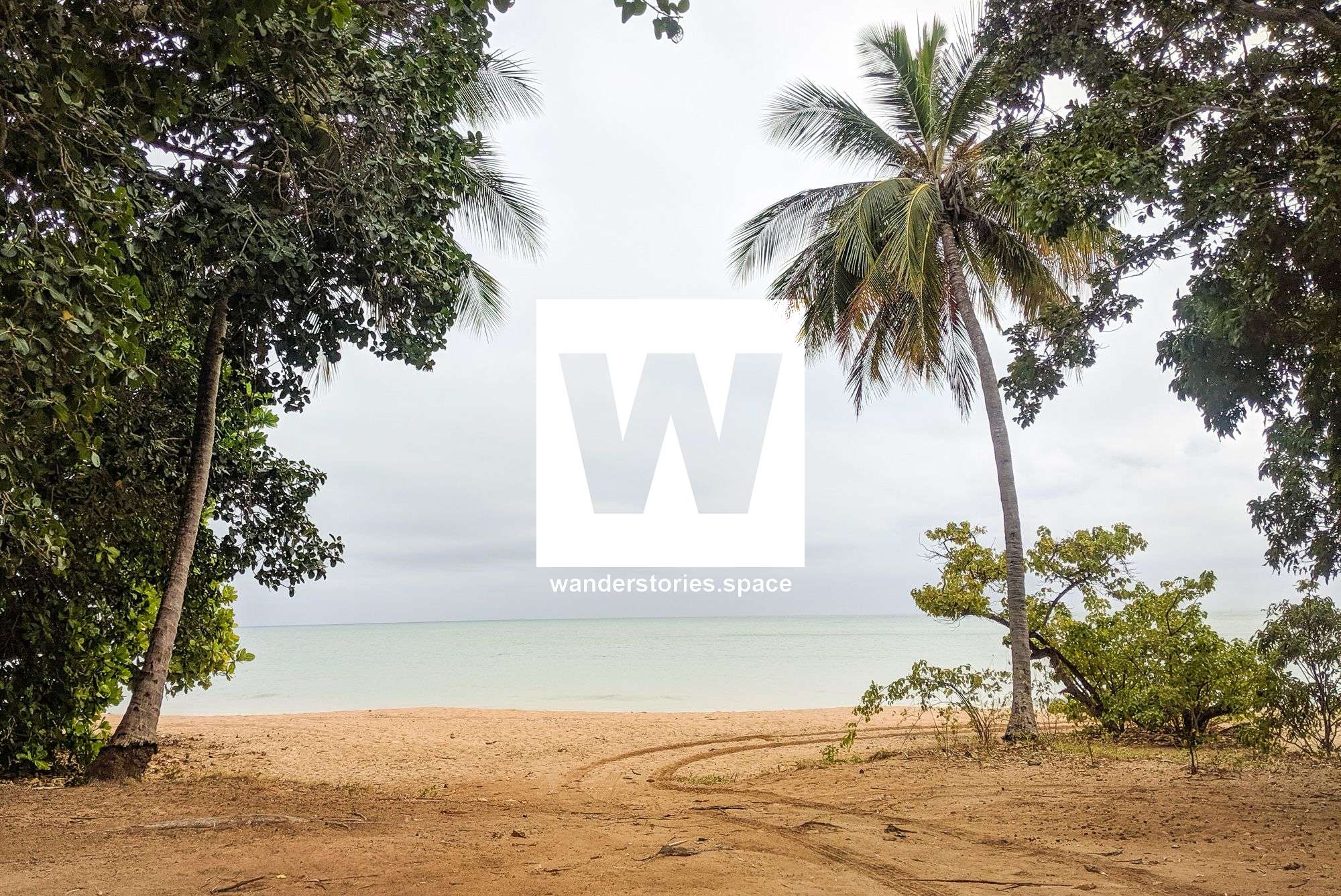
One of the best ways to explore Magnetic Island is by foot. An extensive 26-kilometre network of walking trails allows you to appreciate the island's natural environment, some of which is protected within the bounds of Magnetic Island National Park. The winter months are an ideal time to explore these trails, as temperatures are pleasant. Moreover, there is something for everyone. The array of trails can range from easy, short tracks to those that are much longer and more difficult. See also bushwalking on Magnetic Island.
The trails pass to granite boulders and dry bushland, ranging from wattles and eucalypts to pockets of semi-evergreen forest and often have views across the landscape or over the bays.
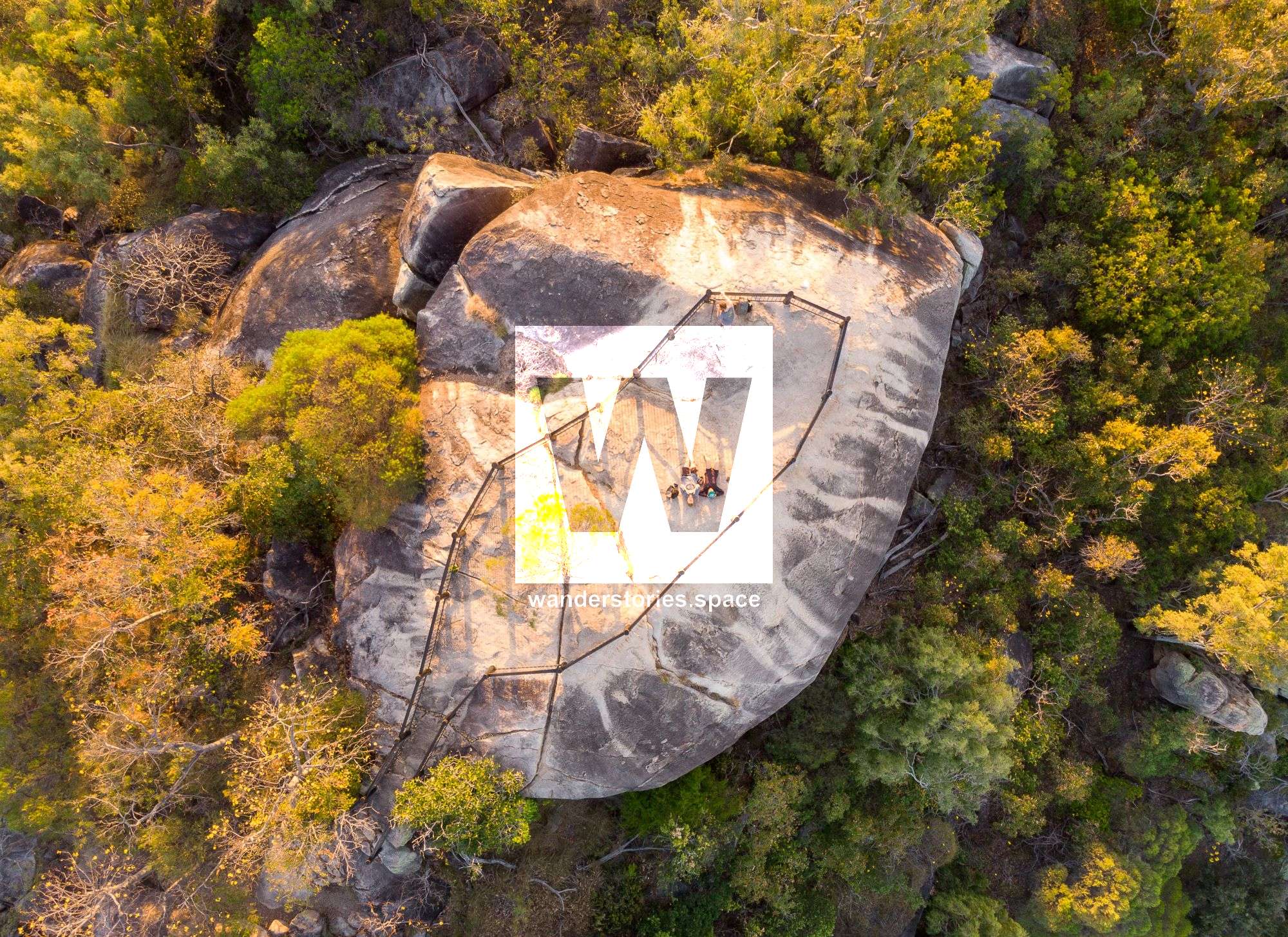
Sails Rock Track (Tom Thumb Lookout)
Distance: 1 km return
Time: 30 min return
Grade: easy
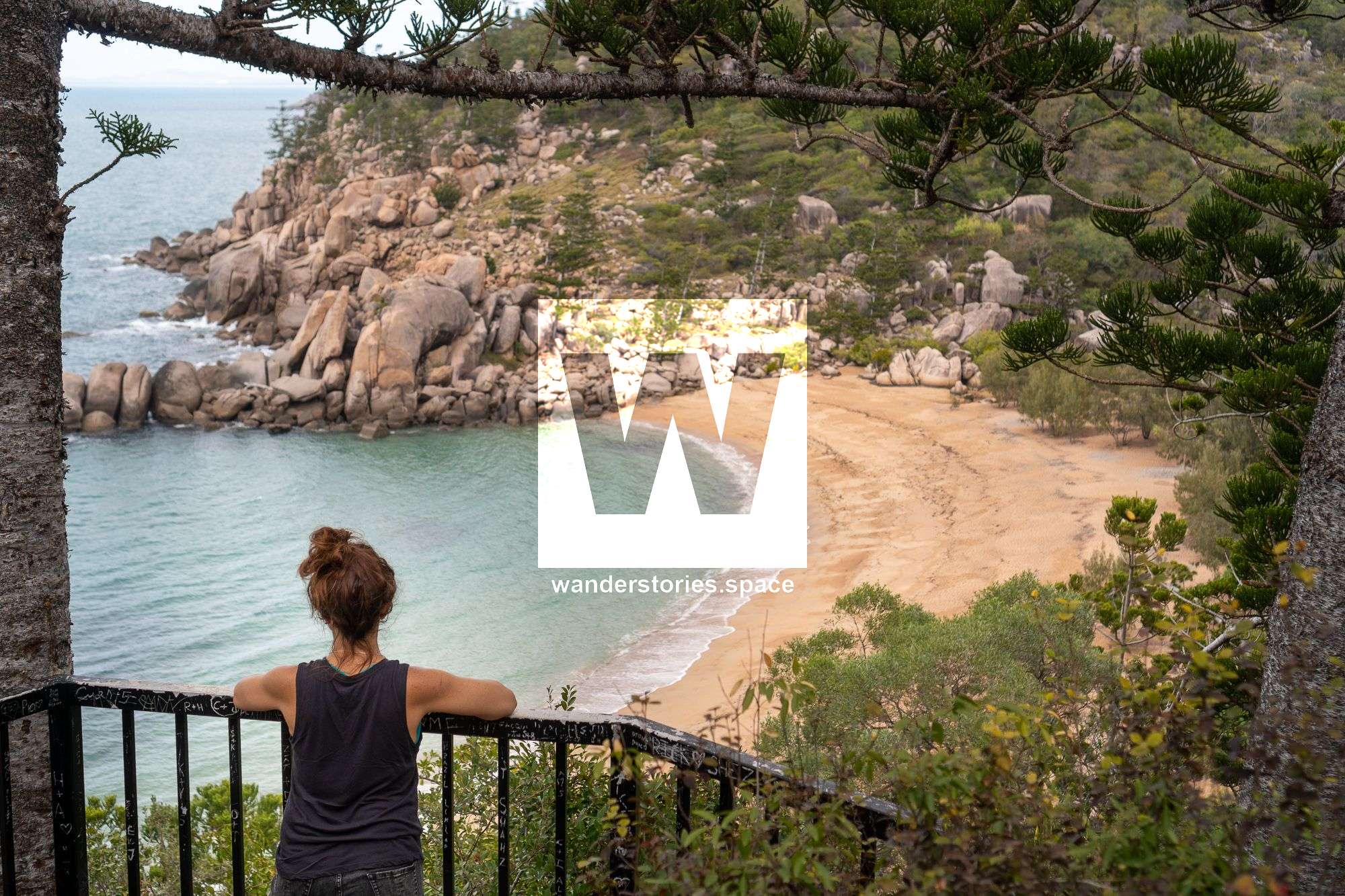
Starting at the end of Yule Street, walk along the trail to Picnic Bay Water Reservoir Road. Pass the gate on your left, and walk up the bitumen road to the water tank. Here, turn left along a dirt track to Sails Rock Lookout. You can see the rock formations as well as beautiful views over Cockle Bay, the SS City of Adelaide shipwreck, and Townsville. The SS City of Adelaide shipwreck is best seen at high tide from this lookout. Return via the same route.
Frank Steele (aged 13 years) climbed this rock (Tom Thumb) in 1927. Helped by a classmate Charlie Olsen, a log was balanced against the rock and a note in a can left on top. The adventurous challenged the unexpected.
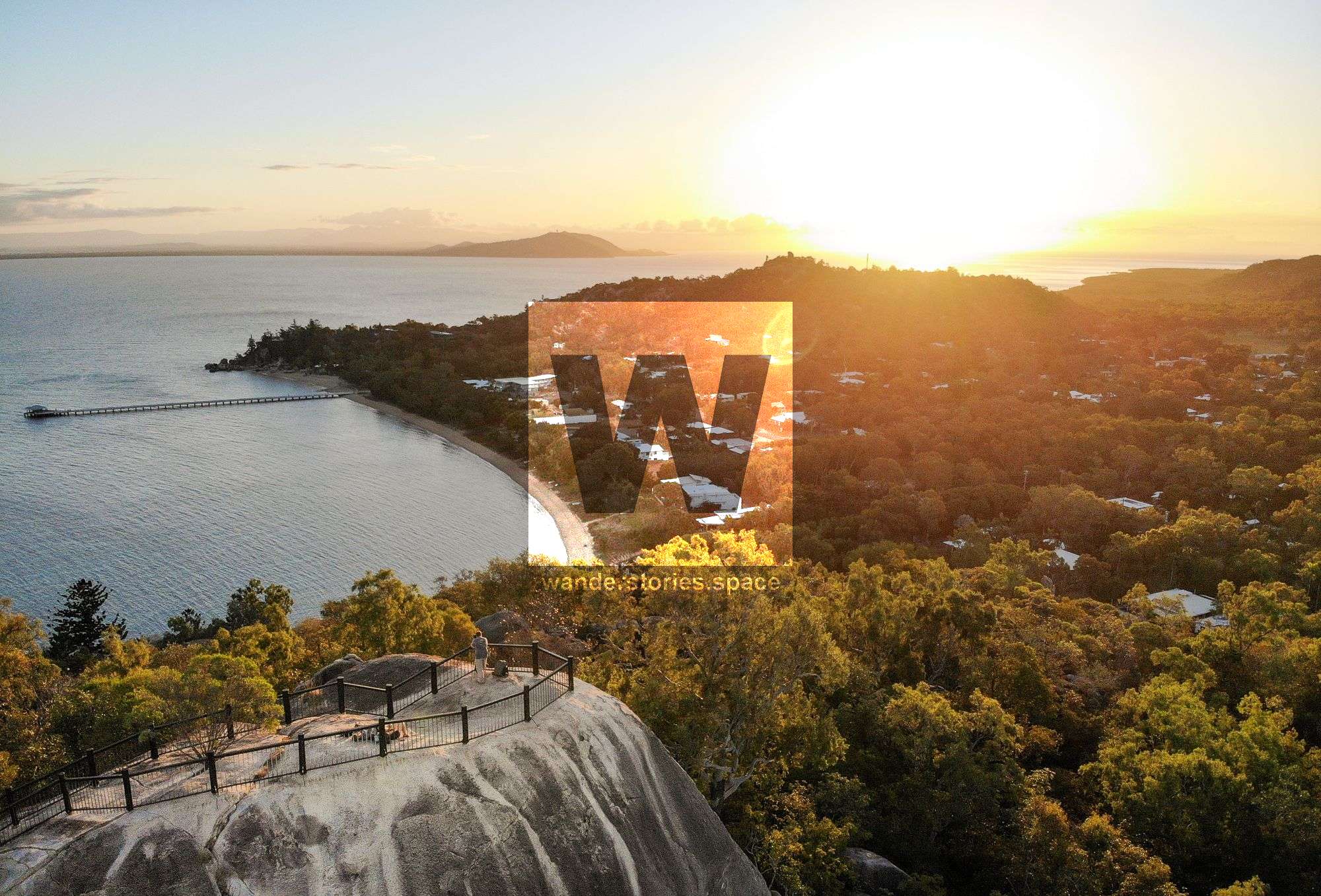
Hawkings Point Track
Distance: 1.2 km return
Time: 1 hr return
Grade: easy
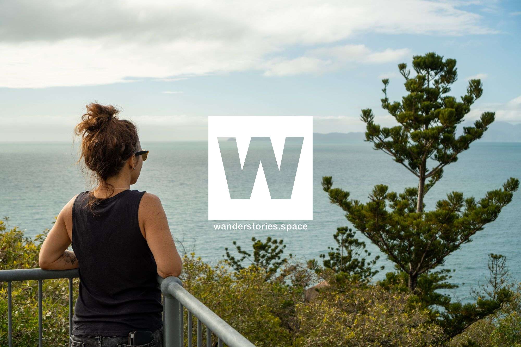
Starting at the eastern end of Picnic Street in Picnic Bay, follow a track that will lead you to the saddle between Rocky Bay and Picnic Bay. Here, you will have a decent view over Rocky Bay. From here, you can even scramble down to Rocky Bay. Otherwise, the track then winds to the top of a large boulder, offering views over toward Picnic, Nelly, and Geoffrey Bays and back toward Townsville. This is Hawkings Point Lookout. One of the best places to watch sunrise and sunset.
Rocky Bay Rock (Rocky Bay and Picnic Bay Lookout)
Distance: 200 m return
Time: 5-10 min return
Grade: easy
This track is a short 100 metres return that goes from the road to a large rocky outcrop overlooking Rocky Bay and Picnic Bay.
Rocky Bay Track
Distance: 200 m return
Time: 15 min return
Grade: easy
You can scramble down to Rocky Bay from car-accessible Rocky Bay Lookout and play on the Whale Boulder or some of the other gorgeous rock formations. Swimming here can be enjoyable as well.
Nelly Bay to Arcadia Bay Track
Distance: 5 km one way
Time: 2.5 hrs one way
Grade: easy
From the end of Mandalay Avenue in Nelly Bay, this walk passes through a vine-thicket pocket beside Gustav Creek, then climbs gradually to the saddle between Nelly Bay and Horseshoe Bay. From here, the track branches. At this point, you can either go down to Horseshoe Bay or continue up the ridgeline to Arcadia Bay. The ridge provides views over Horseshoe Bay. This track then branches again, providing you with two options. Either you can continue down to Horseshoe Bay Road, where you can take the Old Forts Road to access other tracks or, you can continue to Arcadia Bay, where there is a 400 metres return side-track to the Sphinx Lookout – a perfect place for a picnic lunch. After you return from Sphinx Lookout, proceed another 750 metres toward Arcadia, and you will arrive on Endeavour Road. Endeavour Road then continues downhill from the Arcadia Bay Water Reservoir beside Peterson Creek. If you walk up to and behind the water reservoir, you will be pleasantly greeted with a view called Arcadia Lookout. Head back down the bitumen road and you'll see a gate, which signifies the end of this track.
Gabul Way
Distance: 750 m one way
Time: 15 min one way
Grade: very easy
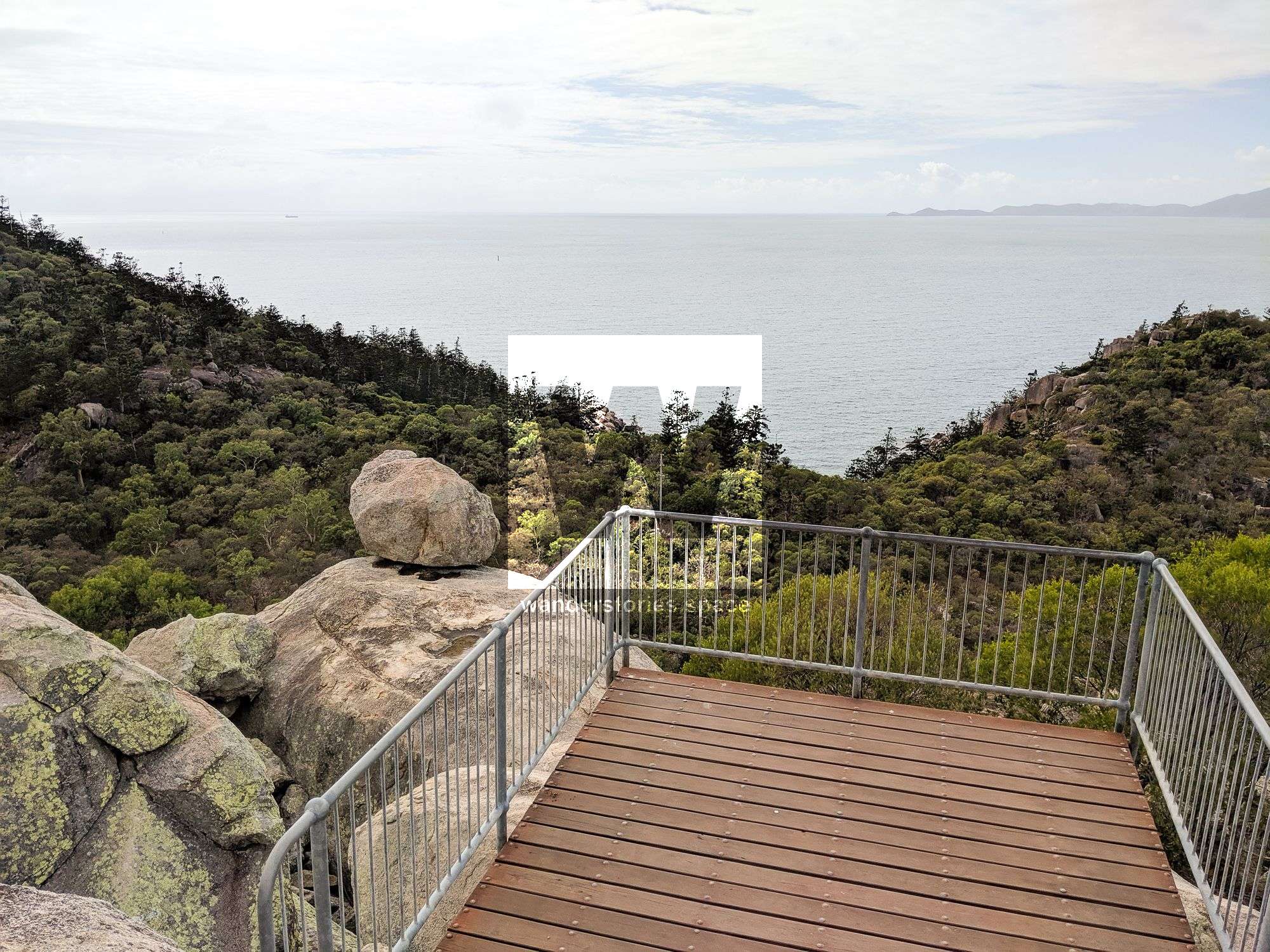
This elevated, scenic walkway is adjacent to Arcadia Road and is made up of two sections linking Nelly Bay and Geoffrey Bay. Gabul Way is suitable for walkers and cyclists and is disabled compliant, with breakout platforms along the way to pause and enjoy the island's coastline and views across the bays. There is also a hidden walking track on the other side of the road that takes you alongside the hoop pines and the rocks.
Olympus Lookout
Distance: 50 m return
Time: 2 min return
Grade: very easy
This track is a short 25 metres one-way that goes from the end of Olympus Crescent to a large rocky outcrop overlooking Fish Cove, just around from Alma Bay.
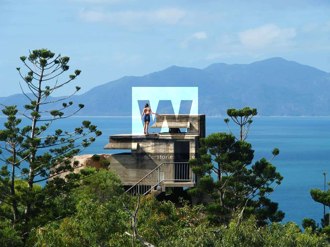
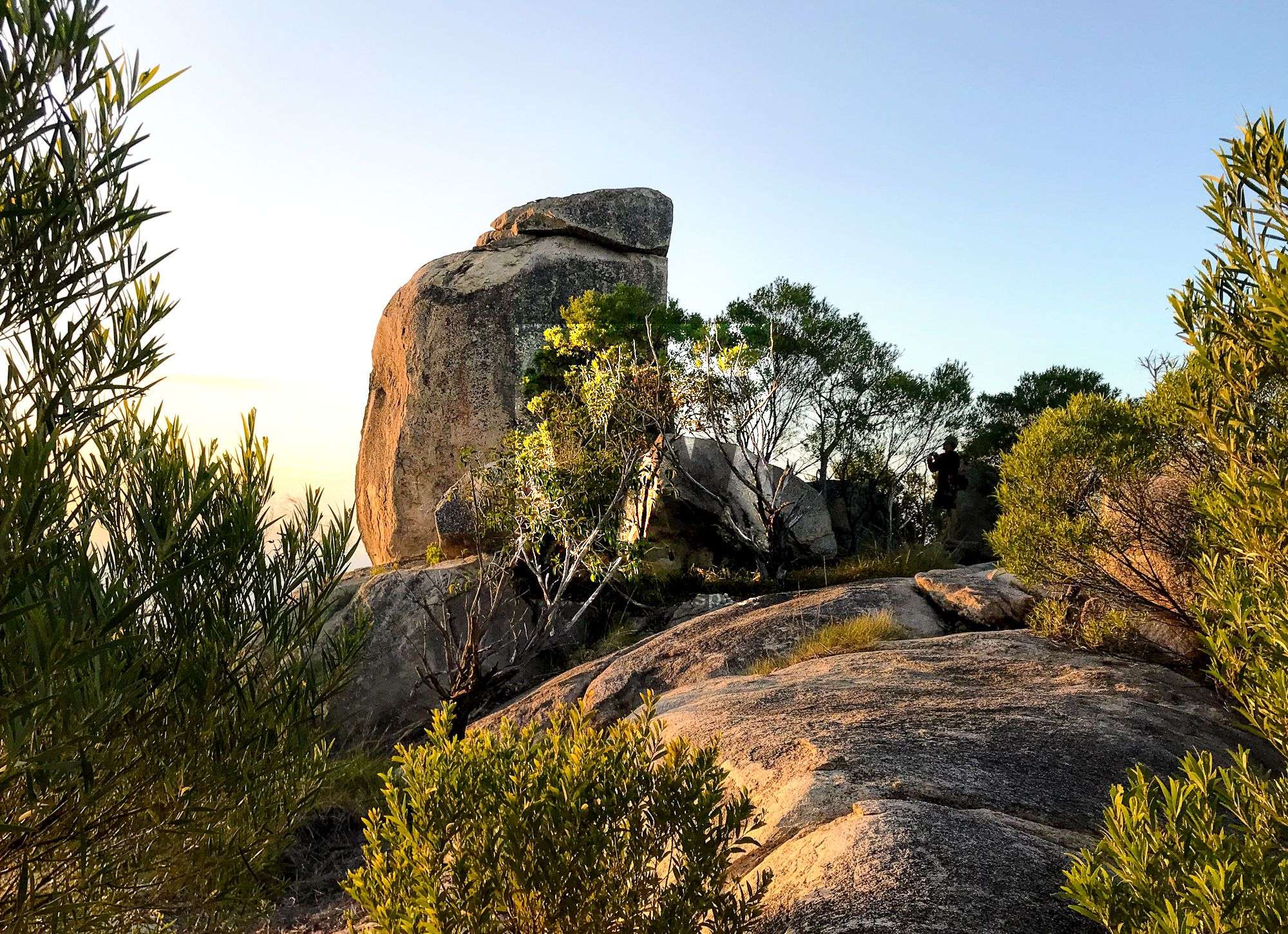
Forts Walk
Distance: 4 km return
Time: 1.5 hrs return
Grade: easy
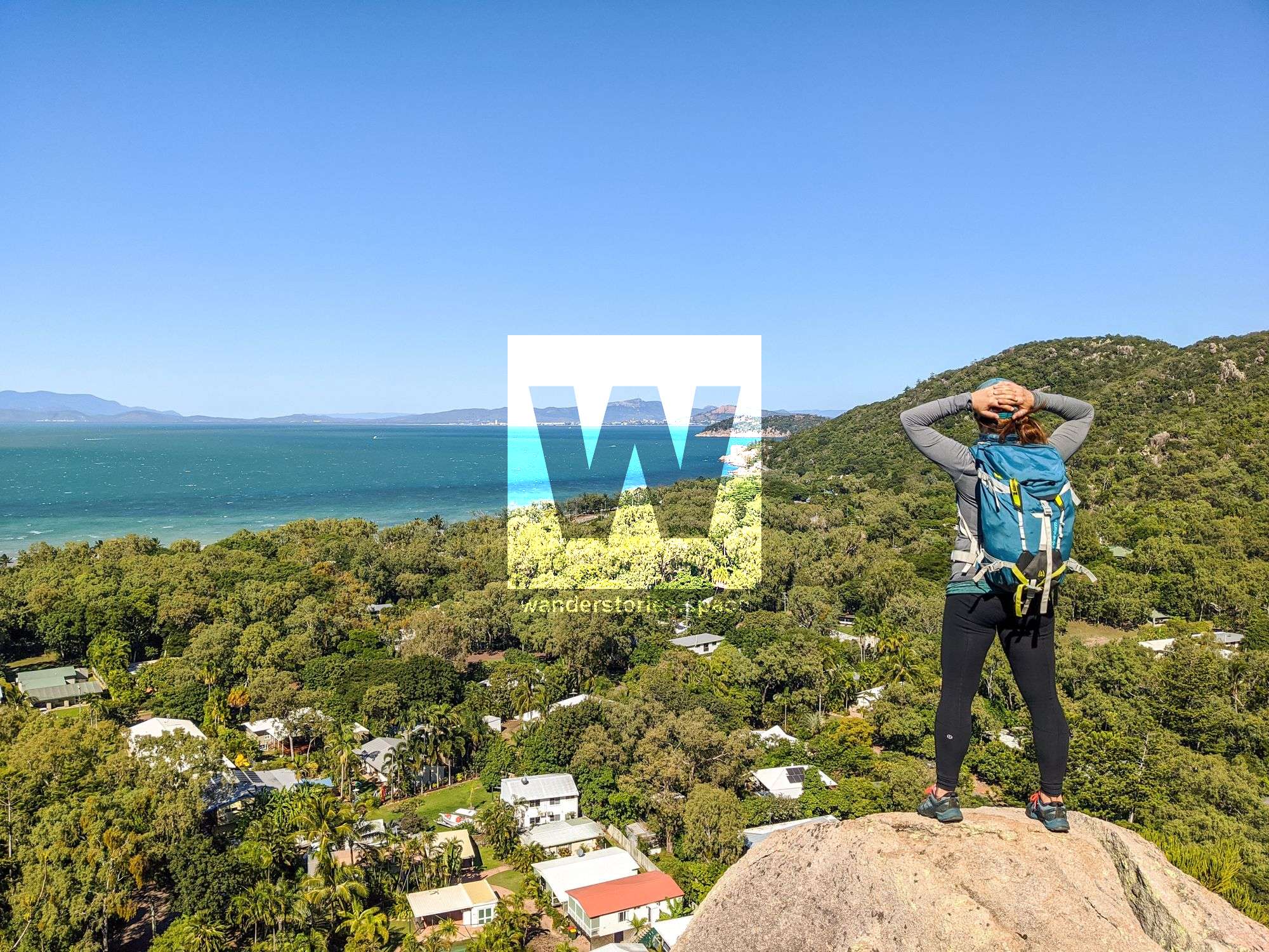
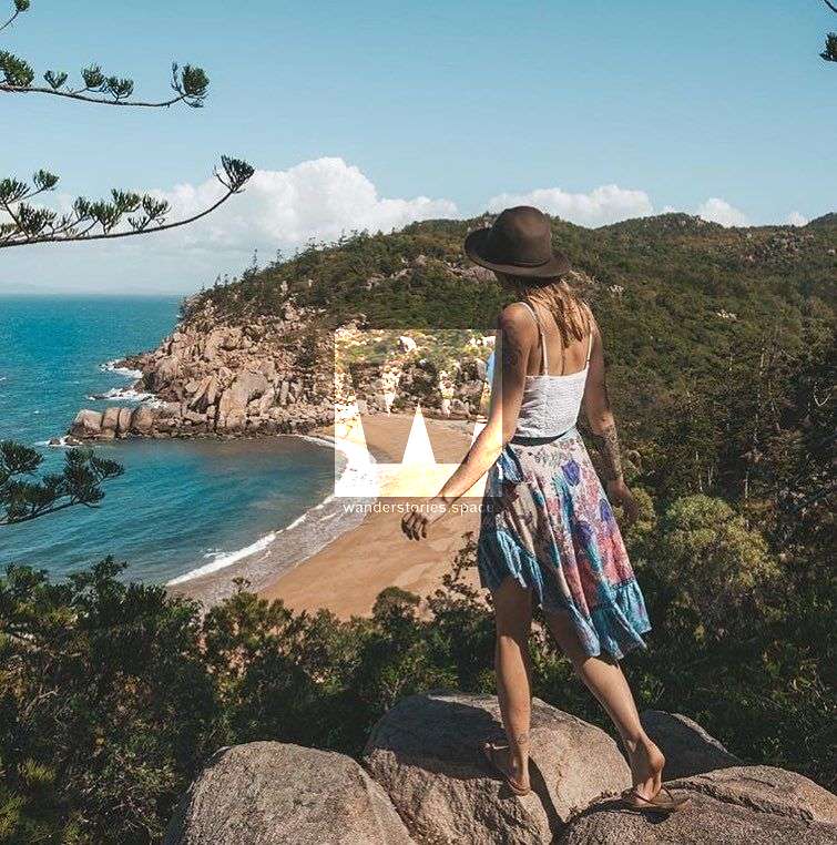
For several reasons, this is one of the most popular tracks on the island. The Forts Walk leads to the historical WWII fortifications and infrastructure. Lookouts along the way afford excellent views to the Palm Island Group in the north and Bowling Green Bay National Park in the south. The Forts Walk is also one of the best places to see koalas in the wild, often sleeping high up in eucalyptus trees. Listen for the male koalas, as their mating call is loud, and some believe they sound like lawnmowers.
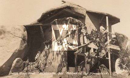
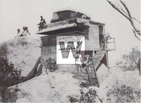
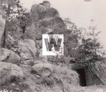
Access to the Forts Walk is via the car park and trailhead at the intersection of Horseshoe Bay Road and the turn-off to Radical Bay. The track ascends, sometimes steeply, to follow a ridge behind both bays. There are side trails that branch off the main track to some ruins. The track then passes the Ammunition Bunker and the two Gun Emplacements before arriving at the main fort complexes operated during World War II. There is also an unmaintained road from the Forts to Florence Bay. At the top, you will be rewarded with a spectacular 360-degree view.
Tracks to Arthur Bay, Florence Bay, and Radical Bay
Arthur Bay - 2 km return (30 min)
Florence Bay - 3.6 km return (1 hr)
Radical Bay - 6 km return (2 hrs)
Searchlight Tower - 3.7 km return (1 hr)
Horseshoe Bay via Radical Bay- 7.5 km one way (2 hrs)
Grade: easy
From the Forts Walk car park on Horseshoe Bay Road, follow a narrow, sealed, but poorly maintained road. Tracks from the Radical Bay Road reveal undeveloped bays that offer excellent swimming and snorkelling opportunities. Toilets are located at Florence Bay and Horseshoe Bay. Drinking water is not available. This is also called The Five Bays Walk (Arthur, Florence, Radical, Balding, Horseshoe Bays)
Arthur Bay Lookout Track
Distance: 100 m return
Time: 5 min return
Grade: easy
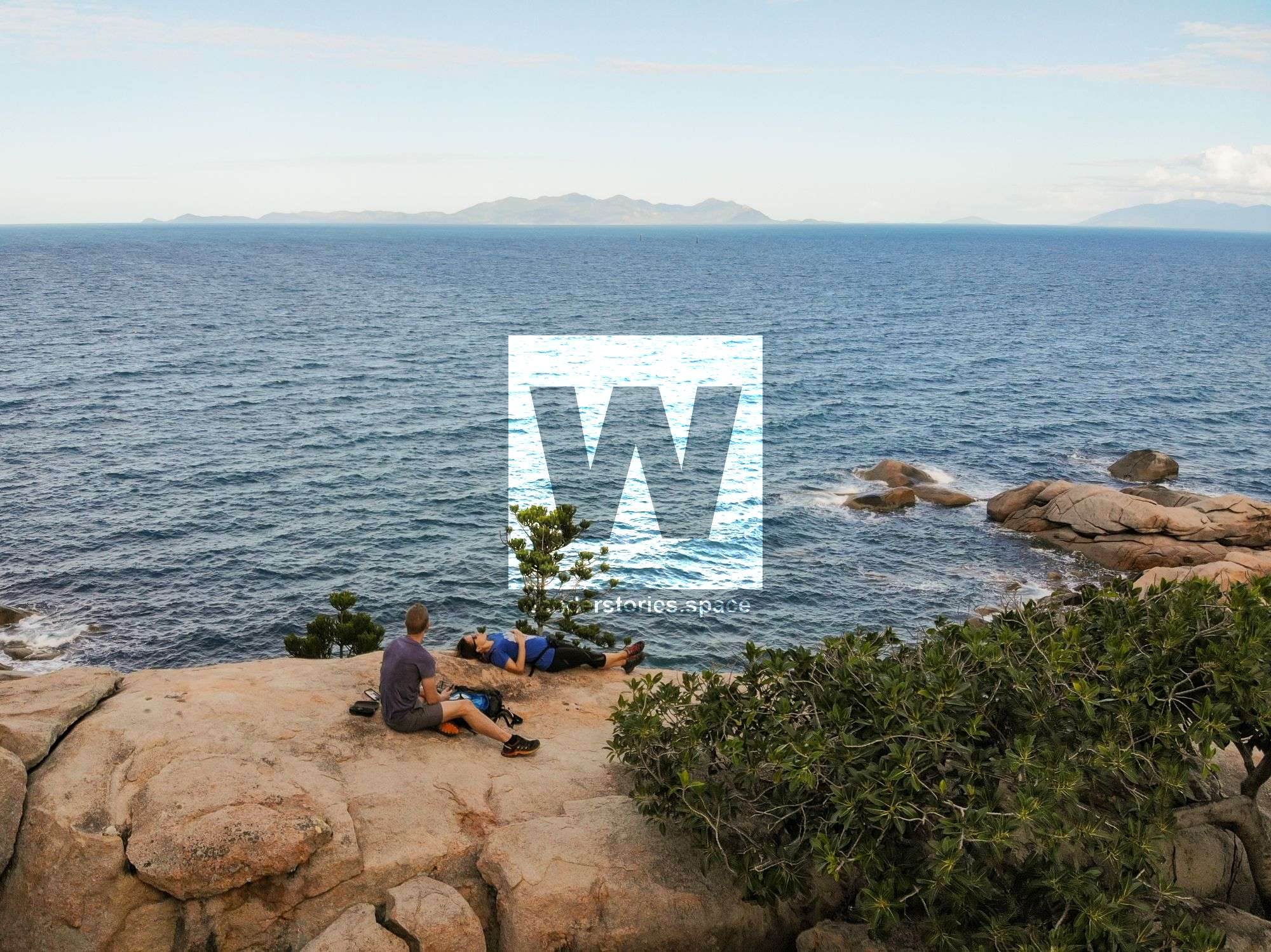
Starting on Radical Bay Road between Arthur Bay and Florence Bay, follow this short track to the popular viewpoint over Arthur Bay.

Searchlight Tower Track
Distance: 1.1 km return
Time: 30 min return
Grade: easy
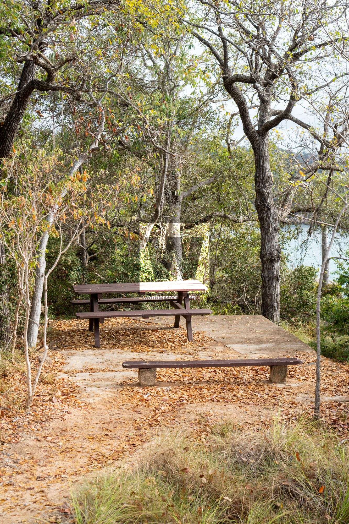
Starting on Radical Bay Road between Arthur Bay and Florence Bay, this track follows the ridge to the historical Searchlight Tower where you can climb to the top and be rewarded with views out to the ocean. There is also a picnic table under a shade tree, so consider bringing a lunch to enjoy.
Balding Bay and Radical Bay Track
Distance: 3.4 km return
Time: 1.5 hrs return
Grade: easy
Radical Bay can also be accessed via Horseshoe Bay. From the eastern end of Horseshoe Bay Beach, access to the start of the trail may be through shallow water at high tide. There is another track from Henry Lawson Street that goes behind some houses at the end of Horseshoe Bay to a bridge over the mangroves. By taking this route, you can avoid traversing the shallow water.
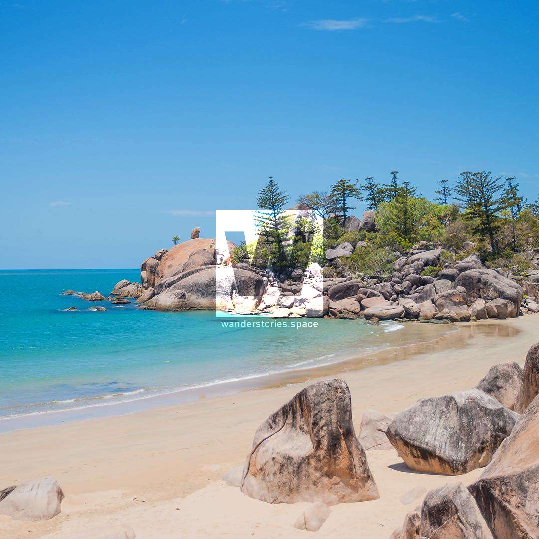
The track then climbs through a steep gully and forest to a ridge with open eucalyptus woodland. The left branch of the track leads down to the secluded Balding Bay. Continue from the turnoff to Balding Bay and over the ridge to Radical Bay. Radical Bay will greet you with its beautiful beach surrounded by hoop-pine and boulder-strewn headlands. There are no toilets or facilities here, and note that parts of the land behind the beach are privately owned. Please observe signs.
Balding Bay Track
Distance: 2.5 km return
Time: 1 hr return
Grade: easy
Continue from the Balding Bay and Radical Bay Track intersection down to Balding Bay. At Balding Bay, a picnic table under a she-oak tree is an ideal place to enjoy your packed lunch. Toilets are also available here; however, drinking water is not.
Horseshoe Bay Lagoon
Distance: 200 m return
Time: 15 min return
Grade: very easy
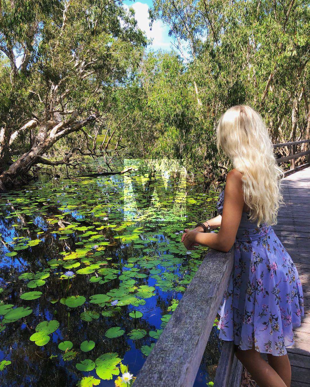
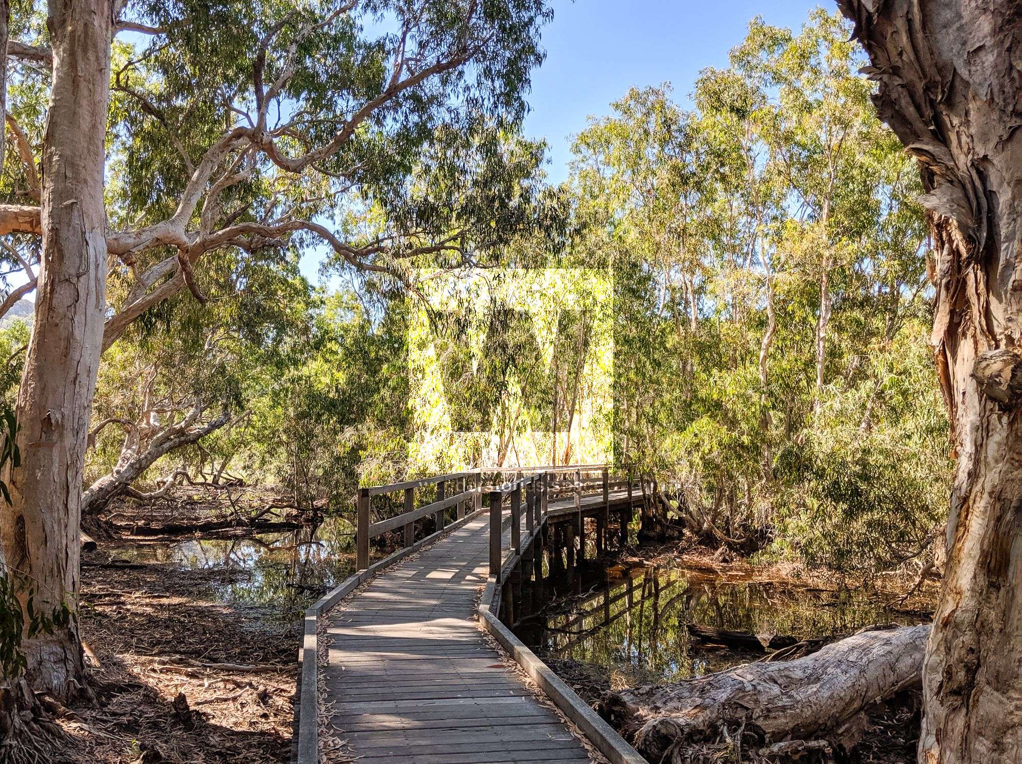
Horseshoe Bay Lagoon is a popular area for birdwatching. The track begins on Horseshoe Bay Road, about 200 metres from the beach. The trail then leads to a lagoon where a number of waterbirds can be spotted. Magpie geese nest in the bulkuru sedges, and the melaleuca woodland is ideal habitat for a number of woodland species.
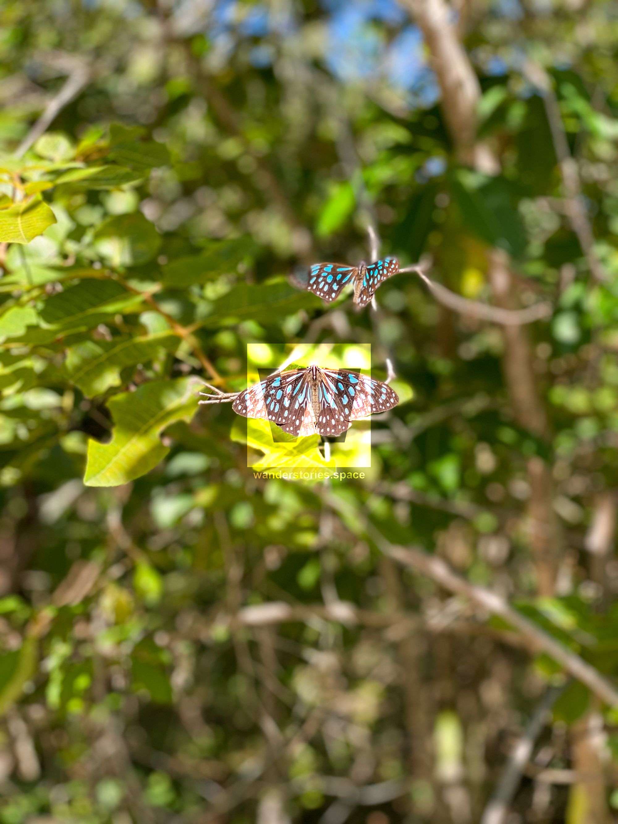
Butterfly Forest Walk
Distance: 200 m return
Time: 15 min return
Grade: very easy
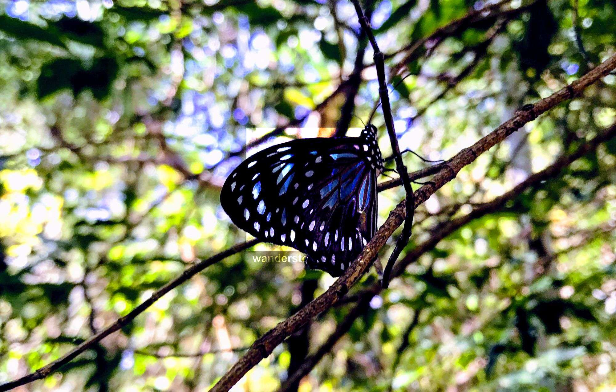
The Butterfly Forest Walk is a hidden track that is filled with hundreds of thousands of blue monarch butterflies. The track begins just beside the Bungalow Bay Koala Park where you'll see a butterfly drawing etched into the side of one of the gumtrees. This short walk is magical in the cooler months. Visit between April and September in the mid-afternoon and be captivated as the butterflies fill the air around you. Please walk slowly and quietly through this walk if it is butterfly breeding season (June-July).
Picnic Bay to West Point
Distance: 16 km return
Time: 5 hrs return
Grade: very easy
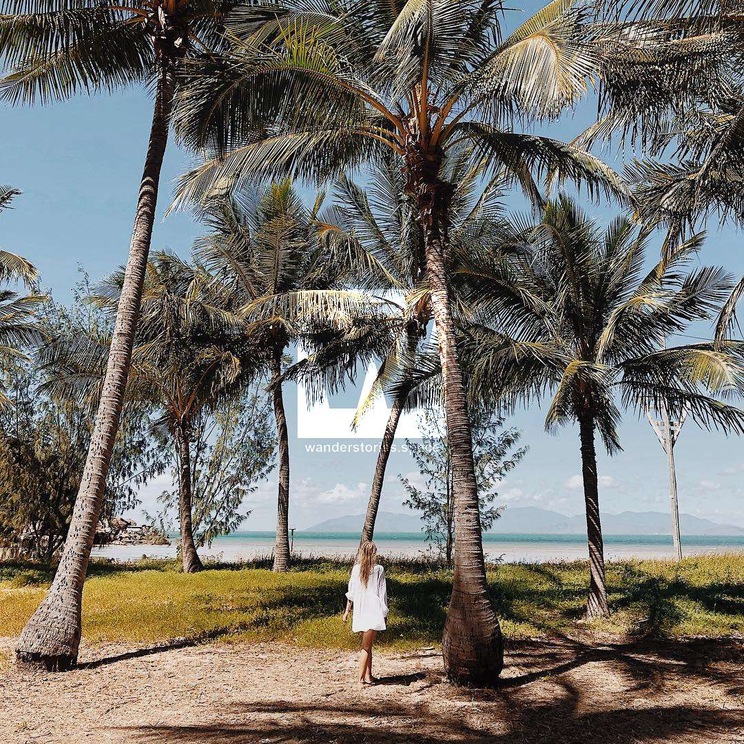
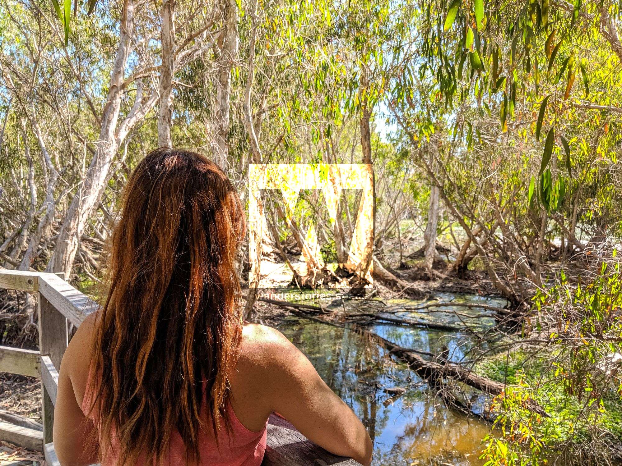
This walk follows an unsealed road that links the bays on the western side of the island. The track starts at Yule Street near the golf course, passing a tidal wetland, mangroves, paperbark swamps, and savanna grasslands. This may be one of the least popular walks, but on the way to West Point, you can access Cockle Bay and, at low tide, the wreck is completely exposed on the mudflats which means you can walk out to the SS City of Adelaide shipwreck. However, it's a nesting site for many birds, so it is best to enjoy the sight from afar.
Interactive Map
See also National Parks Map
Things to remember
- Wear appropriate shoes and sun protection (e.g., hat and sunscreen)
- Bring adequate drinking water. Drinking water is not available on these walks and must be carried with you. A good estimate is a minimum of 3 litres per person per day.
- Be cautious around cliff edges and the defence ruins.
- Be aware of unstable boulders.

This article, and all other articles, are for entertainment purposes only and are not to be used as a guide. Please see our Disclaimer for more information.