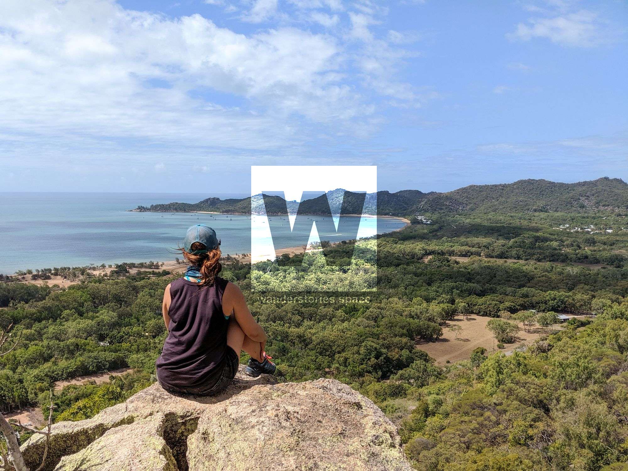
Bushwalking on Magnetic Island
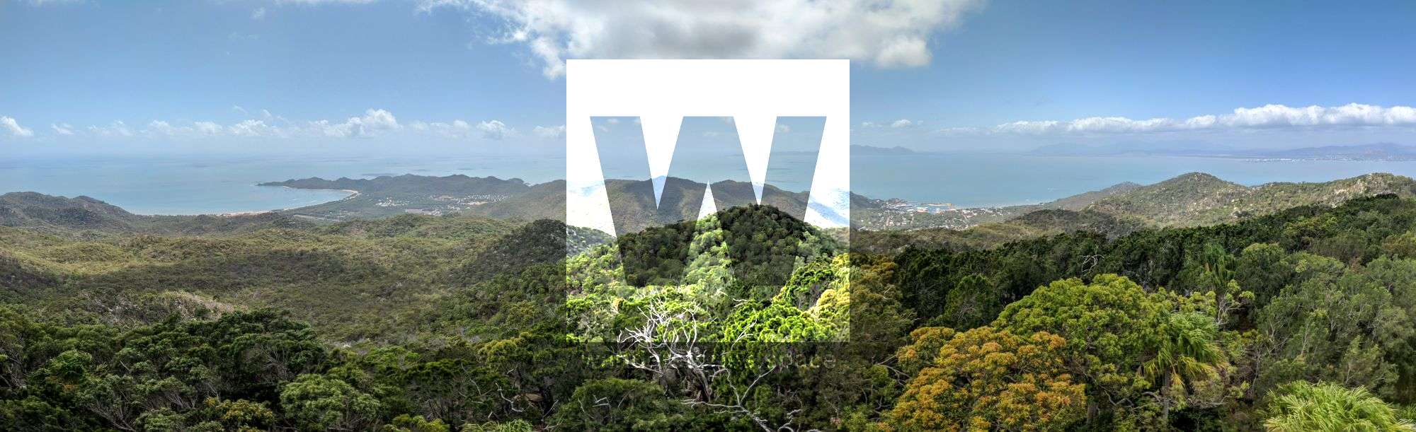
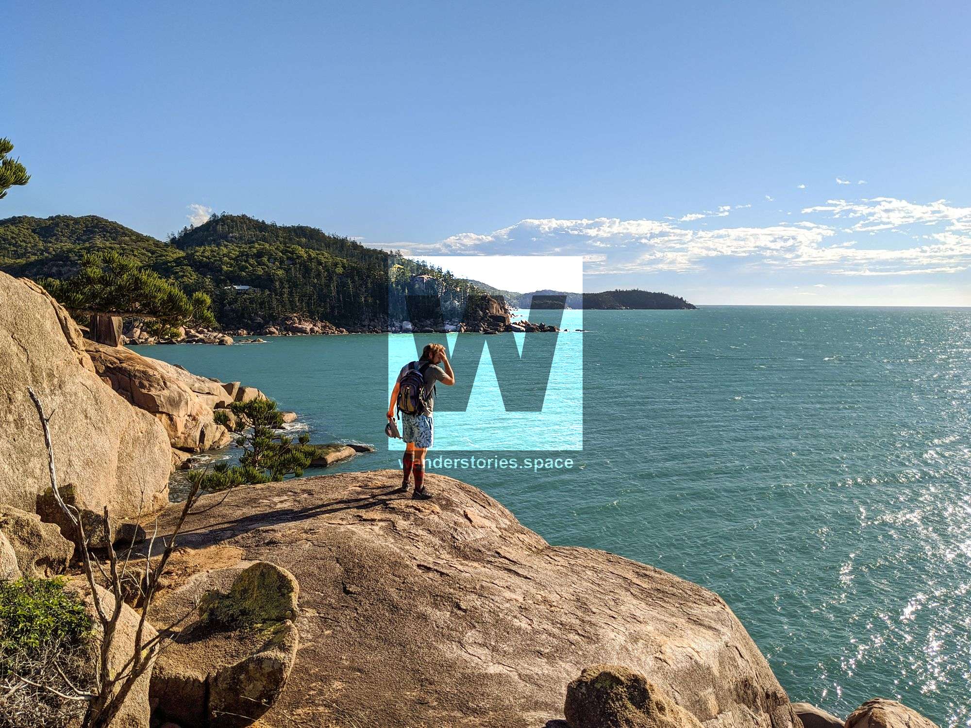
Magnetic Island is a true gem for the explorer, boulder, and/or coasteer. Most of the island is covered in large granite boulders mixed in with the bushland and pine trees. Locals have been roaming these hills exploring their backyard for decades and Aboriginals before that for thousands of years.

Location - Magnetic Island National Park, North Queensland, Australia
Magnetic Island is a true gem for the explorer, boulderer, and/or coasteerer. Most of the island is covered in large granite boulders mixed in with the bushland and pine trees. Locals have been roaming these hills exploring their backyard for decades and Aboriginals before that for thousands of years. Rock art and artefacts from Aborigines, concrete structures from the WWII era, and evidence of previous explorers can be seen all over this island. One thing you may notice is that navigational rock cairns are prevalent on the island and helped locals navigate to these favourites. There are also several on-track walking trails around the island.
Magnetic island is also home to the largest population of koalas in northern Australia. Koalas are quiet, keep to themselves and like to hang out in the eucalyptus trees. Keep looking up in the trees and remember, if you do see them, they are quite shy so give them some space and admire them from afar.
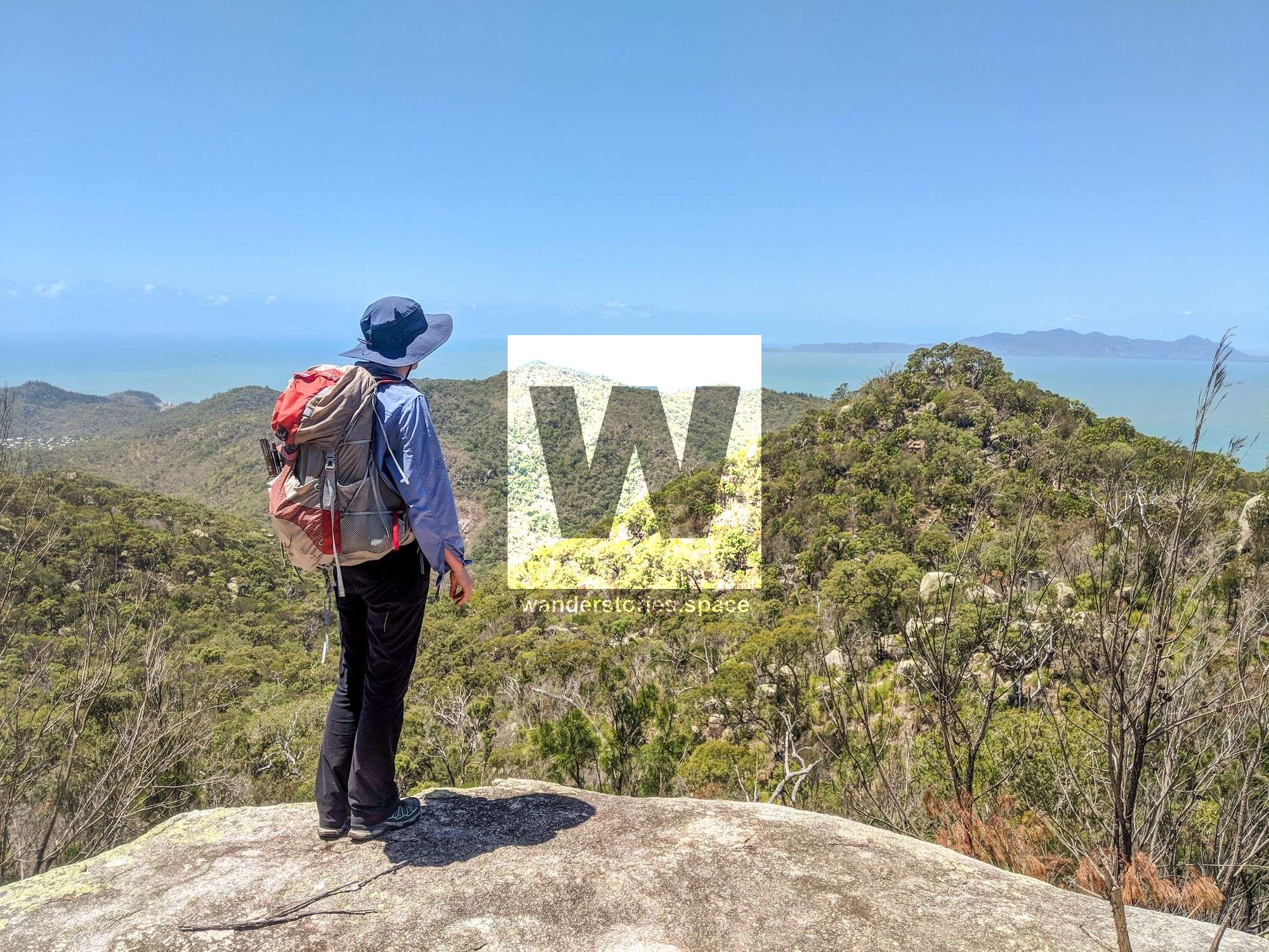
OFF-TRACK HIKES
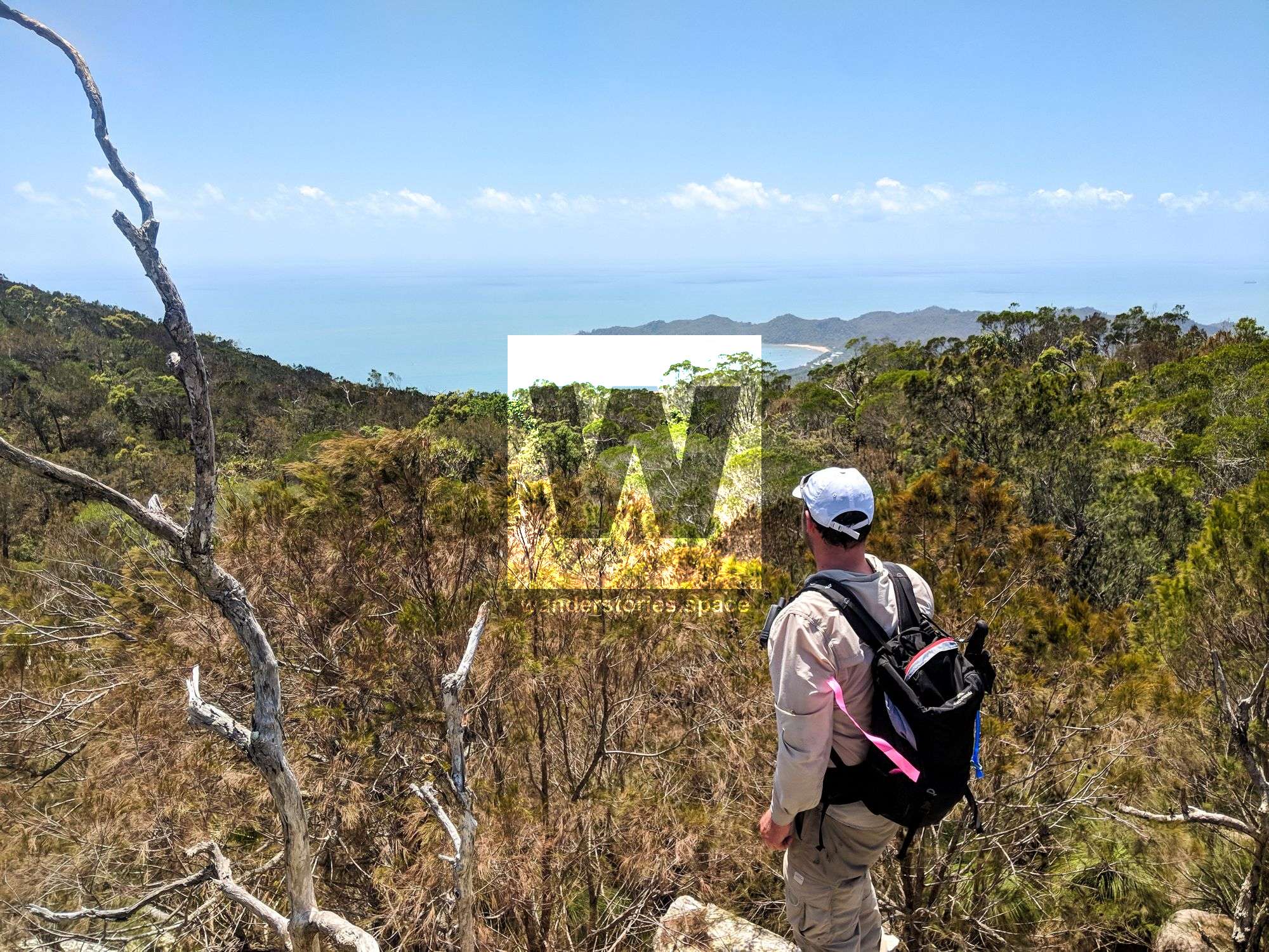
Here's a list of off-track expeditions you can do with your friends:
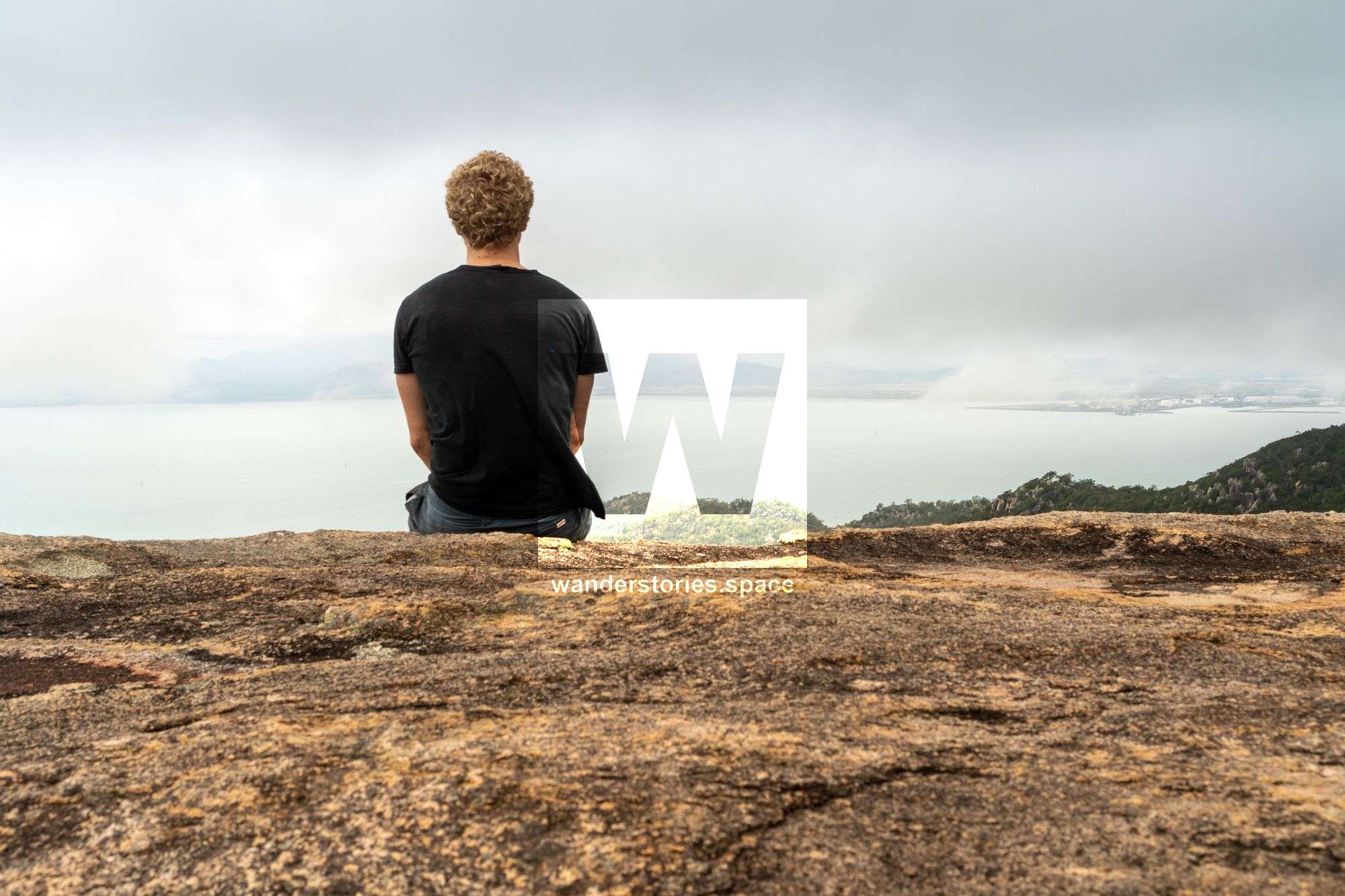
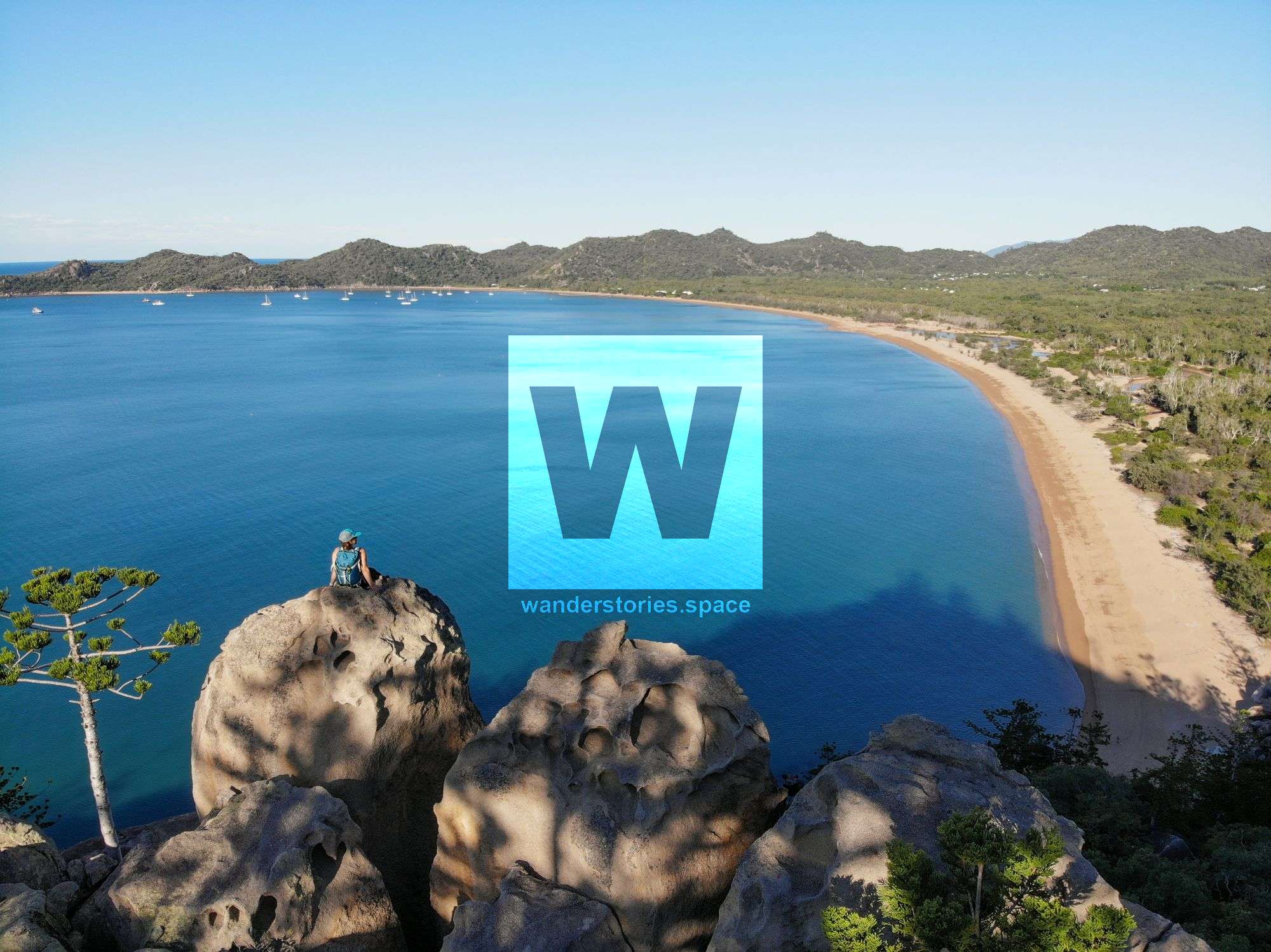
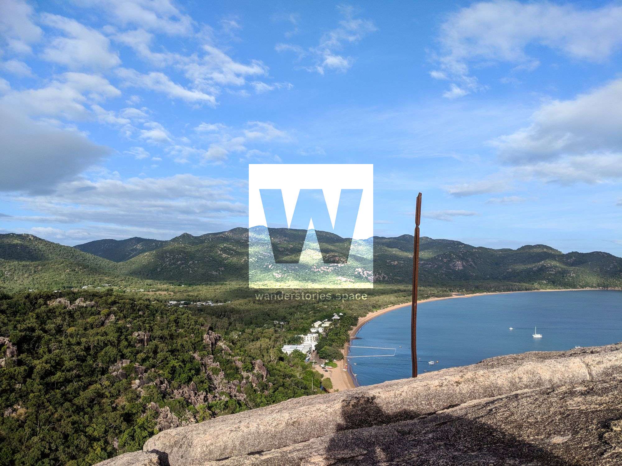
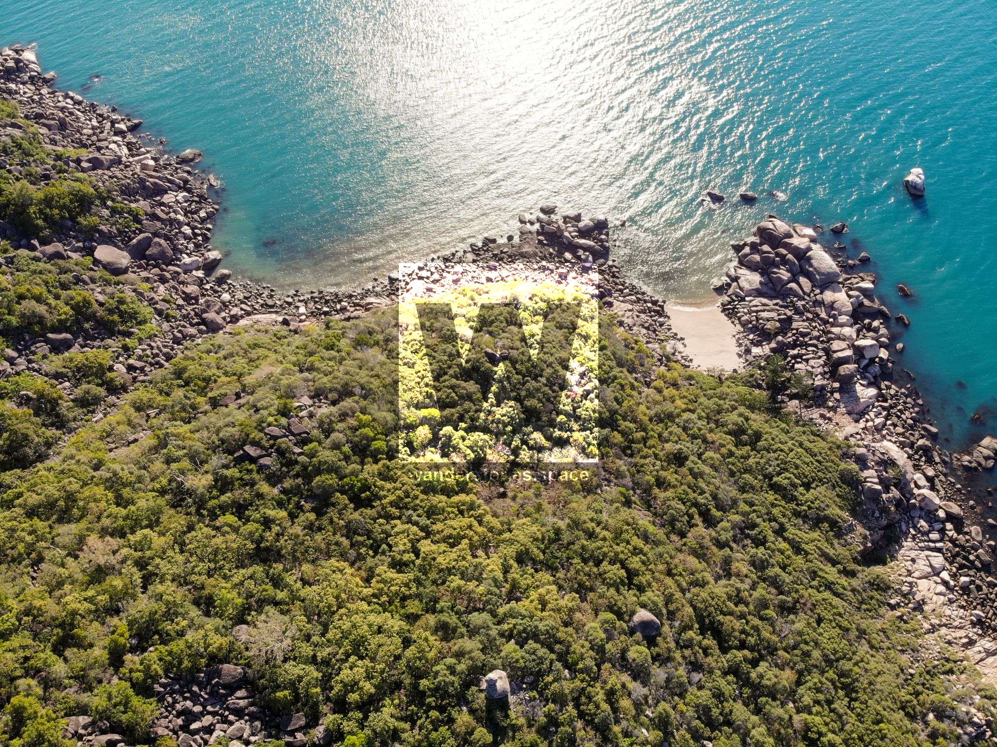
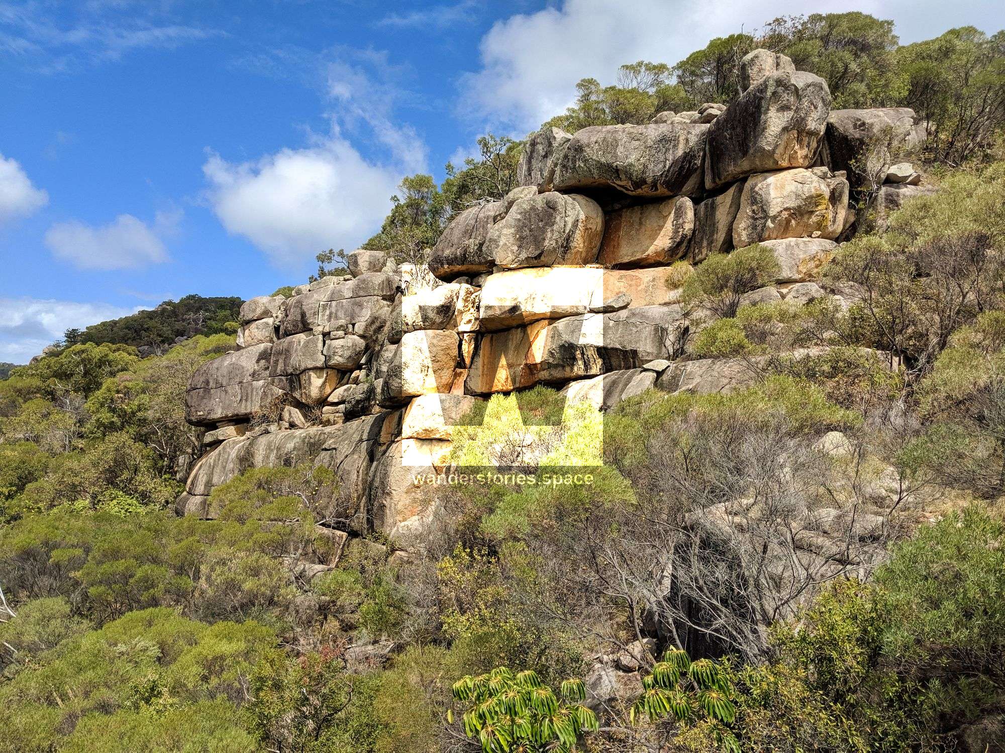
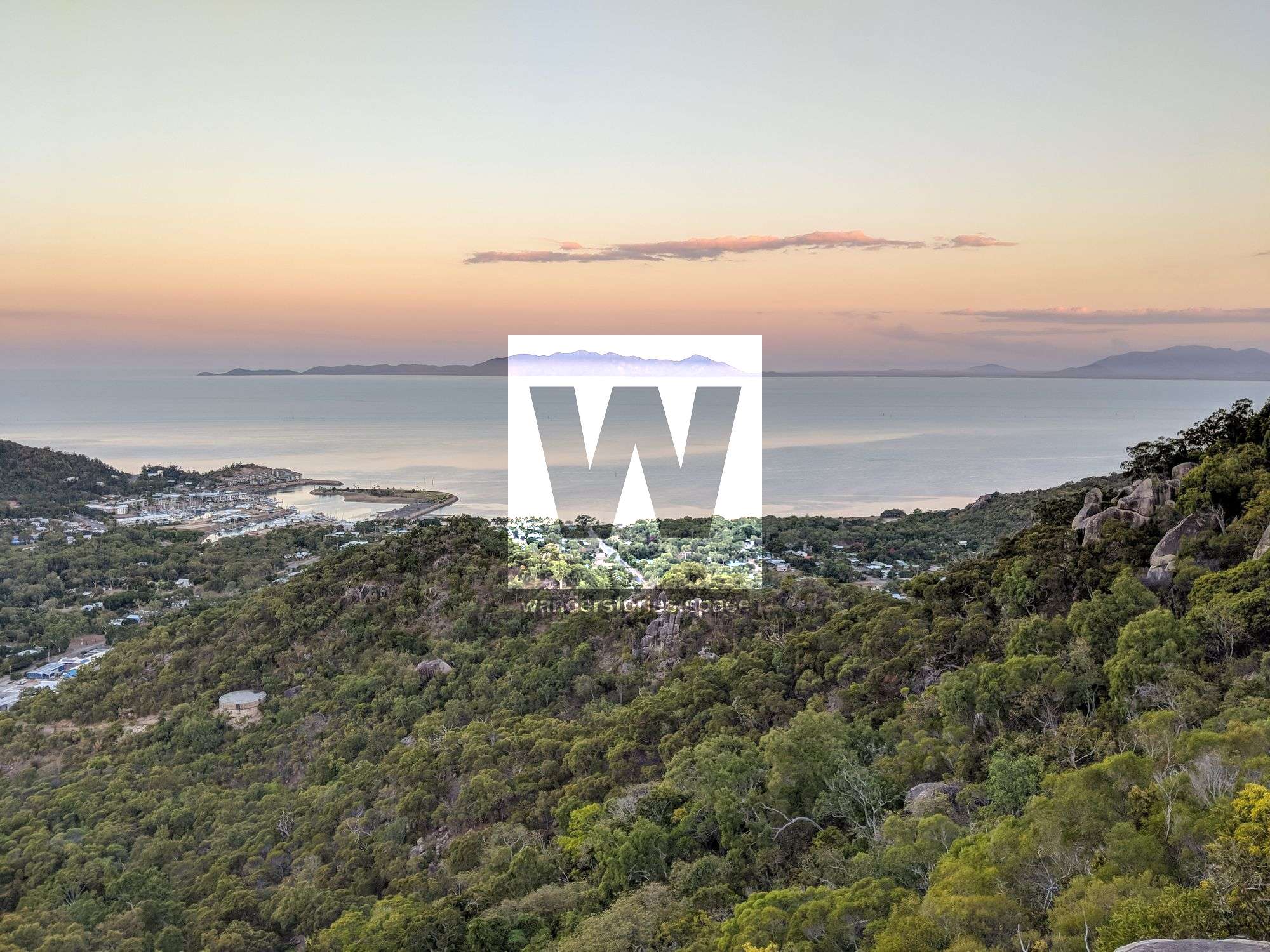
Pride Rock view across Nelly Bay to Horseshoe Bay
Pride Rock, Nelly Bay
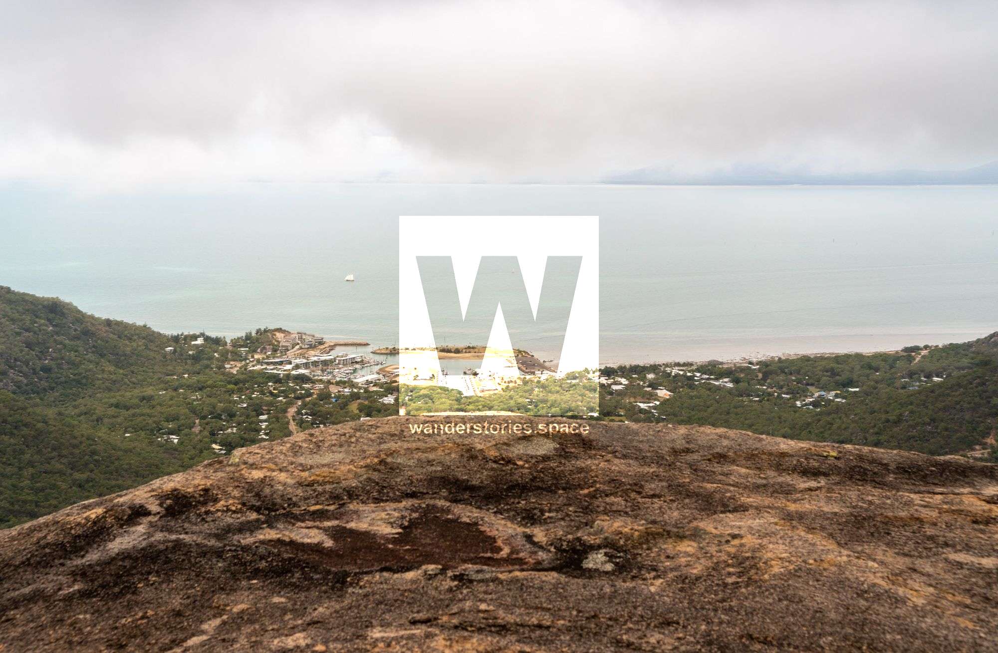
Pride Rock was found by looking at aerial imagery of the surprisingly flat rock feature. The 'Lion King'-styled rock protrudes out into the open air providing the adventurer with a spectacular view of Nelly Bay. There is also a granite slab next to the rock and from this angle, Pride Rock looks like a fish eating a smaller fish with an underbite. The best track up to this is via Kelly Street.
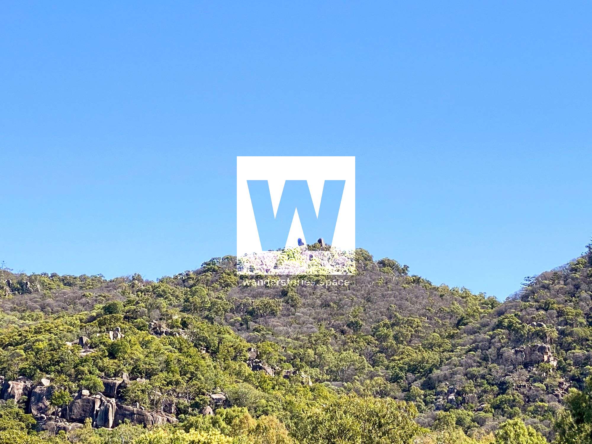
The Pinnacles with views over Horseshoes Bay and Nelly Bay
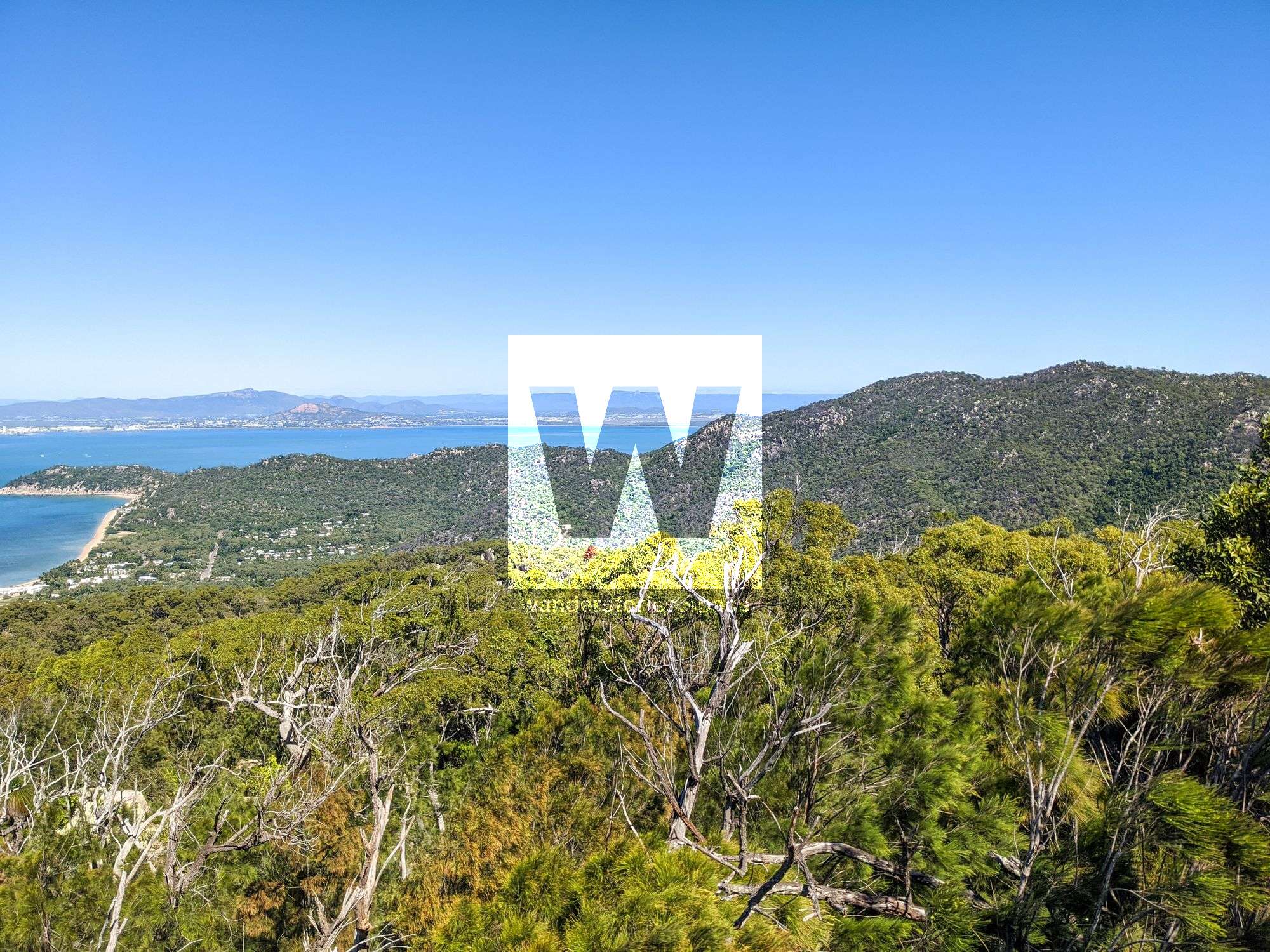
Mount Arua, Nelly Bay
These rock formations are shown as 'Pinnacles' on some topographic maps and is locally known as Mt Arua. It is best accessed via Gustav Creek (alternatively via the boulder field behind the resort, locally known as Rockslides Creek). An old fireplace can be seen at the summit of Mt Arua and it makes for a perfect flat campsite overlooking Nelly Bay. This is also a popular route to take to the summit of Mount Cook, the highest mountain on Magnetic Island.
Mount Cook and The Totem Pole
There are many routes to the summit of Mount Cook all of which are documented in the article - Gustav Creek, Duck Creek. The Totem Pole is just down from the summit and is often missed. Also, see the memorial plaque.
Mount Paluma
There is a historic, overgrown track to Mount Paluma. This summit provides views across the landscape and makes for a perfect place to enjoy lunch in the shade and breeze while taking in the views.
Devils Arch
Just around from Fish Cove is a small headland known as Devils Arch. It's a short walk but the views are quite nice atop the large rock formation out on the point.
Whitfield Cove
Whitfield Cove is the bay just north of Alma Bay. There are no tracks out to this cove but it's a short walk. The bay is covered in rocks.
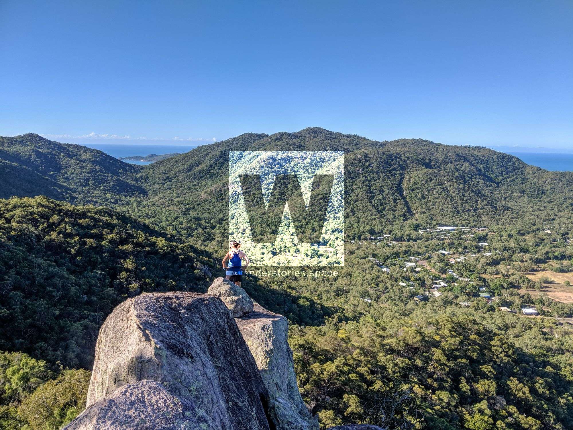
Ridgeline / Water Tank Loop, Nelly Bay
Nearby is also a loop that traverses the ridgeline behind the houses and down near the water tank.
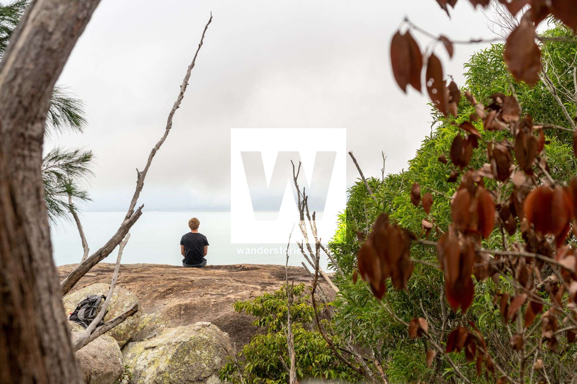
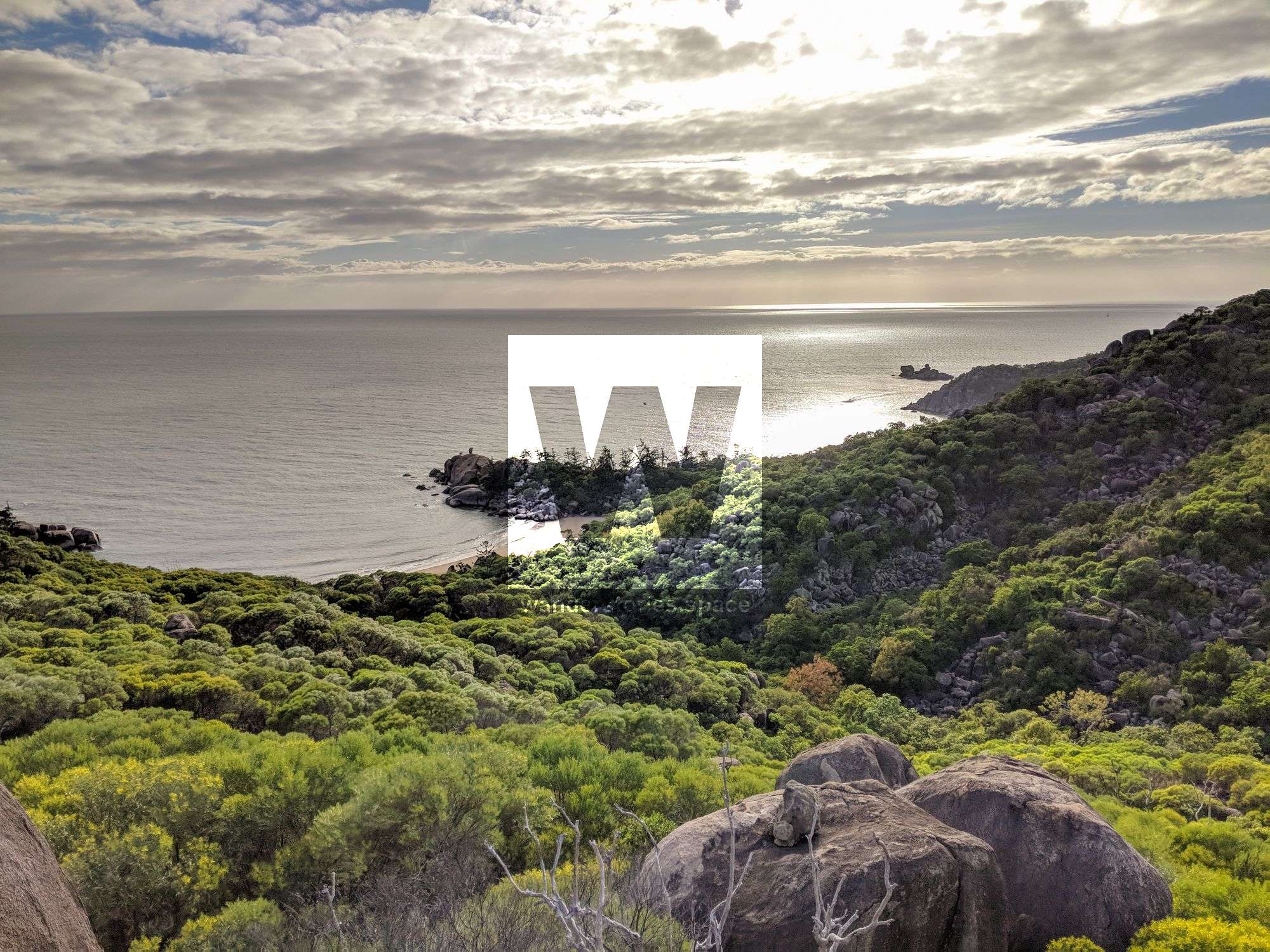
Secluded Beaches

There are several small, secret, secluded beaches on the island that take a bit of rock hopping or bushwalking to get to. You'll need to scramble some big rocks and balance as you traverse across. However, once you arrive, you'll have a secluded spot that's perfect for snorkelling or just enjoying the bay in complete isolation.
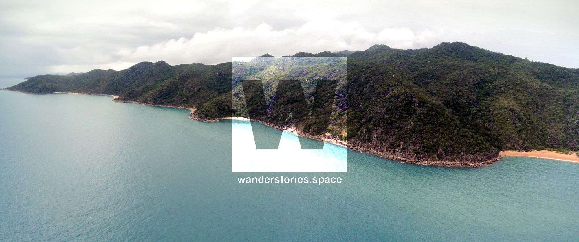
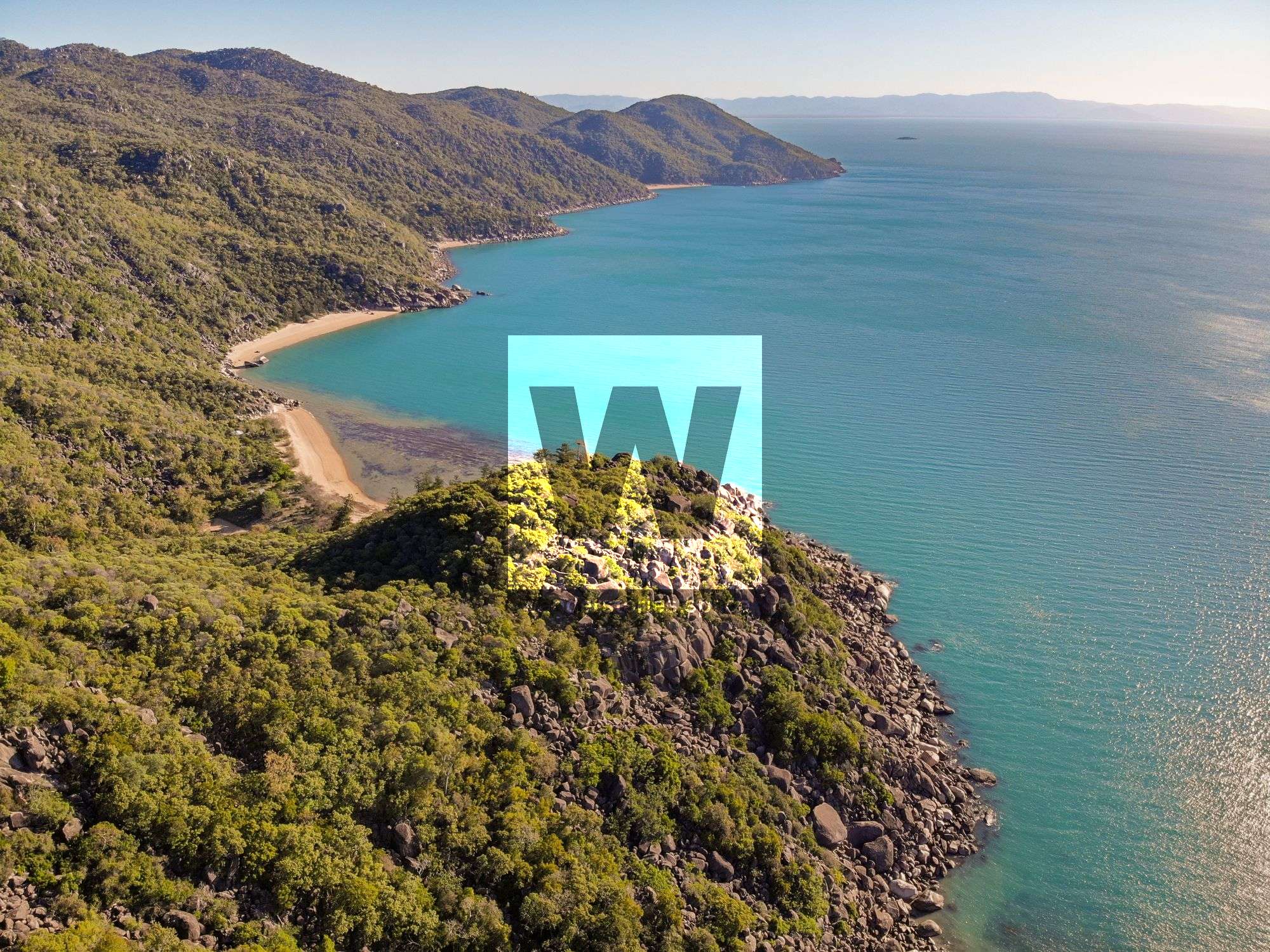
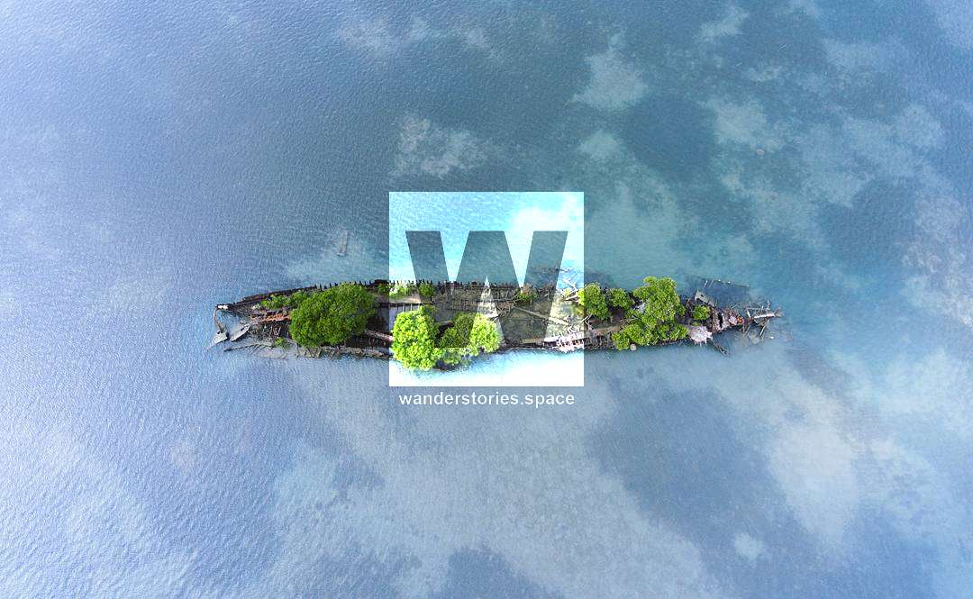
Arthur Bay: It might not be immediately obvious but Arthur Bay has its own hidden sandy bay on the northern end (left-hand side as you look out to the ocean). You will be able to reach this secluded beach in 15 minutes. Keep an eye out for the Platypus Dredge shipwreck.
Florence Bay: Likewise, if you walk around the rocks on the southern end (right side of the bay as you look out to the ocean) of Florence Bay, you will reach Smugglers Cove within about 20 minutes.
The interesting thing is that both beaches are almost in line with each other and also back onto the Searchlight Tower Walk so you can make it into a loop if you choose to do so.
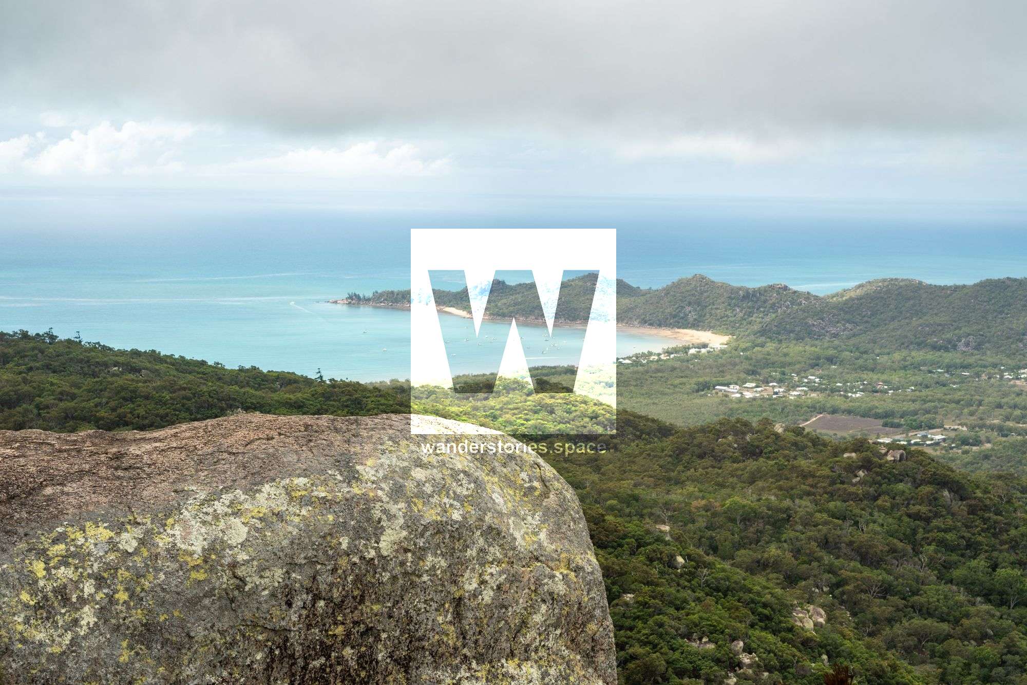
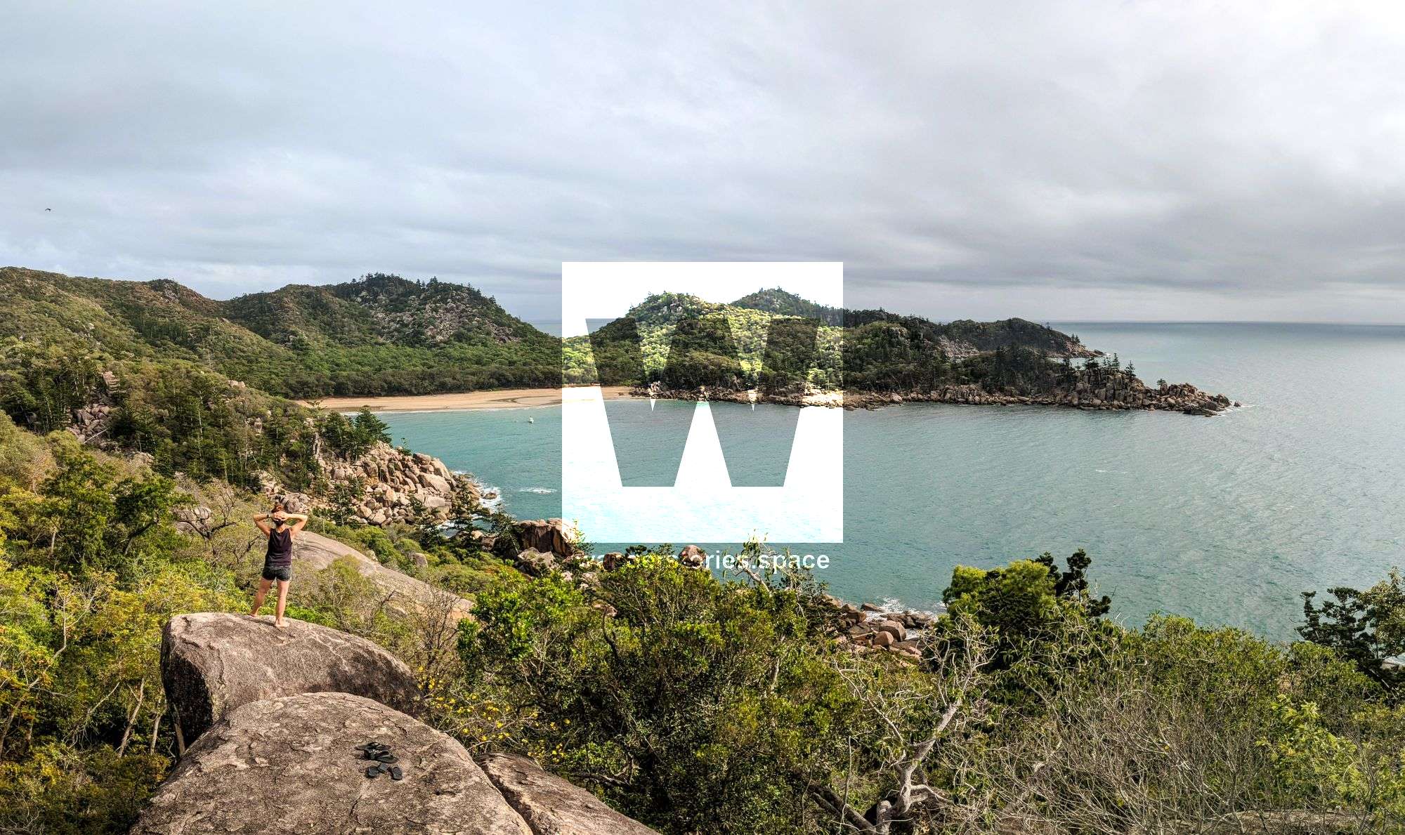
Split Rock views across Horseshoe Bay
Split Rock, Horseshoe Bay
Locally known by the small Magnetic Island community, this rock features a beautiful lookout onto Horseshoe Bay. There is also a cave-like structure on the way which has a fireplace. Apparently, someone live here once. Locals have left camping gear here for impromptu use and now it's known as The Shelter. Once at the top of Split Rock, wander down left and around to the base to see the room-like feature.
Jack and Jill (or Bugs Bunny's ears)
Jack and Jill, Horseshoe Bay
Some say this looking like Bugs Bunny's ears but is known by the local bushwalkers as 'Jack and Jill', an apt name for the peak. Follow the blue tape up from the water tank. The blue tape leads you to the creek bed where you walk up to you see the rock cairn and go straight up the hill from there.
The Labyrinth and The Pyramid
The Labyrinth and The Pyramid, Horseshoe Bay
There is a fireplace in one of these caves just down from The Labyrinth. The Labyrinth, itself is a maze of passages that take you on a three-dimensional exploration. Continue up the hill and along the ridge. Soon you'll find a large granite outcrop providing views across the bays, out to the ocean, and to the forts. This rock looks like a pyramid from certain angles, hence the name.
Picket Peak, Horseshoe Bay
Nicknamed after the rusty picket lodged into the crack on the peak. This peak provides views of Horseshoe Bay across to Balding Bay and Radical Bay. Starting along the Horseshoe Bay to Radical Bay Track and ascend the ridgeline where you see a break in the vegetation.
Dragon's Back, Horseshoe Bay
Locals call the ridgeline between Horseshoe Bay and Balding Bay 'The Dragon'. The head is the furthest lump to the left with its nose in the water – use your imagination. The large granite boulder and cliff face, you can see when on Horseshoe Bay, is the Dragon's Back. Kayak from Horseshoe Bay out to the next beach (White Lady Bay) and then ascend the gully to the right of the rock before coming up the backside.
Eagle's Rock, Balding Bay to Radical Bay
One of the most popular off-track walks on the island. This egg-shaped rock is on the point between Balding Bay and Radical Bay. There's an eagle's nest on top of this rock.
Five Beach Bay
Lovers Bay, Maud Bay, Norris Bay, Joyce Bay
Visit a secluded section of beautiful and picturesque Magnetic Island.
Usually visited by boat however you can also SUP or hike from Horseshoe Bay.
Lovers, Maud, Norris, and Joyce Bays are secluded and rarely visited bays by foot.
Note that Lovers Bay and Joyce Bay are harder to access and best accessed via SUPs or Kayaks.
Maud and Norris Bays (left), Lovers Bay (right)
Huntingfield Bay
Huntingfield Bay is a 500 metre long secluded, not often visited by foot.
The bay can be accessed via Retreat Creek. Enjoy Huntingfield Bay before heading back. Huntingfield Bay is also accessible from Horseshoe Bay via Endeavour Creek or rock hopping around the bays albeit longer.
Rollingstone Bay, West Point
Hike to Rollingstone Bay by one of the larger valleys of Magnetic Island on the western side. Access from West Point Road.

#ThatMaggieTree, West Point
The Maggie Tree can be seen from the mainland and is the most prominent tree on the island.
Cockle Bay Shipwreck
The SS City of Adelaide sunk in 1863 and is located in Cockle Bay on the southern tip of Magnetic Island. The bay is extremely shallow resulting in the bay emptying of water during low tide. During low tide, you can walk to the shipwreck without imposing on the privacy of people holidaying in the Blue House. If the tide is in, please be mindful that the Blue House is private property.
Gowrie Bay
You can either just bushwalk out to this hidden bay from the road or for a longer trip, try rock-hopping from Radical Bay to Florence Bay. Gowrie Bay is a rocky, pebble beach with no sand but you're guaranteed to have it to yourself.
Bremmer Point
Bremmer Point
This 45 min - 1.5 hours rock hop around the point from Geoffrey Bay to Alma Bay. You pass the old shark net which was damaged in a 1970s cyclone.
Hawking Point
Can do a loop via Hawking Point Lookout Track and rock hop back along the coast. But it's easiest done by kayaking.
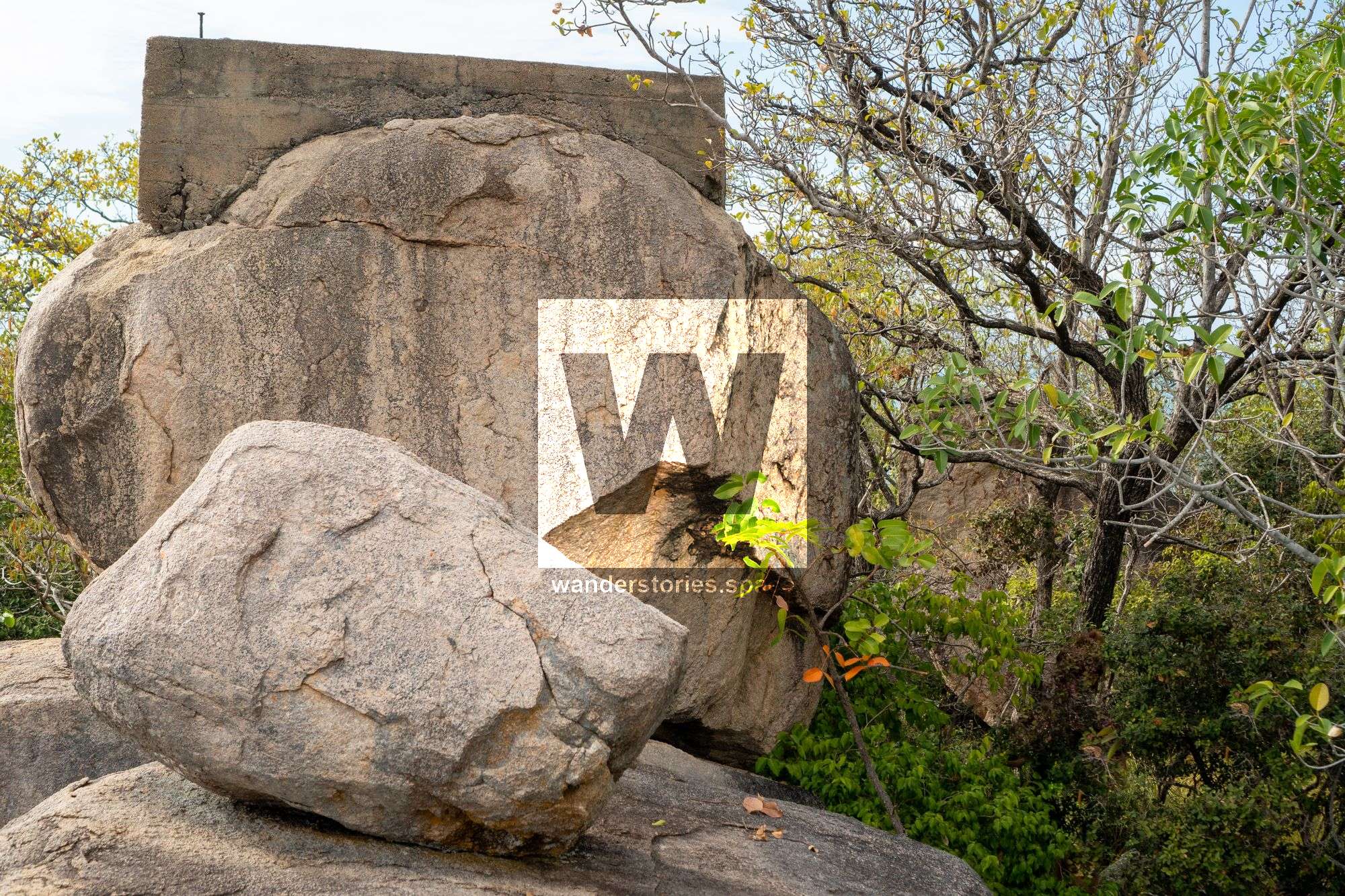
Old World War II Structures
There are several structures across the island. This is structure is just off the beaten track, about 100 meters from the searchlight tower, and is often missed because it is well hidden. It provides one of the best views of Florence Bay. The Searchlight tower track (540 metres - 15 minutes) starts midway along the Radical Bay Road. The start of the track, marked by a National Parks symbol sign, is on the crest of the road before it reached Florence Bay. The World War II searchlight tower overlooks Florence Bay.
Likewise 'The Point', from Horseshoe Bay to Balding Bay, seemingly has an old concrete platform.
West Point
The true west point of the island requires a rock hop.
Liver Point
Is best accessed by kayak or boat and is the only place to offer deep water soloing on the island.
Seasonal Waterfalls and creeks
After heavy rain, Magnetic Island creeks swell and water rushes down the valleys creating some pretty falls and small pools.
Other place names
Nobby Head, Gorge Creek, Chinaman Gully, Cockle Creek
The Hidden Treasure
There is also a local wives tale (rumour) about hidden treasure laying underneath a prominent rock feature on the island.
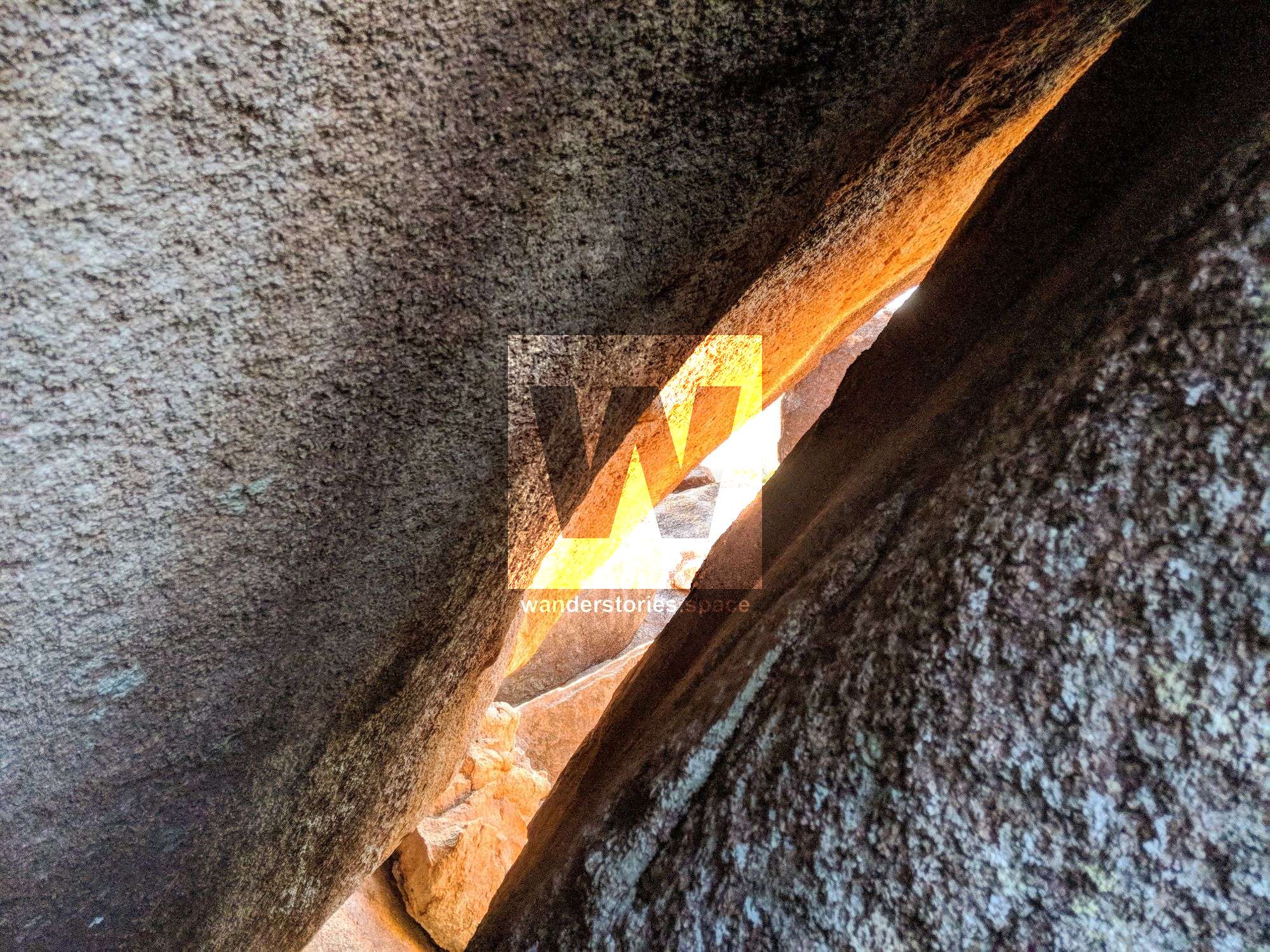
Endeavour Cave
Situated in Endeavour Creek is a granite boulder system, Endeavour Cave. See the Endeavour Cave topo.
Interactive Map
What you need
- 3 litres of water
- Long pants and shirt (Dri-Fit preferred)
- Sun protection: sunscreen, hat, long-sleeved clothing
- Lunch, snacks, and electrolytes (if required)
- Camera
- First Aid Kit
- Insect repellent
- Headlamp and spare batteries (just in case)
Notes
- Camping permits for Magnetic Island National Park are unobtainable from QPWS.
- Please note that dogs and other domestic pets are not allowed in Magnetic Island National Park.
Geology / Rock Formations
The rock formations on Magnetic Island display some excellent examples of igneous and sedimentary formations and interactions between the two.
Intrusive igneous rocks are formed from magma that cools and solidifies within the crust of a planet. Surrounded by pre-existing rock (called country rock), the magma cools slowly, and as a result, these rocks are coarse-grained. The mineral grains in such rocks can generally be identified with the naked eye. Intrusive rocks can also be classified according to the shape and size of the intrusive body and its relation to the other formations into which it intrudes. Typical intrusive formations are batholiths, stocks, laccoliths, sills and dikes.
The central cores of major mountain ranges consist of intrusive igneous rocks, usually granite. When exposed by erosion, these cores (called batholiths) may occupy huge areas of the Earth's surface.
The core of Mount Cook and the majority of Magnetic Island features are intrusive igneous rocks from the Permian Period 280 - 250 million years ago.
It is clear that the core rock (igneous granite) that Magnetic Island is made of was formed deep in the Earth's crust between 280 and 250 million years ago. For it to appear as an Island now, it must have been raised to the surface in massive movements in the Earth's crust, and for the granite to be exposed in places, vast amounts of material would have had to be eroded away through wind and rain.
Over the course of the past 150,000 years, the East Coast of Australia has been up to 300 km further East than it currently is, and as far west as High Range and Mingela Range due to changes in sea level.
This article, and all other articles, are for entertainment purposes only and are not to be used as a guide. Please see our Disclaimer for more information.