Mount Cook, Magnetic Island
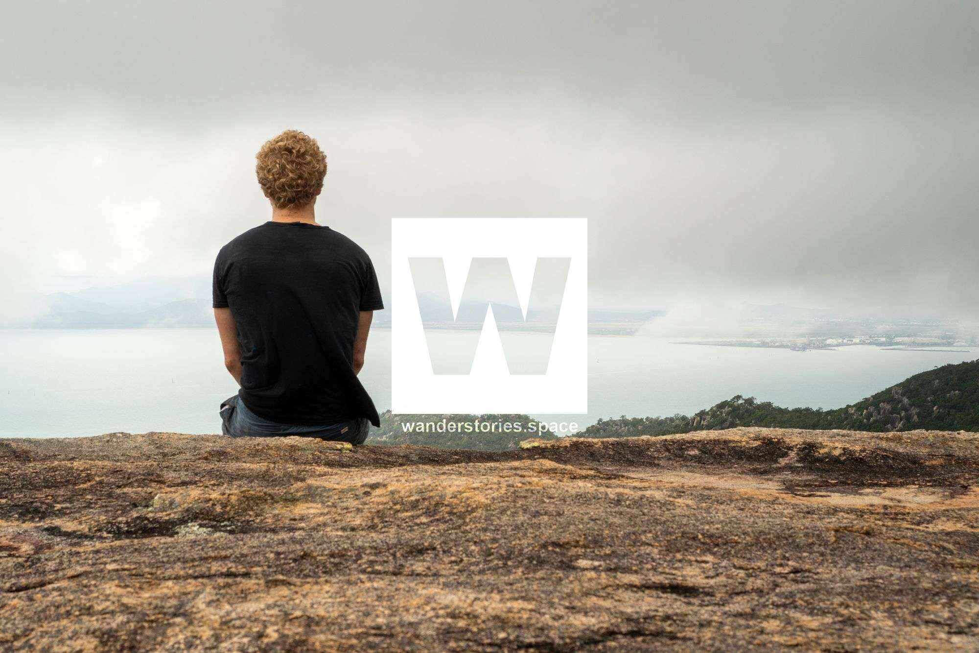
Just 8 km off the coast from Townsville lies Magnetic Island. Mount Cook is the highest point on the island. There are several routes, however, Duck Creek is the easiest route which follows the creek all the way to the summit.

Location - Magnetic Island National Park, North Queensland, Australia
Duration - Allow 8-10 hours depending on route
Distance - depending on route taken
Grade - 5, difficult
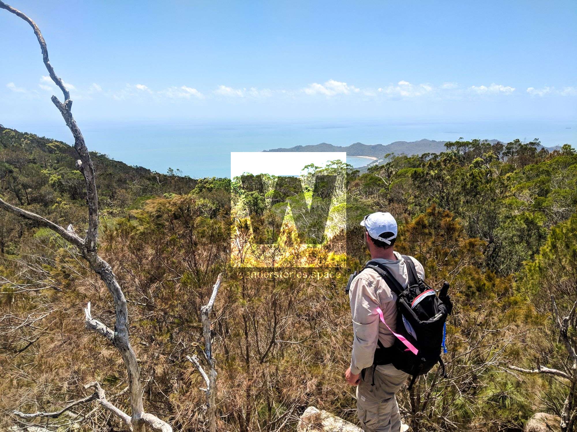
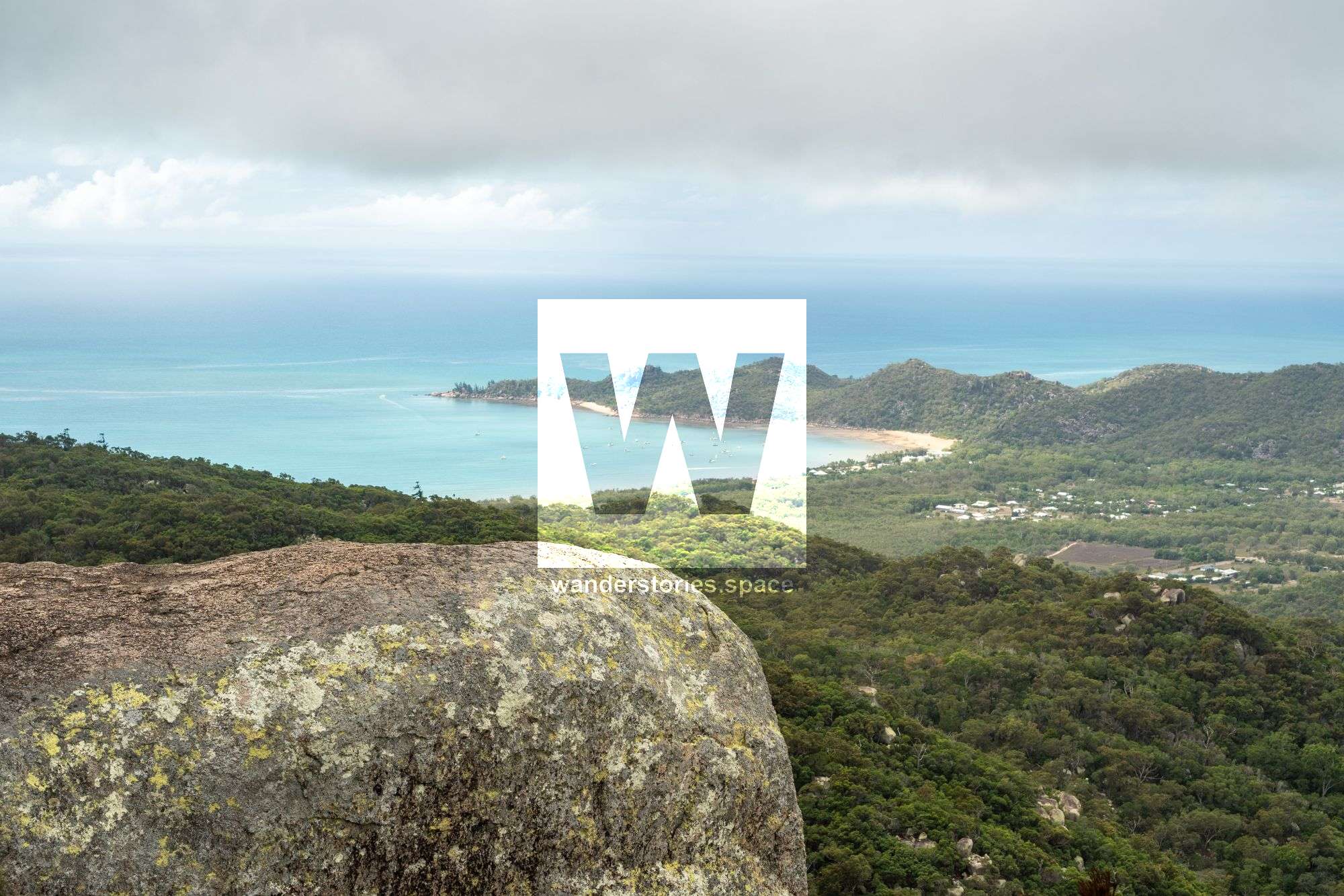
Just eight kilometres off the coast of Townsville lies Magnetic Island - often referred to as 'Maggie' by the Townsville locals. Magnetic Island is a mountainous, thickly-wooded, 5,184-hectare land mass which approximately 40 kilometres of coastline that includes at least 23 bays and beaches. This small island is only 11 kilometres at its widest point, but experiences over 300 days of sunshine per year, and offers visitors 24 kilometres of walking tracks and the iconic Mt Cook, which rises 493 metres above sea level.
There many things to cover in this article, so here are some quick links to sections of this article:
What to do at the summit, The Routes, Duck Creek, Endeavour Creek, Gustav Creek, Rockslides Creek, Goat Track, Endeavour Cave, Interactive Map.
The eastern side of the island has four small settlements - Horseshoe Bay, which is the island's major residential area, Arcadia, Nelly Bay, and Picnic Bay. Some 2,533 hectares of the central core and western side of the island are now national park. Mount Cook is the highest point on the island and the site of a Royal Australian Air Force obstruction beacon and helicopter landing pad.
Magnetic Island was first discovered by Captain James Cook who named it as such because he believed that the ores on the island had affected his compass. Cook's concerns seem to have been unjustified, however, as subsequent tests have shown no magnetising qualities in the island's predominantly granite boulders.

From Sea to Summit
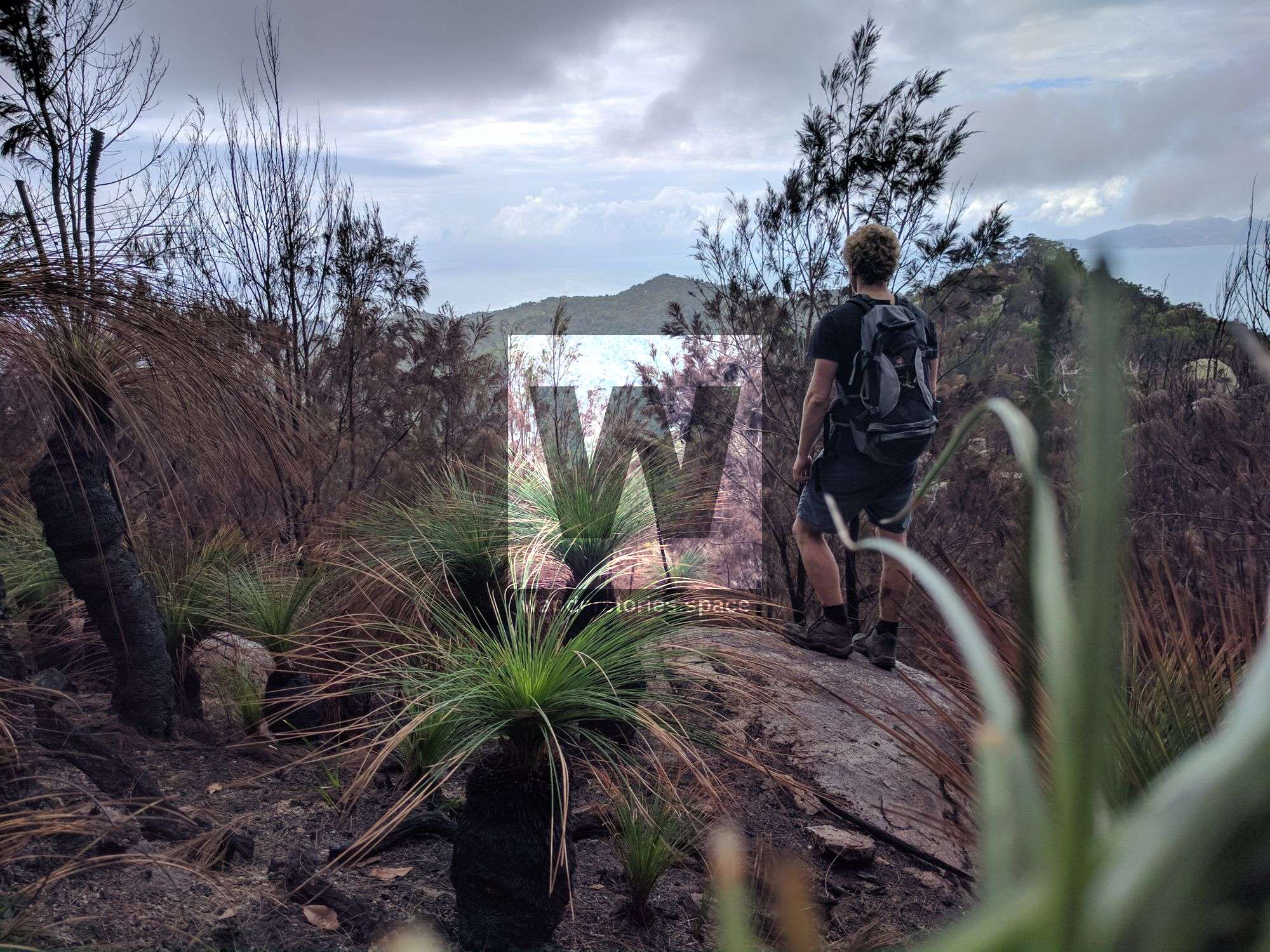
There are several ways to summit Mount Cook; however, Duck Creek is considered the easiest route, as it follows the creek all the way to the summit. There also used to be a rough trail to the summit in the early 1990s what has been called the 'goat-track' that made its up along the ridgeline immediately above upper Gustav Creek. The other routes taken to Mount Cook's summit is up Gustav Creek (near the pump station), what is known locally as Rockslides Creek, and the Endeavour Creek route via Horseshoe Bay.
Allow a full day return to the summit – note that some people like to camp. It's a 30 minute ferry ride from Townsville to Nelly Bay. Park your car at the SeaLink terminal ($7.50) or along The Strand and purchase a return ticket over to Nelly Bay ($33.50, $16 for a local).
On this hike you may encounter barbed wine vine (Smilax australis), wild raspberry (Rubus moluccanus), stinging tree (Dendrocnide moroides) and thick ferns. It is recommended to wear hiking boots, long pants, and a long sleeve shirt for both sun and bush protection.
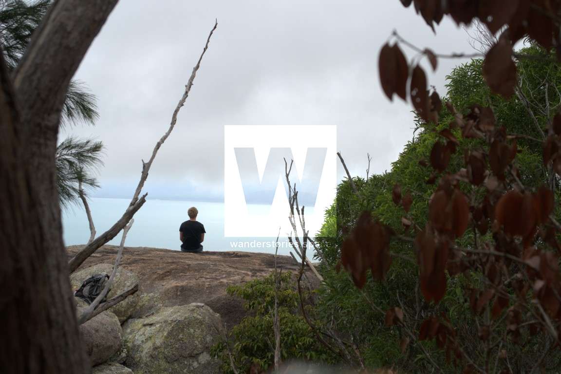
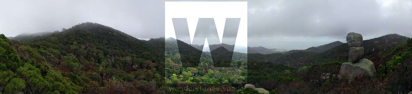
There is not much of a view from the summit - unless you illegally jump the obstruction beacon's barbed wire fence and climb the tower. However, there are plenty rocky outcrops nearby and along the ridgeline routes to the summit.
As usual, take your rubbish back home with you. Follow the Leave No Trace principles and 'Hike It Out'. Please take everything back home with you. If you find rubbish, please pick it up and hike it out. Let's take only photos (and other people's rubbish) and leave only footprints... and, of course, a cleaner environment.
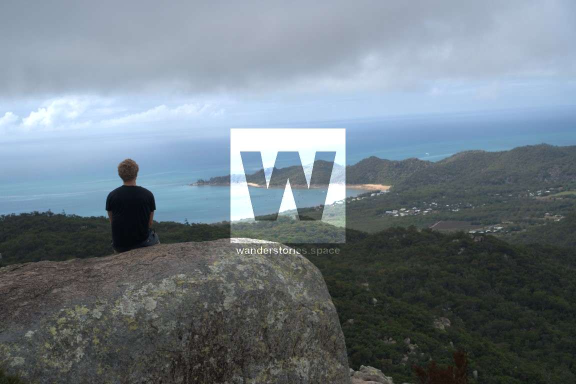
Things to see at the summit
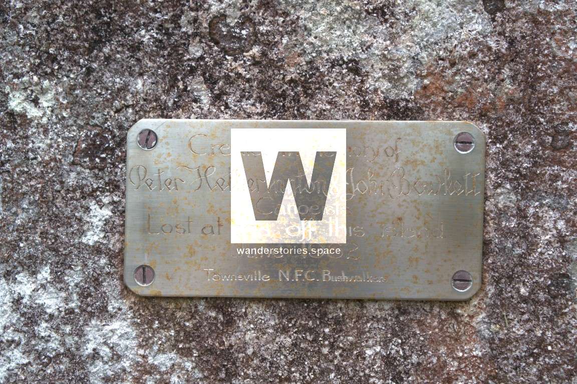
If you have some spare time while at the summit, go for a wander to see the totem pole and also visit the bushwalkers memorial plaque.

In June 1962, two members of Townsville NFC Bushwalkers (now Townsville Bushwalking Club) and the RAAF disappeared on a kayaking trip from The Strand to Magnetic Island. Despite an intensive search, they were never found. Their kayak was located days later near Lucinda. The Bushwalking Club attached a memorial plaque to a rock near Mount Cook looking towards Pallarenda with the plaque facing the line of the airport runway.
From the radio tower, follow the star pickets with yellow caps on them to the helicopter landing pad just West of the summit. Once you run into the siam weed quarantine area, take a left and follow the cut track around the fenced off area. Once past the helicopter landing pad, continue through the Lantana and over to hill 479.
How to get there
Here's an interactive map of the routes:
Duck Creek - Cockle Bay Route
The Duck Creek route is a very easy way to summit Mount Cook and is said to be better than the Gustav Creek, a route from Nelly Bay. Starting out on West Point Road and rises steeply up towards Mount Cook, there isn't any overly hard areas to traverse and the vegetation is a lot less thick in the creek so you don't have to bush bash until the end. But, it is a creek so rop hoping is involved.
Either walk all the way from Nelly Bay, catch a bus to Picnic Bay, or take a taxi to near Duck Creek. Follow the creek line all the way to the slopes of Mount Cook, take the right fork in the creek near the end. Once near the top, it's a quick scrub bash up to the summit.
The other advantage to the western approach is that it is almost absence of stinging tree (Dendrocnide moroides) and barbed wire vine (Smilax australis) until the slopes of Mount Cook, whereas on the eastern / northern side their there are some large clumps of it leading towards the summit. Anyone who has run into these plants will know how bad they are and why avoiding them is necessary.
Endeavour Creek - Horseshoe Bay Route
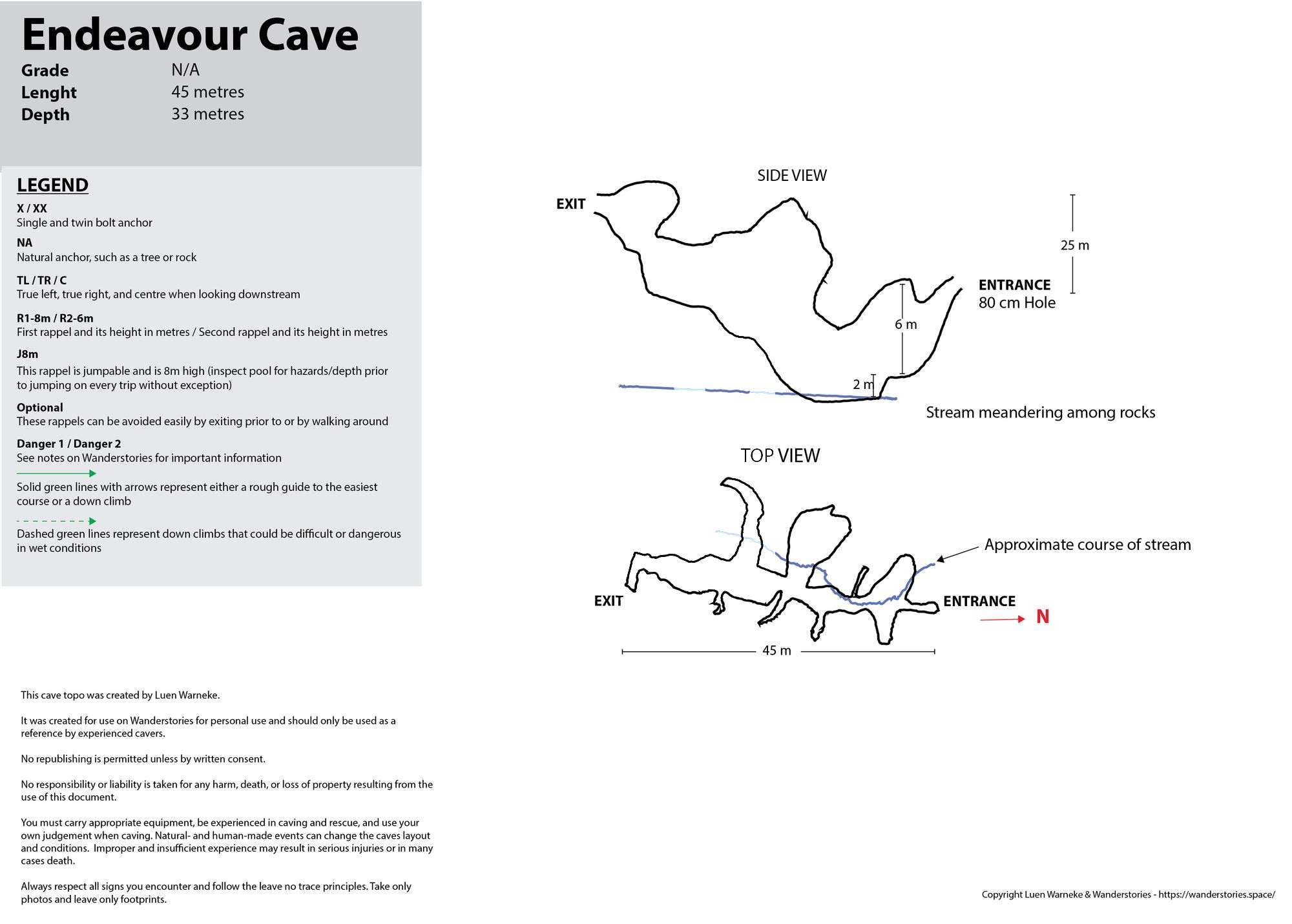
Starting on Henry Lawson Street and down into Endeavour Creek. Follow Endeavour Creek up through the large rocky creek bed to the ridgeline and then the summit of Mount Cook. It's common to descend via this route. While you are in this area, find and pass through the 50m underground creek cave for an extra bit of fun. Note that the Nature Reserve at the bottom is private.
Gustav Creek - Nelly Bay Route
This route passes through a pocket of rainforest, a small rocky dry creek bed, and climbs gradually to the saddle between Mount Arua (The Pinnacles) and one of the peaks along the ridge.
Start by walking down Nelly Bay Street to the end, follow the Nelly Bay to Arcadia Bay walking track a few hundred meters. You should see a sandy creek running parallel with the walking trail. Cut down into the sandy creek and walk along for a few meters and you will see a rock cairns. Follow the creek up keeping left at the fork. You may want to go right because the creek is more open but stay left! Follow the rock cairns up the creek which opens up into a boulder field. You will soon have a little view and see a few more rock cairns. Watch out for the stinging trees though. Dead and alive stinging trees leaves, when disturbed, can produce fine hair particles and can cause respiratory issues when inhaled.
These rocks can be very slippery in the wet so be cautious. When I did this hike last, it was on an overcast day with slight drizzle. Also be sure to watch out for death adders, as they can been seen in the brush.
The Pinnacles views over Nelly Bay
The vegetation start to become more bushy but continue up left to the saddle between the peaks. From here you can make a quick walk up to Mount Arua (The Pinnacles) and then head over to the summit of Mount Cook (493 m).
Once in the saddle, take a right and follow the ridgeline up through the sheoaks and grass trees and over a few smaller peaks. Once at the summit, you will see a pole concreted into rock on top of the highest point. There are possibilities to camp at the summit but there's not much of a view. I would prefer camping on the first peak or at Mount Arua (The Pinnacles) along the way. Please note that QPWS do not offer camping permits for Magnetic Island National Park.
Rockslides Creek - Nelly Bay Route
Start by walking down Nelly Bay Street to the end. This road heads towards the mountains where you will see a boulder field low in the mountain range. Continue down the road into Hideaway Resort and to the creek. This is an interesting and fun climb up via massive boulder. Be careful of loose rocks.
From the top of the creek, follow the ridgeline to The Pinnacles or continue over the saddle to another creek and up to Mount Cook.
Goat Track - The Ridgeline Route
Once a foot track from the WWII era, this walk starts on the trail from Nelly Bay to Horseshoe Bay and Arcadia Bay and climbs gradually to the saddle between the Nelly Bay to Horseshoe Bay; On one side is Gustav Creek and the other is Gorge Creek. From here follow the ridgeline to the summit via a few false peaks. Offering views over Horseshoe Bay.
Apparently there's springs 300 meter from the top the has water all year round.
Ned Lee Creek
This is a rarely done route that follows the creek and them up onto the ridgeline to the summit.
This article, and all other articles, are for entertainment purposes only and are not to be used as a guide. Please see our Disclaimer for more information.