West Mulgrave Falls & Rapid Falls
This hidden gem is tucked deep within the Wooronooran National Park and is reached by a difficult, but extremely rewarding, hike.

Location - Wooroonooran National Park, Far North Queensland, Australia
Difficulty - Grade 5, on rough track
Distance - Approximately 11 km return
Time - Allow 4-6 hours return
Start/Finish - Gourka Road (Atherton Tablelands)
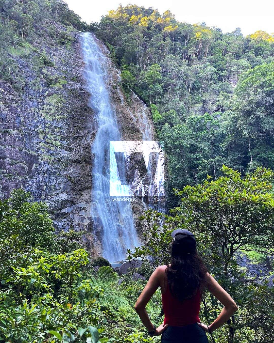
This hidden gem is tucked deep within the Wooroonooran National Park and can only be reached by a difficult but extremely rewarding journey. Located near the Windin Valley, this adventurous route takes along a rough track with creek crossings and through dense rainforest to you to the bottom of West Mulgrave Falls. Although there's effort involved, the beautiful cascade and aqua-blue waterhole below will make the effort worthwhile. Plus you're likely to be the only person there, so you can expect to have the area to yourself.
Note that it's possible to tag the Windin Falls hike along with this trip also.
Interactive Map
How to get to West Mulgrave Falls & Rapid Falls
The trailhead is at the Windin Falls Carpark on Gourka Road (-17.363711, 145.751574). The entrance may be overgrown with long grass and may be hard to spot but you should see the pink flagging tape. The route gradually descends 100 metres over approximately 2.5 kilometres through the tropical rainforest and roughly follows an old logging road.
From here, you begin the steeply descend off the ridge into the gorge on a 40-degree gradient (approximately 250 metres over 1 kilometre). Note that during and after rain, this section can be very slippery as you hike over roots and dirt. At the bottom, is the first creek crossing. The pink and orange flagging tape is downstream of the stream.
Once out of the creek, continue to follow the flagging tape. This path will take you around 700 metres till you reach the next creek crossing. Look for flagging tape on the other side of the creek to ensure you're on route. Once you've crossed the creek, follow the flagging tape for about 500 metres until you reach the falls.
West Malgrave Falls cascades ~70 metres down the granite rock into an aqua-green pool below. It's possible to jump off the large boulder on the left but be sure to check the water first.
After a refreshing dip, return via the same route.
Notes
- If you hike upstream of the first creek your cross, you will find some less-visited, beautiful waterfalls, such as Churnano Falls. Note that this is off-route for experienced hikers.
- Be on the lookout for stinging trees (gimpie gimpie). Wait-a-while (lawyer cane) is also present in this area.
- The rough track is marked by pink and orange flagging tape and it is recommended to be experienced in hiking and navigation as the track is rough, hard to follow, and often overgrown in places. The flagging tape is sparse in places.
- A good level of fitness is recommended.
- It is recommended to treat water when refilling from creeks.
- Dry conditions are recommended. The creek crossings may become dangerous in the wet season and are known to rise rapidly. The steep sections of the trail also become super slippery after rain as well.
- Be mindful of slippery rocks, especially after rain or drizzle. Steep sections and tree roots will also become slippery when wet. Avoid heavy rainfall as the creeks would be hard to cross.
- There are lots of leeches in the area (especially after rain) so pack insect repellent just in case. Also, note that there are wild boars (feral pigs) in the vicinity.
As these trails become increasingly popular, we will need to be more diligent in practising our Leave No Trace philosophy. Please take everything back home with you. If you find rubbish, please pick it up and hike it out. Let's take only photos (and other people's rubbish) and leave only footprints... and, of course, a cleaner environment.
This article, and all other articles, are for entertainment purposes only and are not to be used as a guide. Please see our Disclaimer for more information.