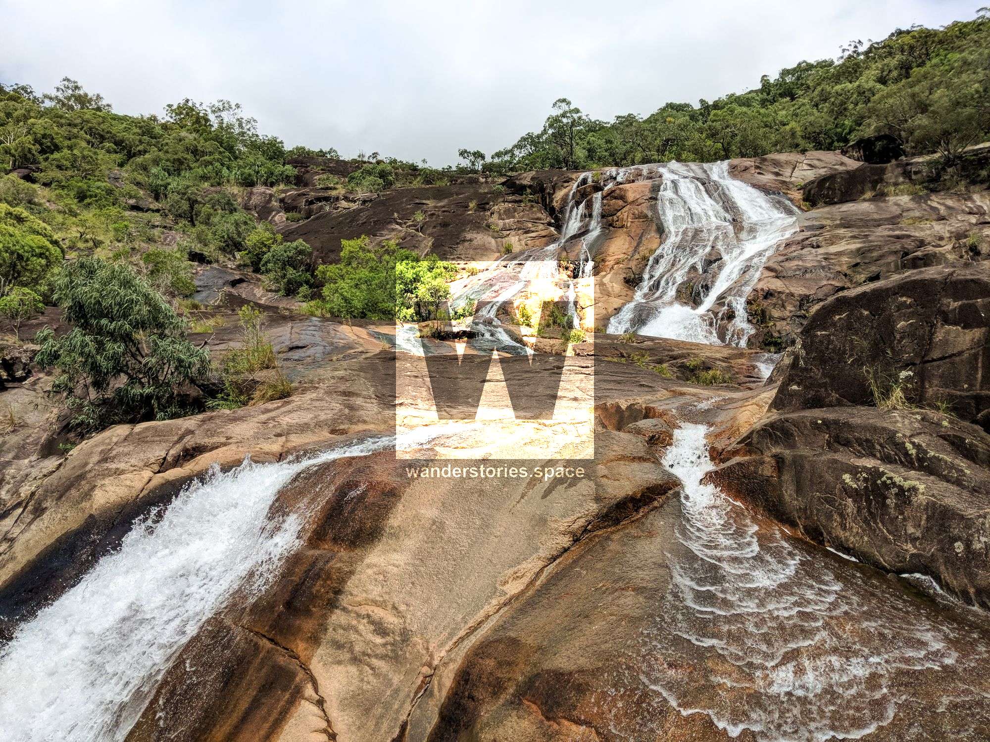
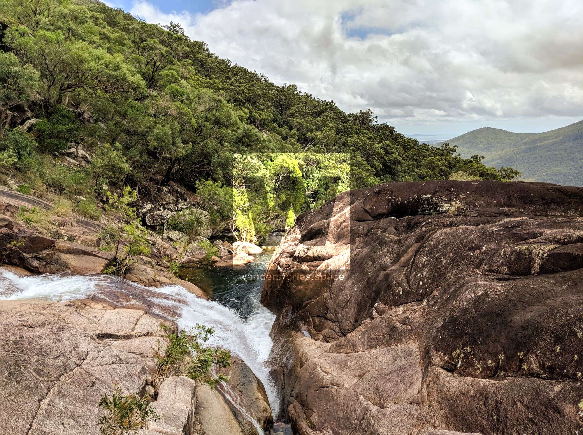
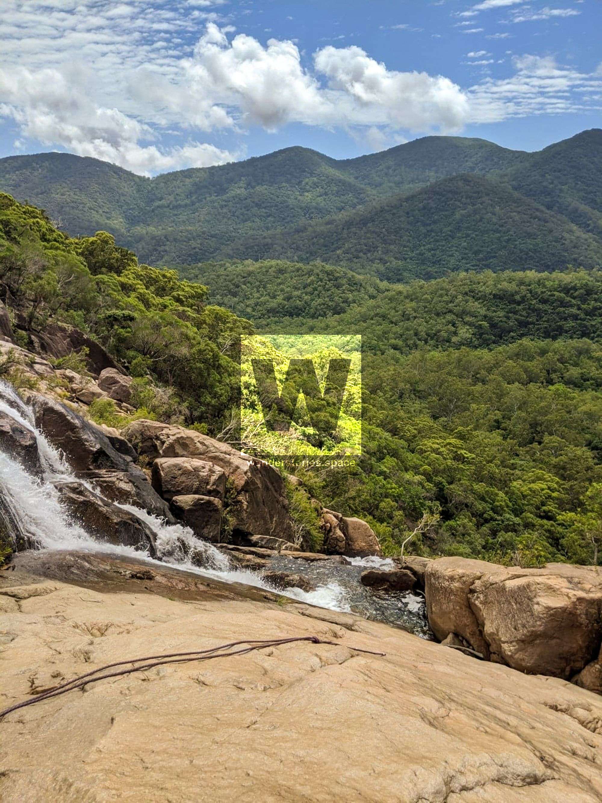
Alligator Canyon, Alligator Creek Falls
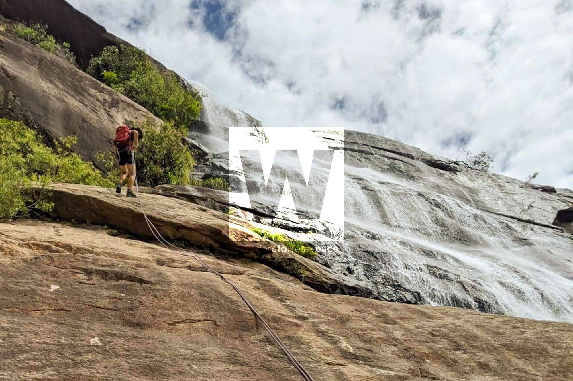
Most people know about Alligator Falls, but how many have abseiled its entirety? The answer is unknown. There's several bolts in place to allow for abseiling in and next to the falls.

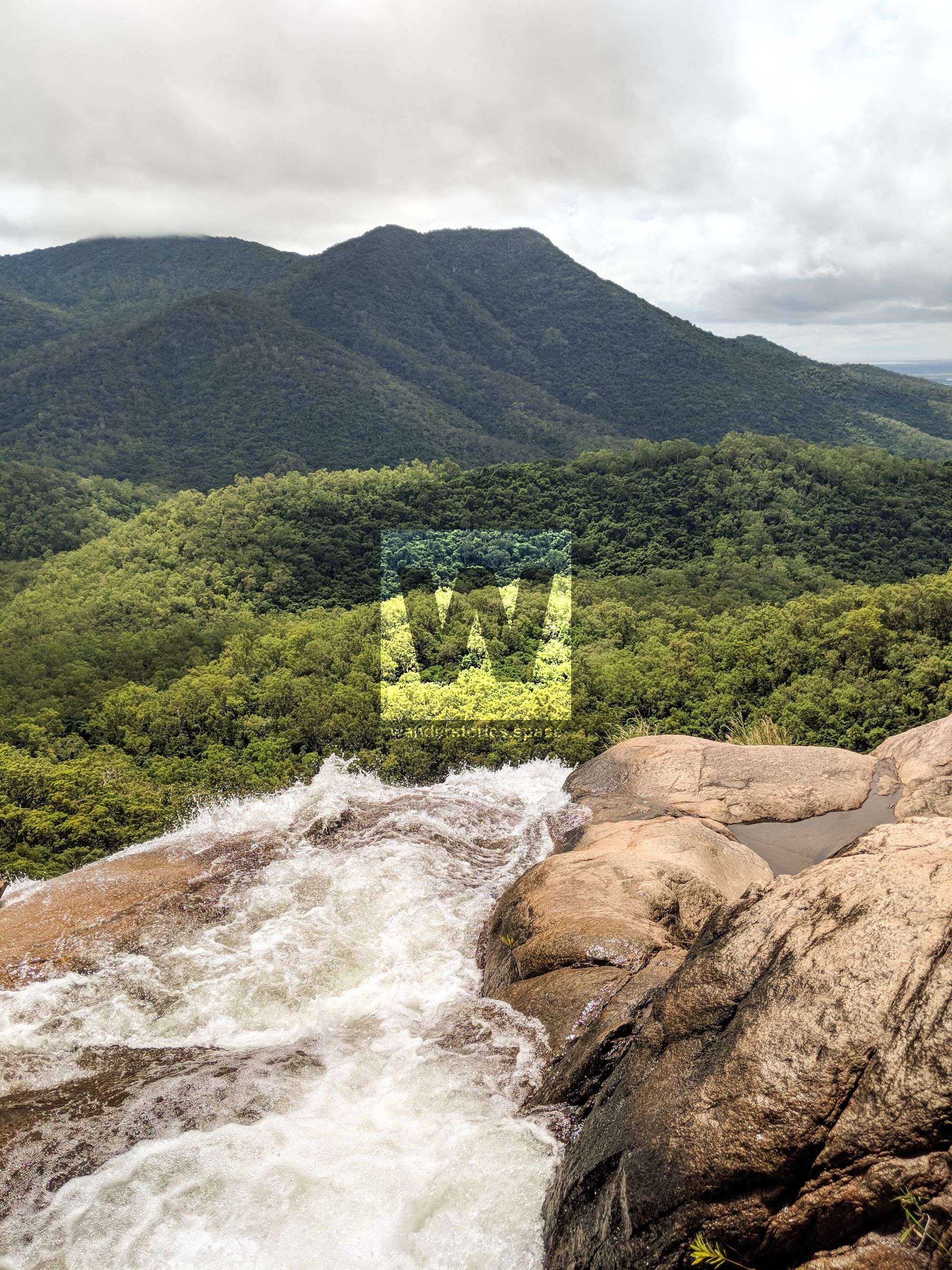
Location - Bowling Green Bay National Park, North Queensland, Australia
Grade - V4 A1 III (French Grading System)
Approach difficulty - Grade 3 (AWTGS)
Approach - 2-4 hours, 8.5 km
Descent - 1-2 hours for 4-6 people
Exit - 2-4 hours, 8.5 km
Total time - Allow 8-10 hours on first trip
Full course - 17 km round trip
Elevation loss - 230 metres
Longest rappel - 50 m
Flash flooding level - Medium
First descentists - Unknown
Most people know about Alligator Falls, but how many have abseiled its entirety? The answer is unknown. There's several bolts in place to allow for abseiling in and next to the falls.
Approach
The approach is described in the Alligator Creek Falls Track article.
Interactive Map
Here's an interactive map of the route you can take to get there:
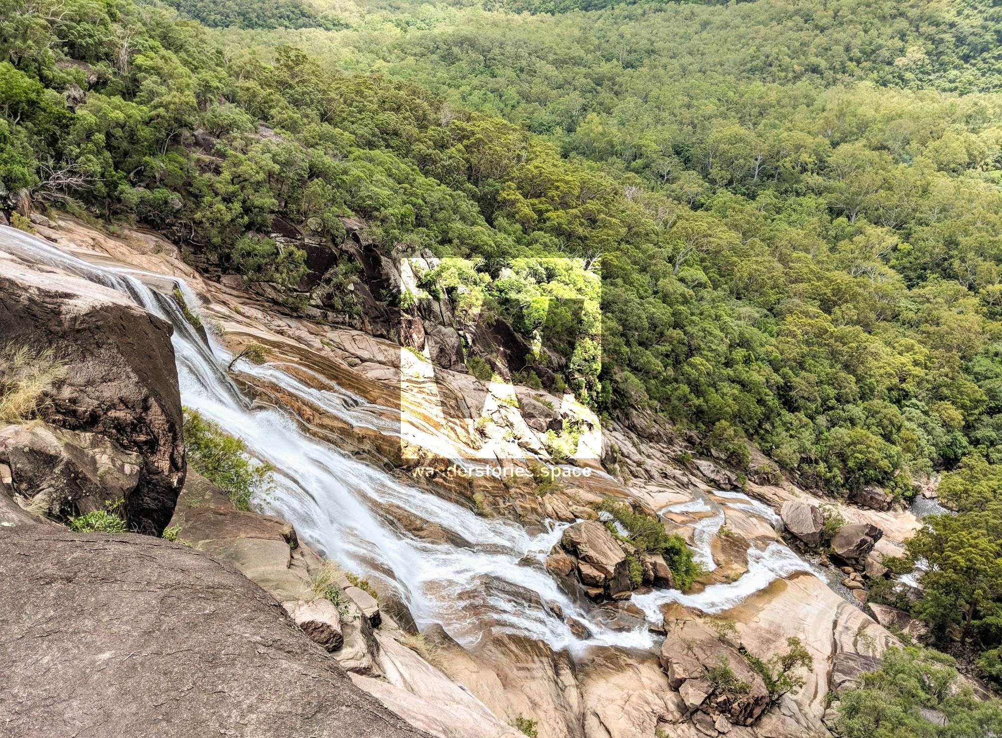
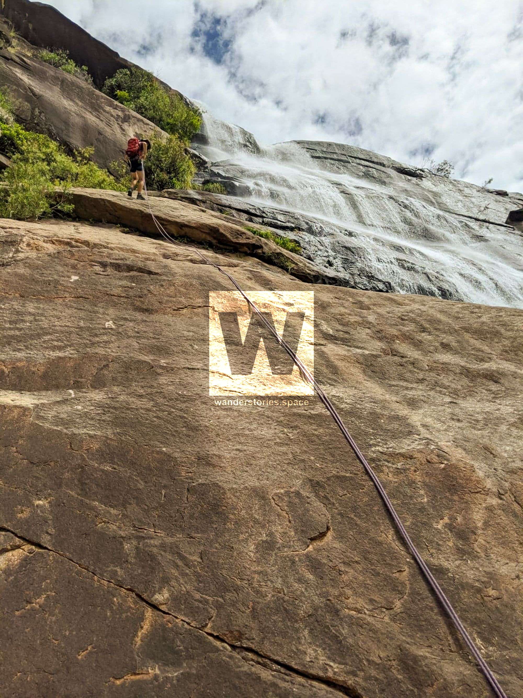
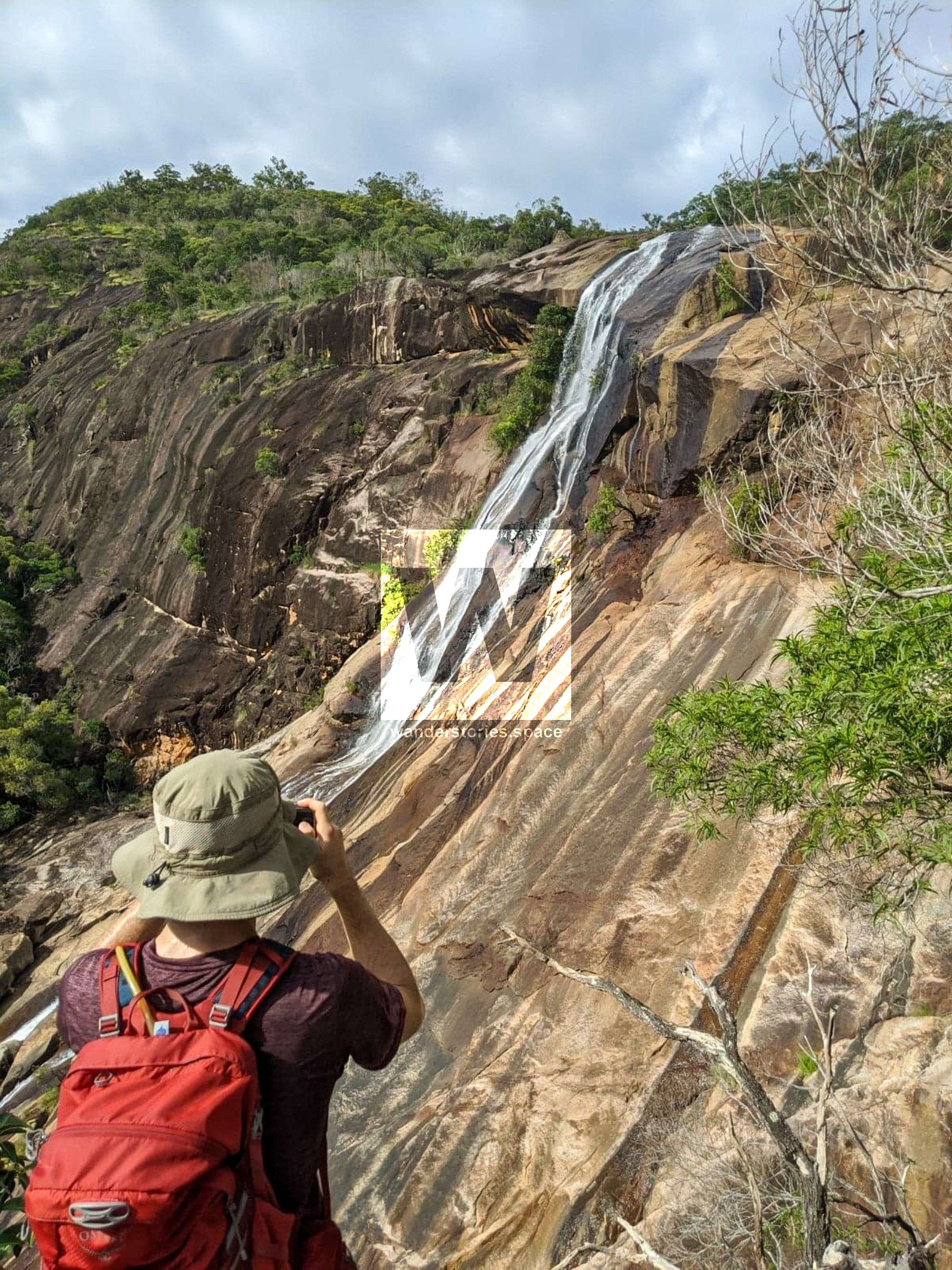
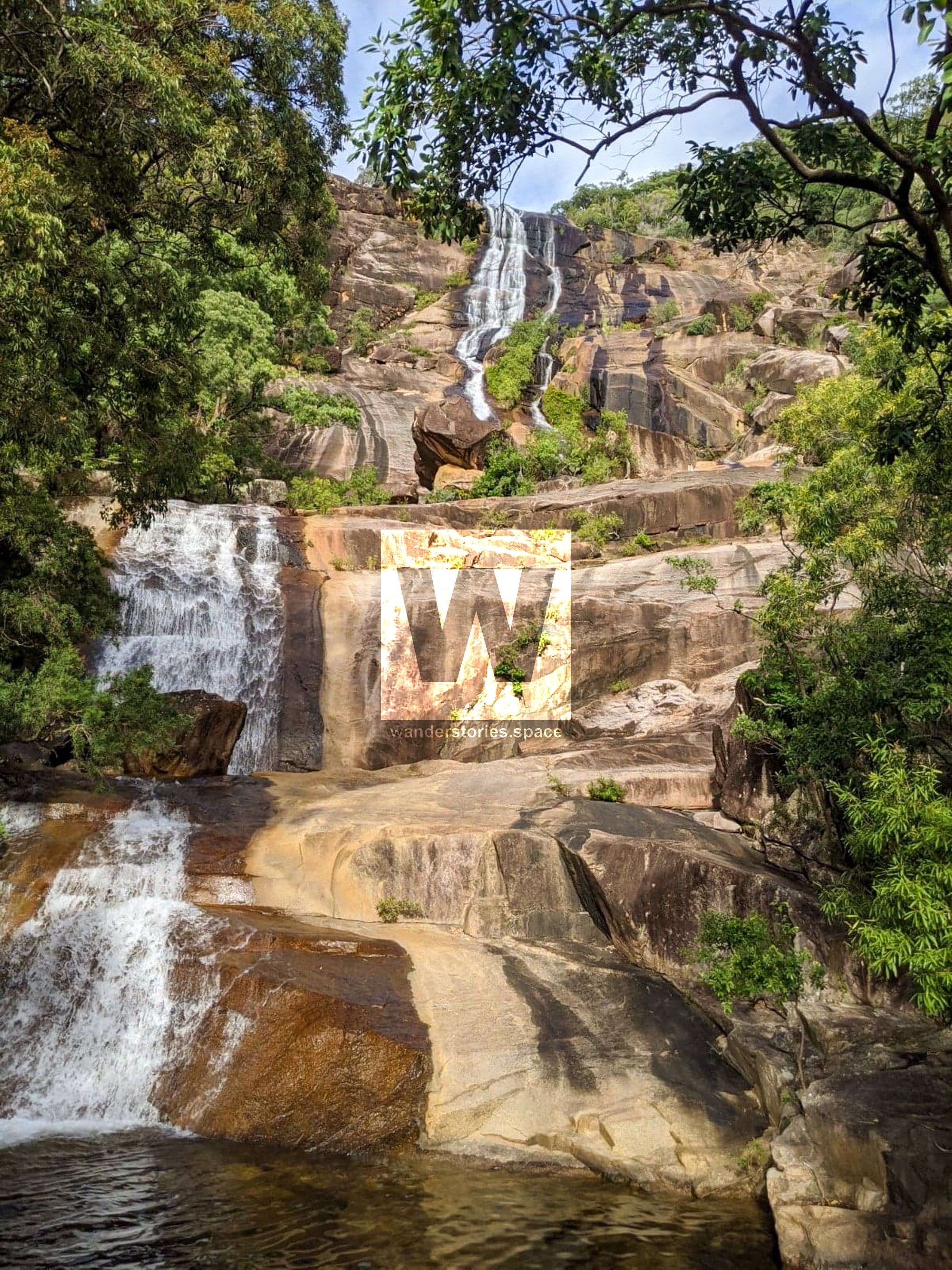
Rappels443573
The route is right off to the true right beside the falls and follows the treeline down.
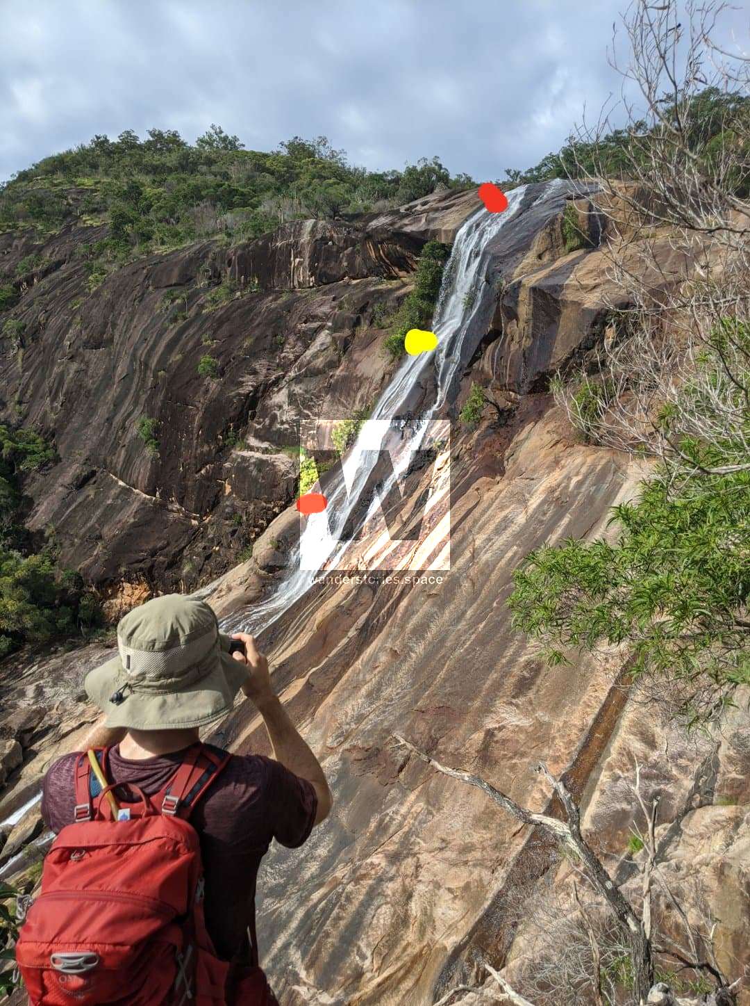
R1-15m NA-TR (optional)
A basic abseil into the top pool. Can easily scramble around.
R2-15m NA-TR (optional)
Could rappel from tree down to next set of trees.
R3-40m NA-TR (optional)
Rappel from tree down to easy slab.
R4-50m XX-TR
The tagged track starts near this rappel. This rappel can be broken up into a 25m and 25m from tree about halfway down.
R5-50m XX-TR
Rappel down to the next tree or to where you can scramble down and out.
R6-50m NA-TR (optional)
Rappel from tree or scramble down the slab.
R7-50m NA-TR (optional)
Optional rappel into pool or easily walk around
Plenty of options and not required but there would be an accessible anchor every 20m of rope tops. By the time you setup the last rappel, you're probaly better off just walking down the slab.
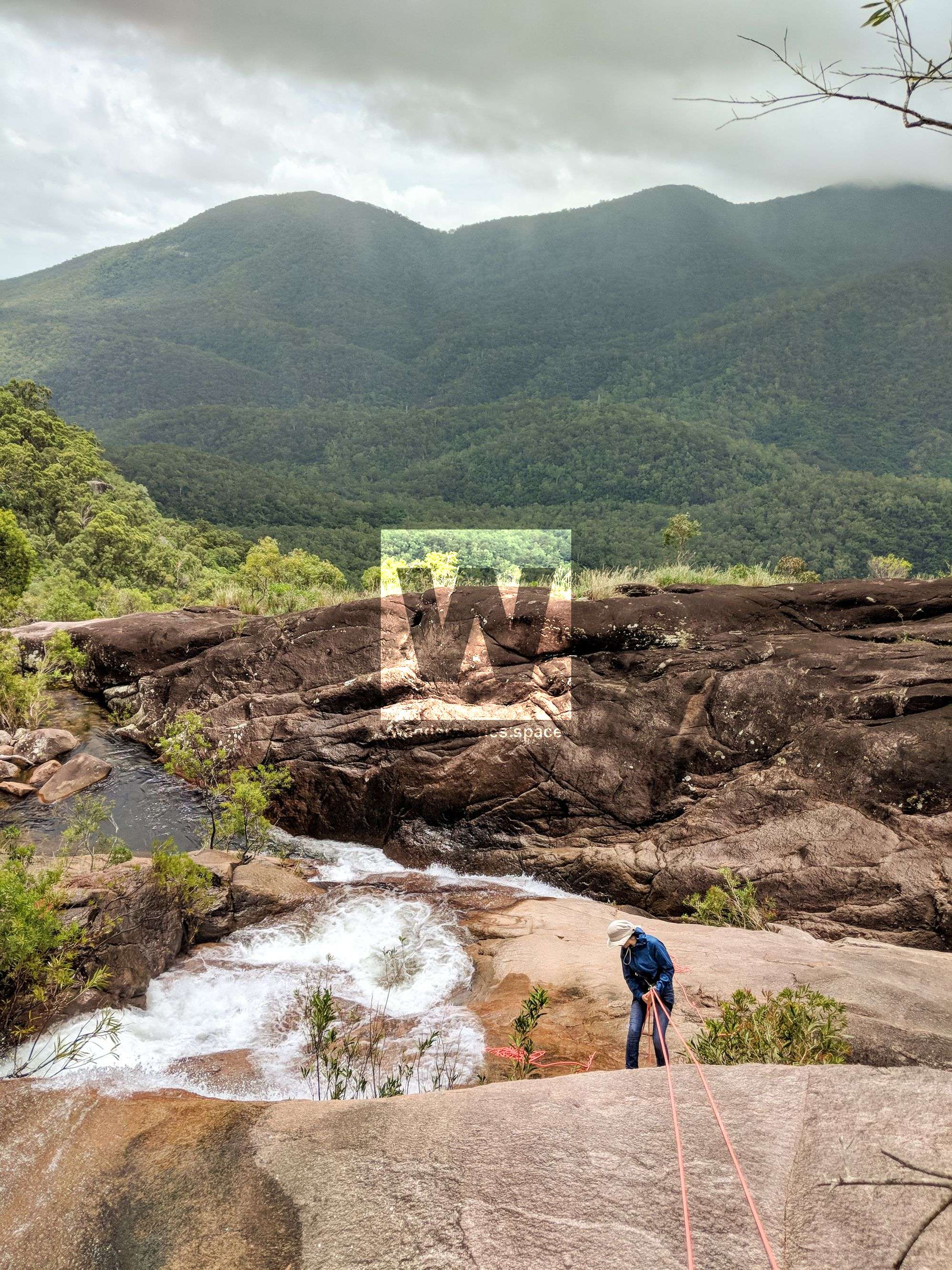
Exit
Exit the falls to the Alligator Creek Falls Track on the true right, right beside the falls. Return via the same route.
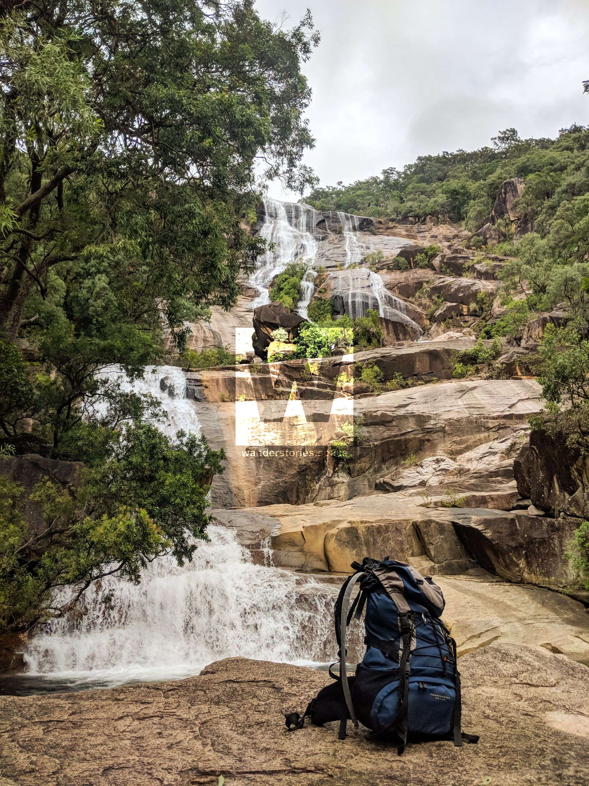
WHAT YOU WILL NEED
- Experience in abseiling (there are some technical challenges)
- Enough rope for a 60m rappel
- Rappel devices, prusiks, and webbing
- Grippy shoes on smooth, wet granite rocks
- Helmet
- Backpack
- Food and snacks for the day
- About one litre of water to hike to the top and a way to sterilise your water from the creek

Anchoring notes
There are various bolt anchors throughout the canyon however it is not unusual to come across damaged or even missing anchors, especially after flooding events. Please use sound judgement when considering previously installed anchors, this includes tape slings, ropes, and other textiles.
Surfaces
Along the route there are various sections of wet, slimy, and dry rock, as with all canyon environments. Please be mindful of your traction and regularly test your grip throughout the route as you cannot rely on the colour or texture of the rock to determine its safety against slippage. Take caution when near cliff edges.
Experience
No responsibility or liability is taken for any harm, death or loss of property resulting from the use of this article. You must carry anchor building materials, be experienced and use your own judgement when canyoning. Flooding events can strip anchors and change the canyons layout and conditions. Improper and insufficient experience will result in serious injuries or in many cases death. Always respect all signs you encounter and take everything in you brought with you.
Please read the Beginners' tips for canyoning in North Queensland article.
See our general disclaimer that includes canyoning.
Canyoning Topo
This canyoning topo is for illustration-purposes only.
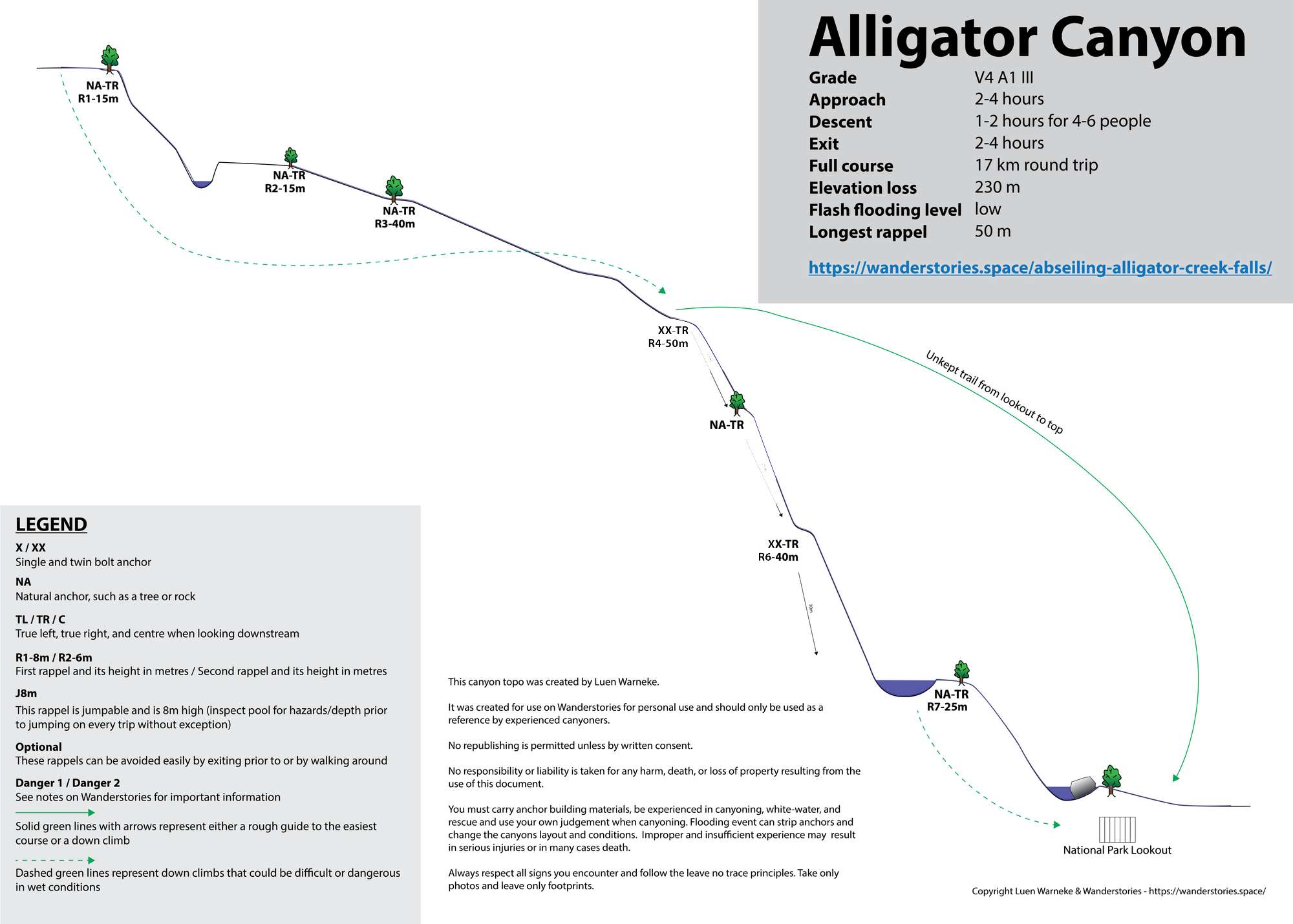
Legend
X / XX - Single and twin bolt anchor.
NA - Natural anchor such as a tree or rock.
TL / TR / C - True left, true right and centre when looking downstream.
R1-8m / R2-6m - First rappel and its height in metres, second rappel and height.
Optional - These rappels can be avoided by exiting prior or walking around.
Please note that an activity permit may be required in national parks.
If this information is outdated or you would like to make a correction, please contact us.
This article, and all other articles, are for entertainment purposes only and are not to be used as a guide. Please see our Disclaimer for more information.