Alligator Creek Falls
Alligator Creek Falls is located in Bowling Green Bay National Park and is an easy one-day hike that is on-track. You will follow a fire break and powerline maintenance track to Alligator Creek Falls for large portions of the walk.


Location - Bowling Green Bay National Park, North Queensland, Australia
Distance - 17 kilometres return
Time - 4-6 hours return
Difficulty - 4, easy to moderate walk on track, but some sections have a slight incline
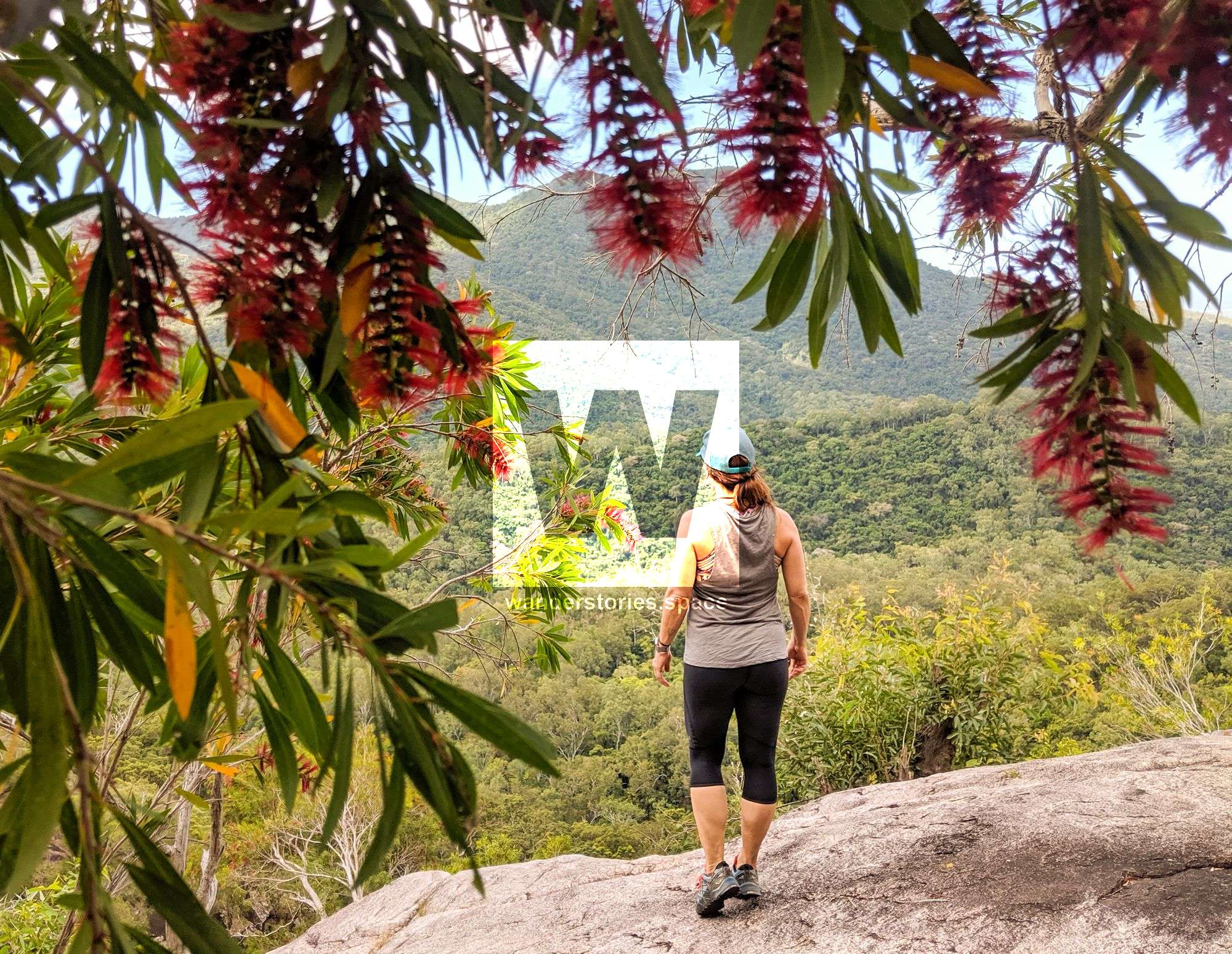
At 1,218 metres, Mount Elliot is one of the highest peaks in Queensland and a unique rainforest refuge emerging above the savanna plains of the dry tropics. Overall, this range is comprised of a granite massif and has numerous small creeks and waterfalls on its slopes. In some areas above 600 metres, you may find small patches of remnant rainforest.
The high peak of Mount Elliot supports rainforest that once stretched north to Mount Spec and south to Eungella. Isolated as a result of a drying climate, Mount Elliot is now evolving independently from other rainforests and is an important local refuge for an array of flora and fauna. Indeed, its carved gorges and valleys and varying annual rainfall have created a diverse landscape that is rich in animal and plant life.
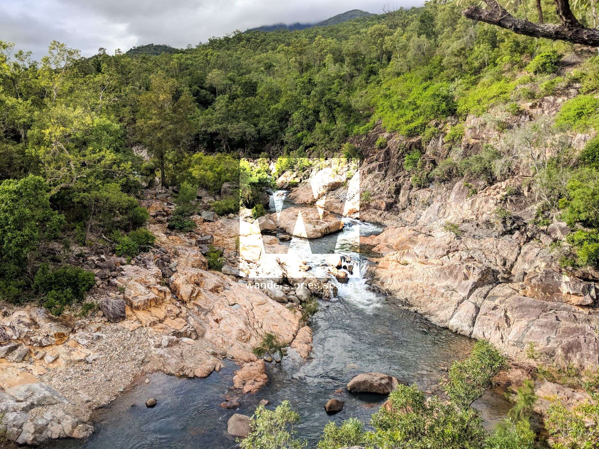
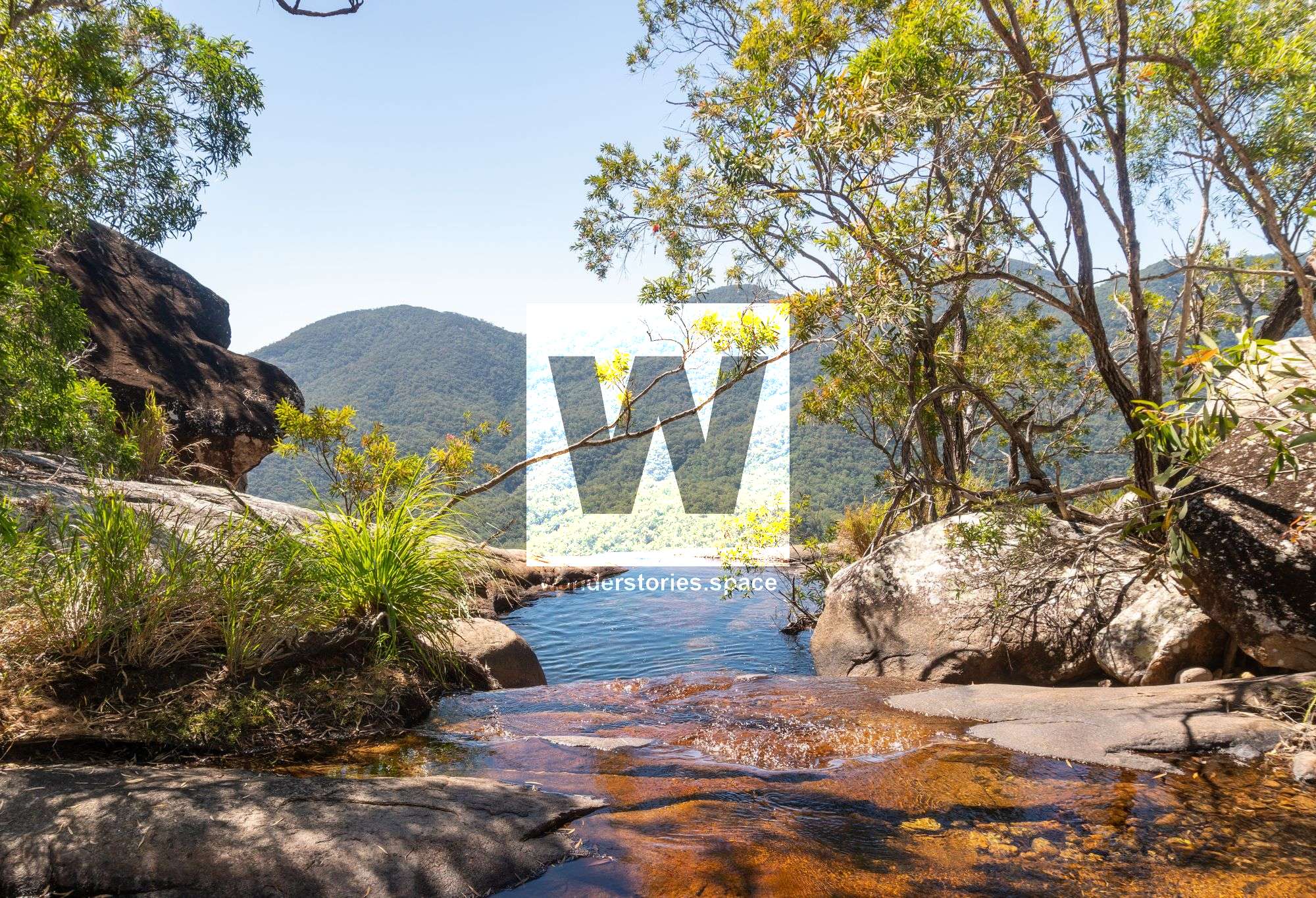
Alligator Creek starts close near Mount Elliot and flows into the valley between two rocky mountains, Mount Elliot and Saddle Mountain. The headwaters of Alligator Creek begin in the upland rainforests near Mount Elliot and descend via waterfalls and cascades that pour into deep pools.
Alligator Creek changes throughout the year, reflecting the seasons and weather patterns of North Queensland. We often experience two distinct seasons, the wet season and the dry season, and both have an enormous influence on the creek environment and its inhabitants. Alligator Creek not only sustains a wide range of aquatic plants and animals, but also serves as a reliable water source for many animals from the surrounding areas.
During the wet season, the Alligator Creek tumbles off the slopes of Mount Elliot and rushes down the creek line through lush, green hill slopes, scouring the rocky walls of the valley. Vegetation grows right down to the high water mark. The bed of the creek is filled with a rumbled mass of rocks, debris, and dry season growth.
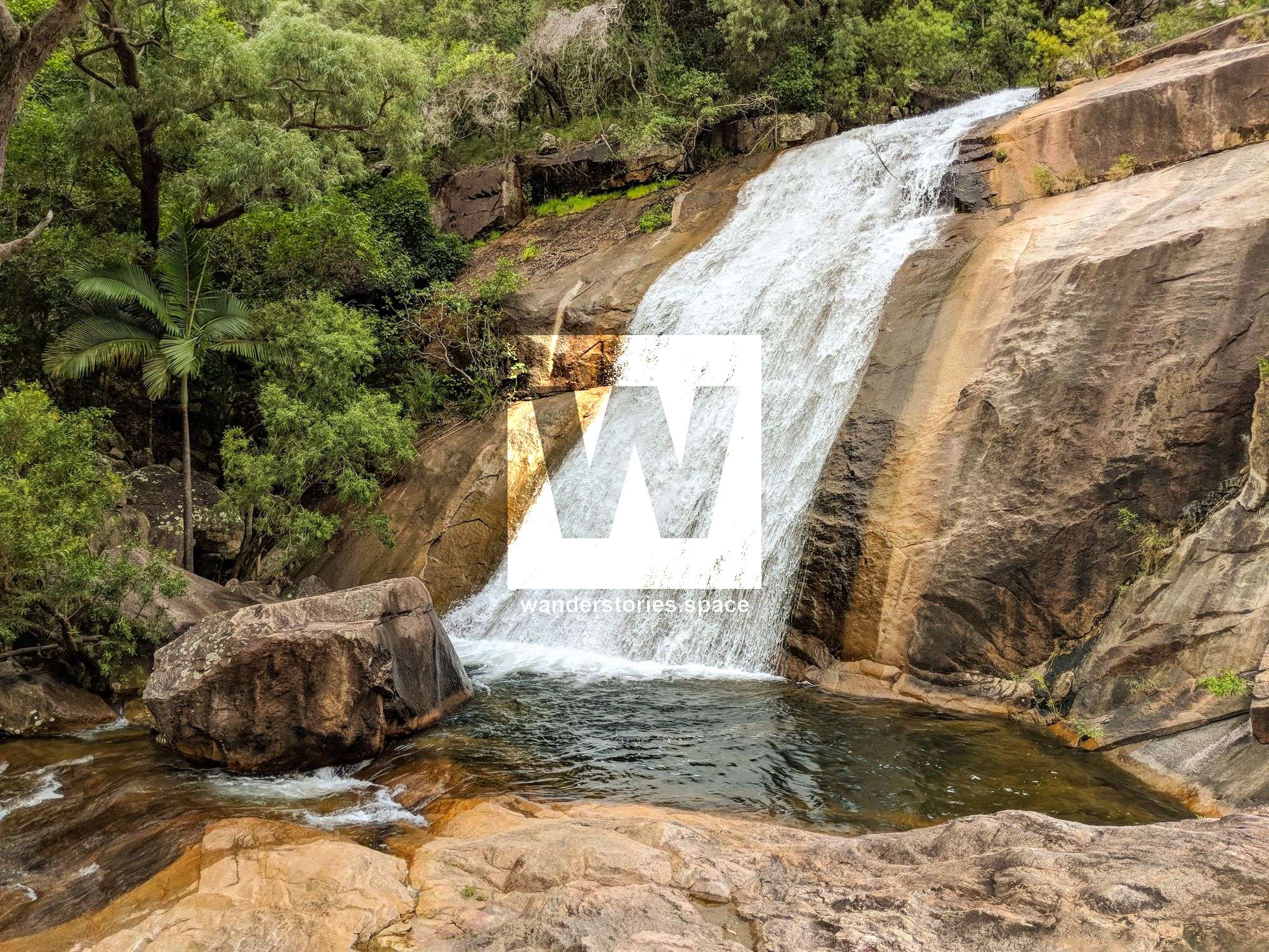
During the dry season, however, water gently cascades over boulders and rocks into rippling pools of clear water. The creek often stops running in the late dry season before the rains of the wet season once again fill the creek line.
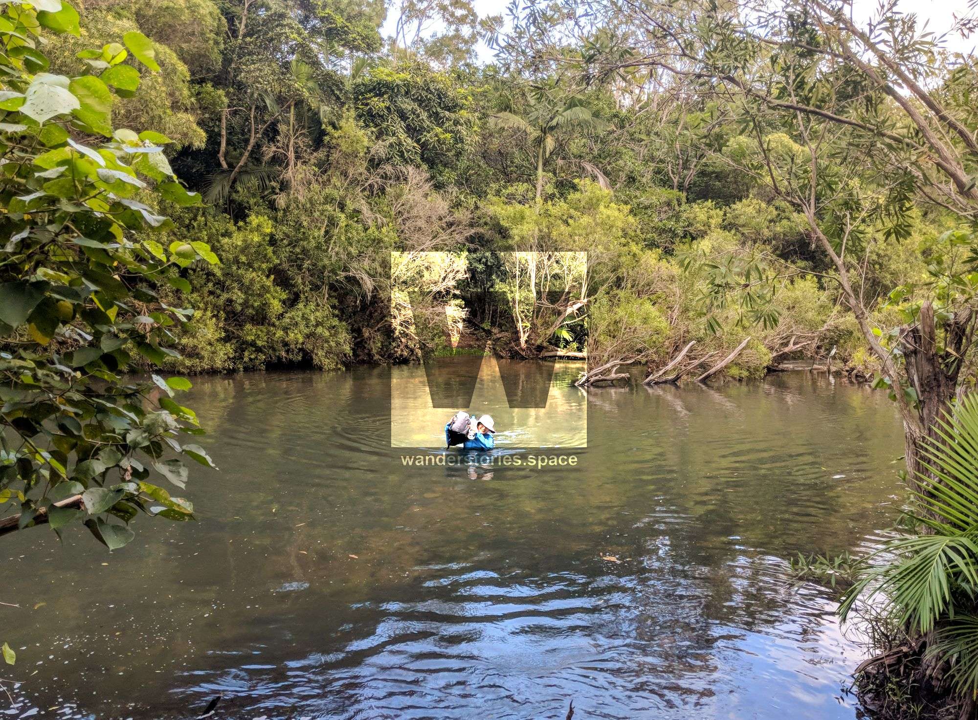
The Alligator Falls track traverses through the Bowling Green Bay National Park, starting from the southern end of the car park and continuing on from Cockatoo Creek venturing through woodland, where you will wade across creeks well into the valley. On the way, there is a clearing called "Hidden Valley", which is the site of an old homestead now long gone. Old mango trees and the clearing are the only evidence that it was ever occupied. Agile wallabies may be spotted here, as they feed closeby.
There are four creek crossings and some boulder scrambling required along the way. The walk is long and can be hot – especially in summer.
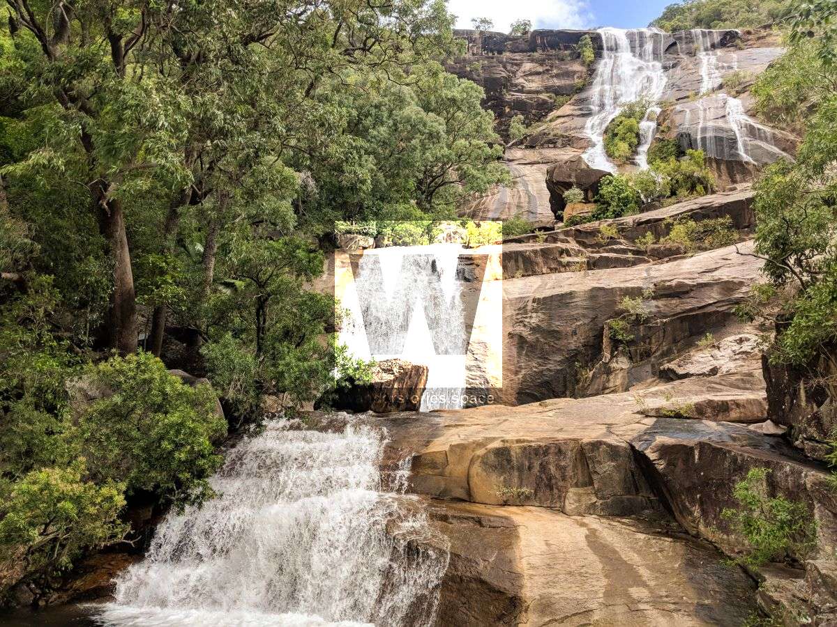
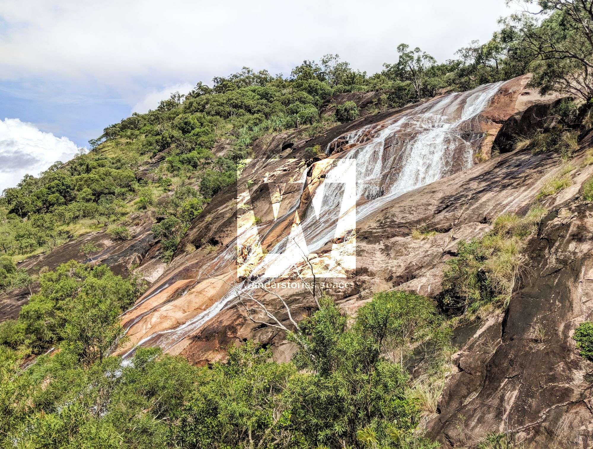
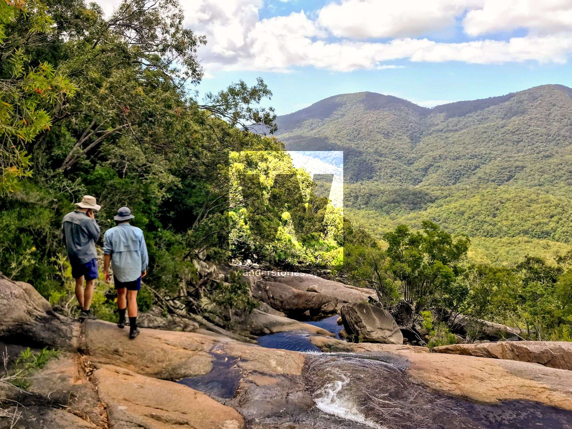
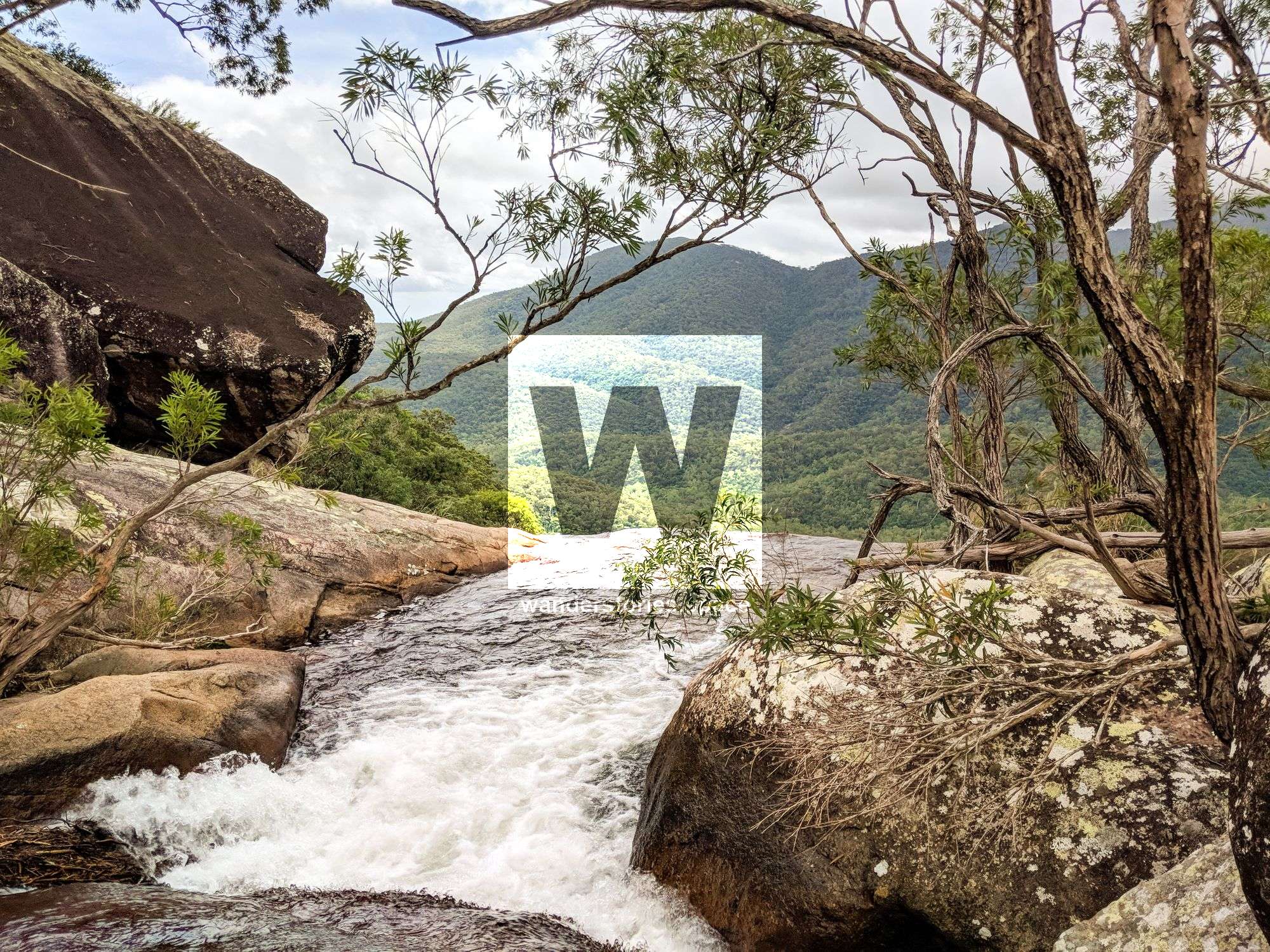
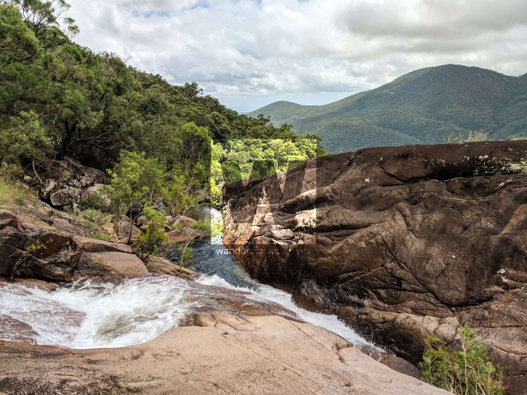
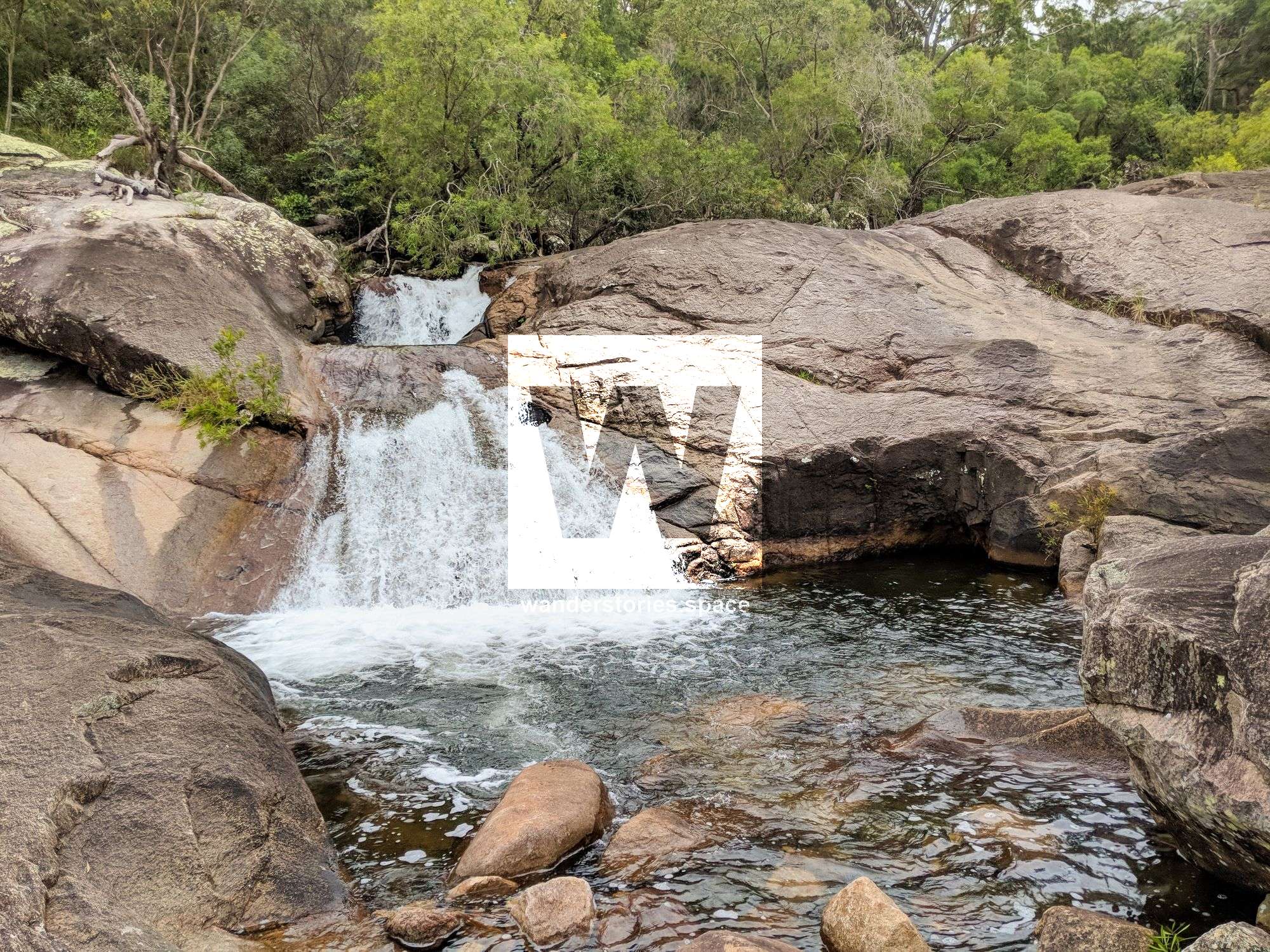
After you take the right fork toward the Alligator Falls camping area, you will continue to ascend through rocky vine thickets and over boulders after which you will emerge suddenly at the base of a massive granite cliff face. Now you will see and experience Alligator Creek Falls and its refreshing waterholes.
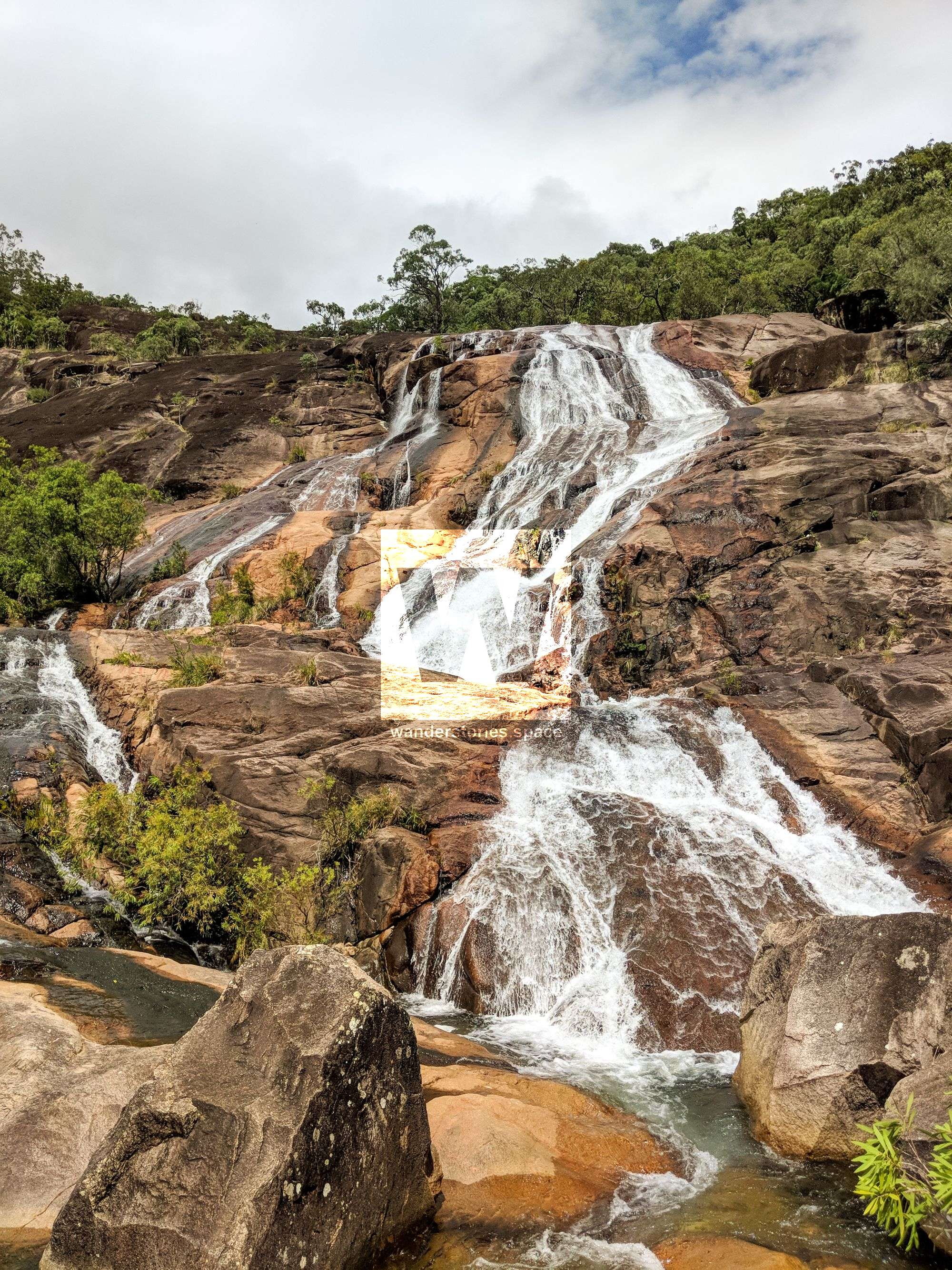
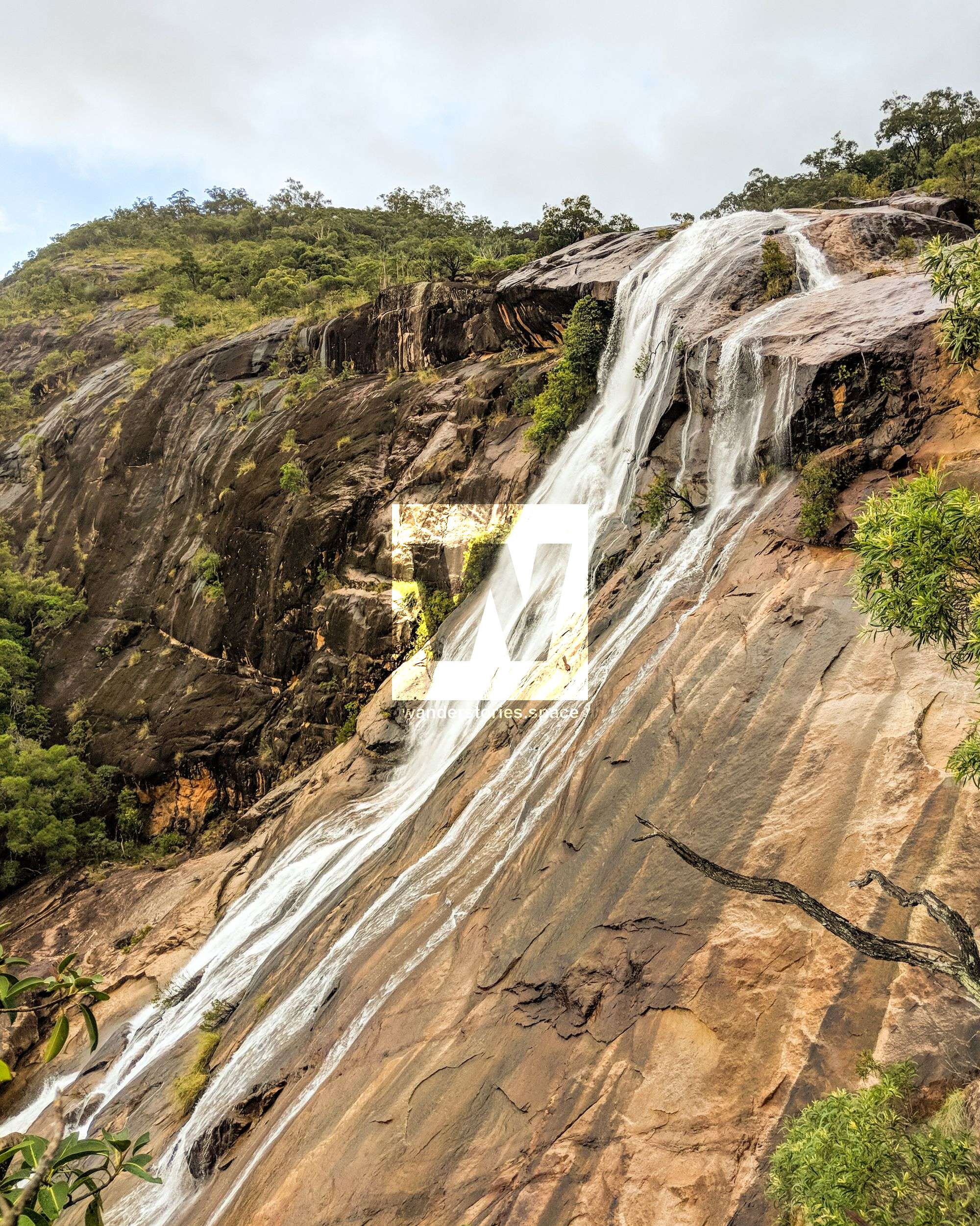
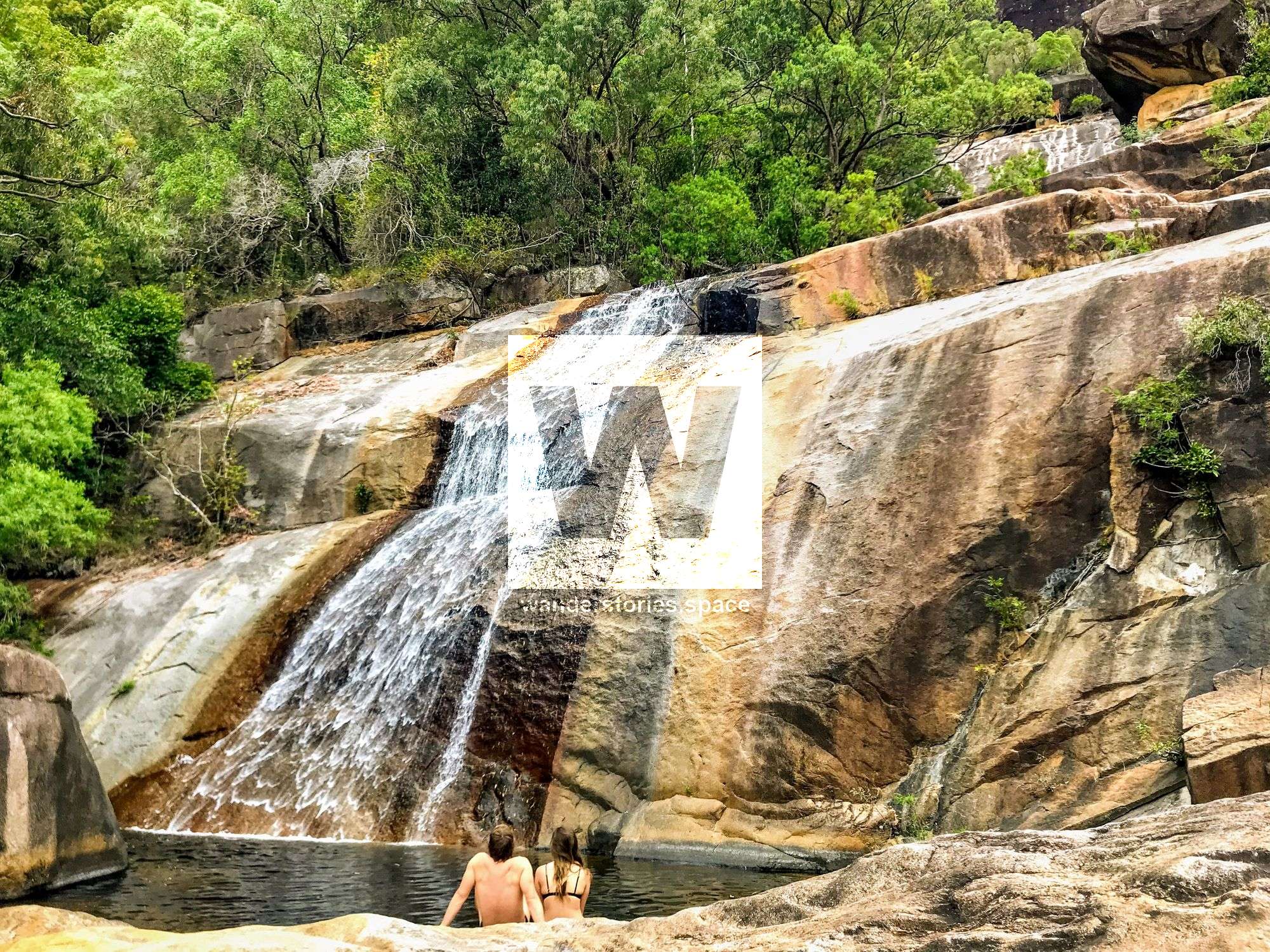
The falls are actually a series of steep sloping cascades. The track ends beside the creek at the base of the falls. With overhanging bottlebrush trees, damselflies skimming water, and butterflies dancing above the surface, these crossings are a perfect place to rest and catch your breath.
The track return is approximately a 17 kilometres. Return along the same track to the car park. Seven kilometres of this track is located under power lines, where it shares the same path as a management access road. This walk is long, can be hot, and should only be undertaken by fit walkers. This walk return can be completed in one day. Alternatively, some hikers do camp overnight at Alligator Falls camping are where camping permits are required.
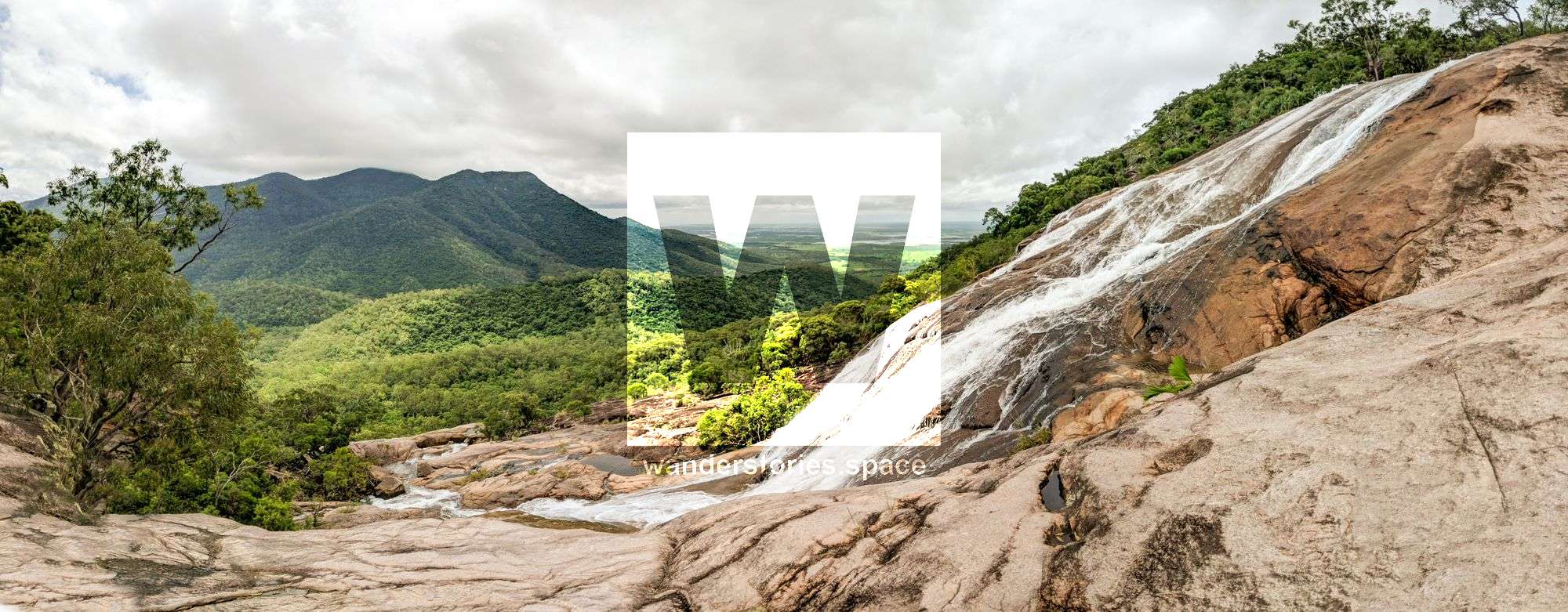
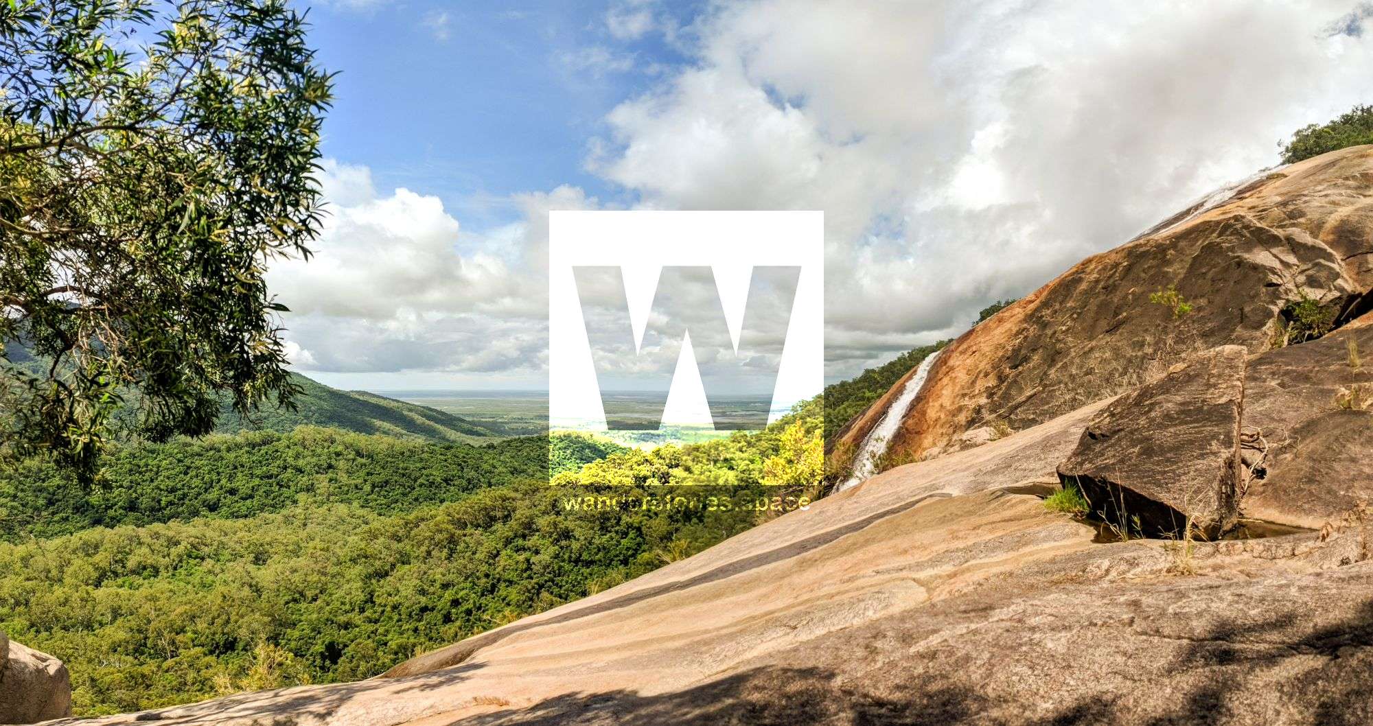
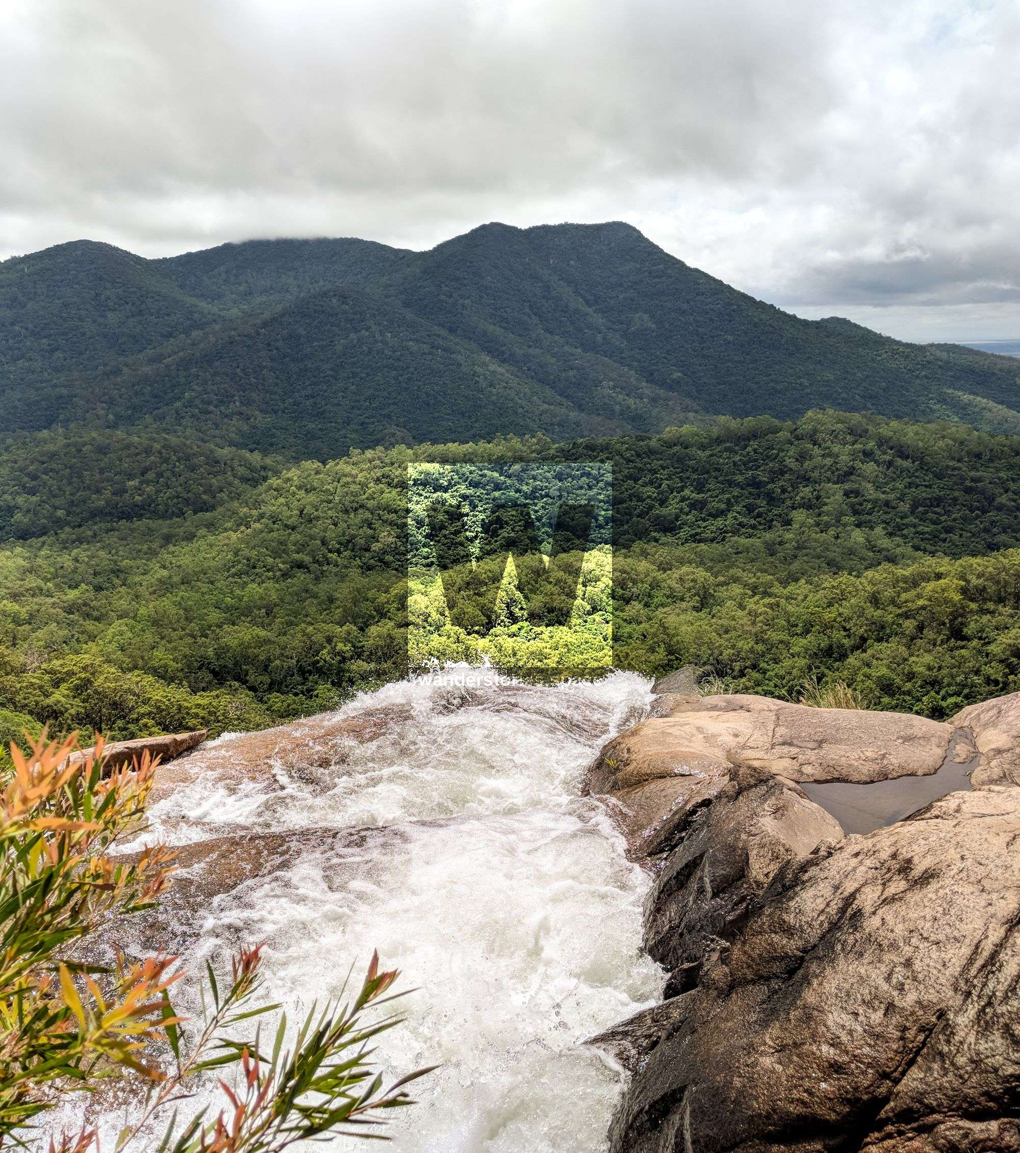
Getting to the top of Alligator Creek Falls
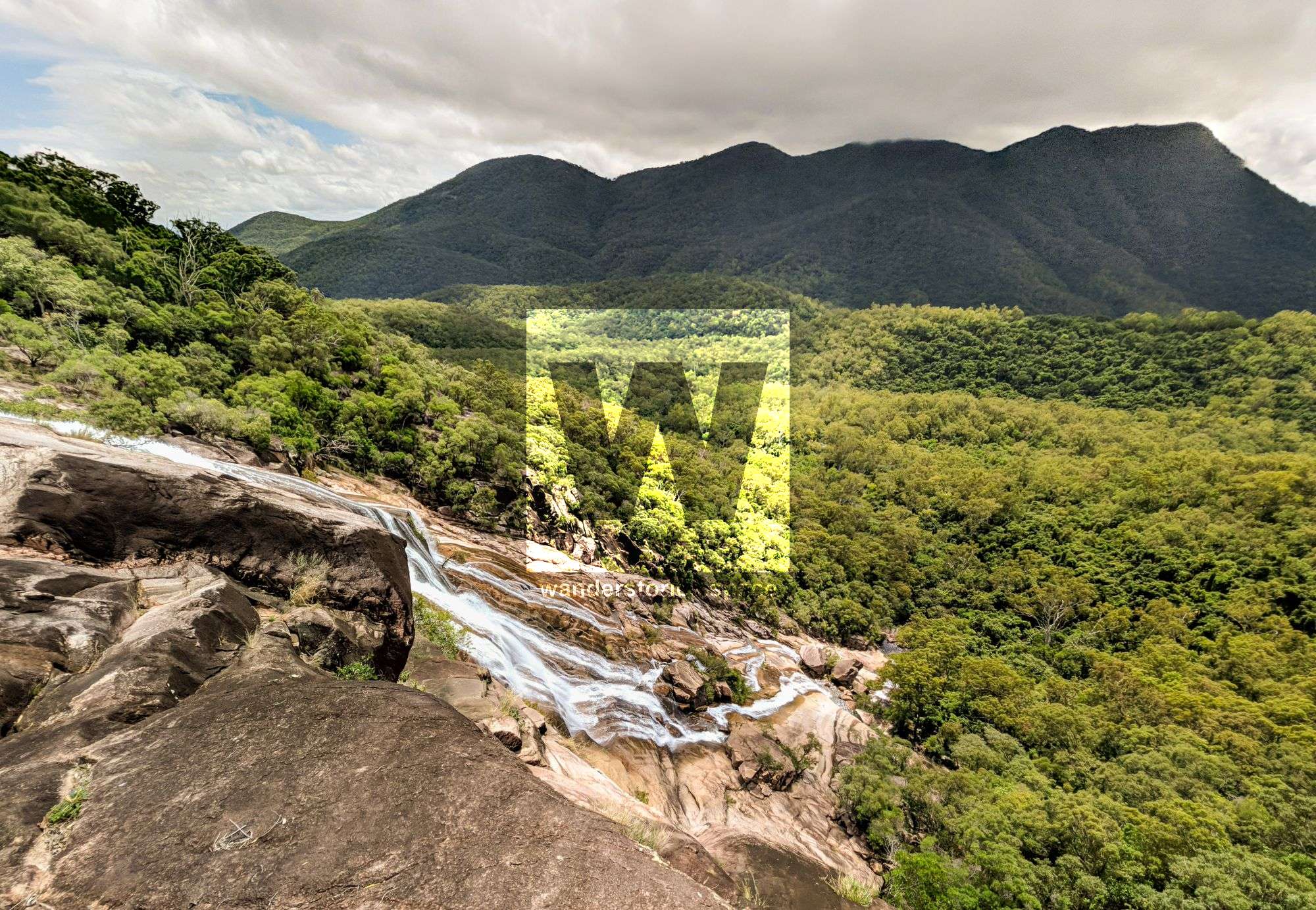
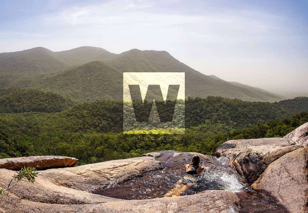
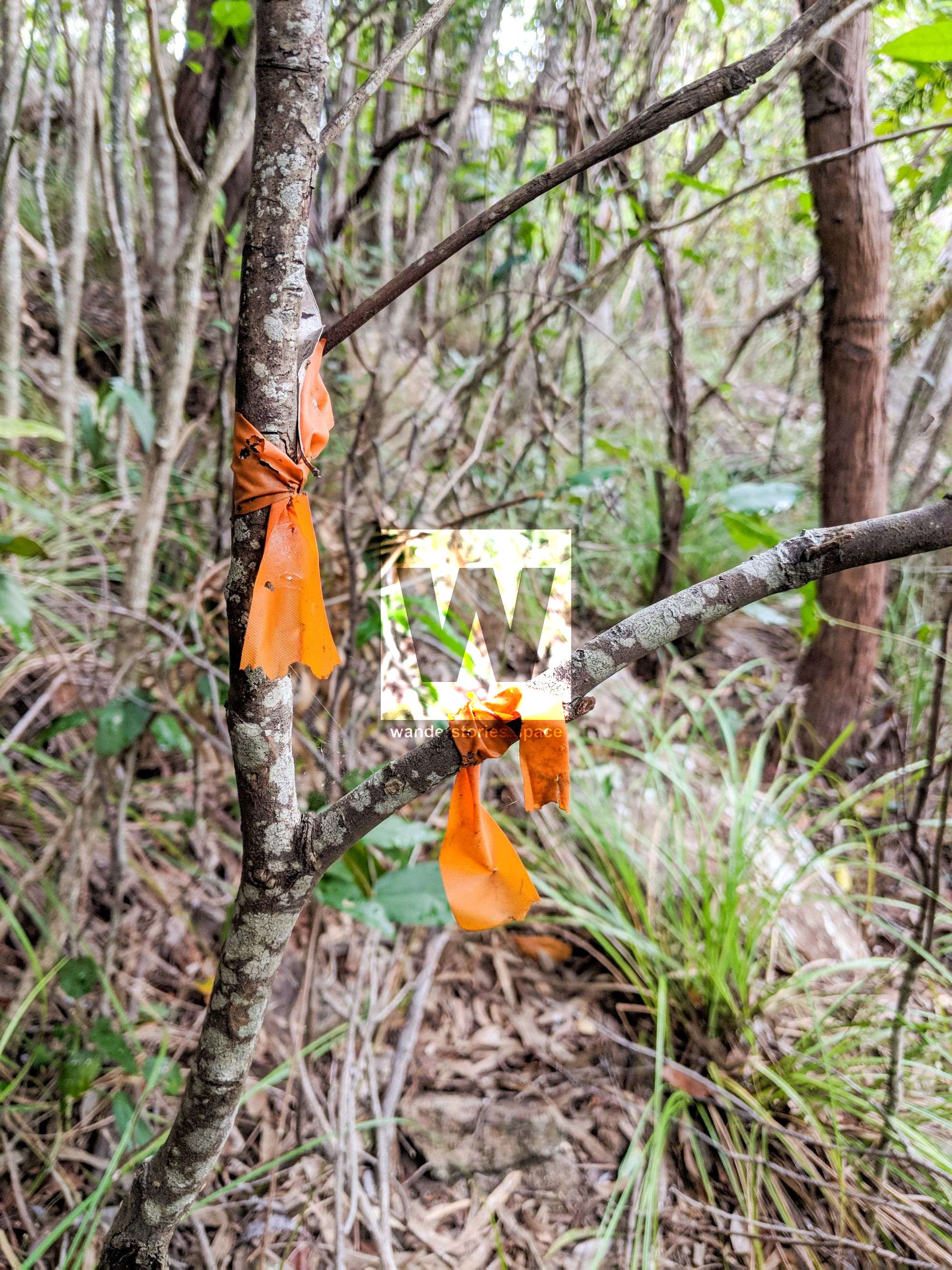
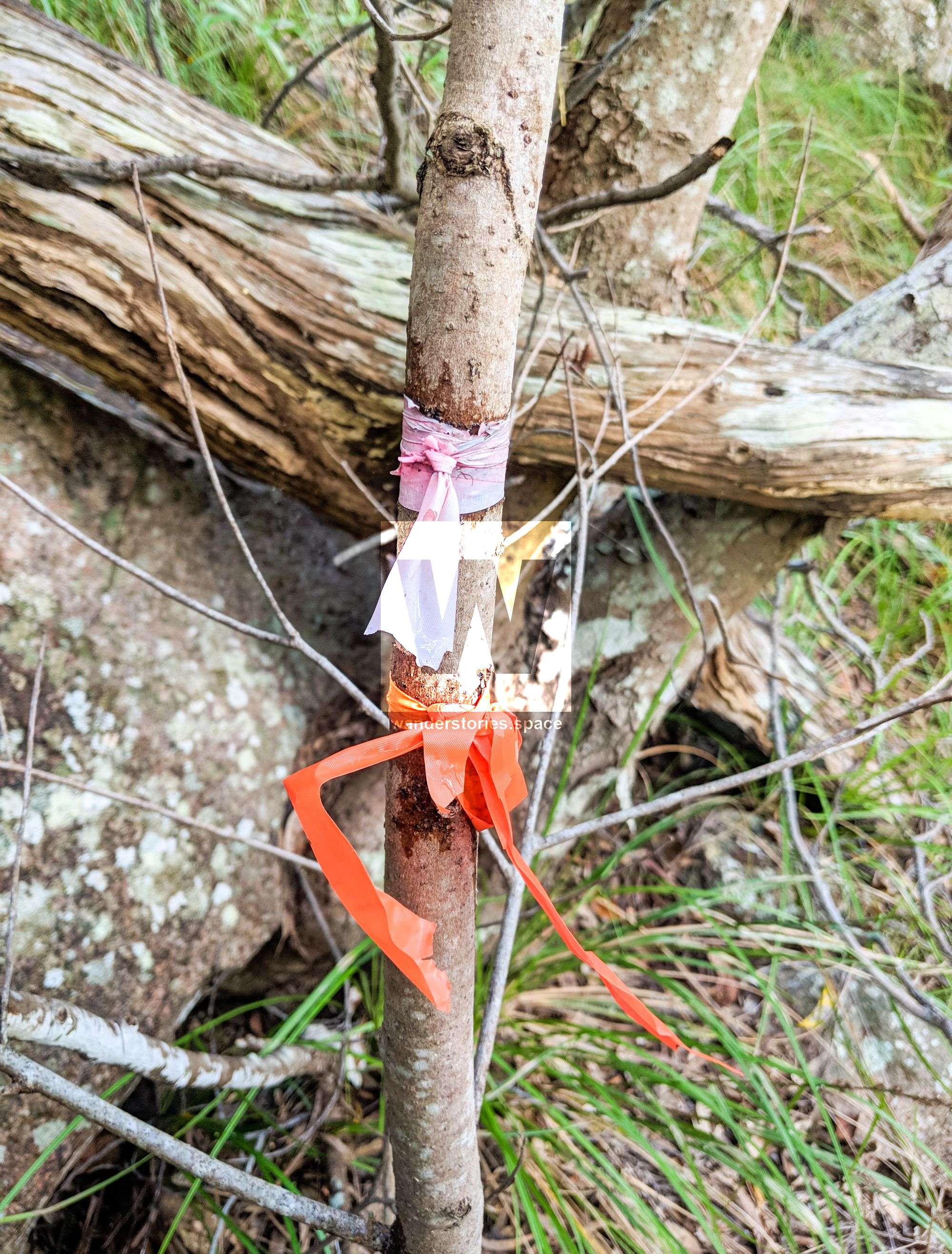
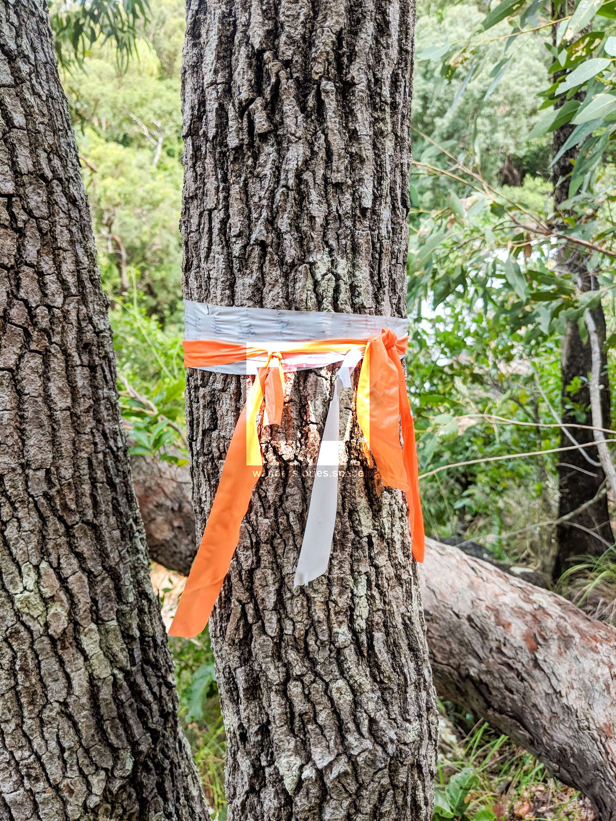
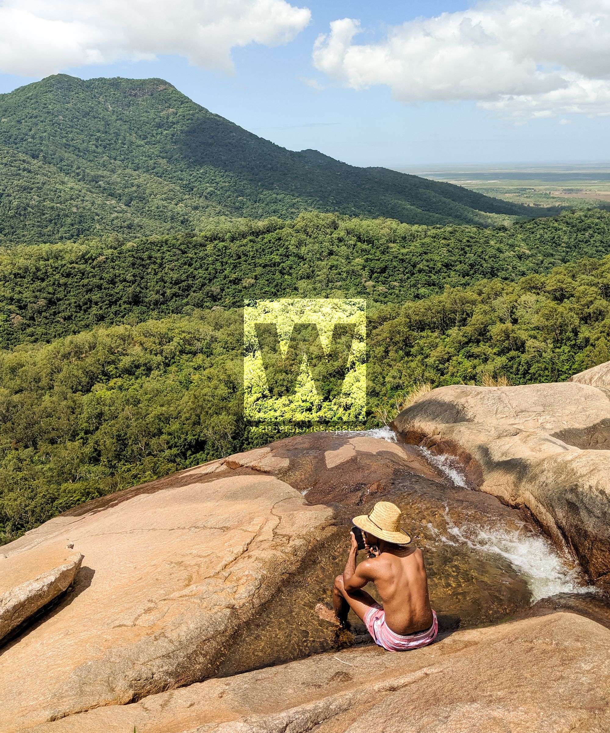
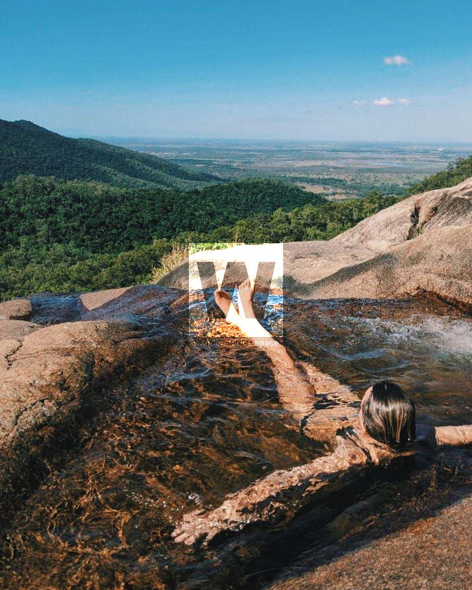
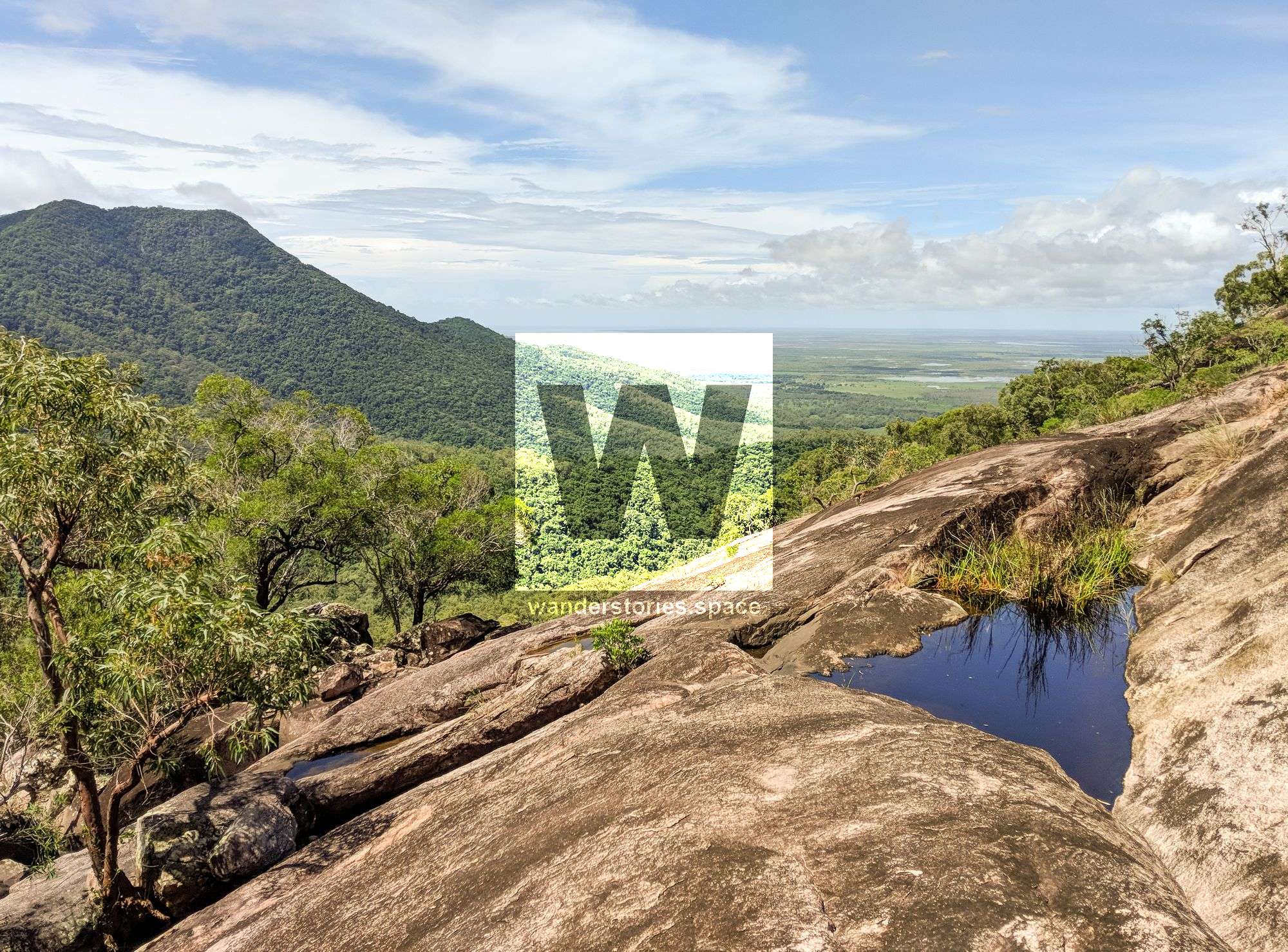
The top of the falls offers private infinity swimming holes and views of Saddle Mountain, Giru, and the ocean. To get to the top of the falls, which is well worth the effort, there is a tagged bush track further to the right marked in orange, blue, and pink tape.
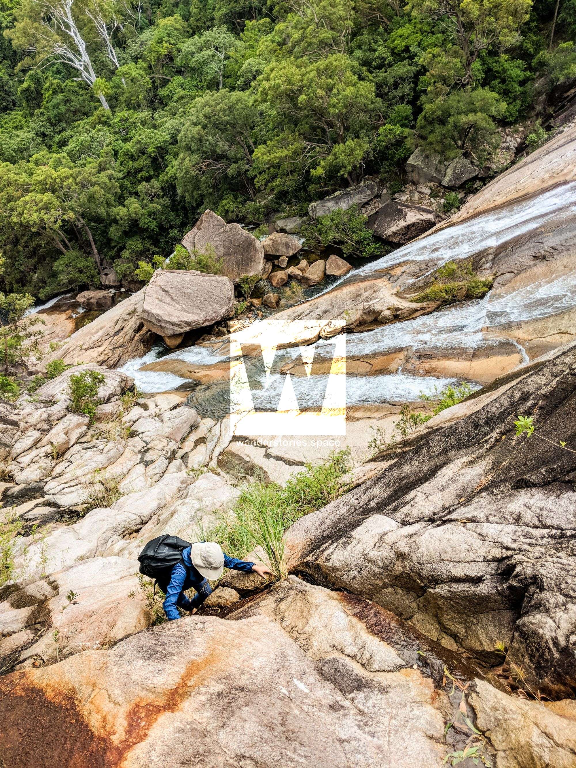
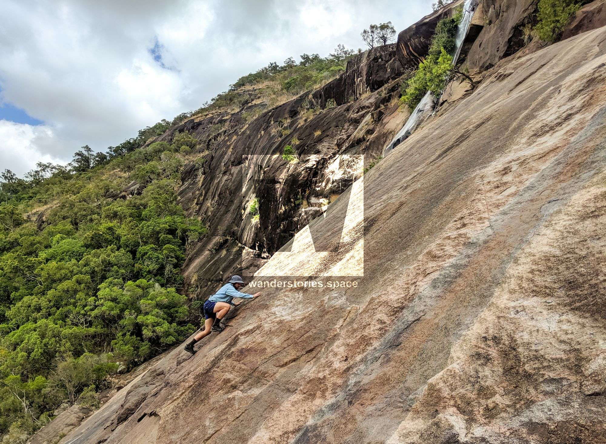
Alternatively for a shorter, more direct approach, and if the weather is dry, you can rock scramble (grade 10) up the right hand side. Do not attempt this in wet weather or even drizzle. Slippery rocks on the cliff face have caused falls and serious injuries. Even if you were to fall into the water, landing on submerged objects in the creek can also result in serious injury or death.
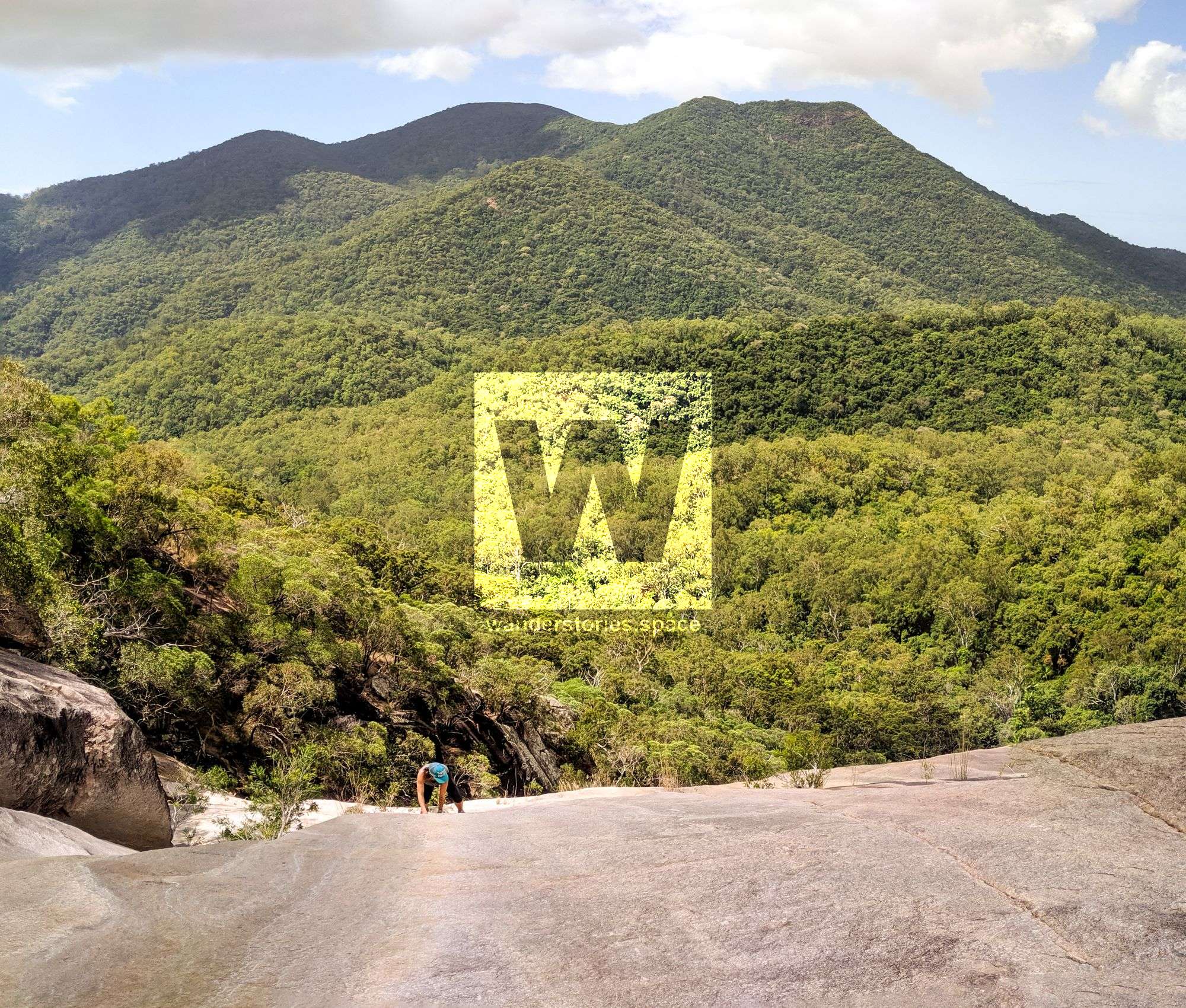
The top of Alligator Creek Falls is also one of the easiest ways to the summit of Mount Elliot. You can also stop along the way and explore Cockatoo Creek or North Creek (also known as Sandy Creek).
What to bring
- 3L of water and electrolytes if you think you will need them
- Trail snacks, morning tea, and lunch
- Swimmers
- A hat, sunscreen, and insect repellent - this walk will be hot.
- Sun safe clothing
- Shoes and socks
- First Aid Kit
- Camera - there is so much beauty to capture on this walk
Activities
- Swimming
- Camping (available at Cockatoo Rock and Alligator Creek Falls)
- Wildlife watching
- Book reading
- Yoga on the rocks
- Photography
- Scrambling and abseiling down Alligator Falls
Interactive Map
Here's an interactive map of the area:
This article, and all other articles, are for entertainment purposes only and are not to be used as a guide. Please see our Disclaimer for more information.