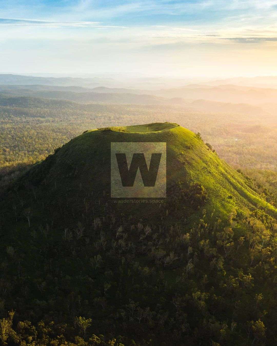
Mount Fox Crater
The Paluma to Mount Fox scenic drive is a great day trip from Townsville. You'll pass through bushland and rainforest, and the towns of Paluma, Trebonne, and Ingham. Regardless, the countryside was beautiful.

Location - Girringun National Park, North Queensland, Australia
Difficulty - Grade 4 (difficult)
Distance - 2 km return
Time - Allow 1-2 hours return
Mount Fox, also known as Mount Yellerai, is an extinct volcano 75 kilometres southwest of Ingham via the Herbert River Valley and the Seaview Range. It was named after Arthur Aloysius Fox who was born in Adelaide on 22/10/1847. It is assumed he managed the Mount Fox Pastoral Area for A. C. Gardiner around 1874. Mount Fox summit is at 810 metres above sea level and is regarded as the youngest of the mainland volcanoes. It was still active during the time of the early Aborigines.
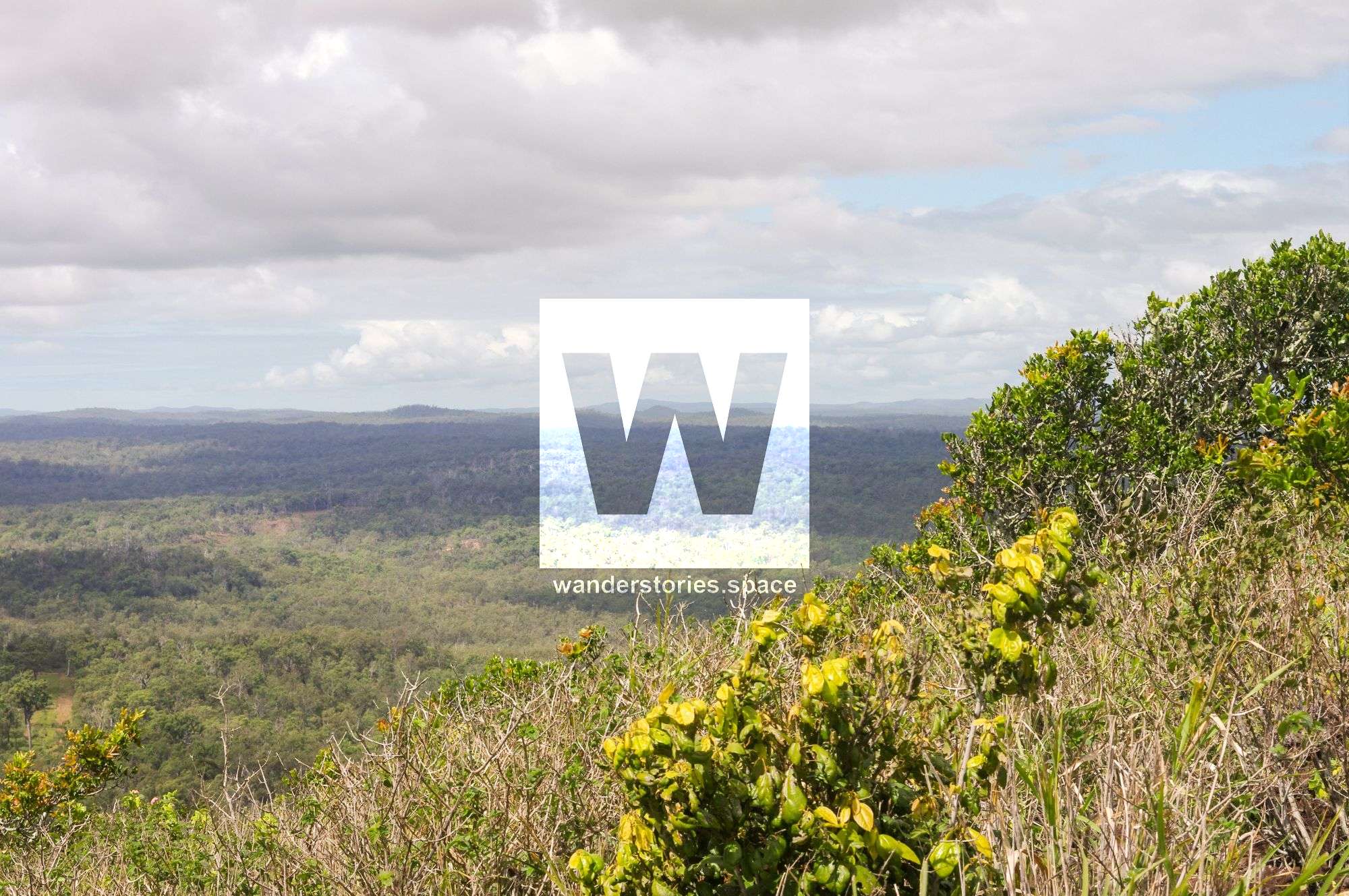
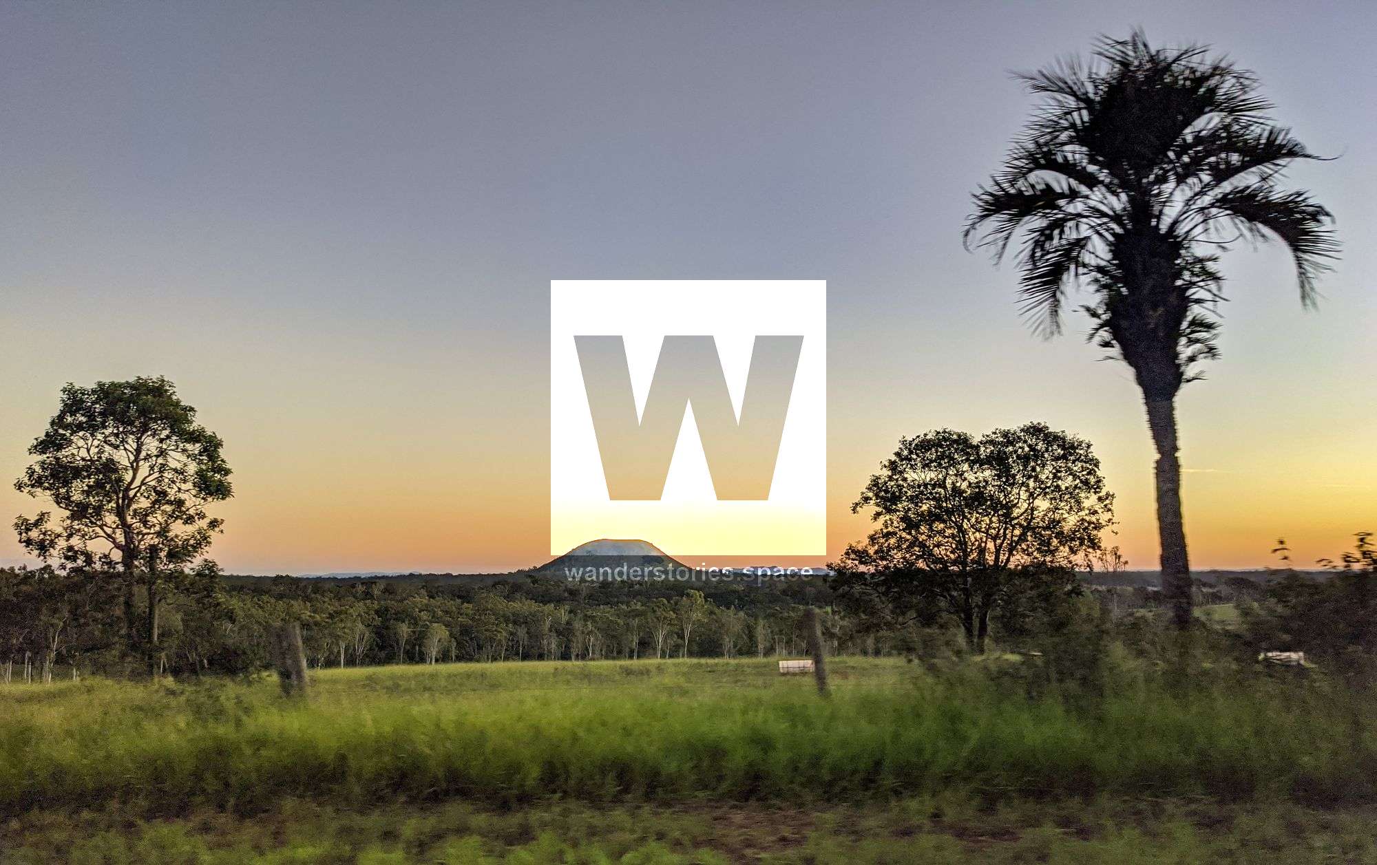
A lookout at Mount Fox Forest Reserve provides views across the valley which is about 20 kilometres from the park in the Mount Fox Forest Reserve.
Mount Fox is a 560,000-year-old cinder cone with a shallow crater and a lava flow that extends away from the southern base of the cone. Mount Fox was created by a violent volcanic explosion about 100000 years ago. In the explosion, a lava flow 10 metres thick spewed from the southern end of the crater and chunks of molten magma were thrown out of the volcano's vent.
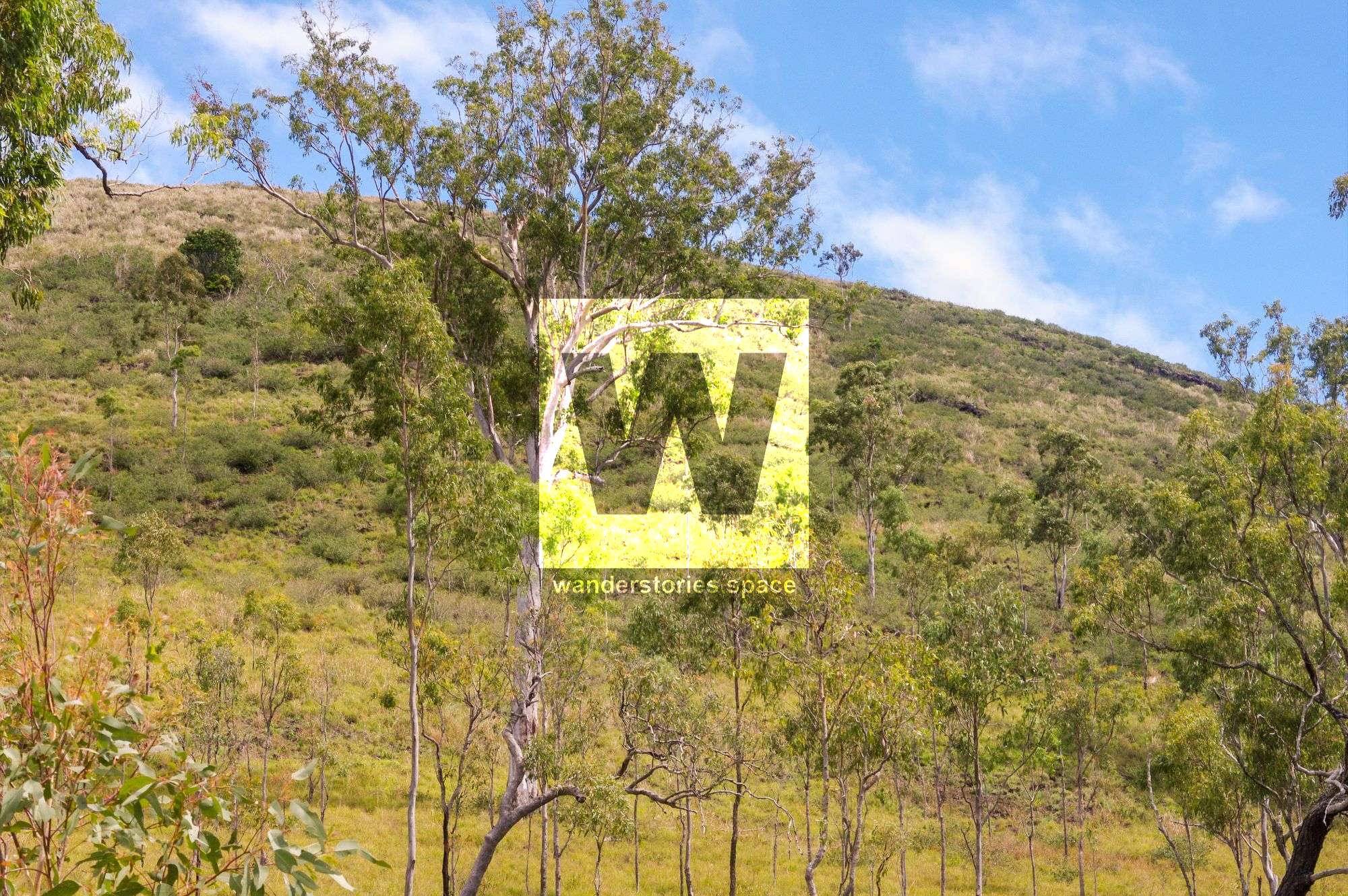
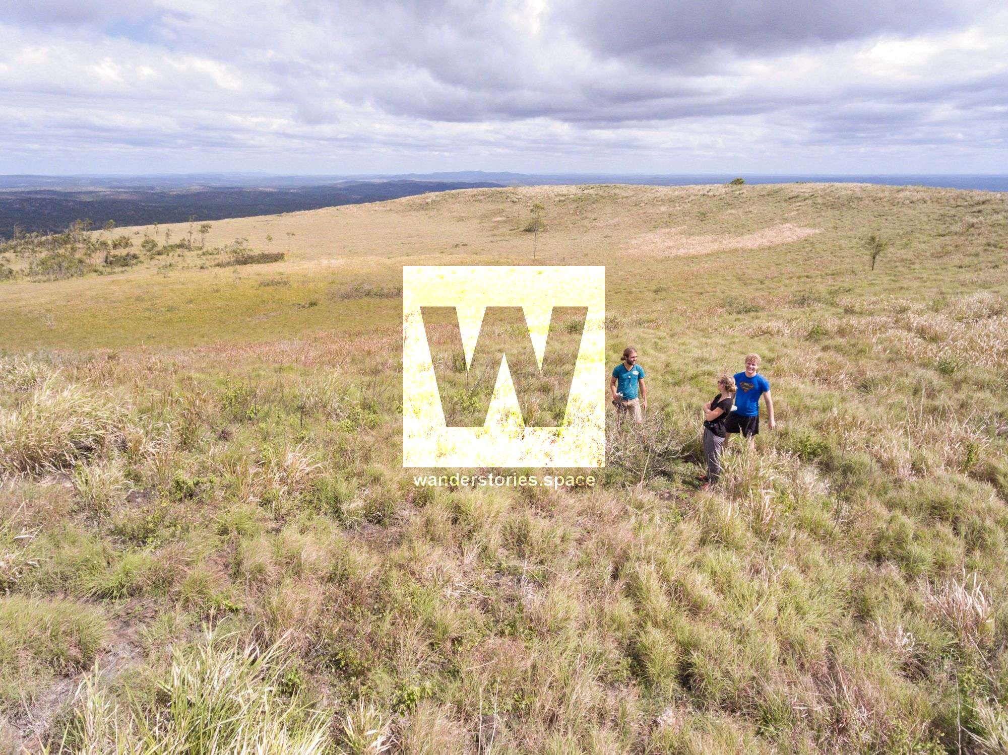
Today, the well-formed crater, about 10 metres deep, is covered with sparse grasses and stunted trees amongst the eucalypt woodland environment. The pink and long-fruited bloodwoods are common in this area and vine thicket is found in a steep gully on the southern slopes.
Mount Fox's tussock grass slopes shelter a number of small animals. On a cool day in the winter months, skinks and other reptiles can be seen basking on volcanic bombs. During the hot summer months, the grasses provide protection from the sun and are ideal nesting places for ground-dwelling birds like the little button quail. After sunset, rufous bettongs (small wallaby-type mammals) emerge to feed on herbs and grasses. The large wingspan of a wedge-tailed eagle can also be seen, as this bird of prey soars above the Mount Fox crater.
Interactive Map
Getting there
Most of the route from Ingham is sealed, with the last five kilometres unsealed. The sealed road up the range is narrow and windy and can be accessed using a conventional vehicle. In summer, the wet season may restrict access to four-wheel-drive vehicles on the wet, slippery, dirt roads.
The Mount Fox to Paluma via Hidden Valley is a great scenic drive and provides a great day trip from Townsville. You'll pass through bushland and rainforest, and the towns of Paluma, Trebonne, and Ingham. Regardless, the countryside was beautiful. Instead of going via Paluma, you can also access it via Hervey Range.
While you are in Girringun National Park, take the short drive to Wallaman Falls. The spectacular Wallaman Falls is a 305 metres single-drop waterfall, the highest in Australia. Another alternative is to continue inland approximately 104 kilometres from Mt Fox to the Valley of Lagoons. The Valley Of The Lagoons are a series of lakes that were formed when lava from recent flows dammed the Burdekin River.
Track Notes
This steep climb takes visitors up the side of Mount Fox, offering views of the crater and the surrounding Kangaroo Hills countryside. There is no marked or maintained track. This walk is for experienced walkers with a good level of fitness. Be prepared for a steep climb on unstable, loose, and slippery surfaces.
Notes
There are no facilities are provided at Mount Fox. Visitors must be completely self-sufficient. The cooler months, from April to September, are the best times to visit Mount Fox. During this time, temperatures range from a minimum overnight temperature of five degrees Celsius to a daytime maximum temperature of 30 degrees Celsius. Rainfall is sparse at Mount Fox, although storms occur in summer.
What to bring
- Plenty of water.
- A basic first-aid kit.
- Adequate clothing. Be prepared for all weather conditions including rain.
- Appropriate footwear.
- A hat, sunscreen, sunglasses, and insect repellent.
- At least one form of communication equipment. Be aware that mobile phone coverage is limited.
See also Raspberry Falls.
This article, and all other articles, are for entertainment purposes only and are not to be used as a guide. Please see our Disclaimer for more information.