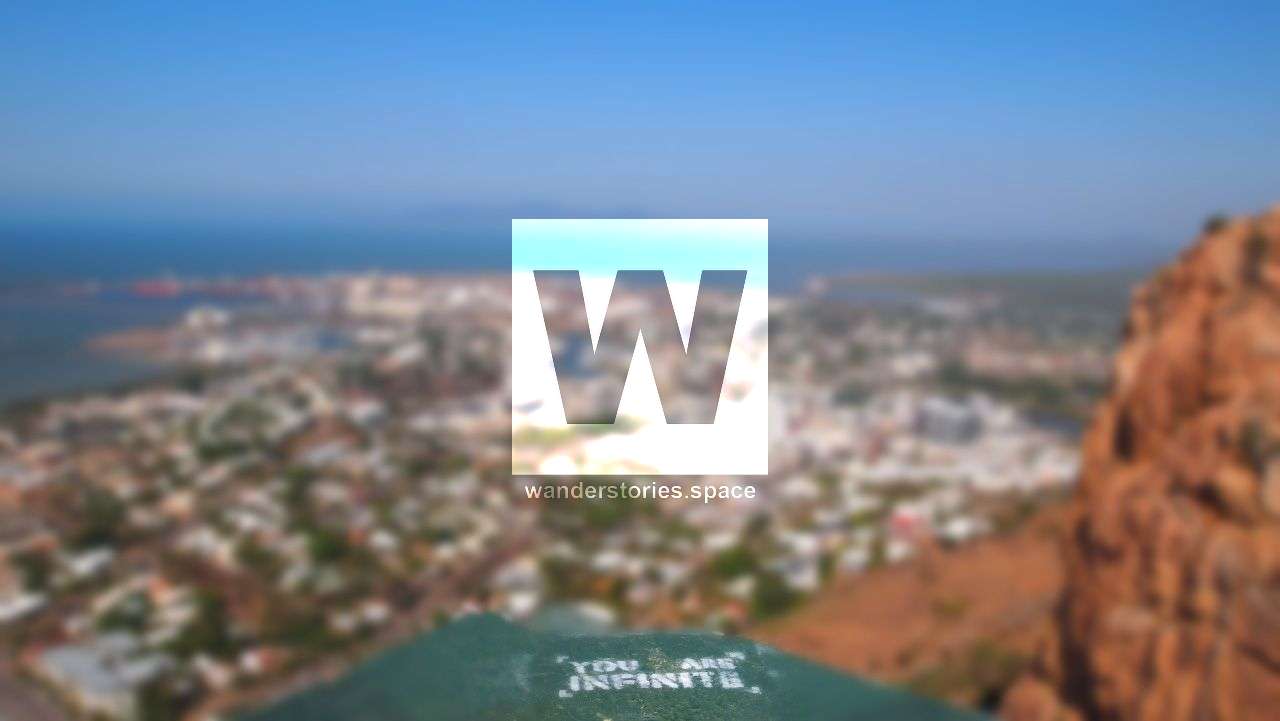
Castle Hill (Cutheringa) - a local's guide
Castle Hill at an elevation 286 metres is the most popular fitness place to be within Townsville City. There are many walking tracks to take to the top and it is a great way to get fit and be active. Castle Hill is even dog-friendly with many people choose to take their dogs on leash via the road.

Location - Townsville, North Queensland, Australia
Distance - 700 metres to 1.1 kilometres one-way depending on track taken
Duration - 30 minutes to 1 hour depending on track taken
Grade - 3, easy
Castle Hill at an elevation 286 metres is the most popular fitness place to be within Townsville City. There are many walking tracks to take to the top and it is a great way to get fit and be active. From the road to the more intensive goat tracks and hell's staircase, there's a route for everyone and any fitness level. Castle Hill is most busy around 5-7 am and 5-7 pm on weekdays as it tends to be the choice for pre- and post-work workouts. During quieter times, the tracks are a good option to practise trail running. Castle Hill is even dog-friendly with many people choose to take their dogs on a leash via the road.
Interactive Map and Downloads, The Summit, Radar Hill, Pillar Box and Jacobs Ladder, Cudtheringa Track, Ironbark Track, Triandra Track, Dianella Track, Blue Spot Track, Maidenhair Track, The Goat Track, Erythrina Track, West Ridge Track, Widowmaker Track, Belgian Gardens Link, West End Link Track, The Scramble Track, Westies Track, Unofficial and Historical Routes, Best circuits/loops, History
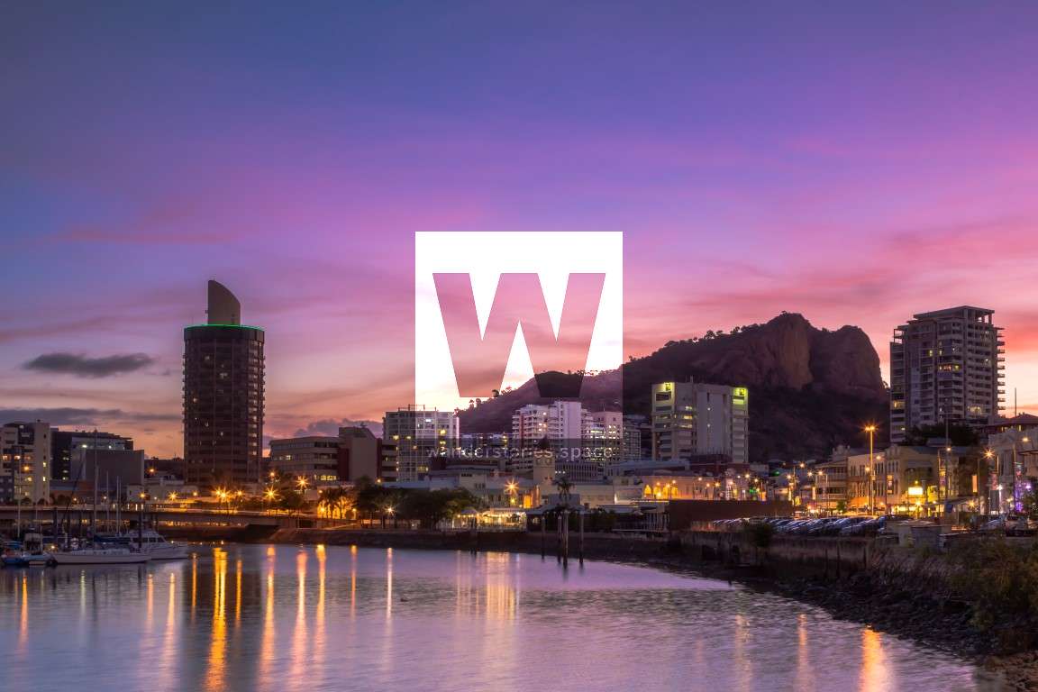
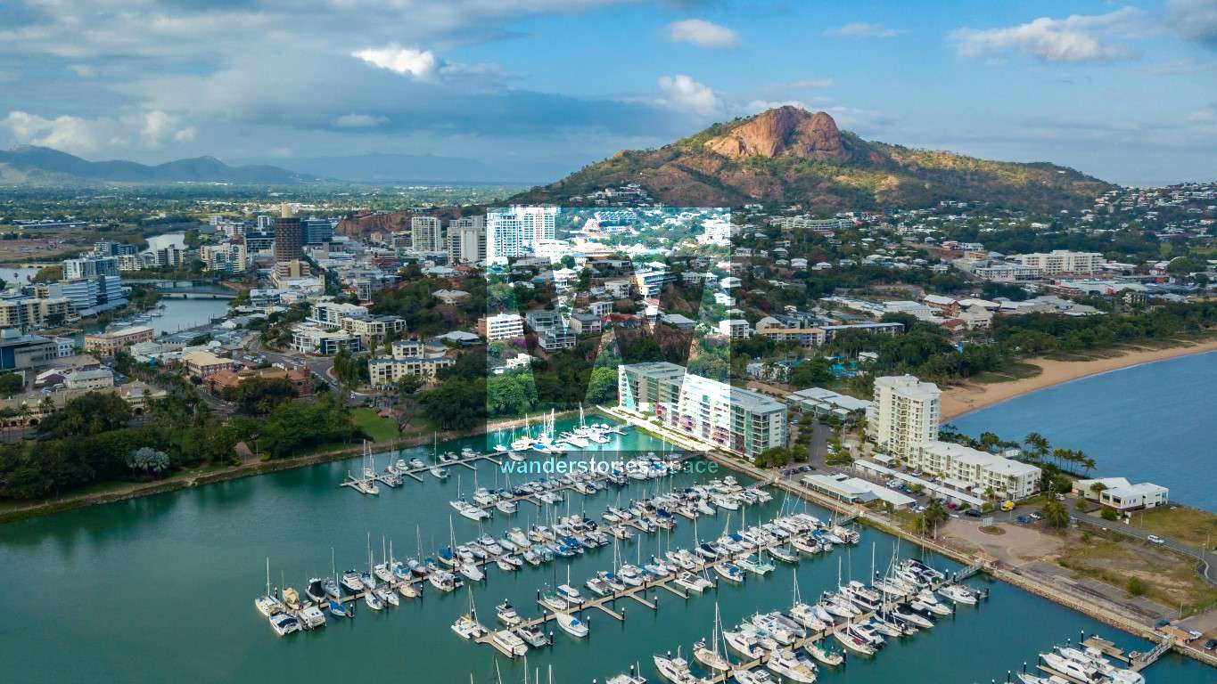
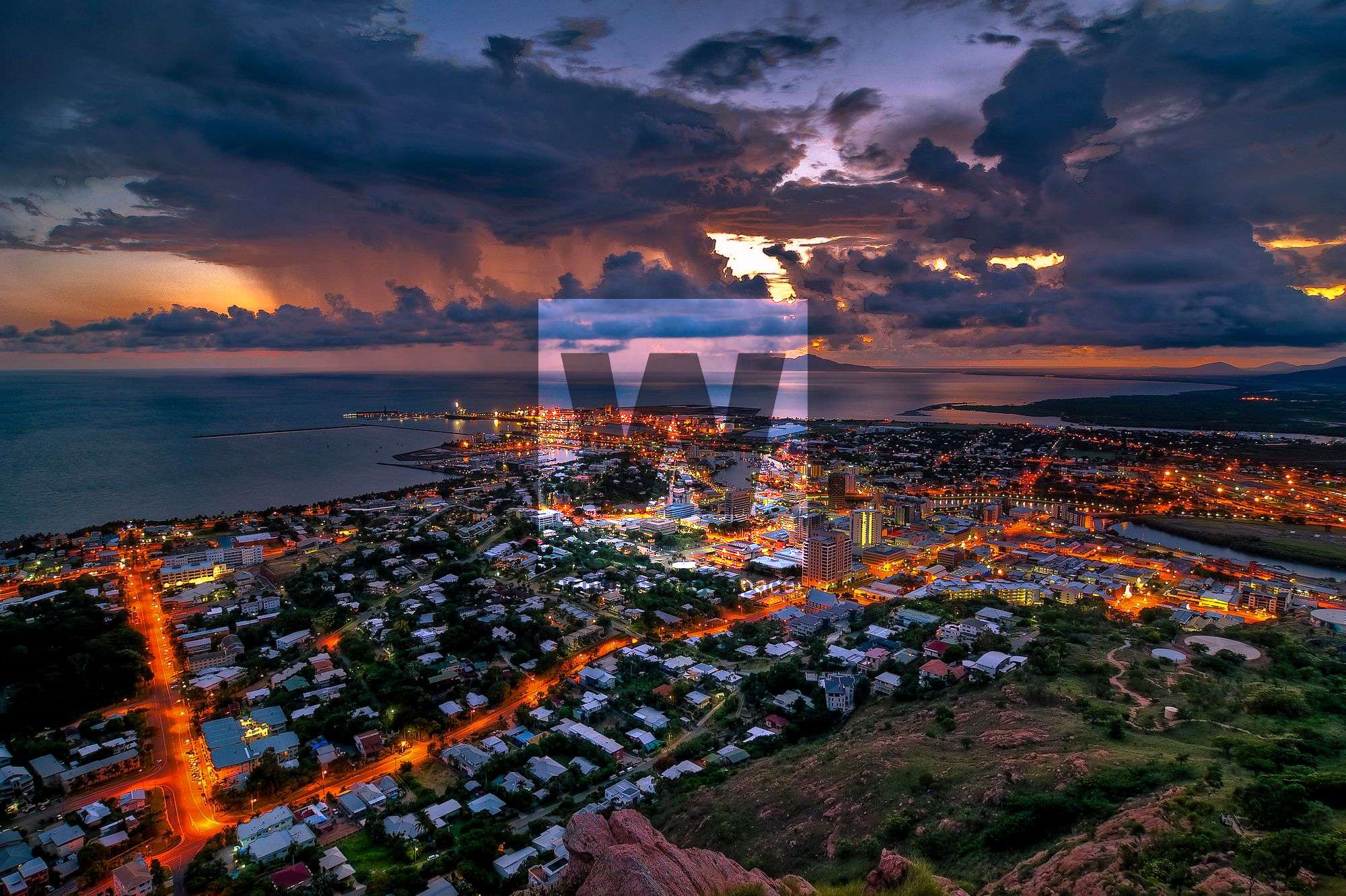
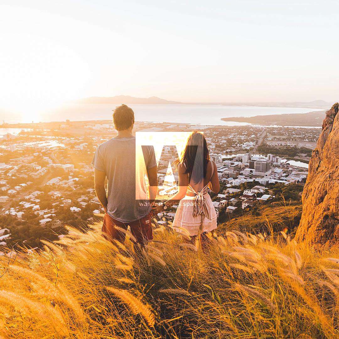
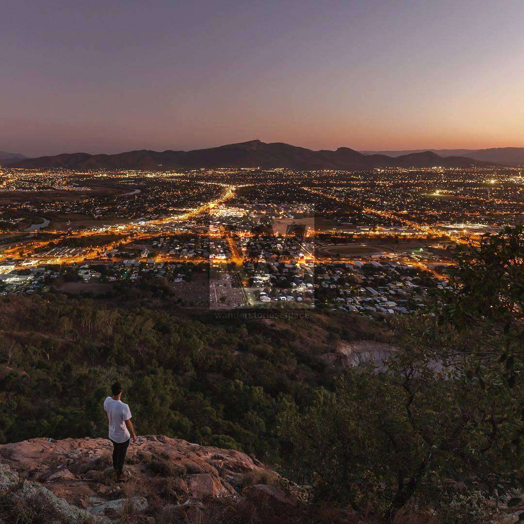
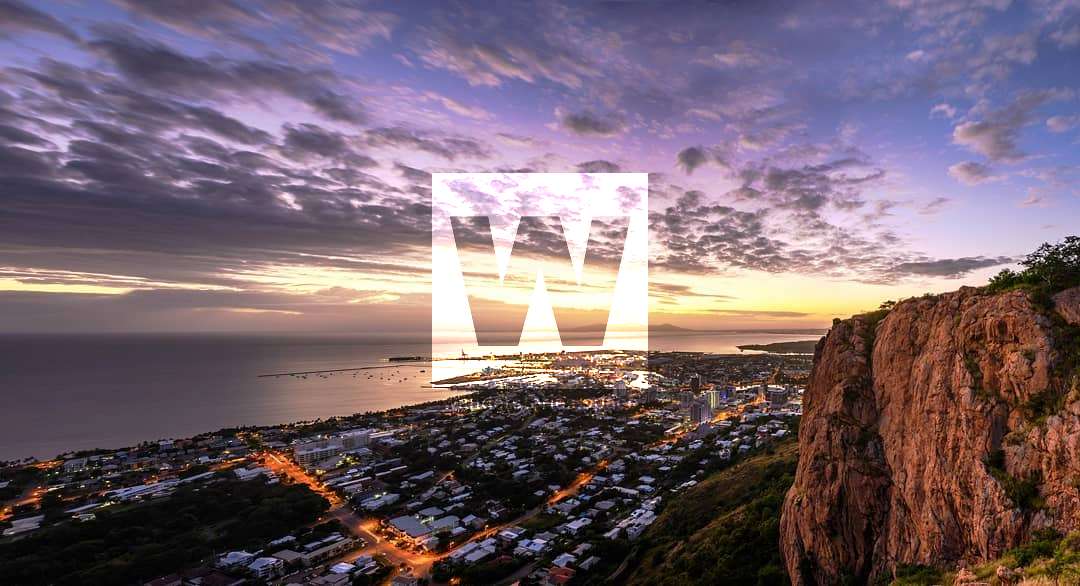
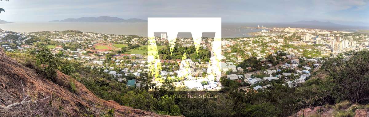
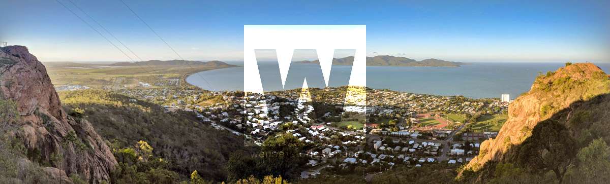
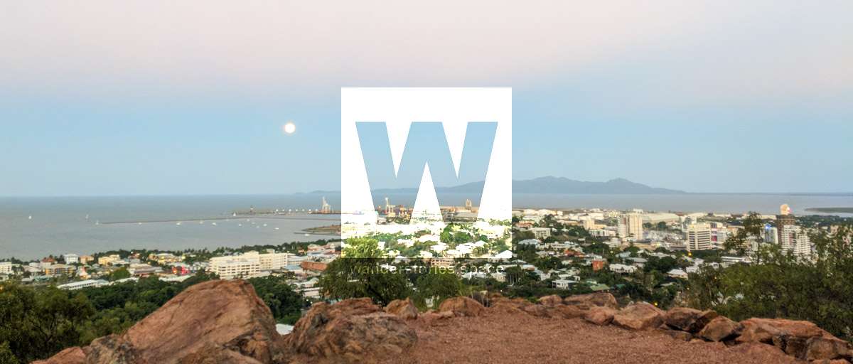
As well as offering vehicle access to the summit, Castle Hill provides a number of popular walking tracks frequented by many locals! The 360-degree views of Townsville at the top are well worth the journey, particularly for sunrise or sunset; Even the view of the city lights is quite spectacular.
Most of the area is taken up with the Castle Hill Reserve with only a small part in the northeast of the area being available for housing. It's a suburb of Townsville that dominates the city skyline. The other iconic centrepiece for the city is a skyscraper known as the "Sugar Shaker".
Facilities
Castle Hill facilities include car parking, coach parking, public toilets, a drinking fountain and shaded seating to enjoy while taking in some of the best views of the city and across to Magnetic Island and Cleveland Bay.
Where to stay in Townsville
Depending on your budget, the CBD is probably the best place for a short-term stay in Townsville. Here's a few hostels that are located near the Orchid Guest House and Civic Guest House are located near the base of Castle Hill near the start of the Goat Track. They also have several dorm options to choose from.
Reef Lodge Backpackers is one of the cheaper options available to backpackers. with Rambutan Townsville nearby which is slightly more upper-class accommodation. Both are conveniently located only ~500 metres from the Magnetic Island Ferries.
Guidelines
It's quite fun to speed down the hill on a bicycle but watch your speed and do not exceed 40 km per hour, otherwise, risk a fine. Walkers and runners must walk no more than two people across - this allows safe space for all users, including cars and cyclists. Townsville also has many great walkways and bike paths throughout the city.
Interactive map
Here's an interactive map of them all:
Lookout Pathways
The main lookout is Jenkinson's Post Lookout but there are also a couple of short, well-maintained, concreted paths you can do when you've reached the top of Castle Hill (either by car, walking/hiking/running, or climbing). These paths are particularly great for visitors and tourists as they afford unrivalled views of Townsville and surrounds and have historical significance.
Summit Walk
Distance: 200 metres one-way
Duration: 5 min return
Grade: 2, some stairs
The Summit Walk is great for those wanting some breeze and 360-degree views. Some run the stairs a few times as an extra workout before they descend. The Summit Walk is also home to Hynes Lookout, which is one of the best and most popular lookouts.
Pillar Box Walk
Distance: 350 metres return
Duration: 2-5 min
Grade: 2, some stairs
The Pillar Box Walk takes you to two lookouts, both of which have views over the city and the Eastern Bluff cliff face, one of the lookouts also is home to a WWII Observation Post constructed in 1942.
Radar Hill Walk
Distance: 300 metres loop
Duration: 5 min
Grade: 2, some stairs
The Radar Hill Walk takes you around the backside of the towers and provides views out to Hervey Range. The best views are at sunset.
Official Trails
There are in fact 8 council-recognised trails and 15 walkable trails to its summit. All the tracks are well-worn and easily followed. Please note that shortcutting causes erosion.
Cudtheringa Track
Distance: 1.1 km one-way
Duration: 30 min
Grade: 3
The most popular Castle Hill walking trail, the Cudtheringa Track 1.1 km one-way, medium difficulty. It is accessed from opposite the bottom car park near the base of Castle Hill Road and leads walkers out back onto Castle Hill Road just below the summit car park. On leaving Castle Hill Road, the route climbs steeply through scrubby vegetation and rocky landscape, heading up the north-western flank, then meets with The Goat Track, before climbing steeply. The middle section of the track is generally flat while the start and end have a steeper incline. Along the trail, you will have views up to the craggy bluffs and out to the city and Magnetic Island. The Cudtheringa Track is the popular choice for pre- and post-work workouts.
Ironbark Track
Distance: 700 m one-way
Duration: 30 min
Grade: 3
This 700 metre one-way track is a pretty but challenging trail. It's not as populated as the city-side tracks, like the Cudtheringa Track. The track starts at James Street, West End or via the gate at Green Street). The track spits you out three-quarters of the way up Castle Hill Road from where you can continue up the road, or take the "Scramble Track" the rest of the way.
The Ironbark Track starts steeply and is loose, rocky and maybe slippery descending, but it's great for cardio. There's a bench at the top of the trail for a rest before continuing. This route will get your calf and heart muscles working a little harder as it is a steep climb for most of the way. The surface is loose, rocky and eroded in places and is not recommended in wet weather. But it has the advantage of fewer people than the city-side tracks.
Triandra Track
Distance: 870 m one-way
Duration: 15-20 min
Grade: 3
The Triandra trail branches off from the Ironbark track and links Stagpole Street, (north) West End to the Dianella Track and Maidenhair Track near the cemetery, (east) West End. This flat trail traverses the base of the hill and has views inland to Mount Stuart. There is a brief break in the track at the disused quarry but the track continues across and up the other side. The most challenging part of the track is on the West End Cemetery side where you need to do a little scramble. There is a rocky downhill section but it all is easy and makes for an enjoyable walk. After heavy rain, the sides of the quarry become a waterfall.
Dianella Track
Distance: 840 m one-way
Duration: 30 min
Grade: 3
Considered one of the most challenging of Castle Hill's offerings, this track starts at the end of Church Street in West End, behind the West End Cemetery, takes you near the summit's lower car park, just a bit downhill from the Cutheringa Track. It is largely straight up and crosses patches of exposed, slabby rock then begins a continuous climb along a rocky track to the summit. The track is 840 metres one-way heads almost straight up the very steep slope.
After scrambling up the first rocky outcrop near the base of Castle Hill, look back at the spectacular views from Frederick Peak across to Cleveland Bay. The top of this rock flattens out nicely where it's possible to enjoy a picnic and the ambience. The track then takes you straight up the rocky climb to the top. This track is steep and can be slippery if descending, especially in the rain.
White Arrow Track // Blue Spot Track
Distance: 850 m one-way
Duration: 30 min
Grade: 3
The Blue Spot Track, also called the White Arrow Track, was given its name by the local walkers (Ian Wallace & co) and is a bit tricky to find the entrance when it's overgrown. This track starts on the Maidenhair Track, just a bit further east of where the Dianella Track joins the Maidenhair Track. Look for the gully with a small, rusty, metal footbridge and the white arrows painted on the rocks on the western side. The Blue Spot Track joins into the Dianella Track near the top where you have the option to easily access Castle Hill Road or head down Dianella Track.
It's best accessed via Skully Street but there's limited car parking here. This trail surpasses the Dianella Track in both technical and endurance difficulty, as it's steep with large granite slabs to clamber over. Apart from the concealed start, the Blue Spot Track is well-worn and clearly marked with white painted arrows, so there's little chance of becoming lost. There are interesting rock formations and grand views along the way, not to mention the peacefulness as it's not often walked.
Maidenhair Track
Distance: 1.3 km one-way
Duration: 20-30 min
Grade: 3
The Maidenhair Track is flat and easy and traverses the base of Castle Hill from West End Cemetery, Church Street to the Goat Track in town. There are some nice pretty sections, including a small footbridge over an intermittent stream that only flows after heavy rain. Although the elevation isn't high, the view out to Mount Stuart is surprisingly impressive for the little effort.
Goat Track
Distance: 1.1 km one-way
Duration: 30 min
Grade: 3
This track has excellent vistas over the city, Magnetic Island, South Townsville, the tip of Pallarenda and around to Cleveland Bay from the lookout. It can be crowded after work and on weekends. It's possible that the name comes from the wild goats that lived on the hill pre-1890s. The well-named Goat Track has an approximate elevation gain of 180 metres.
Starting at either Hillside Crescent, Jones Street, or the newly constructed stairs at the end of Walker Street. The best way to describe the Goat Track is short, steep, and well-worn path up the eastern flank to the summit. This 1050 metre one-way trail starts with a steep climb up the road and offers some brief respite once you get to the track. At the Cudtheringa Track and Goat Track intersection, there is a lookout just before the main staircase. The Goat Track is a good way to add a bit of variation if you usually just stick to the Cudtheringa Track and prefer the city-side tracks. The track then climbs the rock steps to join Castle Hill Road, just a short of the car park and summit.
The Widow-maker Track
Distance: 220 m one-way
Duration: 10-15 min
Grade: 3
Nicknamed the Widowmaker by locals (Ian Wallace & co), the aptly named track provides spectacular views over granite slabs. Just don't lose your footing in some parts as there are no safety barriers. The un-signposted track branches off from the Goat Track and Cudtheringa Track Junction, about three metres past the top of the concrete stairs. If you miss it, there are also a couple more unmarked, right forks along the stairs to enter the Widow-maker Track later.
The route initially traverses loose rocks and progresses upwards onto steep rocks. This trail provides the best views of all the trails. The track may sometimes be hard to follow particularly over the rocky sections but it becomes more obvious in the latter part as there are some old, white, painted arrows. The track eventually spits you out at the end of the Summit Walk at the easternmost lookout - a great place to catch your breath. This track is challenging and rewarding but careful consideration should be taken before taking pets, children, those with a fear of heights, descending this route, or walking it in wet conditions.
Erythrina Track
Distance: 440 m one-way
Duration: 15-20 min
Grade: 3
Erythrina Track is a 'shortcut track' that allows you to cut a corner of road off. The Erythrina Track is short, easy, and convenient. Many walkers know it exists, but many don't realise that it actually starts from Balmoral Place next to Yarrawonga Drive. Try parking at the bottom of Jacob's Ladder, and turn right onto Yarrawonga Drive, and then right into Balmoral Place where the Erythrina Trail takes you to Castle Hill Road.
West Ridge Track
Distance: 1 km one-way
Duration: 30 min
Grade: 3
This one-kilometre trail starts on William Street, West End and finishes halfway up the hill, just opposite the end of the Erythrina Track. The start is rocky and relatively steep and then it flattens out onto the ridgeline where there are views of The Strand and Magnetic Island to Mount Stuart. The track becomes a little easier, although still ascending gradually with the help of stairs in some sections. This track may be slippery, especially when descending and becomes muddy after rain.
Belgian Gardens Link Track
Distance: 1.2 km
Duration: 15-20 min
Grade: 3
This easy track connects Belgian Gardens with the Erythrina Track and is fairly flat with some minor inclines. It starts near Belgian Gardens State School on Potts Street and can be followed around the back of the schoolyard and up to the water reservoir (which is at the end of Grange Court). Once you've just passed the water reservoir and you have two options:
- Follow the footpath at the back of the units which brings you to Chandon Place. Walk up to Yarrawonga Drive, turn right and follow this street until you come to Balmoral Place on the right. The Erythrina Track starts from the end of this road, which in turn, takes you to Castle Hill Road.
- Turn right at the water reservoir and follow the pipeline uphill to the Erythrina Track and Castle Hill Road. This track is a little rougher than option 1.
West End Link Track
Distance: 550 m one-way
Duration: 10 min
Grade: 4
This track starts on William Street (near the West Ridge Track). Follow the rough trail steeply up past some rocky slabs. The track then contours around the hill and then you'll find yourself at the top of a large granite slab overlooking the Belgian Gardens State School. Carefully make your way around and down the right side of the slab and steeply down the hill to link into the Belgian Gardens Link Track. This track required a good level of navigational skills and fitness.
The Scramble Track
Distance: 330 m one-way
Duration: 5-10 min
Grade: 4, loose and steep
The Scramble Track, also known as the "Suicide Track" or "Heartbreak Track", is a well-worn, eroded, and unmarked trail that takes you from Castle Hill Road to around the back of the summit to join the Radar Hill short walk. This trail is very steep, loose, and challenging due to the unstable terrain. There are views that looks out to Magnetic Island and back over the suburbs of Townsville. This track starts on Castle Hill Road, opposite the top of the Ironbark Track, but the entrance may be hard to see.
Westies Track // Donkey Track
Distance: 660 m one-way
Duration: 10-15 min
Grade: 3
The Westies Track is also known as the Donkey Track and is one of the harder trails to see, especially during and after the wet season. This unmaintained trail starts on Castle Hill Road a couple of hundred metres after the bottom car park and eventually links to the Scramble Track, opposite the Ironbark Track. The track offers some unique views with some minor rock scrambles along the way. While it's not an official mountain bike track, downhill mountain bikers built it and have occasionally ridden it. It begins just after the stairs to the Cudtheringa Track, on the left-hand side before the bend. There's some white paint and blue tape at the start.
Jacobs Ladder
Distance: 140 m one-way
Duration: 3-5 min
Grade: 2
Jacobs Ladder is also a popular place to start your journey up Castle Hill. It features a long flight of stairs that steeply rise through the suburbs to the base of Castle Hill. It's a great cardio workout that will definitely get your heart beating.

Choosing a circuit
There are many different possibilities to walk but here are a couple of routes locals have given names to:
Cutheringa Loop
Distance: 4.2 kilometres
Time: allow 1-1.5 hours
Start by walking up the Cutheringa Track to Castle Hill Road. Enjoy the summit before easily walking down the road to your car. This simple route plan is a popular one.
Around the Base Route
Distance: 6.2 kilometres
Time: allow 2 hours
Start at the bottom of Cudtheringa Track on Castle Hill Road. Walk up the road to the Erythrina Track. Walk down the stairs on your right and immediately to your left following the pipeline. Once you reach to the water reservoir, take a left and walk along the Belgian Gardens Link Track. Walk for the pink tape and white star pickets on the left, as this marks the West End Link track. Go steeply uphill past a granite slab and down to William Street. Walk to the West Ridge Track and up along the track to the Triandra Track. Pass the quarry and join into the Maidenhair Track. Contour around the base to The Goat Track and follow that up the stairs to join into the Cudtheringa Track. Walk down the Cudtheringa Track track and back to Castle Hill Road where you started.
City Slicker Route
Distance: 3.2 kilometres
Time: allow 1 hour
Start by ascending the Goat Track to then traverse the Maidenhair Track. Climb up the Dianella Track or the Blue Spot Track onto Castle Hill Road. Walk down the Goat Track.
The Quad Master Route
Distance: 3.6 kilometres
Time: allow 1 hour
Start walking up the Dianella Track or Blue Spot Track to Castle Hill Road. Then walk down the road to descend the Ironbark Track. Finish the route off by traversing the Triandra Track.
West End Wonder Route
Distance: 4.6 kilometres
Time: allow 1.5 hours
Start at the Ironbark Track, cross the road and carefully clamber up the Scramble Track to the summit. Descend Castle Hill Road before making your way down the West Ridge Track. All that's left is a short walk to where you parked.
The Many Trails Route
Distance: 5.9 kilometres
Time: allow 2 hours
Start along the Ironbark Track and traverse the Triandra Track and then the Maidenhair Track. Walk up the Goat Track to Castle Hill Road and then up the Radar Hill Path. Carefully descend the loose Scramble Track to the Erythrina Link Track and then onto Castle Hill Road and down the West Ridge Track. Again, a short walk to the car far from where you started.
The Freeman Circuit
Distance: 11-13 kilometres
Time: allow 3 hours
This 11 to 13 kilometre, one to three-hour walking loop includes Castle Hill, The Strand, Jezzine Barracks (Kissing Point), Rowes Bay, the Mundy Creek Trail and West Ridge Track. It is close to the city and the walk can be started anywhere. Take care crossing the roads.
Unofficial and Historical Routes
The Ladies' Route // Western Water Tank Track (Erythrina to Scramble Track Link)
The Western Water Tank Track, also known by its nickname The Ladies' Track by local walkers (Ian Wallace & co) because it was the inconspicuous route that 'female friends' took to visit the soldiers manning the Pillar Boxes on the top of Castle Hill in WWII. This un-signposted trail is now overgrown and is especially difficult to follow in the wet season. The foot track can be made out as it was well-formed and can be seen from the old aerial imagery. The track starts on the western side of Castle Hill at the Erythrina Track near the water tank. The track then ascends the ridge to the base of the "Scramble Track". The track then traverses below the cliff line and Jenkinson's Post Lookout and across to join into the Pill Box Walk. You can make out some rock steps in places. The track is relatively easy with no steep climbs and is a great way to add variety to your walk.
'The Original Scramble Track' Route
This route is thought to be one of the original tracks up to the summit and can be seen from old aerial imagery dating back to the 1950s. This route is now commonly known as 'The Cleft Track', but is also known as 'The Crack Track' or just 'THE Track', and leaves the Cudtheringa Track between the Eastern and Western Bluffs and ascends the gully. There are some old, white-painted arrows that lead the way up the intermittent stream to an old rusty ladder (which would have been originally scrambled) and then steeply to one of the Pillar Box Walk lookouts. This track was closed due to erosion and turned into a revegetation area.
The Canadian Route
The Canadian route starts at the end of Gregory Street and follows an old road that was used to build the protective rock wall barrier before turning uphill to join in on the Cudtheringa Track. Expect that the trail is overgrown and hard to follow. Good technical skills and navigational skills are required to undertake this route.
Everest Route
The Everest route starts early on the Cudtheringa Track and follows the ridgeline up beside the Western Bluff to join into the 1980 Track and then the Pill Box Walk.
The Rock Face Loop Track (Proposed)
This track was proposed in the Castle Hill 2018 master plan. The Rock Face Loop Track walkway would loop around the summit along the base of cliffs.
Castle Hill's History
It is only when you see the cliff's face that you think about the geological history of Castle Hill. Successive intrusions of volcanic activity formed Castle Hill along with Magnetic Island, Cape Cleveland and Mount Elliot. These landforms resisted erosion leaving Castle Hill as an isolated, pink granite monolith. An inselberg is an isolated hill, knob, ridge, outcrop, or small mountain that rises abruptly from a surrounding plain.
Castle Hill is made of igneous granite rock which is formed when magma cools and solidifies within the Earth's crust and is the most common igneous rock type. Granite crystals form while the molten material inside the Earth's crust cools and tend to be easily seen.
Granite rocks are plutonic igneous rocks, which were formed by slowly cooling pockets of magma trapped beneath the earth's surface. Granites are typically a hard rock with visible crystalline texture, rich in quartz and feldspar. Granite is the most common igneous rock of the Earth's crust. An outcrop of granite on the earth's surface requires some kind of erosion to expose the buried material. Castle Hill is an inselberg of Carboniferous-Permian origins, rising abruptly from the younger Quaternary coastal plain.
The rocky landform predominantly supports mixed eucalypt vegetation with a variable understorey. Grasses such as kangaroo grass and giant spear grass grow on the exposed, steeper slopes while hummock grasses grow on the cliff faces and rocky outcrops. Echidnas are commonly seen at dusk on the hill.
The Traditional Owners of Townsville are the Wulgurukaba of Garumbilbarra and called Castle Hill 'Cutheringa'. Cutheringa is of deep spiritual significance to its Traditional Owners and features prominently in their Dreamtime stories. The Aboriginal history and mythology associated with Cutheringa were not well-documented, but its name survives.
Andrew Ball, Mark Watt Reid, and a small party of aboriginal people set out from Woodstock Station in April 1864 and were the first Europeans to explore the Cleveland Bay and Ross River areas in search of a suitable site for a port and boiling-down works under the instruction of John Melton Black. Andrew Ball named the monolith 'Castle Hill' apparently because it resembled a similar feature in the Isle of Man. Likewise, Andrew Ball also named Mount Louisa, a nearby mountain. Delays with the initial supply ship saw the settlement on the verge of starvation which had them resort to sustaining on 'alligator' eggs. The Townsville settlement was initially known as 'Castletown', until it was renamed Townsville in 1865 by Captain Robert Towns. Castle Hill was admired as a local landmark and gave a unique identity to the town. The settlement's first newspaper was called the Castletown Times. In 1886, Ball built the family villa residence, 1 Rosebank, which still stands today.
Castle Hill, no stranger to the plunder and pillage that characterised European settlement, was well-known for the Townsville residents illegally plundering timber and firewood from the hill. To make things worse, wild goats further ravaged the native vegetation before public outrage during the 1882-1897 period. It wasn't until 1888 that it was gazetted as a recreation reserve with about 228 hectares. Just metres short of a mountain, Castle Hill is now a heritage-listed lone pink monolithic granite giant that overlooks the centre of Townsville making it a perfect landmark for tourists to orientate themselves. A signboard near the top car park details short trails leading to various lookout points.
The road to the summit was called Hynes Road or Hynes Highway, which is now called Castle Hill Road. Both Hynes Road and Hynes Lookout were named after the then Minister for Labour and Industry, Hon. MP Hynes and opened on 27 February 1937.
In 1941, the Captain Robert Towns obelisk-like monument was relocated and erected at the summit car park and commemorates the founder of Townsville. The monument was originally located at the grave of Robert Towns, in Balmain Cemetery, Sydney. When the Balmain Cemetery was converted to parkland, the memorial was moved to Townsville – but not the remains.
During World War II, the vantage points on Castle Hill were used by visiting American soldiers. A concrete bunker was constructed as a Command Post, to allow for surveillance of Cleveland Bay. The Observation Post bunker was constructed in 1942 and still stands today as a reminder of Castle Hill's military history. It's located near the top of Castle Hill facing out northwards at the end of Pillar Box Walk.
Other defence infrastructures, such as searchlight emplacements were also constructed on Castle Hill during that war. A persistent urban legend has it that when American troops were stationed in Townsville during World War II, they offered to demolish the hill and construct a causeway to Magnetic Island.
Rumour has it that a question mark was painted in whitewash the early morning of ANZAC day in the early 1960s. It rained later that day and washed it off. A question mark was repainted in white paint but the city council painted it over with rock-coloured paint. In 1962, eight James Cook University students painted a white stick figure, 'The Saint' from a 1960s British television series, on Castle Hill's northern face as a prank replacing the question mark. In 2002, Townsville City Council reversed its decision to remove it only after a poll indicated 54% of the population considered it an icon! That poll cemented The Stain's place in Townsville's cultural landscape and it's still Townsville's most famous graffiti. The early version has faded, but a second version has been visible since about 1970.
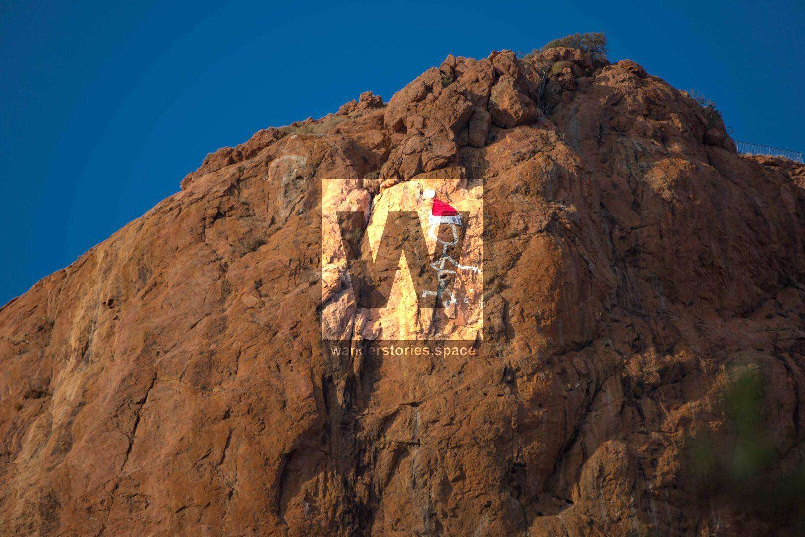
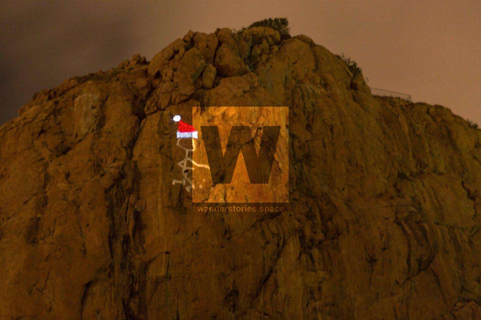
There have been several different modifications to the stain and can still see some of these changes if you look close enough. There is a faded face, and another faded stick figure left of the saint. Over the years, it has been decorated with fluorescent paint, solar fairy lights, and Christmas hats.
In July 1980, a group of Heatley High School students created soil-filled wooden squares in the shape of a pyramid – high enough to push Castle Hill into the "mountain" class and was nicknamed Castle Mountain, Mt Cutheringa, or Cutheringa Mountain for a short time. At an elevation of 286 metres above sea level, Castle Hill is actually taller than Mount Marlow (213 meters above sea level) but is just short of being classified as a mountain (304.8 metres or 1,000 feet).
On 28 May 1993, Castle Hill was listed on the Queensland Heritage Register.
The Panorama Restaurant and kiosk were constructed in 1967-1968 with a seating capacity of 600 and offered dining with views across Townsville. However, it was finally closed and this land has since been converted to freehold. Now only a vacant lot exists.
Approximately in the late 1970s or early 1980s, Castle Hill saw its first bouldering problems and rock climbing routes.
On the 20th of December 2019, Townsville City Council revealed their plans to construct a new eatery and events space near the summit of Castle Hill. It is planned for the former Panorama House site near the top of the hill and aims to cater to the three-quarters of a million people that visit Castle Hill annually. The whole site is 800 square metres and will be a flexible space that can host wedding receptions, comedians, food vans, or perhaps some concerts during the Australian Festival of Chamber Music. Counterpoint Architecture is designing the building and it will be a wonderful spot to eat and look across the city. The new venue expected to open in late 2020. The works on Castle Hill have received almost $2 million in funding from the Federal Government’s Building Better Regions Fund.
See also a book by Dorothy Gibson Wilde
This article, and all other articles, are for entertainment purposes only and are not to be used as a guide. Please see our Disclaimer for more information.